1. Ascent Passport
- Region: Zaalai Range (North Pamir). Gorge: Sauksay Section number according to the 1999 classification table – 4.4
- Peak name: Lenin Peak. Route name: along the rib of the southern edge of the southeastern wall from the Bolshaya Saukdara Glacier.
- Proposed – 5B category of difficulty.
- Route type: snow-ice.
- Height difference of the route: 1709 m (by altimeter) Route length: 3911 m. Length of sections:
- V category of difficulty – 13 m.
- VI category of difficulty – 0 m. Average steepness:
- main part of the route – 39°
- total route – 27°
- Pitons left on the route: total – 0; including, bolted – 0 Pitons used on the route:
- Stationary bolted – 0, including, TCO* – 0
- Removable bolted – 0, including, TCO* – 0 Total TCO* used – 1
- Team's working hours: 24 hours, 3 days
- Team leader: Lebedev Andrey Alexandrovich, Master of Sports of International Class in tourism Team members:
- Lvov Vyacheslav Yuryevich, 1st sports category in tourism
- Nistratov Igor Igorevich, 1st sports category in tourism
- Rykalov Petr Vladimirovich, Candidate Master of Sports in tourism
- Coach: Lebedev Andrey Alexandrovich
- Departure to the route: 8:10, August 11, 2001 Reached the summit: 14:05, August 13, 2001 Descent to Lenin Glacier: 17:40, August 16, 2001
2. General—a Photo of the Summit
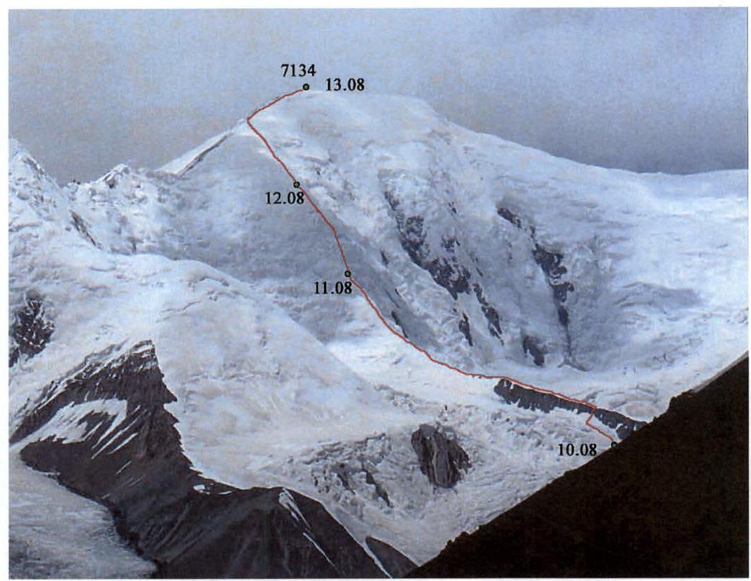 Ф.1. Photograph taken on August 9, 2001.
Photo shoot location – saddle of Oktyabrsky Pass
Ф.1. Photograph taken on August 9, 2001.
Photo shoot location – saddle of Oktyabrsky Pass
3. Area Overview
The southeastern wall of Lenin Peak faces the Bolshaya Saukdara Glacier. There are three logical paths to this glacier:
- Path from the west along the Sauksay valley,
- Path from the east through Profsouzyov or Oktyabrsky Passes,
- Path from the north through Krylenko Pass.
The northern slope of Krylenko Pass is prone to avalanches, so usually, one descends from the eastern ridge of Lenin Peak, having first ascended to the ridge through Lipkin Rocks and the "frying pan". For an approach from the east, Oktyabrsky Pass is more effective than Profsouzyov Pass as it allows a quicker approach to the upper cirques of the Bolshaya Saukdara Glacier. Moreover, unlike Profsouzyov Pass, it leads directly to the clean and even ice of the glacier. The path from the west along Sauksay is characterized by great length and duration.
Our expedition entered the area from the east through Oktyabrsky Pass. The tongue of the eponymous glacier can be reached from Osh by high-clearance vehicle, turning west from the East Pamir Highway before the Markansu valley.
Having descended from the pass to the Bolshaya Saukdara Glacier, we entered the icefall of its right tributary, flowing from the saddle of Zhukov Pass. This pass is located between Lenin Peak and its southern neighbor – Zhukov Peak (this summit was also known as "Moscow-Beijing").
The base camp was set up at an altitude of 5425 m in the cirque of Zhukov Pass above the icefall.
From the southern shoulder of Lenin Peak, at an approximate height of 6800 m, a weakly expressed rib descends to the east, separating the cirque of Zhukov Pass from the southeastern wall of Lenin Peak. Below 6100 m, the rib loses steepness, becomes sharp, and turns into a ridge leading to the nunatak 5623. The route we took passes along this rib.
4. Area Diagram
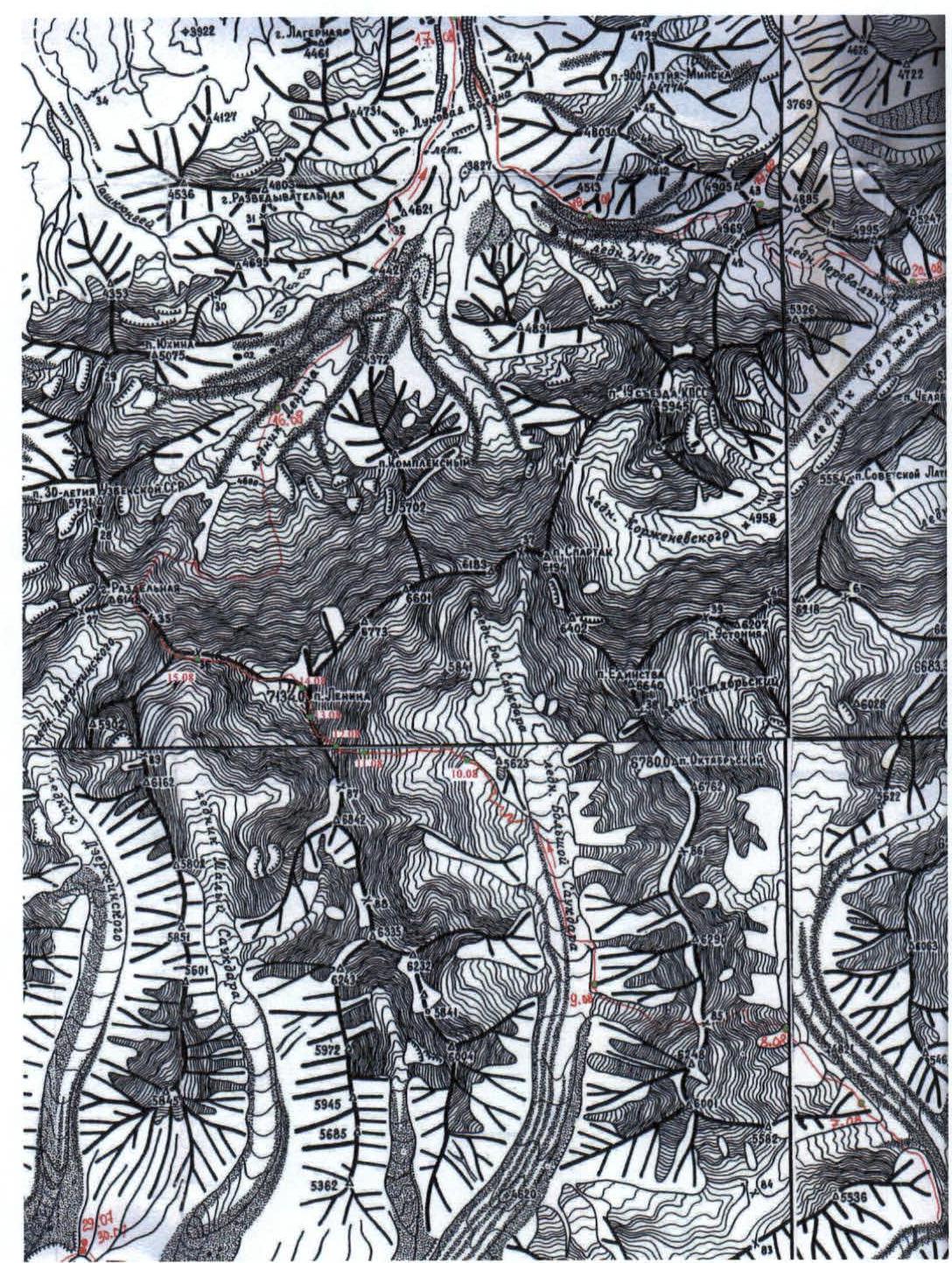
On the diagram:
- 87 — Zhukov Pass
- 37 — Krylenko Pass
- 85 — Oktyabrsky Pass
- 84 — Profsouzyov Pass
5. Technical Photographs of the Route
 Ф.2. Taken on August 10, 2001, from the plateau above the lower icefall of the right tributary of B. Saukdara, which flows from Zhukov Pass. Numbers indicate the ends of corresponding sections.
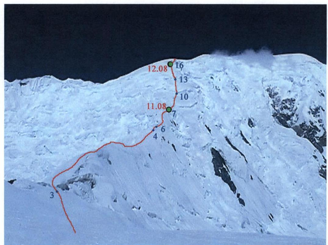 Ф.3. Taken on August 11, 2001, from the ridge of the eastern spur (from the end of section 3). Numbers indicate the ends of corresponding sections.
 Ф.4. Taken on August 11, 2001, from the middle of the "knife" (section 4). Numbers indicate the ends of corresponding sections.
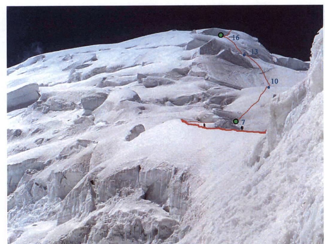 Ф.5. Taken on August 11, 2001, from under the fracture in the rib (from the end of section 4). Numbers indicate the ends of corresponding sections.
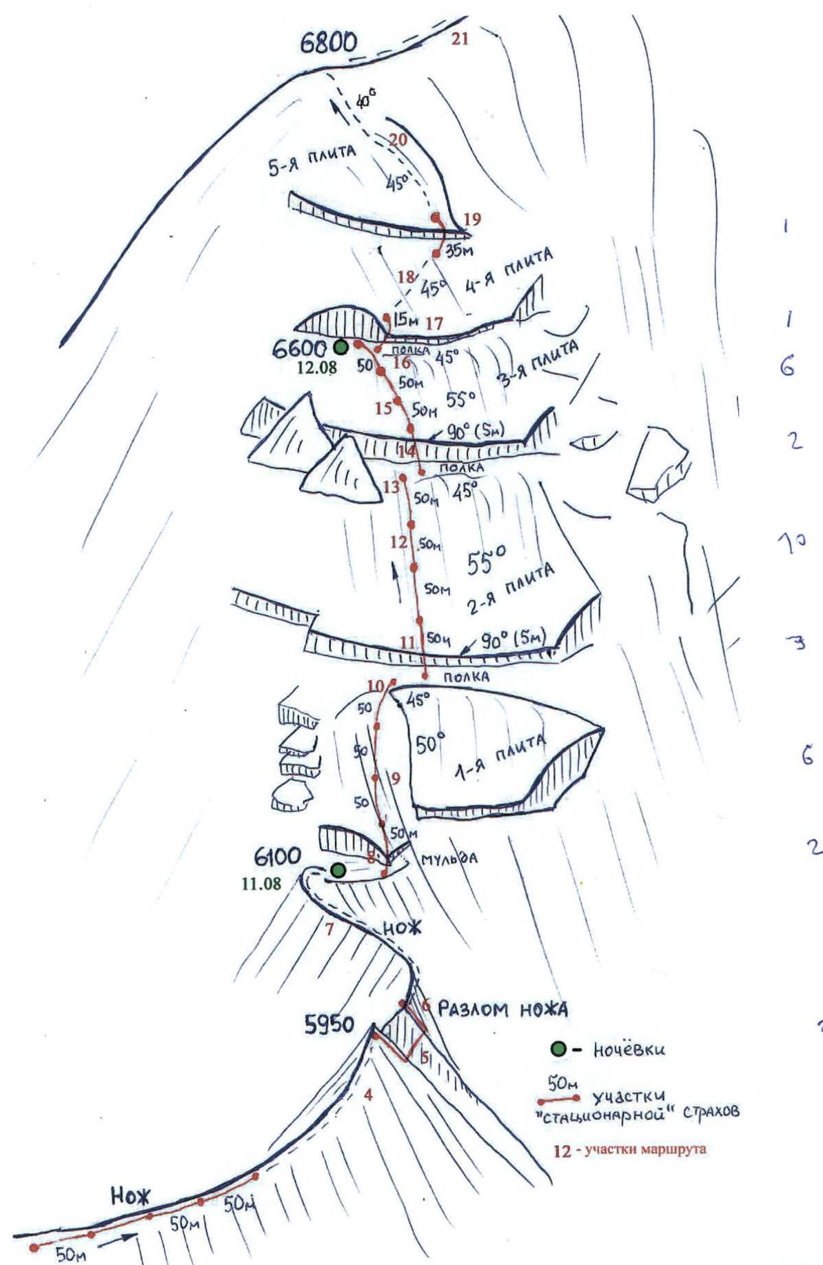
6. Route Sections Table
| № | Section Name | Start Height | End Height | Photo №№ | Difficulty | Length (m) | Steepness (°) |
|---|---|---|---|---|---|---|---|
| 22 | Plateau | 7050 | 7134 | - | 1 | 500 | 8–10 |
| 21 | Wide sn-ice Ridge | 6800 | 7050 | 1 | 2 | 550 | 25–30 |
| 20 | Sn-ice Slope | 6706 | 6800 | 1, 16, 17 | 3 | 140 | 40–45 |
| 19 | Ice Wall | 6703 | 6706 | - | 4 | 3 | Up to 80 |
| 18 | Sn-ice Slope | 6604 | 6703 | 1 | 3 | 140 | 45 |
| 17 | Firn Wall | 6600 | 6604 | - | 4 | 4 | 70–80 |
| 16 | Sn-ice Slope | 6544 | 6600 | 5, 9 | 3 | 80 | 45 |
| 15 | Sn-ice Wall | 6421 | 6544 | 5, 9, 13 | 4 | 150 | 55 |
| 14 | Ice Wall | 6416 | 6421 | 5, 9 | 5 | 5 | 90 |
| 13 | Sn-ice Slope | 6381 | 6416 | 4, 5, 9 | 3 | 50 | 45 |
| 12 | Ice Wall | 6258 | 6381 | 4, 5, 9 | 4 | 150 | 55 |
| 11 | Ice Wall | 6253 | 6258 | 11, 12 | 5 | 5 | 110 (overhanging) |
| 10 | Sn-ice Slope | 6218 | 6253 | 4, 5, 9 | 3 | 50 | 45 |
| 9 | Sn-ice Wall | 6103 | 6218 | 4, 5, 9 | 4 | 150 | 50 |
| 8 | Ice Wall | 6100 | 6103 | - | 5 | 3 | 90 |
| 7 | Sn-ice Ridge | 5975 | 6100 | 5, 9, 10 | 2 | 220 | 35 |
| 6 | Sn-ice Slope | 5956 | 5975 | 4, 6, 9 | 4 | 25 | 50 |
| 5 | Firn Wall | 5950 | 5956 | 4, 6, 8, 9 | 4 | 6 | 60–90 |
| 4 | Sharp sn-ice Rib («knife») | 5780 | 5950 | 3, 4, 6, 7, 9 | 3 | 500 | 20 |
| 3 | Sn Ridge | 5675 | 5780 | 1, 2, 3 | 1 | 600 | 10 |
| 2 | Couloir (ice, rocks) | 5550 | 5675 | 2 | 2 | 220 | 35 |
| 1 | Sn-ice Slope with breaks | 5425 | 5550 | 2 | 1 | 360 | 20 |
7. Climbing Diagram for Key Route Sections
9. Itinerary Schedule
1 — date; 2 — working time [hours: minutes]; 3 — ascent height [meters]; 4 — height difference [meters]; 5 — length of path with stationary belay [meters]; 6 — daily transition name.
| 1 | 2 | 3 | 4 | 5 | 6 |
|---|---|---|---|---|---|
| August 11 | 7:00 | 575 | 5425–6100 | 250 | BC — end of ice "knife" |
| August 12 | 7:00 | 500 | 6100–6600 | 600 | p.t. — fracture between platforms № 3 and № 4 |
| August 13 | 4:40 | 474 | 6600–7134 | 50 | p.t. — southern summit of Lenin Peak (start of snowstorm) |
| August 14 | 0 | 7134–7050 | 0 | p.t. — western slope of northern summit of Lenin Peak (snowstorm) | |
| August 15 | 0 | 7050–6465 | 0 | p.t. — western ridge of Lenin Peak (snowstorm) | |
| August 16 | 5:30 | 0 | 6465–4300 | 50 | p.t. — camp 4300 on the moraine of Lenin Glacier |
10. Route Description
(Edited excerpts from the tourist trip report)
August 10. Approach to the start of the route. The description is given from the camp in the mouth of the Bolshaya Saukdara tributary, which flows from Oktyabrsky Pass. Entering the glacier from the pocket of the right bank of Bolshaya Saukdara (referring to the orographic left bank) is complicated by a band of seracs. A convenient passage among the seracs was found only near the next left tributary of Bolshaya Saukdara, which descends to the west from peak 6290.
- From the camp to this tributary — 45 minutes along the pocket.
- Another 1 hour 30 minutes along the even and clean ice to the foot of the icefall descending from the cirque of Zhukov Pass.
We entered the icefall near its left edge, formed by the rocks of nunatak 5623. Navigating between fractures, we gradually shifted to the center until we found a convenient ice wall devoid of fractures (25–30°, местами до 45°). The ascent along this wall leads to a plateau with huge fractures. We had to move back to the left edge again because:
- the fractures narrowed,
- they developed crossovers.
We traversed the icefall in 1 hour 30 minutes.
After lunch and organizing a cache, into which we discarded all unnecessary food, toiletries, and other encumbrances for the traverse, we moved with a six-day supply of fuel and food along the left edge of the glacier. To the right of the nunatak 5623, there is a rocky spur transitioning into the rib of Zhukov Pass. We didn't hurry to reach its ridge, hoping to find water on the glacier. After two afternoon transitions, we set up camp near a stream flowing from the rocks. Height 5425 m.
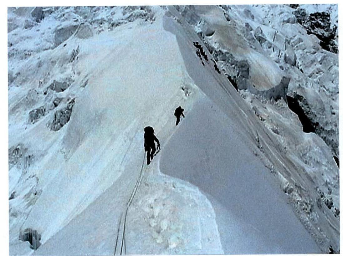
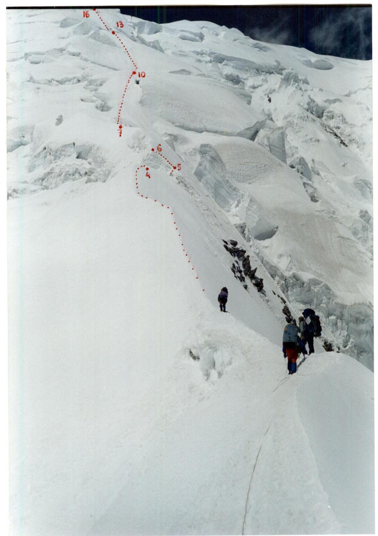
August 11. Passage of the "knife".
In its western part, the rocky spur stretching from nunatak 5623 turns into a "knife" — a sharp ice-snow rib abutting the slope of the southern shoulder of Lenin Peak at a height of 6100 m. The mentioned slope is actually also a rib but not clearly expressed.
In 45 minutes, we reached the couloir along the glacier and ascended along it to the rocky spur of nunatak 5623 (sections 1 and 2). Traversing the spur is straightforward (section 3) until it turns into an icy "knife" (section 4). To reach the "knife" along the ridge takes another 15 minutes. The northern slope of the "knife" is very steep, the southern one is gentler. Therefore, we moved along the ridge or alongside it on its southern side.
In the sharpest middle part of the "knife", we applied the "link by link" tactic (4 ropes), and all other places were passed mainly simultaneously. At a height of 5950 m, there is a fracture in the rib. To bypass it, we had to exit onto the northern slope (one rope of belays):
- first, a six-meter firn wall of 70–90° — section 5,
- then a 50-degree snow slope — section 6.
We processed the wall during lunch. Having set up belays, the lead link without backpacks cleared a path along the snowy rib (section 7) to the base of the wall of Zhukov Pass and descended to camp 5950. After lunch, we moved the camp to the base of the wall to a height of 6100 m. There was a convenient spot for setting up camp — a snow-covered ice fracture.
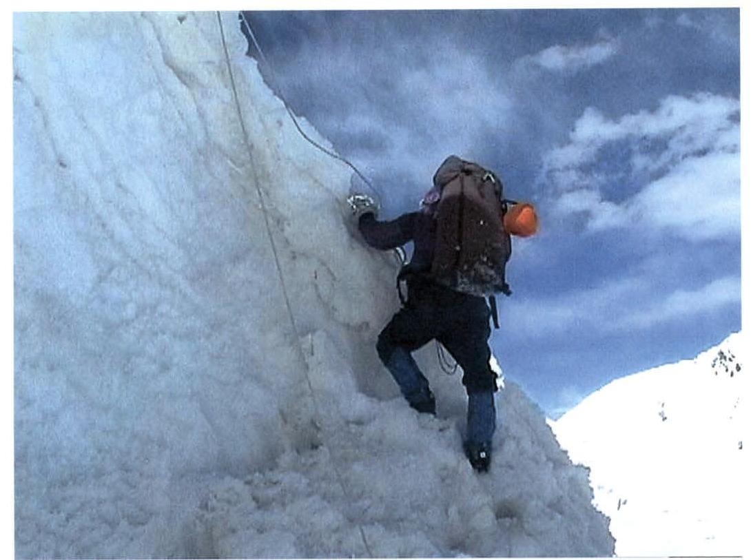
August 12. Ascent along the wall.
Above 6100 m, a vaguely expressed ice rib leads to the southern shoulder (6800 m) of Lenin Peak, which is perceived as a slope of the wall during ascent. This wall resembles a "shell" consisting of five ice platforms or slabs separated by fractures. On photo 5, the three lower, steepest slabs are clearly visible. These slabs are traversed with stationary belays (we used ropes).
Above the last drop visible in photo 5 (6600 m), there are two more gentler slabs, which are traversed mainly simultaneously. The fracture under the ice drop (6600 m) between the 3rd and 4th slabs is the last convenient spot for setting up camp. The next ice drop (between the 4th and 5th slabs) lacks a wide fracture, and above the 5th slab, the southern rib of Lenin Peak features hard firn and strong winds.
Therefore, the plan for this day was to overcome the section from 6100 to 6600 m, consisting of the three lower platforms.
The described section of the wall is 700 m long. Ascending each platform begins with overcoming a sheer wall. Then follows a steep (55–50°) ice wall, which becomes gentler (45°) as it approaches the next platform (50 m of snow up to the knees).
Before the walls, there are narrow (1.5–2.5 m) ledges (beware of bergschrunds), where one can rest.
This is a typical picture with minor variations. The middle (second platform) is especially steep.
Overcoming the sheer walls when entering each platform was very difficult and physically demanding. The first person climbed without a backpack, then set up belays along the inclined slab until the rope ran out, after which they descended to the ledge to their backpack. When ascending to the second platform, we had to use artificial points of support (section 11, one TCO*).
Before setting up camp in the fracture of the ice drop at 6600 m (between the 3rd and 4th slabs), the lead link on foot cleared a path along the 4th slab and scouted the further route. The reconnaissance showed that there wouldn't be any convenient spots for setting up camp higher.
August 13. Ascent to Lenin Peak summit.
The plan for this day was to move from camp 6600 m through Lenin Peak to Razdelny Pass. However, this was not meant to be. Above the camp, we only once set up belays when transitioning from the 4th to the 5th slab (section 19). All other sections of the path were traversed simultaneously. The steepness of the slope up to the southern shoulder at 6800 m remained significant — about 45°. However, deep snow allowed for the creation of convenient steps.
The morning was the same as on all previous days. A strip of clouds was visible on the horizon to the southeast, while the rest of the sky was clear. During the day, it was sunny, the top of Lenin Peak was often shrouded in clouds, but by evening, everything cleared up. We felt that this was not a good sign, that it was a harbinger of bad weather. But it didn't come, and it didn't come.
It arrived on August 13 — the day of the ascent to Lenin Peak. When we reached the southern ridge, we still didn't understand what was happening: whether the main peak was shrouded in clouds again towards lunch or if a fundamental change in weather was underway. We guessed about the deterioration in weather only at a height of 6900 m when cirrus clouds began to fly across the sky.
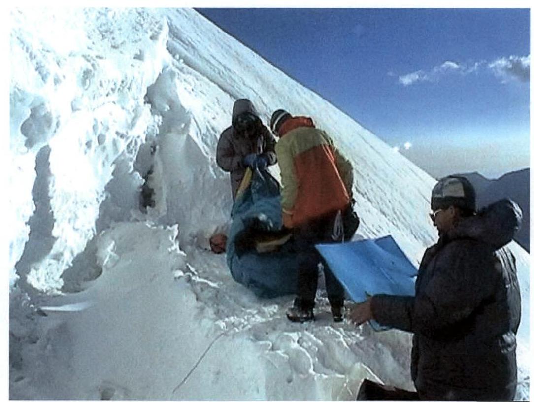
We reached the southern summit of Lenin Peak at 14:05 on August 13 in complete visibility (20 m). From the tour, we retrieved a note left by Alma-Ata climbers in 1999 (the southern summit is rarely visited). Right next to the tour, we set up camp.
We were already noticeably tired. Further movement was dangerous. If we overexerted ourselves and didn't descend from the summit, one of the participants might develop severe altitude sickness at night. For now, our condition was good enough to easily adapt to the 7-kilometer height.
As for the descent, the most we could hope for in such poor visibility was to descend to the 6900 m plateau at the beginning of the western ridge. And that was if we were lucky.
After lunch, we engaged in minor repairs to our gear. The GPS altimeter reading was 7140 m. The wind significantly strengthened towards the evening.
August 14. Life on the Summit.
The wind raged. The tent hummed, giving the impression of flying in an airplane. Sometimes the tent was "lashed" by the wind. All our gear was covered in a thin layer of fine snow needles that penetrated through the pores of the nylon sidewalls of the tent. It was enough to unfasten the zipper for snow to drift in at the entrance.
"To go or not to go?" — that's the question.
What prevents us from descending?
- Everyone's condition is good.
- The wind is not the worst; worse is the lack of visibility.
- We were primarily afraid of descending into Malaia Saukdara.
- We needed to accurately calculate to hit the western ridge of the summit.
Our main hope was in short-term clearings. To use them effectively, we needed to be "on our feet." Therefore, every morning, we had to:
- Get ready.
- Spend as much time as possible under our backpacks or sitting next to them but be ready to take immediate advantage of any information.
This was our strategy. Besides the above, this line of behavior didn't allow us to relax and become sluggish in the tent. We were mobilized for a fight!
In the morning, we got ready to attempt a descent from the summit. We moved slowly, stopping frequently and peering into the white haze. At first, it seemed we were descending to the 6900 m plateau. Then, a sense of complete disorientation arose. The wind was unbearable. We had to find a gentle spot on the slope and set up the tent. Height 7050 m.
August 15. Descent in a Snowstorm.
In the morning, we got ready again. The wind seemed a bit weaker, and visibility was slightly better. We moved according to the compass to the north to reach the edge of the northern wall of Lenin Peak. We hoped to use this landmark to turn left onto the western ridge.
Along the way, we encountered signs of human presence:
- some boxes,
- metal pieces...
Before the northern wall, we found a trail. What luck! We turned west and began our descent. The trail quickly disappeared in the snowdrifts. We walked in circles for a long time, searching for the trail and waiting for a clearing. Then we found the trail again, got lost again, and found ourselves in what seemed to be a hollow. The hollow was wide and flat. We sat down and waited for a clearing for half an hour.
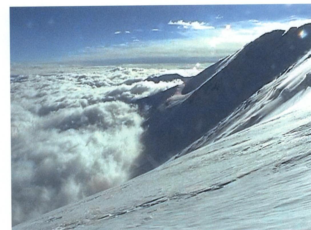
And then a miracle: a particularly strong gust of wind blew, the clouds lifted, the sun appeared, and the horizon showed a blue sky — everything was visible! This lasted 2–3 minutes, but it was enough.
We were standing at the entrance to the 6900 m plateau:
- 50 m from us, a red flag was sticking out,
- from it began a familiar arc leading in a traverse to the western shoulder,
- the entire path to the shoulder was marked with flags!
It's practically impossible to stray from the ridge below the western shoulder. On the northern side of the 50-meter "knife", meter-long cornices hung. The situation was very avalanche-prone. We had to wait and provoke an avalanche of these cornices. The avalanche not only went north but also slightly cleaned the adjacent southwestern slope. We descended along the "knife" in three steps with alternating belays.
Closer to the evening, we reached the area of Razdelny Pass but, in complete visibility, didn't dare to descend. We spent the night on the western ridge, sheltered from the raging wind behind a rock. However, the rock didn't prevent the wind from knocking Igor off his feet when he tried to build a wall. Height 6475 m.
August 16. Return to People.
What news — the blue sky is above us, and a sea of clouds is below! The main thing is that Razdelny Pass peak stood out above the clouds, so we knew where to go. We descended to the saddle of Razdelny Pass along the standard path. Here, as usual, the 3rd camp was set up, but all climbers had descended due to bad weather. The tents in the camp were heavily snowed in.
On the slope of Razdelny Pass peak during the descent to its northeastern ridge, we sank up to our waists in snow. There's less snow on the ridge. We descended to camp 5300 m along the standard ice-snow couloir before the rocks. There were people in this camp. Two guides had already climbed here from camp 4300 m. We, of course, used the trail they had beaten. It led:
- first in a traverse to the east,
- then turned sharply left and down,
- entered the icefall,
- and finally led to the even and white surface of Lenin Glacier.
11. Photo Illustrations
 Ф.6. Section 4
 Ф.7. Upper part of section 4
 Ф.8. On section 5
 Ф.9. Sections 4–16
 Ф.10. On section 7
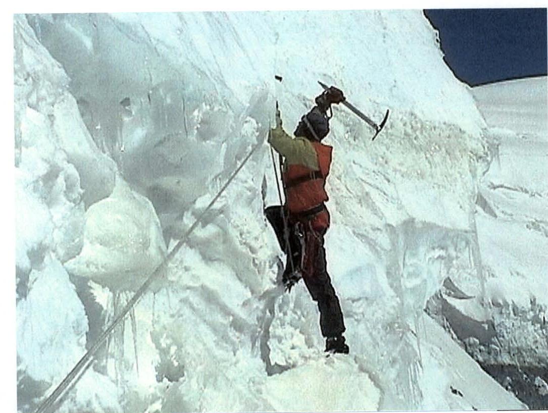 Ф.11. TCO* on section 11
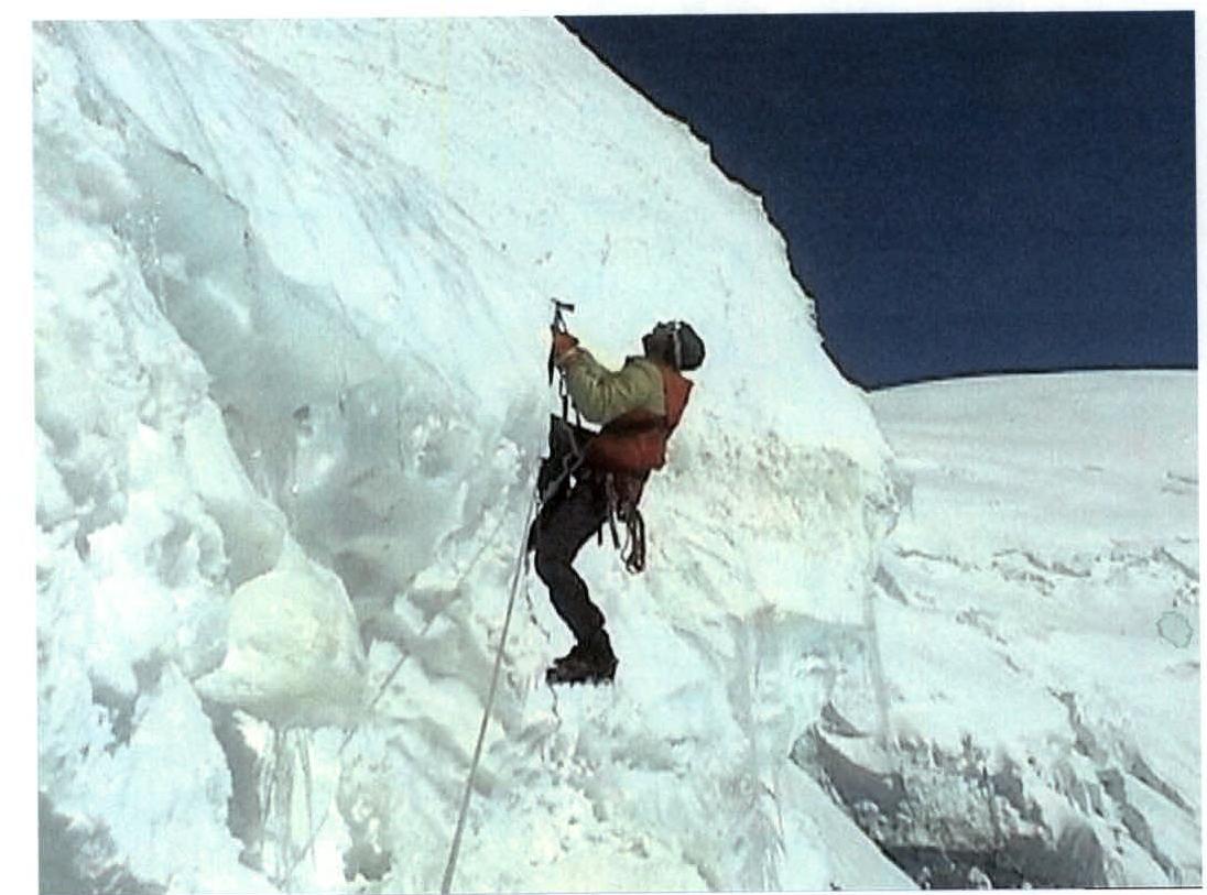 Ф.12. Overcoming section 11
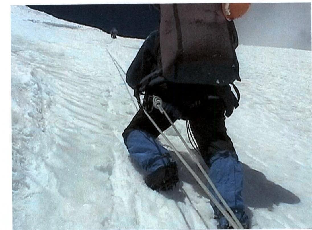 Ф.13. On section 15

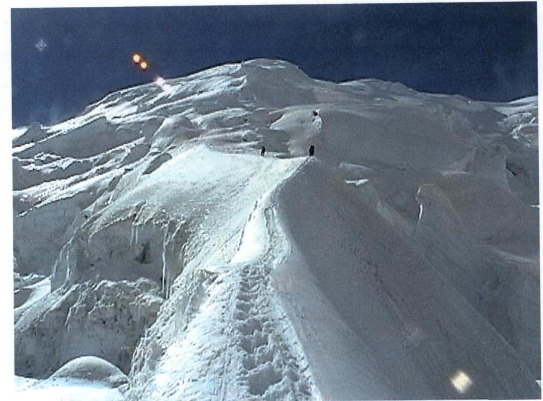
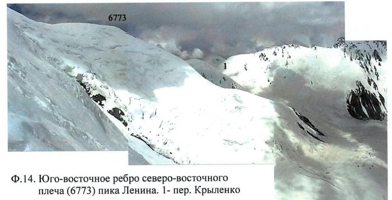 Ф.14. Southeastern rib of the northeastern shoulder (6773 m) of Lenin Peak. 1st Krylenko Pass.
 Ф.15. Morning of August 13, 2001. Camp 6600 m
 Ф.16. Profile of the slope to the left (along the route) of section 20. In the background, Zhukov Peak (6842 m)
 Ф.17. Upper part of section 20. Behind the backpack, the southern shoulder (6800 m) of Lenin Peak is visible.
 Ф.18. Morning of August 16, 2001. The first clear morning after three days of bad weather. View from the western ridge of Lenin Peak to the northeast.
 Ф.19. Western ridge of Lenin Peak. Taken on the morning of August 16, 2001, from Razdelny Pass. 2nd western shoulder of Lenin Peak.
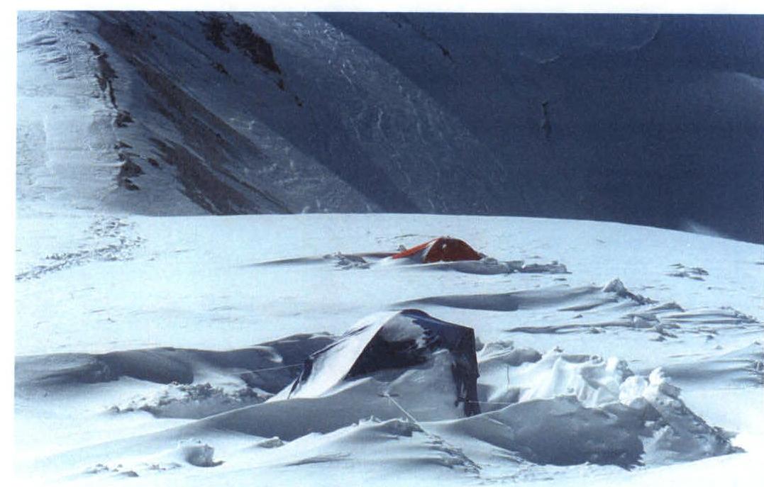 Ф.20. During bad weather, participants of alpine camps left the 3rd camp (6080) on Razdelny Pass.
 Ф.21. On Razdelny Pass (6080). Now it's time for tea.


