
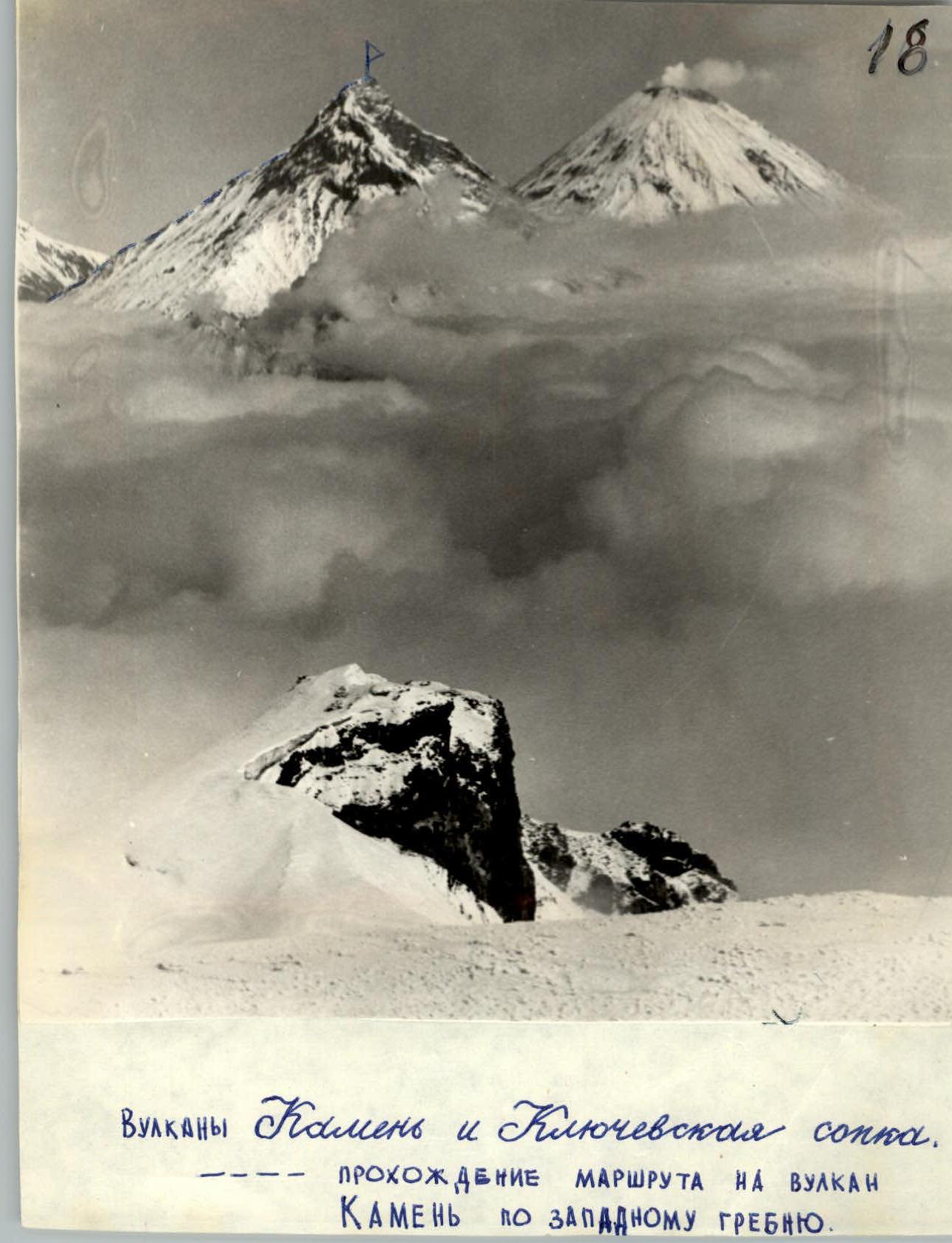
Kamen and Klyuchevskaya Sopka volcanoes
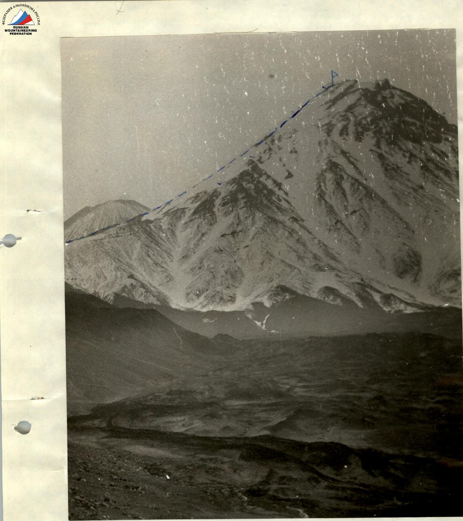
Ascent route to Kamen volcano via the western ridge.
Completed. No. 347 dated January 18, 1972, cat. difficulty 3B/m. V. Kamen, along the ridge.
Kamen and Klyuchevskaya Sopka volcanoes. General view.
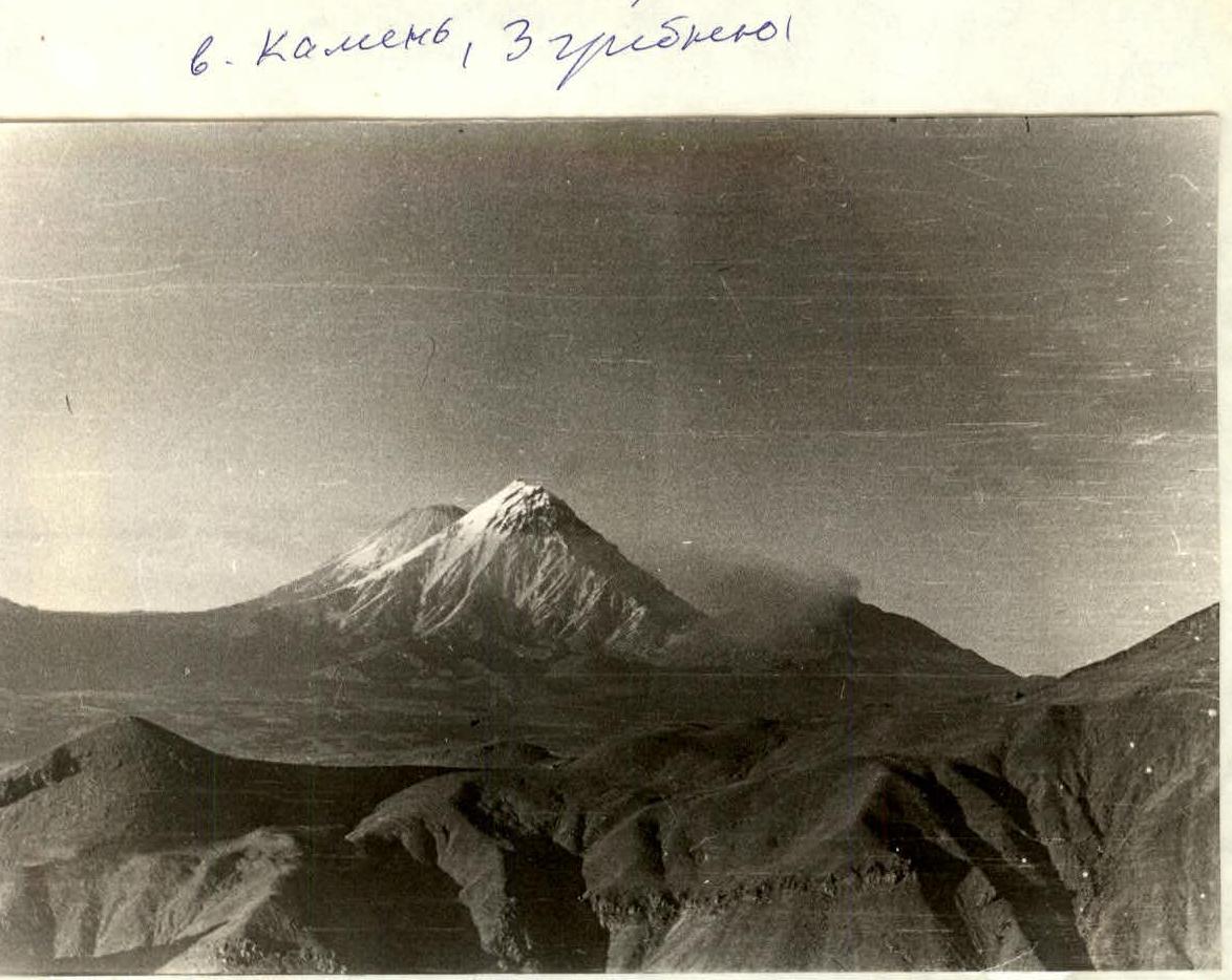
Kamen Volcano

P — summit of Kamen volcano. Ascent route
Description
Ascent to Kamen volcano summit via the western ridge, cat. difficulty 3B.
Kamen volcano is the second highest peak in Kamchatka after Klyuchevskaya Sopka. It is one of the most beautiful volcanoes in Kamchatka. Its summit rises as a huge and at the same time unusually light, pointed dome with intricate outlines.
To the north, a crescent-shaped sharp ridge leads to the summit. Huge glaciers slide down from the west.
- From the south, access to the summit is blocked by red-black rocks.
- To the east lies a giant cliff of about 3,000 m.
- The cause of the biological disaster that led to the formation of this cliff has not been established.
- The summit of Kamen rises like a huge stone table.
- The highest point of the summit is 4,595 m.
1. Approach to the starting point of the ascent
The approach follows the same path as to Bezymianny volcano. However, upon reaching the cinder cone, turn north along the right edge of the Bogdanovich glacier. The cinder cone ahead on the next spur is bypassed from the western side. Behind it lies a wide valley called "Dolina Parazitov" (Valley of Parasites).
It got its name due to:
- abundance of lateral cinder cones.
We pass through this valley in a northerly direction and exit onto the ridge, which runs eastward from the Bogdanovich glacier to the summit. The ridge does not pose technical difficulties up to an altitude of 2,500 m. From the ridge, the cinder cone is visible, limiting the "Valley of Parasites" from the south. A benchmark with a mark of 2,150 m is installed on it. At an altitude of 2,500 m, stop for a bivouac. Travel time from the base camp is 10 hours.
2. Description of the ascent by sections
The count starts from the camp at an altitude of 2,500 m. The relative height to the highest point is 2,095 m.
R1
Height difference: 350 m. Slope: 15°. The ridge consists of medium and large scree. Travel time: 1 hour 45 minutes.
R2
Height difference: 320 m. Slope: 20–25°. The ridge consists of large scree with individual slab sections of 10–15 m. Movement is in teams with simultaneous belay. The slabs have icing. Travel time: 2 hours 25 minutes.
R3
Height difference: 290 m. Slope: 35–45°. Rocky ridge. The rocks are partially destroyed. Slabs up to 10 m. Passed with alternate belay through protrusions.
Travel time: 3 hours.
At the end of this section, there is a good platform for an overnight stay. There are no more good platforms further. It is advisable to stop for the night here.
R4
Height difference: 290 m. Slope: 45°, in some places reaching 60°. Rocky ridge. Rocks with icing. Two rocky steps of 15 and 20 m. Passed with alternate belay. Travel time: 3 hours 20 minutes.
R5
Height difference: 300 m. Slope: 30–40°. Snow-ice slope, passed with simultaneous belay, in some places with alternate belay through an ice axe. Travel time: 2 hours 45 minutes.
R6
Height difference: 410 m. Slope: 45°. At the beginning of the section, for 80 m, the slope reaches 55°. Pure ice. Passed with alternate piton belay. The rest of the path is traversed with simultaneous belay.
- Slope: 45°
- First 80 m: slope reaches 55°
- Surface: pure ice
- Belay at the beginning: alternate piton
- Belay further: simultaneous
- Travel time: 3 hours 15 minutes
R7
Height difference: 135 m. Slope: 40°. At the end of the ascent, when climbing the pillar, there is a rocky ridge of 80 m. In the middle of this ridge, there is a 15 m wall with a slope of 85°. Passed with alternate piton belay. The ridge is also traversed with alternate belay through protrusions. Travel time: 2 hours 15 minutes.
3. Descent from the summit
Descent is made via the ascent route. The pre-summit ridge is traversed with alternate belay. Further, 340 m with simultaneous belay: 90 m is traversed along the rope, 320 m along a snow-ice rocky slope, and at the end of the section, along a slope with simultaneous belay. The steps are traversed using the Dulfer method and further in teams until the overnight stay location. Travel time: 3 hours 40 minutes.
From the overnight stay location along the ridge to the snowfield descending into the "Valley of Parasites". Descent time: 1 hour 30 minutes. Crossing the valley, we exit onto the path along the ridge. We return to the base camp along this path. Travel time: 10 hours.
4. Calculation of the route duration
Day 1. Approach from the base camp to the starting point of the ascent — 10 hours.
Day 2
- R1: 1 hour 45 minutes.
- R2: 2 hours 25 minutes.
- R3: 3 hours
Total: 7 hours 10 minutes.
Day 3
- R4: 3 hours 20 minutes.
- R5: 2 hours 45 minutes.
- R6: 3 hours 15 minutes.
- R7: 2 hours
Time spent on descent to the overnight stay location: 3 hours 45 minutes.
Total: 15 hours 5 minutes.
Day 4
- Time spent on continuing the descent: 1 hour 30 minutes.
- Time to the base camp: 10 hours
Total: 11 hours 30 minutes.
5. Recommendations for climbers
Everyone should have crampons. The group can consist of up to 6 people. It is necessary to bring sleeping bags for at least two people, as well as special equipment for a group of 6.
List of equipment for the group:
- Main ropes: 3 × 40 m.
- Rock pitons: 3 pcs.
- Ice pitons: 6 pcs.
- Climbing hammers
- Repschnur for loops: 10 m.
- Carabiners: 4 pcs.
- Crampons: 6 pairs.
- Personal equipment
- Bivouac equipment.
The repeat ascent was made on August 17, 1971. The description was compiled on November 10, 1971.
Comments
Sign in to leave a comment