Climbing Report
To the summit of Erydag (3925 m) via the center of the left part of the 3rd wall (A. Nekrasov's route, 1986, 5A category of complexity)
The route was completed on April 29, 2023, by the team of Alpine Club "Bars" (St. Petersburg):
- Nikolai Yakuba
- Denis Chetverikov
- Natalia Tsareva
Contents
- Climbing Passport — 3
- Route Description — 5
- Tactical Actions of the Team — 6
- Impressions — 6
1. Climbing Passport
1. General Information
1.1. Leader: Nikolai V. Yakuba — 1st sports category 1.2. Participants:
- Denis P. Chetverikov — 2nd sports category
- Natalia S. Tsareva — 1st sports category
1.3. Coach: Sergei A. Semiletkin 1.4. Organization: Alpine Club "Bars" (St. Petersburg)
2. Characteristics of the Climbing Object
2.1. Region: Caucasus 2.2. Area: Dagestan mountains, Erydag massif 2.3. Section number according to the 2013 classification table: 2.10.45 2.4. Name and height of the summit: Erydag, 3925 m.
3. Route Characteristics
3.1. Route name: via the center of the left part of the 3rd wall 3.2. Category of complexity: 5A 3.3. Relief characteristics of the route: rocky 3.4. Height difference of the route: 480 m. 3.5. Route length: 530 m. 3.6. Descent from the summit: via the plateau, using route 1B or 2A category of complexity.
4. Characteristics of the Team's Actions:
4.1. Preparation time: 4 hours. 4.2. Travel time: 30 min approach, 13 hours to the summit, 2 hours descent. 4.3. Start of movement along the route: April 29, 2023, 6:30. 4.4. Reaching the plateau: April 29, 2023, 19:30. 4.5. Return to camp: April 29, 2023, 21:30. 4.6. Pitons left on the route: 1 on section R13–R14 (could not be retrieved). 4.7. Use of pitons on the route:
- bolted station pitons — 7 (left by other groups)
- for ITO — 8
4.8. Use of belay points on the route:
| Total | Including ITO | |
|---|---|---|
| chock | ≈ 10 | 1 |
| camalot/totem | ≈ 25 | 3 |
| anchor piton | ≈ 15 | 6 |
4.9. Equipment used:
- Chocks — set of 12 pcs.
- Camalots — 6 pcs.
- Totems — set of 7 pcs.
- Anchor pitons — 5 pcs.
- Quickdraws — 10 short + 4 long
- Station loops — 4 pcs.
- Ropes — 3 pcs. 50 m (2 dynamic, 1 static)
- Weather conditions: cloudy, no precipitation, moderate wind 3–5 m/s.
- Responsible for the report: Nikolai Yakuba, nick.yakuba@gmail.com
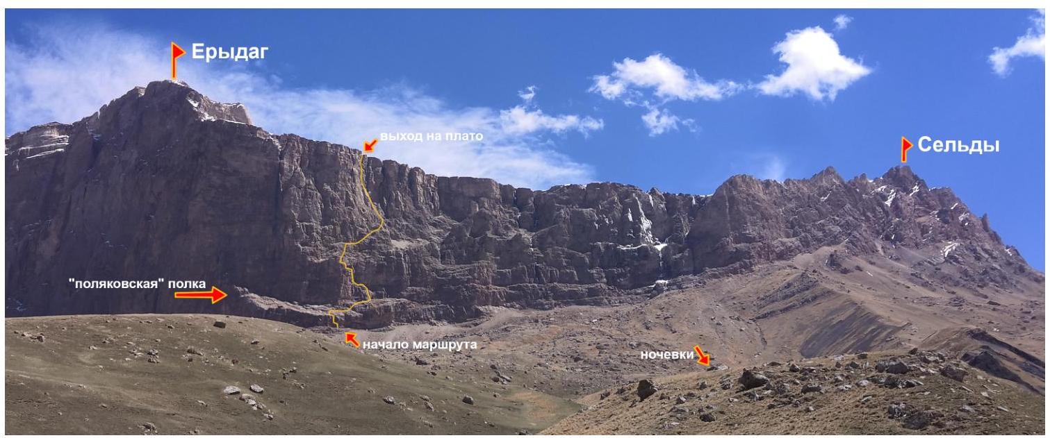
Fig. 1: Photograph of the area
2. Route Description
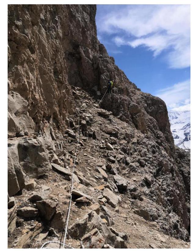
- R0–R1: The route begins on the right part of the "Polyak's" ledge. The triangular cornice is bypassed via the inner corner on the left. Climbing is difficult. Station is three meters to the left after reaching the ledge on a bolted piton and an anchor piton. Fig. 3.
- R1–R2: Up and to the right along the ledge. Climbing is easy. Fig. 4.
- R2–R3: Through the wall, climb onto the ledge and move right. Climbing is not difficult. Fig. 5.
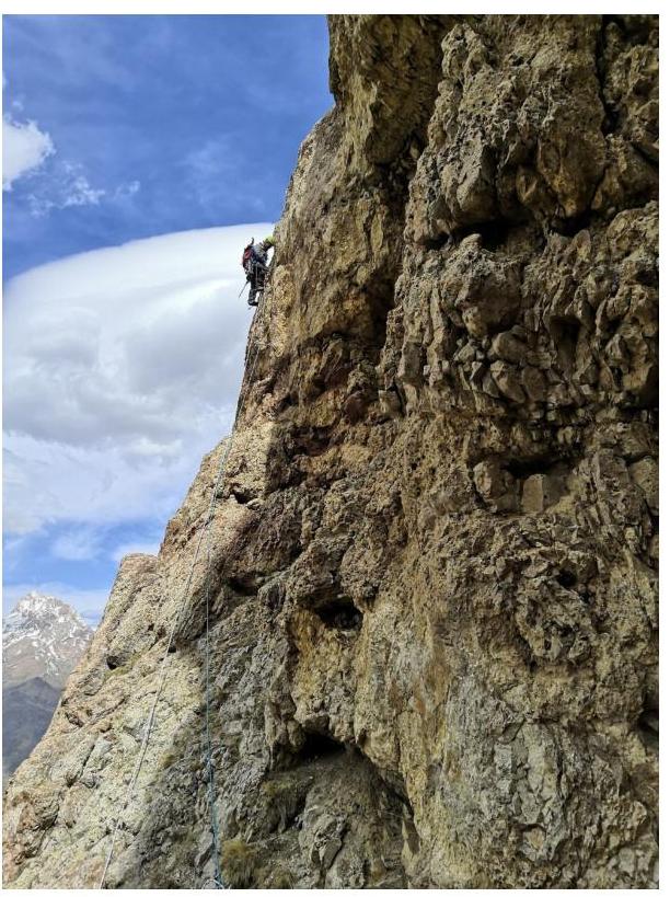
- R3–R4: Up the wall onto the ledge under the red wall with a cornice. Nekrasov's bivouac. Fig. 6.
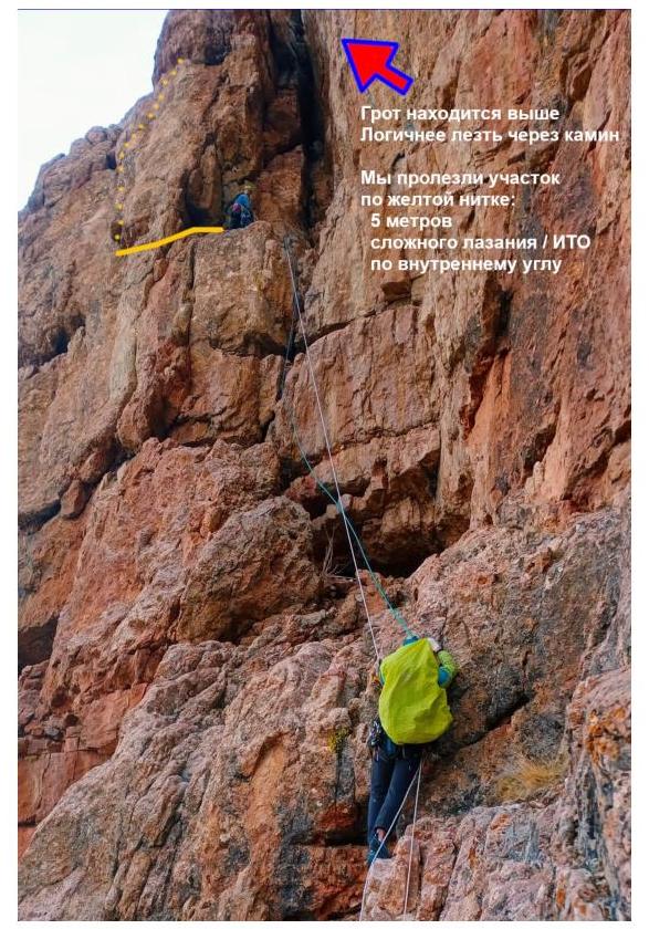
- R4–R6: Up through the inner corner via a chimney to a grotto/niche. Climbing is difficult. Bivouac. Control point. Fig. 7.
- R6–R7: From the grotto, 5 m to the left, and straight up (ITO, bolted piton) onto a narrow ledge. Along the ledge 5 m to the left to approach the inner corner. Fig. 8.
- R7–R8: Up the inner corner to climb onto a scree ledge. Climbing is difficult.
- R8–R9: The section can be climbed simultaneously. Move up and to the right. Approach a couloir from which the upper part of the route is visible. Fig. 9.
- R9–R10: Up the inner corner. Climbing is not difficult, but the rock becomes more fragile.
- R10–R11: Up the inner corner to reach a ledge.
- R11–R12: From the ledge, through large cracks, reach a chimney with a plug. The plug is bypassed on the right. Climbing is difficult. Station is in the inner corner.
- R12–R13: From the inner corner, move left and up onto a ledge. To the left is a large chimney from which sections R13–R15 are visible before reaching the plateau.
- R13–R14: Up the right wall of the chimney under an overhanging crack.
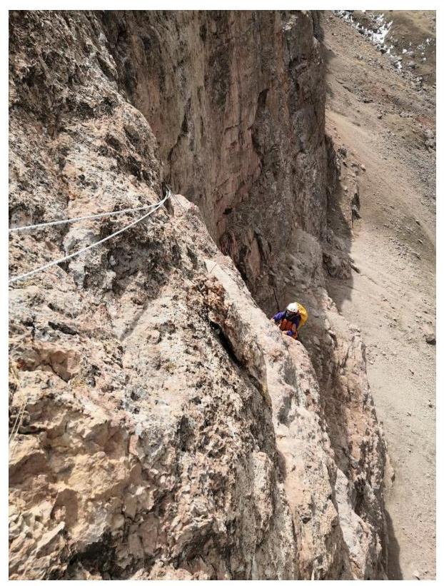
- R14–R15: Through the narrow overhanging crack (anchor pitons, ITO) to reach the plateau.
- From the plateau, move towards the summit, bypassing the Erydag tower on the right.
3. Tactical Actions of the Team
The route was climbed in a team of three with the first four sections being processed. The total climbing time was 17 hours, including 4 hours of processing. Three ropes were used for the ascent. The following tactics were chosen:
- The leader climbed with two ropes, one of which was later used as a fixed rope.
- The second climber provided simultaneous belay to the leader and the third climber, with the rope used for top-rope belay of the third climber being anchored to the leader and potentially used for bottom-rope belay.
On the day of the ascent, movement along the route began at around 6:30 AM, and the plateau was reached by 7:30 PM. Due to the onset of darkness and potential weather deterioration, it was decided not to ascend to the summit of Erydag.
During the ascent, on section R5–R6, it would have been more logical to move through the chimney. However, assuming the chimney was a niche, it was decided to move left (according to the description). To the left, there is an inner corner with seemingly rich relief for belaying, which in practice turned out to be less suitable. The section was climbed using ITO. Except for this section, there were no significant navigation issues. The route was climbed at a relatively good pace. The descent was made via route 2A to Sel'dy in the dark. By 9:30 PM, the team returned to camp without incident.
4. Impressions
The route is excellent. There are few sections with fragile rock. The line of movement is logical. During our ascent (late April), icicles hung from the edges of the plateau on the last ropes. Due to active melting in the sun, icicles fall off, and fragments of ice periodically fly down the couloir on sections R9–R13. One needs to be particularly attentive.
Also, due to ice melting, the rocks on sections R13–R15 become wet. The exit to the plateau required ITO via the only accessible narrow overhanging crack. The relief to the right and left of the exit was covered in ice.

Fig. 2: Route thread. Photos from different angles
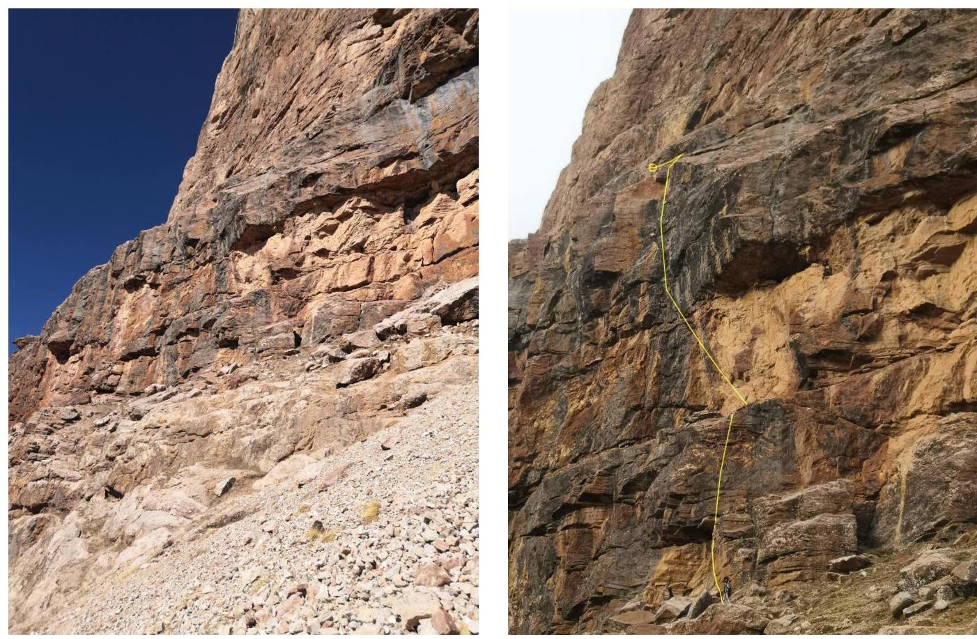
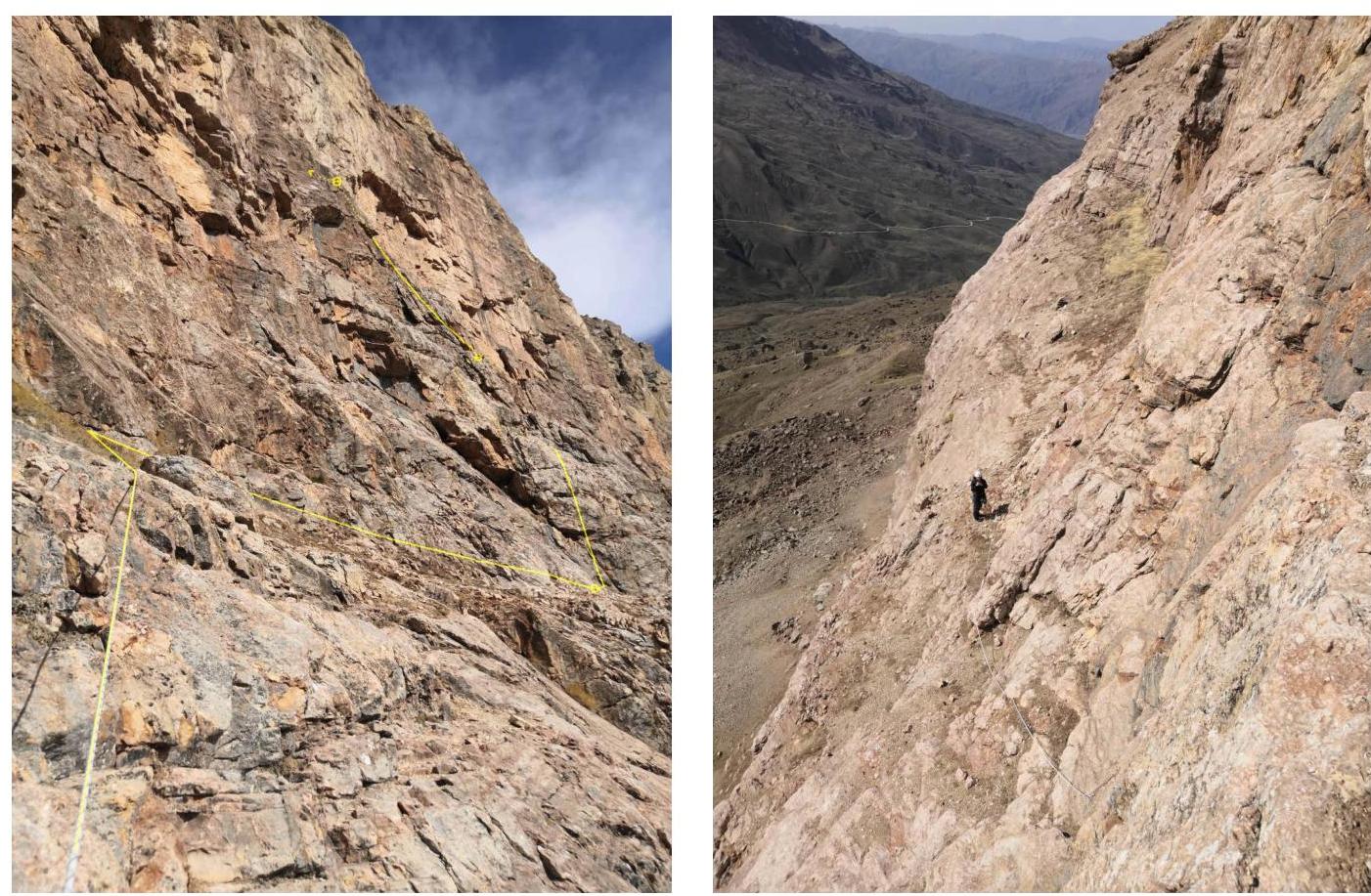
Fig. 3: Beginning of the route. The first rope is visible on the right photograph
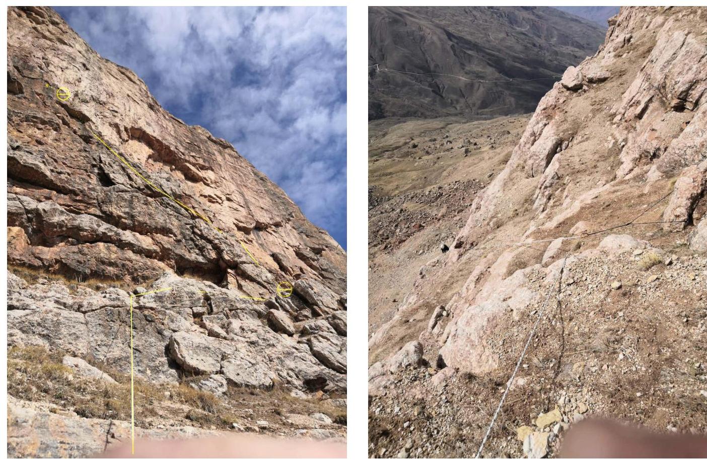
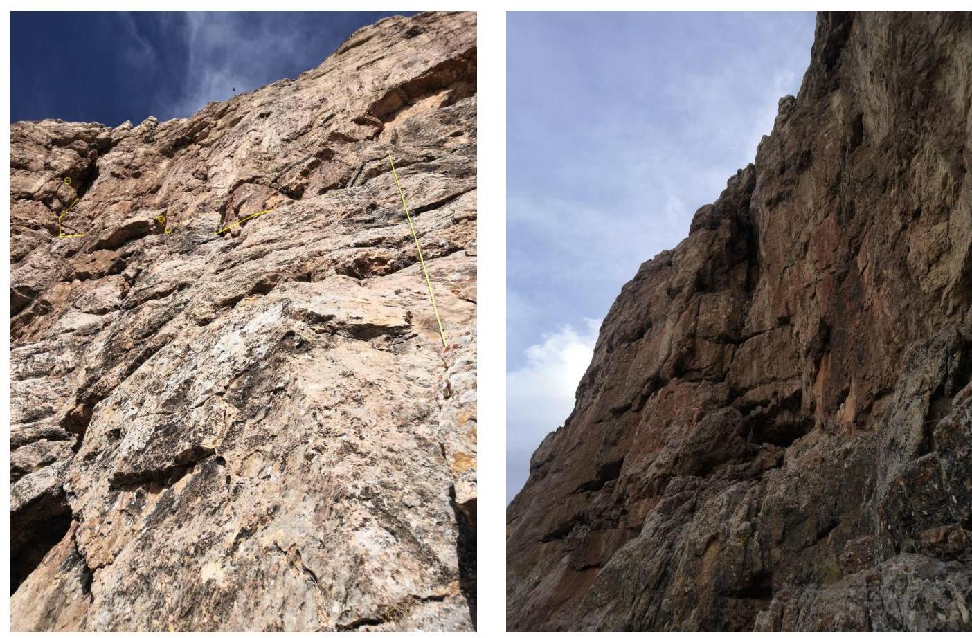
Fig. 4: Section R1–R2. View from below and above
(a) Work on section R4–R5
 (b) ITO on section R6–R7. View from the grotto
Fig. 5: Section R2–R3. View from below and above
Fig. 6: Sections R3–R4 and R4–R5
 (a)
Work on section R4–R5
(a)
Work on section R4–R5
(b)
ITO on section R6–R7. View from the grotto
Fig. 7: Work on sections R4–R7
 (a)
View from station R7
(a)
View from station R7
 (b)
Section of simultaneous movement
(b)
Section of simultaneous movement
Fig. 8: Sections R7–R9
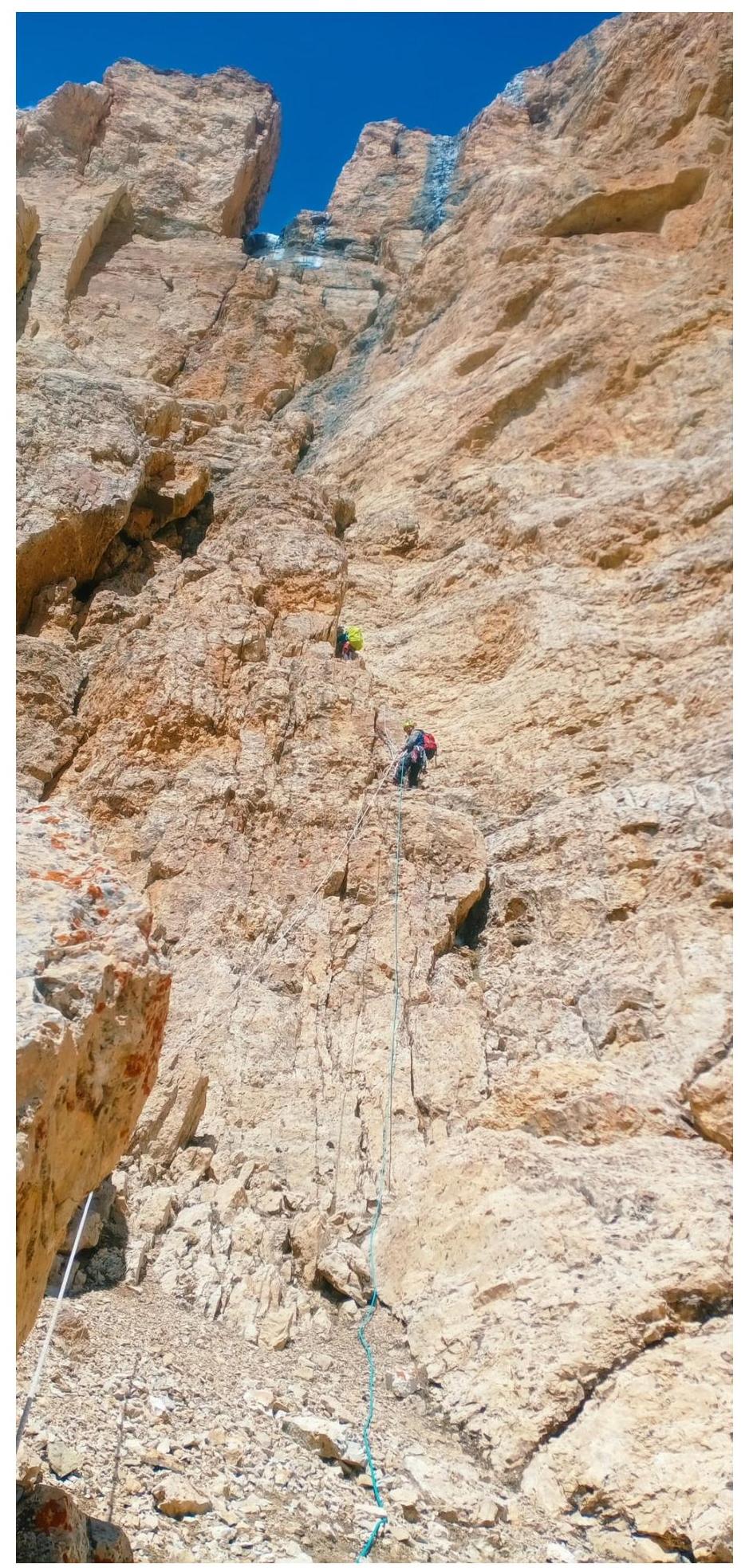
Fig. 9: View of the upper part of the route R9–R13
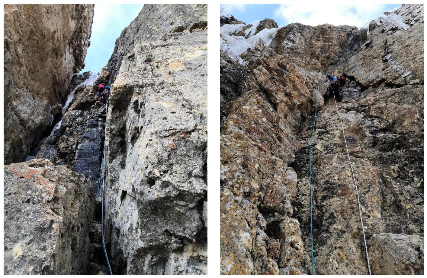
Fig. 10: Work on sections R13–R15 before reaching the plateau


