
Russian Mountaineering Championship
Technical Climbing Category
Ascent Report
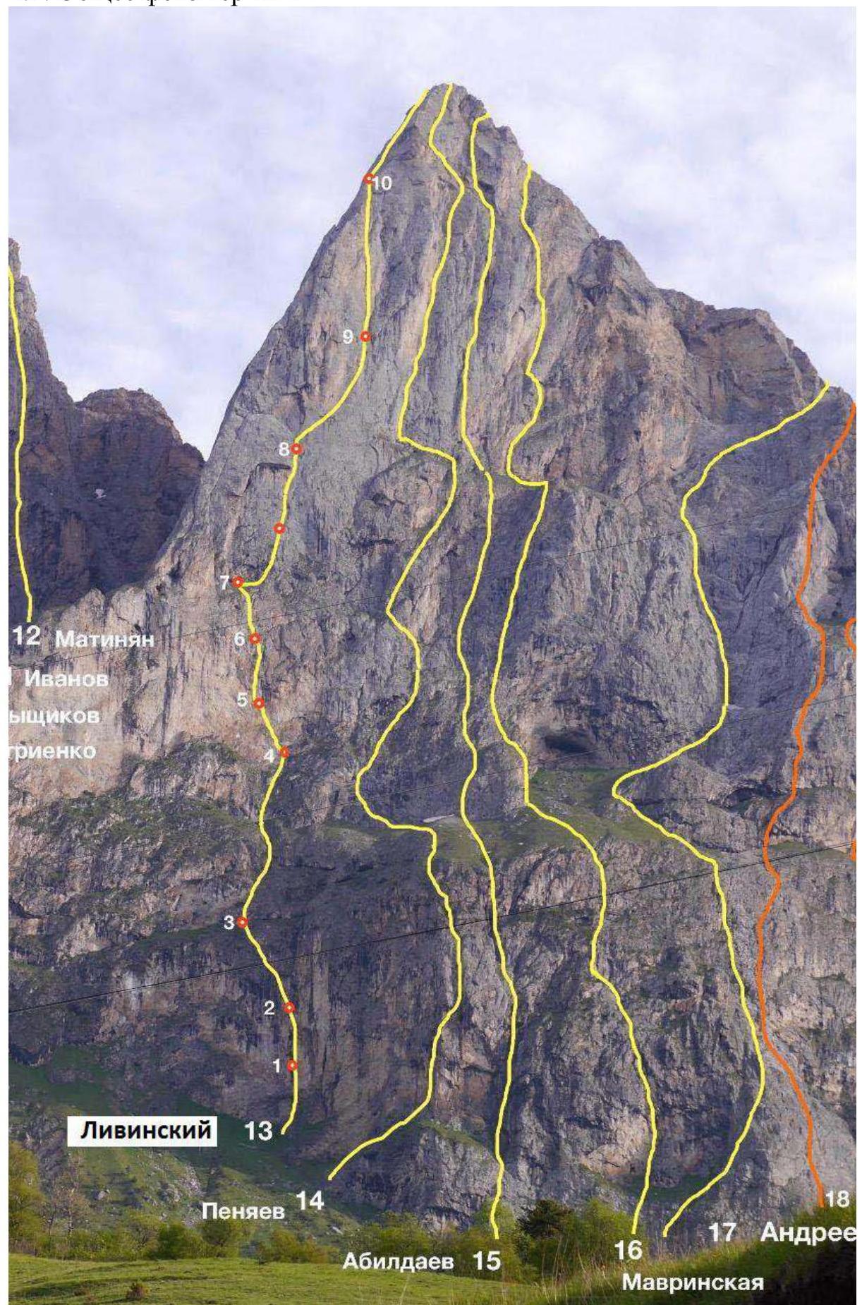
TO THE SUMMIT OF KOAZOY-LOAM (3100 m) VIA THE LEFT PART OF THE SOUTHWEST WALL (LIVINSKY'S ROUTE)
6A category of difficulty by the team from Voronezh Region, October 29-31, 2024
I. Ascent Passport
| 1. General Information | ||
|---|---|---|
| 1.1 | Full Name, Sports Rank of the Team Leader | Torshin Mikhail Viktorovich, CMS |
| 1.2 | Full Name, Sports Rank of the Team Members | Maksin Alexander Alexandrovich, CMS Zavalishin Maxim Alekseevich, CMS |
| 1.3 | Full Name of the Senior Coach of VRO SFA | Torshin Mikhail Viktorovich |
| 1.4 | Organization | VRO SFA |
| 2. Characteristics of the Ascent Object | ||
| 2.1 | Region | Region 2.9. From the Kreстовый Pass to the Shaviklde Peak |
| 2.2 | Valley | Dzheyrakh |
| 2.3 | Number of the Section in the 2013 Classification Table | 2,9 |
| 2.4 | Name and Height of the Summit | Koazoy-Loam (Kyazi Central), 3100 m |
| 2.5 | Geographical Coordinates | 42.833233, 44.845774 |
| 3. Route Characteristics | ||
| 3.1 | Route Name | Via the left part of the SW wall |
| 3.2 | Category of Difficulty | 6A |
| 3.3 | Degree of Route Exploration | 6th ascent |
| 3.4 | Terrain Type of the Route | Rock |
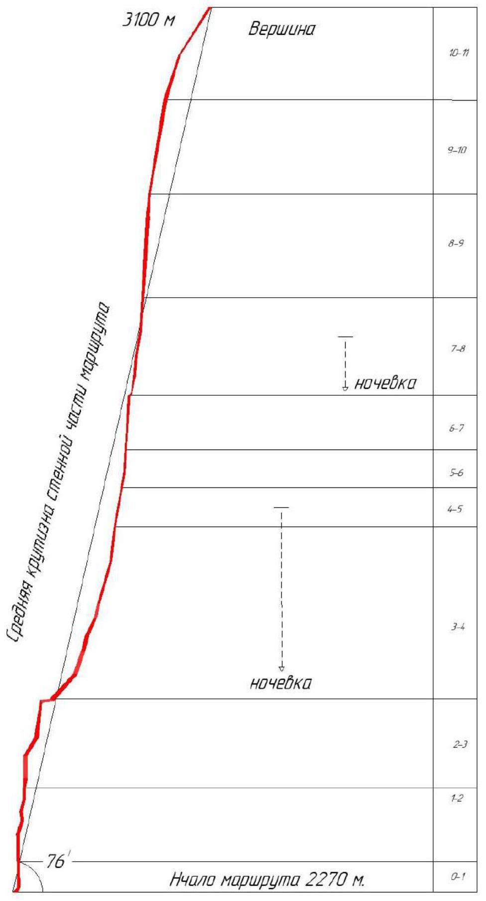
| 3.5 | Elevation Gain of the Route (m) | 830 m |
| 3.6 | Route Length (m) | 1040 m |
| 3.7 | Technical elements of the route (total length of sections of different difficulty categories is indicated, with terrain type specified (ice-snow, rock)) | IV cat. dif. rock – 180 m. V cat. dif. rock – 180 m. VI cat. dif. rock – 290 m. VI+ cat. dif. rock – 120 m. Rock VI, A2 – 240 m Rock VI, A3 – 40 m |
| 3.8 | Average Steepness of the Route, (°) | 75° |
| 3.9 | Average Steepness of the Main Part of the Route, (°) | 80° |
| 3.10 | Descent from the Summit | Via 4B cat. dif. to the valley |
| 3.11 | Additional Route Characteristics | Water is absent on the route. Snow on the summit and in the rock shelves along the route |
| 4. Characteristics of the Team's Actions | ||
| 4.1 | Time in Motion (team's marching hours, indicated in hours and days) | 26 h (3 days) |
| 4.2 | Overnight Stays | Platforms in grottos |
| 4.3 | Route Processing Time | absent |
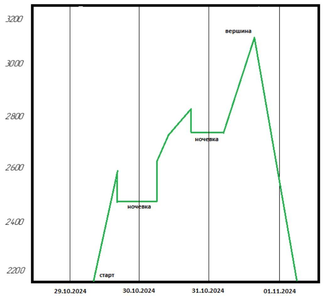
| 4.4 | Start of the Route | 10:20, October 29, 2024 |
| 4.5 | Summit Ascent | 18:10, October 31, 2024 |
| 4.6 | Return to the Base Camp | 04:00, November 1, 2024 |
| 5. Weather Conditions | ||
| 5.1 | Temperature, °C | +5 °C – −5 °C |
| 5.2 | Wind Speed, m/s | 3–5 m/s |
| 5.3 | Precipitation | Absent |
| 5.4 | Visibility, m | good |
| 6. Person Responsible for the Report | ||
| 6.1 | Full Name, e-mail | Zavalishin M.A., max-xam-xam@mail.ru |
II. Ascent Description
1. Characteristics of the Ascent Object
1.1. General Photo of the Summit
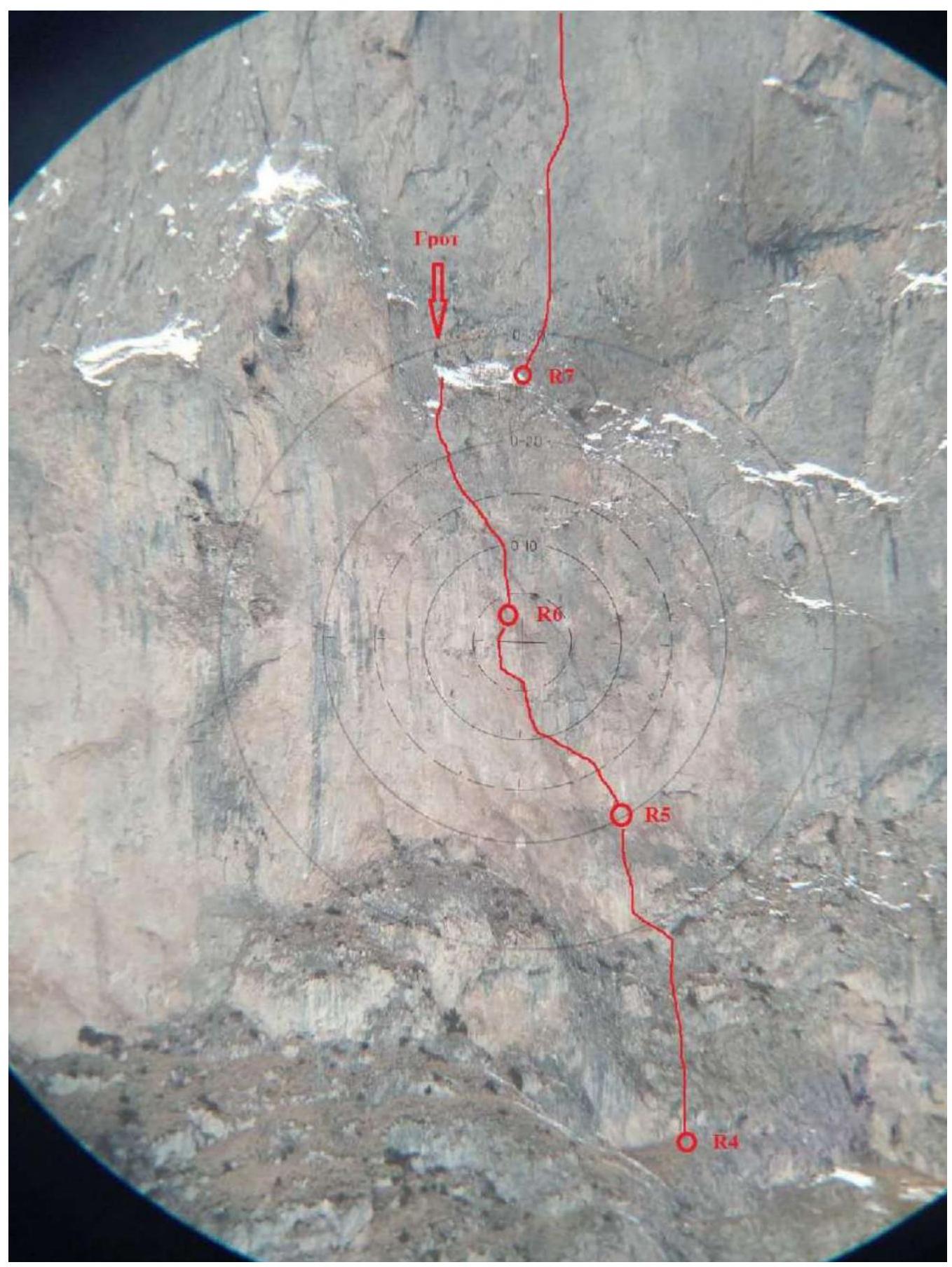
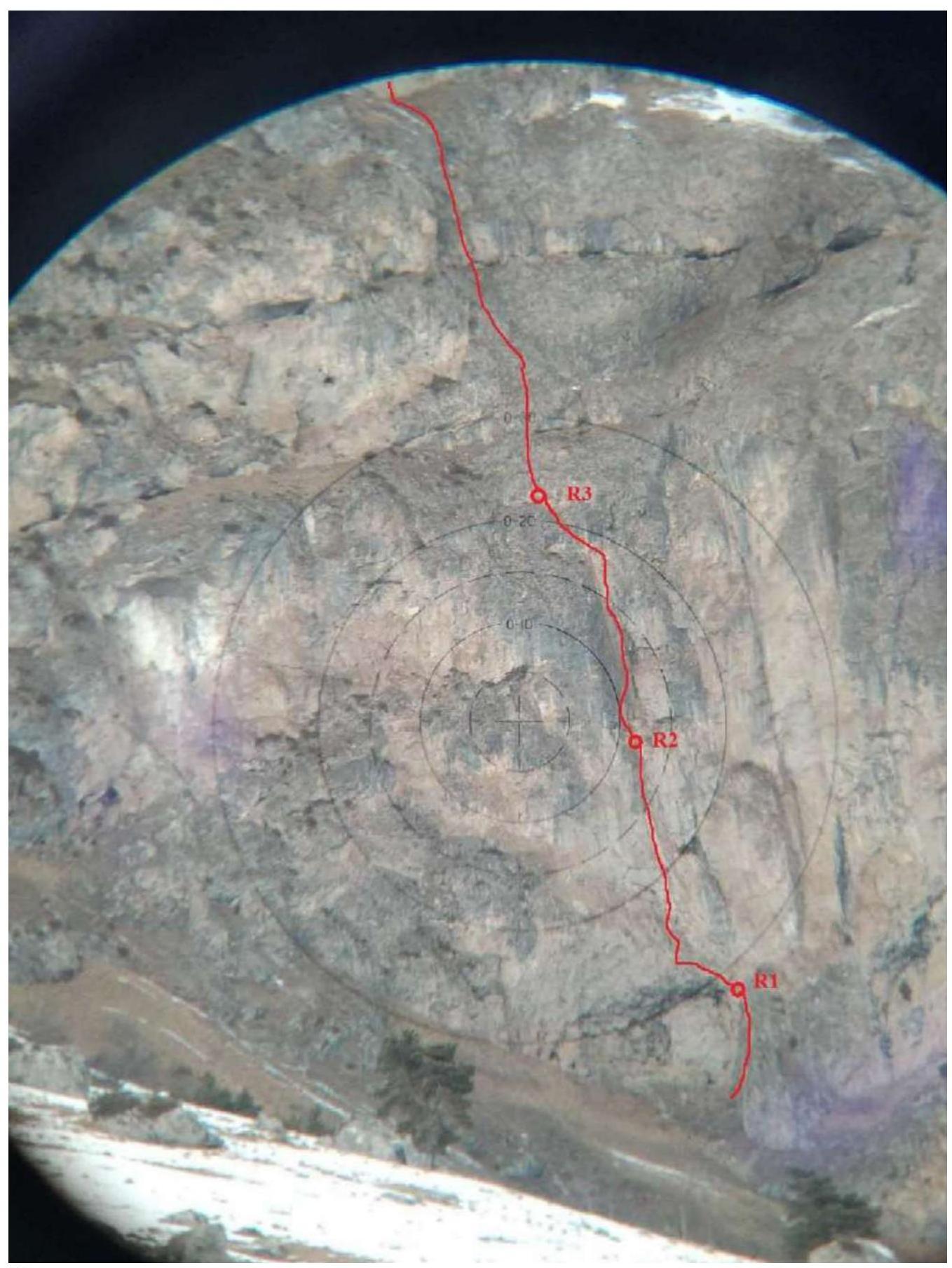
1.2. Drawn Profile of the Route
1.3. Ascent Graph
2. Route Characteristics
2.1. Technical Photos of the Route
Upper part of the route

Third quarter of the route
Second quarter of the route
Lower part of the route
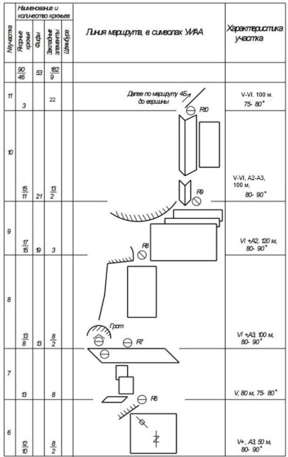
2.2. Route Diagram in UIAA Symbols
3. Characteristics of the Team's Actions
3.1. Description of the Route Ascent
| Section No. | Description |
|---|---|
| R0–R1 | Start right of the large cave (niche). Up to the upper edge of the cave: 30 m, free climbing 4 cat. dif., 75°. Monolithic terrain. |
| R1–R2 | Then above the cave, slightly left up towards the system of internal corners and cracks leading straight up: 80 m, free climbing 5 cat. dif., 80°. Poor belay, heavily destroyed. |
| R2–R3 | Up and slightly left through the system of internal corners, cracks, then a chimney with a plug and under an overhang: 100 m free climbing 6 cat. dif. with short sections of AID, 80–85° A1. The overhang is bypassed left up on AID to reach a ledge: 10 m, 80–85°, A2. |
| R3–R4 | Along ledges alternating with small walls, up to the red wall: 200 m, 4 cat. dif., 75°. |
| R4–R5 | Up, slightly left through a series of cracks and small walls: 50 m, free climbing with sections of AID, 5+ cat. dif., 80–90°, A1. |
| R5–R6 | Through a series of cracks and flutes up and slightly left, overcoming a small overhanging section at the end (about 3 m, passed on AID A3): 50 m, AID with sections of free climbing, 5+ cat. dif., 80–90°, A3. |
| R6–R7 | Up through grassy rocks – exit to a ledge with a grotto: 80 m, 5 cat. dif., 75–80°. The grotto provides a comfortable bivouac for 4 people. |
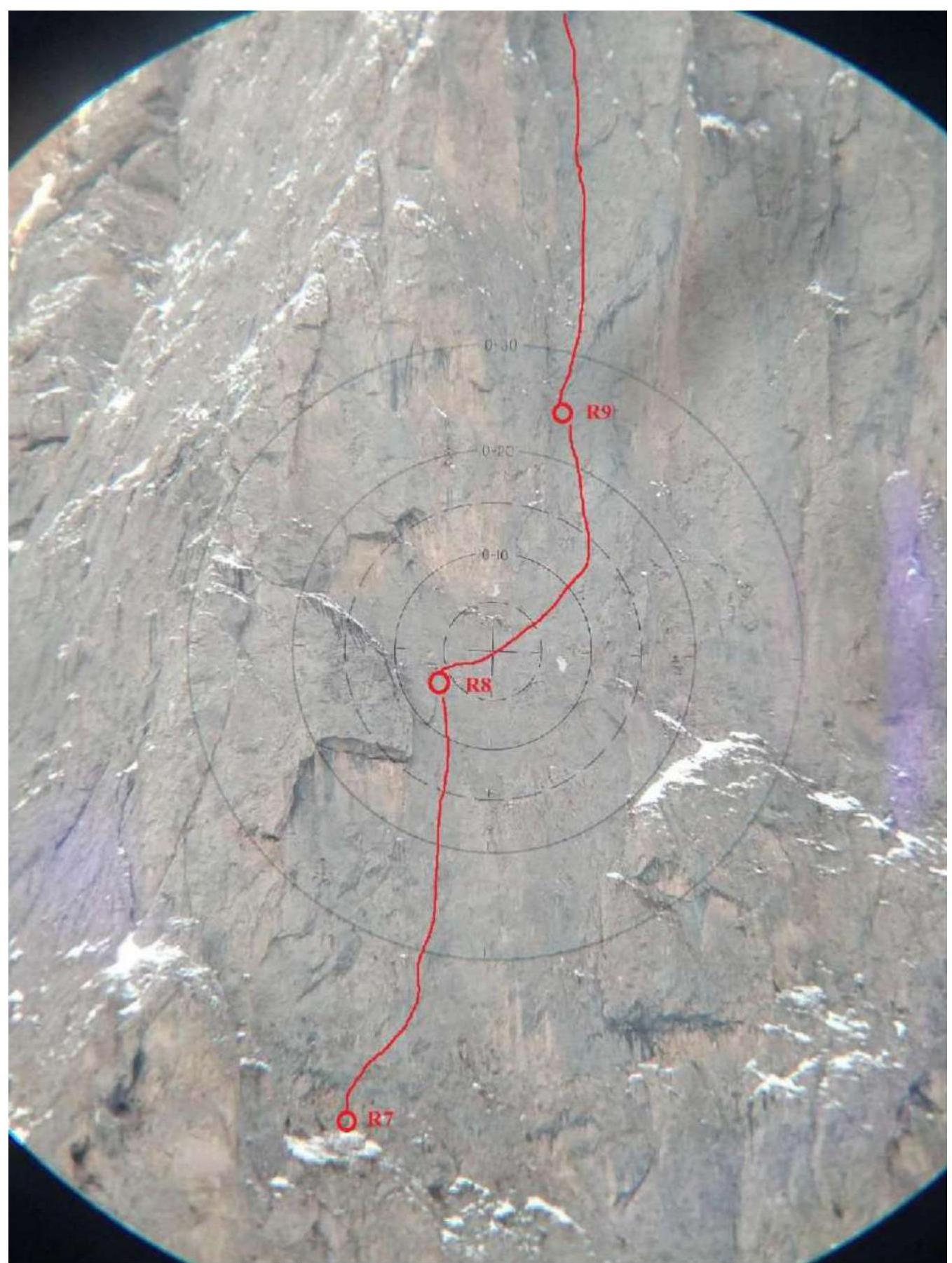
| R7–R8 | From the cave, traverse right along the ledge 10 m, then up to the right edge of the L-shaped cornice: 100 m, AID (micro-protection, anchors), 2 pitons, 6+ cat. dif., 80–90°, A3. |
| R8–R9 | From the edge of the L-shaped cornice, traverse right (micro-protection, anchors) with a slight gain in height to bypass the overhang with red-colored rocks: 120 m, 6+ cat. dif., 80–90°, A3. |
| R9–R10 | Up along the system of cracks and internal corners on their right wall to join route 4B "Koazoy – Loam via SW ridge, Loginov I., 2017". Junction with route 4B in the corner with a section of red, heavily destroyed rocks (about 7 m, on AID A3): About 100 m, sections of free climbing 5–6 cat. dif. for 15–20 m, 80–90°, A2–A3. |
| R10–R11 | Then to the summit via route 4B "Koazoy – Loam via SW ridge, Loginov I., 2017". About 100 m of climbing 4–5 cat. dif. |
On the morning of October 29, 2024, around 7:00, the team arrived at the "Kyazi" alpine camp. At 8:30, they started their approach. They began the route at 10:40. At 17:20, they finished on section R4–R5 and descended to a ledge (in the cave) for the night. First overnight stay in the cave.
The next morning:
- At 8:20, they continued moving along the route.
- At 12:20, all participants were at R7, where they organized a bivouac in the grotto and by 16:40, they processed two ropes (up to R8).
- Overnight stay in the grotto.
Then:
- Started from R8 at 7:20.
- Reached the summit as a team at 18:10.
3.2 Photo of the Team on the Route
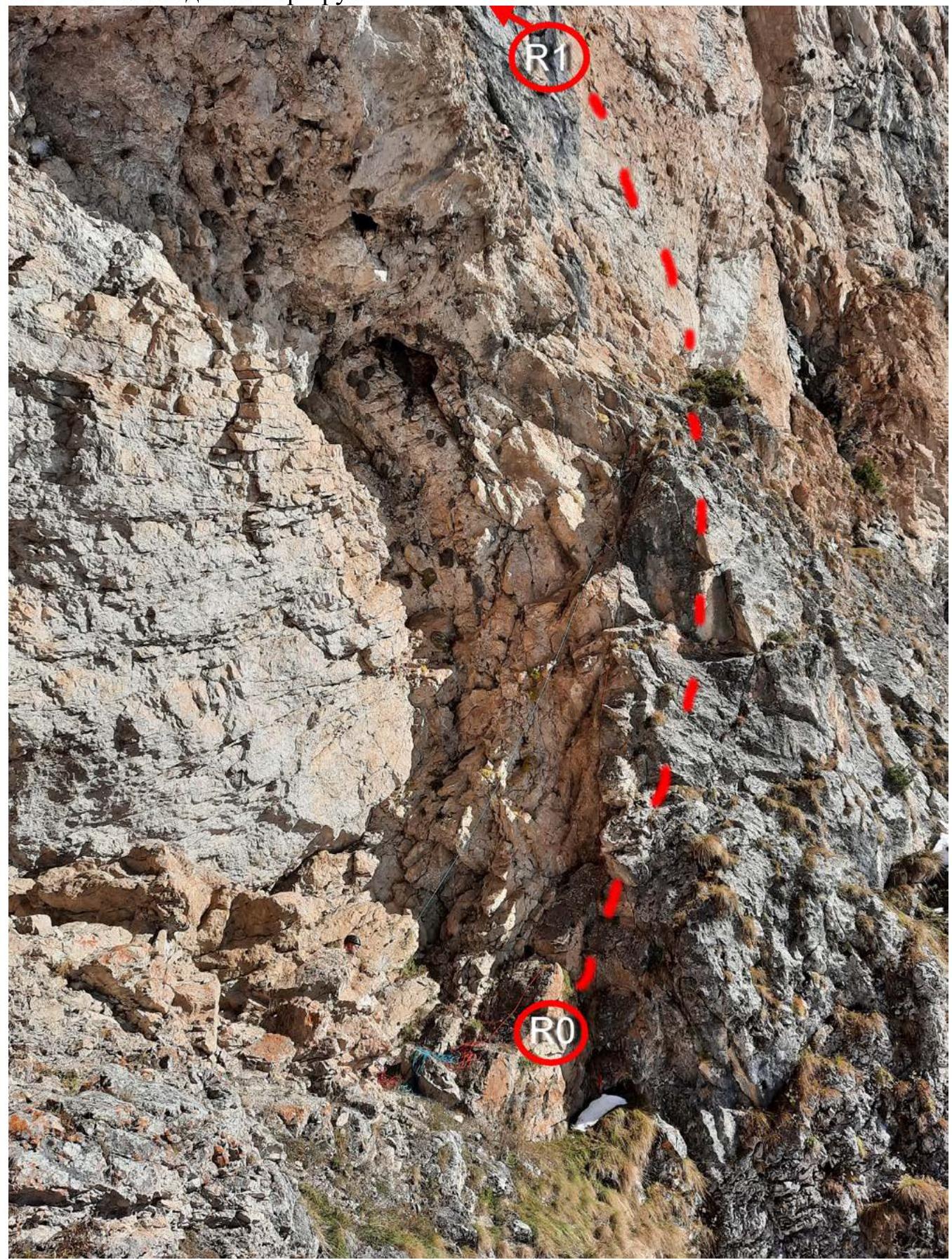
Photo №1 – R0–R1. Start of the route.
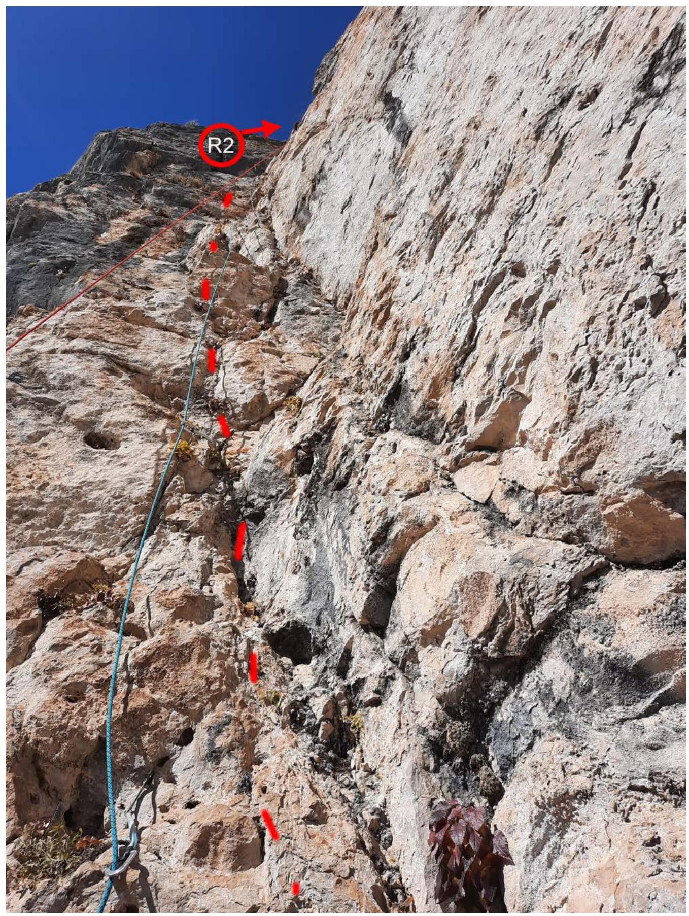
Photo №2 – View from R1 upwards.
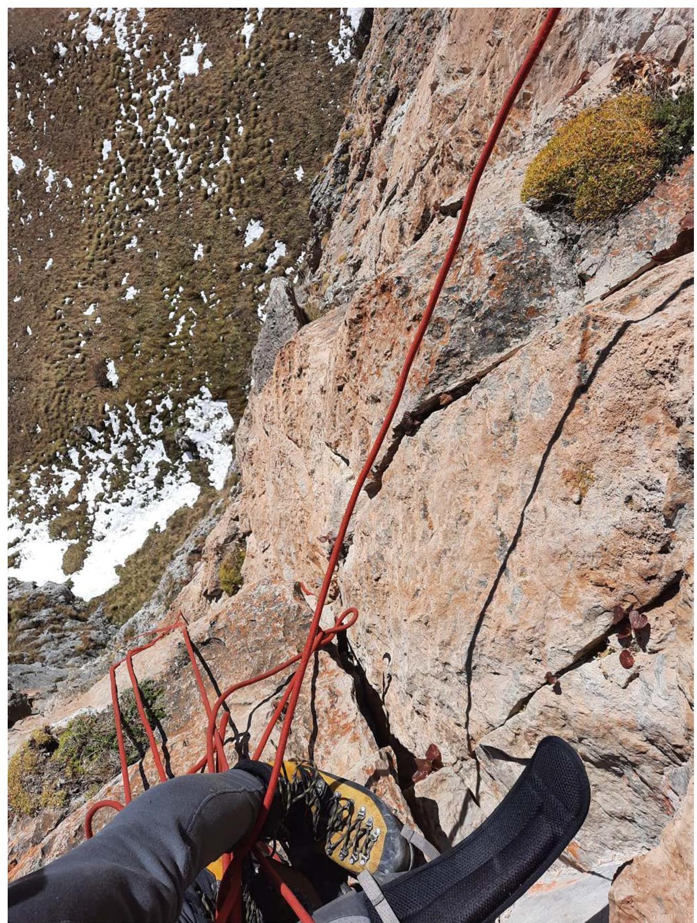
Photo №3 – View from R2 downwards.
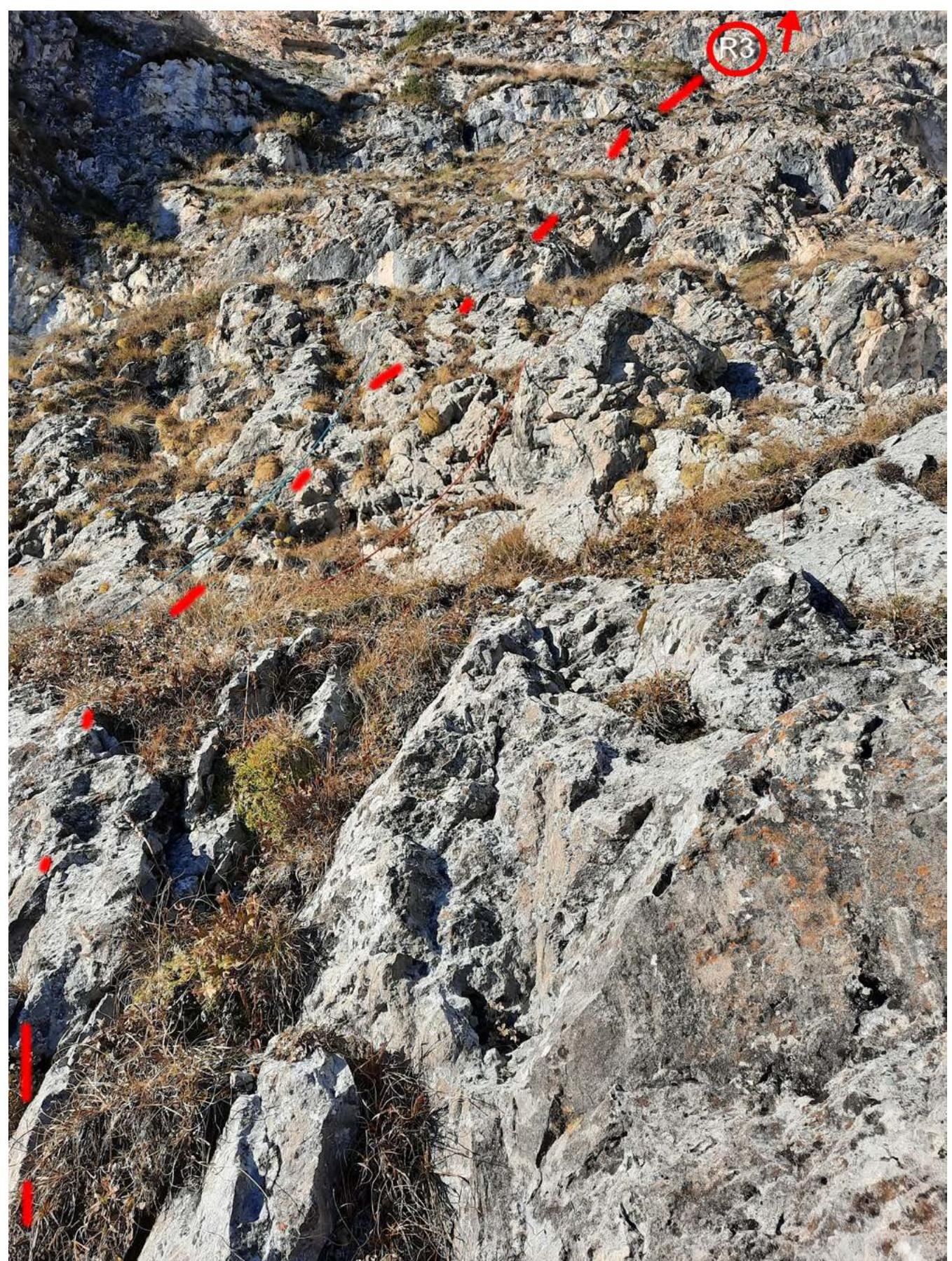
Photo №4 – Section R2–R3. Grassy ledges-walls.

Photo №5 – R5–R9. Photo from a large grassy ledge. (R5–R6 – alternative routes)
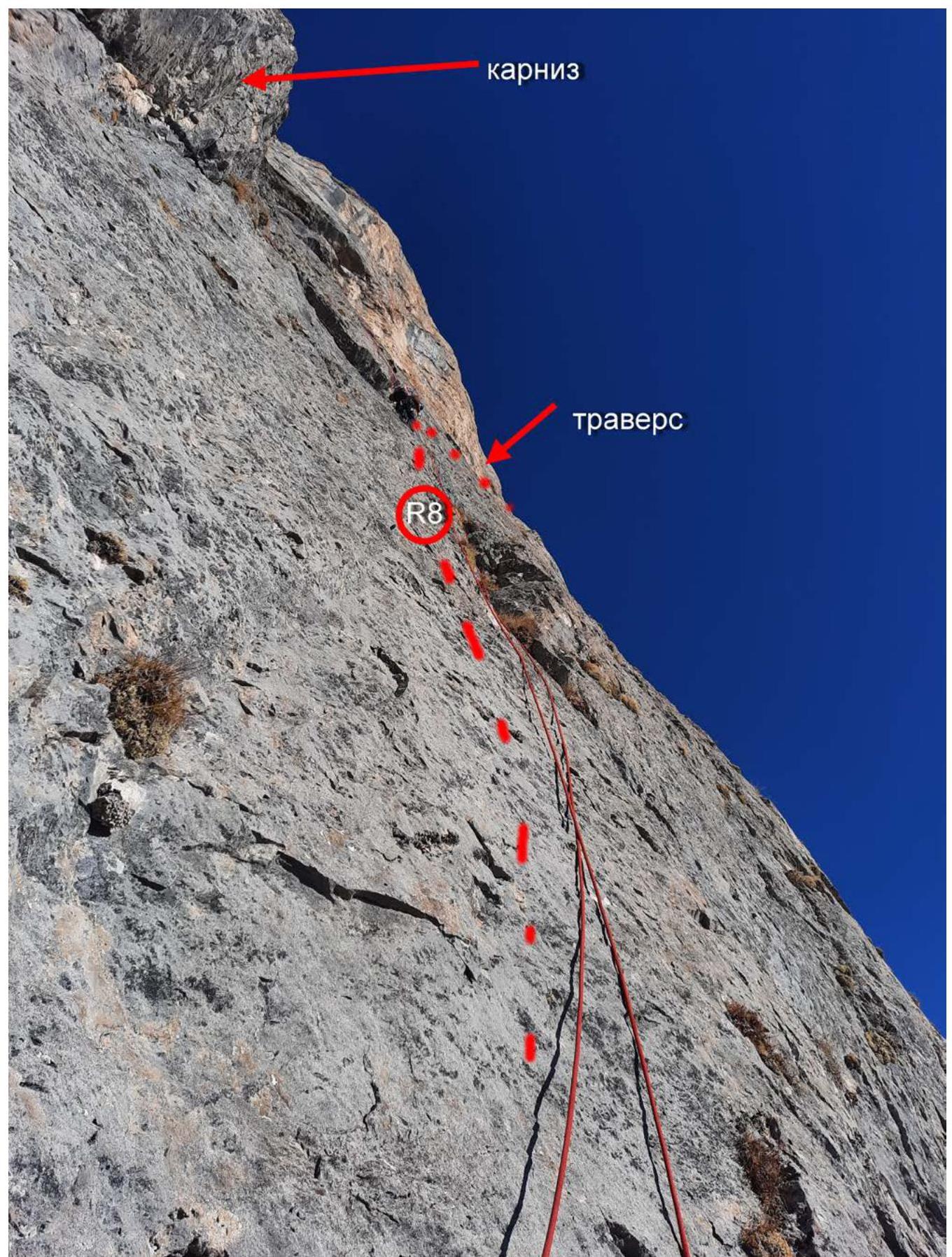
Photo №6 – R7–R9.

Photo №7 – Traverse on section R8–R9. View from R8.
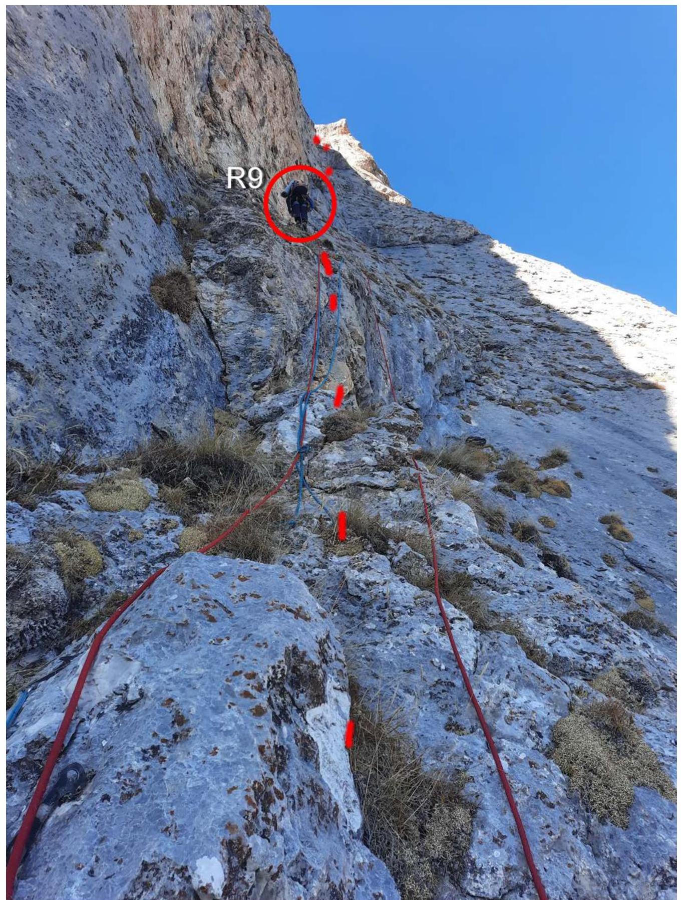
Photo №8 – R9.
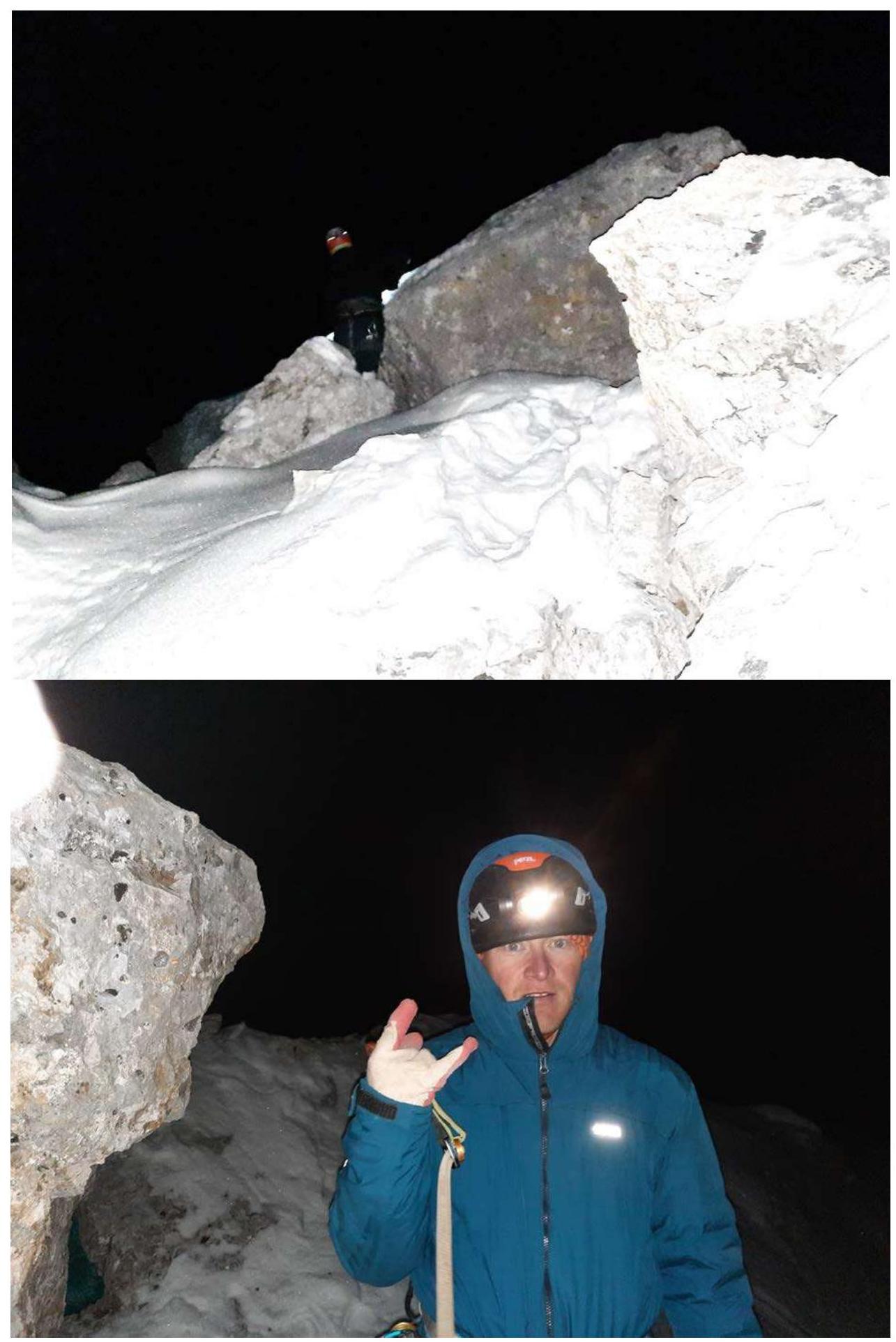
Photo №9 – At the summit.
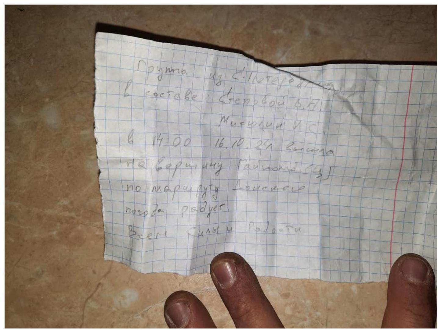
Photo №10 – Removed note.
3.3. Comments on the Route
Route Safety Assessment:
A significant part of the route is safe. Sections R0–R5 are characterized by a destroyed state. Sections R3–R5 are characterized by a combination of bumps, grass, rubble, and walls. Sections R6–R11 are relatively monolithic.
Communication Options on the Route:
- Phone along most of the route
- Radios
Recommendations for Future Climbers:
- After rain and during snowmelt, rockfalls are possible from the upper part of the mountain
- It is undesirable to allow other teams to work above those climbing – a large scatter of the flying rocks
Detailed Information on the Descent from the Summit, Indicating Landmarks:
- Descent via 4B
- Some stations are marked with reflective tape and drilled with pitons
Conclusion on the Preliminary Assessment of the Route Compared to Classified Routes of the Same Category in the Climbers' Experience:
The route corresponds to the assigned category.
Comments
Sign in to leave a comment