
St. Petersburg Championship. High-Altitude Technical Class
2024 Alpkлуб "Gorniak" Team
Report
Ascent of Koazoy-Loam (3100 m) via the right part of the SE wall, Glazunova route, 5A category of difficulty February 29 - March 1, 2024
Sirel Alexander Nikolayevich, Pavlenko Georgy Dmitrievich, Kachkov Vladimir Vladimirovich
I. Ascent Passport
| 1. General Information | ||
|---|---|---|
| 1.1 | Full Name, Sports Rank of the Leader | Sirel Alexander Nikolayevich, 2nd sports rank |
| 1.2 | Full Name, Sports Rank of Participants | Pavlenko Georgy Dmitrievich, 2nd sports rank, Kachkov Vladimir Vladimirovich, 2nd sports rank |
| 1.3 | Full Name of Coach | Kachkov Vladimir Ivanovich, Timoshenko Tatiana Ivanovna |
| 1.4 | Organization | St. Petersburg Alpine Federation, Alpkлуб "Gorniak" |
| 2. Characteristics of the Ascent Object | ||
| 2.1 | Region | Republic of Ingushetia, Dzheyrakhsky district. From Kitlod pass to Gezevtsak pass (south of the Main Caucasian Range) |
| 2.2 | Gorge | Kyazi, Ingushetia |
| 2.3 | Number according to the 2013 Classification Table | 2.9 |
| 2.4 | Name and Height of the Summit | Koazoy-Loam, 3100 m |
| 3. Route Characteristics | ||
| 3.1 | Route Name | Via the right part of the SE wall, Glazunova |
| 3.2 | Category of Difficulty | 5A |
| 3.3 | Degree of Route Exploration | – |
| 3.4 | Terrain Characteristics | Rocky |
| 3.5 | Elevation Gain (data from altimeter or GPS) | |
| 3.6 | Route Length (in meters) | 915 m |
| 3.7 | Technical Elements of the Route (total length of sections with varying difficulty, indicating terrain type: ice-snow, rocky) | I cat. diff. Rocks — 0 m, II cat. diff. Rocks — 300 m, III cat. diff. Rocks — 0 m, IV cat. diff. Rocks — 125 m, V cat. diff. Rocks — 280 m, VI cat. diff. Rocks — 210 m |
| 3.8 | Average Steepness of the Route, ° | 68.7° |
| 3.9 | Average Steepness of the Main Part of the Route, ° | 57.5° |
| 3.10 | Descent from the Summit | Via 4B cat. diff. in the couloir between Tsey-Loam and Koazoy-Loam |
| 3.11 | Additional Route Characteristics | Lack of water |
| 4. Characteristics of Team Actions | ||
| :--: | :-------------------------------------------------------------------------------------------------------------------------------------------------------------: | :----------------------------------------------------------------------------------------------------------------------------------------------------------: |
| 4.1 | Time in Motion (team's travel hours, in hours and days) | 28 h 30 min |
| 4.2 | Overnight Stays | Grot |
| 4.3 | Route Processing Time | – |
| 4.4 | Start of the Route | 04:00 02/29/2024 |
| 4.5 | Summit Ascent | 16:20 03/01/2024 |
| 4.6 | Return to Base Camp | 22:00 03/01/2024 |
| 5. Responsible for the Report | ||
| 5.1 | Full Name, e-mail | Kachkov Vladimir Vladimirovich vova_kachkov@mail.ru |
1. Characteristics of the Ascent Object
1.1. General Photo of the Summit
 Photo 1 (red line — team route)
1.2. Route Profile (right)
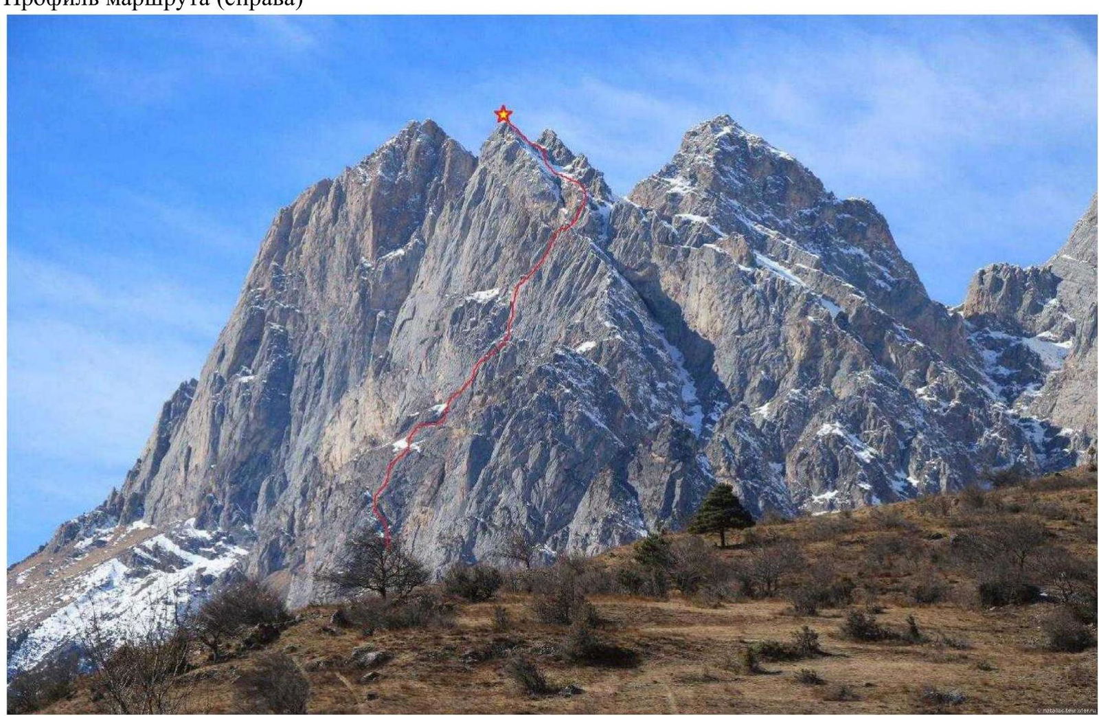 Photo 2
Hand-Drawn Route Profile
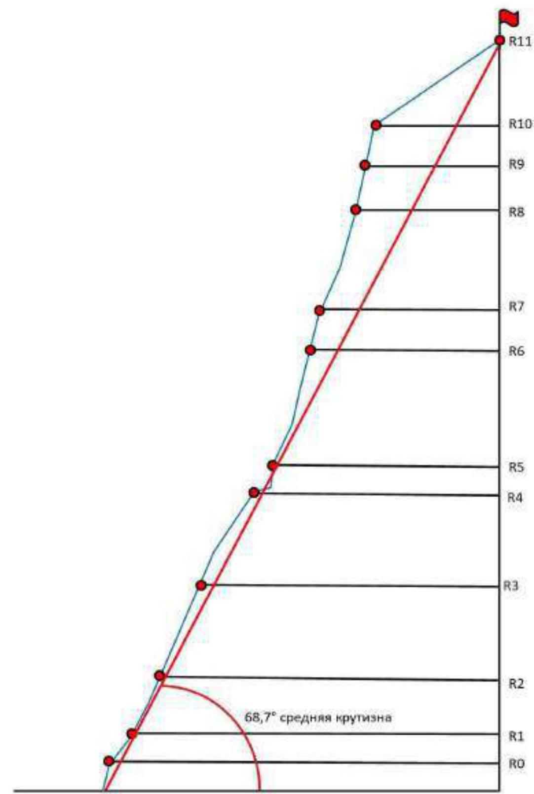 Photo 3
1.3. Photopanorama of the Area
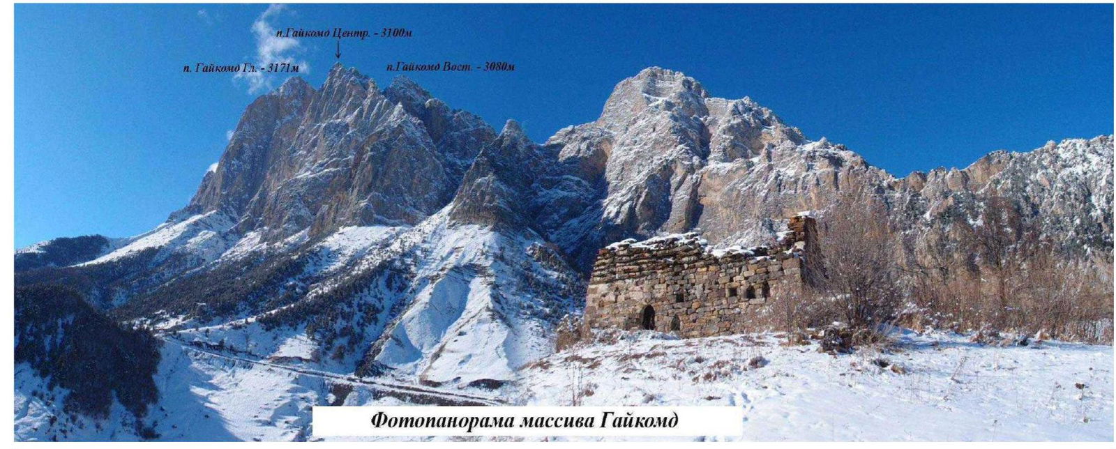 Photo 4
1.4. Description of the Ascent Area
The Gaikond massif is located in the Rocky Range of the Greater Caucasus, in the section of the range between the Terek River (to the west) and the Assa River (to the east). The Gaikond Main summit is the highest peak in the massif, towering over the Central and Eastern peaks. Previously, the summit was named "Girech"; currently, in the classifier, the main peak is referred to as "Tsey-Loam," also known as "Kyazi"; we refer to it as Gaikond.
The administrative border between the Republic of Ingushetia and the Republic of North Ossetia-Alania runs along the ridge of the rocky range to the Gaikond summit from the west, then it heads north. The ascent route and approaches are located within the Dzheyrakhsky district of the Republic of Ingushetia.
The base camp is situated 200 m from the border post on a large clearing. Border permits are not required for the Gaikond peaks, but it is necessary to inform the outpost of your presence in the area.
Cellular network coverage is available with:
- Beeline
- Megafon
At higher elevations and on the wall, MTS and mobile internet are available. The weather in the area is relatively stable; snowfall periods typically last 2-3 days, and snow on the routes melts quickly. This should be considered for lengthy wall ascents. In winter, after heavy snowfalls, be cautious in couloirs and on leeward slopes due to potential avalanches.
The approach to the route takes about 1.5 hours. Descend to the road, then move along it towards the gorge, turning left when facing the post. Continue for about 20 minutes; the road will turn right, while a trail begins on the left, just before the turn, and disappears among the boulders. Move up the slope towards the mountain; the route starts from a ledge that goes left, immediately past a large boulder. The landmark is two large holes in the rock — "eyes" — directly under the ledge.
2. Route Characteristics
2.1. Technical Photograph of the Route
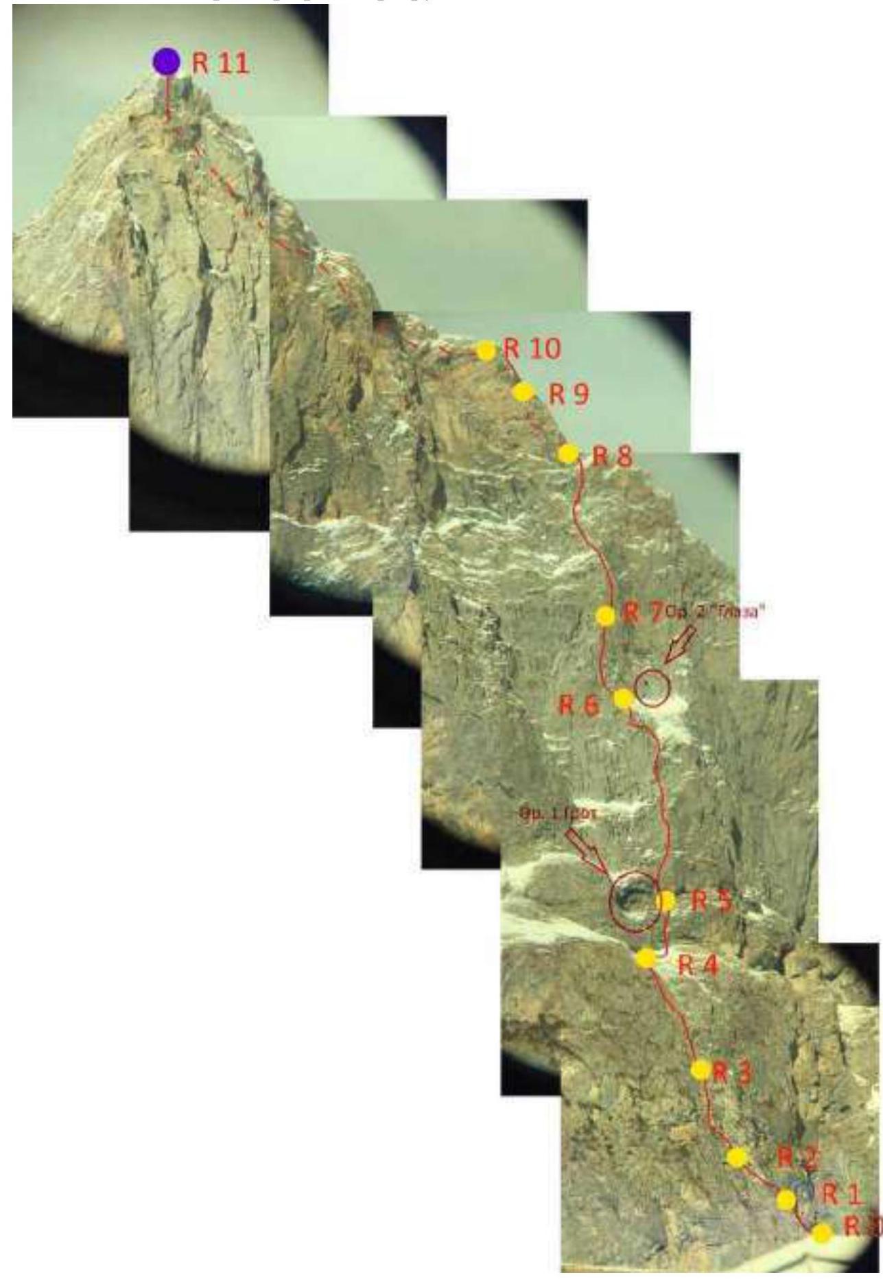 Photo 5
2.2. Route Diagram in UIAA Symbols
 Photo 6
3. Characteristics of Team Actions
3.1. Brief Description of Route Passage.
| Section | Description | Photo Number |
|---|---|---|
| R0–R1 | Move left along the ledge. Midway, climb over a boulder. Continue traversing upwards towards grey vertical internal corners. | 7 |
| R1–R2 | Up through a system of internal corners, towards the southern side of the bastion. Numerous snow-covered ledges and grass. In winter, it's easier to pass the initial sections in crampons. | 8, 9 |
| R2–R3 | Ascend through a logical system of fissures and corners. At the end, reach a characteristic shoulder. A small tree grows on the shoulder. | 10 |
| R3–R4 | From the shoulder, approach the wall, then traverse right along a system of ledges and corners to a small ledge. From it, climb vertically up the slabs, with a crack (6A+), to a ledge with a large boulder. From here, move towards a large ledge. Pass the ledge; at its end, there's a station under the cliffs. It's convenient to divide this section into 2-3 smaller pitches. | 11, 12 |
| R4–R5 | Traverse right along the ledge to an internal corner with a crack, climb it to the next "floor" of the ledge-terrace. To the right of the grotto, there's a station on a large boulder. | – |
| R5–R6 | Climb up the slabs without obvious cracks through a cornice ("Key Section") — in the slabs, one needs to find pockets for anchor placement since there are no cracks up to the cornice. 5 m on artificial aids or climbing (7B–7C). The terrain then transitions into an internal corner, climb it until reaching grey rocks on the wall's edge, then ascend towards a characteristic depression with "eyes." The section can be divided into 2-3 shorter pitches. | – |
| R6–R7 | From the depression, move left towards the wall's edge, through a system of cracks and corners. On a ledge, there's an intermediate station. From the station, climb up through cracks (a left-in anchor hook remains), then left to exit beyond the wall's edge. The terrain becomes easier; ascend towards ledges. | 13 |
| R7–R8 | Ascend, gradually moving left, bypassing a rocky bastion through a system of corners. Move towards the ridge until connecting with the Andreev route. Midway through the section, there are two intermediate stations. | – |
| R8–R9 | Continue along the ridge, following the Andreev route, with a slight rightward traverse of 5 m "around the corner." Then, follow the corner (midway, there's an 8 mm bolt). At the end of the corner, there's a station at the base of a characteristic wide crack. | – |
| R9–R10 | From the station, move left into an internal corner, climb it to the ridge; along the ridge, pass 15 m through a fissure towards a small shoulder, bypassing slabs. Here, there's a station on a boulder. | – |
| R10–R11 | Traverse along slabs at the boundary between snow and rock. Snow on the slabs may melt, so it's recommended to ensure thorough protection on this section due to potential consequences from slab failure. Then, exit onto the ridge and ascend to a couloir, climb it to a saddle, from which the central peak can be ascended. | 14, 15 |
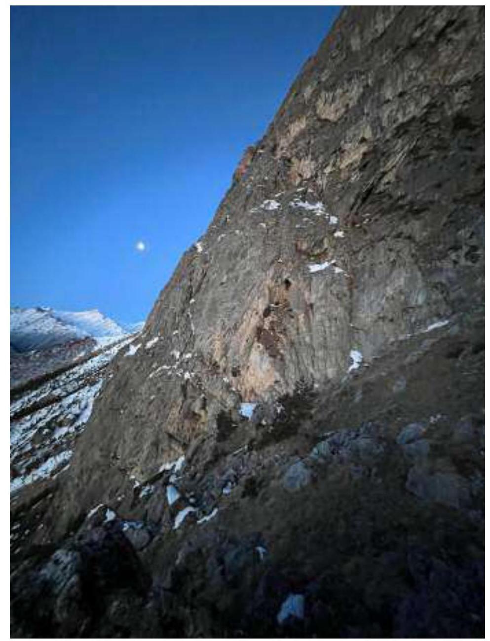 Photo 7
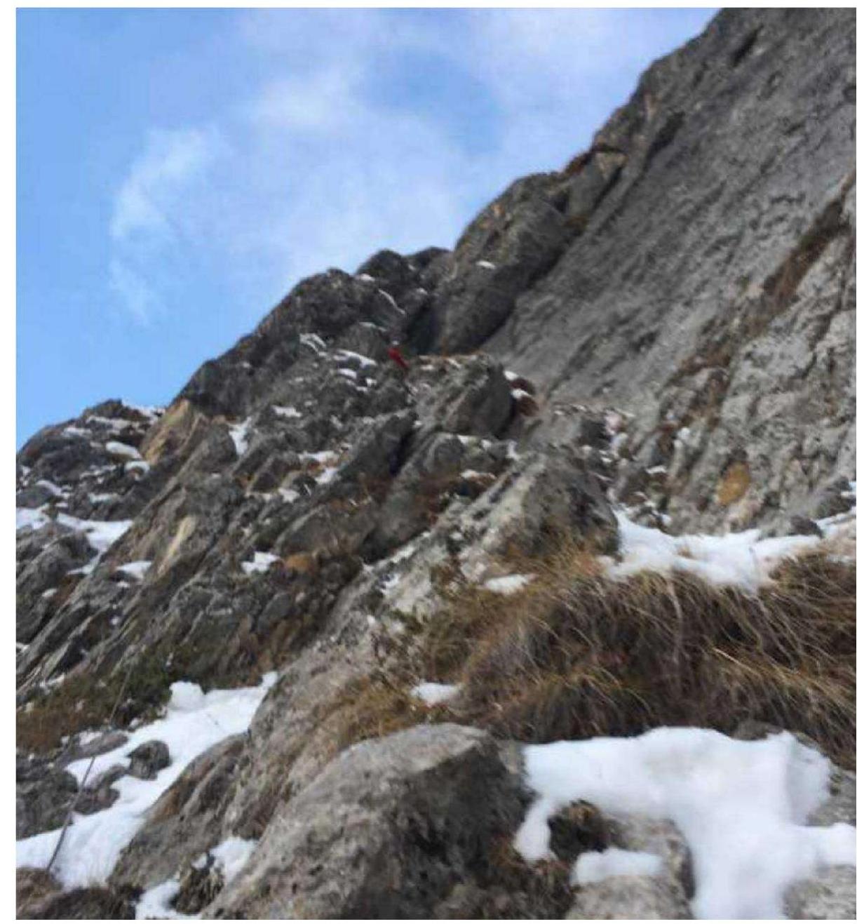 Photo 8
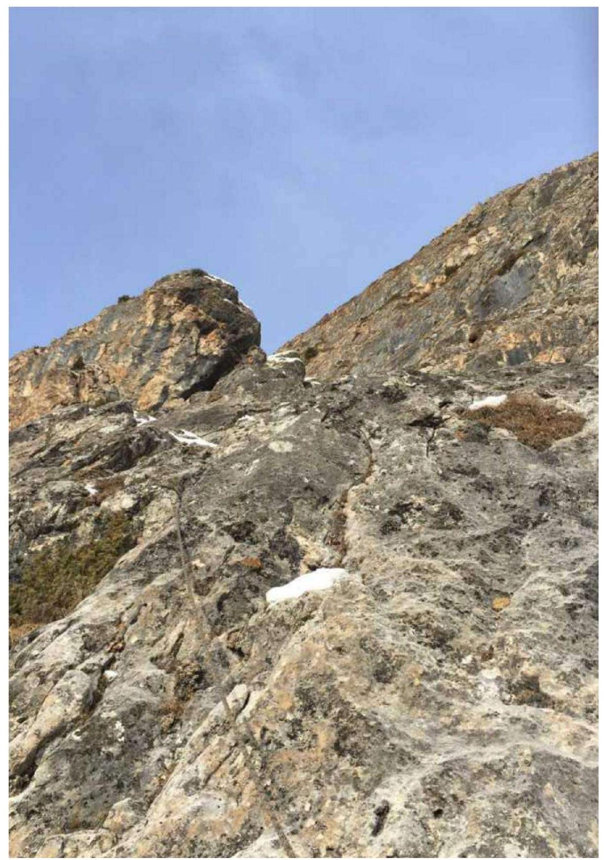 Photo 9
 Photo 10
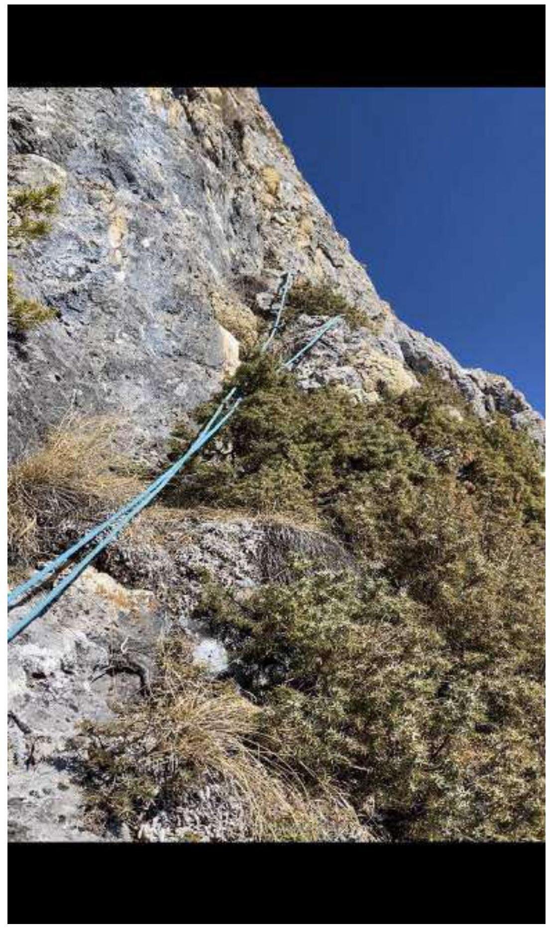 Photo 11. R3–R4, start from the tree
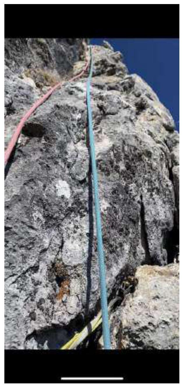 Photo 12
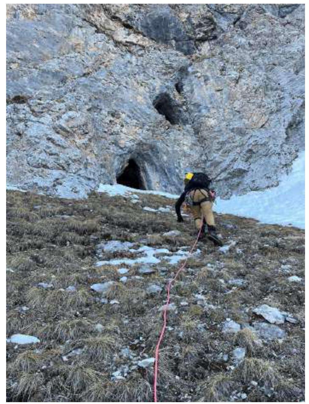 Photo 13 "Eyes"
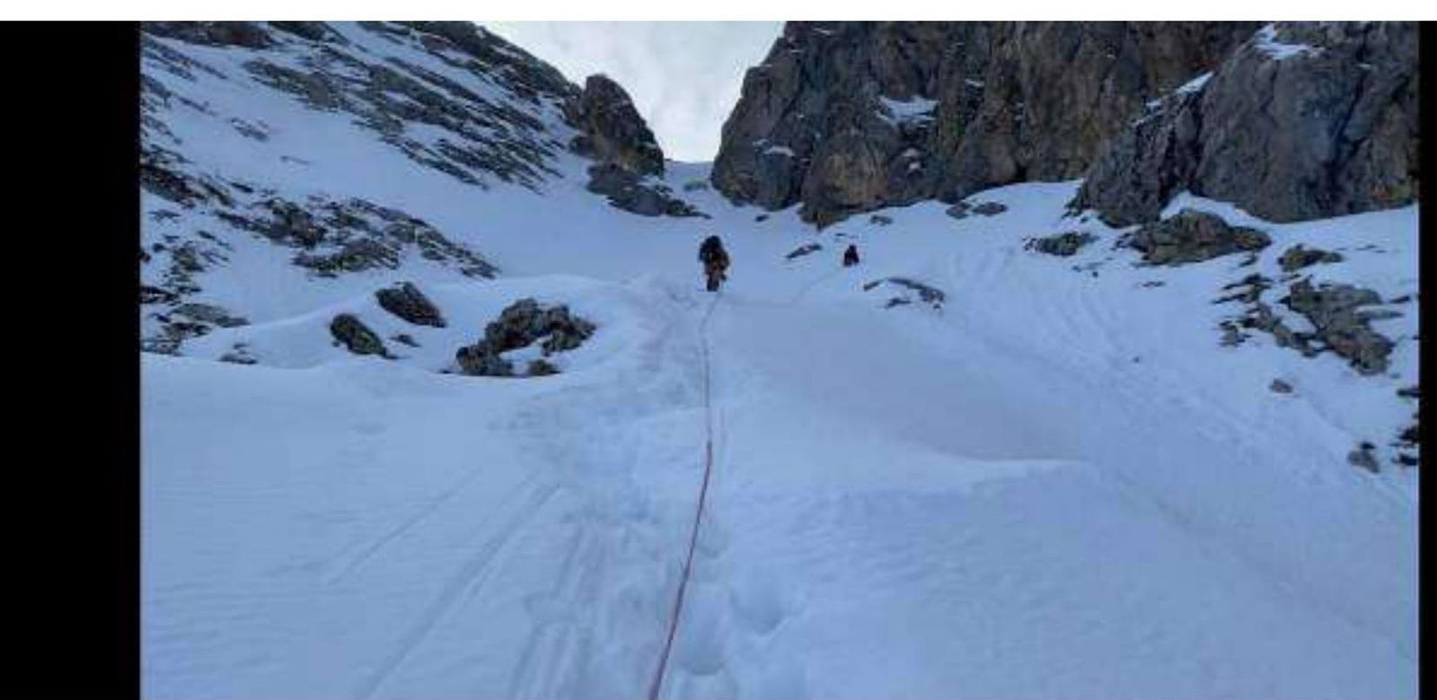 Photo 14
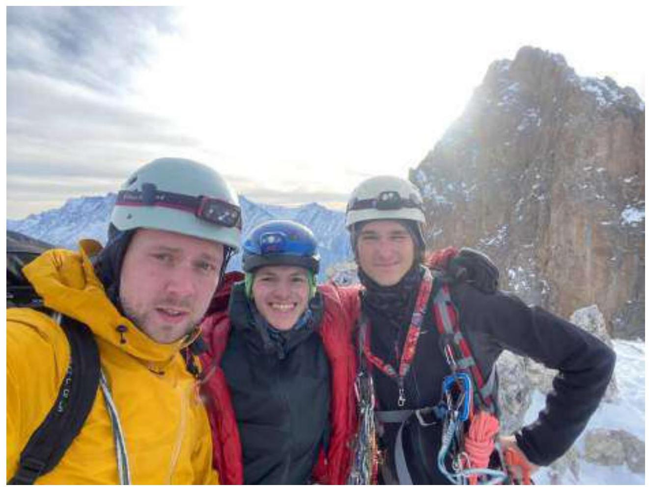 Photo 15
3.2. Photo of the Team at the Summit with the Control Tour
3.3. The route is good, fairly monolithic; the initial part has some destroyed rocks that require extra caution. The route is frequently ascended by experienced climbers and justifies its category. Radio communication with the base camp is stable.
The descent involves rappelling towards the couloir between Tsey-Loam and the Main peak. There are 12 rappels. After the 2024 championship, the rappels are marked with reflective elements, aiding descent in the dark. The first rappel starts from a ledge 5 m below the summit to the southeast. Traverse 30-40 m north along the ledge to a boulder with a bolt and loop. Then, rappel down the fissure, gradually moving right and down to a large ledge in the middle of the wall. After passing this ledge with simultaneous protection, there are 3 more rappels to the couloir. It's recommended to check the stations as some loops and anchors may need replacement.
Comments
Sign in to leave a comment