
Report
On the ascent to the summit of Tsey-Loam (Kyazi Gl.) via the route on the left part of the SE wall (K. Dorro) 6A category of complexity by the team from the Moscow Region from June 6 to 7, 2024.
I. Ascent Report
| 1. General Information | ||
|---|---|---|
| 1.1 | Full name, sports rank of the leader | Mikhail Sergeyevich Shiryaev, CMS |
| 1.2 | Full name, sports rank of participants | Vadim Sergeyevich Mirzoyev, 1st sports rank |
| 1.3 | Full name of coach | Alexander Nikolayevich Yakovenko |
| 1.4 | Organization | Alpinism Federation of the Moscow Region |
| 2. Characteristics of the Ascent Object | ||
| 2.1 | Region | Republic of Ingushetia, Dzheyrakhsky District. |
| 2.2 | Valley | From Kytlod Pass to Gezevtsek Pass (south of the Main Caucasian Range) |
| 2.3 | Section number according to the 2013 classification table | 2.9.61 |
| 2.4 | Name and height of the summit | Tsey-Loam (Kyazi) Main, 3171 m |
| 2.5 | Geographic coordinates of the summit (latitude/longitude), GPS coordinates (1) | 42°46′40″ N 44°58′47″ E |
| 3. Route Characteristics | ||
| 3.1 | Route Name | Via the left part of the SE wall |
| 3.2 | Category of Complexity | 6A |
| 3.3 | Degree of Route Exploration | Explored, popular |
| 3.4 | Terrain Type | Rock |
| 3.5 | Elevation Gain (data from altimeter or GPS) | 795 m |
| 3.6 | Route Length (in meters) | 1185 m |
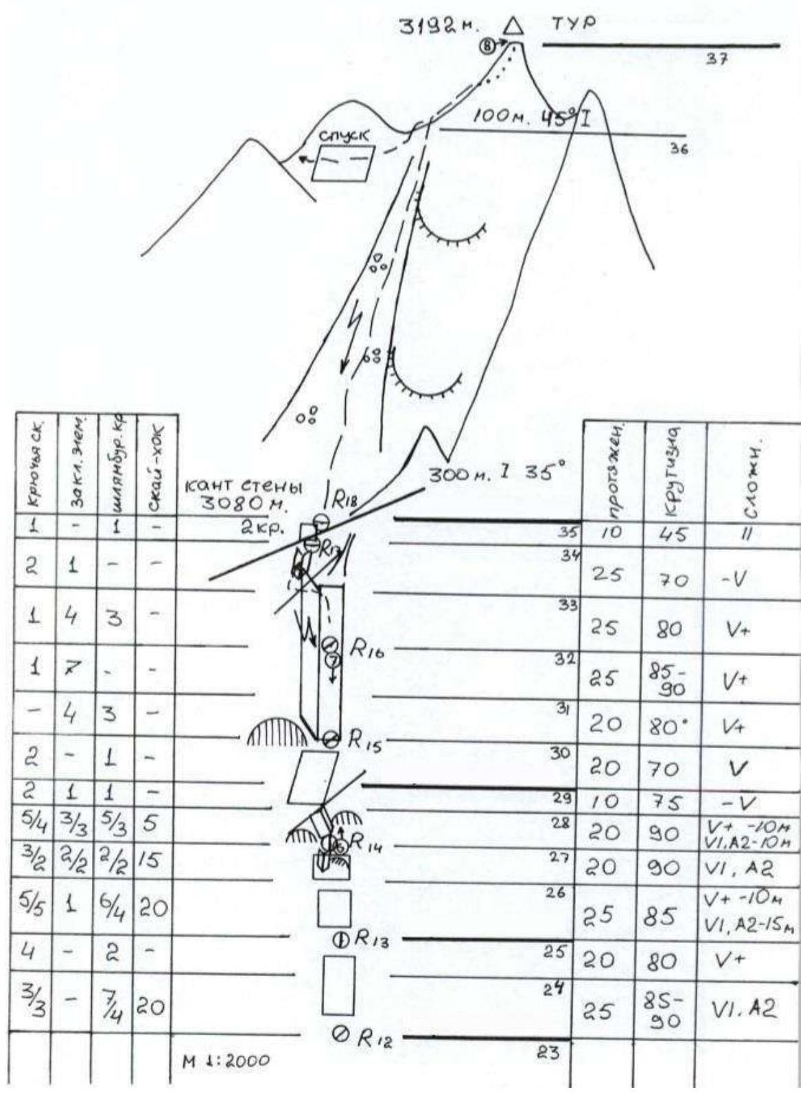
| 3.7 | Technical elements of the route (total length of sections of varying complexity with terrain type indication (ice-snow, rock)) | V complexity rock – 415 m VI complexity rock – 180 m |
| 3.8 | Average Steepness of the Route, (°) | |
| 3.9 | Average Steepness of the Main Part of the Route, (°) | 75 |
| 3.10 | Descent from the Summit | Via the right couloir of the 3rd ridge, 2A |
| 3.11 | Additional Route Characteristics | Water on the route is absent. Used belay points: – for ITB – 25; – rock hooks – 100; – chocks – 7; – friend – 85. |
| 4. Characteristics of Team Actions | ||
| :--: | :--: | :--: |
| 4.1 | Time of Movement (team's travel hours, in hours and days) | 18 hours, 2 days |
| 4.2 | Bivouacs | Shelf (R11) |
| 4.3 | Route Preparation Time (3) | Without prior preparation |
| 4.4 | Start of the Route | 8:00, June 6, 2024 |
| 4.5 | Summit Ascent | 15:00, June 7, 2024 |
| 4.6 | Return to Base Camp | 18:00, June 7, 2024 |
| 5. Weather Conditions | ||
| 5.1 | Temperature, °C | +5 (night)…+15 (day) |
| 5.2 | Wind Speed, m/s | 5–8 |
| 5.3 | Precipitation | Light rain at night, heavy rain after 15:00 on June 7. |
| 5.4 | Visibility, m | June 6 – excellent visibility, June 7 – fog from 12:00. |
| 6. Person Responsible for the Report | ||
| 6.1 | Full Name, e-mail | Mikhail Sergeyevich Shiryaev, misha_shiraev@rambler.ru |
II. Ascent Description
1. Characteristics of the Ascent Object
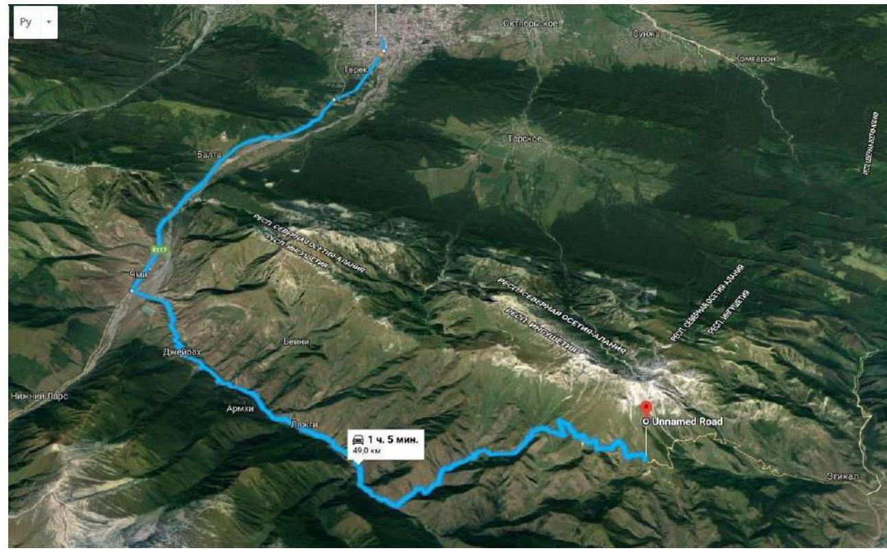
The massif with the summit Tsey-Loam is located in the Rocky Range of the Greater Caucasus, between the Terek River (to the west) and the Assa River (to the east). The summit Tsey-Loam (3171 m) is the highest peak of the massif. Previously, the summit was known as Gaikomd Gl., and even earlier as "Girech" (the summit Koazoy-Loam was known as Gaikomd Ts.). The administrative border between the Republics of Ingushetia and North Ossetia-Alania runs along the Rocky Range to the summit Tsey-Loam. The ascent route and approaches are located in the Dzheyrakhsky District of the Republic of Ingushetia. Ascents are made from the "Kyazi" alpine camp.
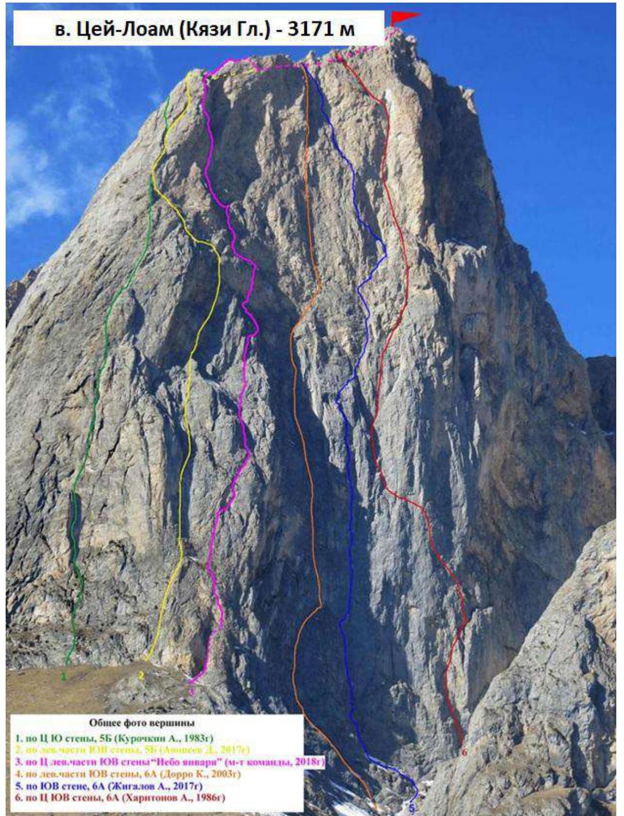
1.1. General photo of the summit and the nearest classified routes on the right and left.
Team route No. 4.
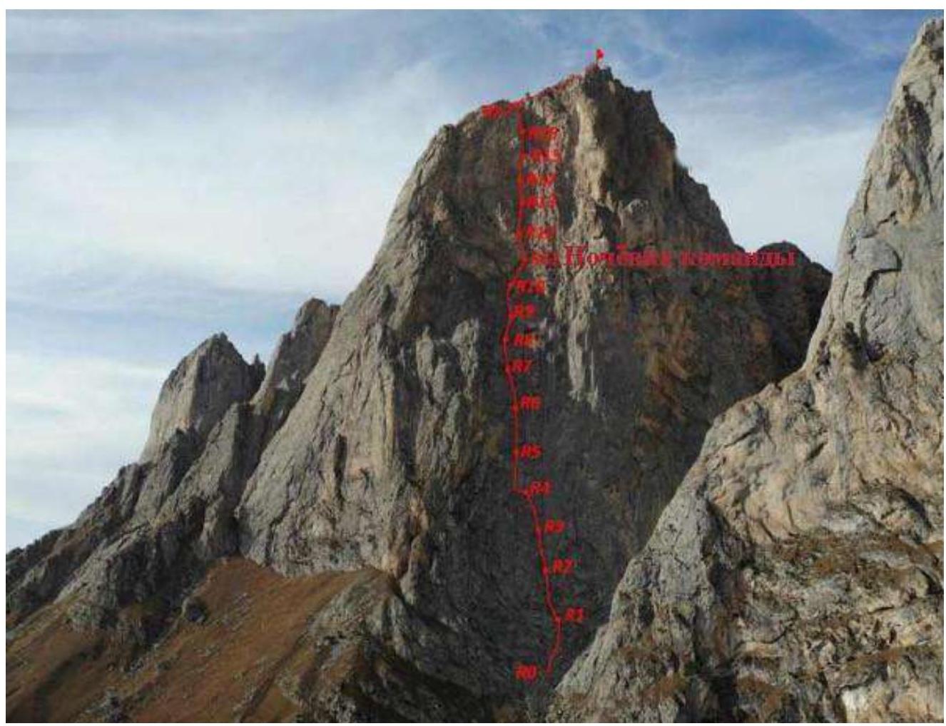
1.2. Photo of the route profile.
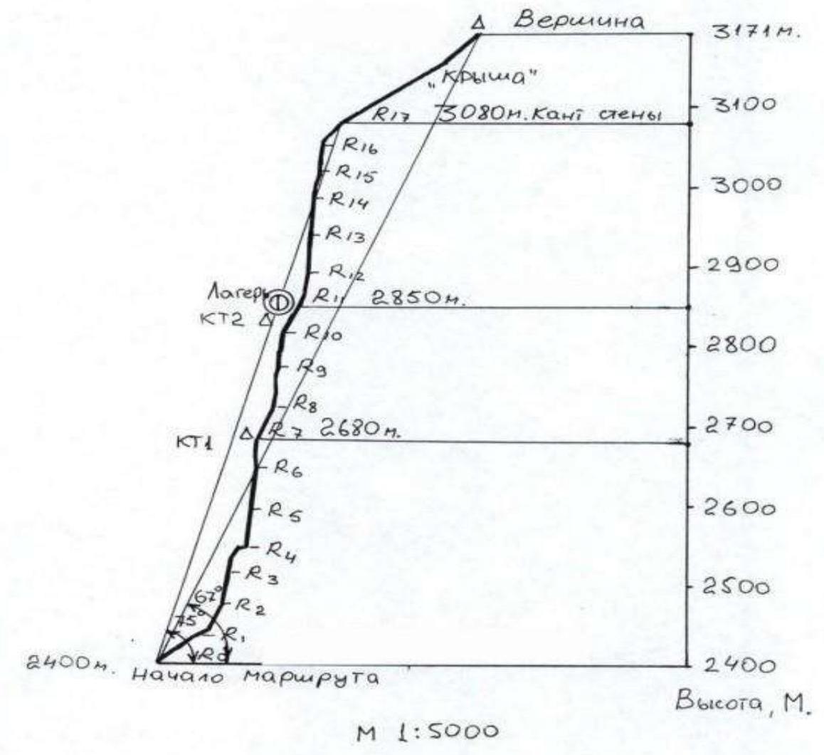
1.3. Hand-drawn profile of the route.
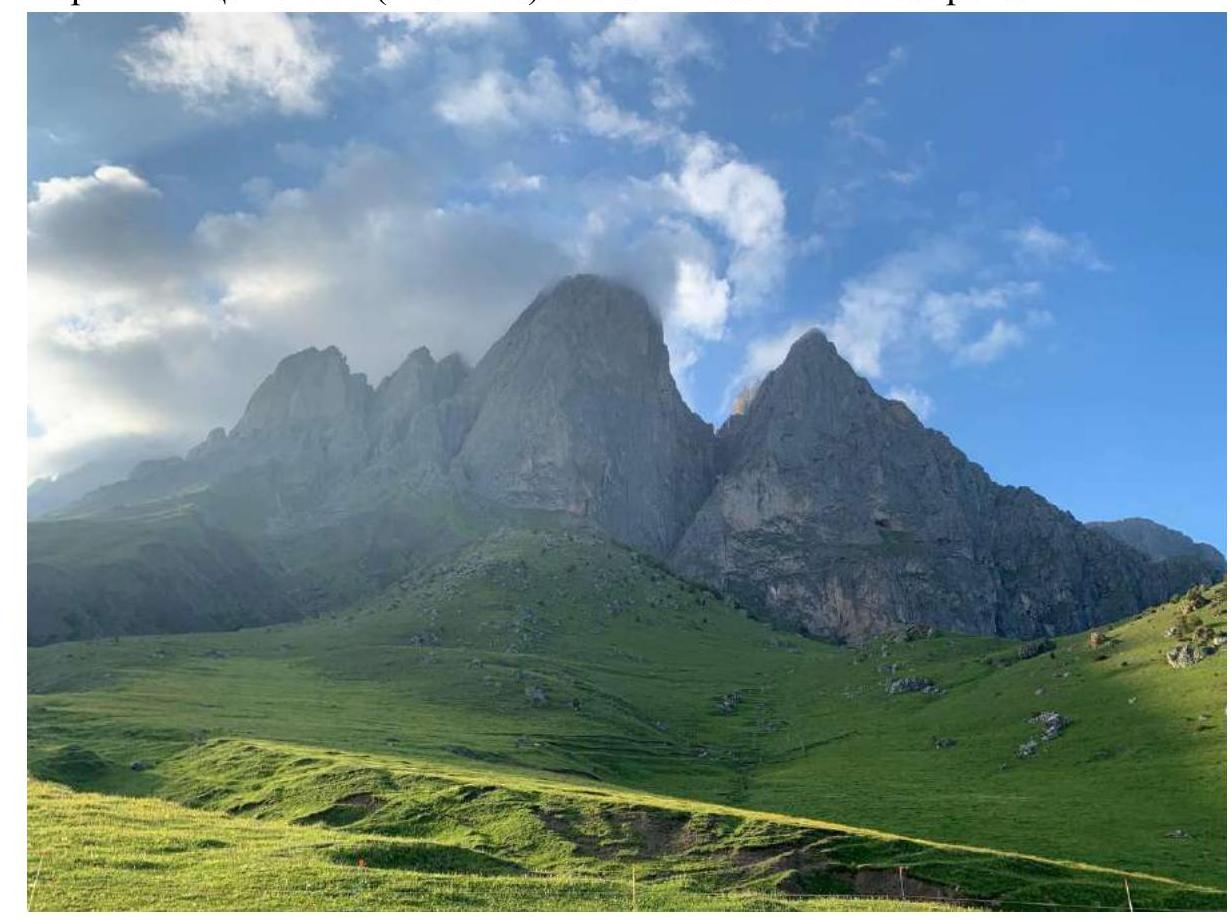
1.4. Photo panorama of the area.
Summits Tsey-Loam (Kyazi Gl.) on the left and Koazoy-Loam on the right.
1.5. Map of the area.
2. Route Characteristics
Route scheme in UIAA symbols (taken from the description of the first ascenders): Route scheme in UIAA symbols
3. Characteristics of Team Actions
3.1. Description of the route passage with photo illustrations.
The route can be divided into two parts: the first half (up to R11, where the night's bivouac was set up) is relatively monolithic. The terrain on the second half of the route (from R11 to R18) is loose and unreliable. Visually, the two parts of the route differ in color: the lower part is gray, while the upper part is reddish. The red rocks are crumbling, and the handholds are unreliable, with some breaking apart under load. Nevertheless, the terrain on the second half of the route is quite varied:
- There are many cavities, shells, and curved niches with white crystals, white chalk, etc.
Sections R1–R9 are characterized by a large number of grassy tufts and earth in the cracks. There are many places for reliable belay setup. Initially, simultaneous movement was planned on the route, but after the leader fell on a grassy tuft, the team switched to alternate movement for safety.
On these sections:
- There are many cracks suitable for placing chocks.
- Anchors with offset were used effectively.
Sections from R11 to R18 differ from the first half of the route. Climbing is unreliable due to the crumbling terrain.
The route was mostly climbed using free climbing techniques.
3.2. Description of the route by sections.
| Section No. | Route Description | Photo No. |
|---|---|---|
| R0–R1 | Ascend simple rocks to a shelf. Station on a bollard. | - |
| R1–R2 | From the station, move left along an internal corner overgrown with grass, then right up to a convenient shelf. Station on hooks. | 1 |
| R2–R3 | A system of steep internal corners begins, with earth and rocks in the corners, and some areas are crumbling. | - |
| R3–R4 | Ascend the internal corner, which leans left, and exit onto a grassy shelf. Convenient station on a large shelf with bollards. | 2 |
| R4–R5 | From the station, traverse 6 meters left along the shelf (bypass an external corner) and then ascend a vertical internal corner. For protection, mainly use anchors on this rope. Station on a sloping ledge. | 3 |
| R5–R6 | Continue up the same internal corner. Climbing is relatively easy. However, the cracks are filled with earth and dust. Especially unpleasant are the tufts with dry grass, which release dust when touched. Hanging station. | 4 |
| R6–R7 | Ascend the corner, bypassing a cornice on the right, and exit onto a slab. Move left up the slab and enter an internal corner. Station. There is a control cairn (tin can). | - |
| R7–R8 | Continue up the internal corner, with some grass and tufts. The rope is not complicated. | |
| R8–R9 | Move right up the corner with ringing slabs through a small overhang. Climbing is difficult, with a bollard on the right before exiting the overhanging corner. Station on a shallower area on the right with a bollard and hook. | 5 |
| R9–R10 | From the station, move 1 meter left and then ascend. The steepness increases. Use anchors for protection. Then move left up, bypassing overhangs, to a shallower area. | 6 |
| R10–R11 | Continue up a gentle slab to the right, to a shelf and a niche. Climbing is easy. Station on two bollards. There is a shelf about 1 meter wide for a lying bivouac under an overhang. However, there is little space for a tent. Team's bivouac site. | 7 |
| R11–R12 | From this rope, the second half of the route begins. The rock is fragile and brittle. Much destruction. From the station, move 3 meters right and then left. Climbing is not complicated. Protection is sparse. | 8 |
| R12–R13 | From the station, move slightly left, then slightly right. Climbing is more challenging, with cavities, shells, and irregular holes and depressions in the rock. The terrain appears unreliable. Protection is sparse. Hanging station. | - |
| R13–R14 | From the station, move left up, orienting towards the trodden grassy tufts, then up slightly to the right along a poorly defined external corner (climbing is difficult, terrain is unreliable, problems with setting up points), then exit right up under overhanging blocks. Station under the overhanging blocks on one new bollard and hook. | - |
| R14–R15 | From the station, ascend the corner, carefully bypassing the overhanging blocks, then move left up to exit onto an external corner (climbing becomes easier), and then move right up along easy terrain. Station at the base of a large internal corner, to the right of it (move along a small ledge to the right from the base of the internal corner). Station on two bollards. | - |
| R15–R16 | From the station, enter the large internal corner on the left and move up it. Climbing is not complicated, but handholds are unreliable, so climb carefully. Protection with anchors and chocks inside the corner. | - |
| R16–R17 | Continue moving up the internal corner. Climbing becomes easier. Station on a large boulder on the ridge. Section length is 60 m. | 9 |
| R17–R18 | Then move right. The rocks are simple. Move on foot along loose rocks to the summit. | - |
| Descent | Descent via 2A, marked with flags. Initially, descend loose terrain – from the cairn, right down, then ascend a couloir left up, then along the ridge to a large grotto. From the grotto, move left down the couloir, staying in its right part. In the middle part of the couloir, there is a 30 m rappel. Then descend the couloir, filled with stones, and grassy slopes, bypassing gullies, to the road. Follow the road back to base camp. | - |
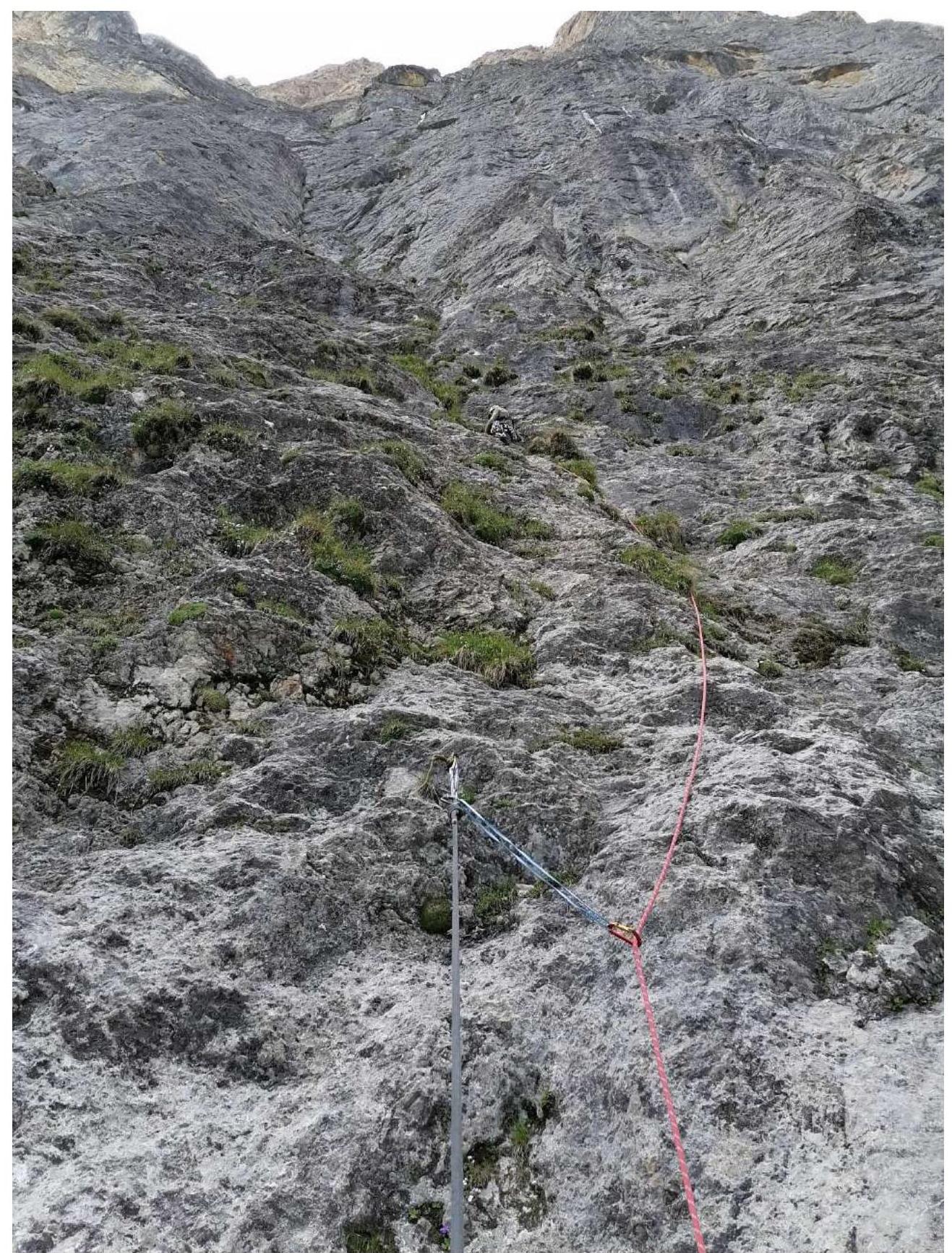
Photo No. 1. R1–R2
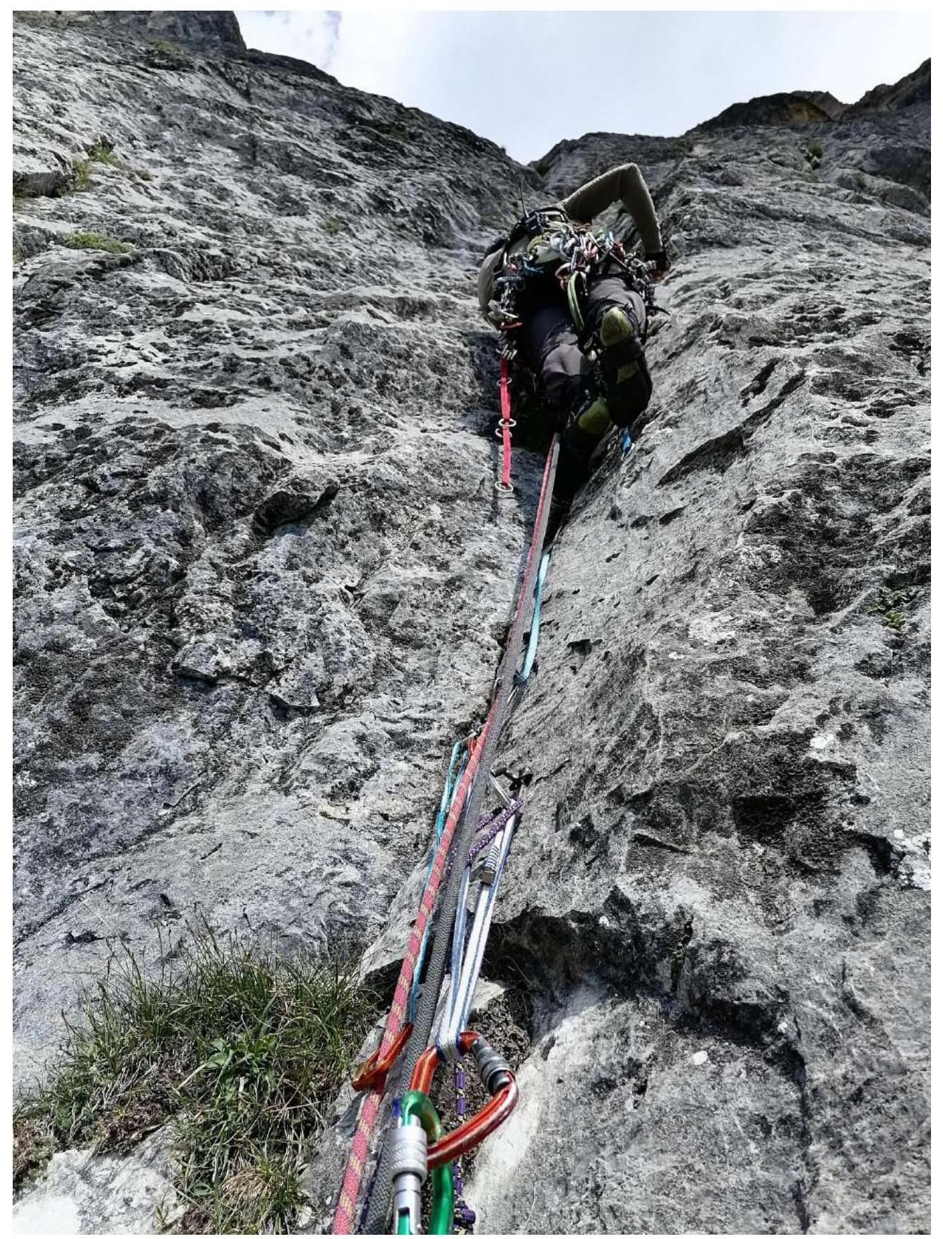
Photo No. 2. R3–R4
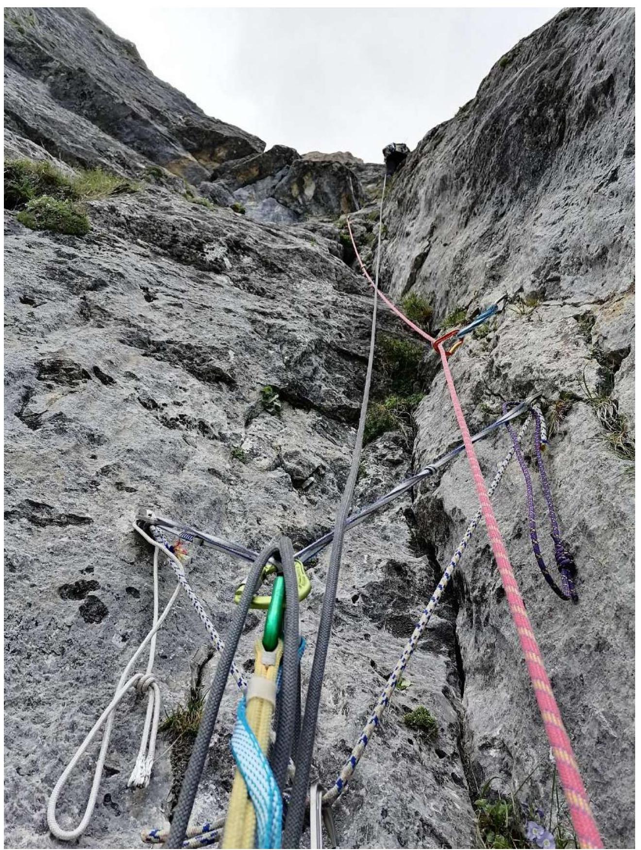
Photo No. 3. R4–R5
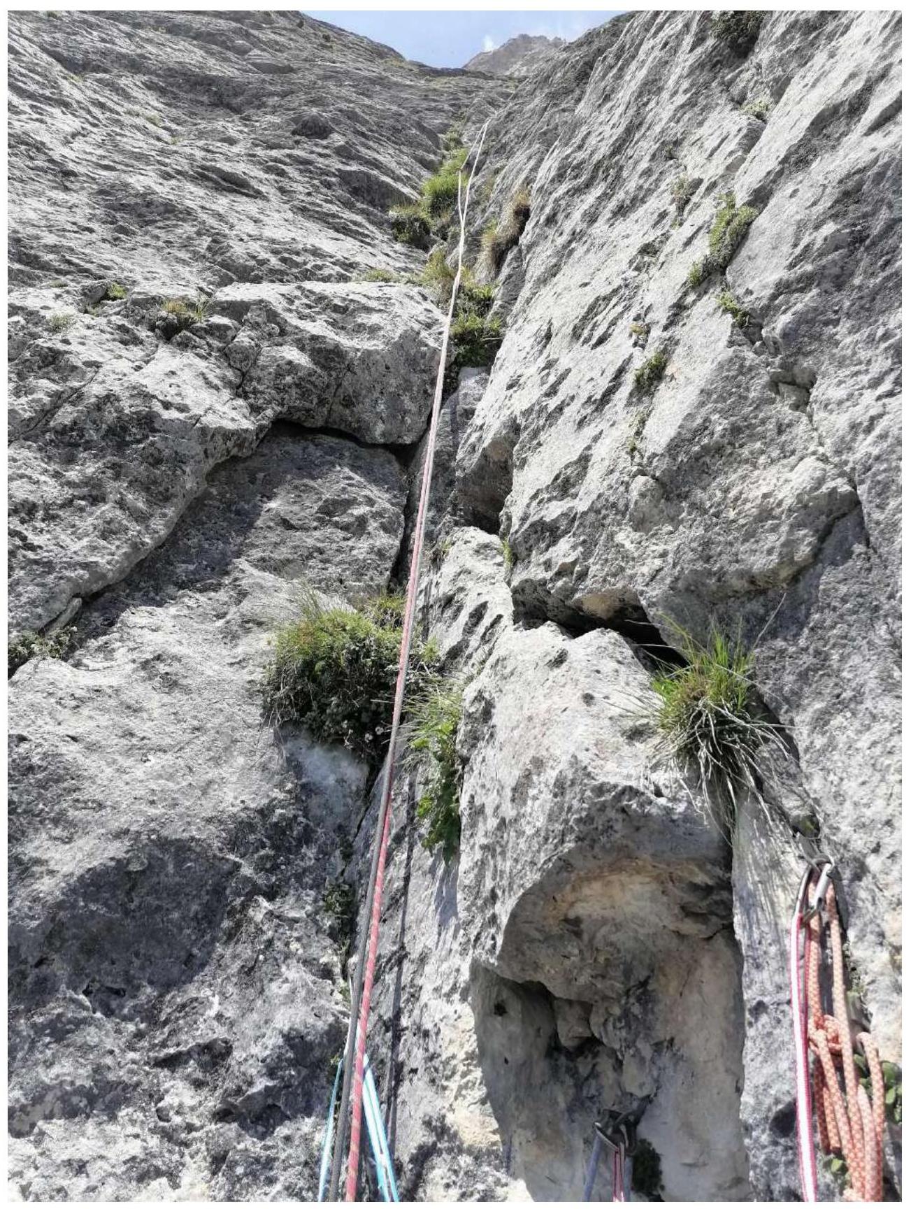
Photo No. 4. R5–R6

Photo No. 5. R8–R9
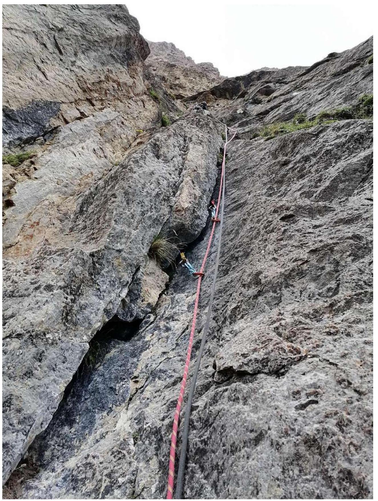
Photo No. 6. R9–R10
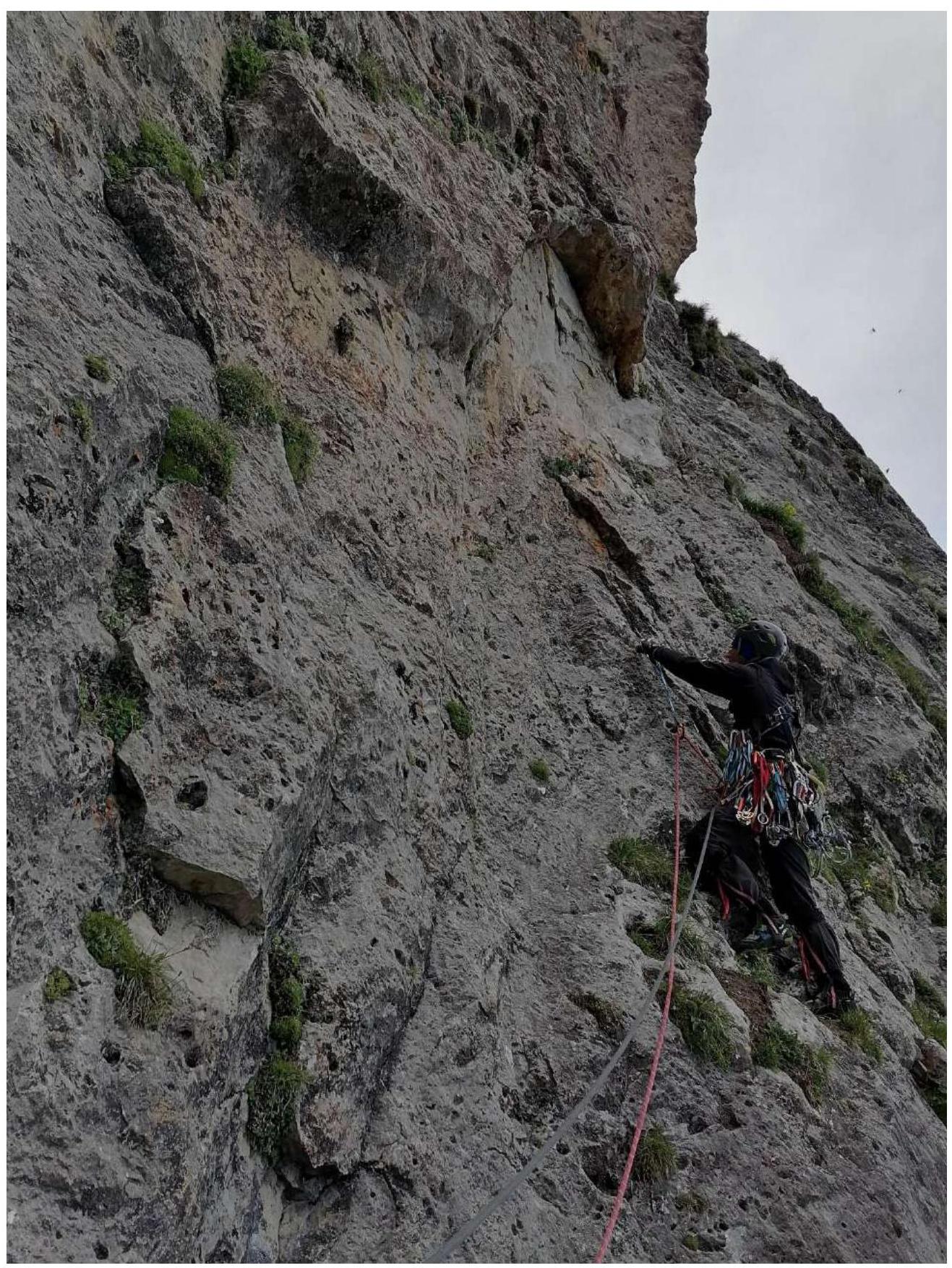
Photo No. 7. R10–R11
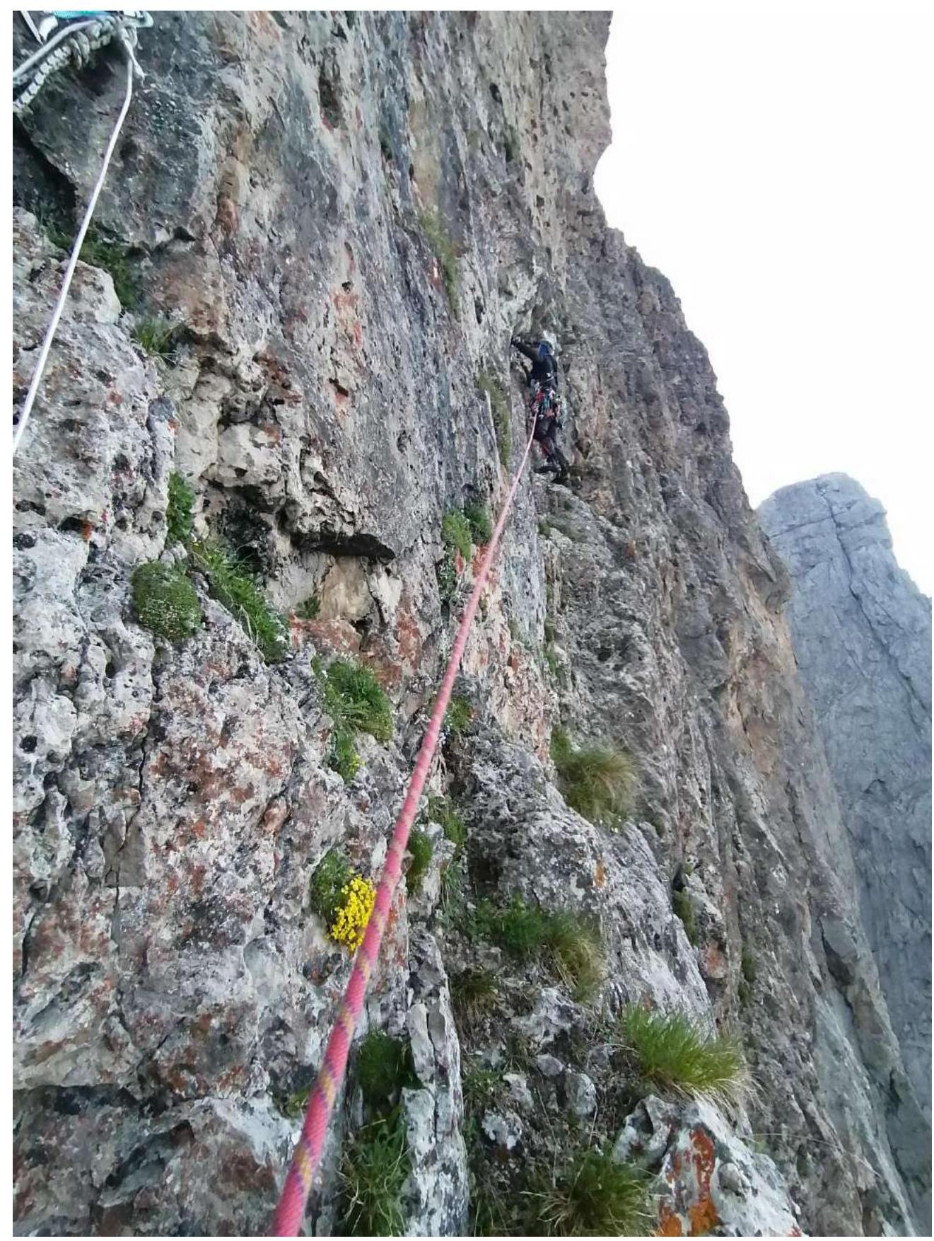
Photo No. 8. R11–R12
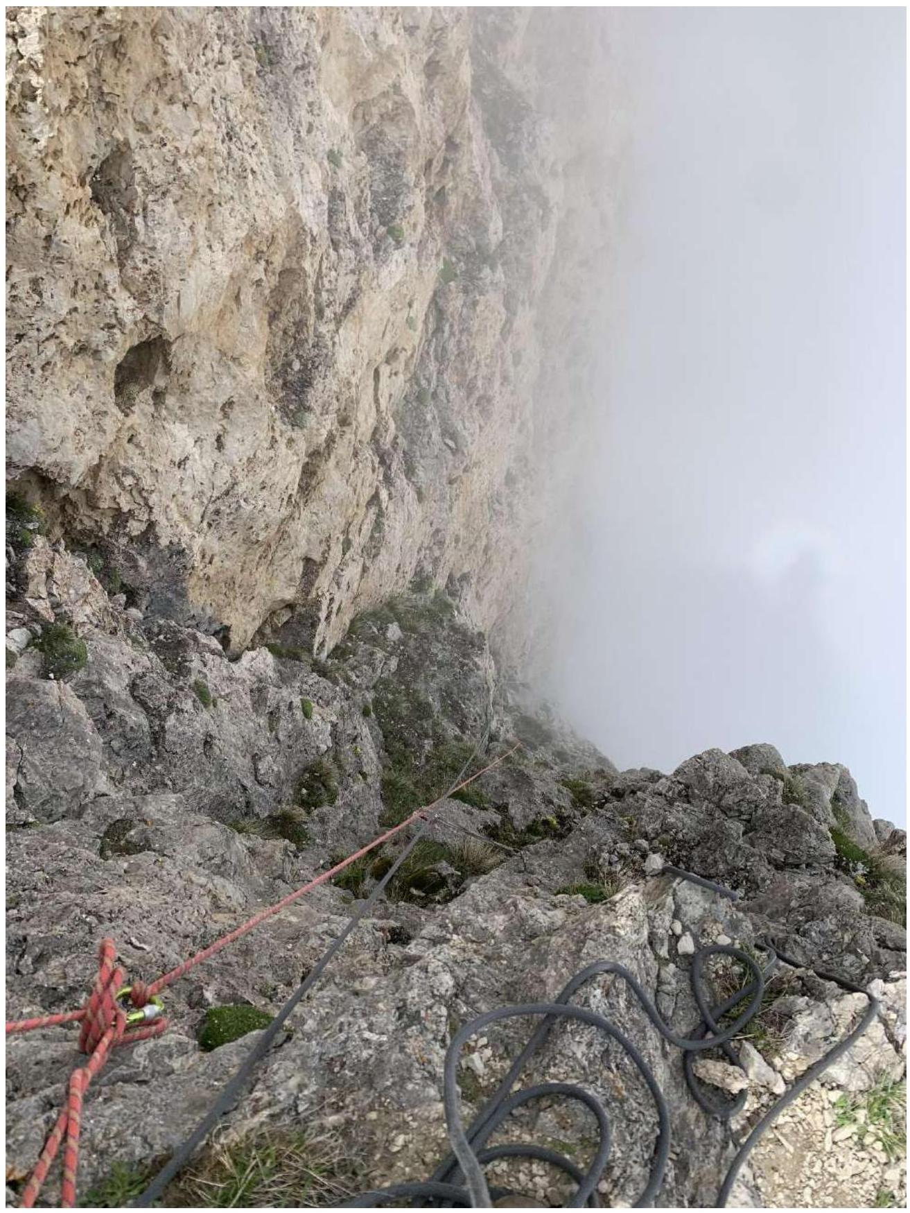
Photo No. 9. R16–R17 (view from R17)
3.2 Photo of the team on the summit at the control cairn and the note from the summit
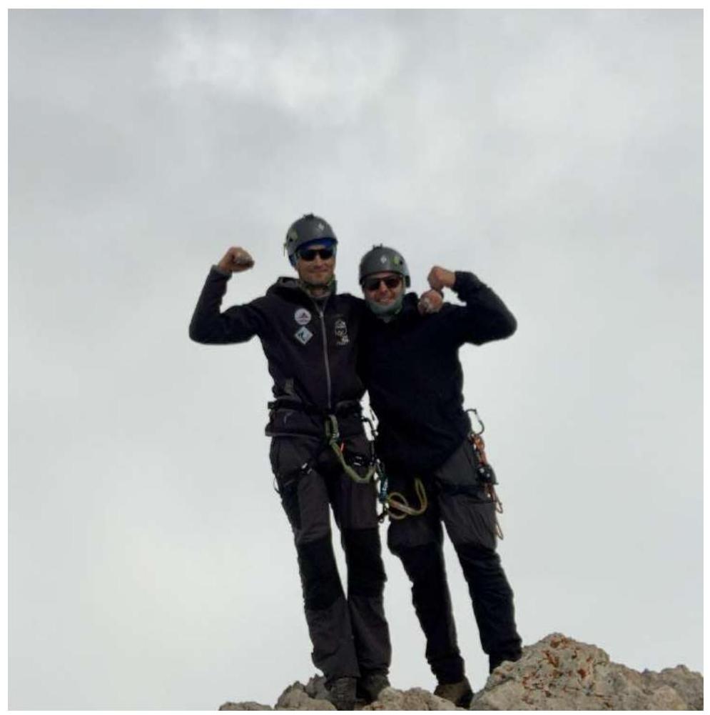
Wishing everyone good weather and luck
Note on the summit
"June 6, 2024
at 9:40 AM.
Group: "Special Forces of Russia"
consisting of: "2 men 746 years old"
completed the ascent to the summit: "Tsey-Loam"
via the route: "2A" category of complexity.
Took the note of the group: "Grishin S. V." dated: "March 3, 2004"
Weather conditions: "sunny, partly cloudy"
Descent via the route: "ascent route"
started at 9:50 AM.
Group leader: "Ivanov L. M. and Pereverzev N. V."
Comments
Sign in to leave a comment