Report on the ascent to the summit of Tsey-Loam (Kyazi) 3171 m via the left part of the southeast wall, 6A category of complexity (K. Dorro's route), for the period from 29.04.2024 to 01.05.2024
I. Ascent Passport
| 1. General Information | ||
|---|---|---|
| 1.1 | Full Name, Sports Rank of the Leader | Paducheva Olga Pavlovna, CMS |
| 1.2 | Full Name, Sports Rank of Participants | Kochubey Oksana Andreevna, CMS, Pilshchikova Nadezhda Sergeevna, MS |
| 1.3 | Full Name of Coach | Timoshenko Tatiana Ivanovna, Molodozhen Vladimir Aleksandrovich |
| 1.4 | Organization | RSSO "Federation of Alpinism of St. Petersburg" |
| 2. Characteristics of the Ascent Object | ||
| 2.1 | Region | 2.9. From the Krestovyi Pass to the Shaviklde summit |
| 2.2 | Valley | |
| 2.3 | Section Number according to the Electronic Russian Classifier of Routes to Mountain Peaks | 2.9.61 |
| 2.4 | Name and Height of the Summit | Tsey-Loam (Kyazi), 3171 m |
| 2.5 | Geographical Coordinates of the Summit (Latitude/Longitude), GPS Coordinates | N 42.83429° E 44.85099° |
| 3. Route Characteristics | ||
| 3.1 | Route Name | Via the left part of the SE wall |
| 3.2 | Proposed Category of Complexity | 6A |
| 3.3 | Degree of Route Exploration | Explored, popular |
| 3.4 | Relief Character of the Route | rock |
| 3.5 | Height Difference of the Route | 792 m |
| 3.6 | Route Length (in meters) | 1180 m |
| 3.7 | Technical Elements of the Route (total length of sections of varying complexity with indication of relief character (ice-snow, rock)) | V cat. sl. Rock = 395 m. VI cat. sl. Rock = 195 m. |
| 3.8 | Average Steepness of the Route, (°) | |
| 3.9 | Average Steepness of the Main Part of the Route, (°) | Wall part = about 75° |
| 3.10 | Descent from the Summit | via the right couloir of the 3rd ridge, 2A |
| 3.11 | Additional Route Characteristics | Logistics are convenient, near the start of the route there is a namesake alpine camp. The approach to the mountain takes 1–1.5 hours. After the Russian Championship in 2024, a marked trail remained. The route is monolithic up to the 11th rope, then it goes through "rusty" crumbling rock to the very summit. There is no water in summer. A shelf for a sitting overnight stay is on R11. Most of the wall has cell phone coverage, and there is radio communication with the camp. |
| 4. General Information about the Route Passage | ||
| 4.1 | Time of Movement (team's working hours, in hours and days) | 25 hours, 3 days |
| 4.2 | Overnight stays | R11 |
| 4.3 | Time for Route Processing | April 29, 2024 13:00–16:30 (3 hours 30 minutes) |
| 4.4 | Exit to the Route | 6:00 30.04.2024 |
| 4.5 | Ascent to the Summit | 17:20 01.05.2024 |
| 4.6 | Return to the Base Camp | 20:00 01.05.2024 |
| 5. Weather Conditions | ||
| 5.1 | Temperature, °C | +5°C – +10°C |
| 5.2 | Wind Speed, m/s | calm |
| 5.3 | Precipitation | rain with snow in the second half of the day (12 mm) |
| 5.4 | Visibility, m | good in the morning, partly cloudy, fog in the afternoon |
| 6. Responsible for the Report | ||
| 6.1 | Full Name, e-mail | Paducheva O.P. (paducheva.olia@yandex.ru) |
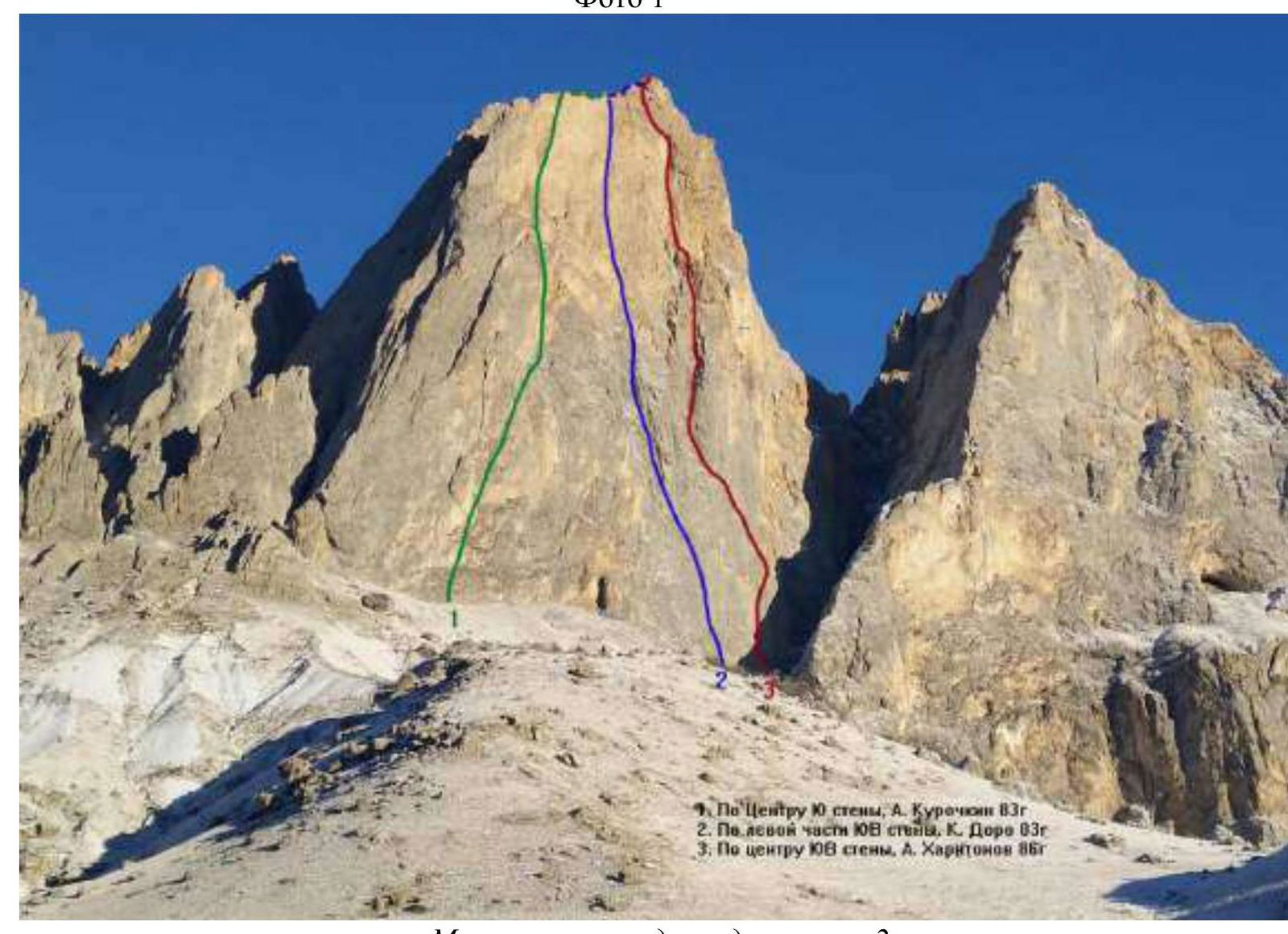
General photo of the route. Photo 1
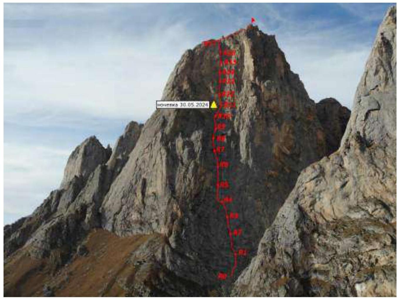
The team's route is numbered 2
Technical photo of the route
Photo 2
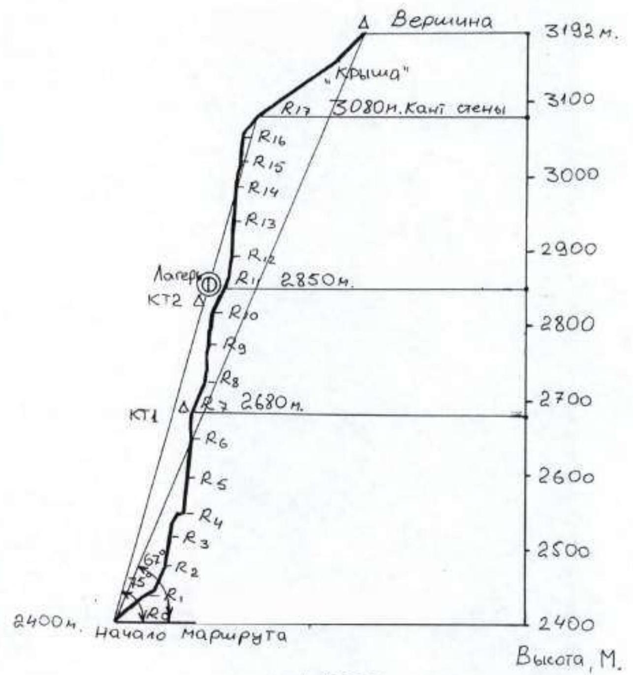
Drawn profile of the route
Panorama of the area (from Google Earth)
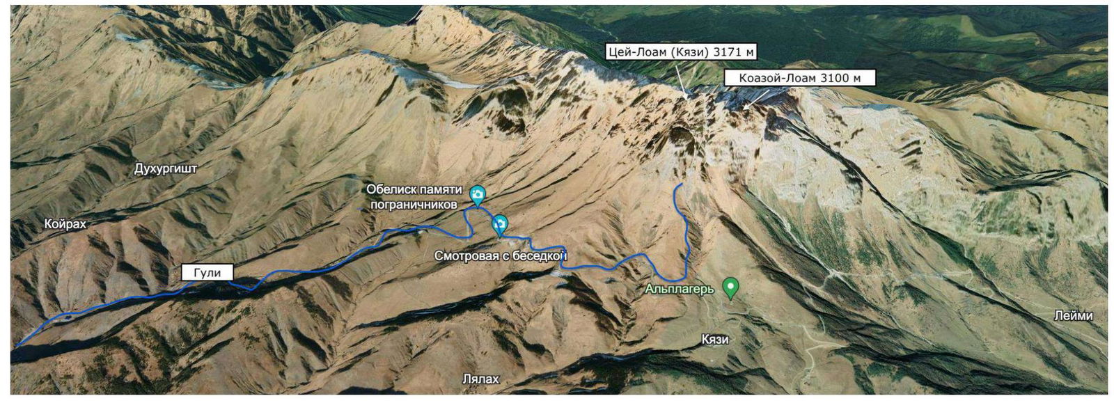
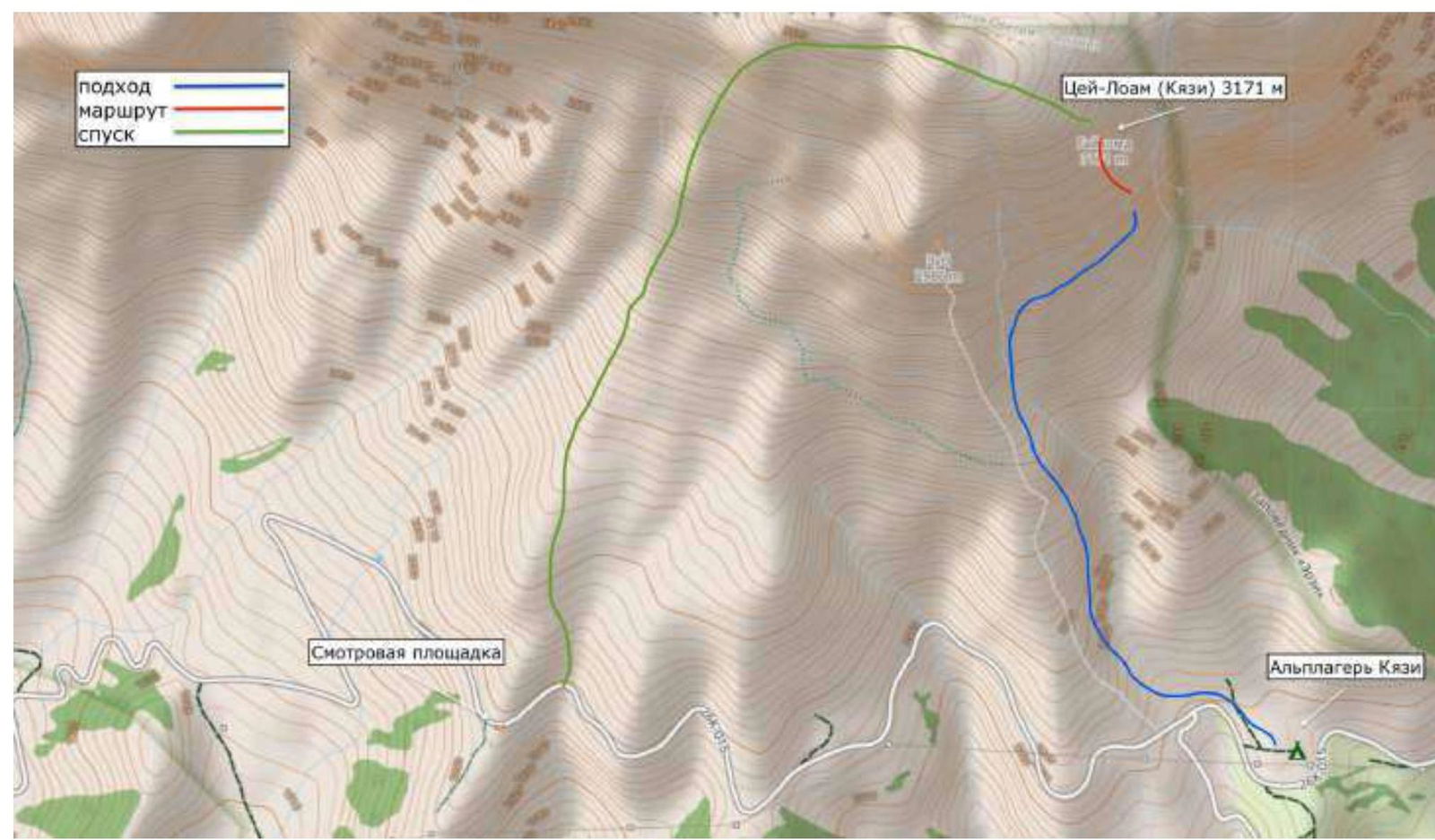
Area map
Description of the Ascent Area
Peaks Tsey-Loam (Kyazi, Gaikomd Main) on the left and Koazoy-Loam on the right.
The Gaikomd peak massif is located in the Rocky Range of the Greater Caucasus, in the section of the range between the Terek River (to the west) and the Assa River (to the east).
The Gaikomd Main summit is the highest peak of the massif, rising above the Central and Eastern peaks. Previously, the summit was named "Girech"; now, in the classifier, the main peak is named "Tsey-Loam"; it is also called "Kyazi"; we refer to it as Gaikomd.
Along the ridge of the rocky range to the Gaikomd summit from the west passes the administrative border between the Republic of Ingushetia and North Ossetia – Alania, then it goes north. The ascent route and approaches to it are located on the territory of the Dzheyrakhsky district of the Republic of Ingushetia.
The base camp is located 200 m from the border post on a large clearing.
Border permits are not required for the area; however, it is necessary to notify the border guards of your presence.
Cell phone coverage: only Beeline and Megafon networks, and at the top and on the wall – MTS, mobile internet. The weather in the area is quite stable; snowfall periods last 2–3 days, and snow on the routes melts very quickly. This should be taken into account during prolonged wall ascents.
In winter, after heavy snowfalls, be cautious in couloirs and on windward slopes – there is a risk of avalanches.
The Gaikomd ridge is composed of sedimentary rocks – limestone, partially metamorphosed. The wall alternates between crumbling sections with a yellow-white hue and sufficiently monolithic rocks with a gray hue. It is rich in various cracks, crevices, and cavities.
The relief is very reminiscent of Crimean walls:
- Morcheka,
- Forossky Kant,
- Sokol.
Most of the relief is clogged with earth, grass, and tufts. It takes a long time to clear the relief for reliable points, and fine grass dust clogs the eyes.
The upper part of the wall is quite steep and destroyed, very similar to:
- Ak-Kaya,
- Kara-Kaya in Bezengi,
- Erydag in Dagestan.
The rock is fragile, with sections of soft chalk inclusions. In crevices, you often find:
- fragments of destroyed rocks,
- "live" rock, which complicates the installation of reliable insurance points.
Special attention should be paid to:
- the reliability of stations,
- station locations.
Approach
From the a/l "Kyazi" (42.81955; 44.85741), move up the grassy slope towards the Tsey-Loam (Kyazi) summit. Staying on the left side, exit onto the ridge of the left spur.
Follow the trail on the ridge to a large stone. Bypass it from the right side. Then 15 m to the trail that crosses the slope on the right side, exiting onto the right spur.
After the Russian Championship in 2024, markers remained on the right side of the ridge – trail markers.
It is advisable not to traverse the slope until the first marker is visible at the bottom of the right spur, as the slope is quite steep and slippery after rain, making it easy to get lost.
Then, traverse right, gradually climbing, crossing the slope. After each marker, the path to the next one is visible.
The first good landmark is a moraine with large stones; the trail then passes by trees, down the slope.
From this point, the couloir and route are already visible. Move up, along the rocks, to the base of the wall. The route starts from the "ram's foreheads" at the lowest point of the wall, left of the couloir and gully.
R0–R1: (40 m: 15 m II, 5 m I, 20 m III) Along simple rocks of the foreheads, exit onto a shelf. Be cautious, as there are many loose stones that can be dislodged onto companions.
R1–R2: (50 m: 15 m II, 35 m IV) From the station, left along an internal corner, then right up steep foreheads to a comfortable shelf. Station.
R2–R3: (40 m: 40 m V+) Then begins a system of steep internal corners, with earth and stones in the corners, wet. Station is hanging.
R3–R4: (40 m: 20 m V+, 20 m III+) Corners are monolithic, few loose stones. Then the corner flattens left, exit onto a grassy shelf.
R4–R5: (40 m: 20 m VI, A1–10 m, 10 m V+) Do not go straight up the corner. Along the shelf, left down, bypass the outer corner and enter the inner one. Relief is monolithic.
R5–R6: (45 m: 20 m VI A2, 25 m V+) Further, the difficulty increases. Station is hanging.
R6–R7: (55 m: 25 m V+, 30 m VI A2) Along the corner, bypassing a ledge on the right, exit onto a slab. Along it, left up. Enter the inner corner. Station.
R7–R8: (40 m: 40 m IV) Further along the inner corner, with some grass and tufts. The rope is not complicated.
R8–R9: (45 m: 30 m VI A2, 15 m V+) Further, the difficulty increases. Move along the corner under an overhang, then right up. In the corner, there are loose blocks and slabs. At the flattening, there is a station.
R9–R10: (45 m: 15 m VI A1, 30 m V+) The steepness increases again. Along the corner, climbing, exit onto a wall with corners and crevices. Along it, left up, bypassing overhangs, onto a flattening.
R10–R11: (40 m: 20 m V, 20 m IV+) Further along a not-steep slab, right up to a visible shelf and niche. Here is a shelf for an overnight stay (sitting).
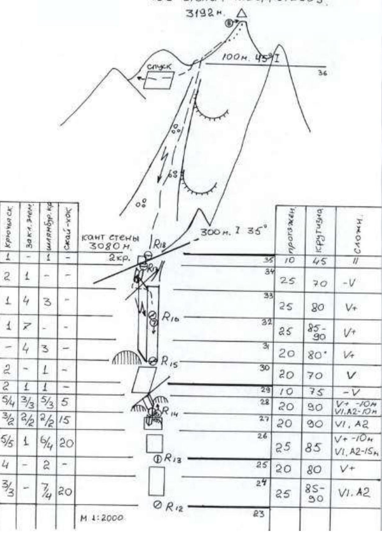
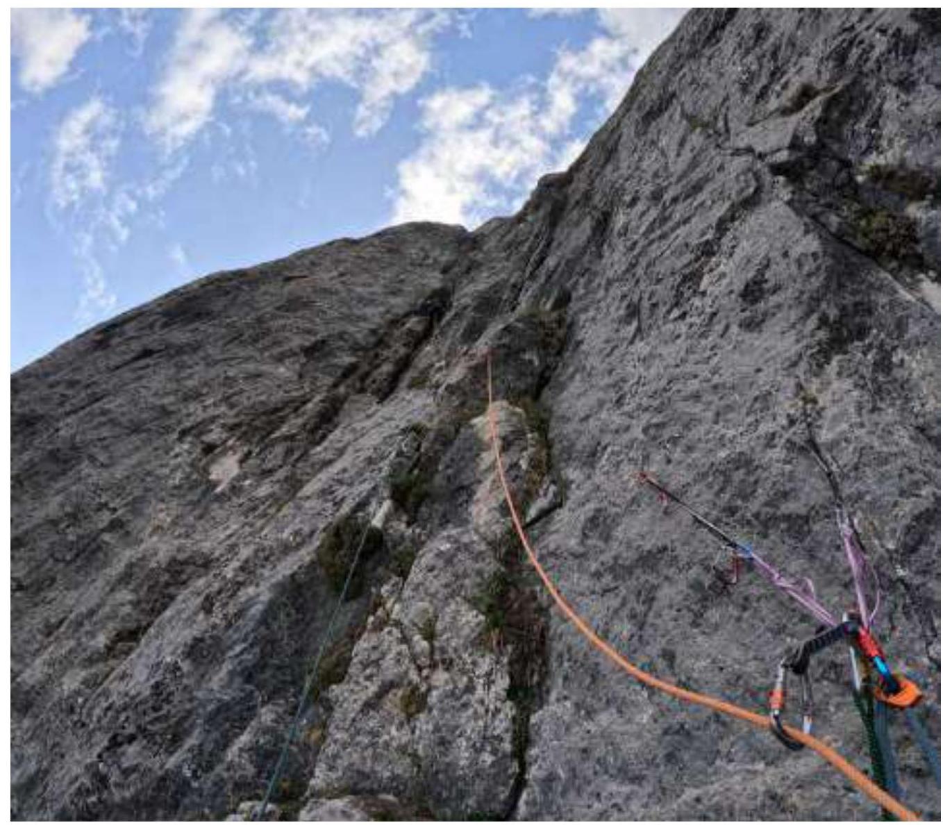
R11–R12: (45 m: 15 m V, 30 m V+) From this rope, the upper part of the wall begins. The rock is fragile, brittle. Much destruction. Landmark from the station – move straight up, not changing trajectory much.
R12–R13: (45 m: 25 m VI A2, 20 m V+) From the station, difficult climbing initially slightly left, then slightly right. Orientation is challenging. The second half of the rope is simpler. Station is hanging.
R13–R14: (45 m: 35 m VI A2, 10 m V+) From the station, left up to a not-explicit outer corner. Bypass steep sections, then right up under overhanging blocks.
R14–R15: (50 m: 10 m VI A2, 10 m V+, 10 m V, 20 m V) From the station – traverse around the corner; there will be a bolt. Along crevices and corner up, then left. Under an overhang, exit onto the outer corner and along its left side to a visible large inner corner. At its base, there is a station.
R15–R16: (45 m: 45 m V+) Further along the corner. Climbing is not complicated, but there are many loose stones. When stones fall, everything falls onto the station.
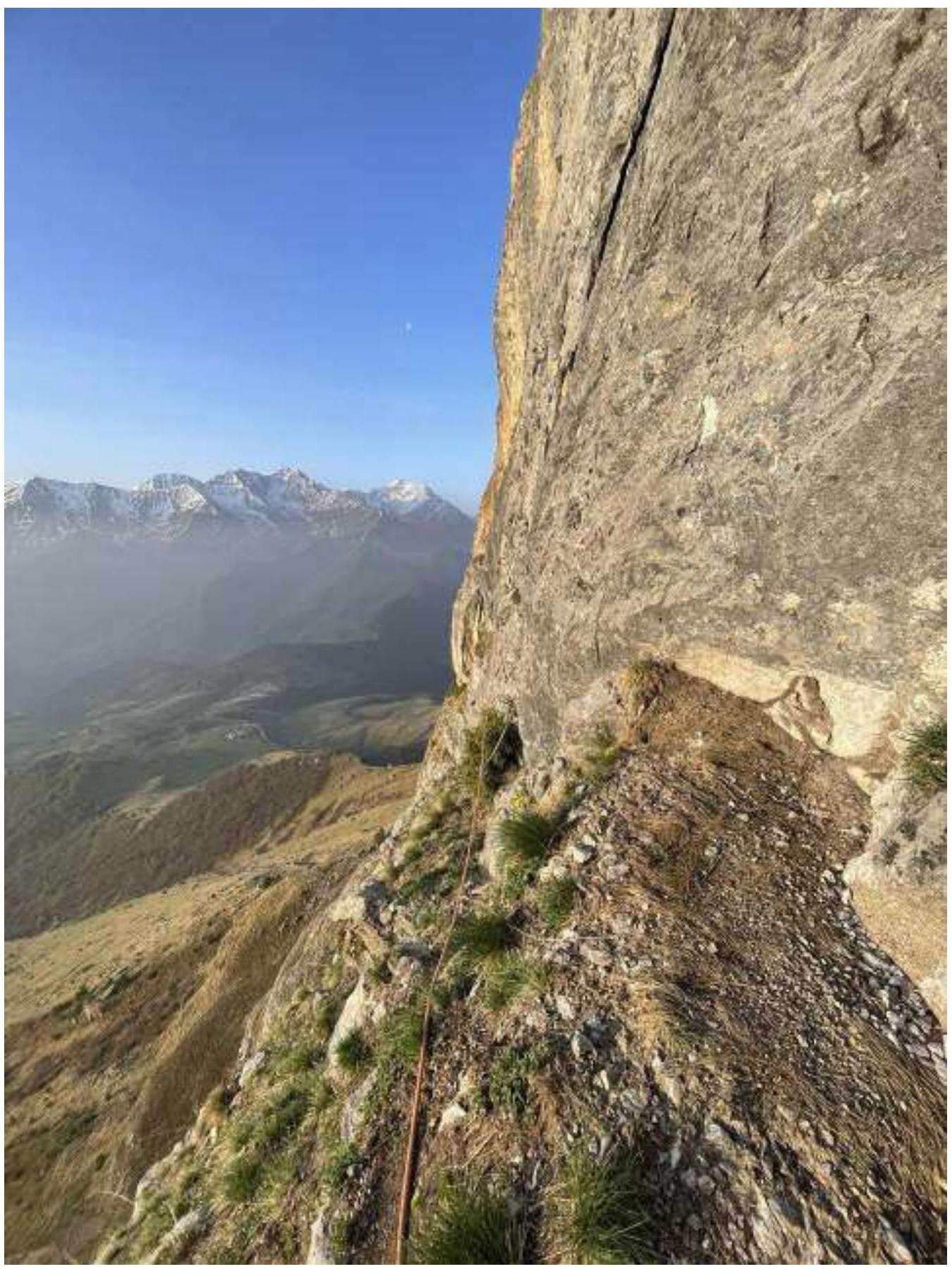
R16–R17: (50 m: 25 m V+, 25 m V) Again along the inner corner, then through its left wall, exit into a gully going left towards the wall's edge. Station is on the edge.
R17–R18: (10 m: 10 m II) Further, right through a rock step. Rocks are simple.
R18 (300 m: 300 m I) – Summit: Then along a slope-couloir and simple rocks, exit onto the summit.
Descent
Descent via 2A, marked with flags.
Route diagram in UIAA symbols
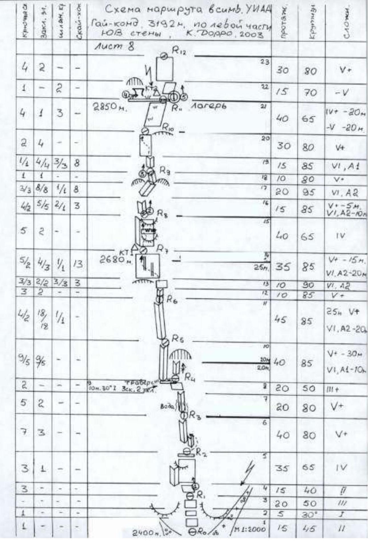 Route diagram in UIAA symbols Gaikomd, 3192 m, via the left part of the SE wall. K. Dorro. 2003.
Ascent Schedule and Weather Conditions
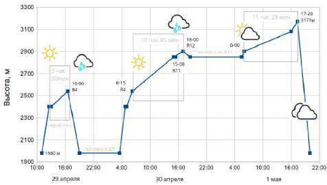
Team Actions
The team arrived in the area on April 28, 2024. Until then, there was a prolonged dry spell. There was no snow on the wall.
The weather forecast for the next few days was unstable, with snow and a sharp cooling expected in 3 days (from May 2). It was decided to process the first ropes the next day and complete the route with one overnight stay.
On April 29, 2024, they left the Base Camp (a/l "Kyazi") at 11:00. Approached the route at 12:30.
At 13:00, they began processing the route. The first ropes are simple, along the "ram's foreheads." In rain or with snow, it is necessary to be very cautious, as the rock becomes slippery. There is little insurance.
Then begins a system of internal monolithic corners. In the corners, there are places with earth and stones, wet. It is necessary to climb carefully.
At 16:30, they reached the end of the internal corners, a flattening, and exited onto a good grassy shelf (R4).
Having processed 4 ropes, they descended to the Base Camp for an overnight stay.
On April 30, 2024, they left the Base Camp at 3:30. Approached the route at 4:45. At 5:00, the first participant started working on the rope.
At 6:15, they began working on the route from R4. Climbing is monolithic, but there are many crevices filled with earth and moss. Climbing without glasses is difficult; dust flies into the eyes, both for the leader and the belayer.
Insurance is reliable. Orientation is simple, corresponding to the description.
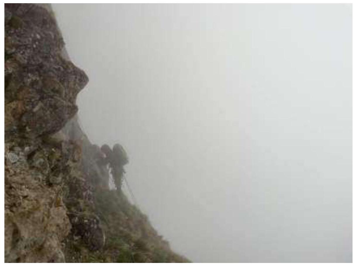
Weather – clear in the morning; after lunch, clouds arrived, and it became noticeably colder. After 14:00, light rain started; the route was enveloped in cloud, visibility worsened.
At 15:00, the leader reached station R11; further, at 16:00, all participants gathered on R11 (overnight stay). The niche for the overnight stay is located to the left on the shelf, in a conditional "grotto" on a sloping shelf under a small overhang. For a group of two, a lying overnight stay is possible. For our group of three, there was only enough space to sit.
After 16:00, the weather worsened; heavy rain started. To utilize the remaining daylight – it was decided to process as many ropes as possible.
The key to the route is the first three sections from the grotto (R11–R14). Already complex climbing on destroyed rocks was complicated by weather conditions. The rocks are slippery. Once, the leader dislodged a large stone underfoot, which flew directly into the station. Fortunately, the station in this section is protected from falling stones, and with quick reaction, the belayer can press against the rock. On this and the next two sections – challenging orientation; it was necessary to move left/right – searching for relief. Section R11–R12 took 2 hours to process. After that, it was decided to stop work and descend for an overnight stay.
One participant remained below to organize the bivouac. An attempt was made to enlarge the shelf for three people but was unsuccessful.
At 18:30, the entire team descended to the bivouac.
On May 1, 2024, at 5:30, the group started working on the route, jumaring the previously fixed section.
At 6:00, the leader began working from section R12.
Sections R11–R18 differ significantly from the first half of the route. Climbing becomes more dangerous due to the fragility of the rock. местами ITO A2. Challenging orientation; it is easy to get lost. Climbing on some sections is complex. For insurance, anchors work well.
All stations are equipped with bolts and are 40–50 m apart. Our team did not find one of the stations on section R12–R14. As it later turned out, they deviated significantly to the right.
At 16:00 – the leader completed work on the wall part of the route. At 17:20 – the entire team reached the summit. At 17:40 – the descent began. At 20:00 – return to the Base Camp.
Safety Assessment of the Route. Recommendations for Subsequent Climbers
The route can be divided into two parts: the first half (up to R11) is monolithic. The rock on the second half (from R11 to R18) is crumbling, dangerous. Visually, the two parts of the route differ in the color of the relief: below, it is gray; in the upper part, it is rusty.
The rusty rocks crumble; handholds are unreliable; some crumble in hands under load.
Sections R1–R9 are characterized by a large number of grassy tufts, earth in crevices, and dust. There is a lot of dust and earth; it clogs the eyes both for the climber and the jumaring. Due to "vertical" tufts, it is sometimes challenging to organize reliable insurance. Nevertheless, compared to the upper part of the route – climbing and point placement are simpler here. Anchors work well, including with offset.
For movement in the lower part of the route up to R11, a simultaneous movement scheme was used (the second participant jumars and insures the leader). In the upper part of the route, maintaining such a scheme was challenging due to the complexity and destruction of the relief; organizing intermediate stations was sometimes unsafe. Due to challenging orientation, it was necessary to search for relief and sometimes lay traverses, which also negatively affected the team's speed.
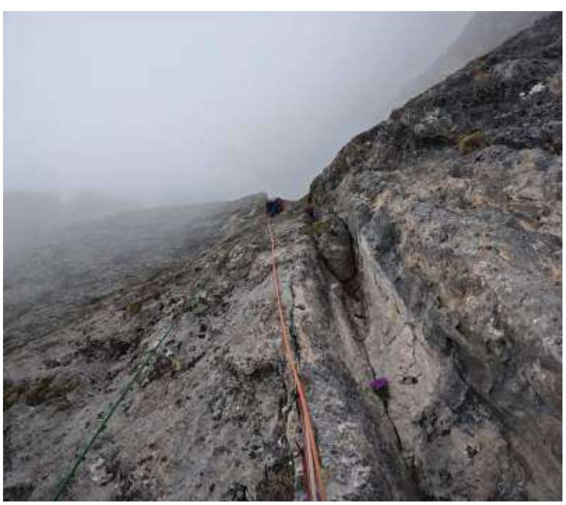
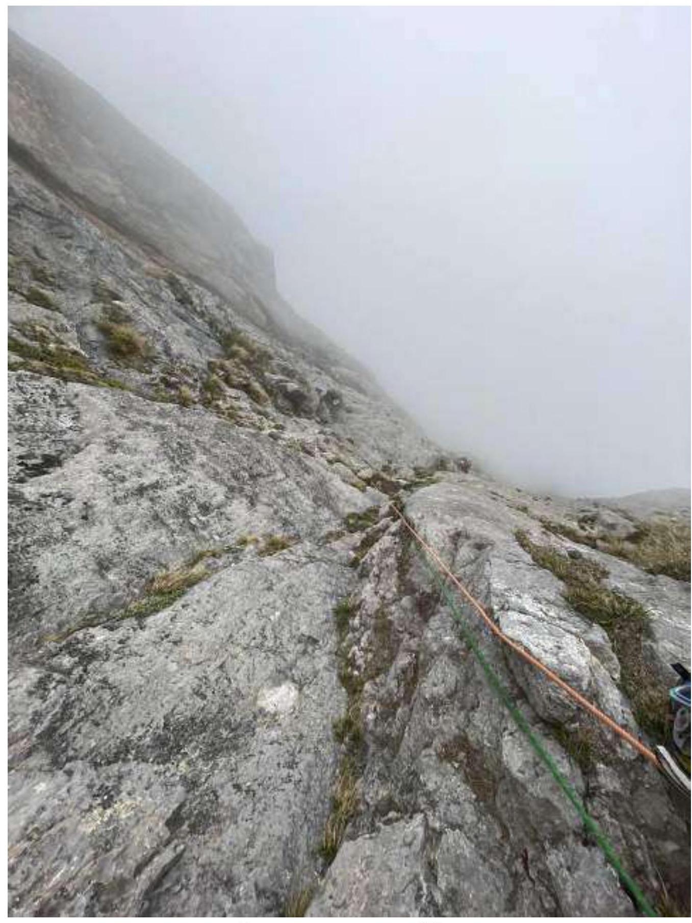
Above R14, when the wall "releases" – the relief becomes simpler but more lively.
Descent from the summit via route 2A. On the descent, there is an equipped rappel in the couloir; a doubled 50 m rope is sufficient for the rappel.
Emergency exit from the route: via the ascent route.
Recommendations for equipment: a set of sling "hardware," anchor hooks, rock pitons, rock shoes.
Photo Report
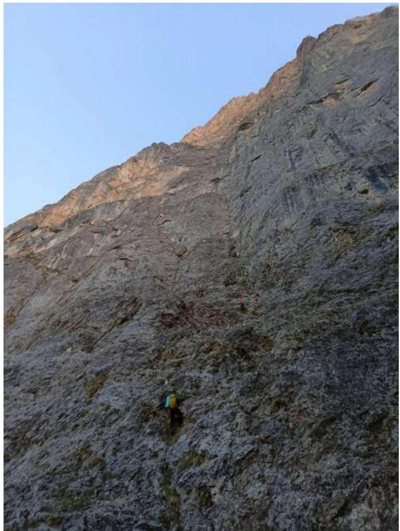
Ascent along fixed ropes during processing on sections R0–R1–R2. Photo from the start of the route.
Leader on section R3–R4. Photo taken on April 29 during route processing.
Traverse R4–R5
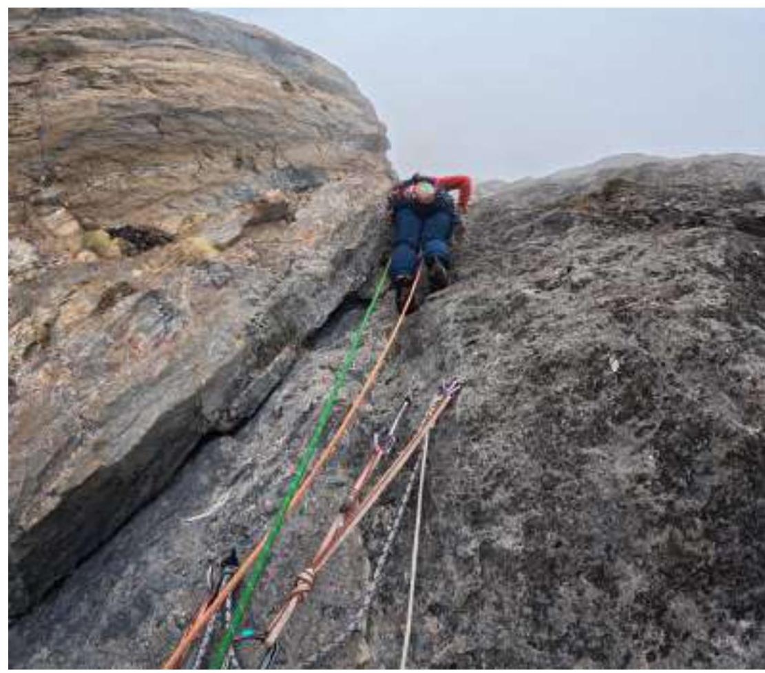
Start of section R6–R7
Leader in the upper part of section R6–R7 (photo from an intermediate station)
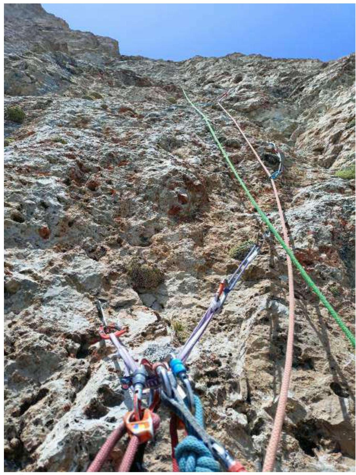
R7 Control Tour
View down from station R7
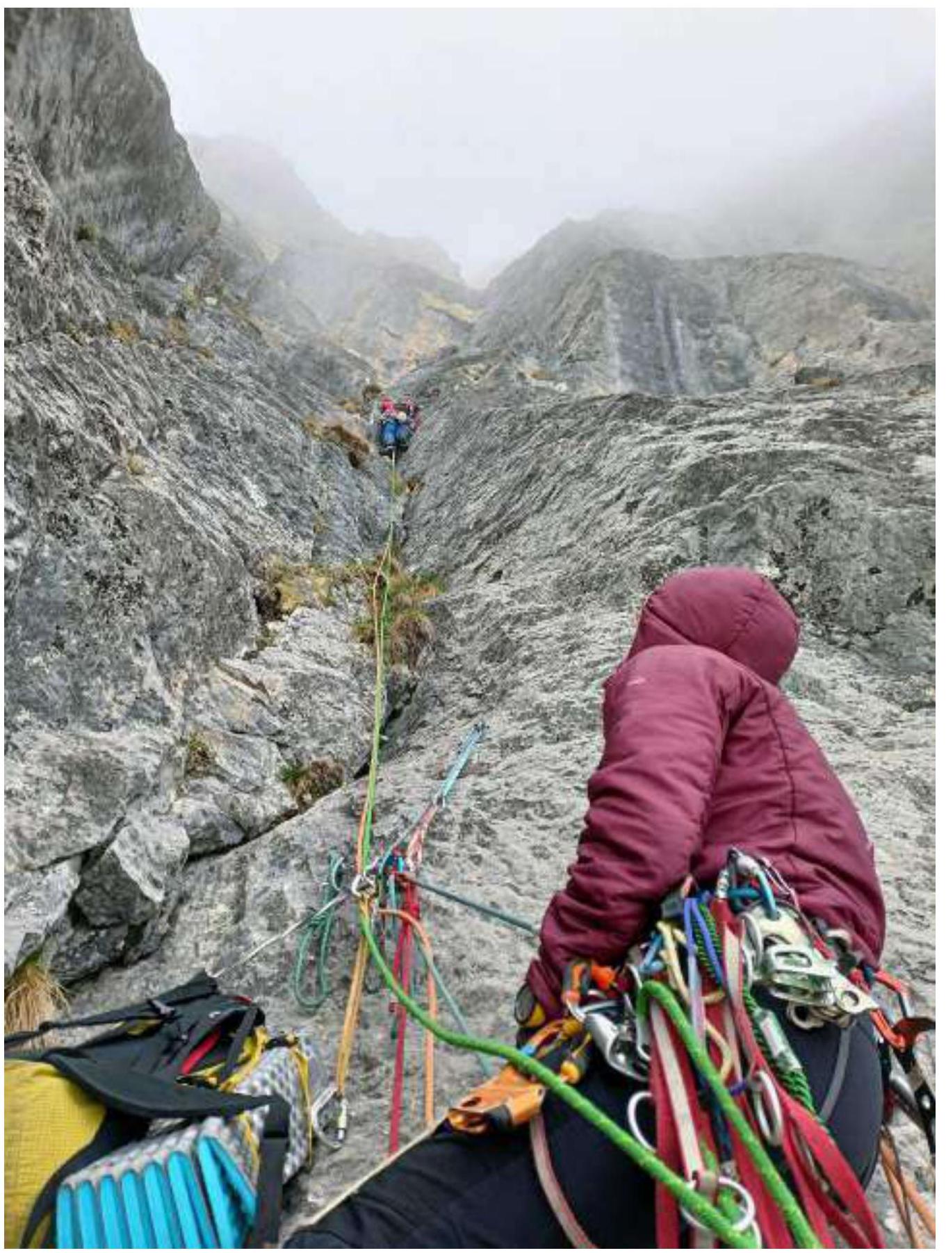
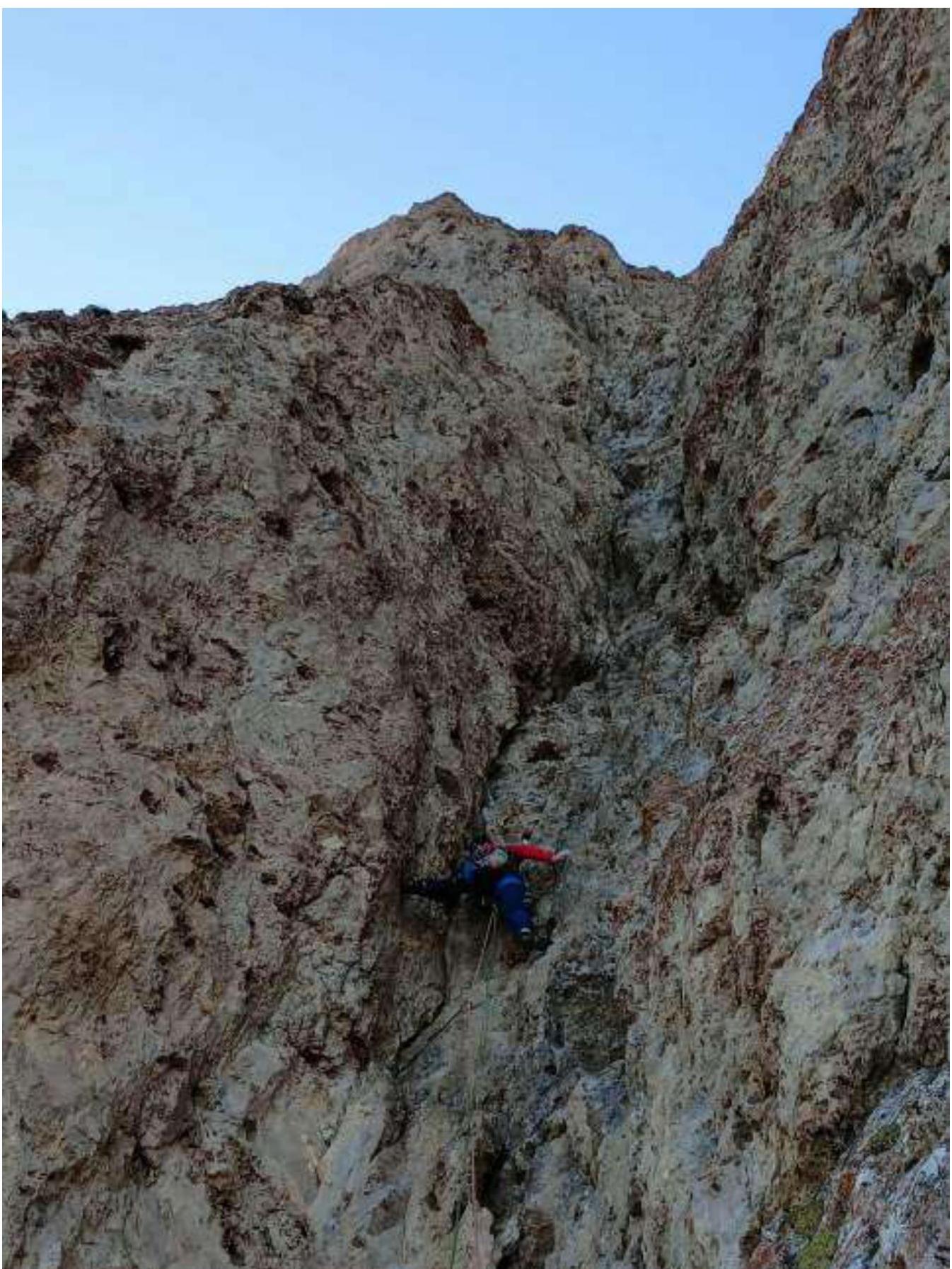
Leader on section R8–R9
View of the leader from station R9

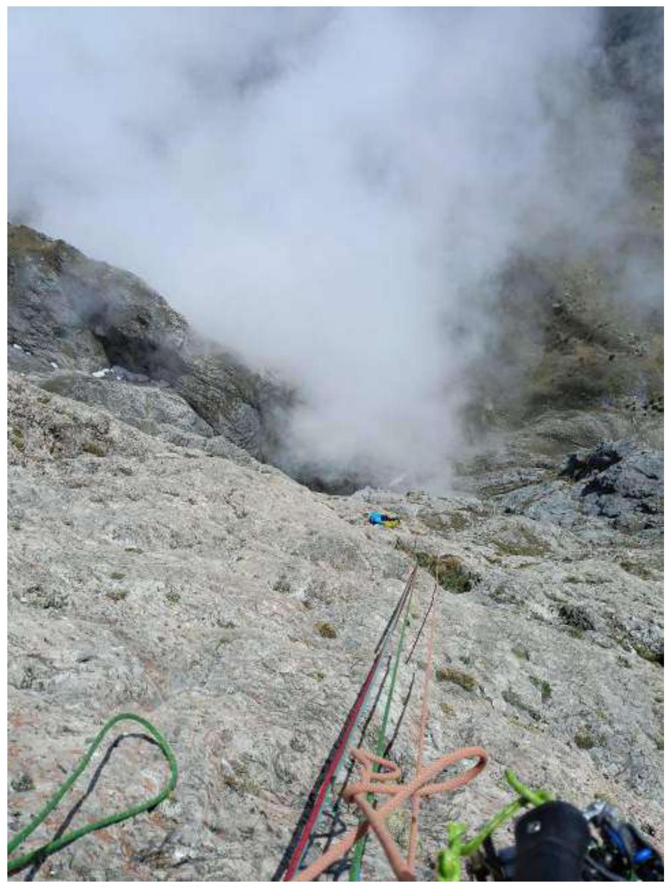
View down at the third participant from station R9
View from the grotto (overnight stay) at station R11.
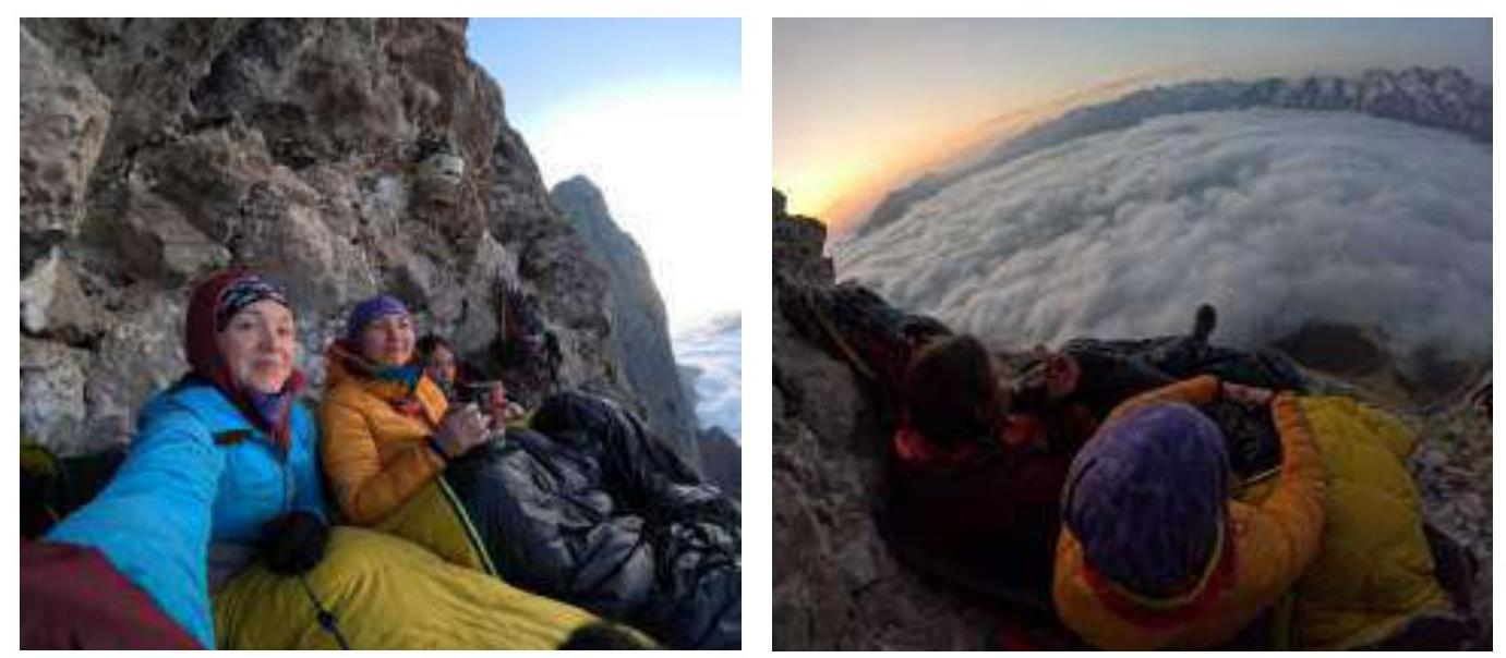
Overnight stay in the grotto on R11
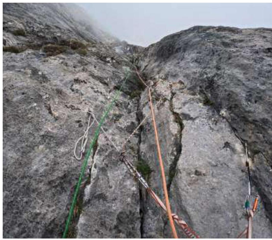
Station on own points on section R12–R14. As it turned out later, we deviated significantly to the right and therefore did not find station R13.
Section R12–R14, view down from an intermediate station.
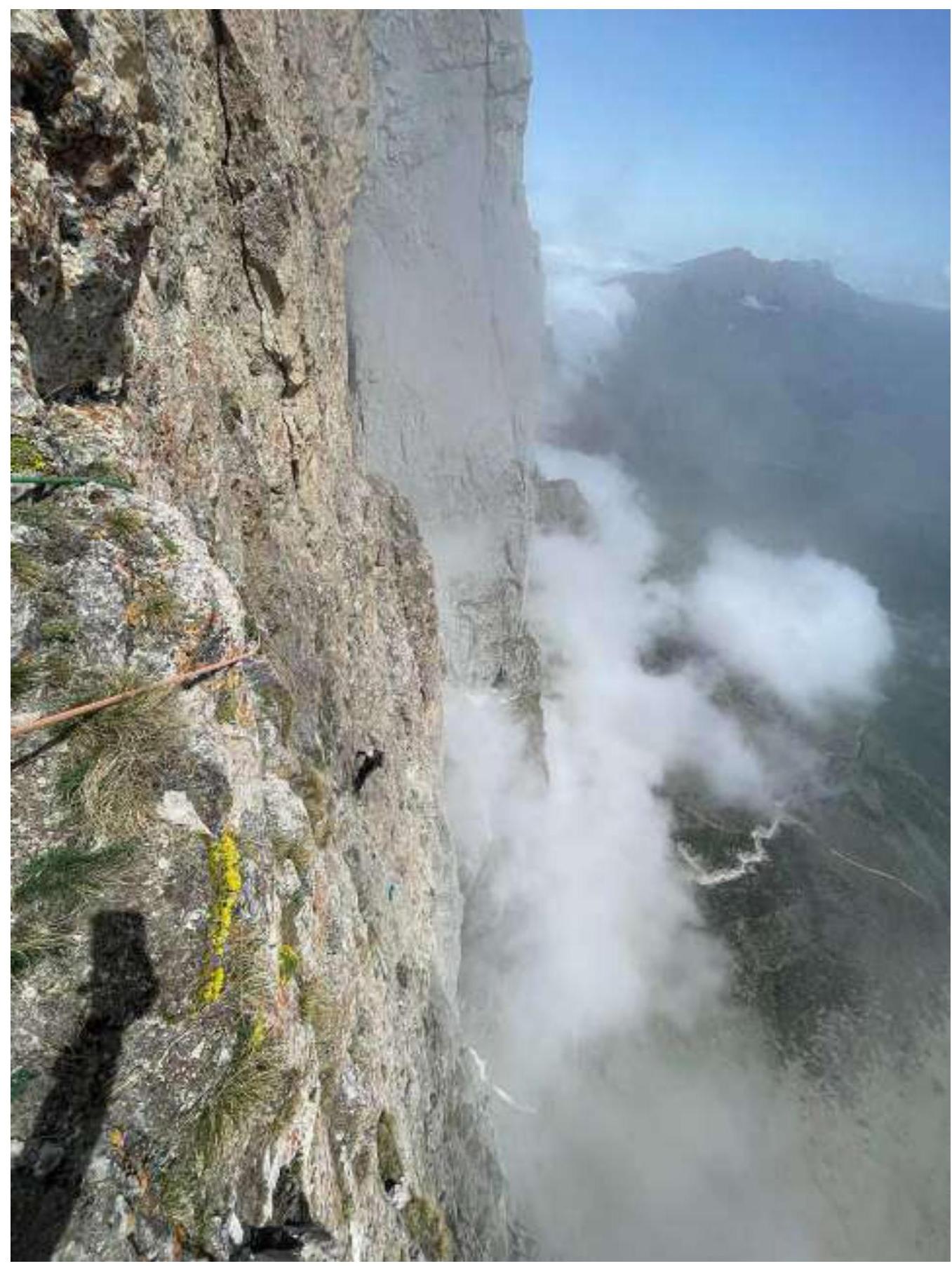
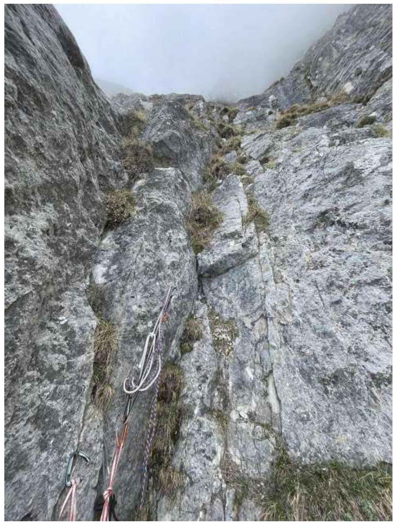
View down from station R14. Since we deviated significantly to the right, we had to make a traverse to reach the station.
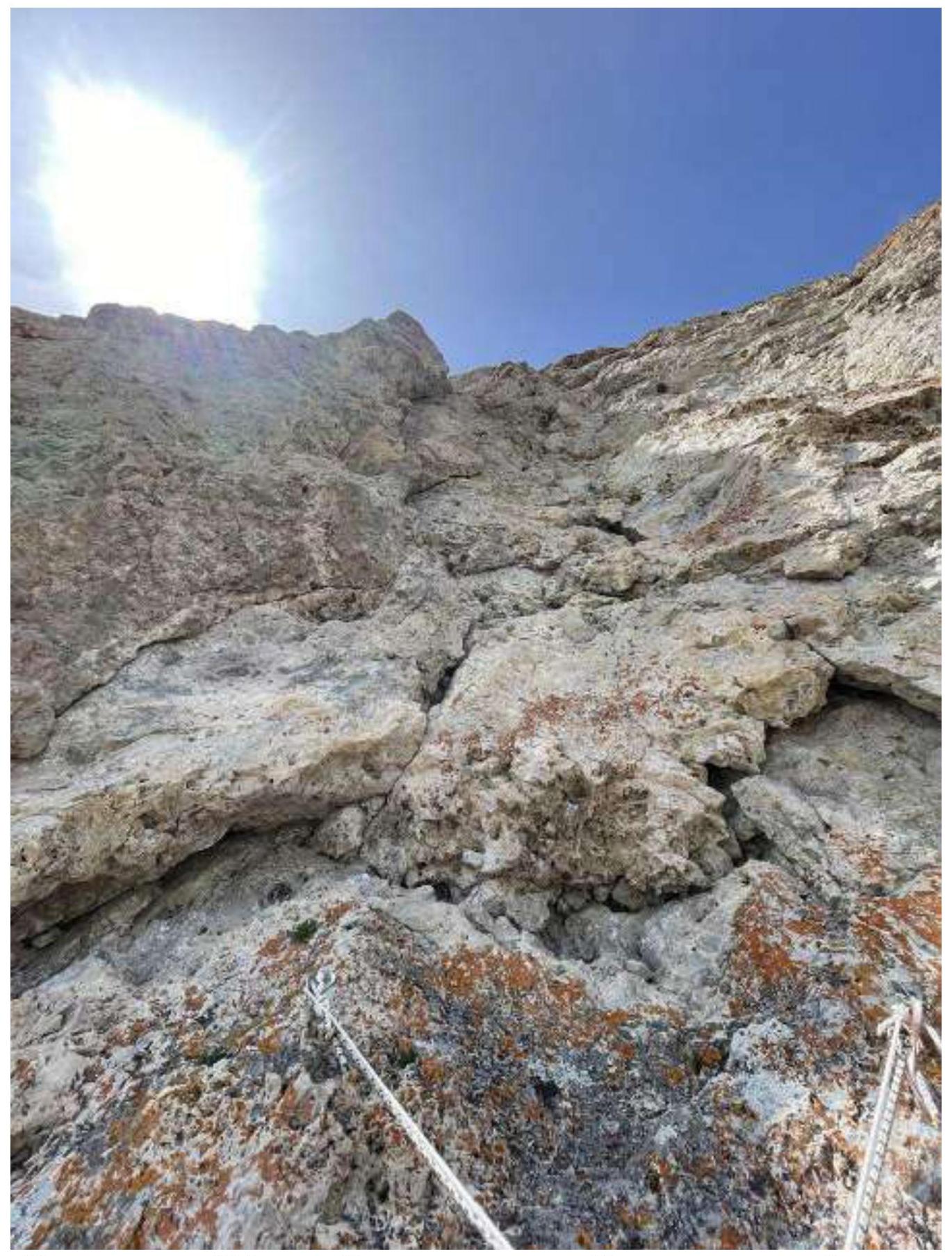
View from station R14 upwards. There is no need to climb there. You need to move from the station around the corner to the left, where there is a bolt.
Leader in a destroyed rusty corner on section R15–R16
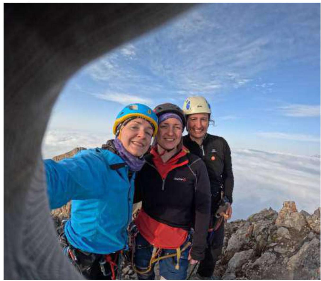
At the summit
