
General Description of the Peak and its Location
The Midagrabin Plateau area is adjacent to the Kazbek high-altitude region, located to the west in the eastern part of the Central Caucasus and is entirely within the North Ossetian ASSR.
The most significant peaks in the area are giants such as:
- Jimarai-khokh
- Shau-khokh
- Suatisi-khokh
- Zeigalan-khokh
- Tsiti-khokh
- Khirkhaten
- Donchenty.
These peaks form a mountain "ring," with a giant bowl stretched in the latitudinal direction, housing the Midagrabin Glacier, which translates from Ossetian as "located in the corner."
The peaks of the Midagrabin Plateau are located in the Main Ridge of the Greater Caucasus and partly in its northern spurs. The most significant massif of the northern spurs of the Midagrabin area is one of the most beautiful and highest peaks in the area - Shau-khokh ("Black Mountain," 4646 m above sea level).
The immediate "neighbors" of the peak are:
- to the southeast - Jimarai-khokh (4778 m)
- to the northeast - Geodesist Peak (4100 m)
- to the west - Zeigalan-khokh (4200 m). To the south, the Shau-khokh massif is bounded by the Midagrabin Glacier.
To the north, the massif is encased in ice, and from its slopes flow:
- to the north-northwest - the Zeigalan-Tsiti Glacier
- to the north-northeast - the Tsata-Tsiti Glacier.
To the ice dome of the peak from the north approaches the northern ridge, turning into an edge.
Ascents to Shau-khokh from the south, from the Midagrabin Glacier, as well as along the eastern ridge are classified as 2B cat. diff.
The ascent along the northern edge begins from the village of Jimara, located in the upper reaches of the Gizeldon River, which is there called "Shtri-don."
From the village of Jimara, you can drive from the city of Ordzhonikidze - the capital of the North Ossetian ASSR - by car through:
- the low Kakadur Pass
- the villages of Gizel and Karmadon
- Gizeldon via a cable car and the village of Dargavs.
The relative height of the peak above the village of Jimara is approximately 2 km, and the height difference between the extreme points of the route along the ridge and edge is 1 km.
The ascent along the northern edge of Shau-khokh with a descent through the Goltsa Glacier to the tongue of the Maili Glacier takes about 4 days.
The ascent along the northern edge of Shau-khokh was first made in 1938 by a group led by A. Japaridze.
The second ascent along this route with a descent along the eastern ridge of Shau-khokh was made from June 30 to July 7, 1955, by a group of students from the North Caucasus Mining and Metallurgical Institute, consisting of:
- I. Sujaev
- V. Gorelov
- R. Proskuryakov
- B. Ryazhsky (1st sports category).
Detailed Description of the Ascent Route
Day I. The group leaves the bivouac located in the valley of the Shtri-don River.
From the right (orographic) bank of the river begins the ascent through the gorge of the Zeigalan-don River. Initially, a trail winds steeply up the left (orographic) bank of the Zeigalan-don. Then - a transition to the right bank, along which the group reaches the mouth of the couloir descending from the saddle on the northern ridge of Shau-khokh, overcoming a steep ascent along scree and grassy slopes and simple rocks. From here, in the upper reaches of the gorge, the Zeigalan-Tsiti Glacier is visible. The couloir, which will be ascended, is about 600 m long. The couloir is filled from bottom to top with medium and fine scree, and the ascent is extremely laborious. In the upper part, the couloir is partially snow-covered. The steepness of the couloir is obviously over 40°.
On this day, a significant part of the couloir is traversed, and the night's bivouac is organized under one of the rocky outcrops on the right side of the couloir, where a platform for a tent has been laid out by the SKGMI group using stone slabs.
Day II. Starting to move up the unstable scree of the couloir early in the morning, the group reaches the saddle of the ridge in 1 hour. Here, a convenient bivouac can be organized.
From the saddle begins the ridge route. Having traversed a 100–150-meter steep, debris-covered ascent of the wide ridge at this point, the group emerges onto the narrow part of the rocky ridge. The ridge is 100–150 m long, studded with frequent small rock spires. Climbing along the narrow ridge of moderate difficulty takes 1–1.5 hours. (Climbing in teams!)
At the end of the "saw-tooth" ridge, it broadens significantly due to an adjoining ridge on the right. Leaving the line of the ridge with its spires, one must exit to the right and, having traversed this broad ridge, descend along rocks of moderate difficulty, parallel to the line of the ridge, 10–15 m to the side of the gap before the "Big Gendarme" on the Northern ridge.
The traverse of the gendarme to the right involves traversing the tower's rocks along ledges and shelves, heavily destroyed and snow-covered.
The belay is through outcrops; the length of the traverse is 4–5 ropes. Following the traverse of the tower, there is an ascent to the left and upwards along simple rocks and scree slope towards the col behind the "Big Gendarme," leaving it to the left.
On the rocky ledge of the ridge, behind the col, there are three platforms for tents, laid out in 1938 by Aleksey Japaridze's group. Here is the control cairn on the northern edge of Shau-khokh.
At this location, the night's bivouac is organized.
Day III. From the "Big Gendarme," the ridge becomes steeper, rising towards the ice dome of Shau-khokh.
From the bivouac site, the group moves directly along the line of the ridge, which is technically not complex here. Having traversed 100 m and bypassing several small gendarmes on the way (all bypasses are to the right), they emerge onto the steep snowy western slope of the Northern edge and traverse it, heading towards the base of the II "Big Gendarme."
Then they traverse the slope, cross two steep and destroyed rocky buttresses, and further - a snowy couloir behind the gendarme tower, and ascend along the next rocky-scree steep buttress. The advance along the buttress upwards towards the line of the ridge is not difficult but is dangerous due to the heavily destroyed slates that make up Shau-khokh's massif. Further movement is along the line of the edge, which becomes narrow here. Climbing is of moderate difficulty.
After 100 m, the heavily snow-covered edge here approaches the ice "cap" of Shau-khokh. Upwards rises an icy, partially snow-covered slope, with a 40–45° steepness. On the slope, hook belays and step-cutting are necessary. At the end, the slope turns into an icefall, under which they traverse to the right with step-cutting (slope 45–50° steepness) and enter the labyrinth of seracs and blocks of the grand ice dome of Shau-khokh.
After traversing to the right for 15–20 m, the path goes upwards for two to three ropes along a 45–50° icy slope, partially covered with a thin layer of snow. Here, under one of the icefalls of the dome, a bivouac can be organized in deep snow filling the crevices under the seracs.
On this day, it is possible to ascend higher; however, the subsequent complex and labor-intensive sections are better tackled with fresh strength.
Day IV. Finding a passage through the chaos of the icefall is not easy and is not without danger due to the enormous crevices hidden under deep snow in the icefall.
To pass through the icefall, it is necessary to overcome an ice wall 4 m high, overhanging from below and vertical at the top.
The wall, at one of the breaks in the glacier, opens access to an icy "corridor" with a 40° steepness, which leads out of the lower, heavily crevassed part of the icefall.
In places, the "corridor," which is two ropes long, is filled with deep snow; in places, it is icy. The average group overcomes the wall with great effort; to do so, it is necessary to hammer 4 ice screws into it, and for the front-runners to climb on crampons onto the rucksack of a standing comrade. This section takes 2 hours of work.
Further, they ascend upwards onto one of the blocks of the icefall along the "corridor," after which, also with thorough belaying, they move along the block to the left and then, having crossed a very wide "fault" between the blocks of the icefall filled with snow, exit to the right along a steep (45°) icy slope onto a neighboring block located higher. From it, having crossed another "fault" along a snow bridge with thorough belaying, they emerge onto a steep 45–50° icy slope, partially covered with snow slabs.
Movement along the slope must be combined with thorough belaying through ice screws. Over the length of three ropes, the slope is mainly icy; further, the snow cover on the slope increases. Loose, powdery snow, knee-deep, lies on the icy base. The entire final steep slope, 150 m long, is covered with such snow. They move directly upwards, trampling a deep trench along the way. The slope leads onto the wide eastern ridge of Shau-khokh, where, 100 m to the west, on the rocks, near the highest point, a cairn is located.
The ascent from the bivouac site takes 5–6 hours. The descent route, compared to the ascent route, is technically not difficult and requires only physical endurance, as the entire eastern ridge of Shau-khokh, the slopes of the ridge towards the Golda Glacier, and the Golda Glacier are covered with deep, loose snow. From the Golda Glacier, by the end of the same day, it is possible to descend to the tongue of the Maili Glacier, to the Karmadon hot springs.
Day V. Through the Zeleny Pass, a cable car on the Gizeldon, or via Karmadon and Gizel, the climbers can return to the city of Ordzhonikidze the next day.
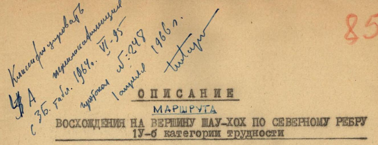
Route Assessment
The assessment of the route's difficulty according to the old classification (3B cat. diff.) clearly does not correspond to the current classification and the true difficulties of the route.
The unanimous opinion of the group and climbers familiar with the massif is that the route to Shau-khokh along the northern edge should be rated 4B cat. diff.
One of the most challenging routes in the mountains of North Ossetia - Shau-khokh (4646 m) along the northern edge is primarily snow-ice and is recommended for sports groups of the 2nd category.
Description compiled by
 (R. Proskuryakov)
Attached to the description:
- ...........
- Photos by Proskuryakov. Equipment recommended for a group of 4.
- Ropes - 2 pcs. 30 m each
- Rock pitons - 6 pcs.
- Ice screws - 5 pcs.
- Crampons - 4 pairs
- Carabiners - 8 pcs.
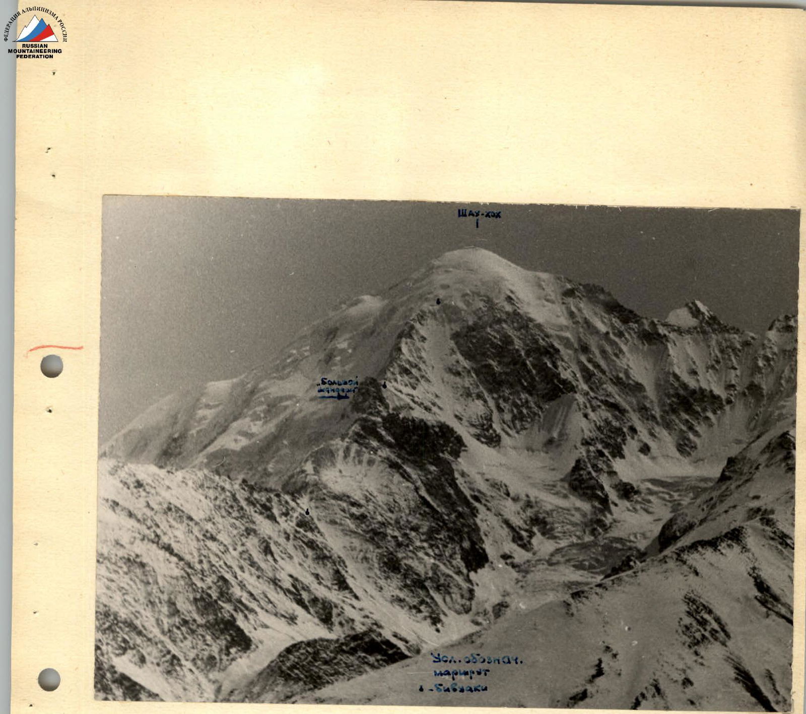
Shau-khokh (telephoto by R. Proskuryakov). View from the north.

Map-scheme of the ascent to Shau-khokh along the northern edge 4B cat. diff.
Comments
Sign in to leave a comment