Report
on the first ascent to the summit of Kormilina via the Northwest Ridge, category 2A, by the team of the North Ossetian Rescue Squad of the Ministry of Emergency Situations of Russia, from July 5 to 6, 2019.
1. Ascent Passport
| № | 1. General Information | |
|---|---|---|
| 1.1 | Full Name, sports rank of the leader | Egorin S.V. — Master of Sports |
| 1.2 | Full Name, sports rank of the participants | Tekhov V.M. — honored master, Chikin A.B. — 2nd sports rank, Kulchiev A.S. — 3rd sports rank, Arakelyants V.M. — 2nd sports rank |
| 1.3 | Full Name of the coach | Egorin S.V. |
| 1.4 | Organization | Russian Mountaineering Federation (FAR) and Ministry of Emergency Situations of Russia |
| 2. Characteristics of the Ascent Object | ||
| 2.1 | Region | North Ossetia, Tmiakom–Tepli region. |
| 2.2 | Valley | Tmiakom |
| 2.3 | Number of the section according to the 2013 classification table | 2.2.8 |
| 2.4 | Name and height of the summit | Kormilina 3649 m. |
| 2.5 | Geographical coordinates of the summit | 42°44.1′ N 44°04.3′ E |
| 3. Characteristics of the Route | ||
| 3.1 | Name of the route | Northwest Ridge |
| 3.2 | Proposed category of difficulty | 2A |
| 3.3 | Degree of route exploration | First ascent |
| 3.4 | Nature of the route relief | Combined |
| 3.5 | Height difference of the route | 300 m |
| 3.6 | Length of the route | 700 m |
| 3.7 | Technical elements of the route | Category I ice/rock/combination — 300 m. Category II ice/rock/combination — 300 m. Category III ice/rock/combination — 80 m. Category IV ice/rock/combination — 20 m. Movement on a closed glacier — no. Rappelling on descent — no. |
| 3.8 | Descent from the summit | East Ridge, category 1A, to Tmiakom valley |
| 3.9 | Additional characteristics of the route | Presence of water (snow from the North) |
| 4. Characteristics of the Team's Actions | ||
| 4.1 | Time of movement | 5 hours |
| 4.2 | Overnight stays | No |
| 4.3 | Departure on the route | 5:00, July 6, 2019 |
| 4.4 | Arrival at the summit | 10:00, July 6, 2019 |
| 4.5 | Return to the base camp | 14:00, July 6, 2019 |
| 5. Person responsible for the report | ||
| 5.1 | Full Name, e-mail | Egorin S.V., e.s.128@mail.ru |
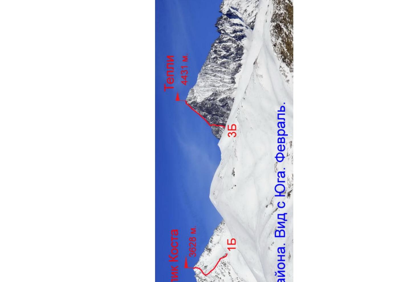
Panorama of the area. View from the South. February.
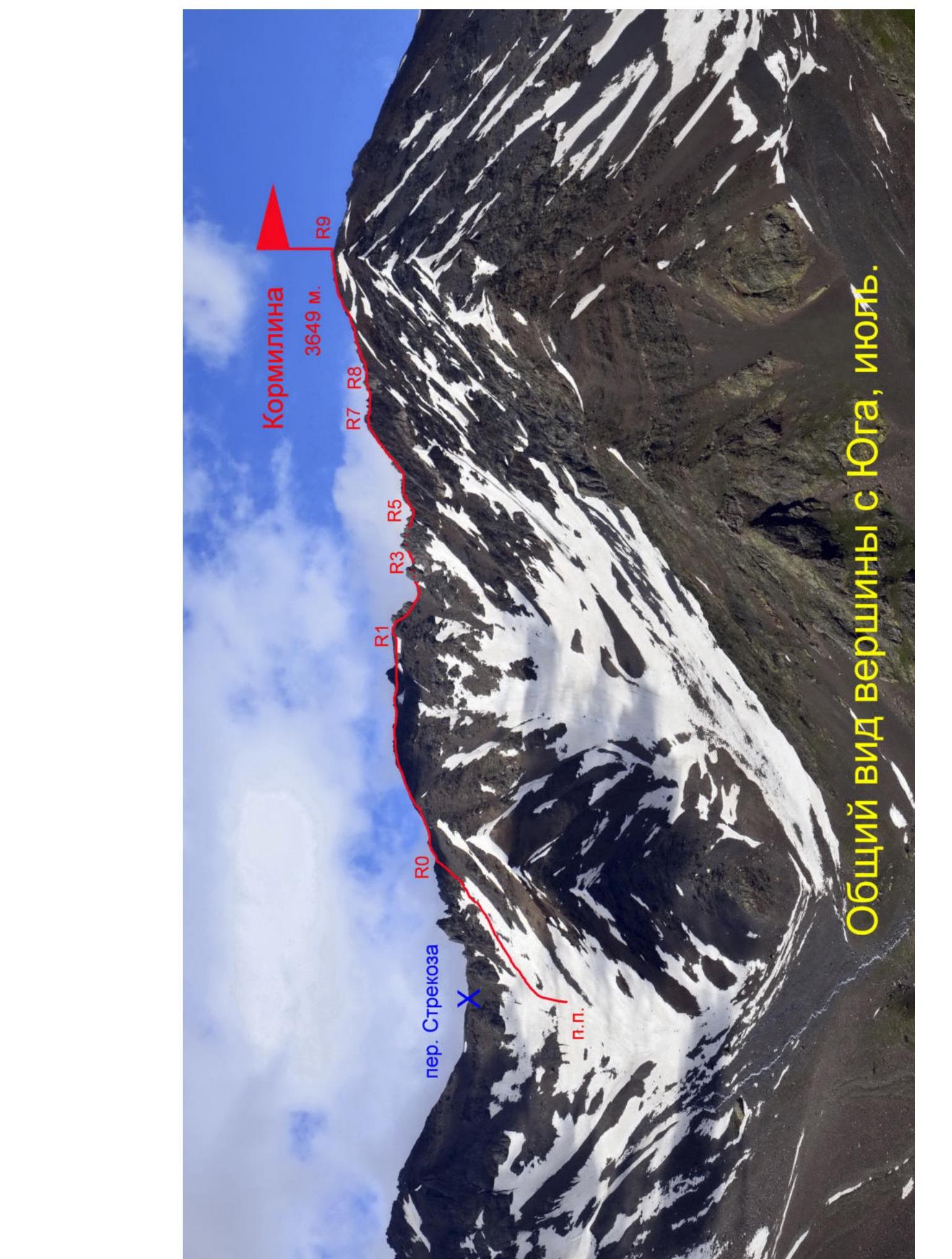 Kormilina 3649 m. General view of the summit from the South, July.
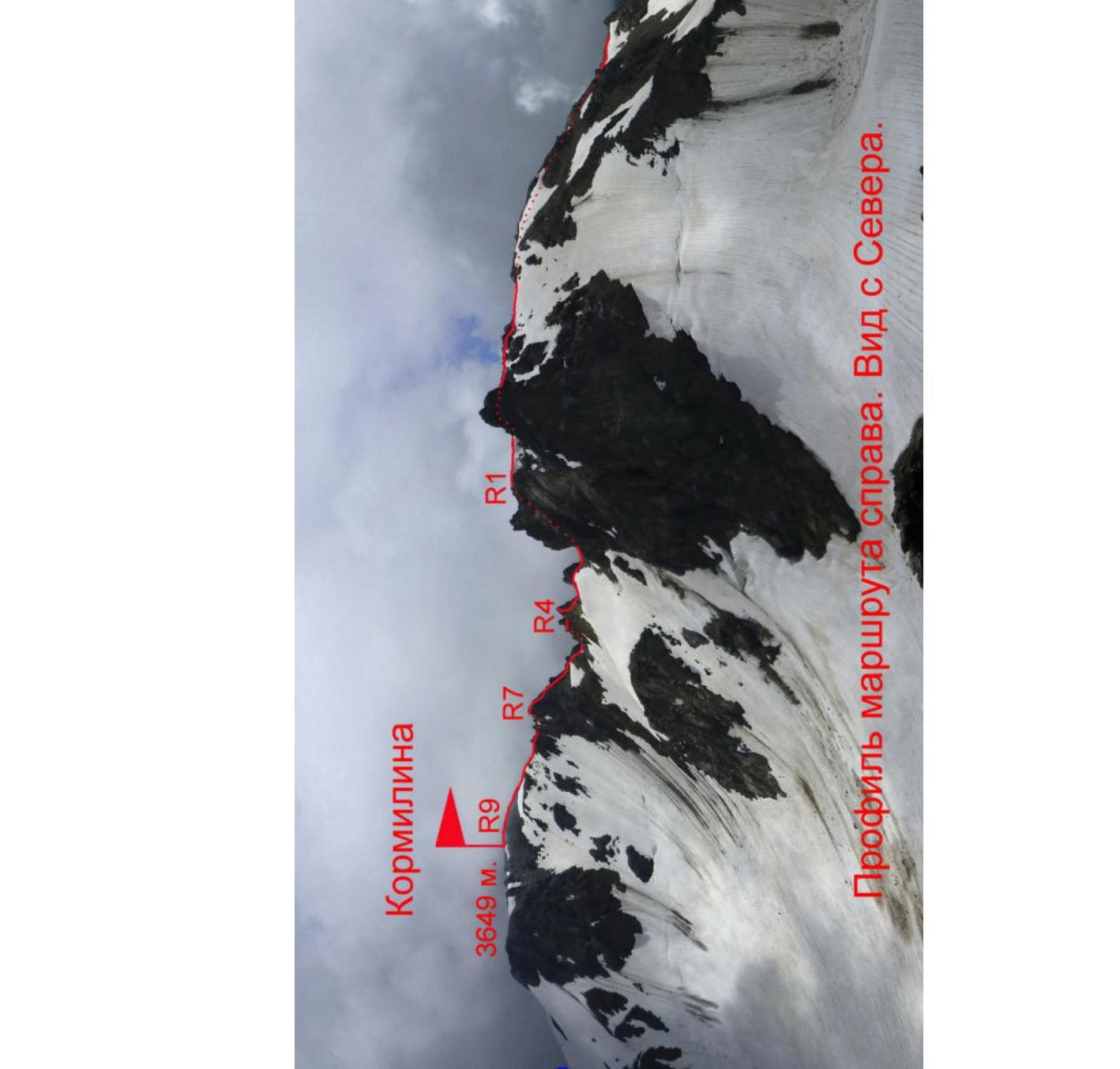
Route profile on the right. View from the North.
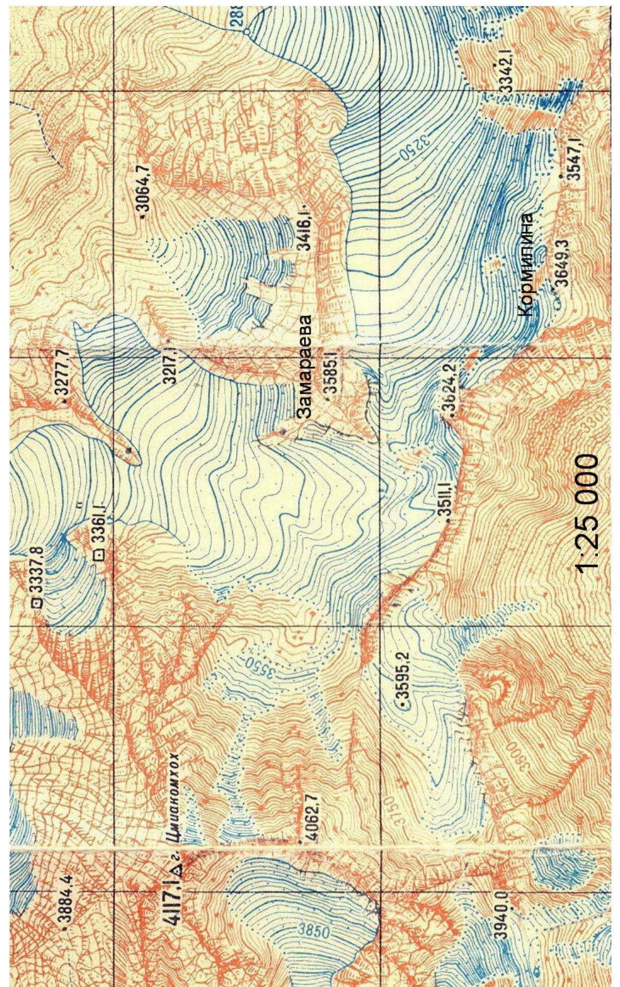 Scale 1:25 000
2. Technical Characteristics of the Route Sections:
| Section | Relief Characteristics | Category of difficulty | Length, m | Type and number of hooks |
|---|---|---|---|---|
| R0–R1 | Rocky-scree ridge | 1–2 | 300 m | - |
| R1–R2 | Rocky-scree destroyed ridge | 1–2 | 50 m | - |
| R2–R3 | Snow-scree slope | 1–2 | 40 m | - |
| R3–R4 | Rocky ridge | 2–4 | 30 m | 3 friends, 2 hooks |
| R4–R5 | Rocky ridge | 1–3 | 50 m | 3 wedges |
| R5–R6 | Rocky ridge | 1–2 | 50 m | - |
| R6–R7 | Rocky ridge | 2–3 | 50 m | - |
| R7–R8 | Rocky ridge | 1–4 | 50 m | 2 wedges |
| R8–R9 | Rocky-scree ridge | 1–2 | 80 m | - |
3. Characteristics of the Team's Actions.
3.1 Description of the Approach to the Route:
From the city of Vladikavkaz to the beginning of the Tmiakom valley along the Transcaucasian Highway is about 120 km. At the beginning of the valley, we drive through the village of Tmi along a dirt road. After the village, we cross the river by car and start moving along the right bank of the river. The road ends after a while, and the path continues. After a steep ascent, a hut is visible on the other bank of the river, below which there is a bridge. We cross the river via the bridge and move along the left bank.
The valley gradually turns north, and the summit of Kormilina 3649 m is visible ahead.
We move:
- First through meadows,
- Then through overgrown morainic ridges — under the southern ridge (a counterfort of this summit).
Before reaching the base of the counterfort, at an altitude of 2800 m — overnight stay.
- Water is available on the left — in the river.
- From the end of the road, the ascent is 1 km.
- The approach takes about 4–5 hours.
From the overnight stay location, we head to the left cirque, under the Strekoza pass. The pass is visible from the overnight stay location as the lowest saddle in the left part of the ridge. To the right of the saddle is a sharp gendarme, leaning to the right. We reach the main ridge to the right of this gendarme via a steep snow-scree slope; crampons and ice axes may be necessary in the first half of the summer.
3.2 Brief Description of the Route Passage.
| Section | Description | Photo number |
|---|---|---|
| R0–R1 | After reaching the Northwest Ridge, we turn right. We move along the rocky-scree ridge along the line of the ridge or to the right of it. | |
| R1–R4 | From the ridge shoulder, we descend along a heavily destroyed ridge — slope. Attention: move one by one! | |
| R2–R3 | From the ridge saddle, we bypass the first gendarme on the left along the northern slope. Crampons and ice axes may be necessary in the first half of the summer. | Photo 1 |
| R3–R4 | Along the sharp ridge, we approach under the western wall of the second gendarme and cross to the other side of the ridge via slabs. | Photo 1–2 |
| R4–R5 | We bypass the next gendarme from the north along a ledge. Further along the ridge or its right side, we reach the scree ledges. | Photo 3 |
| R5–R6 | Directly along the rocky-scree ridge, category 1–2, we pass another 50 m. | |
| R6–R7 | Along the rocks, category 2–3, we approach under the rise of the ridge. | |
| R7–R8 | We overcome the rise of the ridge directly head-on. The subsequent small gendarmes are passed first along and then to the right of the ridge line. | Photo 4–5 |
| R8–R9 | Along the rocky-scree ridge, we ascend to the summit of Kormilina. |
3.3 Recommendations.
The descent from the summit along the scree East Ridge (along which the main group of climbers ascended within an hour to erect a memorial plaque) is approximately category 1A.
There is no cell phone coverage on the route.
The passed route along the Northwest Ridge is safe and corresponds to category 2A.

Photo of the technical part of the route
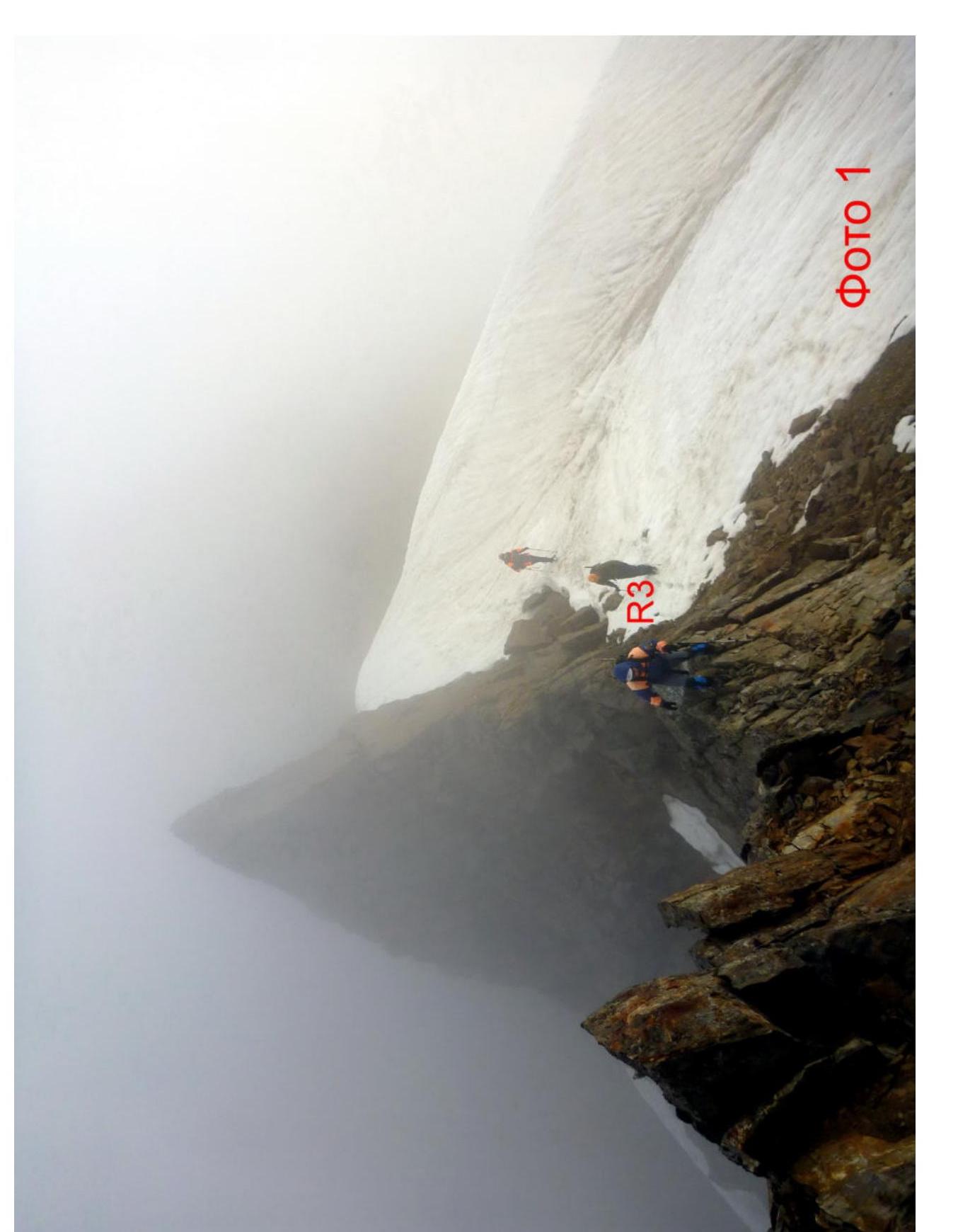 Photo 1 ⊕
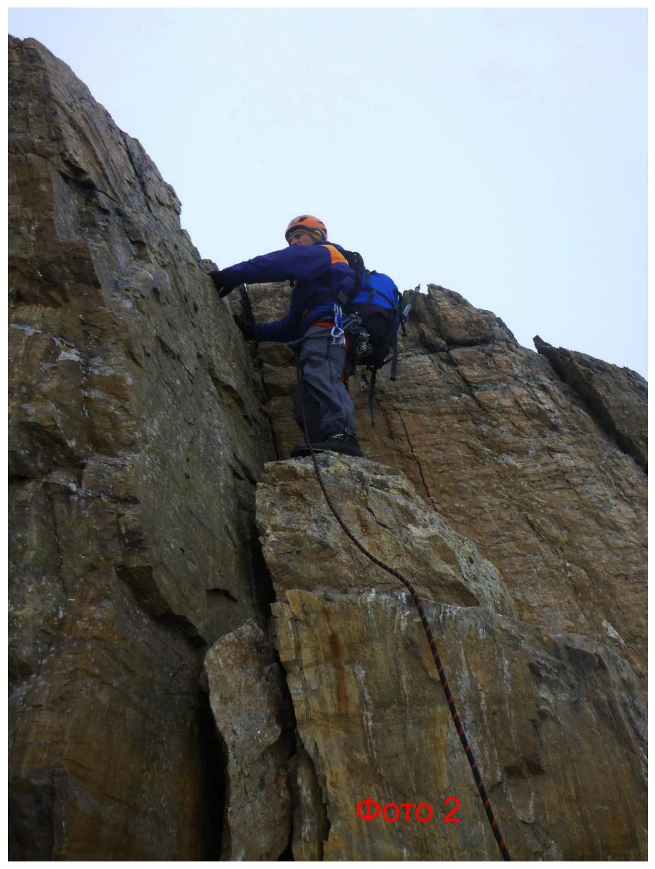 On the summit of Kormilina
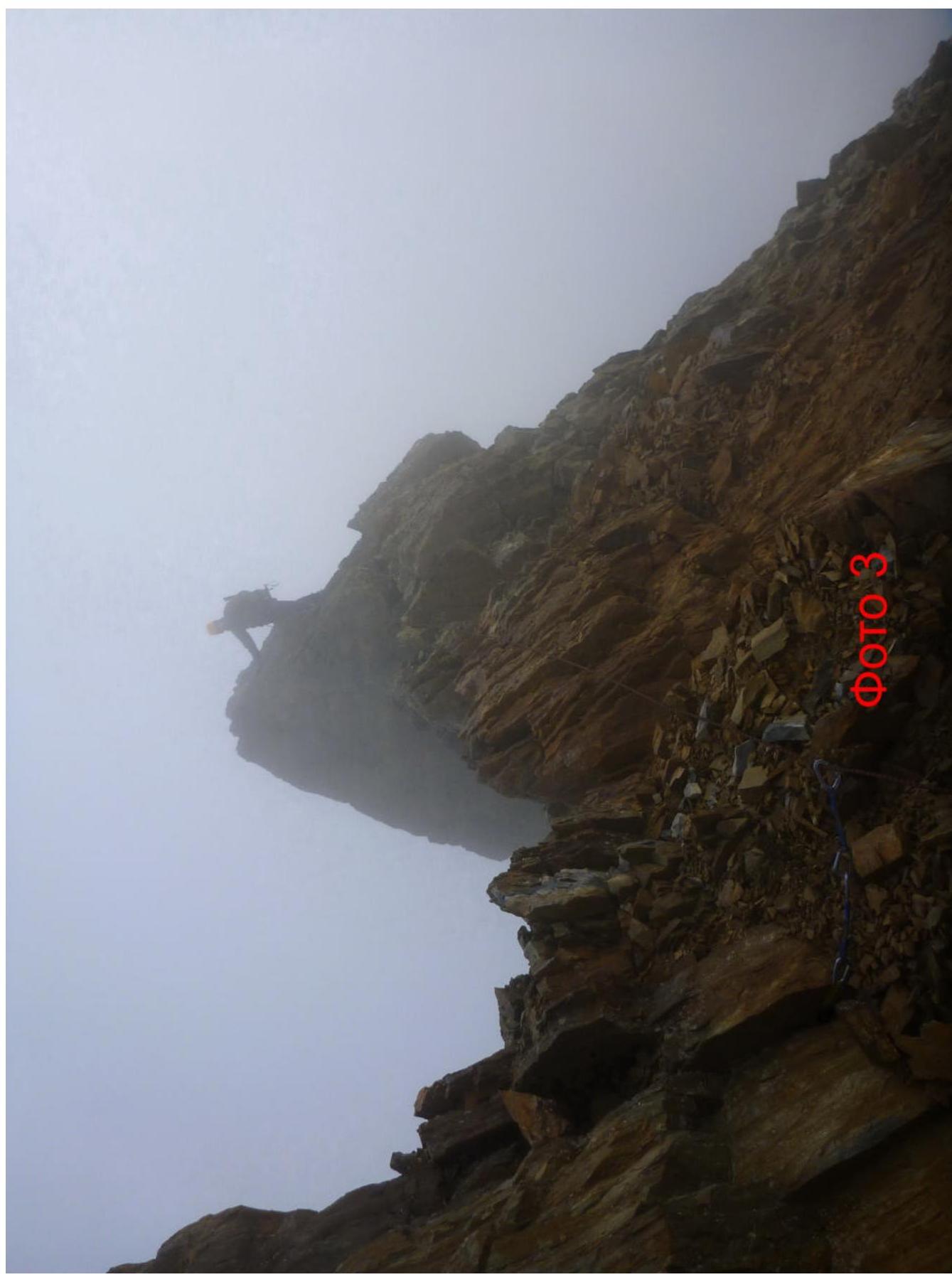 Photo 4 □
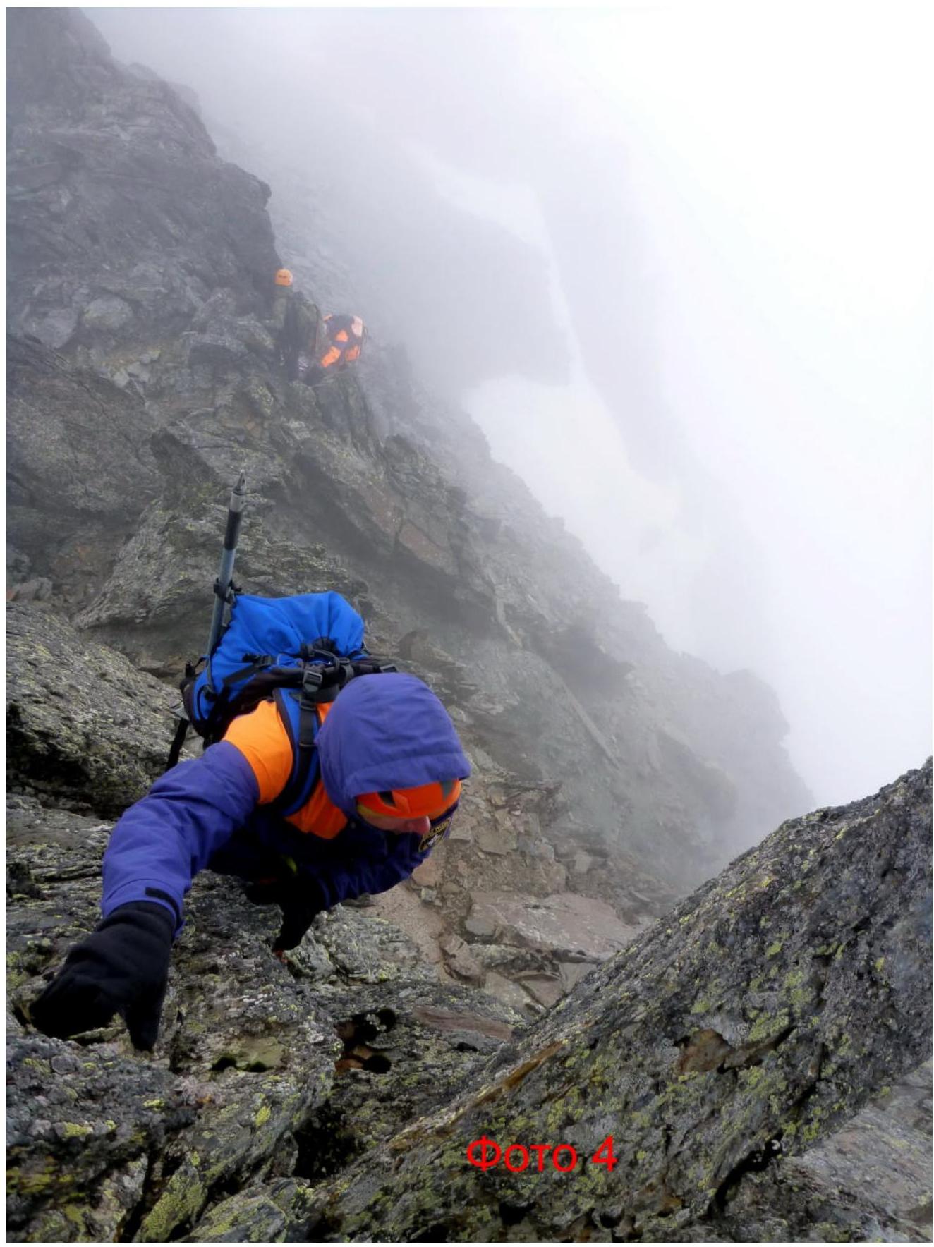 Photo 5
Kormilina Mountain
rescuer Dmitry Kormilin was born on November 4, 1963.
died during the rescue operation in Beslan, School No. 1
September 3, 2004
Government of the Russian Federation
Decree
dated July 7, 2018 № 1395-r, Moscow
In accordance with the Federal Law "On Names of Geographical Objects" and based on the proposal of the Parliament of the Republic of North Ossetia — Alania, as well as to commemorate the memory of the Hero of the Russian Federation V.V. Zamaraev, who made a significant contribution to the development of rescue operations in Russia, and holder of the Order of Courage D.I. Kormilin, who contributed to the organization and development of the diving service of the Ministry of Emergency Situations of Russia, assign the following names to unnamed geographical objects located in the Tepli massif of the Main Caucasian Range on the territory of the Alagirsky district of the Republic of North Ossetia — Alania: "Zamaraeva" — to the unnamed mountain with coordinates 42°44.6′ north latitude, 44°04.0′ east longitude and an absolute height of 3585 m; "Kormilina" — to the unnamed mountain with coordinates 42°44.1′ north latitude, 44°04.3′ east longitude and an absolute height of 3649 m. D. Medvedev