Peak Cherevichenko — route description.
- Approaches.
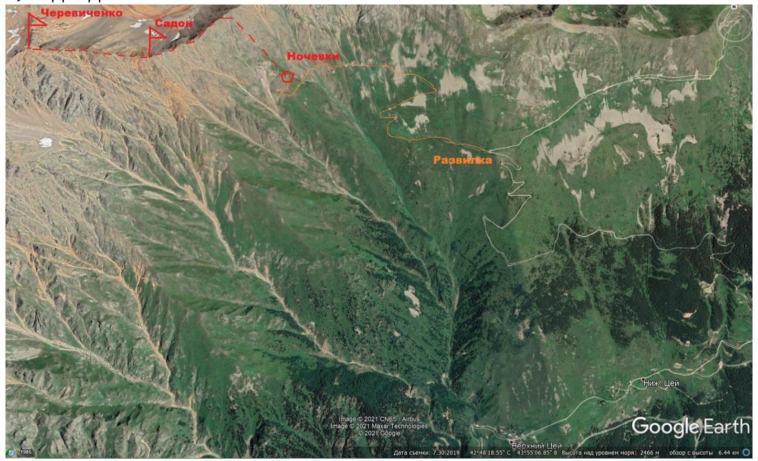
From Vladikavkaz, take a vehicle to Tsey valley, then to Verkhniy Tsey village, after which move along the dirt road leading to the repeater.
Before the last turn of the road directly to the repeater — there is a fork, to the left a branch goes off, with a spring as a landmark. Turn left, move another 2–3 km to the end of the road leading to the abandoned adit.
- All-wheel drive vehicle can ascend almost to the place where the road is blocked by a stone (there is a turnaround area)
- From there, another 20 minutes moving along the road to the adit
- Below the adit, a wide shelf is cut into the ground, where several tents can easily fit
- Water is available directly in the adit
2) Route.
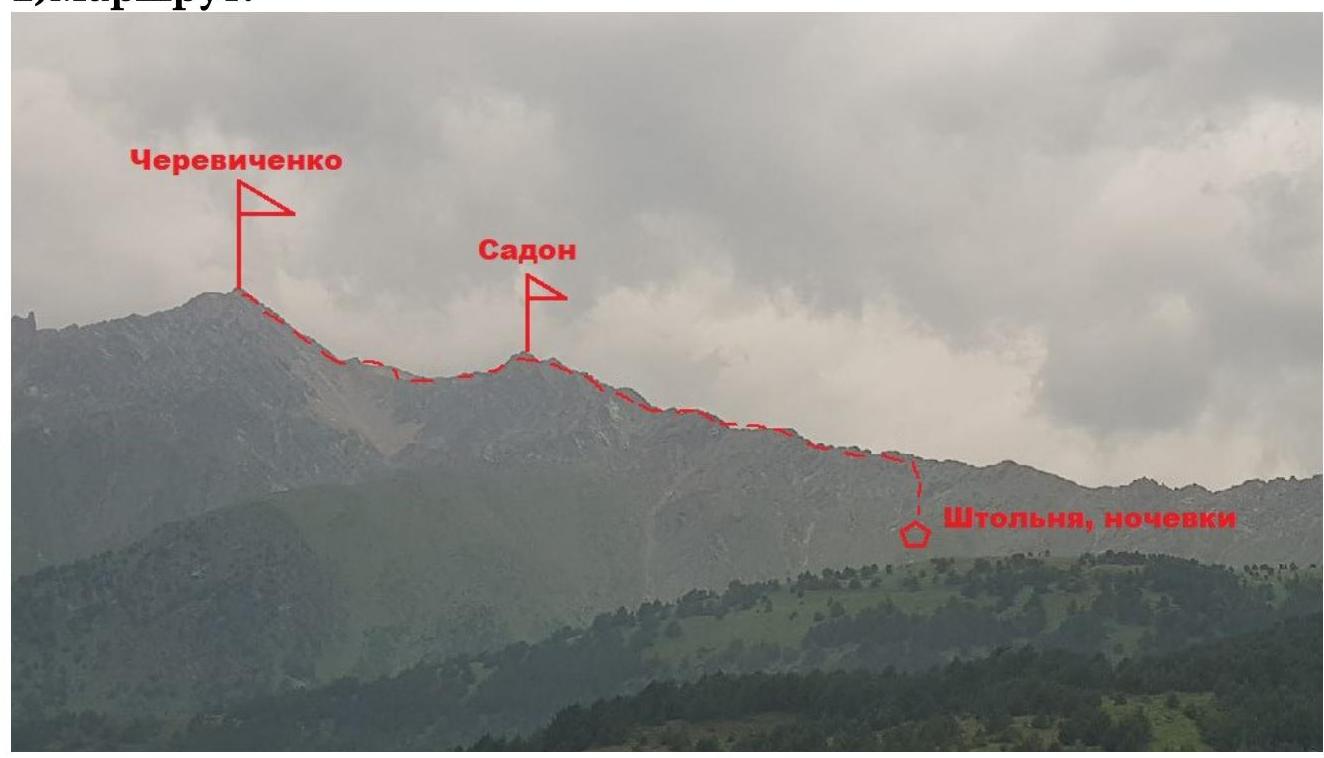
From the adit, move along a faintly expressed ridge (grass, 2nd category rocks) to NE — the crest of Peak Cherevichenko. Having reached the crest, move southwest along the ridge line, toward Peak Sadon. To Peak Sadon — 2nd-3rd category rocks.
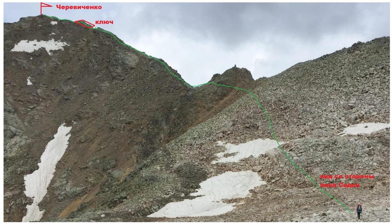
Having reached Peak Sadon, observe the further path to Peak Cherevichenko. Descending from Peak Sadon to a small plateau (there may be snow, water), crossing it, ascend along a coarse-block talus to the pre-summit ridge, continue along the ridge line through 2nd-3rd category complexity rocks to a smooth inclined slab before the pre-summit ascent.
Then, along the slab (25–30 m, 4th category complexity) reach the pre-summit ascent and ascend through 3rd category complexity rocks to the summit.
The descent is made along the ascent route.
3) Route recommendations:
The time taken to complete the route by a group of experienced climbers is from 4 to 6 hours, descent — 3–4 hours. From the moment of reaching the ridge, it is advisable to move in a rope team.