Ascent Passport
- Caucasus. Saudor ridge. Section number in the Classification is 2.7.
- Tsakhfedor peak (4068 m) from the South.
Peak coordinates: 42°50′18.38″ N; 43°45′51.50″ E.
- Proposed 2A category of difficulty, first ascent.
- Route character — rocky.
- Route elevation gain — 200 m.
Total route length — 300 m. Length of sections 3–4 category of difficulty — 50 m. Steepness of key sections — up to 65°. Average steepness of the route — 35°.
- Pitons left on the route — none.
- Trekking hours — 5; days — 1.
- Leader: Egorin S. V. — Candidate Master of Sports.
Participants: Abisalov A.D. — 2nd sports category, Stadeev N.G. — 2nd sports category, Wagilov A.P. — 3rd sports category, Gazdarova O.V. — 3rd sports category.
- Coach: Egorin S.V. — Candidate Master of Sports.
- Approach to the route, summit, descent: July 10, 1999.
- Organization: North Ossetian Rescue Team of the Ministry of Emergency Situations of Russia.
- Leader's contact information for report inquiries:
phone: +7 928 490–31–28; email: e.s.128@mail.ru
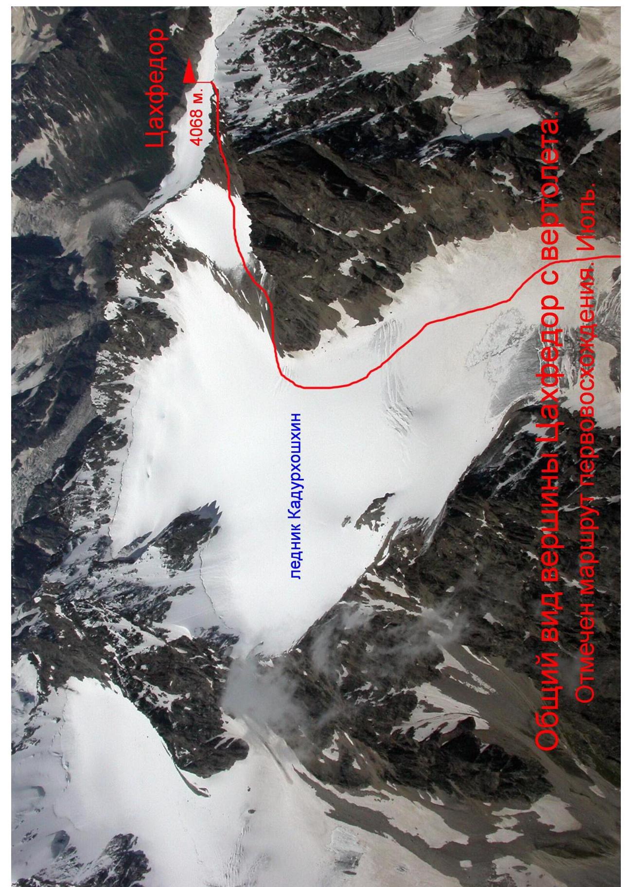
General view of Tsakhfedor peak from a helicopter. The first ascent route is marked. July.
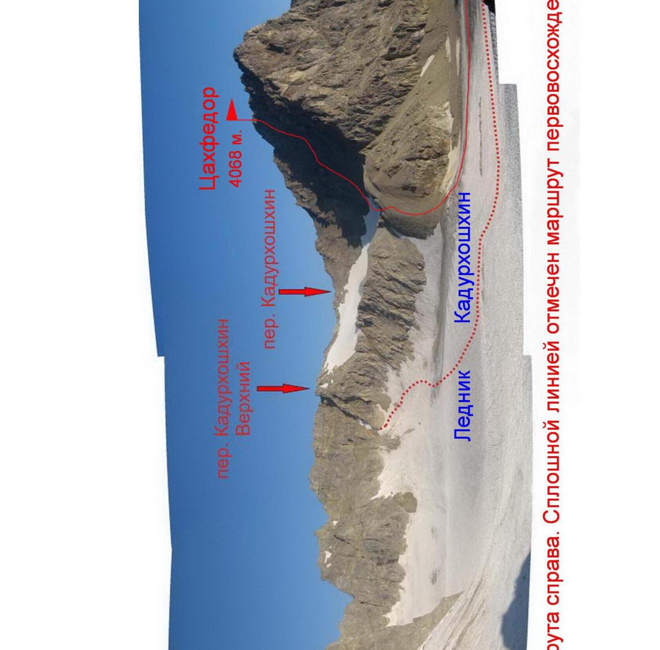
Route profile from the right. The first ascent route is marked with a solid line. July.
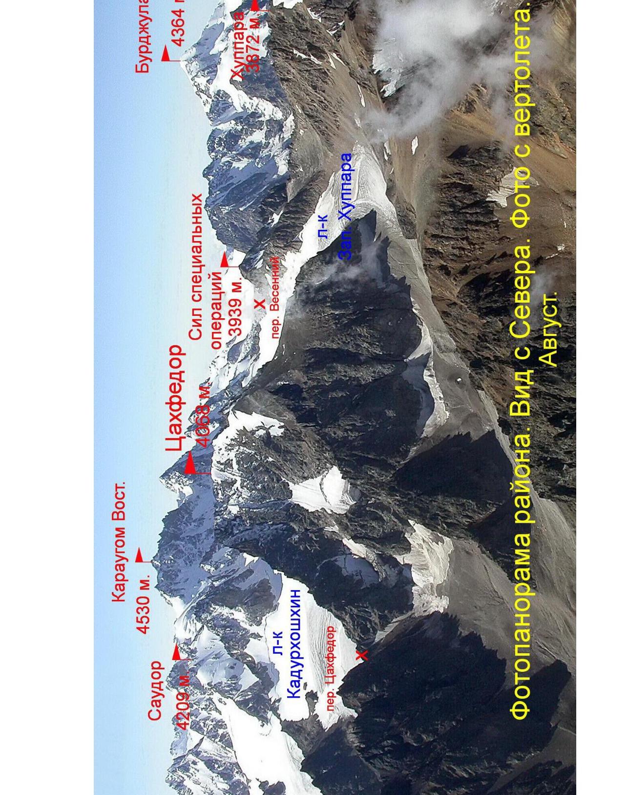
Photopanorama of the area. View from the North. Photo taken from a helicopter. August.
Overview of the Ascent Area
History of Peak Exploration
Tsakhfedor peak 4068 m (more precisely, 4067.6 m) is located in the center of the Saudor ridge. The Saudor ridge (translated from the Digor dialect of the Ossetian language as "black stones") is situated in Eastern Digoria — in the mountainous region of the Republic of North Ossetia — Alania. The length of the Saudor ridge is about 10 km. In fact, this ridge is a spur of the Lateral ridge, which is located to the south. Its highest point is Saudor peak 4209 m, and from it, the Saudor ridge extends in a northwest direction.
The Saudor ridge is composed of ancient rocks: paleozoic light-gray granites and dense, strongly metamorphosed clay shales of the lower Mesozoic. There are several glaciers that continue to shrink. The largest of them are Chilingini, Kadurkhoshkhin, Khuppara, Tsadoti.
On topographic maps, the Saudor ridge is labeled with a mistake — through the letter "o", i.e., Soudor, but this is not the correct spelling. The average height of the peaks in the ridge is about 4000 m. Despite this, the Saudor ridge is poorly explored by climbers, likely due to its remoteness from the alpine camps of the Tsey gorge and Western Digoria. Tourists, on the other hand, have explored the ridge well — more than 20 passes have been traversed and described. As of early 2017, there is only one route to the peaks of the Saudor ridge in the Classifier — this is the route to Saudor peak from the Gular glacier, 2B category of difficulty.
The Saudor ridge is located between the basins of the Karaugomdon river to the West and the Sardidon river to the East.
Locals call the Sardidon river gorge — Skatikom gorge. That is, the gorge is a cattle pen. Due to the gorge's isolation, cattle are driven there for the entire summer, and the animals graze on these meadows independently.
Tsakhfedor peak separates the Khuppara and Kadurkhoshkhin glaciers, and its name translates literally as "strong gray stones". This name becomes easily understandable at first glance — compared to the surrounding peaks, Tsakhfedor has walls with a height difference of up to half a kilometer.
Our team first saw Tsakhfedor peak in the summer of 1996, returning from search operations on the Karaugom plateau. Due to bad weather, the helicopter could not pick up our group, and we went through the Kupol Vologaty pass into the Skatikom gorge. Walking down the gorge, we saw a wall with a height difference of about 500 m in the upper part of the side gorge. Already down, starting to study maps and descriptions of the area, I realized that this was the 4068 m peak, and the side gorge was the Kadurkhoshkhin gorge, with a glacier of the same name.
In 1999, our leadership had the idea to climb some unnamed peak and name it the Peak of Rescuers of the Ministry of Emergency Situations of Russia. The choice fell on the 4068 m peak, and at the same time, we decided to scout out its Eastern wall.
In July 1999, we made the planned ascent via the route from the South, approximately 2A category of difficulty. The reconnaissance of the Eastern wall showed that it is possible to climb routes of 5 category of difficulty there. Because of this, the registration of the first ascent was postponed, hoping to climb the Eastern wall soon at some second-tier championship as a first ascent. But "soon" never came.
Our brief report on the ascent was published in the "Rescuer" journal, but no one in the Ministry of Emergency Situations dealt with the official naming of the peak.
Later, while helping Mikhail Gолубев (http://www.caucatalog.narod.ru↗) edit the map of Ossetia, I learned that mountain tourists call this peak and the pass nearby Tsakhfedor. Later, local hunters who frequent this gorge confirmed this name. Local residents also refer to a small ridge separating the Khuppara and Skatikom gorges as Tsakhfedor.
The next time I visited this area was in July 2016, during the first ascent of the 3939 m peak — the Peak of Special Operations Forces. While selecting photos for the report from geologists, I found the necessary angles and views of the 4068 m peak for classifying the route climbed in 1999. In light of new data on the toponymy of the area, the peak is submitted for classification as Tsakhfedor.
Photos from the ascent, presented in this report, were scanned from films shot in July 1999.
Description of Approaches to the Route
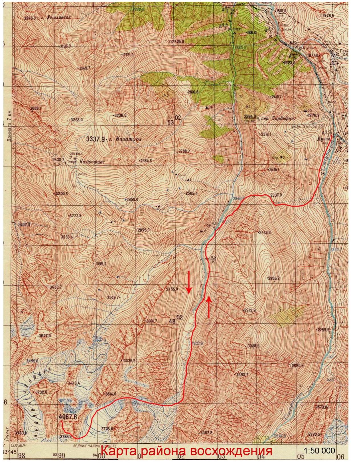
From the city of Vladikavkaz, take a bus to the village of Dunta — about 120 km. From below, it is not possible to enter the Sardidon river valley due to a canyon in the lower part of the gorge, so from the village of Dunta, one must cross the Kazatytseg pass (known to tourists as the Dunta pass), with a height of 2337 m.
To reach the trail to the pass:
- enter the village of Dunta,
- cross the Dargom river by bridge,
- descend to the right to the bridge over the Songutidon river.
After crossing the bridge, we exit onto an old trail and follow it for 2–3 hours, turning left up to the pass saddle of Kazatytseg.
The ascent from the village of Dunta is about 600 m. The descent from the pass goes left down on a good trail. After 30 minutes, we reach a cattle pen where cattle are driven to pasture in the summer. Passing the cattle pen, we ascend to the bank of the Sardidon river and see a stream flowing into the main river to the right. This is the Khuppara river.
We continue up the gorge, along the Sardidon river, for another 4 km. The trail follows the left bank, near the river. The next right-hand side gorge is the Kadurkhoshkhin gorge, with a glacier and river of the same name. "Kadurkhoshkhin" in Ossetian means one of the types of grass of the legume family. It grows abundantly in the lower part of this gorge.
After fording above the confluence of the Sardidon and Kadurkhoshkhin rivers, we cross the former to the opposite bank. Then we ascend, alongside the Kadurkhoshkhin river stream, up a steep grassy slope with scree. Overnight stay is possible in the area of the confluence of the rivers. From the village of Dunta — about 6 hours of walking.
Approaching the "ram's foreheads" of the retreated Kadurkhoshkhin glacier, we cross the river to the other bank and move towards a narrow, scree-filled couloir to the right of the "ram's foreheads".
Up the couloir (with possible rockfall from above!) for about 50 m to its narrowing and to the beginning of a narrow grassy ledge that goes left.
Along the ledge (with protection!) for 80 m to exit onto a scree terrace.
It is possible to reach this point (marked with a red dot in the photo) directly from below, but with climbing through rocks of 4–5 category of difficulty for about 50 m.
Then we proceed along the right part of the "ram's foreheads", on scree ledges and terraces, with individual rock sections of 1–2 category of difficulty. The lower part of the glacier with crevasses is bypassed on the right, on a scree slope.
Upon reaching the glacier, we move up, leaving to the right:
- first, the saddle of the Tsakhfedor pass,
- then the Eastern wall of Tsakhfedor peak.
After passing the peak, we turn right and ascend on scree-covered southern slope into the cirque of the retreated glacier, under the southern slopes of Tsakhfedor peak. Here, at an altitude of 3700 m, is a suitable place for an overnight stay. From the start of the ascent up the Kadurkhoshkhin gorge, it takes about 5 hours.

Path through the "ram's foreheads" of the Kadurkhoshkhin glacier
Route Breakdown by Sections
| Section № | Length, m | Steepness, ° | Terrain Character | Category of Difficulty | Number of Pitons |
|---|---|---|---|---|---|
| R0–R1 | 120 | 25 | Scree, snow | 1 | - |
| R1–R2 | 80 | 30–35 | snow | 1 | - |
| R2–R3 | 100 | 35–65 | rocks | 2–4 | 3 |

Technical photo of the route
Route Description
From the overnight stay, we move left up along the scree-covered moraines, towards the beginning of the leftmost southern couloir on the southern slope of Tsakhfedor peak.
R0–R1: First, along a scree slope, then up a snowy couloir. Section length 120 m, 25°, 1 category of difficulty.
R1–R2: Up the snowy couloir of 1 category of difficulty, with a steepness of 30–35°, we ascend under the rocky wall blocking the couloir. Total section length 80 m.
R2–R3: Through a rocky wall of 3 category of difficulty, 10 m high, we exit left up onto an inclined terrace. Along it, left for 20 m, and approach a wall leading to the ridge. Up the wall of 3–4 category of difficulty, 50–65°, for 40 m to exit onto the ridge. On the ridge, we turn right and after 30 m ascend to Tsakhfedor peak 4068 m.
From the overnight stay, it takes 5 hours. The peak is a good panoramic point — visible are the peaks of Karaugom, Burjula, Saudor, and the mountains of Western Digoria. No signs of other groups were found. No notes or touras were discovered. Peak coordinates by GPS: 42°50′18.38″ N; 43°45′51.50″ E.
Descent is via the ascent route.
Conclusions and Recommendations for the Route
The route corresponds to 2A category of difficulty. With a large amount of snow, the ascent couloir is avalanche-prone.
The approach to the start of the route from the side of the Western Khuppara glacier, with a passage through the Kadurkhoshkhin pass, will likely be technically easier due to avoiding the "ram's foreheads" of the Kadurkhoshkhin glacier.
For visiting the Sardidon, Kadurkhoshkhin, and Khuppara gorges, border crossing permits are not required.
Cellular communication is absent after passing the Dunta pass.
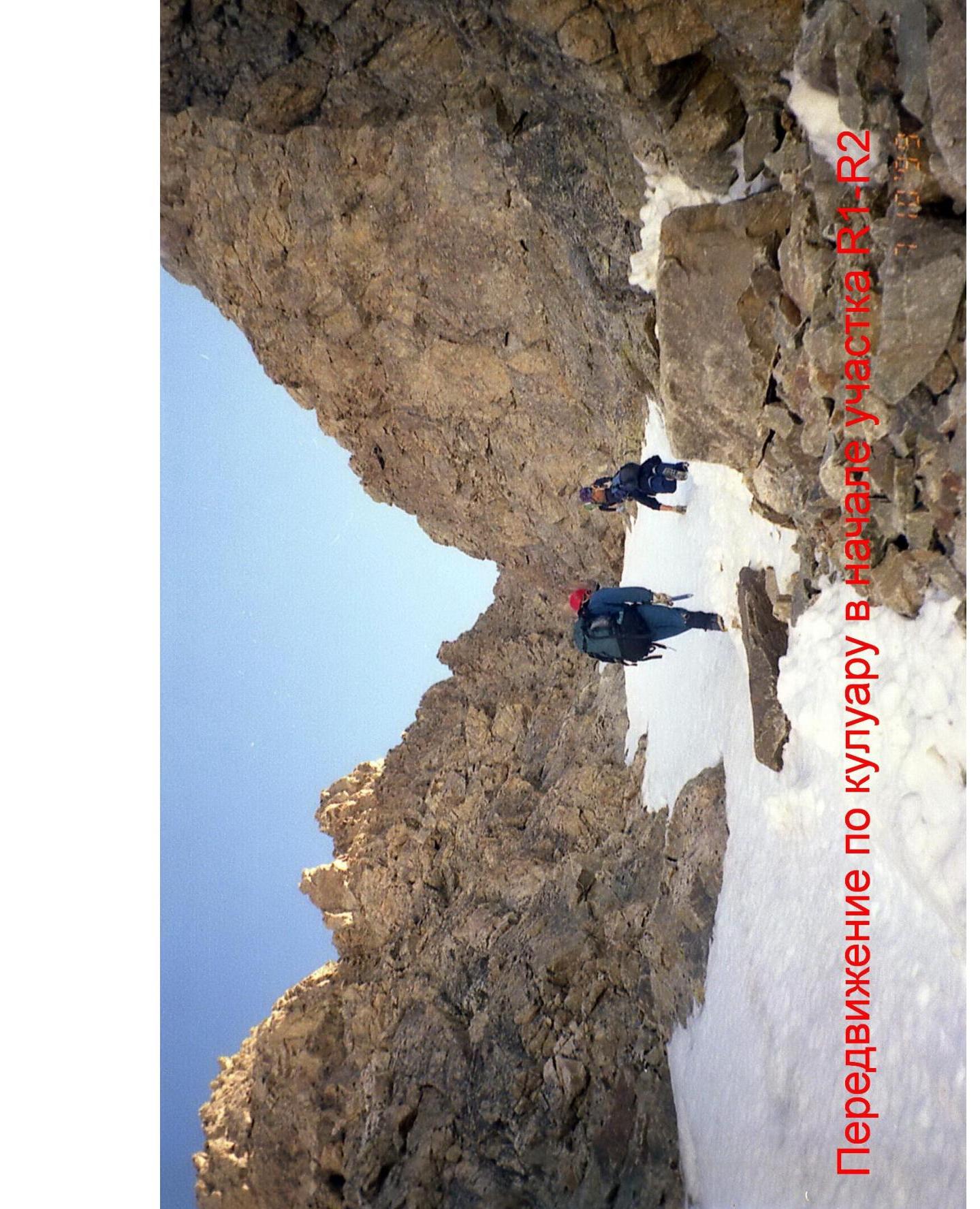
Movement along the couloir at the start of section R2
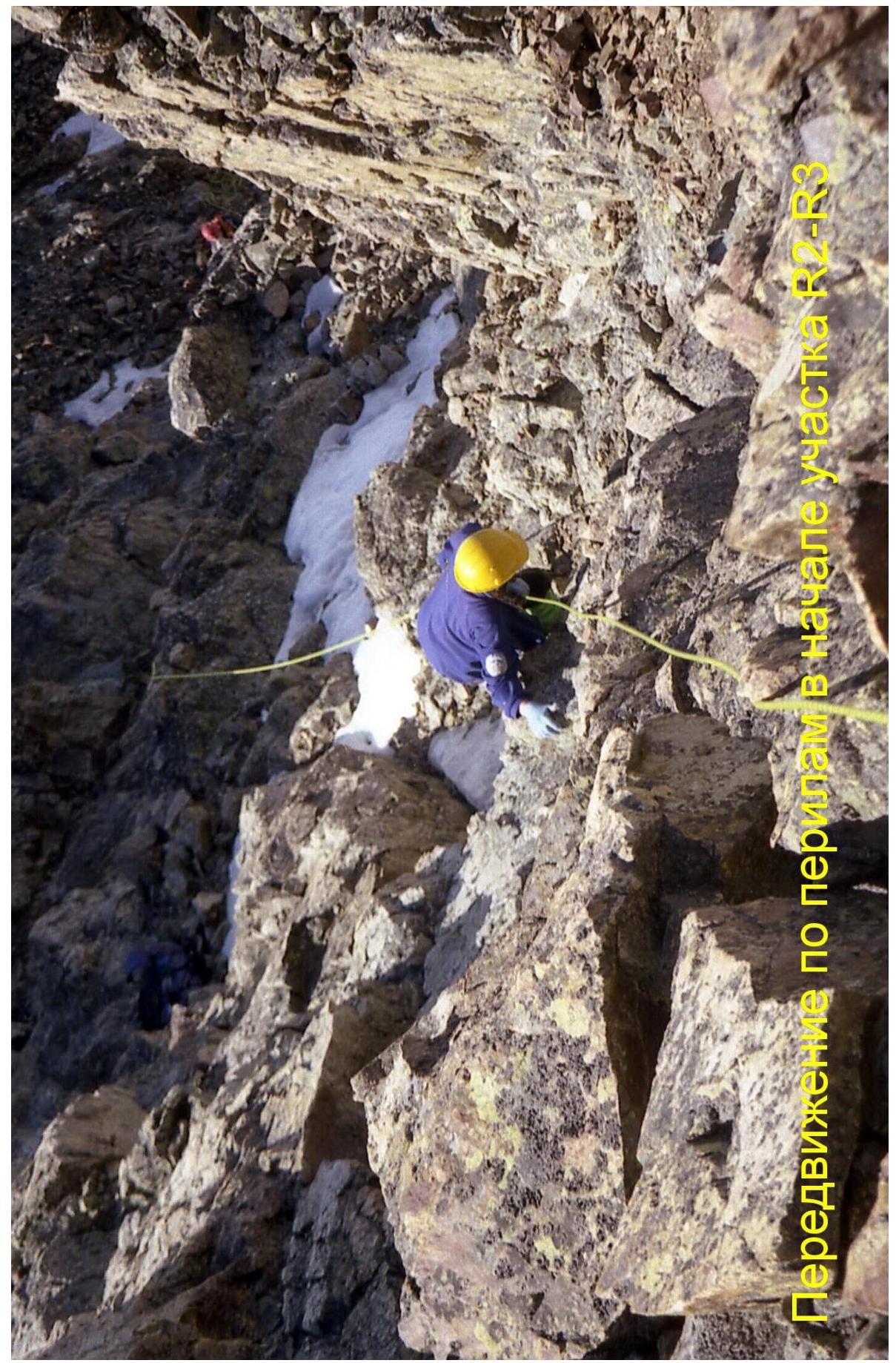
Movement with protection at the start of section R2–R3
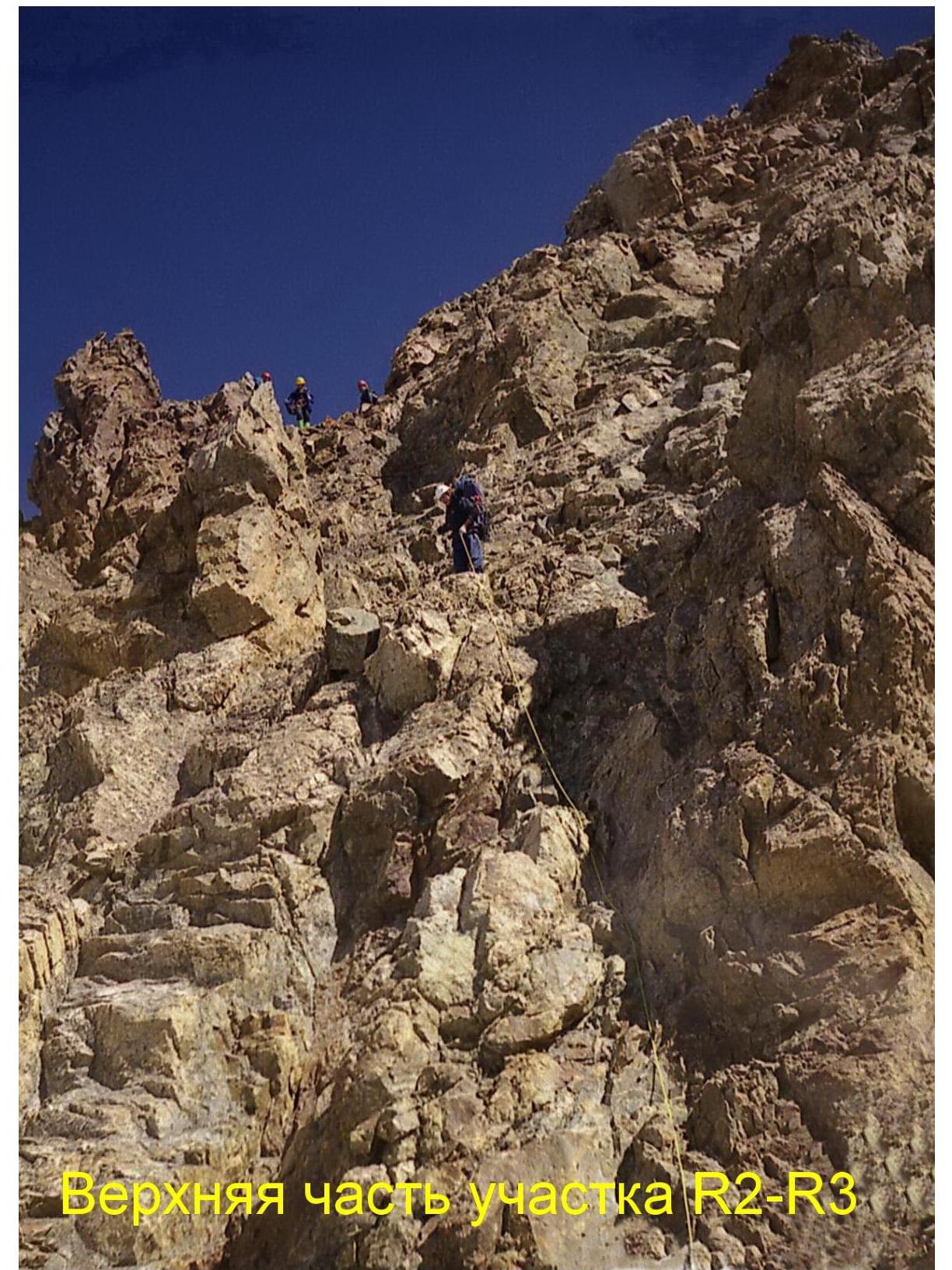
Upper part of section R2–R3
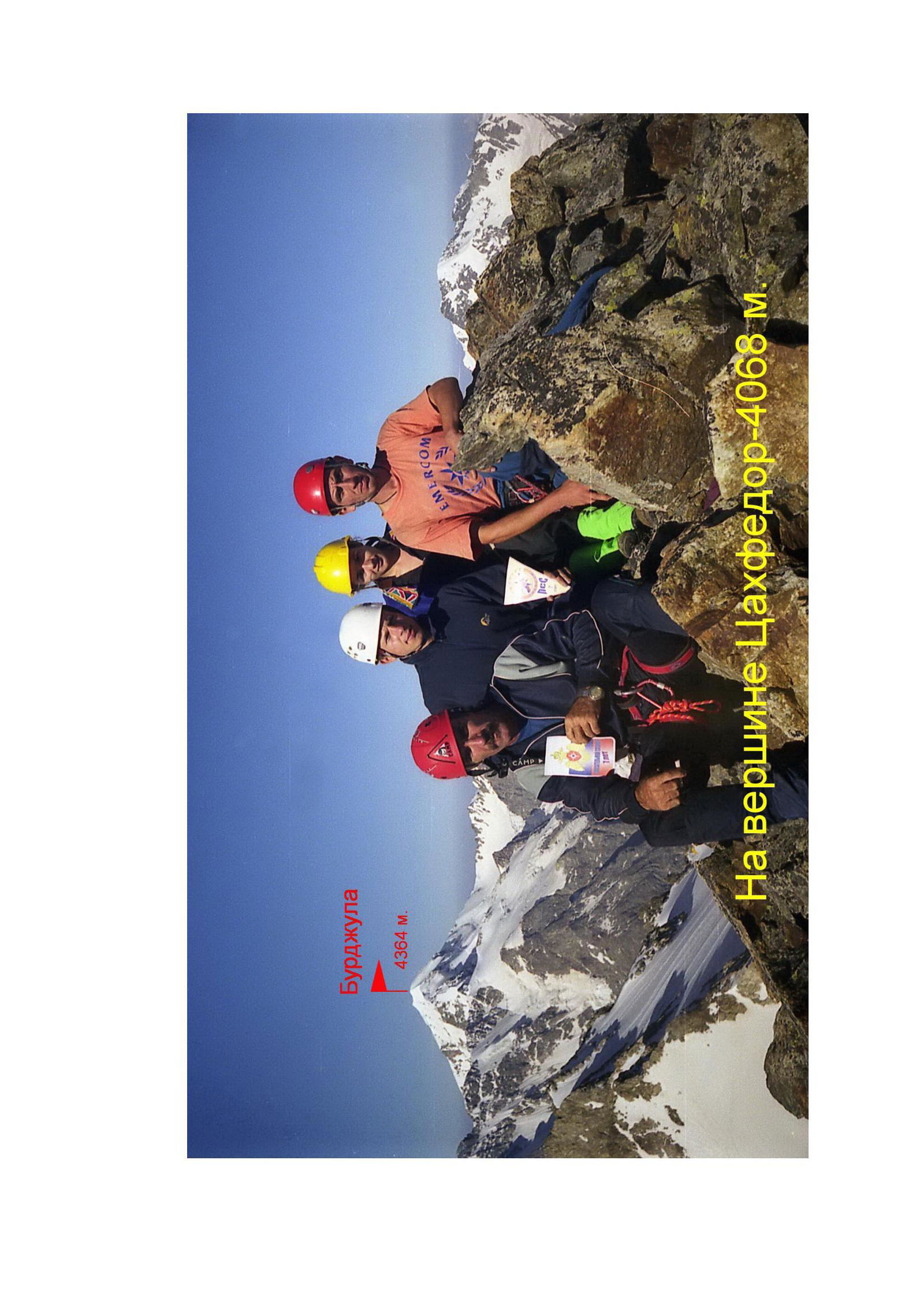
On Tsakhfedor peak — 4068 m.