
PASSPORT
I. Climbing category — technical.
2. Climbing area — Eastern Caucasus, Main Caucasian Range.
3. Mamisong (4358 m) via the center of the north wall triangle.
4. Second ascent — 5B cat. tech. combined.
5. Height difference — 820 m.
Including triangle — 340 m.
Length — 1200 m.
Length of sections with 5–6 cat. tech. — 600 m.
Of which 6 cat. — 130 m.
Average steepness of the wall section — 68°, including main sections 80°.
6. Pitons hammered:
Rock: 53 (3 used); Shlammbur: 8 (0 used); Wedges: 88 (2 used); Ice: 10 (0 used).
7. Team's travel hours: 19 hours (2 days).
8. Overnight stays: 1 sitting, in a tent on a prepared site.
9. Team from SA and VMF.
10. Team leader and coach — Mr. Aygistov Gleb Akhmetovich, Master of Sports.
Participants:
- Povetin Anatoly Alekseevich
- Vekhter Vladimir Viktorovich
- Ryabov Stanislav Gennadievich
11. Senior coach — Master of Sports of the USSR Timofeev Alexander Veniaminovich.
12. Departure to the route — August 15, 1984.
Summit ascent — August 16, 1984.
Return — August 17, 1984.
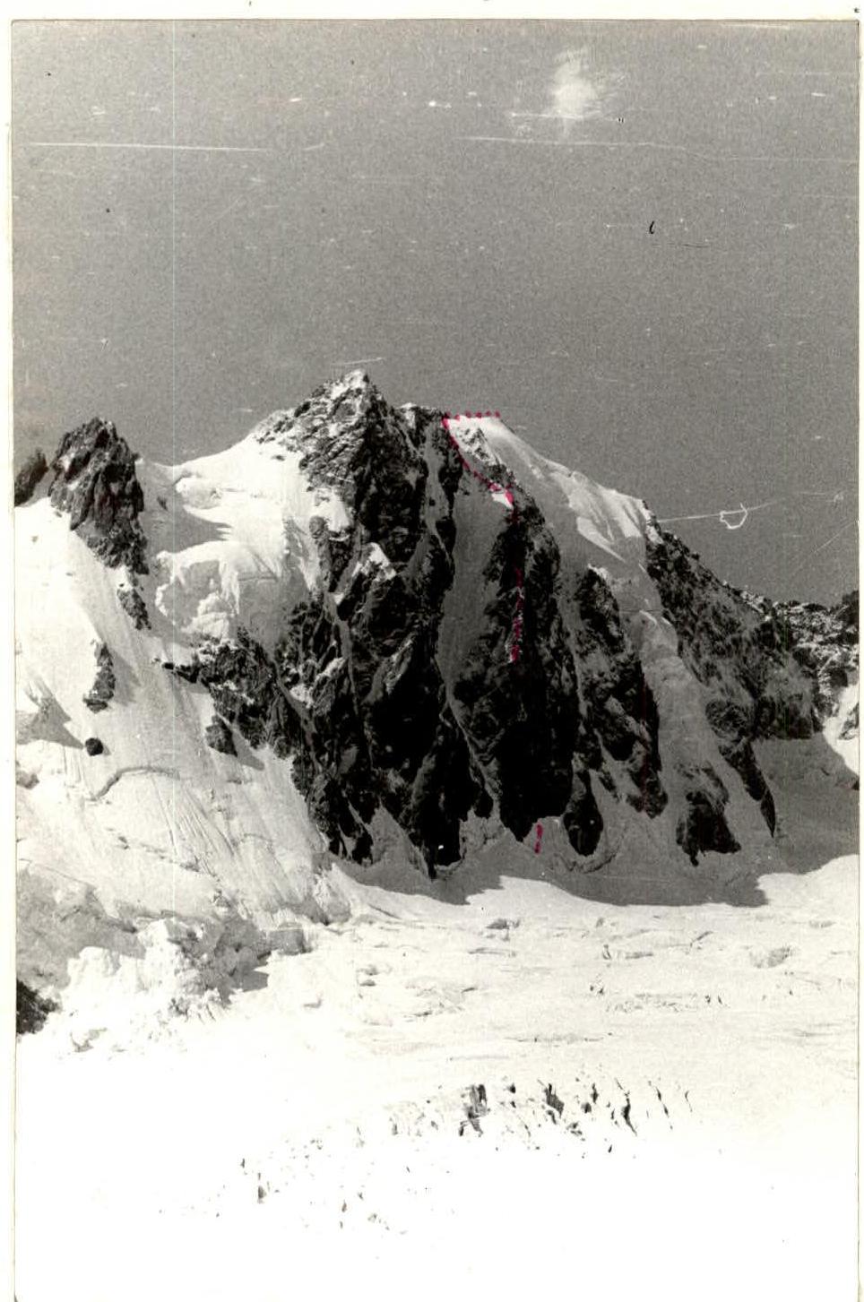
General photo of the summit. Rusyaev's group route.
Description of the ascent route to Mamisong via the right part of the north wall
I. Approach
From the CSP of the Tsey district (recreation center "Torpedo") cross the river Tseydon by the bridge. Turn left after the bridge and follow the road, then the trail in the forest on the right bank of Tseydon, ascending through the gorge. Exiting the forest, the trail approaches a large boulder near the right-bank moraine of the Tsey glacier, not far from its tongue. From the boulder, follow the right trail onto the crest of the right-bank moraine of the gorge. The trail leads to the tongue of the Tsey glacier. Cross the Uilpatinka stream by a small bridge near the lower ice camps, then follow the moraine crest and grassy slopes to reach the upper ice camps. From the CSP of the Tsey district, it takes 4 hours 30 minutes. Continue along the moraine crest to approach the "ram's foreheads" to the right of the First step of the Tsey glacier icefall. Ascend via a good trail onto the "ram's foreheads" and exit onto the scree above the icefall. From the scree, traverse the Tsey glacier left-upwards, below the icefall of the Northern branch of the glacier. Approach the right side of its southern branch and ascend it to reach the right-bank moraine on the southern slopes of the Eastern ridge of peak Hitsan. Pass by the hut, ascending 100–150 m up the right side of the Southern branch, then turn right into the first scree-filled couloir with snow in the upper part. The couloir leads to the Hitsan pass. Descend from the pass, bearing left onto the plateau of the Northern branch of the Tsey glacier. Traverse the glacier initially towards Dubll-peak, then, once the deep crevasses are on the left, turn towards the Chanchaikhi-Tsey pass between Mamisong and Chanchaikhi peaks. Set up a bivouac on a safe section of the glacier.
2. Ascent
Ascend via steep avalanche cones and debris to reach the bergschrund. Use artificial holds to overcome the upper (90°, 15 m, extremely difficult climbing) wall of the crevasse and exit onto very steep (70°) dense glacier ice. Traverse 90 m on the front teeth of crampons on the ice to reach the base of the left rock island in the right part of the North wall of Mamisong. Ascend 80 m up (difficult climbing) partially destroyed rocks (70°) below the rock overhang of the second rock island. Ascend 25 m (80°) on the right part of the island (very difficult climbing) — exit onto smooth slabs below a huge slab-like boulder. Under the boulder, traverse right through an ice gully and ascend 70 m (65°) on the left part of the rock ridge (difficult climbing) — exit onto a 15-meter ice slope (60°) with a large boulder at the top. From the boulder, ascend 25 m (70°) right-upwards to an 8-meter sheer smooth wall — difficult climbing. Then ascend 90 m (80°) up smooth slabs (very difficult climbing) — exit onto a depression in the monolithic rock ridge (danger from icefall on the left). From the depression, ascend 60 m right-upwards below overhangs onto smooth slabs with occasional blocks. Ascend 85 m (80°) right-upwards on slabs resembling an "open book" (very difficult climbing) to a turn in the internal angle becoming vertical. Ascend 30 m up the angle (85°) to a narrow ledge (extremely difficult climbing) — overnight stay, control tour. Continue ascending up the internal angle 70 m (85°) to the ridge (extremely difficult climbing). Traverse 70 m (75°) on slabs and ledges on the left side of the ridge, then 85 m (65°) on a snow-rock edge — exit onto the shoulder of the Northwest ridge. Continue along the ridge to reach the summit.
3. Descent
Descend via the classified route 3A cat.
PHOTO ILLUSTRATION OF THE REPORT
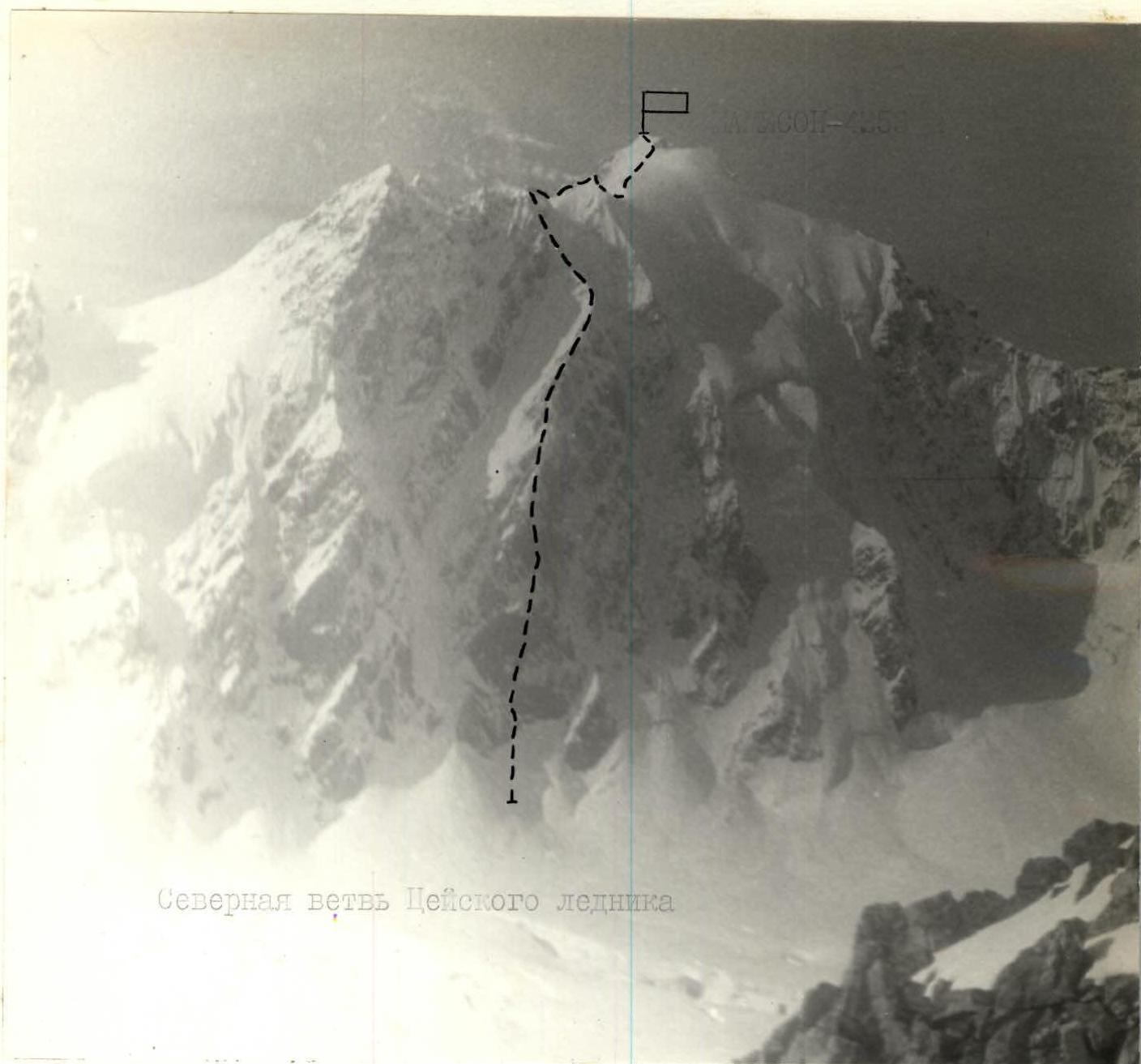
Northern branch of the Tsey glacier Photo-7
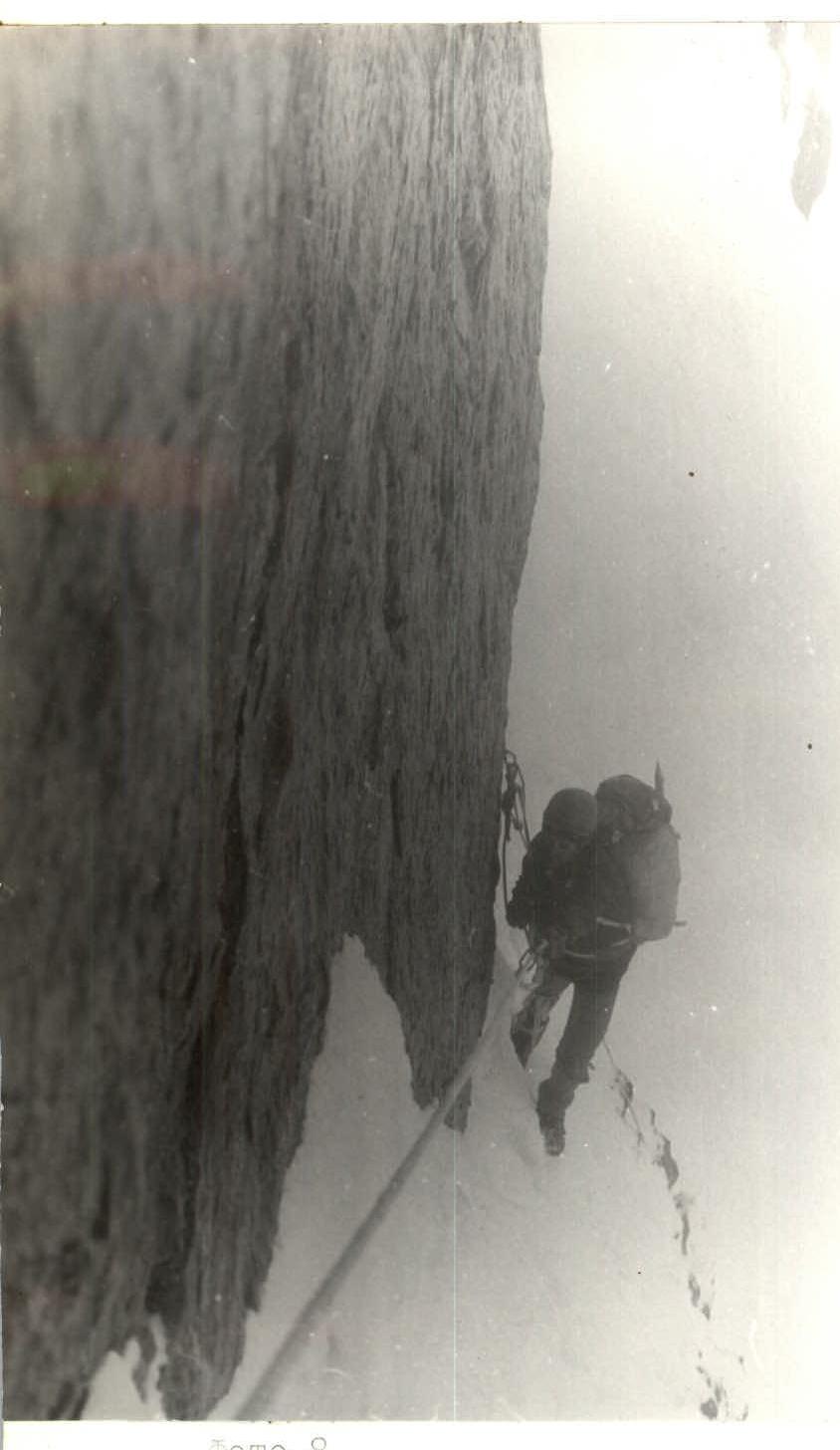
Photo-8. Section R2–R3. Diagonal snow-ice ledge.