Ascent Passport
- Ascent class — Technical (first ascent).
- Ascent area — Central Caucasus. Sugansky Ridge.
- Doppakh Z. NE face. NE ridge.
- Estimated difficulty category — 6A.
- Height difference of the wall section — 750 m. Total to the summit — 1098 m. Length of sections with 5–6 difficulty category — 210 m. Average wall slope — 65°.
- Pitons driven: rock 124/29, bolted 3, chocks 95/16
- Movement hours — 67 (6 days).
- Overnights — one sitting, the rest lying. Equipped by the team.
- Team of ALP "Strannik" FaIS Moscow.
- Leader — Zadokhin V.Yu. — CMS
- Dulnev V.E. — CMS
- Borshchev M.V. — CMS
- Polivko V.N. — CMS
- Filippov A.L. — CMS
- Yatsenko P.N. — CMS
- Team coach — Dulnev V.E.
- Departure to the route — July 21, 1999. Summit — July 27, 1999. Return — July 27, 1999.
Route description by sections
The approach to the start of the route is made from the tongue of the Nakhashbita glacier, along the moraine on the left. At the end of the moraine, turn right onto the glacier, and then move up the glacier under a pronounced triangular nunatak. From the nunatak, turn right along the gentle glacier, avoiding crevasses, under the right part of the NE wall of the NE ridge of the western Doppakh. On the glacier plateau or right talus, there is an initial bivouac. From the tongue of the Nakhashbita glacier, it takes 3–3.5 hours.
Section R0–R1:
- Snow and ice slope with a complex bergschrund, 50 m, and then through a small rantkluft, exit through a difficult 5-meter wall into an internal corner.
Section R1–R2:
- Difficult climbing on the left part of the internal corner using IT.
- Live rocks.
- Water flows.
Section R2–R3:
- The upper part of the internal corner turns into a difficult chimney with smoothed small footholds.
- The chimney is passed using IT.
- Bolted pitons.
- Water flows.
Section R3–R6:
- From the chimney, straight up along complex, partially destroyed rocks, to an indistinctly pronounced shelf 70 m under an overhanging internal corner.
- First control point.
- Rocks fly down the large couloir on the right.
Section R6–R8:
- From the shelf, along a very difficult wall on the right part of the overhanging internal corner, turning into a chimney with a plug.
- Difficult climbing using IT, 70 m.
- Bolted pitons.
- Water flows.
- Rocks partially destroyed.
- The chimney with a plug is passed on the right along overhanging rocks to a small inclined shelf.
- Live rocks.
Section R8–R11:
- Further movement along complex and moderately difficult, partially destroyed rocks of an indistinctly pronounced 200-meter ridge with short 15–25-meter difficult walls onto an oblique shelf.
- Sitting bivouac.
- Second control point.
Section R11–R13:
- From the shelf, movement along an indistinctly pronounced ridge, partially destroyed rocks of moderate and above-moderate difficulty.
- Rocks fly down the couloirs on the right.
- Ridge rocks partially icy.
Section R13–R16:
- From the ridge, along shelves and internal corners, we gradually move left, avoiding the heavily destroyed rocks of the upper part of the ridge, and then exit to the beginning of the NE ridge.
Section R17–R18:
- From the shoulder of the NE ridge, move along heavily destroyed rocks in the direction of the ridge.
- Along a heavily serrated section with numerous gendarmes, 150 m, to the first large gendarme.
- Bypass the gendarme on the left along rocks of moderate difficulty, 50 m, to a narrow isthmus under the second gendarme.
- Live rocks.
- Pass the second gendarme head-on along a narrow, difficult 10-meter crevice.
- From the gendarme, rappel 20 m to a shelf.
- From the shelf, move right onto an ice and snow ridge.
- Further along the ridge, 150 m, to a snow mulda.
- Bivouac in the mulda.
Section R18–R19:
- From the bivouac, along heavily destroyed rocks of moderate difficulty of the rock belt, straight up 150 m to a snow and ice dome.
- Along the snow and ice dome, 120 m, to the shoulder of the western ridge.
- From the shoulder, left to the summit of Doppakh Western.
Descent:
- Along the ascent route to the snow and ice ridge, and from it, left 200 m rappel to the western branch of the Nakhashbita glacier.
- Route 4A difficulty category, NE ridge.
| CHOCK | DRIVEN | LEFT |
|---|---|---|
| 1 | 10/2 | 8/2 |
| 1 | 10/2 | 8/1 |
| 2 | – | 2 |
| 5/2 | 5/1 | – |
| 5/1 | 6 | – |
| 8/2 | 6/2 | – |
| 6/3 | 5/2 | – |
| 10/3 | 6/1 | – |
| 1 | 0 | 0 |
| SECT. | Length | Steepness | Difficulty |
|---|---|---|---|
| R0 | 50 | 50° | IV |
| R1 | 40 | 65° | V |
| R2 | 25 | 65° | V |
| R3 | 20 | 70° | V+ |
| R4 | 25 | 50° | IV |
| R5 | 35 | 55° | IV+ |
| R6 | 10 | 40° | III |
| R7 | 25 | 80° | VI+ |
| R8 | 45 | 85° | VI+ |
| R9 | 50 | 65° | IV+ |
Route diagram in ChIAA symbols.
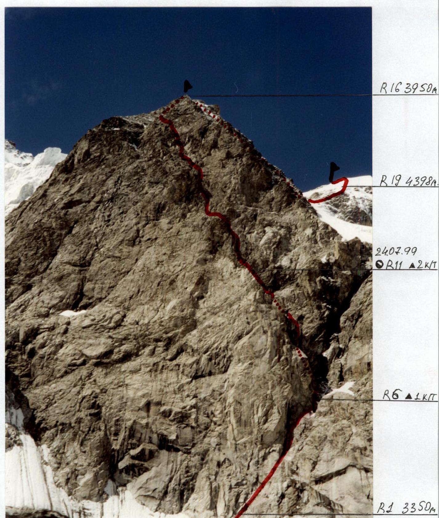
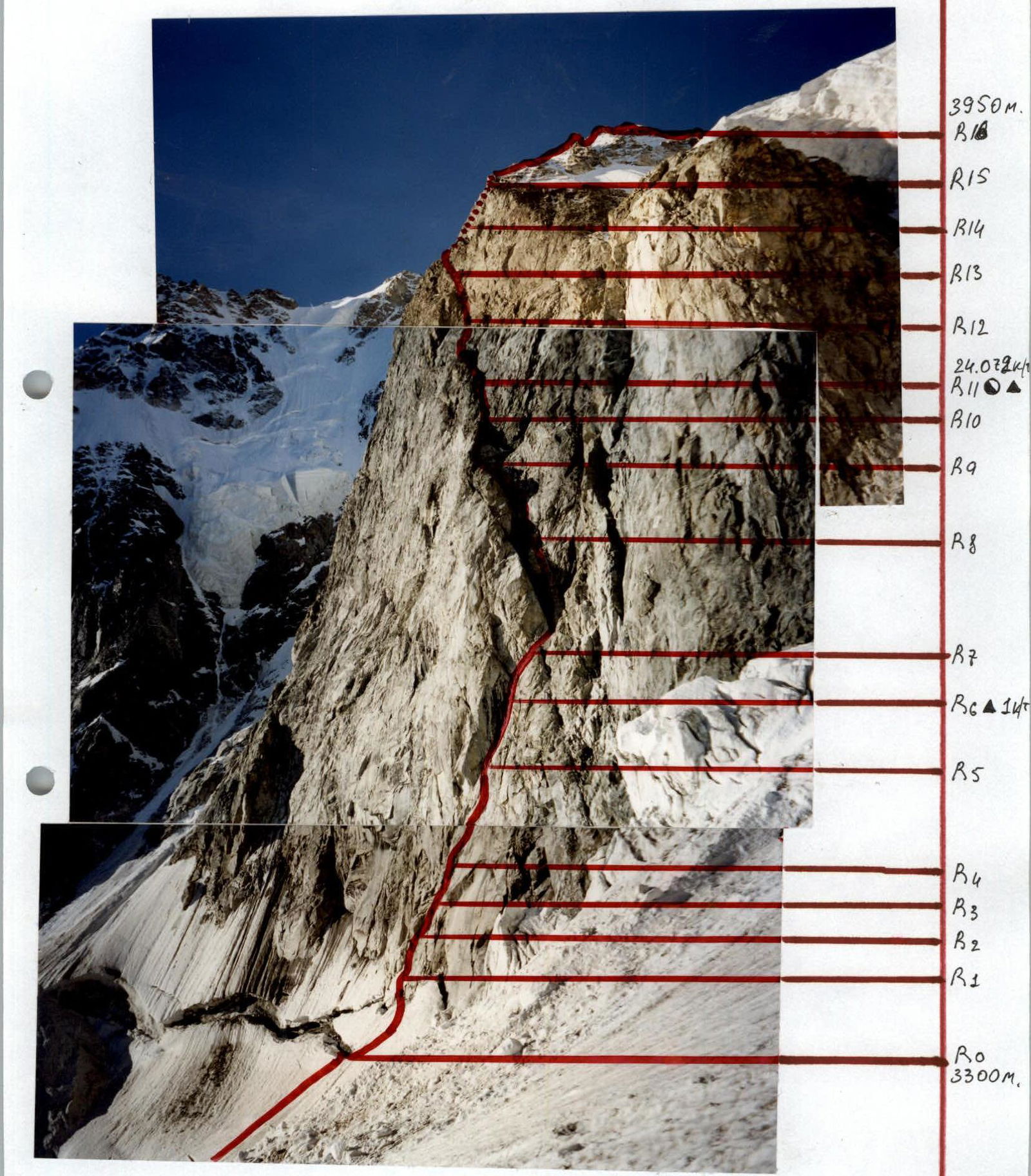
Doppakh Western. Right part of NE face. NE ridge (4398). First ascent. Approximately 6A difficulty category. Date taken — July 20, 1999. Shooting point — 3200 m. Distance — 1500 m.
Technical photograph of the wall part of the route, NE face. NE ridge. Doppakh Z. (4398). Date taken — July 27, 1999. Distance — 1500 m. Shooting point — 3450 m.
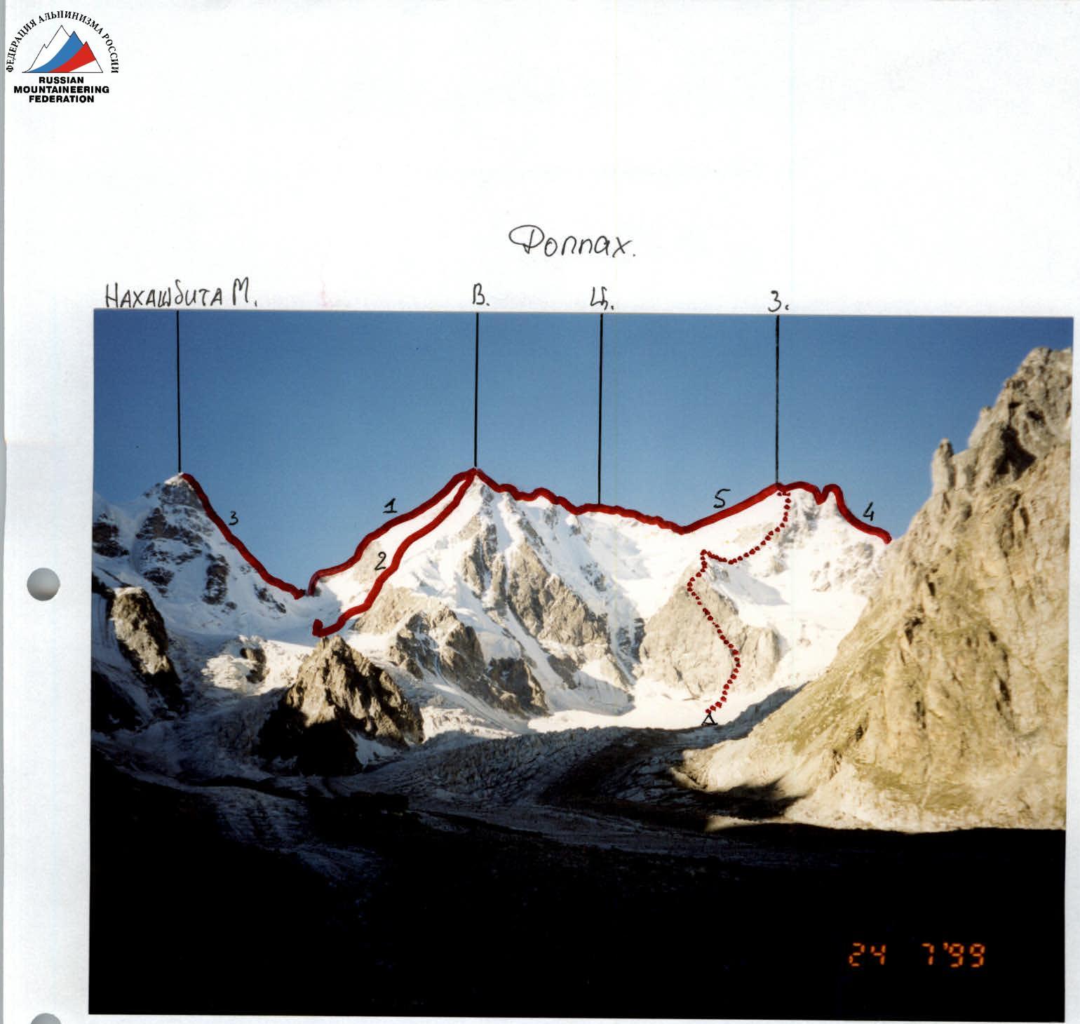
Panorama of the area. Section of the Sugansky Ridge. Upper reaches of the Nakhashbita glacier.
- Route: Doppakh V. W ridge. 4A difficulty category.
- Doppakh V. NE rock. 4B difficulty category.
- Traverse of the Doppakh massif 5A difficulty category.
- Nakhashbita M. NW ridge. 5A difficulty category.
- Fopnakh 3 N 54r 4B difficulty category.
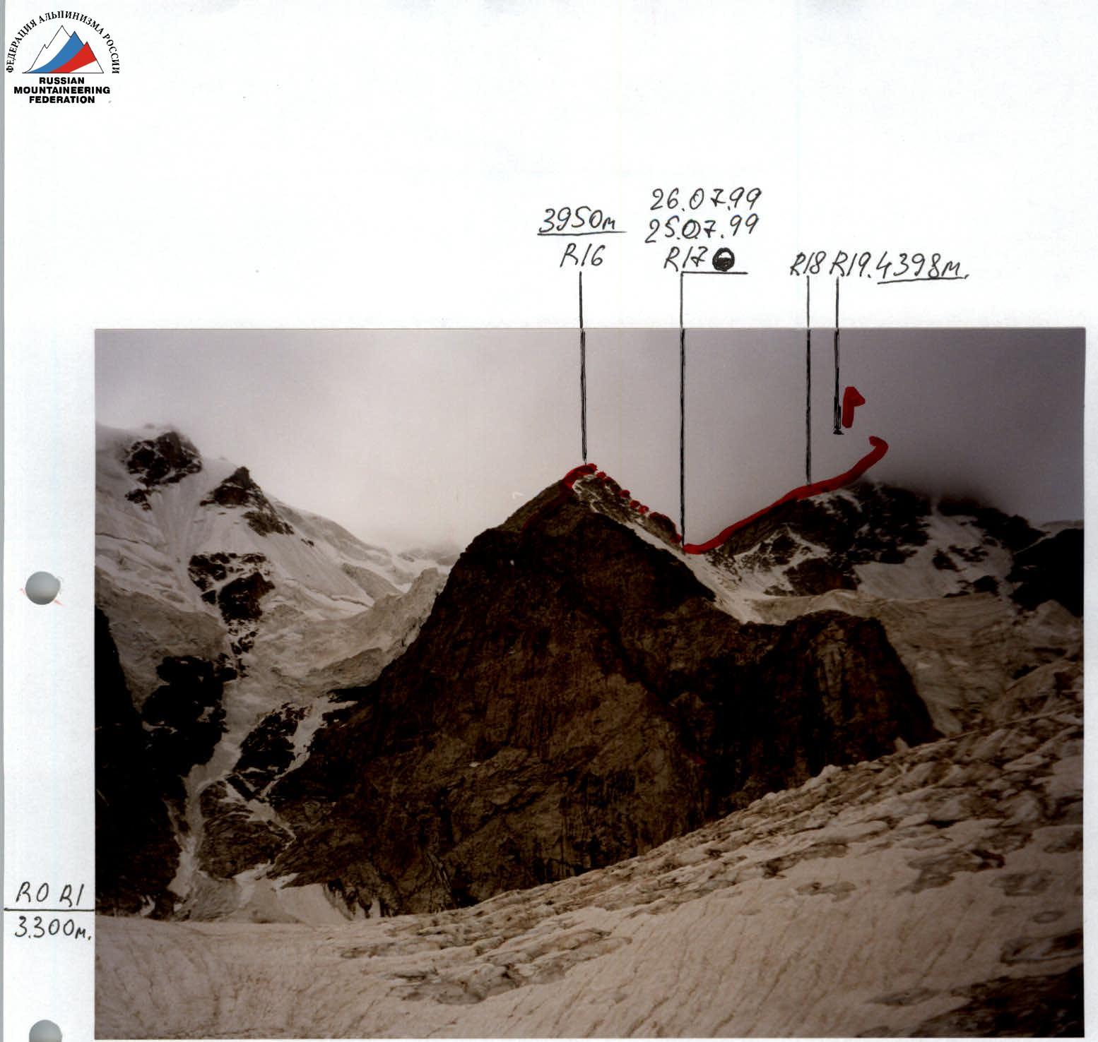
Doppakh Western NE face. NE ridge. Shooting point — base camp.
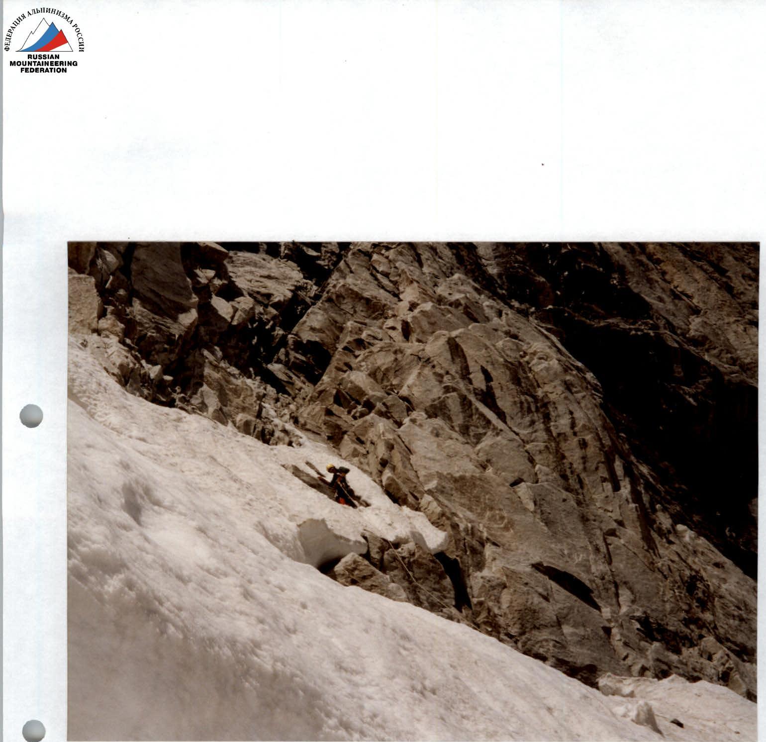
Section R0–R1
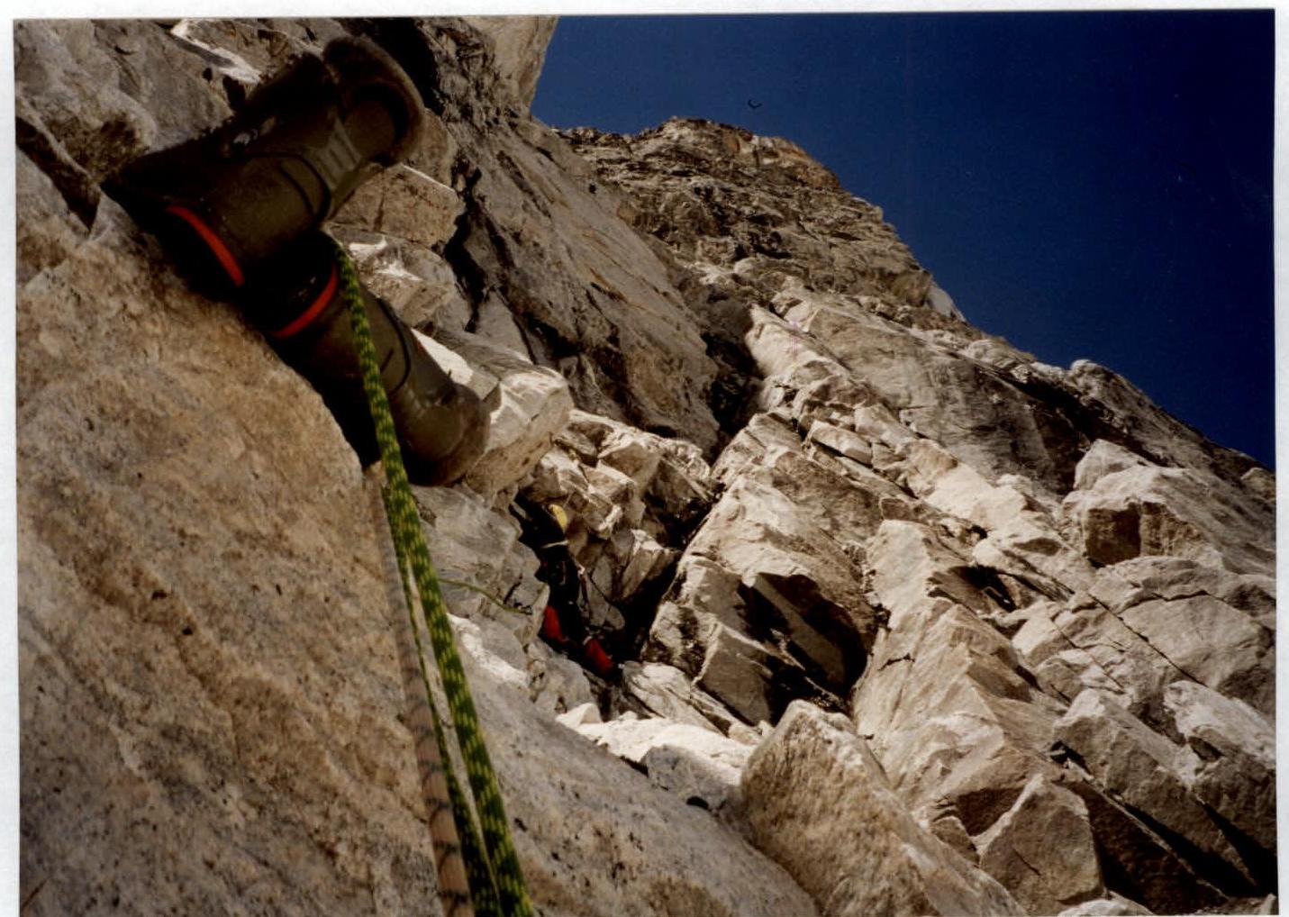
Section R1–R2
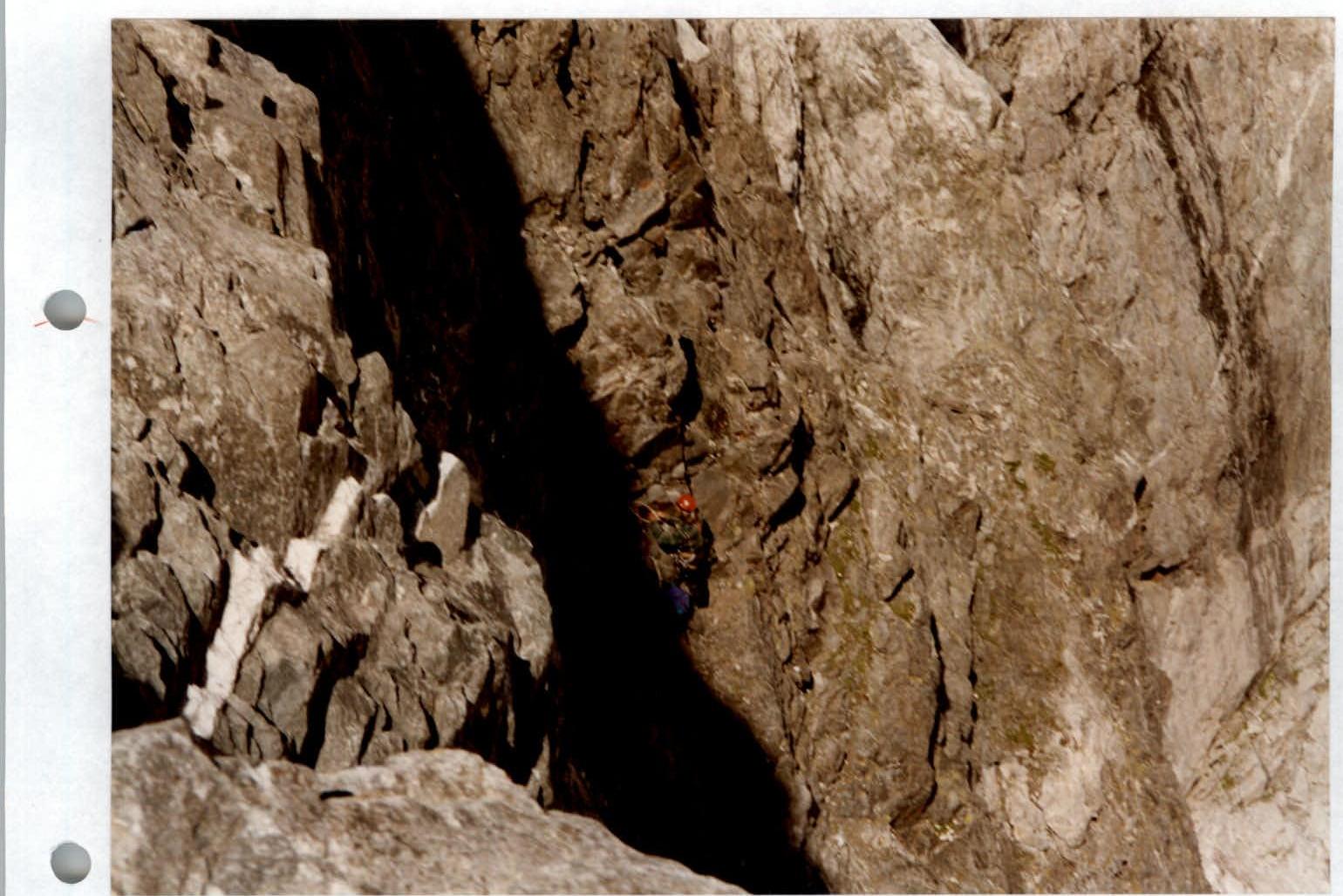
Section R7–R8
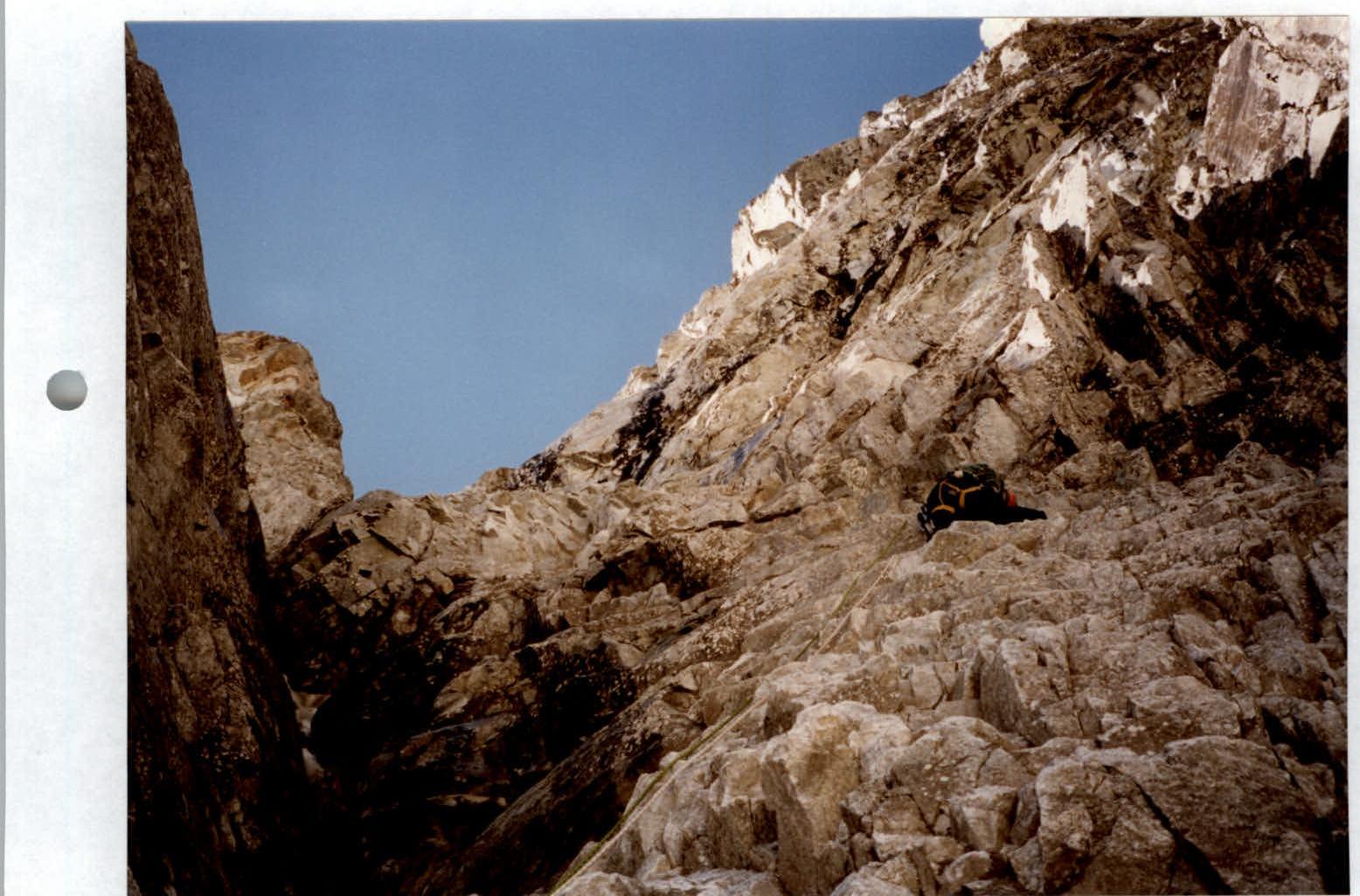
Section R8–R9
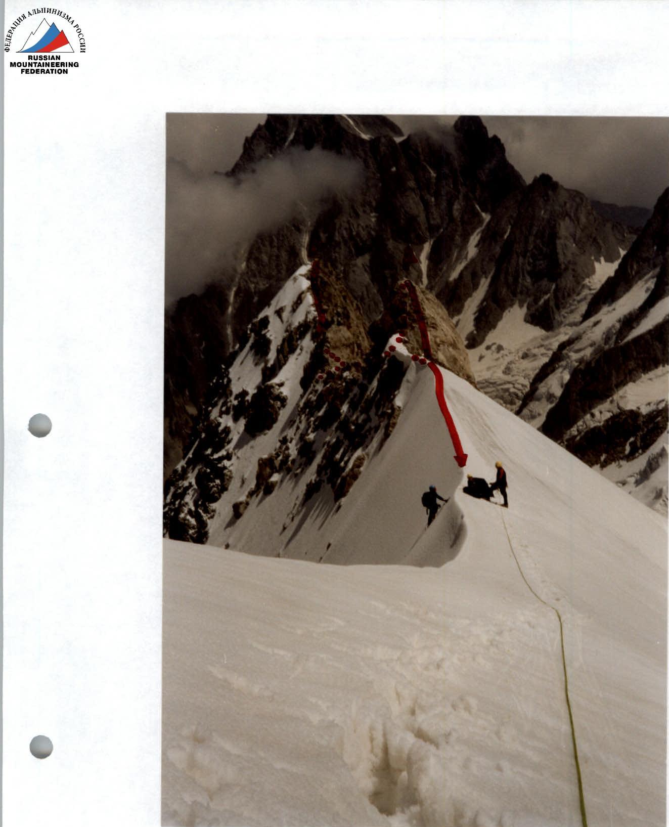
Section R17–R18
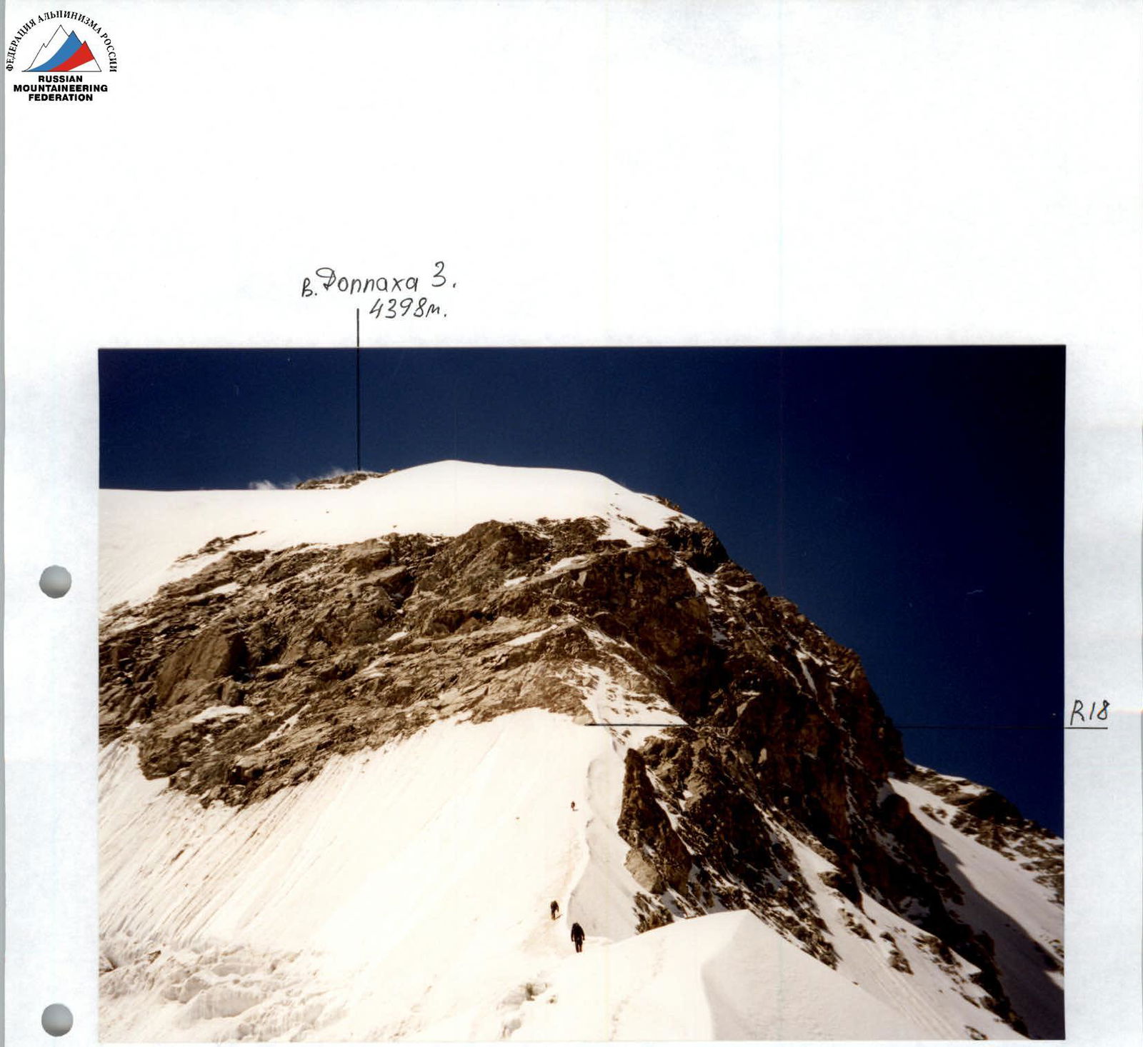
Section R18–R19. Pre-summit rock belt.

Rappel on section R19