MOSCOW ALPINISM AND ROCK CLIMBING FEDERATION
Report
On the ascent of the Demchenko-named CSKA team
To the summit of Prividenie (Ghost) 3809 m
Central Caucasus, Koshtan-krest ridge (43°2′37.71″ N, 43°16′25.86″ E)
via the Northern slope First ascent, presumably category 2B
Zaryaev V.V. – Galimzyanov T.R.
Participants of the ascent
-
Team leader – Zaryaev Vladimir Valerievich¹ 1st sports category
Address: 117465, Moscow, Profsoyuznaya str., 156, bld. 1, apt. 384. VVZaryaev@yandex.ru, +7 903 105-81-48
-
Galimzyanov Timur Ravilievich. 2nd sports category
Coach: Kuznetsova E.V.
Route 2B to the summit of Prividenie via the Northern slope
Ascent passport
-
Central Caucasus, Koshtan-krest ridge area, Gerty glacier, section 2.5 of the classifier.
-
Prividenie 3809 m (43°2′37.71″ N, 43°16′25.86″ E) via the Northern slope.
-
Proposed category – 2B, first ascent.
-
Route type: combined.
-
Route elevation gain: 310 m (according to Google Earth).
Route length: 900 m. Average slope: 20°
- main part of the route – 20°
- entire route – 20°
-
Pitons left on the route:
total – 0; including bolted pitons – 0.
-
Team's climbing hours: 1.5 h (excluding descent and approach to the route), 1 day.
-
Team leader: Zaryaev V.V., 2nd sports category.
Participants:
- Galimzyanov T.R., 2nd sports category.
-
Coach: Kuznetsova E.V.
-
Approach to the route from the night camp on Gerty glacier: 5:30 AM, August 4, 2016.
Route started: 6:30 AM, August 4, 2016. Summit reached: 8:00 AM, August 4, 2016. Return to the base camp: 11:30 AM, August 4, 2016. Descent from the summit: via the ascent route.
-
Organizations: Moscow Alpinism and Rock Climbing Federation, Demchenko-named CSKA.
-
Person responsible for the report – Zaryaev Vladimir Valerievich. VVZaryaev@yandex.ru, +7 903 105-81-48.
General photograph of the summit.
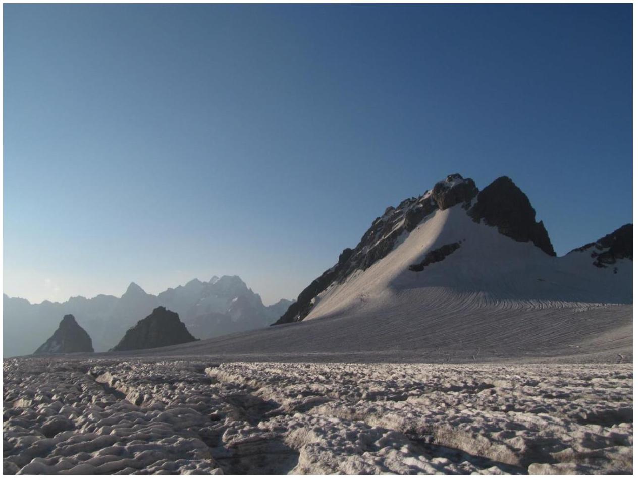
Fig. 1. Prividenie summit from Gerty glacier.
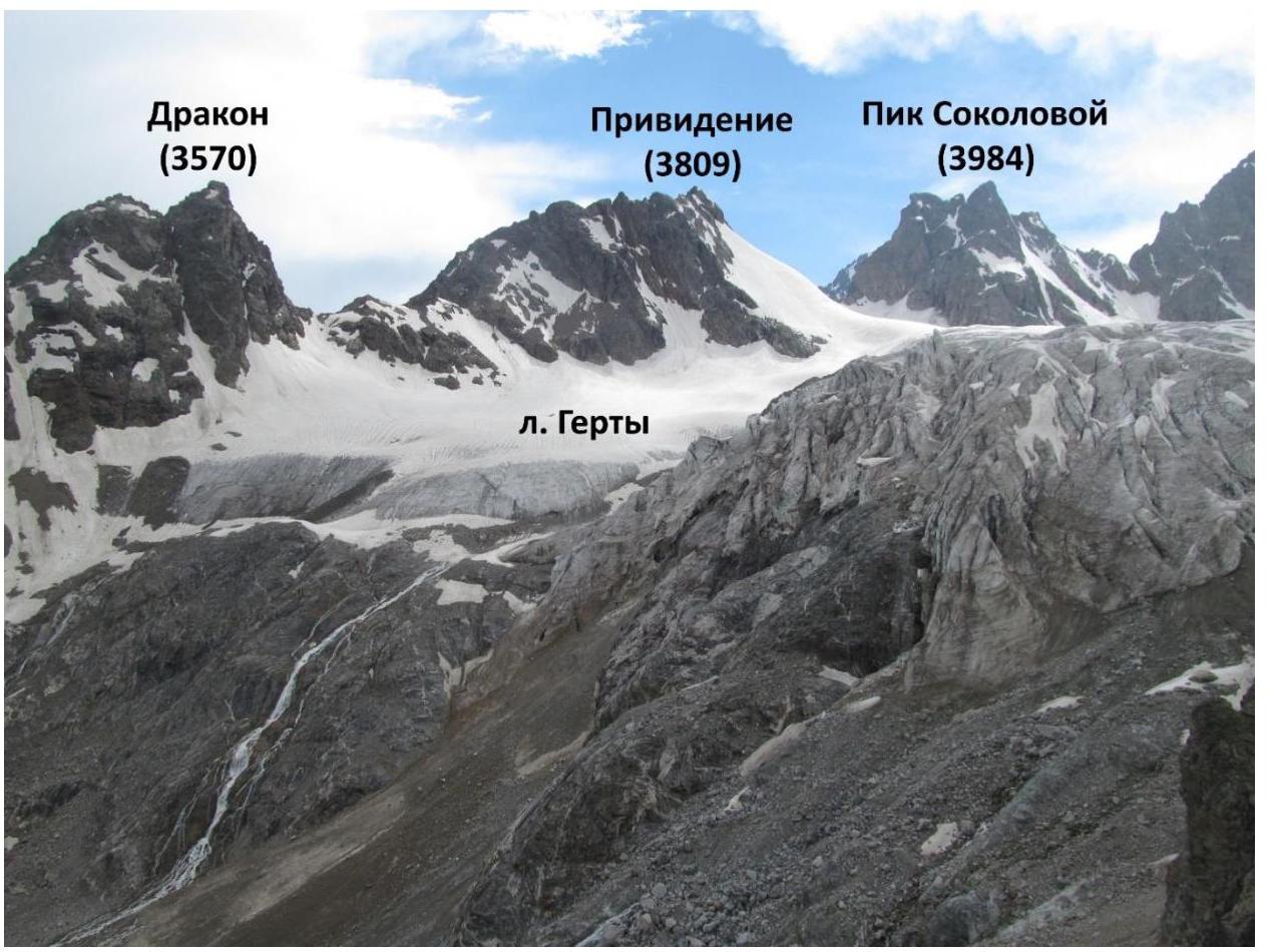
Fig. 2. Photograph of Prividenie summit in the context of the area. Overview photo taken from Shesti pass to the south.

Fig. 3. Map of the area.
Central Caucasus, Koshtan-krest ridge, Gerty glacier.
Brief description of the area
"The Koshtan-krest ridge is located east of Koshtantau summit and is a continuation of its Eastern ridge in the neighboring Dumala valley, near Mizhirgi and Bezengi valleys. The ridge closes the Dumala valley from the east and south, and the Tyutyun and Gerty valleys from the north and west. The western part of the ridge lies between Ullu-Auz and Trud passes with an average height of 4400 m. To the east from the Mira peak, a long, heavily serrated ridge descends with several unnamed summits. The eastern part of the ridge:
- has a height of 3900–4000 m;
- stretches from Trud pass to the east to Kayashkisubashi summit.
Climbers rarely visit the summits of this ridge, as the approach from Bezengi alpine camp takes 1–2 days. All Northern and Southern walls and spurs of the ridge, routes from category 3A to 5B, are still waiting for their conquerors. The ascent to Mira peak via the long Eastern ridge with several rock formations and unnamed summits is very interesting, with a route category of 5B." Description on the website (http://www.kmvline.ru/lib/center/25.php↗)
Approach
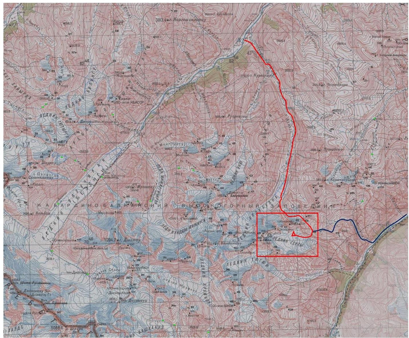
Fig. 4. Route map from Bezengi and Verkhnyaya Balkaria valleys to Gerty glacier. The climbing area is marked.
Two main paths lead to Gerty glacier:
- From Bezengi valley up to Dumala valley, then through Koshtan pass (category 1B) and Shesti pass (category 1B) (the path is marked with a red line on Fig. 5). The path from the beginning of Dumala valley to the night camp under Koshtan pass takes 1 climbing day. The path from the night camp under Koshtan pass through the pass, and then through Shesti pass to the night camp on Gerty glacier takes 8–9 hours. In total, the approach to the base camp via this path takes 2 climbing days. This approach is the most logical.
- From Verkhnyaya Balkaria valley through Stoyansu river canyon via Additional pass (category 1A), then through Shesti pass. We took this route on the descent, which took 1–1.5 climbing days. The ascent is estimated to take 1.5 climbing days from the beginning of Stoyansu river canyon. It should be noted that this path is considered the most logical in this direction due to the high complexity of Additional pass. The descent initially followed snow and scree couloirs, and then steep grassy slopes; no suitable camping spots were found, so this canyon should be traversed in one day.
Night camps
No warm and suitable night camps were found on the scree. The base camp was set up on the glacier, on its orographically left side, near a stream.
Supplement
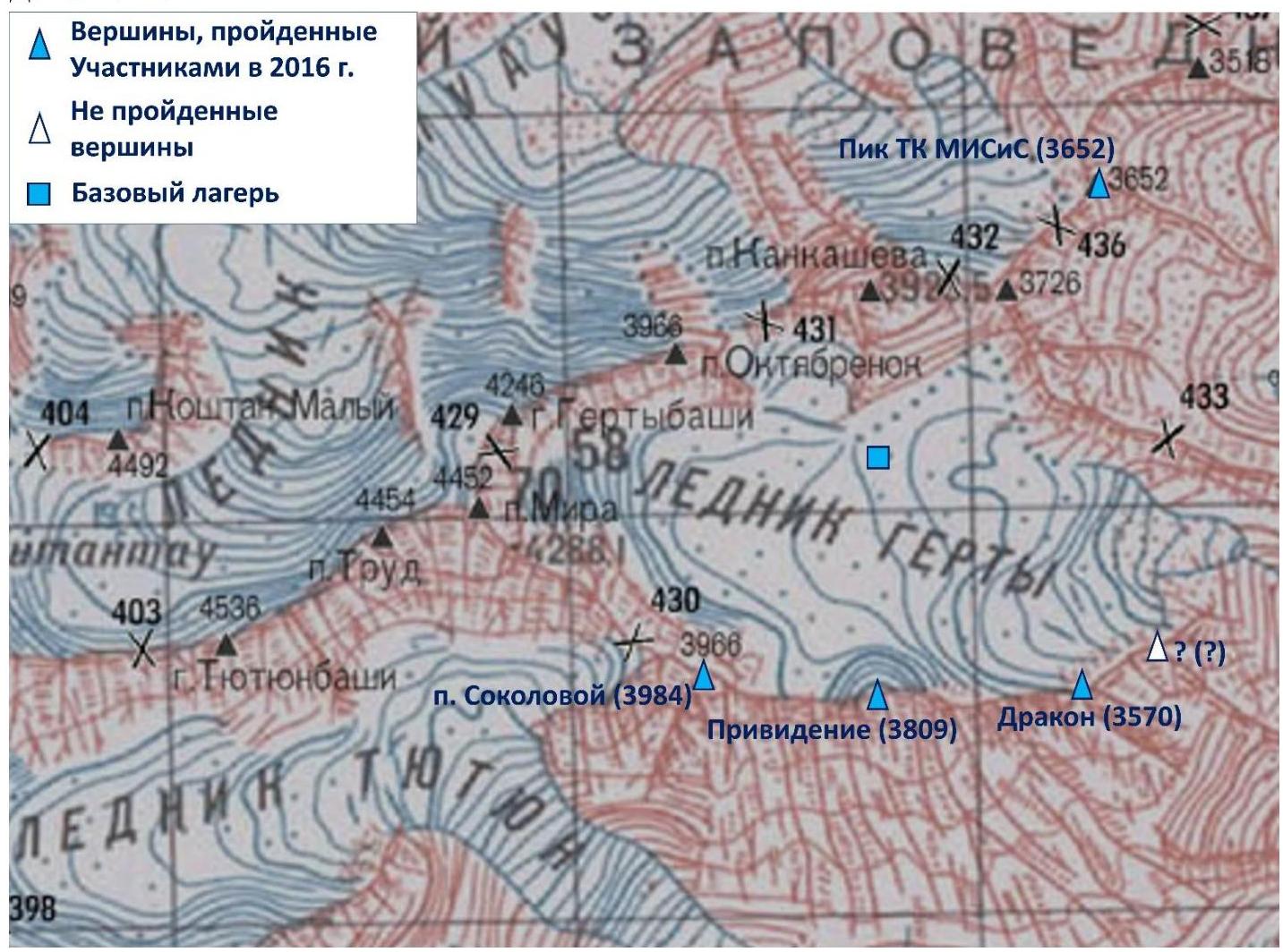
Fig. 5. Summits climbed during the 2016 trip. A summit that was not climbed is also marked (see the report on the ascent to Dragon summit).
Photograph of the route profile.

Fig. 2. Ascent route to Prividenie summit.
Description of route sections' difficulty
| Section | Length | Steepness | Terrain type | Category |
|---|---|---|---|---|
| R0–R1 | 600 m | 20–30° | Snow-ice slope | 2 |
| R1–R2 | 100 m | 30–40° | Ice couloir | 3 |
| R2–summit | 200 m | 0–40° | Broken rocks | 2–3 |
Brief description of the route passage by sections.
Approach to the start of the route – via Gerty glacier in rope teams. R0–R1. Ascent up the snow-ice slope along a weakly defined ridge. Then traverse to the right under the ice couloir². If necessary, protection via ice axes. Snow pitons may be required. Protection via ice screws is almost impossible. 2, 20–30°, 600 m. R1–R2. Ascend the ice couloir to reach the ridge. It is possible to move left along the boundary between rocks and ice. Protection via ice screws. On the ridge above the couloir, there is a convenient pocket for rest. 3, 30–40°, 100 m. R2–summit. Along the rocky ridge to the left, ascend to the summit. Climbing is straightforward, but the rocks are heavily broken, making protection difficult. 2–3, 0–40°, 200 m.
Descent.
Descent from the route is made via the ascent path.
Route recommendations
The route is short but quite tense. According to our observations, there is no rockfall hazard. However, the third section of the route is hazardous due to the lack of protection possibilities. Therefore, ascending via the opposite, longer Eastern ridge is an interesting alternative.
Route length 900 m, elevation gain 310 m.
Photo illustrations for the report.
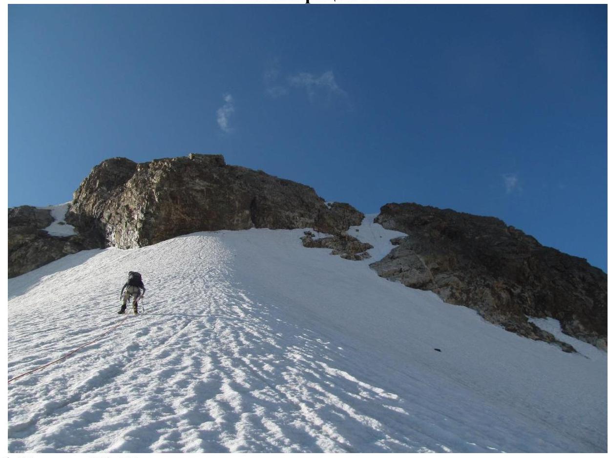
Fig. 6. Section R0–R1.
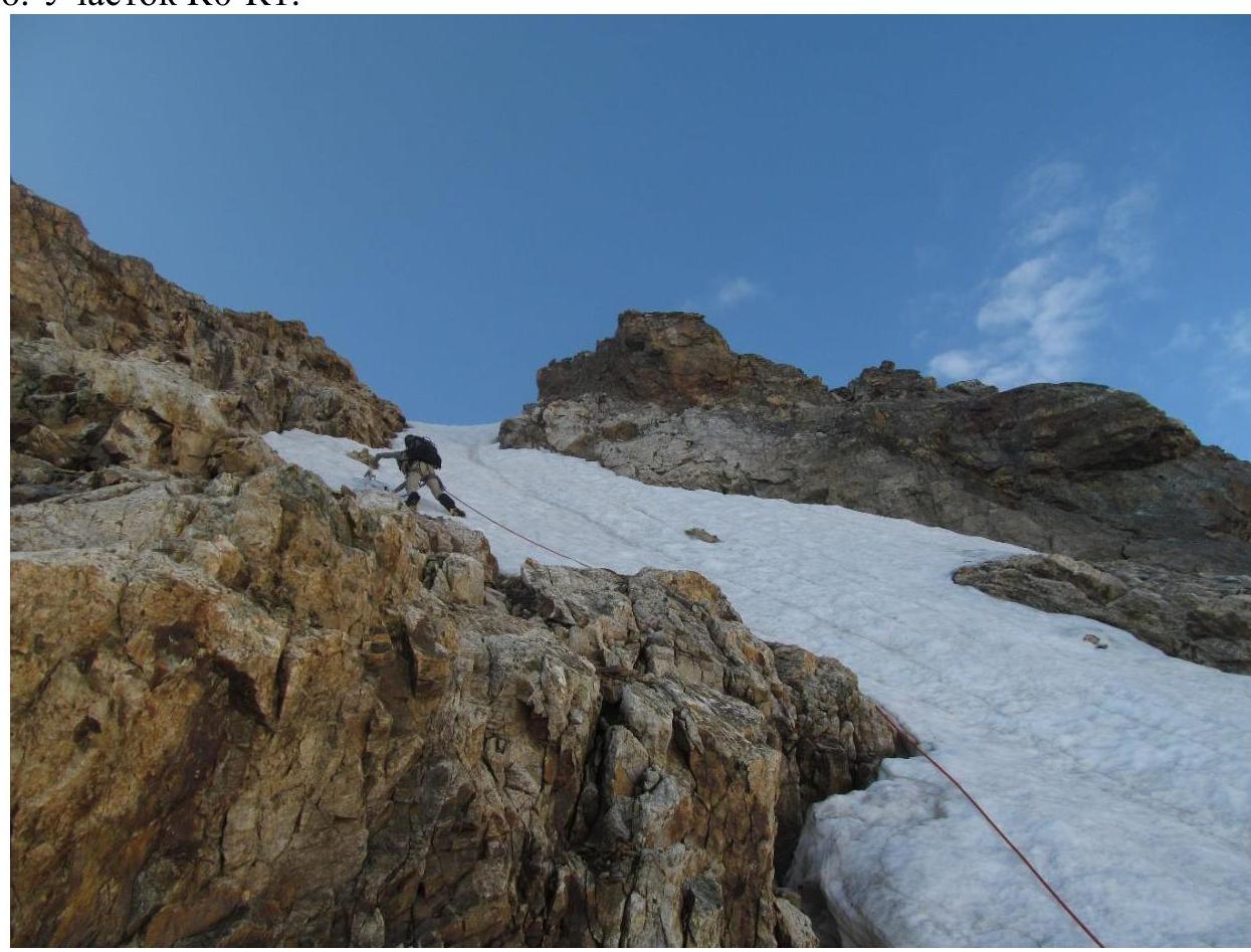
Fig. 7. Passage through the ice couloir (section R1–R2).
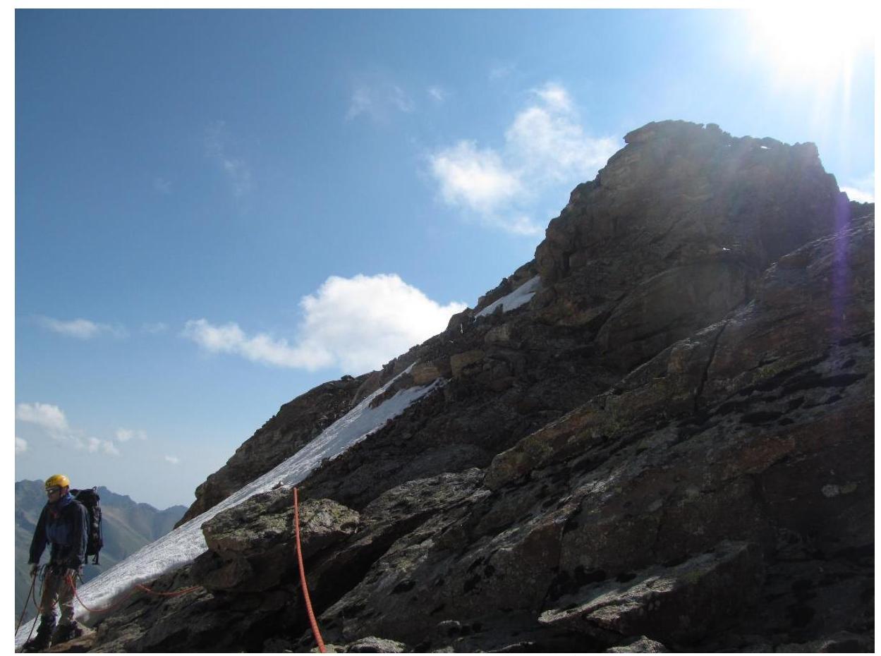
Fig. 8. Passage of the third section (descent). View of the summit.
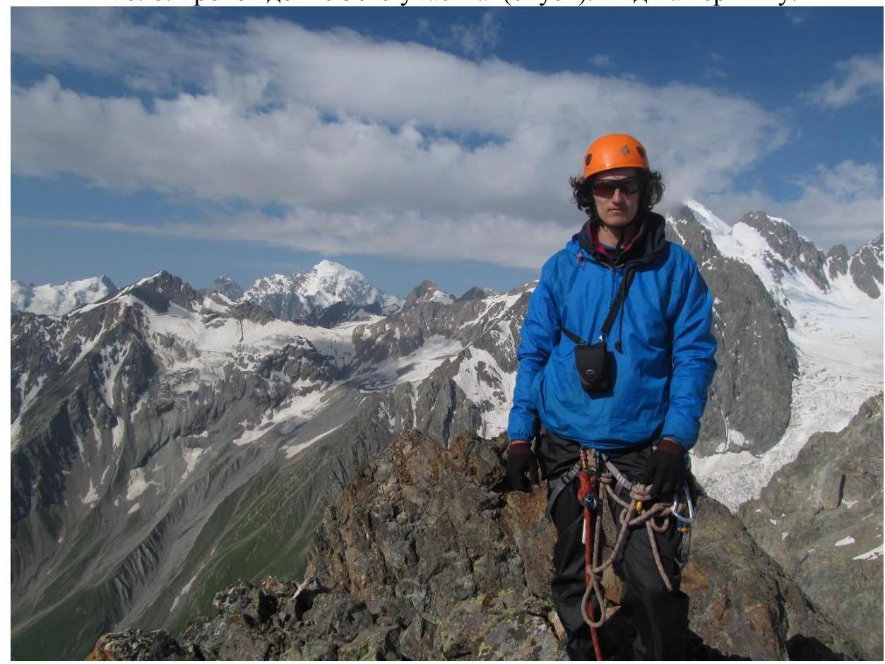
Fig. 9. Participant Galimzyanov T.R. on the summit.
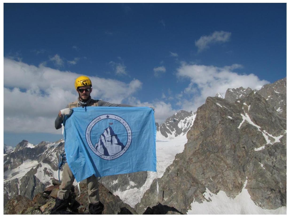
Fig. 10. Flag of Demchenko-named aviation club on the summit (and participant Zaryaev V.V.).
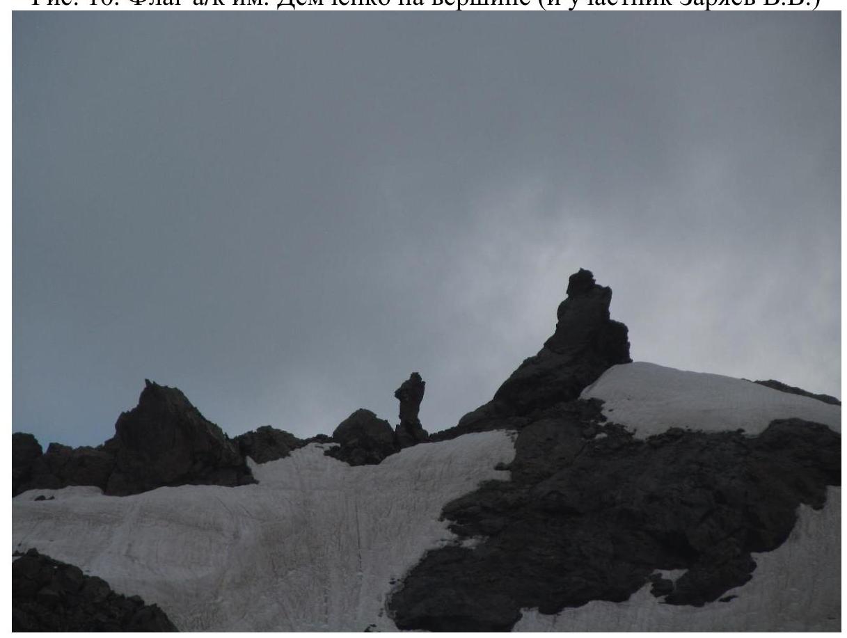
Fig. 11. Rock to the left of Prividenie summit, creating an illusion of a moving person.
This phenomenon suggested the name, reflecting the atmosphere of the glacier.