Report
Championship of the Caucasian Territorial National Management of Alpine Camps
on the ascent to the summit Glavnaya Shkhara (5200 m) via the North wall (first ascent) by the team of alpine camp “Bezengi”
team captain Kraynov I.P. team coach Kudinov I.B.
August 1–5, 1983
Alpine camp “Bezengi”:
- Nalchik, 360000, Pacheva st., 34.
- Kharkov, 310014, Kandaurova st., 46 b, Kraynovu I.P.
- Moscow, 117463, Golubinskaya st., 25, apt. 523, ph. 421-79-00, Kudinovu I.B.
The height of Glavnaya Shkhara was determined from a map in the book by Naumov A.N. “Central Caucasus”, published by FIS, 1970.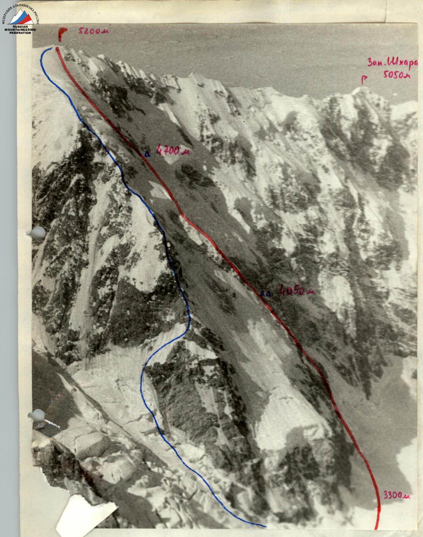
Profile of the wall from the left.
I — Tomashek's Route — 5B cat. diff.
II — Route climbed by the team of alpine camp “Bezengi” in 1983.
Photo (№3) taken on July 29, 1981 at 9:00, lens I-61, distance about 4 km, point №2, height about 4600 m, from S. ridge of West Mizhirgi.
It was not possible to take a photo of the wall profile from the right due to the lack of accessible points for photography.
Route diagram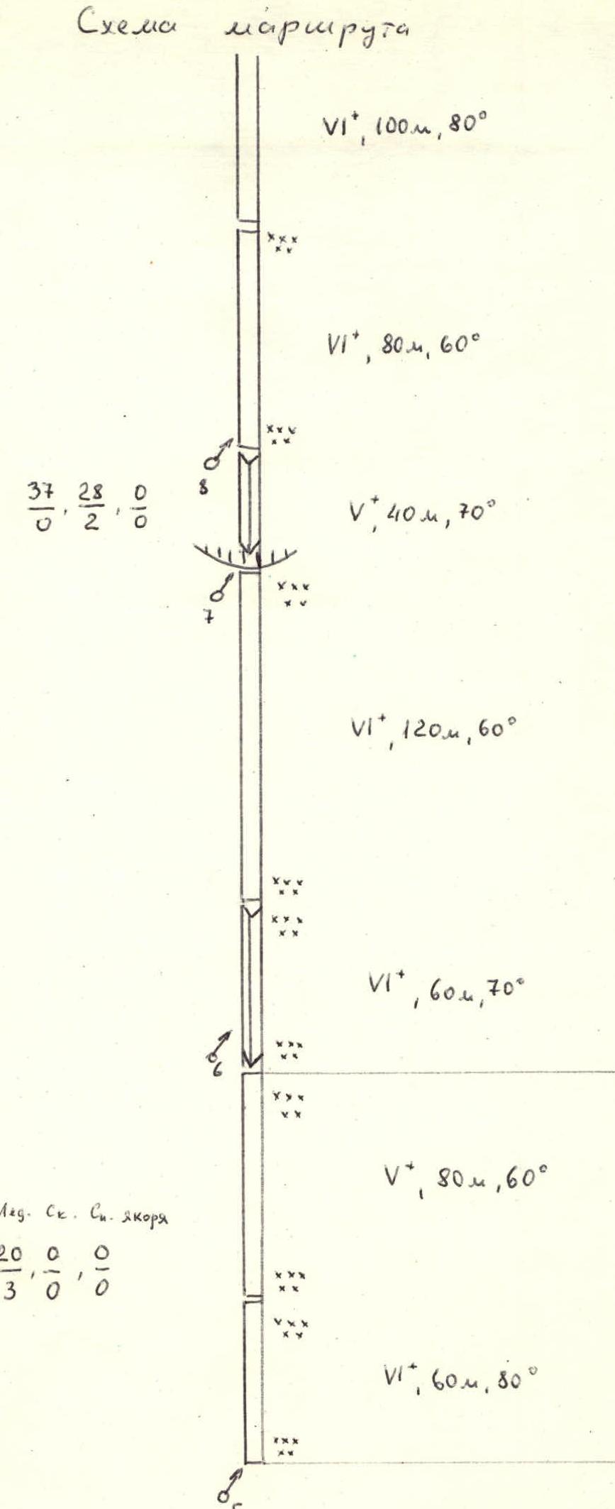
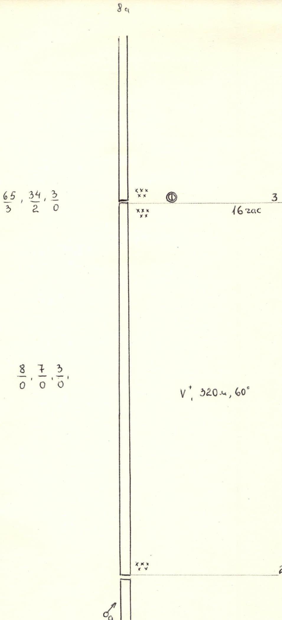
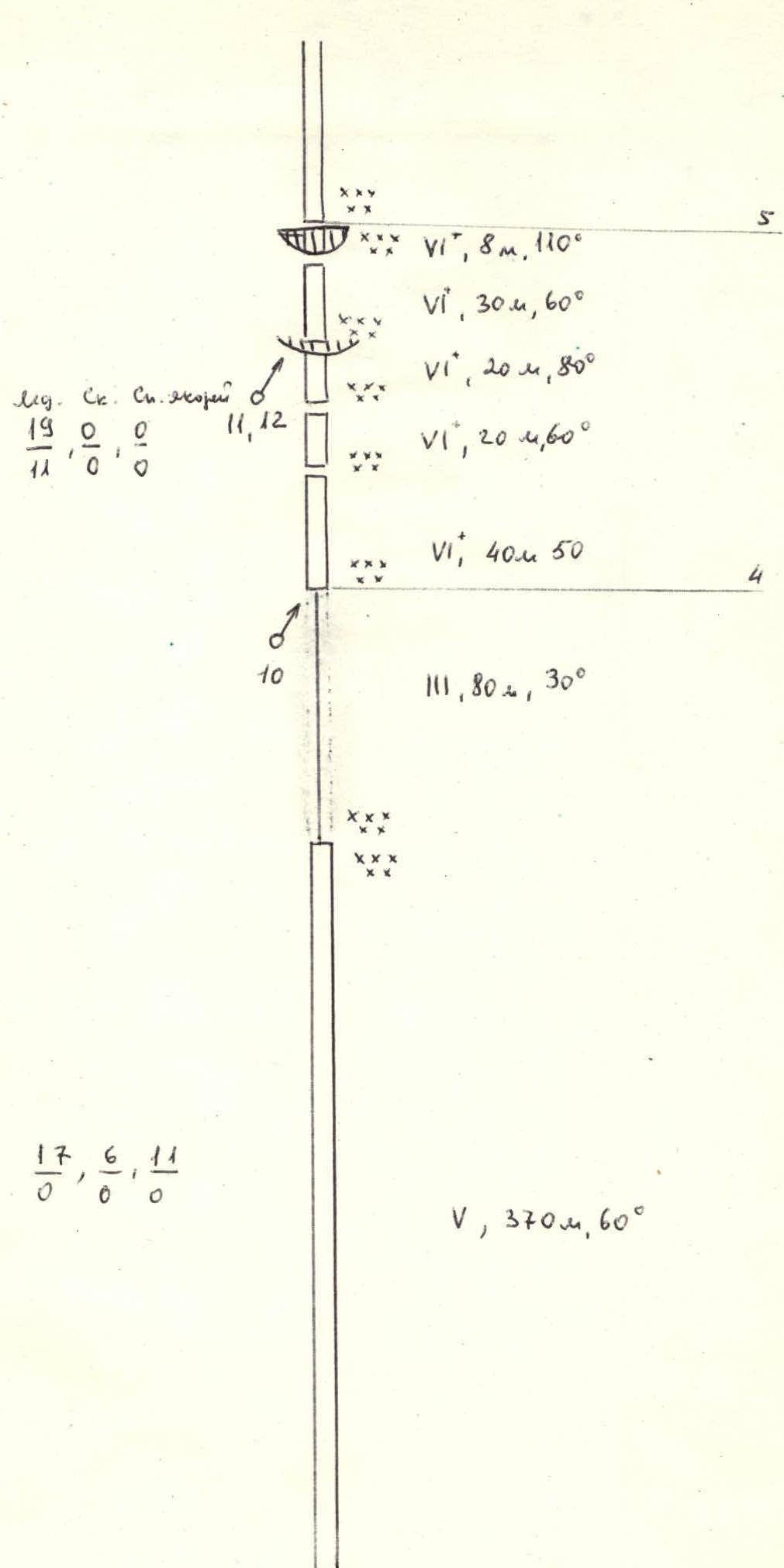
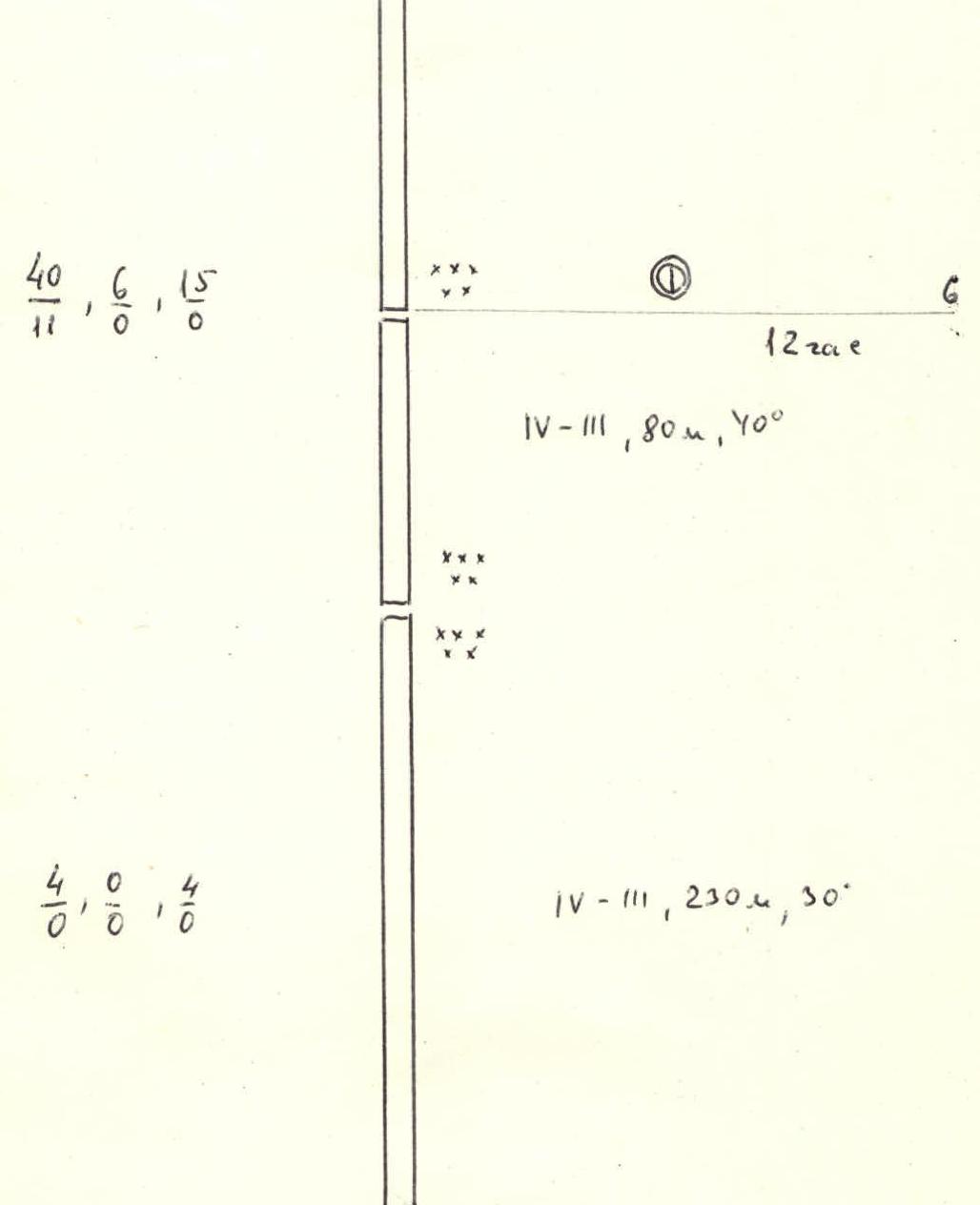
Description of the route by sections
Section R0–R1, ice wall 140 m long, up to 80° steep, formed by the upper wall of a significantly lowered bergschrund. Passage was made using “Ice-axe” and ice axes. The first climber went without a backpack.
Section R1–R2 — rock-ice belt, 400 m long, about 70° steep. Heavily snowed and covered with ice, destroyed rocks, interspersed with monolithic slabs and ice walls. About 180 m of this section the first climber went without a backpack. “Ice-axe” and ice axes were used.
This section ends with a monolithic rock wall crossing the entire route and bounded on the right and left by snow-ice, objectively dangerous couloirs. The length of the wall is about 100 m. The rocks are covered with ice. The first climber went without a backpack and on a shortened rope. Climbing was extremely difficult. Artificial handholds were used.
Section R2–R3, ice-snow slope 320 m long, steepness from 40 to 60° with individual “debris” of heavily destroyed rocks. Snow anchors and avalanche shovels were used for belay. The slope ends with a steep ice ridge extending from the rock-ice belt. A safe overnight stay was organized on it. We stopped for the night at 20:00. Due to severe weather, we stayed here on August 2.
Section R3–R4, second rock-ice belt, 450 m long, steepness from 30 to 60°. The rocks are covered with ice and heavily destroyed. This section ends with a snow ridge leading to an ice barrier.
Section R4–R5 — ice barrier. Length 120 m. Has a steepness from 45 to 110°, consists of three ascents, each steeper than the previous one. The upper ascent overhangs. The ice is hard and “Ice-axe” did not penetrate. Movement was on artificial handholds. The barrier ends with a snow-firn wall, about 30 m high, and a vertical section about 8 m. The wall was climbed using ice axes with loops inserted horizontally. For the team, this wall was not unexpected, as we had already encountered such a phenomenon during the first ascent of West Shkhara via the center of the North wall.
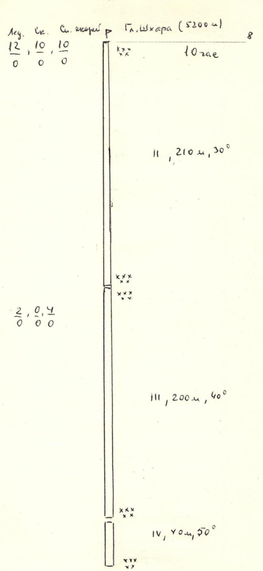
Section R5–R6, snow-firn slope, 310 m long, steepness 30–40°. Belay on the steepest sections via avalanche shovels. On the snow ridge closing this section, a safe bivouac was set up. We stopped for the night at 18:00.
Section R6–R7, third rock-ice belt. Length 260 m, steepness about 60°. The rocks are heavily destroyed and covered with ice.
Section R7–R8. Snow slope leading to the summit of Gl. Shkhara. Length 450 m, steepness initially 45–50° (about one rope length) and then becomes gentler to 30° and turns into the summit ridge.
We reached the summit on August 4 at 16:00. Immediately began descent via the E. ridge through the summit of V. Shkhara on a route of 5A cat. diff.
On the route, we had four overnight stays — three on the ascent and one on the descent. The second overnight stay on the route was due to severe weather that lasted a day. Bivouacs were in tents, lying down.
On the first day, we left the Jangikosh bivouac at 2:00, approached the route at 4:30, and began moving along it.
Technically difficult sections were climbed using modern ice and rock equipment.
The passage of the route took a total of 5 days. Of these:
- 1st day — good weather;
- 2nd day — severe weather (spent in tents);
- 3rd day — good weather;
- 4th day — fog, light snowfall, and very strong wind;
- 5th day — clear, but strong wind.
The route is snow-ice with a large number of steep rock outcrops covered with ice. The route is original and represents undoubted sporting interest. Objectively safe. Requires high tactical and technical preparedness of groups. Its category, in our opinion, is above 5B, but since all Caucasian routes of 6 cat. diff. are determined by the presence of extended rock sections of maximum complexity, we cannot draw analogies. We believe that this route can be classified as a snow-ice route of 6 cat. diff.
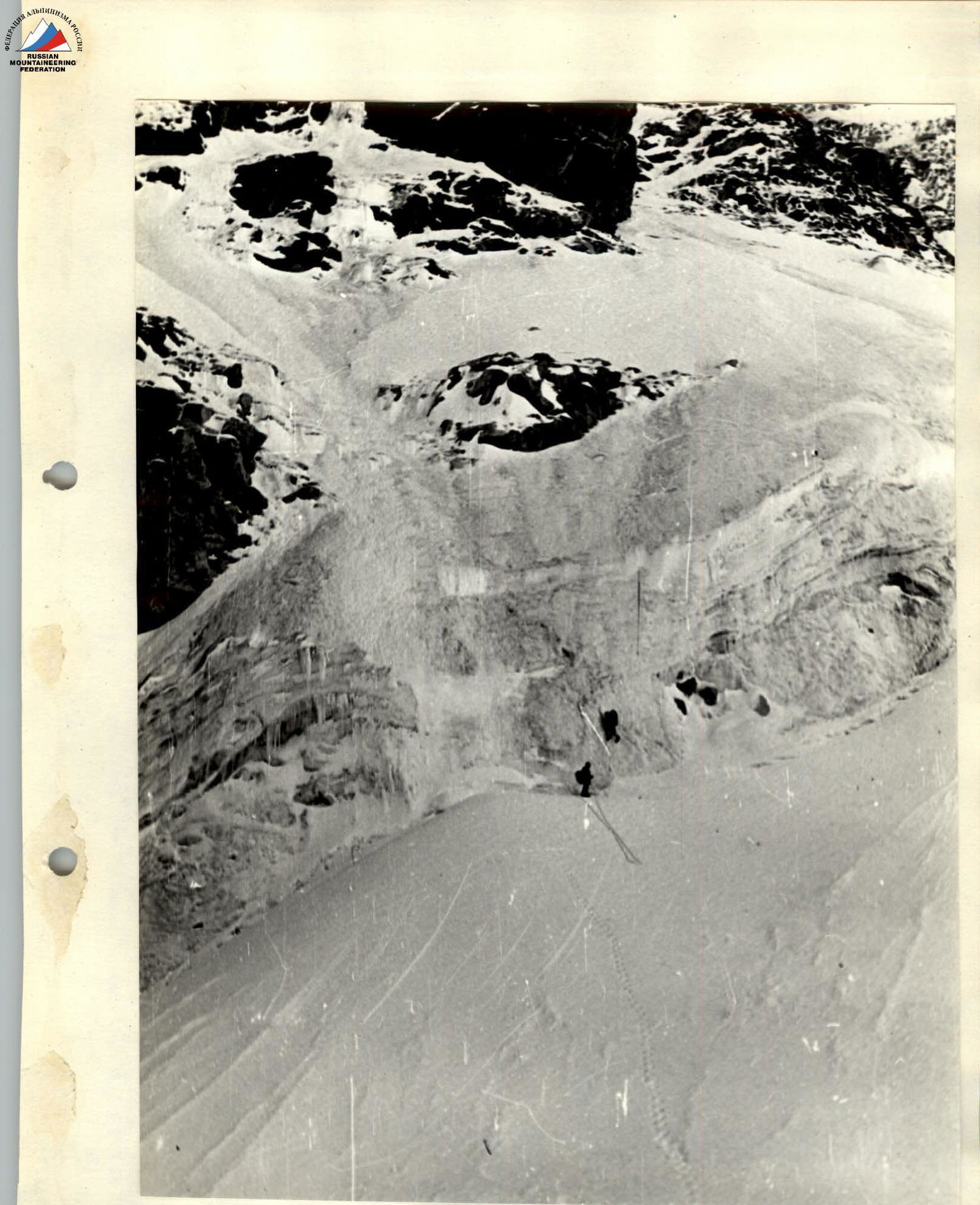
Photo №5, section R0–R1.