TO THE QUALIFICATION COMMISSION FASIL ST. PETERSBURG
St. Petersburg Championship in mountaineering in the high-altitude and technical class 2012
DESCRIPTION OF THE ASCENT TO THE SUMMIT OF MISSES-TAU (4427 m) VIA THE CENTER OF THE EASTERN WALL, 5B cat. dif.
team captain: Molodozhen V. A. team coaches: Lobachev E. A. Timoshenko T. I.
St. Petersburg 2012
Ascent Passport
-
Central Caucasus, Mizhirgi gorge (north of GKKh), section № 2.5 of the route classifier for mountain peaks
-
Name of the peak and route name: Missees-Tau (4427 m) via the center of the eastern wall (2002)
-
Category of difficulty: 5B (proposed – 6A)
-
Route type: combined
-
Height difference of the route: 980 m (by altimeter) Route length: 1375 m Length of sections: 5 cat. dif. – 350 m 6 cat. dif. – 160 m
Average steepness: Main part of the route: 85° Total route: 70°
-
Number of belay points and ITO used: rock pitons (including anchor): 40 pcs. (ITO 10) chock stones: 147 pcs. (ITO 46) bolt pitons: 17 pcs. ice screws: 5 pcs. "Pitons" left on the route: rock (including anchor): 0 pcs. bolt: 0 pcs. ice: 0 pcs.
-
Team's total climbing hours: 47 h
-
Leader: Molodozhen Vladimir Aleksandrovich, MS Participants:
- Olennikov Sergey Aleksandrovich, 1st sports category
- Tuzova Ekaterina Alekseevna, 2nd sports category
-
Coaches: Lobachev Evgeny Aleksandrovich Timoshenko Tatyana Ivanovna
-
Departure to the route: 12:00, August 11, 2012 Reach the summit: 12:00, August 15, 2012 Return to BL: 23:00, August 15, 2012
General photo of the summit with the route marked.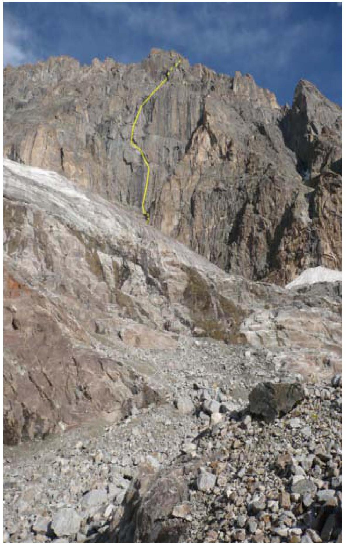 Panorama of the area
 Drawn profile of the route.
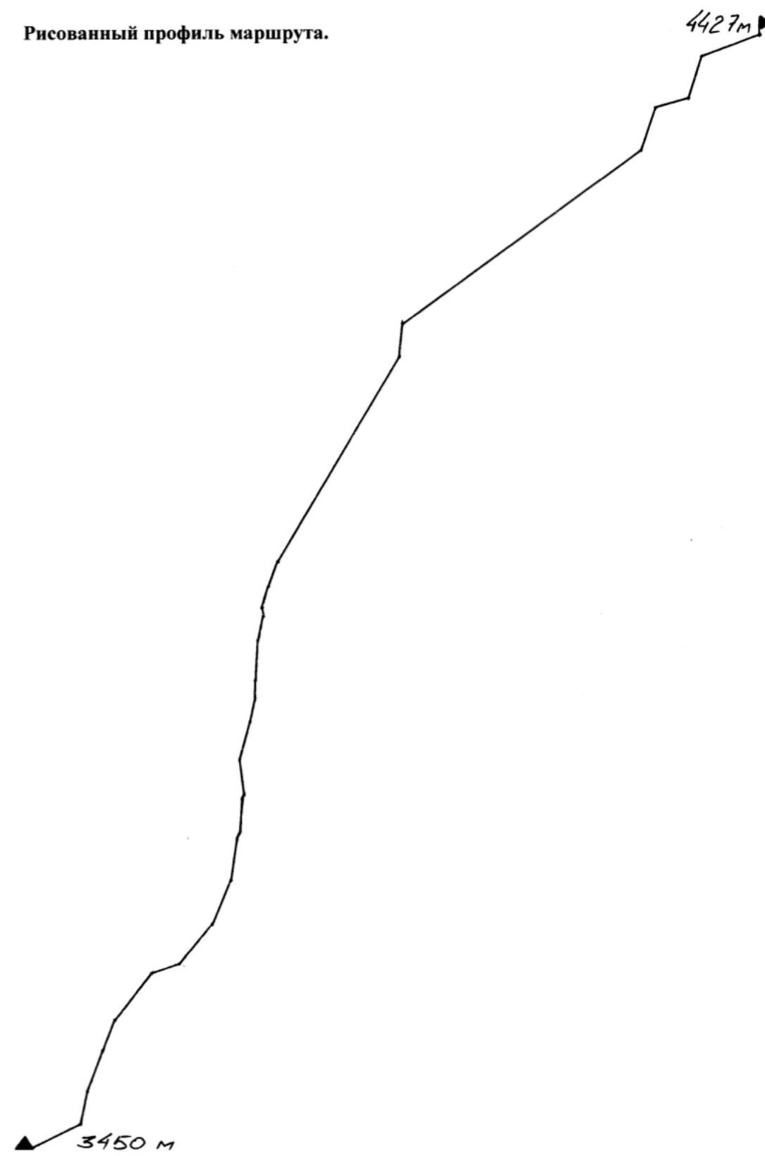 Ascent graph (horizontal – ascent days, vertical – route heights), taking into account processing time (if any) and weather conditions;
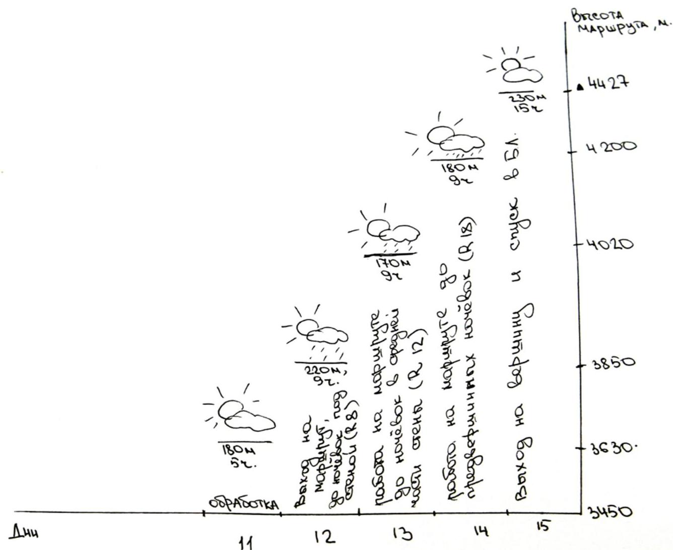
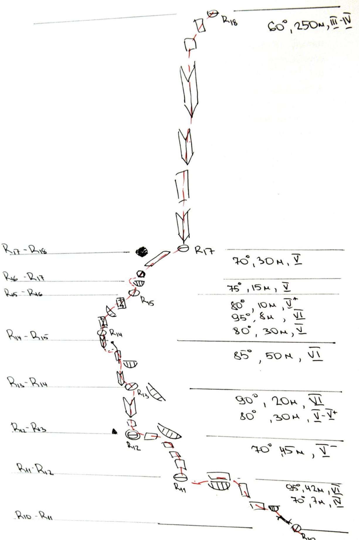
Route diagram in UIAA symbols R20–R24: 20°, 70 m, 3–4 R22–R20: 75°, 50 m, 4 R21–R22: 20°, 40 m, 3 R20–R21: 70°, 50 m, 4 25°, 250 m 85°, 40 m, 5+ 85°, 40 m, 5+
Email addresses of all ascent participants
Molodozhen V. A.: jen@ahd.ru Olennikov S. A.: olennikov.sergey@gmail.com Tuzova E. A.: tuzova.k@gmail.com
Overview of the area
The Central Caucasus is the highest and most inaccessible part of the Greater Caucasus mountain system. The Bezengi region, which is part of this mountain system, occupies a relatively small area between the Tviber pass and the Digor ridge. Nevertheless, the high density of peaks exceeding 5000 m above sea level and walls with a total height difference of 1500–2000 m makes this area one of the most unusual mountain regions in the world.
To the north of the Central ridge, north of the Bezengi glacier, is the system of mountains of the Lateral ridge, with six peaks exceeding 5000 m above sea level in the area, four of which are located in this ridge. This is the main sports mountaineering massif of the area, which forms a horseshoe-shaped cirque of the Mizhirgi glacier.
The walls of the area are sharply divided into northern and southern. The northern walls, as a rule:
- are snow-ice and combined;
- have steep rocky bastions;
- ice falls;
- snow cornices.
The southern walls are predominantly rocky.
The Missees-Tau peak is located in the Lateral ridge, in the area of the Mizhirgi glacier. The Missees-Tau peak (4427 m) faces the Mizhirgi glacier with its almost 500-meter wall. The wall is not entirely visible from the glacier, as it is partially obscured by a counterfort in the lower part, and only the upper part is visible. The wall is oriented to the east, so it is lit by the sun for most of the day in good weather. Closer to the evening, if there is snow on the ledges at the top, streams run down the wall. This solves the issue of drinking water. If there is no snow at the top, there is no water on the wall.
The journey from the "Bezengi" tourist camp to the initial bivouac, located in the lower cirque of the Mizhirgi glacier, takes an average of 2–3 hours. From the second "football fields" along the "green strip" – exit to the "Moscow" overnight stays. From these overnight stays along the boundary of the talus moraine and the glacier to the "ram's foreheads", of which there are three. Climb up to the talus slope via the central "ram's forehead" ledges. At the top of the talus slope – a small platform, which is used for overnight stays.
From the intermediate bivouac on the second "football fields" to these overnight stays takes 2–3 hours. From the overnight stays to the start of the route – 40 minutes. The route begins to the right of the snow-ice couloir and coincides with the beginning of the Shevchenko route (5B) for the first three ropes, but then the route goes left, passes under the wall in the cirque formed by the wall and the right and left counterforts, and exits onto the wall in its central part.
Photo illustrations
Overnight stay under the route.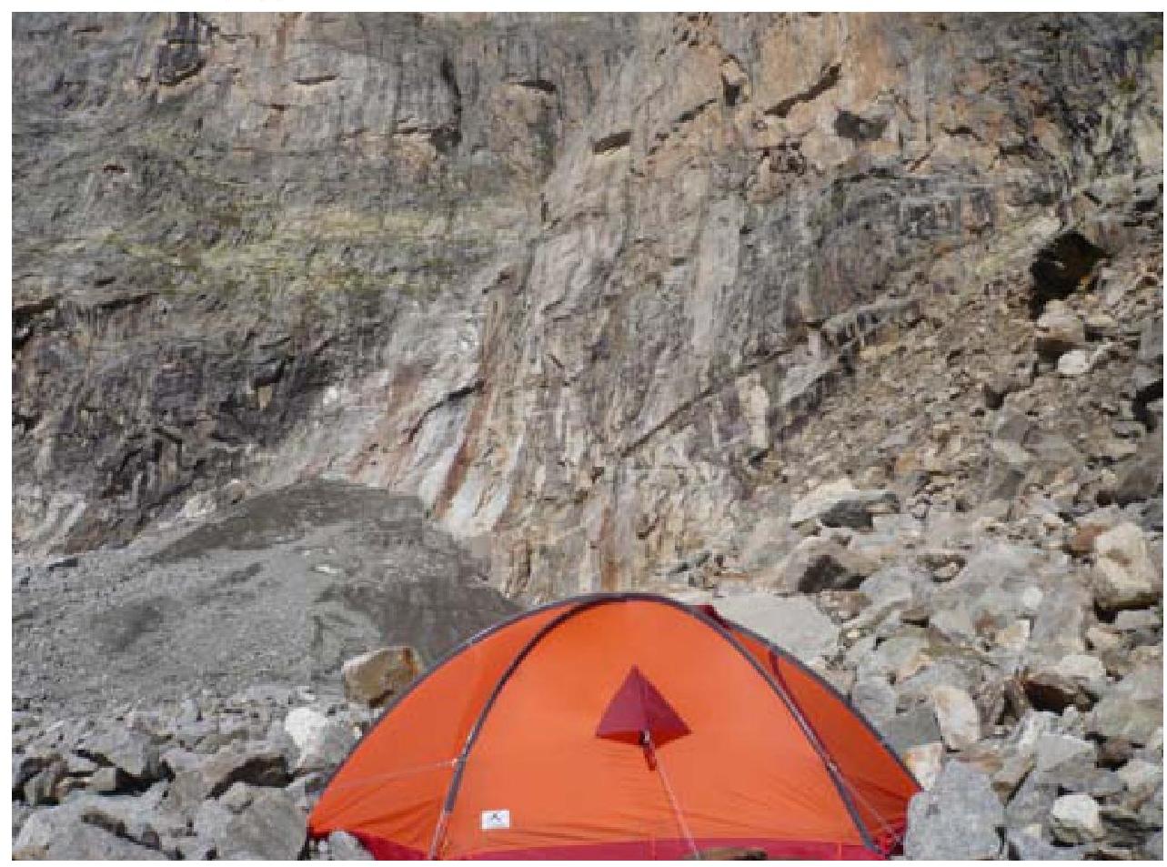
Section R2–R3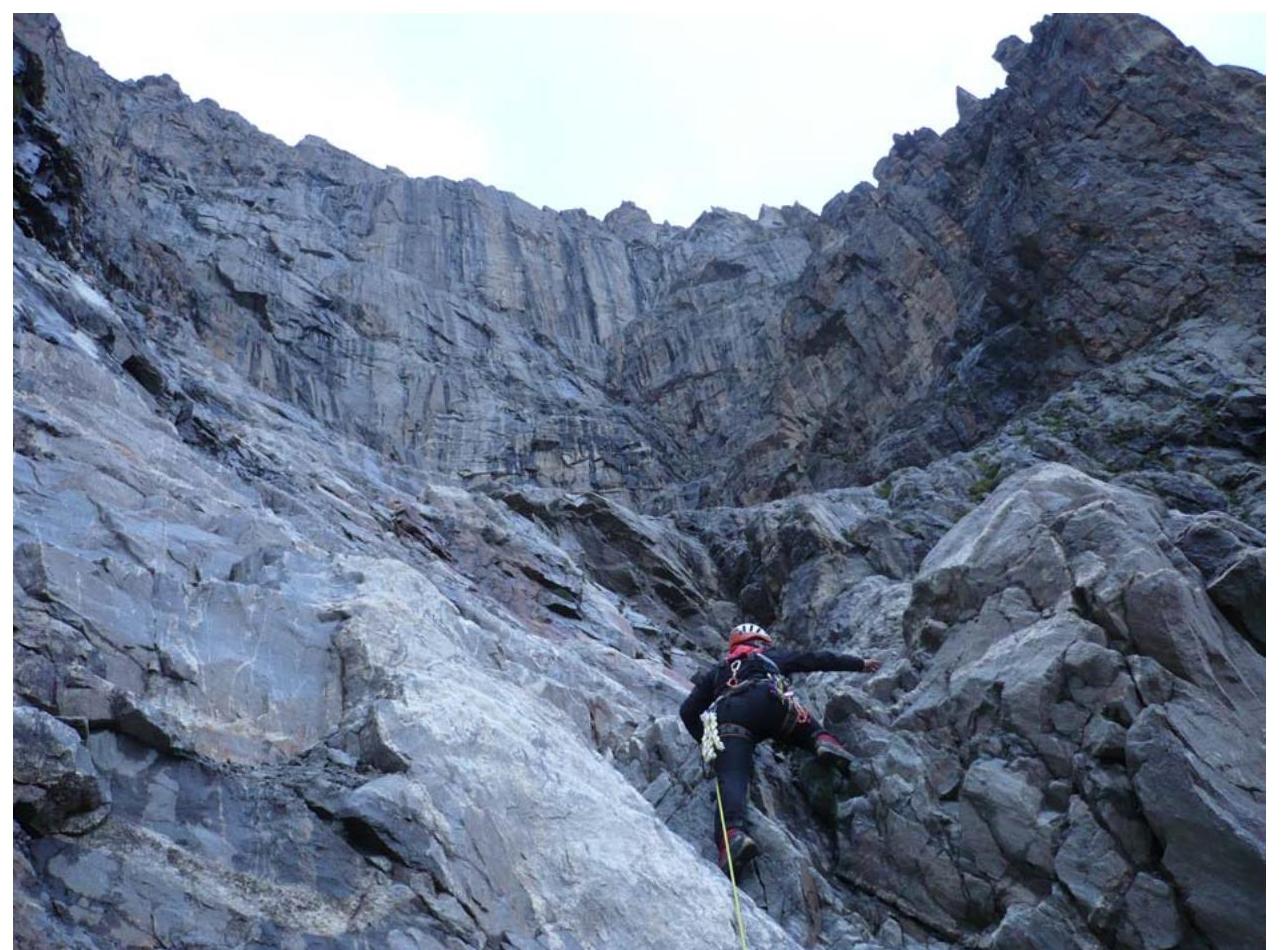
Overnight stay on section R8 (under the wall part of the route)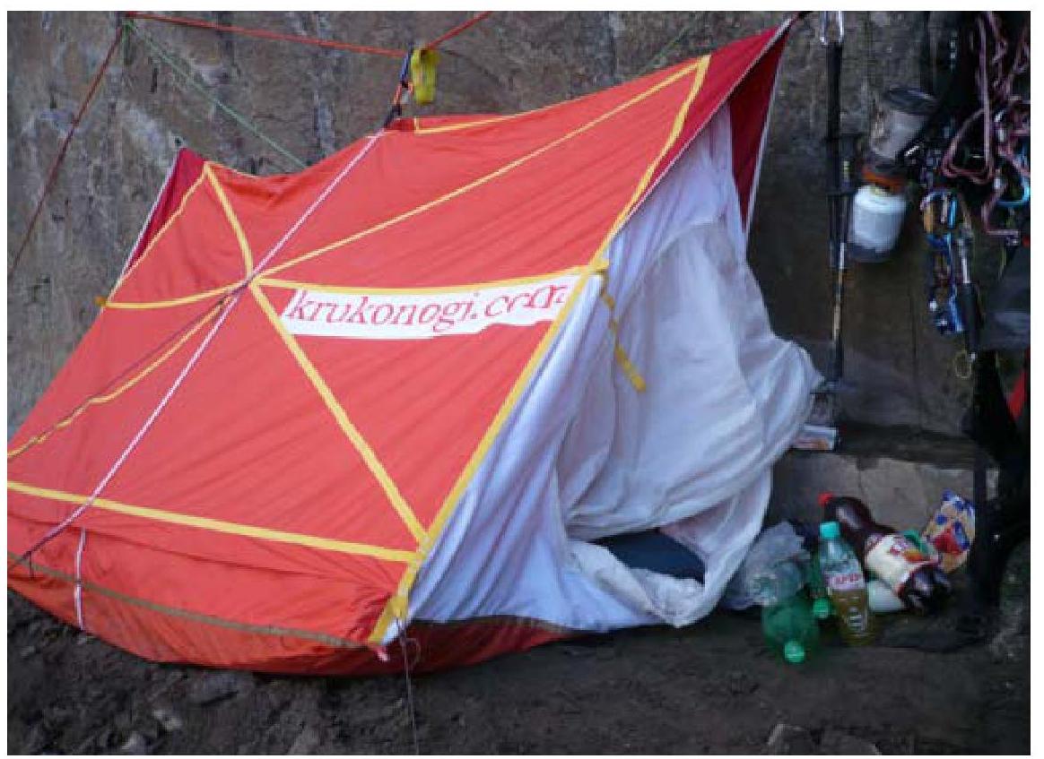
Start of the wall part of the route (R8–R9)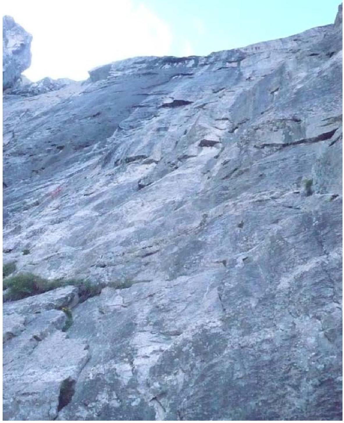
R9–R10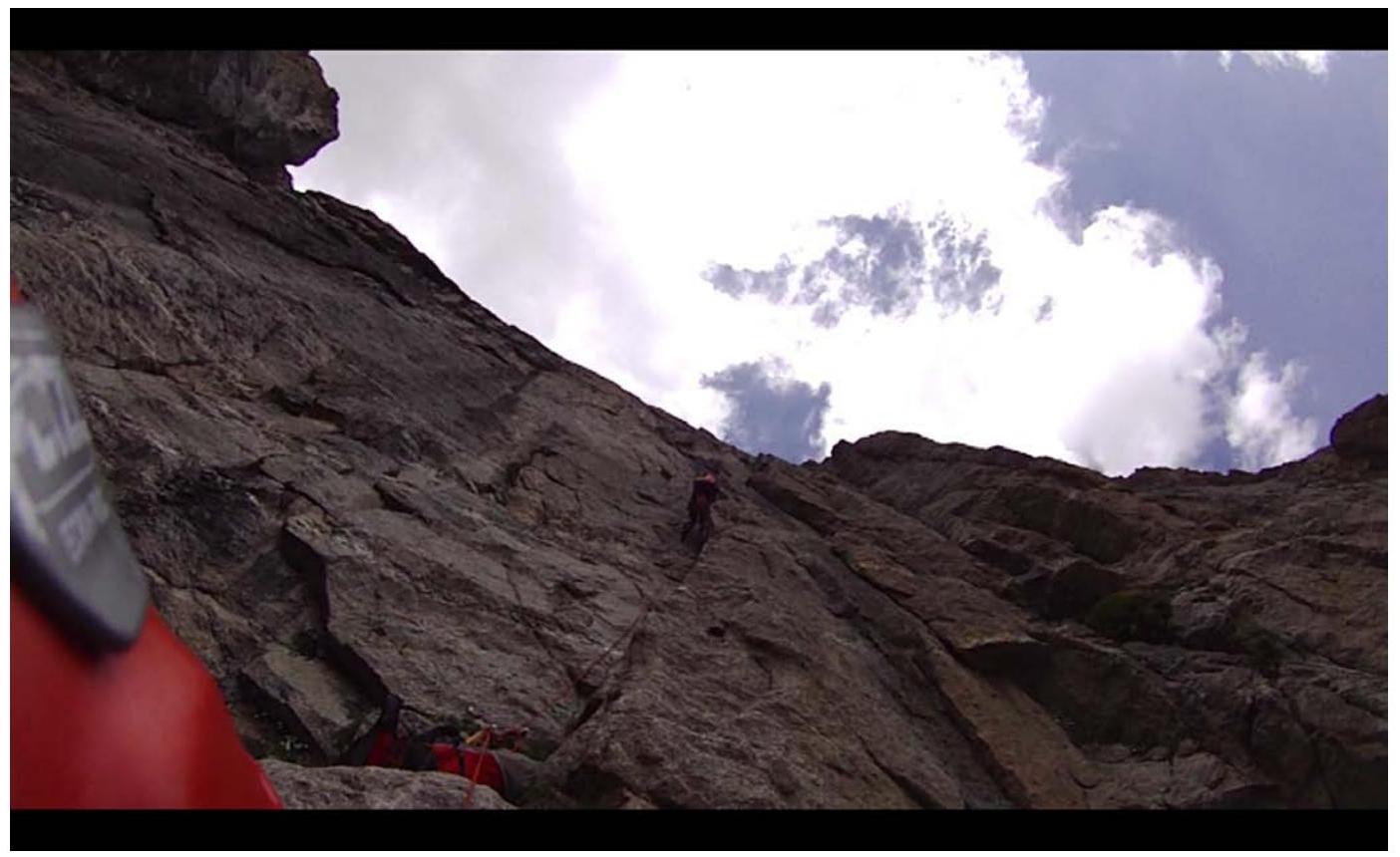
R12–R13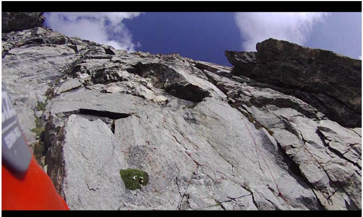
R14–R15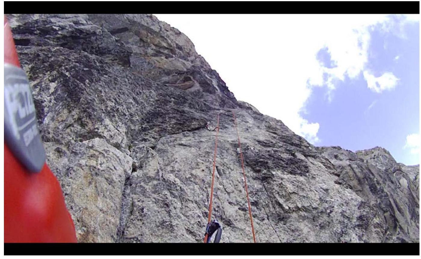
Route description
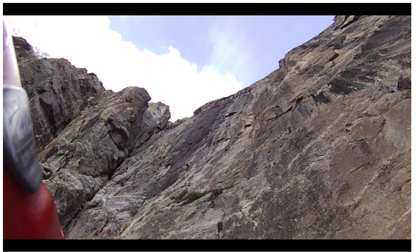
Approach to the wall via a snow-ice slope, 35°. The start of the route is on the right rib.
R1–R2
Start from the bergschrund. Straight up from the snowpatch, via monolithic rocks 5–6 cat. dif., 75–80°. Rocks 3–4 cat. dif., 60–70°.
R2–R3
Straight up from the belay station, via destroyed rocks 5 cat. dif., 70–75°. The couloir remains on the left, exposed to rockfall.
R3–R4
From the belay station upwards via destroyed rocks, oriented towards the overhanging rock block. Further, "with feet" towards the overhanging block. Rocks 3–4 cat. dif., 60–70°.
R4–R5
Leftwards traverse along the talus ledge, then upwards via destroyed rocks, approximately 4 cat. dif., 50–60°.
R5–R6
Leftwards upwards via destroyed rocks 4–5 cat. dif., 70°.
R6–R7
Leftwards under an overhanging rock with a black streak. Further leftwards upwards via very destroyed wet rocks.
R7–R8
First leftwards upwards, then straight up via rocks 5 cat. dif., 70°, to a large ledge with several blocks. Overnight stay to the right of the exposed couloir on an equipped small ledge.
Start of the wall
R8–R9
To the left of the ledge with the overnight stay (5–6 m) is a system of small ledges, via which climb straight up, gradually moving to the right. Find yourself almost above the large ledge. 10 m, 5 cat. dif., 75–80°. Further 40 m via an internal corner, 6 cat. dif., 85–90°.
R9–R10
Straight up via an internal corner 5+–5 cat. dif. Further, two internal corners with blind, overgrown cracks diverge. Move via the left internal corner, 40 m.
R10–R11
From the belay station, leftwards upwards in the direction of large cornices, 7 m, 4 cat. dif., oriented towards the right (light) one. Further, 20 m of climbing under the cornice – 6 cat. dif., then through the cornice upwards. Leftwards via simple rocks, 5 m.
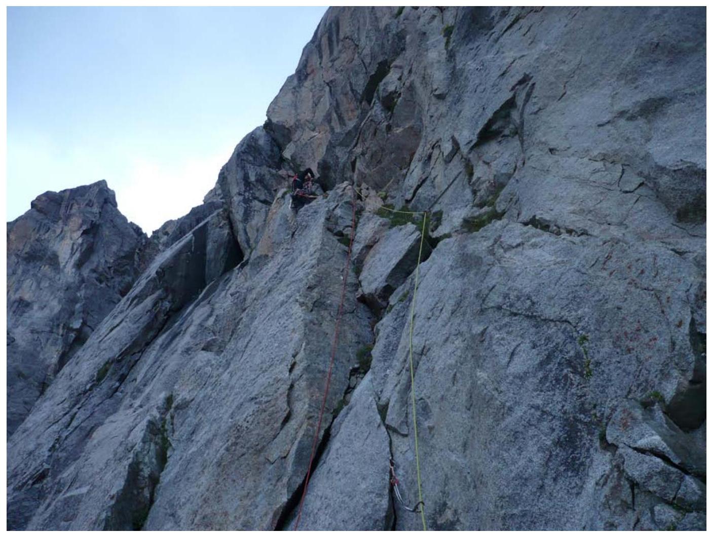
R11–R12
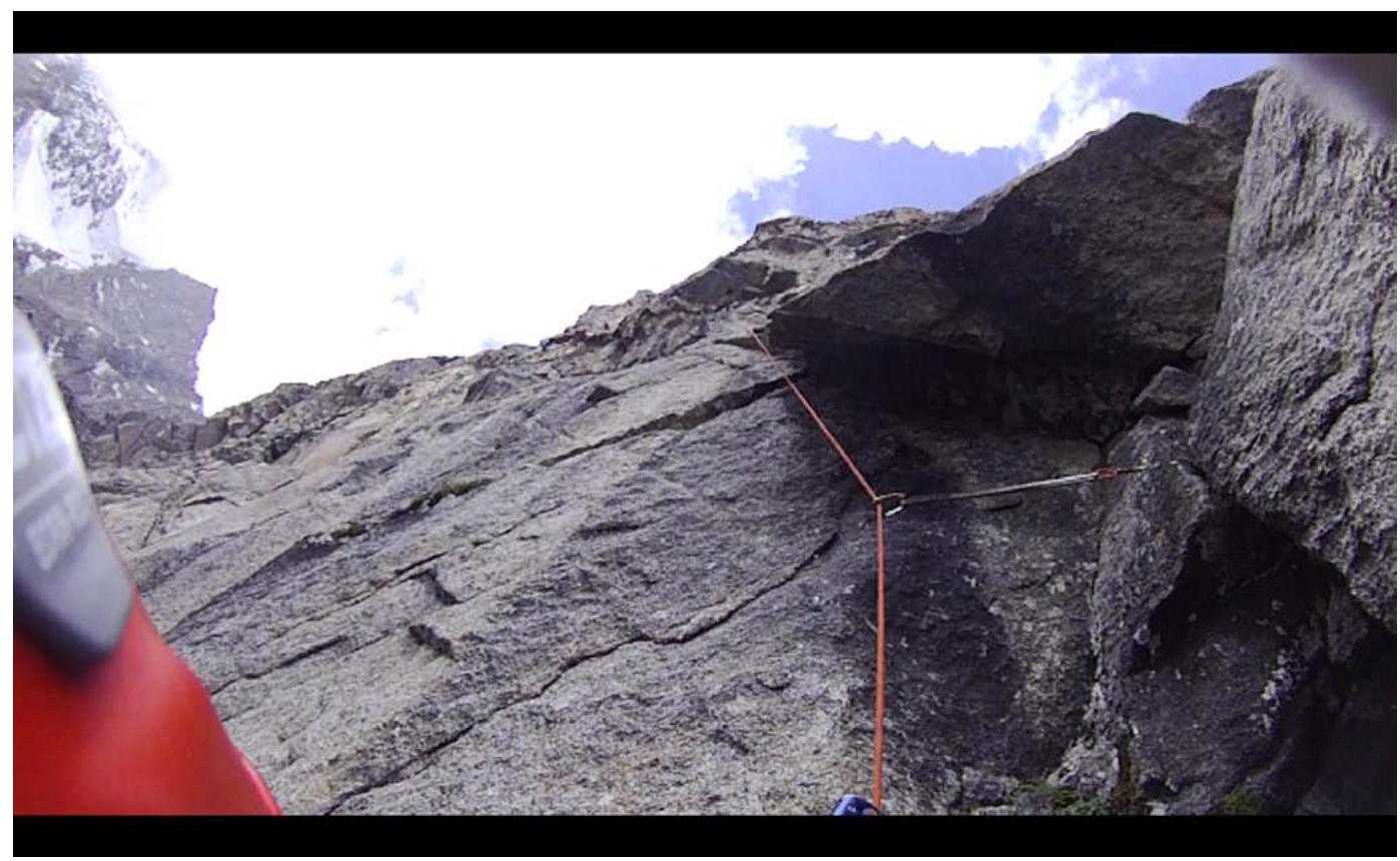
From the belay station, leftwards upwards via simple rocks 4–5 cat. dif. Many large, loose blocks. Exit onto a ledge with a control cairn. Sitting overnight stay. The ledge is located above a large cornice in the middle part of the wall.
R12–R13
From the overnight stay, straight up via an internal corner, climbing, about 30 m, 5 cat. dif., further straight up, bypassing the cornice on the left, 6 cat. dif.
R13–R14
Straight up via an internal corner under a black triangular cornice, about 20 m, 6 cat. dif. Bypass the triangular cornice on the left, 10 m, A2. Further up via an overgrown blind crack, 20 m, A3 to a bolt. From the bolt, a pendulum swing leftwards into the adjacent crack and up it to a wedged block.
R14–R15
Upwards and to the right, through a bend, 25 m, 6 cat. dif. At the end of the section, a wet corner under an overhang, 10 m through the overhang, 95°. Further, again to the right and upwards. Exit onto the left edge of the wet slab.
R15–R16
To the left of the belay station, straight up through a cornice, 15 m, 5–6 cat. dif.
End of the wall
R16–R17
To the right, traverse along the "ram's foreheads" for the entire rope. Route condition:
- Many ledges
- Simple rocks, 30 m
- 5 cat. dif.
R17–R18
Further via strongly destroyed rocks, leftwards upwards in the direction of the 5A route. About 250 m to the ridge. Overnight stay.
R18–R19
From the ridge, via a snow-ice slope, ascent to the saddle under the summit tower, 100 m.
R19–R20
From the saddle, upwards via a snow-ice slope to the tower, 200 m.
R20–R21
From the saddle between the first rocky island and the summit tower, upwards via несложным скалам 4 cat. dif.
R21–R22
Traverse along ledges to the left and approach under an implicit couloir, 45–50 m, 3 cat. dif.
R22–R23
Upwards from the ledges via easy rocks, 50 m to the summit ridge.
R23–R24
Leftwards upwards along a simple ridge, 80 m to the summit, 2–3 cat. dif.