St. Petersburg Alpinism Championship 2020 (high-altitude technical class)
Report on the ascent to the summit of Misses-Tau (4427 m) via the center of the W wall, 5B category of complexity
The route was completed by the team of FASPb St. Petersburg 2020
Ascent Passport
- Central Caucasus, Mizhirgi gorge Section No. 2.5 of the route classifier for mountain peaks
- Summit Misses-Tau, 4427 m, via the center of the W wall (2002) 4th ascent.
- Category of complexity – 5B.
- Route character – combined.
- Height difference of the route ~1000 m. Route length ~1450 m. Section lengths: ~V category of complexity 180 m, ~VI category of complexity 210 m. Average steepness: main part ~81°, total route ~56°.
- Pitons left on the route: total 1, including bolted pitons – 0. Total points used on the route: anchor pitons ~40, chocks, camalots ~150, bolted pitons – 14. Total artificial technical aids (ITOs) used ~120 (including fifi hooks).
- Team's climbing hours (to the summit): 35.5 hours, 4 days.
- Leader: Fominykh Pavel, 1st sports category Participants: Pilshchikova Nadezhda, 1st sports category
- Coaches – Molodozhen V.A., Master of Sports
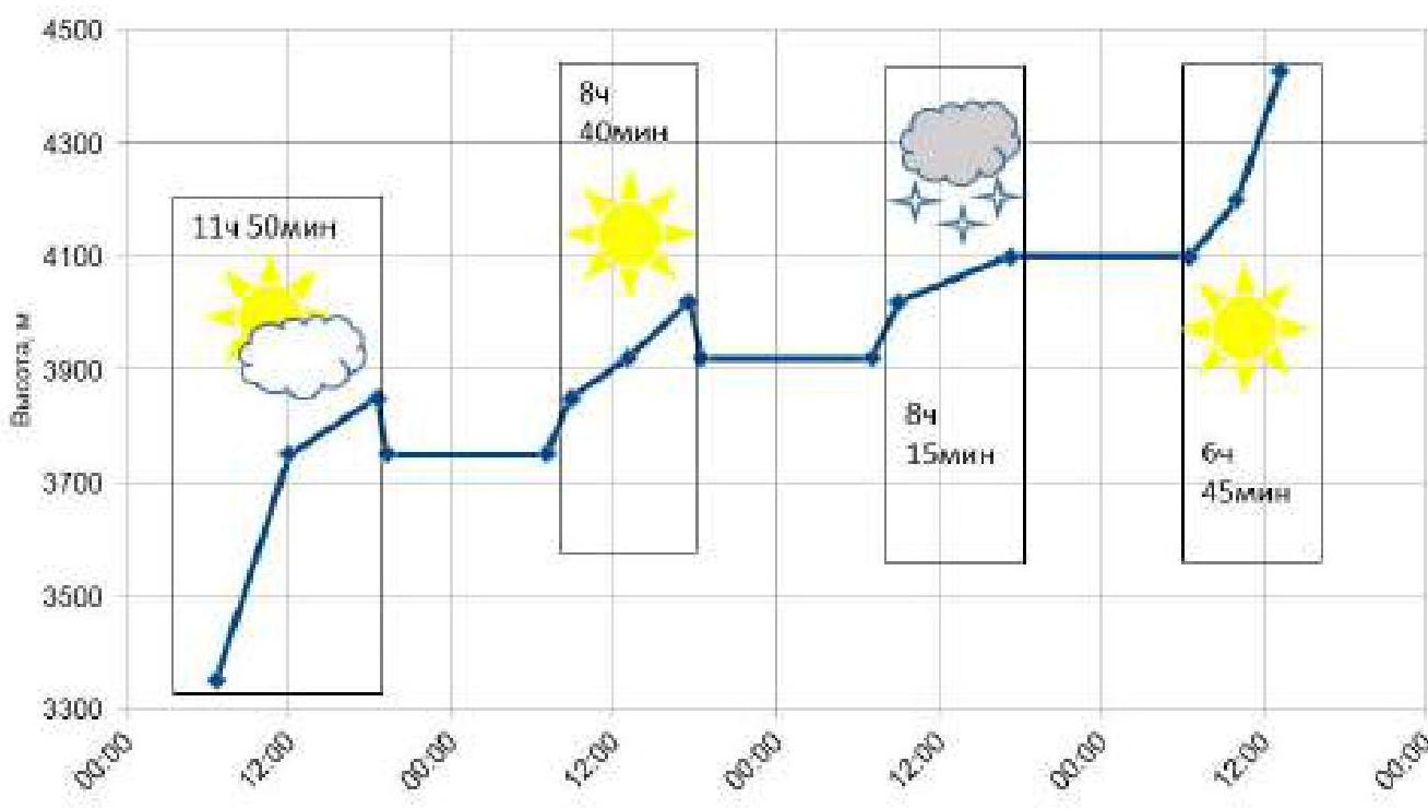
- Departure from Bezengi base – July 14, 2020, at 5:30 Start of work on the route – July 15, 2020, at 6:40 Reaching the summit – July 18, 2020, at 13:15 Return to Bezengi base – July 19, 2020, at 14:00
E-mail of the person responsible for the report: pascal-fom@yandex.ru
General photo of the summit
Misses-Tau, 4427
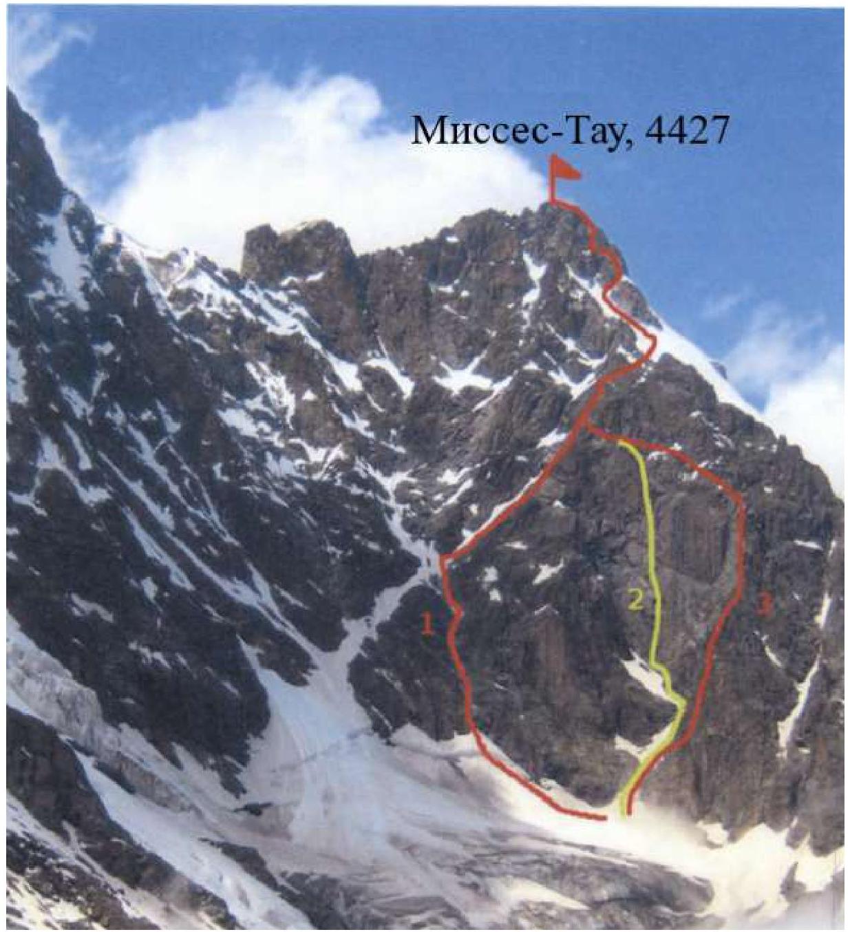
- Via W wall 5A
- Via center of W wall 5B – team's route
- Via right edge of W wall 5B
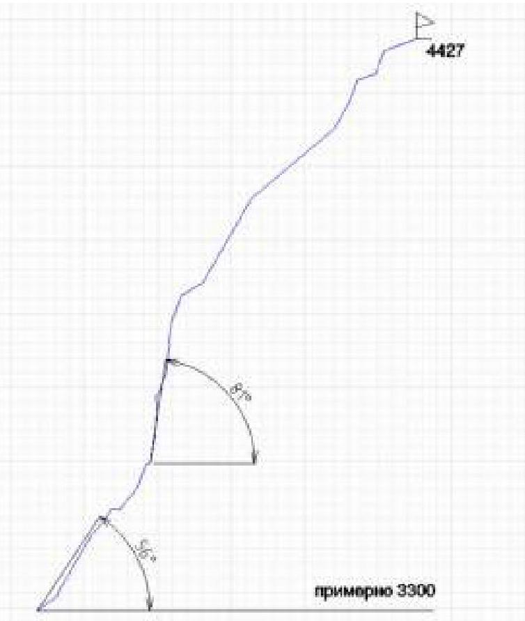
Route profile
4427
approximately 3300
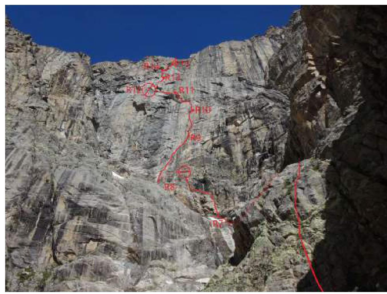
Technical photo
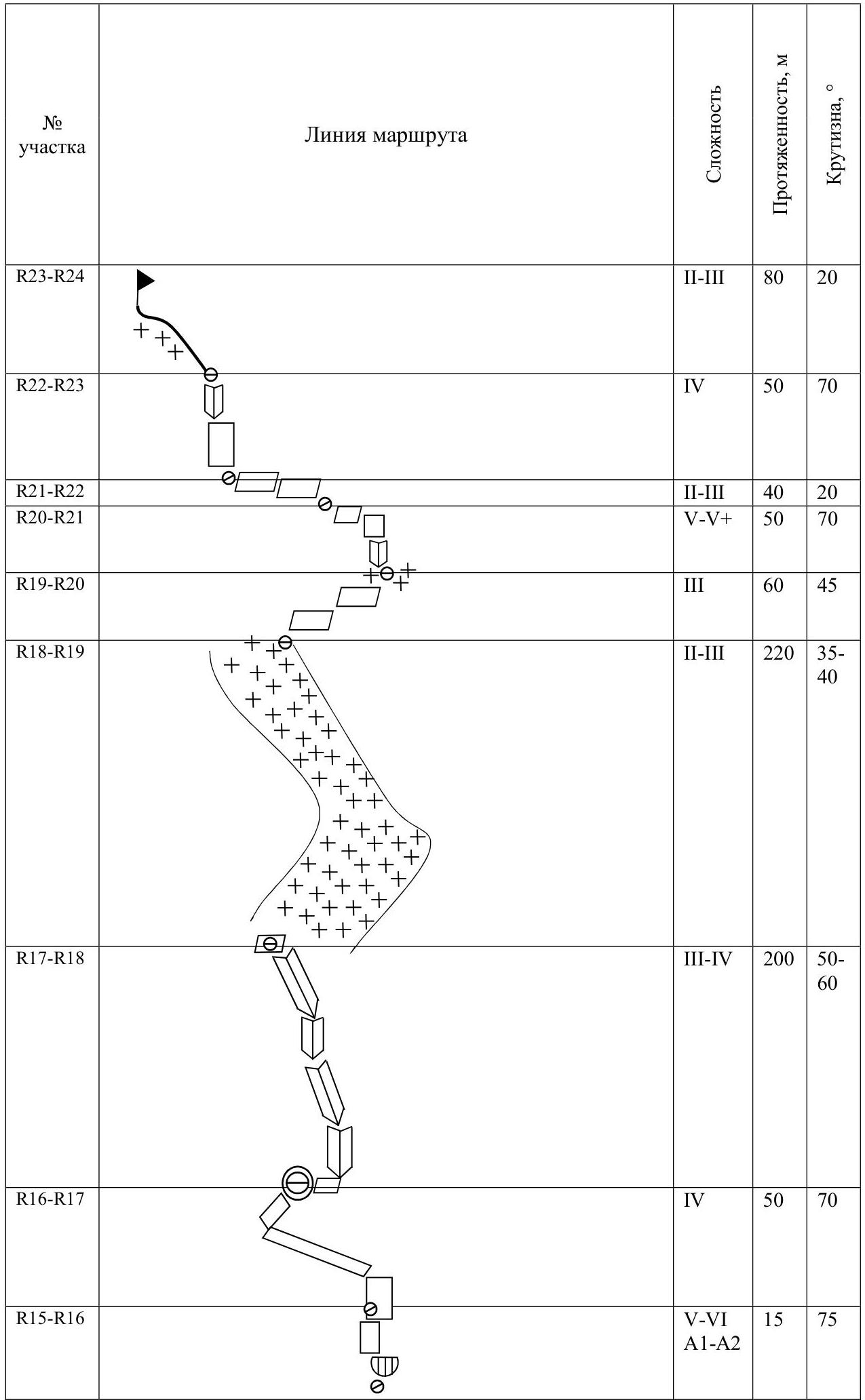
Route scheme in UIAA symbols
| Section No. | Complexity | Length, m | Steepness, ° | |
|---|---|---|---|---|
| R14–R15 | V–VI A1–A2 | 50 | 70–95 | |
| R13–R14 | VI A1–A2 | 50 | 80–90 | |
| R12–R13 | V–VI A1 | 50 | 80–90 | |
| R11–R12 | IV | 30 | 50 | |
| R10–R11 | V–VI A2 | 40 | 80–95 | |
| R9–R10 | VI A1–A2 | 50 | 80–90 | |
| R8–R9 | V–VI A1 | 50 | 75–90 | |
| R7–R8 | V | 50 | 70 | |
| R6–R7 | III | 50 | 50 | |
| R5–R6 | II–IV | 45 | 0–70 | |
| R4–R5 | III–IV | 50 | 50 | |
| R3–R4 | III–IV | 40 | 60 | |
| R2–R3 | III–IV | 50 | 60 | |
| R1–R2 | III–V | 50 | 60 | |
| R0–R1 | II | 30 | 35 |
Ascent graph
Route Description
Approach to the wall via a gentle snowy slope.
R1–R3
From the bergschrund straight up, through an inner corner 10 m V, then to the right up via "barranii lby" with short walls about 90 m. Easy rocks to a ledge under the overhanging part of the right edge. Belaying is difficult. There is some grass climbing. Station on a ledge (local bolt).
R3–R4
From the station upwards via broken rocks, aiming for an overhanging rock block. Further "on foot" to the overhanging block. Easy rocks, small scree. Under the overhanging block, a place for a station (local piton).
R4–R5
To the left up via broken rocks in traverse and then simply up to a scree ledge. Local piton at the station, remnants of an old rope.
R5–R6
To the left up via broken rocks, then scree to a snowpatch, under an overhanging wall, along the snowpatch to a broken wall in a "rantklyuft". Local piton, inconvenient station.
R6–R7
Up under the overhang via a broken inner corner and then via scree up to the next snowpatch. Own station near a steep corner.
R7–R8
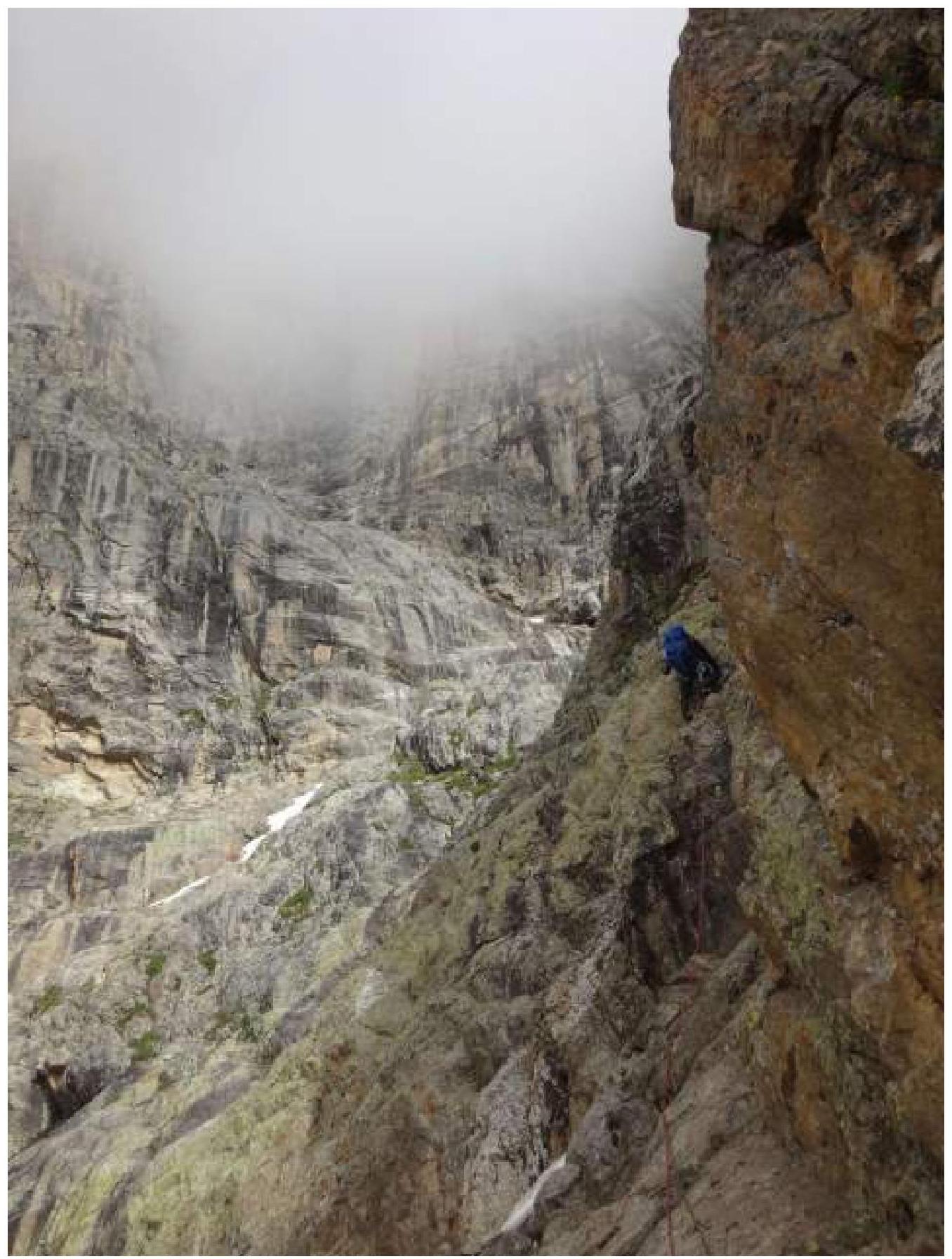
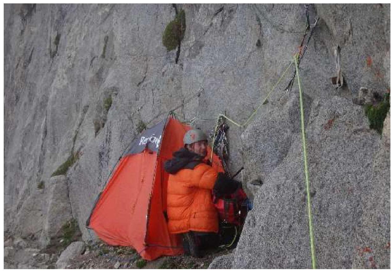
Up and to the left, via slabs V category of complexity to a large ledge with several blocks. Belaying is poor, some "live rocks" are present. On the large ledge to the right, a platform is equipped for an overnight stay.
Start of the wall section
R8–R9
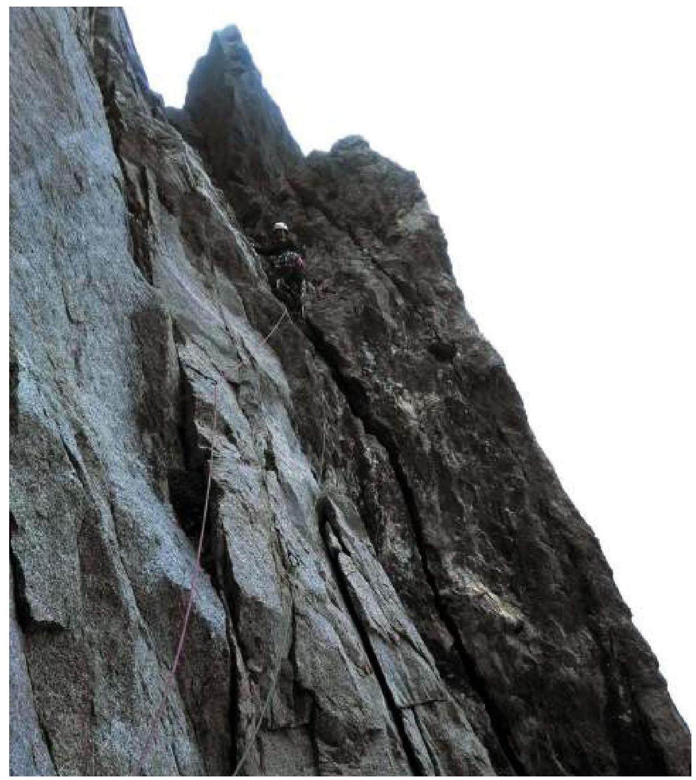
To the left below the ledge with the overnight stay, a local station on bolts. From it, a system of small ledges starts to the left. Via these ledges straight up, climbing, gradually moving to the right, under a characteristic crack-split. 10 m V. Further up and to the right, via a corner about 40 m, climbing up to 6B and A1 ITO.
R9–R10
Straight up via a steep inner corner. It seems easy to climb, but the whole crack is overgrown with grass. One has to "weed out" and therefore A1. Further, two inner corners diverge with blind, overgrown cracks. Movement via the left inner corner 40 m. Part of it is climbed 6a–b, but there are "live rocks". Mostly ITO A2. The crack leads to the right to a small ledge with a station (local bolt).
R10–R11
From the station to the left up about 20 m towards large cornices, aiming for the right (light) one, climbing 5c–6a and A1 ITO. Further: through a cornice up A2, at the top, there is a bolt. To the left via easy rocks to a station (local bolt).
R11–R12
From the station to the left up via easy rocks. Slabs, live blocks. Exit to a ledge with a control cairn. Place for an overnight stay. The ledge is located above a large cornice in the middle part of the wall.
R12–R13
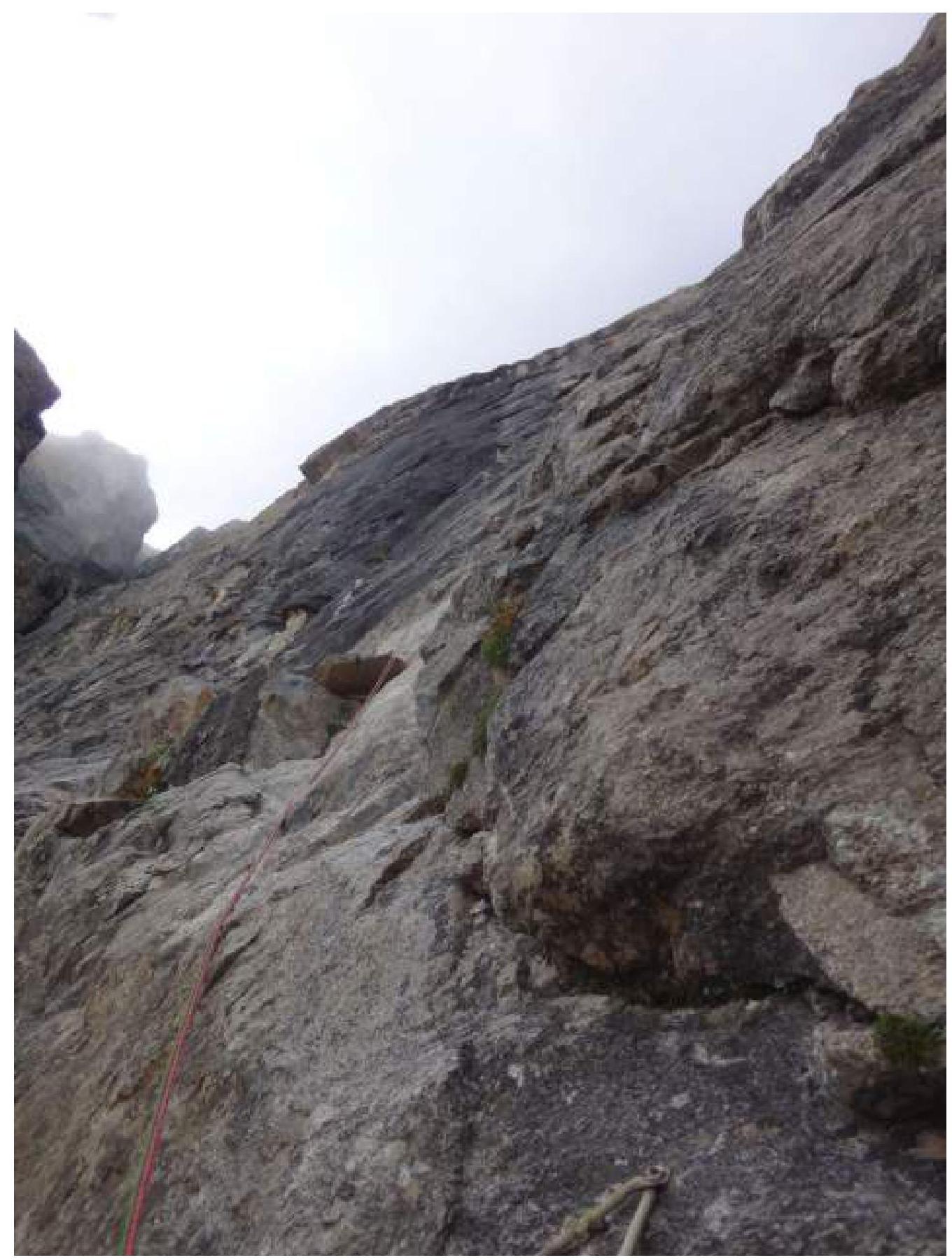
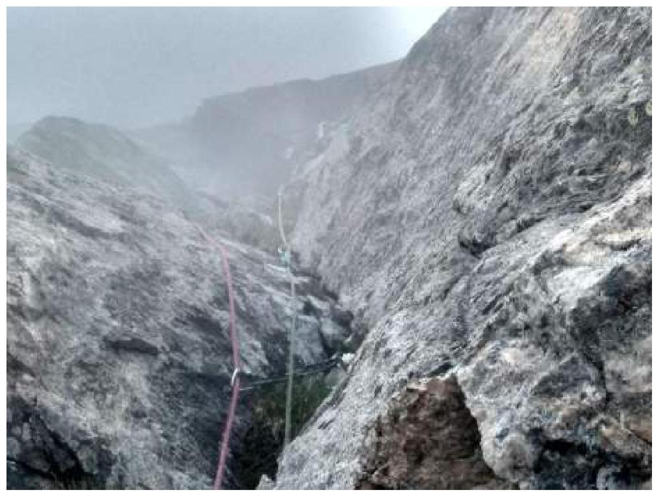
From the overnight stay via an inner corner to the right, climbing 5c–6a and A1 ITO about 30 m. Further, moving to the right via ledges with live blocks (V), and then to the left via easy rocks to a small ledge under an overhang. Station (local bolt).
R13–R14
Straight up via an inner corner under a black triangular cornice, about 15 m.14</B: Via W wall ( Mikhailov) on p. Bok in Ala-Archa. is considered a non-trivial 5B due to an intense wall section, but a small length.
It looks like you can climb, but everything is overgrown, therefore A1–A2. Circumventing the triangular cornice to the left, 5 m A2, local "iron". Further up via an overgrown blind crack 10 m A2, a few steps of "podlaz" to a local bolt. From the bolt, a pendulum to the left to a wide crack (at the narrowest place, a camalot No. 3 fits), therefore via a blind crack on the wall to the right A1–A2 and a few steps of "podlaz" to a station – a loop on a wedged block.
R14–R15
Up and to the right, via a bend about 15 m. Probably can be climbed (VI), but we have snow, therefore A1. Cracks are overgrown, one has to "weed out". Through an overhang under a stream a few meters up 10 A1 on steep slabs, via them to the right around a corner A1–A2. Behind the corner: up and to the right via blind cracks A2/+; again on steep slabs, there climbing (V) to the right around a corner. Wet climbing is psychologically challenging, considering the belay points on the section below. Behind the corner, a place for a station.
R15–R16
To the left of the station, a steep slab for climbing (local "iron"), but via wet rock straight up through a cornice 15 m 5c and A1. Station on a sloping ledge (local bolts).
End of the wall section
R16–R17
From the station to the right up and then to the left on a full rope length to scree ledges. Climbing is steep but not difficult, belaying is infrequent. To the right up on foot to the base of a large corner going up to the right. Place for an overnight stay.
R17–R18
Via strongly broken rocks of the large corner to the left up. About 200 m. Climbing is not difficult, sometimes small steep walls are encountered. Some local "iron" is present. At the end of the section, a place for a tent is laid out.
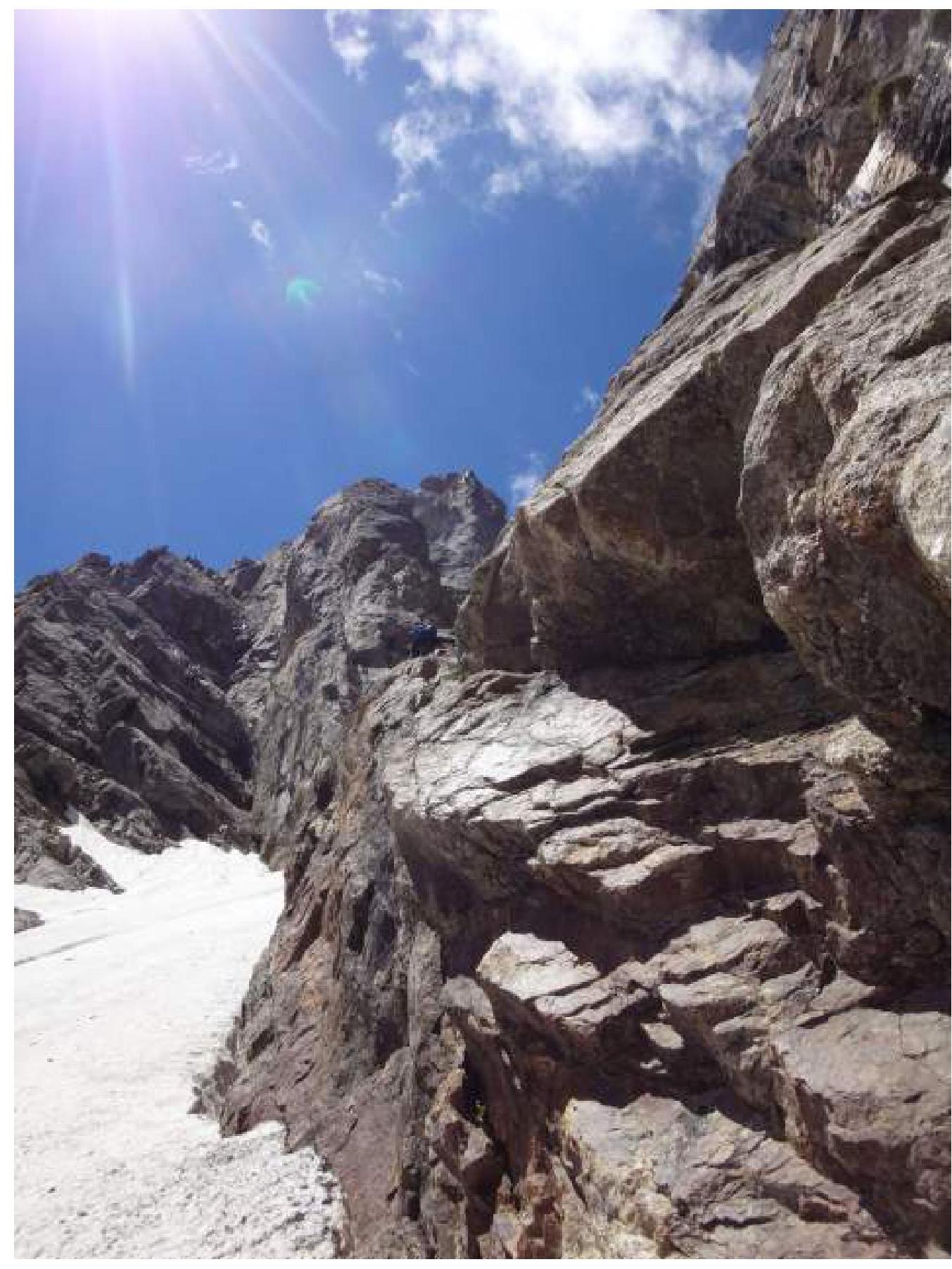
R18–R19
Via a snow-ice couloir, ascent to a snowy shoulder of Misses-Tau, about 100 m. Further to the left up via a snow-ice slope, circumventing a rocky "island". To the right, many old rappel loops are visible along the route.
R19–R20
To the right up to the summit of the rocky "island" via easy rocks – ledges.
R20–R21
Straight up via a monolithic corner (V–V+) on a full rope length, moving to the left. Station on a slab in an inner corner. To the left above, a native station on old pitons.
R21–R22
Traverse via ledges to the left past a local station and approach under a steep wall. Practically walking.
R22–R23
Up through a steep wall (a couple of difficult moves) and to the left up via steep, broken rocks (some local "iron" is encountered) on a full rope length to a comfortable ledge. To the right on a ridge, 10 m away, a rappel station can be seen on a ledge.
R23–R24
To the left up via an easy ridge about 80 m to the summit.
Descent
Via the ridge from the summit to a station (R23), climbing, the first rappel from a ledge to the right of the station 10 m leads to a large ledge (R21–R22), walking to a native station on pitons, from there a rappel to the summit of the rocky "island". Descend about 10 m to the side of the snowy couloir and a third rappel from a native station on a ledge straight to the snowpatch. Via snow, walking to the snowy shoulder. Further to the edge of the ridge to the right along the route, and there one can rappel (local loops), or half the way can be walked (depending on the slope condition) via snow to local rappel stations on pitons. 3–4 rappels via rocks and further via an ice slope to the glacier in the Misses–Brno cirque.
Team's Actions
Day 1. Departed from the base at 5:30. Arrived at the overnight stay under the route by 10:30. Heavy cloud cover – the route is not visible, decided not to prepare the route.
Day 2. Departed from the overnight stay at 5:45, started the route around 6:40. Fominykh worked first. By noon, reached a ledge where they planned to spend the night (R8). By 18:30, prepared almost up to R10. Periodically found themselves in a cloud. Descended to prepare for an overnight stay. Water can be replenished to the left in a scree couloir ("be careful, rocks!"). Overnight stay was in a lying position.
Day 3. By 8:50, climbed via pre-fixed ropes. Pilshchikova worked first. By 13:00, worked up to the next overnight stay (R12). By 17:30, fixed 2 ropes up to R14 and descended to prepare for an overnight stay. Overnight stay was in a semi-lying position. There is no water on the ledge. In a control cairn, a note from Kyiv climbers was found (on a photo), but no information about their successful completion of the route was found.
Day 4. Snow is falling in the morning. By 9:00, climbed via pre-fixed ropes (one of which was badly frayed on a sharp edge). Fortunately, they had a third rope to insure themselves. Fominykh worked first. While climbing R14–R15, got heavily wet (water was flowing like a shower via the rocks). By mid-day, it became drier, the weather cleared up, and the rocks dried. Reached R17 by 17:30, laid out a platform for a tent. Nearby, there was an ice cache, and plenty of water.
Day 5. Departed at 6:30. Pilshchikova went first. The terrain became easier, by 10:00, they were on the Misses shoulder. Climbed to the summit and by 15:00, returned to the shoulder. Continued descending. By 19:30, arranged an overnight stay on the Misses–Brno glacier.
Day 6. Descended via the glacier to "kursant" overnight stays and further down. Arrived at the base by 13:30.
Used Equipment
3 half ropes (50–60 m), 15 quickdraws (15–120 cm), a set of chocks (8 pcs), a set of friends-camalots (11 pcs, from C3 to No. 3), 8 anchors, fifi hooks, 3 jumars, a pulley, ladders and "krukonogi", 3 ice screws, 2 ice axes, 2 pairs of crampons, 1 tent (RF solo xace plus), 1 down jacket, 1 sleeping bag, a stove, a pot, 1 penka, a backpack, a bowline, personal gear.
A Few Words About the Route
The route is not very popular. We know of three ascents (2002 – Rakhmanin, 2006 – Nikitin, and 2012 – Molodozhen). All three teams suggested a 6A category in their reports.
The length of the main part is not large, about 7 rope lengths, before and after it, there is some "podlaz" and "dolaz". This immediately brings to mind the very popular Mikhailov route on p. Bok in Ala-Archa, considered a non-trivial 5B due to an intense wall section but a small length. However, there is no "podlaz" there, and one can almost do without ice equipment, and water can be fetched. If Bok is compared to the relief of Karavshin (we haven't been there), we would compare Misses to the Crimean Sokol. The same slabs with blind cracks (only very overgrown).
After "cleaning" the cracks from grass and dirt, the percentage of free climbing on the route can be increased if the weather is right (in Bezengi, ha), so if the route gains popularity, the time for its completion can be further reduced. We believe that a strong team in ideal conditions can complete it with one overnight stay.
Sometimes, a large camalot (at least No. 4) and another thin anchor were lacking; otherwise, the set was well-chosen. A few thin carabiners would not be superfluous (local bolts have thin ears).
On the route, some local "iron" is encountered, part of which is, of course, in a deplorable state. Bolts are present on most stations of the main part of the route, at least one, and a couple are in necessary places for the passage.
The ledge on R8 would be suitable for an overnight stay for three people in a lying position, but on R12, even for two, it was a bit cramped; they lay in a half-turn position: for three, it would be only sitting.
If comparing this route to other 5B routes we've done, it is comparable to m. Mikhailov on p. Bok, and definitely more complex than:
- m. Ruzhevsky on the 5th tower of the Corona
- m. Nikiforenko on p. Semenov-Tyan-Shansky
- m. Laskavy on Chegem
- m. Samoded on Erydag
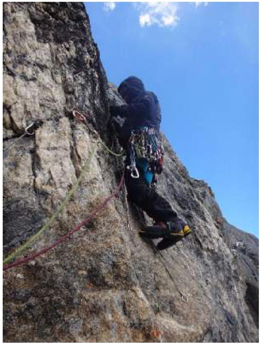
Photos from the Route
 R1–R2
R1–R2
 R3–R4
R3–R4
 Start of R7–R8
 Start of R8–R9
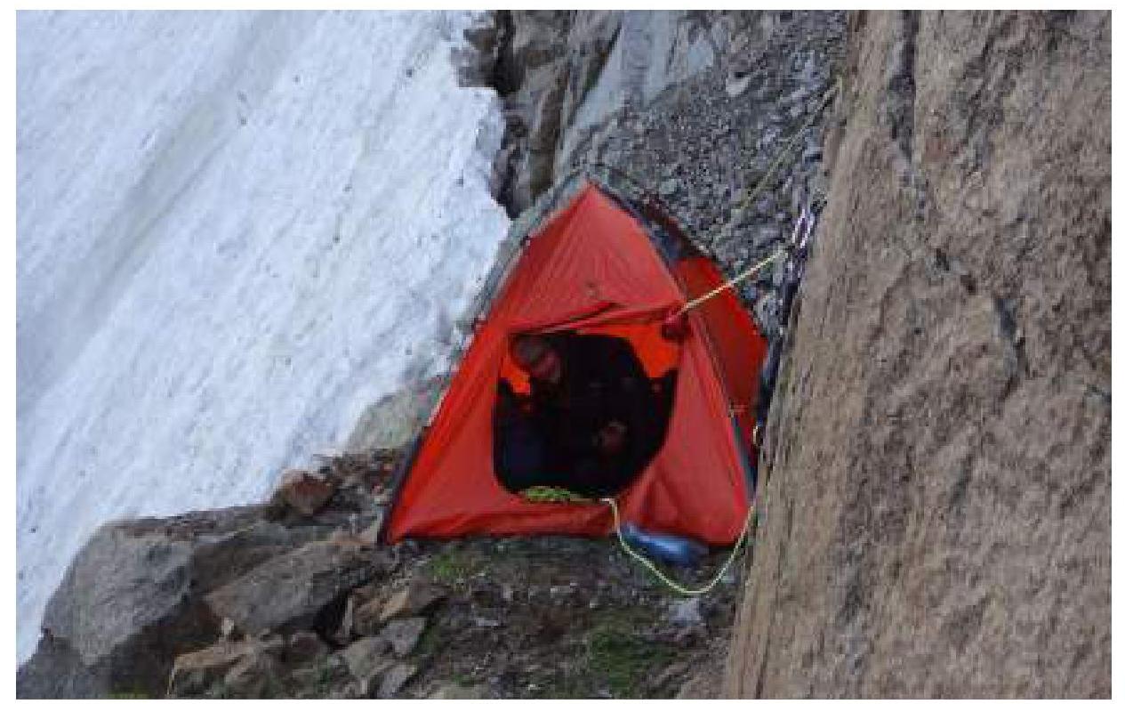 Overnight stay on R8
 End of R8–R9
 Start of R9–R10
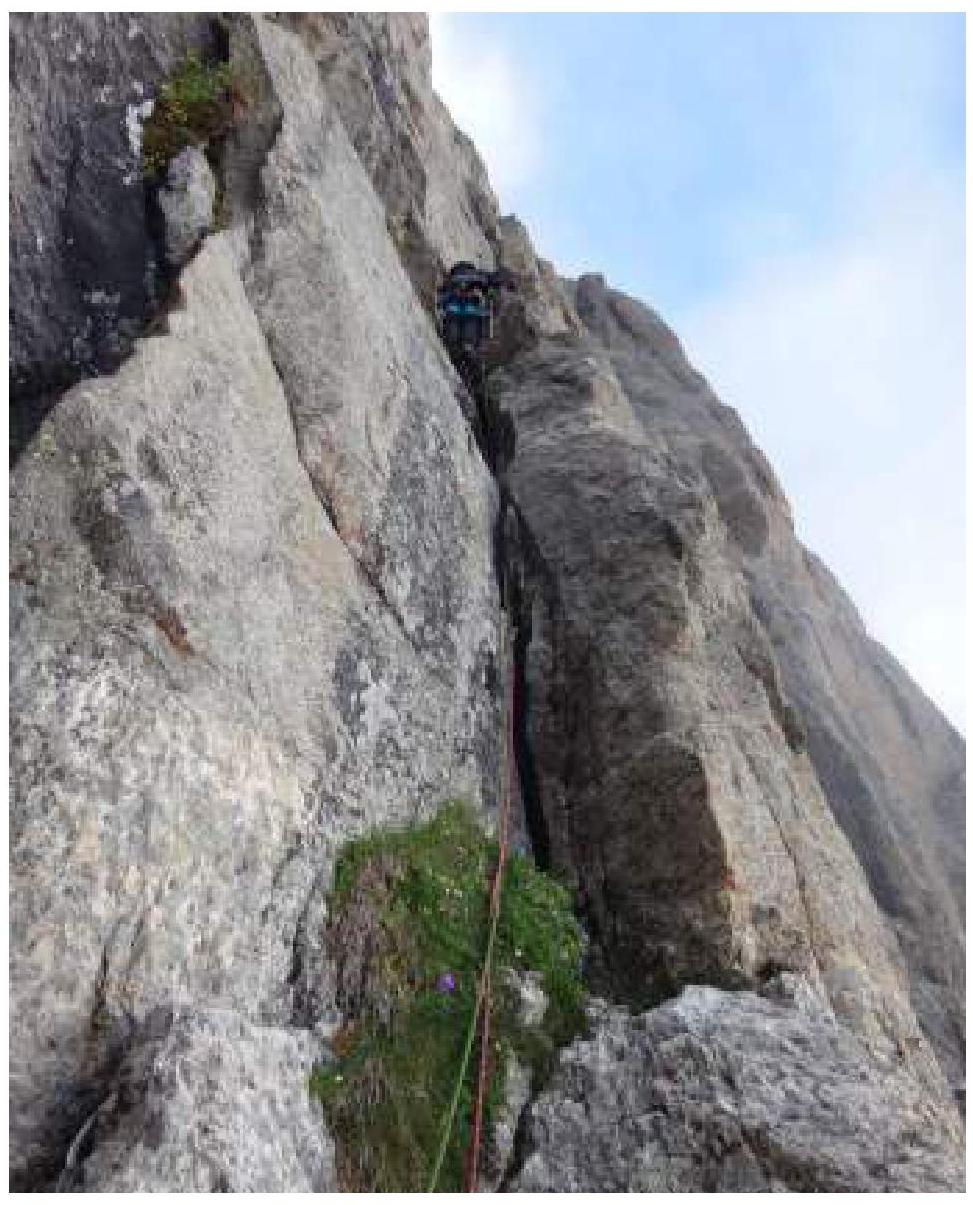
 R10–R11
 Start of R11–R12
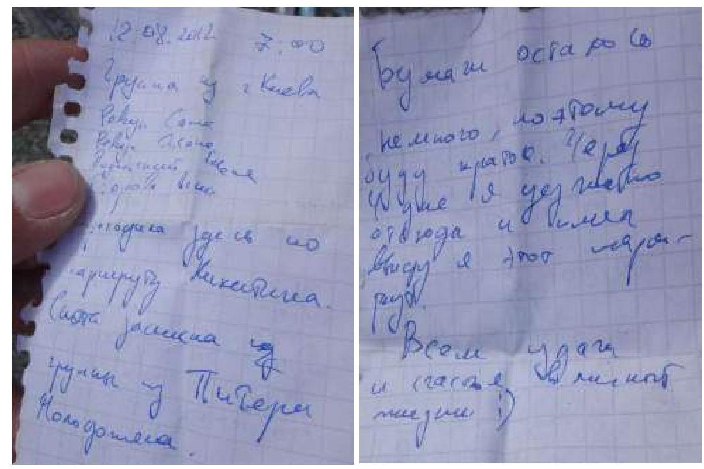 Note from the control cairn
 R12–R13
 Start of R13–R14
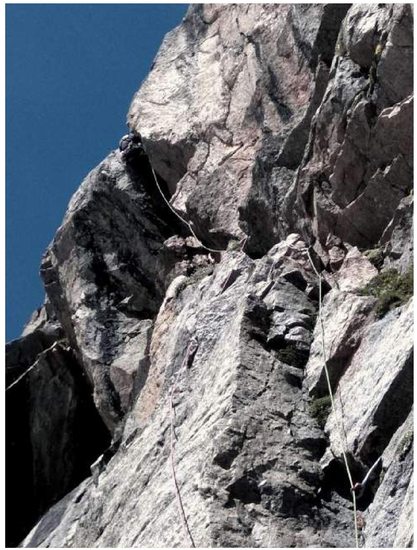
 Upper part of R13–R14
 Overnight stay on R12
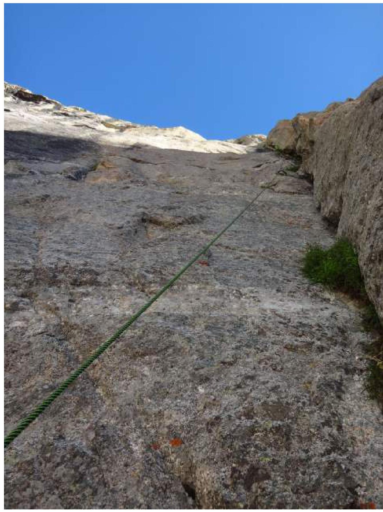
 Mid-R14–R15
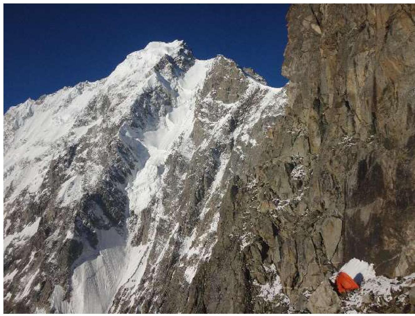 Overnight stay on R17
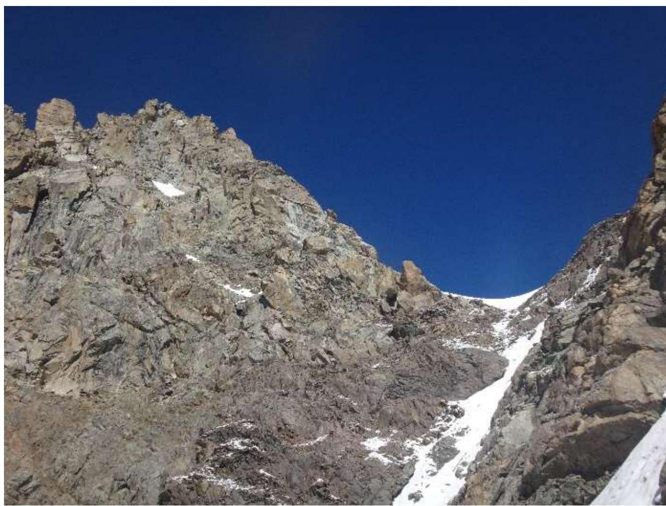 Exit to the shoulder, R18–R19
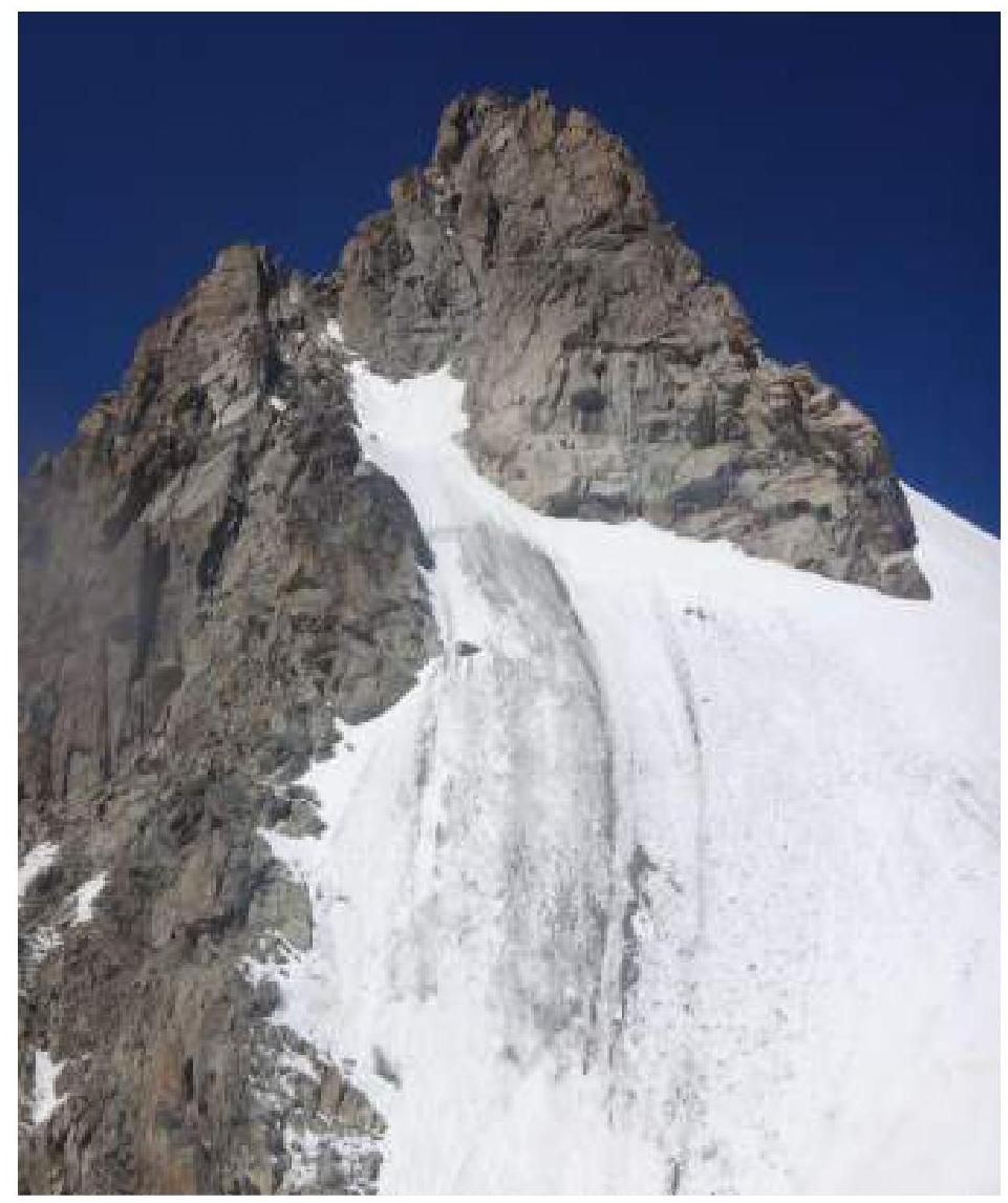 Ascent to the rocky "island", R18–R19
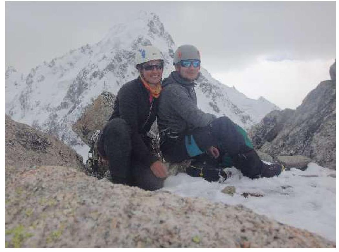 On the summit