1. Climbing Report for the Ascent of Misses-Tau via the Right Counterfort in the Wall, Category 5B (Combined) Route by Yu. Shevchenko's Mixed Team from Magnitogorsk and Yekaterinburg "MiKraLip" from 17:00 on August 17, 2024, to 17:00 on August 21, 2024
1. Ascent Passport
| 1. General Information | ||
|---|---|---|
| 1.1 | Name, sports rank of the team leader | Lipatnikov Andrey Vladimirovich, 1st sports rank |
| 1.2 | Name, sports rank of the participants | Krasnov Mikhail Yuryevich, 1st sports rank, Mishchenko Ivan Valeryevich, 2nd sports rank |
| 1.3 | Name of the coach | Lipatnikov Andrey Vladimirovich |
| 1.4 | Organisation | Chelyabinsk Region Alpine Federation, Sverdlovsk Region Alpine Federation, MBU "TsFSD" Magnitogorsk |
| 2. Characteristics of the Climbing Object | ||
| 2.1 | Region | Central Caucasus |
| 2.2 | Valley | Mizhirgi |
| 2.3 | Number according to the 2013 Classification Table | |
| 2.4 | Name and height of the peak | Misses, 4425 m |
| 2.5 | Geographical coordinates of the peak (latitude/longitude), GPS coordinates | 43.069955, 43.132401 |
| 3. Characteristics of the Route | ||
| 3.1 | Route Name | Via the right counterfort in the wall |
| 3.2 | Proposed category of difficulty | 5B |
| 3.3 | Degree of route exploration | — |
| 3.4 | Terrain characteristics of the route | Combined |
| 3.5 | Elevation gain of the route (altimeter or GPS data) | 1270 m |
| 3.6 | Length of the route (in meters) | 1880 m |
| 3.7 | Technical elements of the route (total length of sections with different difficulty categories, indicating terrain type (ice-snow, rock)) | Category I ice — 30 m, Category II rock — 170 m, Category II ice — 110 m, Category III rock — 565 m, Category IV rock — 445 m, ice — 120 m, Category V rock — 285 m, Category VI rock — 155 m |
| 3.8 | Average slope of the route, (°) | ~50° |
| 3.9 | Average slope of the main part of the route, (°) | ~70° |
| 3.10 | Descent from the summit | Via the Category 4B route to the Mizhirgi valley |
| 3.11 | Additional route characteristics | Absence of snow and water up to the "shoulder" of Misses |
| 4. Characteristics of the Team's Actions | ||
| 4.1 | Time of movement (team's walking hours, in hours and days) | 48 hours, 4 days |
| 4.2 | Overnight stays | Bivouac on the first night, bivouac on the second night, platform on the third and fourth nights |
| 4.3 | Approach to overnight stays | 18:30, August 17, 2024 |
| 4.4 | Start of work on the route | 16:00, August 17, 2024 |
| 4.5 | Reach the summit | 14:00, August 20, 2024 |
| 4.6 | Return to the base camp | 18:00, August 21, 2024 |
| 5. Person Responsible for the Report | ||
| Name, e-mail | Krasnov Mikhail Yuryevich mike261@yandex.ru |
2. Description of the Area
The Bezengi alpine camp is located in Kabardino-Balkaria on the northern slope of the Great Caucasus. Figure 1 shows the approximate approach route from the Bezengi alpine camp to the judges' bivouac, from which the ascent was made, marked with a red line, and the approach to the start of the route, marked with a green line.
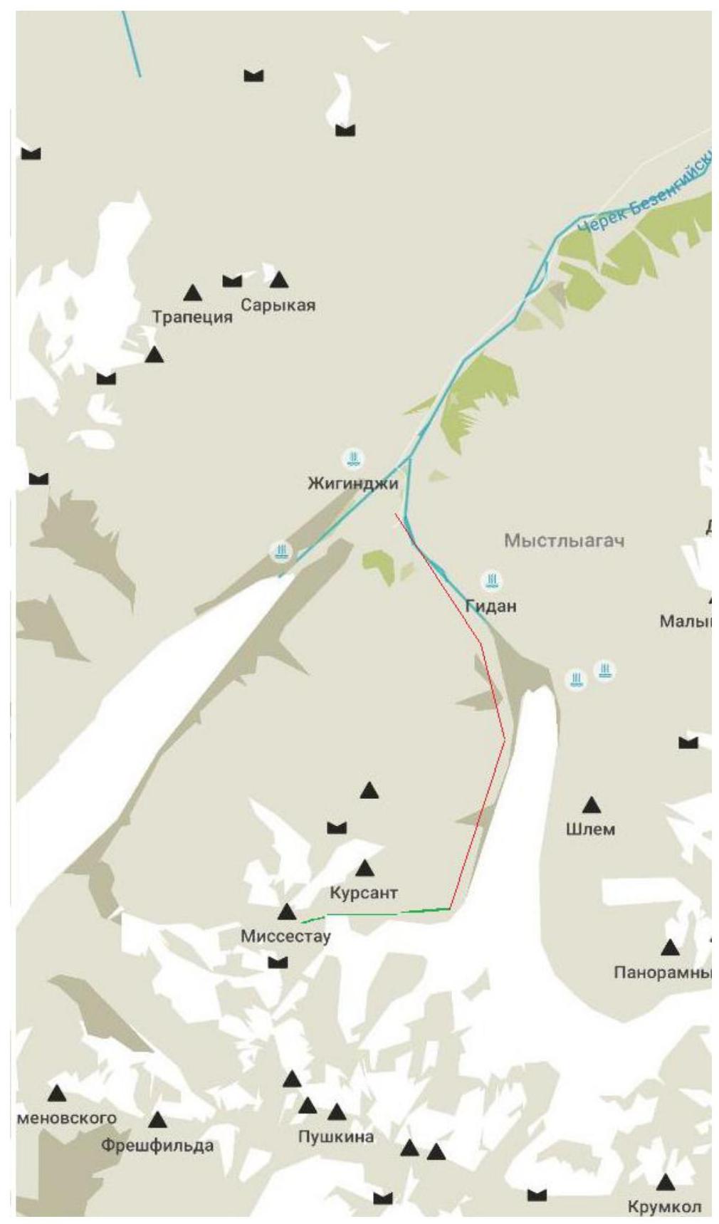
Figure 1 – Map of the climbing area
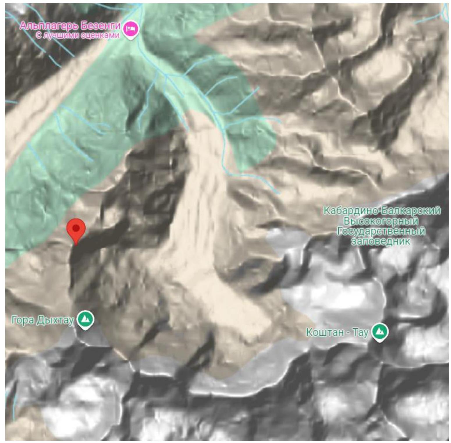
Figure 2 – Relief map of the area
3. Route Description
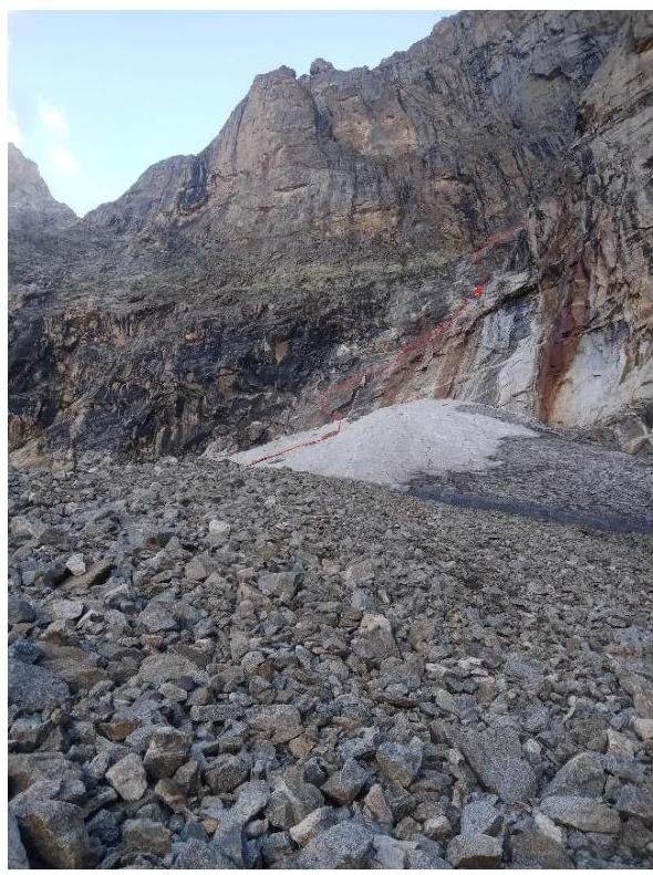
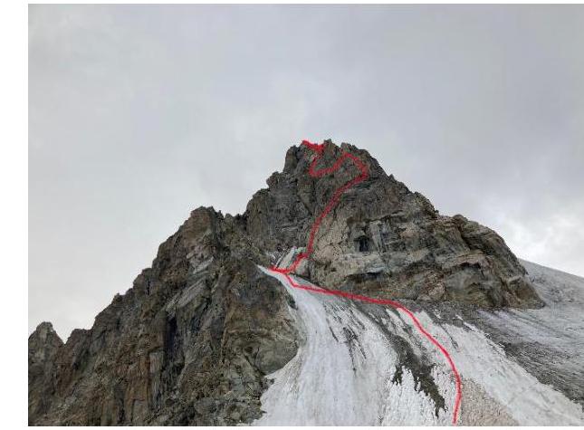
In Figure 3, the approximate movement along the route is marked in red, with insurance stations indicated. The approximate descent route is marked in green.
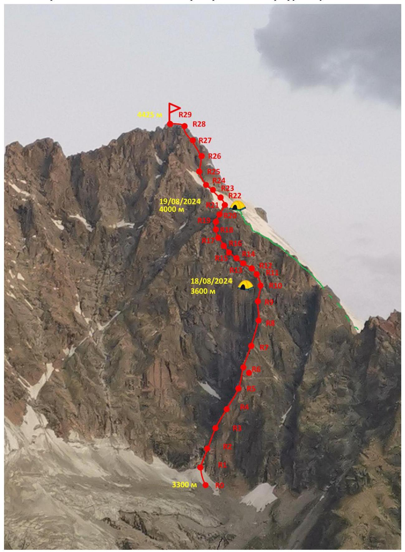
Figure 3 – Technical photo of the route
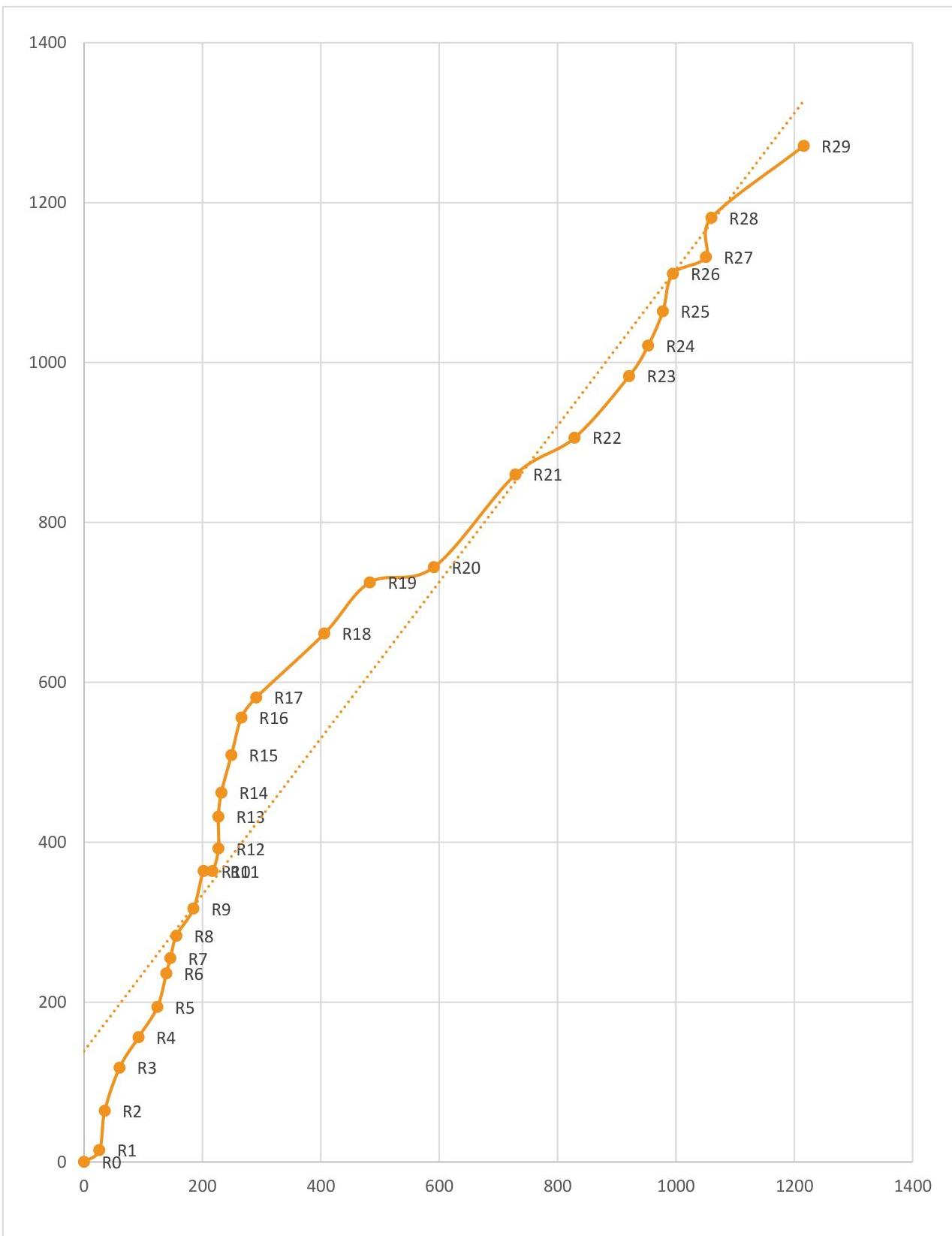
Diagram 1 – Route profile
4. Approach to the Route
Figure 4 shows the approach route to the climbing route from the judges' bivouac. The summit is indicated by an arrow.
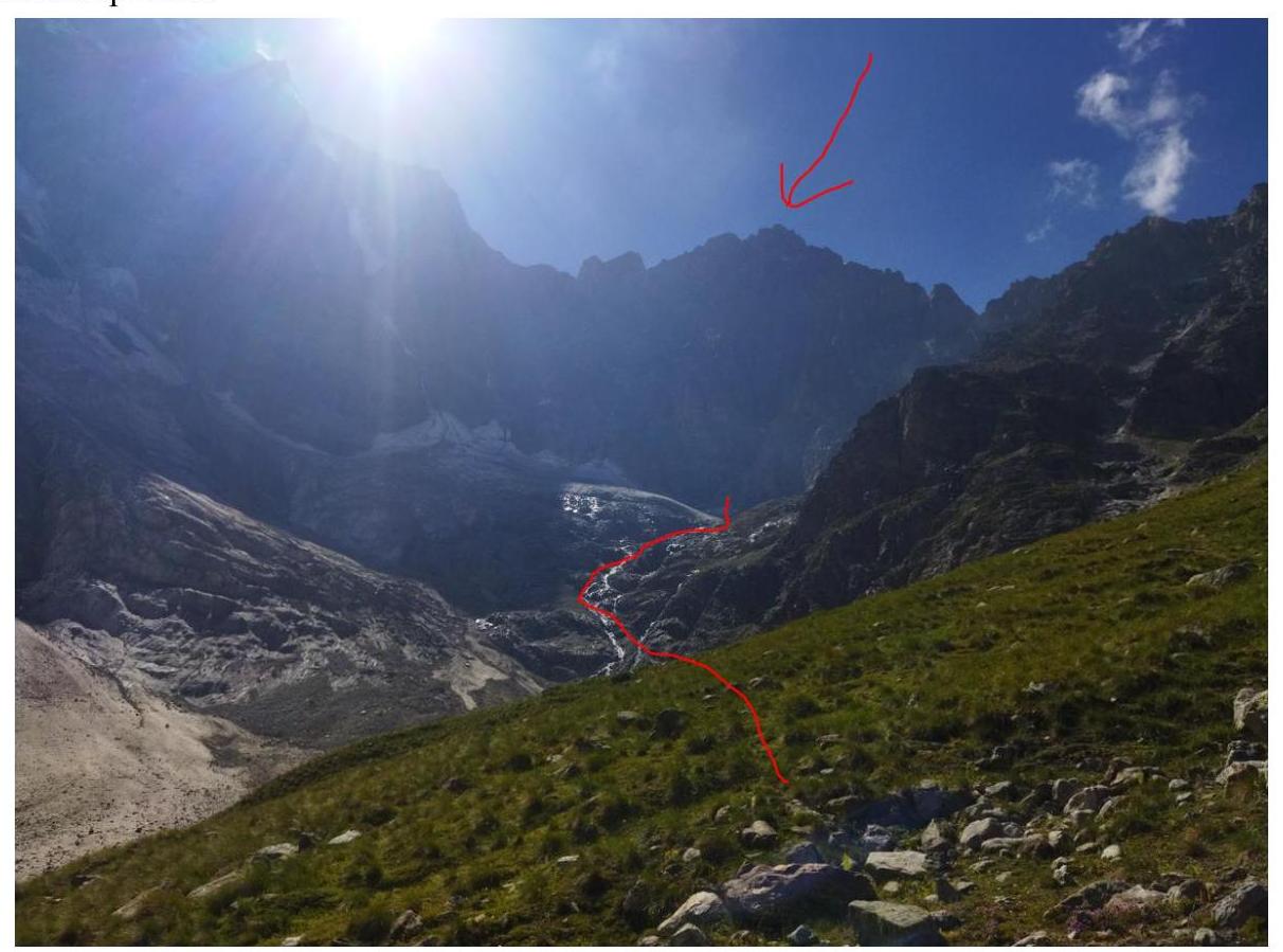
Figure 4 – Approach to the route
5. Route Description in UIAA Symbols
| Section | UIAA | Difficulty | Length | Steepness |
|---|---|---|---|---|
| R28–R29 |  | III | 180 m | 10°–45° |
| R27–R28 | V | 50 m | 80° | |
| R26–R27 | II | 60 m | 20° | |
| R25–R26 | V | 50 m | 70° | |
| R24–R25 | IV | 50 m | 60° | |
| R23–R24 | IV | 50 m | 50° | |
| R22–R23 |  | IV | 120 m | 30°–50° |
| R21–R22 | II | 110 m | 25° | |
| R20–R21 |  | II–III | 180 m | 25",°–50° |
| R19–R20 | I–II | 110 m | 0°–10° | |
| R18–R19 |  | III–IV | 100 m | 20°–60° |
| R17–R18 | II–III | 140 m | 20°–45° | |
| R16–R17 | V–VI | 35 m | 45° | |
| R15–R16 | V–VI | 50 m | 70° | |
| R14–R15 | IV | 50 m | 70° | |
| R13–R14 | VI | 30 m | 80° | |
| R12–R13 | VI | 40 m | 85°–110° | |
| R11–R12 | V | 30 m | 70° | |
| R10–R11 | III | 15 m | 0° | |
| R9–R10 | IV | 50 m | 70° | |
| R8–R9 | IV | 45 m | 50° | |
| R7–R8 | V | 30 m | 70° | |
| R6–R7 | V | 20 m | 70° | |
| R5–R6 | V | 45 m | 70° | |
| R4–R5 | IV | 50 m | 25°–70° | |
| R3–R4 | III | 50 m | 30°–60° | |
| R2–R3 | V | 60 m | 30°–80° | |
| R1–R2 | IV | 50 m | 80° | |
| R0–R1 | I | 30 m | 30° |
6. Route Description by Sections
| Section | |
|---|---|
| R0–R1 | Up the snowy slope, sticking to the left side. Climbing without crampons is possible. |
| R1–R2 | Up and right along the ledge. Easy climbing in boots. |
| R2–R3 | Up the wall, easy climbing in boots, but it's better to hold onto the points. Then up and right along the "ram's foreheads" under the wall. There's a place for an overnight stay a bit further right, with a piton hammered in. |
| R3–R4 | Up and right along the wall and slope. Easy climbing in boots. |
| R4–R5 | Up the wall and right along the ledge. Easy climbing in boots. If you see a plug in the crack, it means you've missed the ledge. |
| R5–R6 | Vertically up the internal corner under the overhanging cornice, with a station right under the cornice. The station is hanging, with local "iron" (piton). It's recommended to have 2 sets of friends for convenience. It's recommended to use rock shoes for climbing from here onwards. |
| R6–R7 | To the right of the cornice and up the internal corner to a stone ledge about 30–50 cm wide. |
| R7–R8 | Left and up the crack, then up to a ledge. Traverse along the ledge to the right into a "little cave". |
| R8–R9 | Up the internal corner and further up the wall. |
| R9–R10 | Climb the wall to the left, enter the scree couloir. Move along the couloir, sticking to the left side. The couloir is divided into 2 parts by a "gendarme"; be sure to bypass it on the left. The station is on a stone ledge. |
| R10–R11 | Traverse 15 m to the wall above a pronounced ledge. You can set up an overnight stay on this ledge. |
| R11–R12 | It's recommended to put on rock shoes immediately. Up the crack to a gap in the ridge, where there's a horizontal slab about 2 x 2 meters. Climbing is moderately difficult. |
| R12–R13 | First, 3 m traverse to the right along a small ledge. Then right and up the internal corner for 20–25 m, with a нависающее живьё (overhanging living rock) on the right at the end of the corner. Then a ledge and a 15 m wall up. Climbing is very difficult. At the end of the section, there's a cornice and a jammed stone forming a plug. |
| R13–R14 | Climb over the plug (it's hard for those who are jumaring with a backpack under the plug) and continue up the wall, following a system of cracks. The relief becomes easier and leads to a large ledge, where you can set up an overnight stay. This is a key section. Climbing is very difficult. |
| R14–R15 | Up a system of walls and ledges. Climbing is moderately difficult. The relief is heavily destroyed. |
| R15–R16 | From the station, traverse to the right through a gap, then up a large, smooth slab at an angle of 50–60° to the right and up to a ledge. Climbing is difficult. There's a station in a crack. Then it's vertical. |
| Up, then up and left onto a smooth slab under the wall. Climbing is difficult. The original description is below. Since orientation is difficult, we climbed our own variant. (Up the walls. In the upper part of the section, the relief consists of steep slabs, making it very difficult to set up insurance. Climbing is difficult. The ridge of the counterfort ends here.) | |
| R16–R17 | Bypass the wall by traversing to the right and up — movement along the ridge. There are 2–3 local shвеллера (channels) on the section. Climbing is difficult. The relief is heavily destroyed in places. The station is on a pillar on the ridge. It's better to remove rock shoes here. |
| R17–R19 | Move left and up for 250–300 m. Follow a series of ledges to the base of the bastion forming the "shoulder" of Misses-Tau. There are difficult sections up to 10 m in places. The relief is heavily destroyed. It's recommended to move in rope teams here. There's a good place for a tent at the end. |
| R19–R22 | Along the left wall of the counterfort, follow simple rocks for 300–400 m to the "shoulder" of Misses. |
| R22–R23 | From the overnight stay on the "shoulder", move up along the bergschrund. |
| R23–R24 | Follow the ice to approach the rocks, then along the rocks, traverse left to the icy slope. Then exit to a scree ledge. |
| R24–R25 | Through steep "ram's foreheads" with few handholds, climb to a ledge under the wall. Move along the wall to the left and set up a station. |
| R25–R26 | Up the wall, enter a wide internal corner, and move up and to the right. After passing a not-too-steep wall, you can set up a station here. |
| R26–R27 | Along the internal corner, move up and to the left. The station is on a ledge under a small overhang. |
| R27–R28 | Simultaneously follow a wide ledge under the start of the wall, leading to the ridge. |
| R28–R29 | Up the wall to the ridge. |
| R29 – summit | Initially, climb the steep ridge, then walk to the summit. |
7. Tactical Actions of the Team
August 17 — Approach to the Misses-Tau route, Category 5B, processing R0–R2. August 18 — Section R2–R11. August 19 — Section R11–R21 (Misses "shoulder"). August 20 — Section R21–R28–R21 (Summit assault). August 21 — Descent to the base camp.
The team used two main dynamic ropes and one static rope. When preparing for the ascent, bivouac and personal gear, food, gas, and other supplies were optimized by weight to lighten the leader's load. Each of the three participants took turns being the first on the route for one day.
On the first day, the team left the judges' bivouac after lunch, approached the wall, and decided to process the route up to the ledge on R2. They started working on section R0 at 16:00. The leader was on station R2 by 18:00. Since it was getting dark and it was unclear where the nearest suitable place for a tent was after R2, they decided to spend the night on the ledge. There was no water on the ledge, although they had been promised some by climbers who had done the route 3 days before.
On the morning of the second day, after hanging rappel lines down, the leader went for water. They started working at 8:00. By 17:00, the group had gathered on the overnight stay on ledge R11.
On the third day, they started working at 5:00. They reached the "shoulder" of Misses-Tau by 17:00 and set up an overnight stay.
The next day, the team started working at 6:00, which was late — rocks started falling. It's highly recommended to pass the icy section of the route to the pre-summit tower in the dark!!! They reached the summit at 14:00. They descended to the overnight stay on the "shoulder" by 17:00 and decided to spend another night there.
The next day, the group left the overnight stay at 6:00 and began descending along the right ridge. First, there were rappels down rocks mixed with icy sections, about 8–10. Then there were 2 more rappels down the glacier. After that, they moved in rope teams along the glacier. They reached the judges' bivouac around 14:00, had some tea, packed up, and headed to the camp, arriving around 18:30.
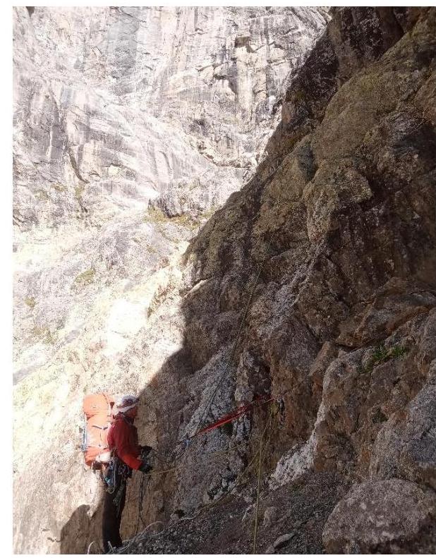
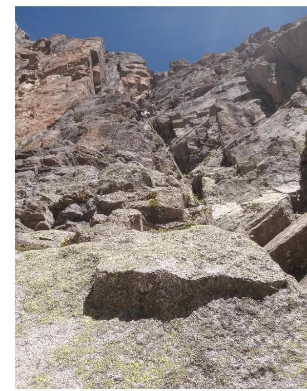
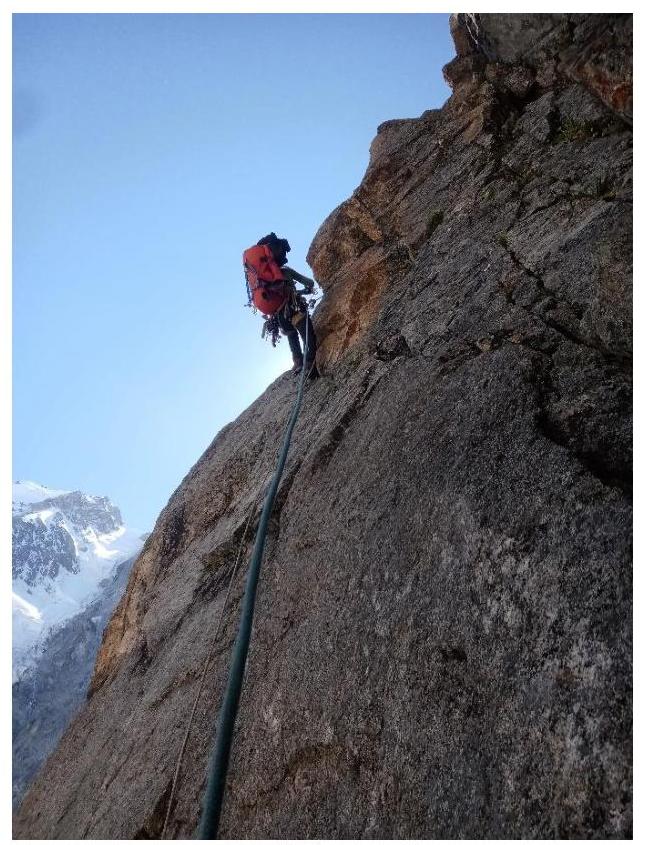
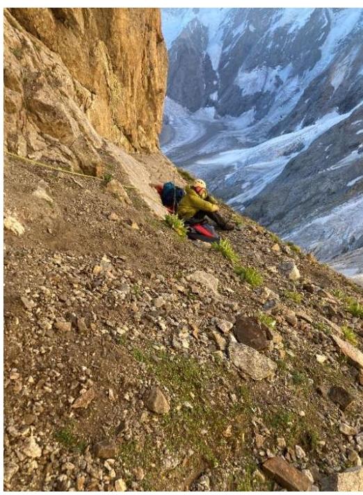
8. Photographic Materials
Start of the route

R2–R3
Station R4
R5–R6
R7–R8
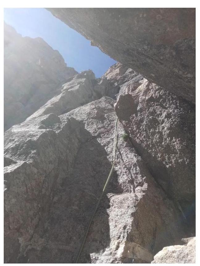
R8–R9
R14–R15
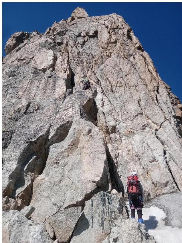
Approximate line of the 3rd section
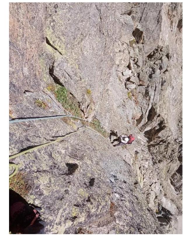
R26–R27
Overnight stay on R3
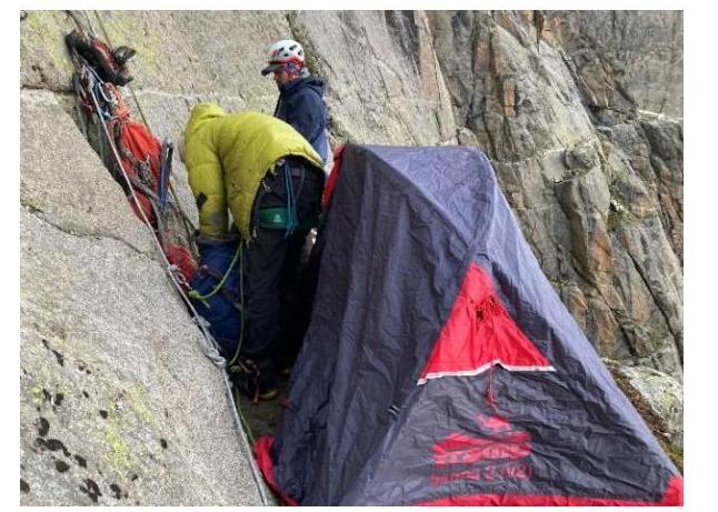
Overnight stay R11
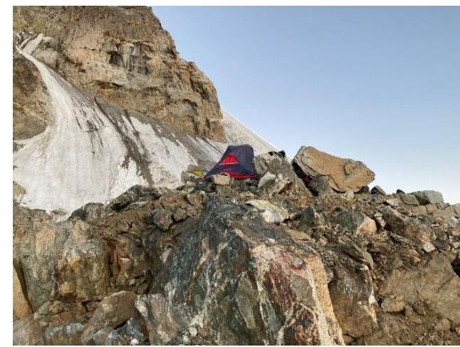
Overnight stay on the "shoulder" R21

Approximate descent line
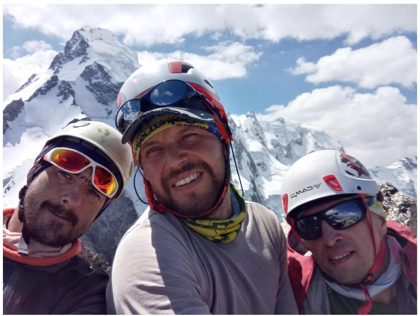
Brave mountaineers on the summit with Dykhtau in the background