Moscow Alpinism Championship 2010. Technical Climbing Class
Ascent Report
Teams of the Moscow Power Engineering Institute Climbers' Club
On Mt. Mizhirgi (3) 5025 m.
Route via the S ridge, 5A category of difficulty, L. Salandina, 1934, 27.08.2010
Moscow 2010 Passport
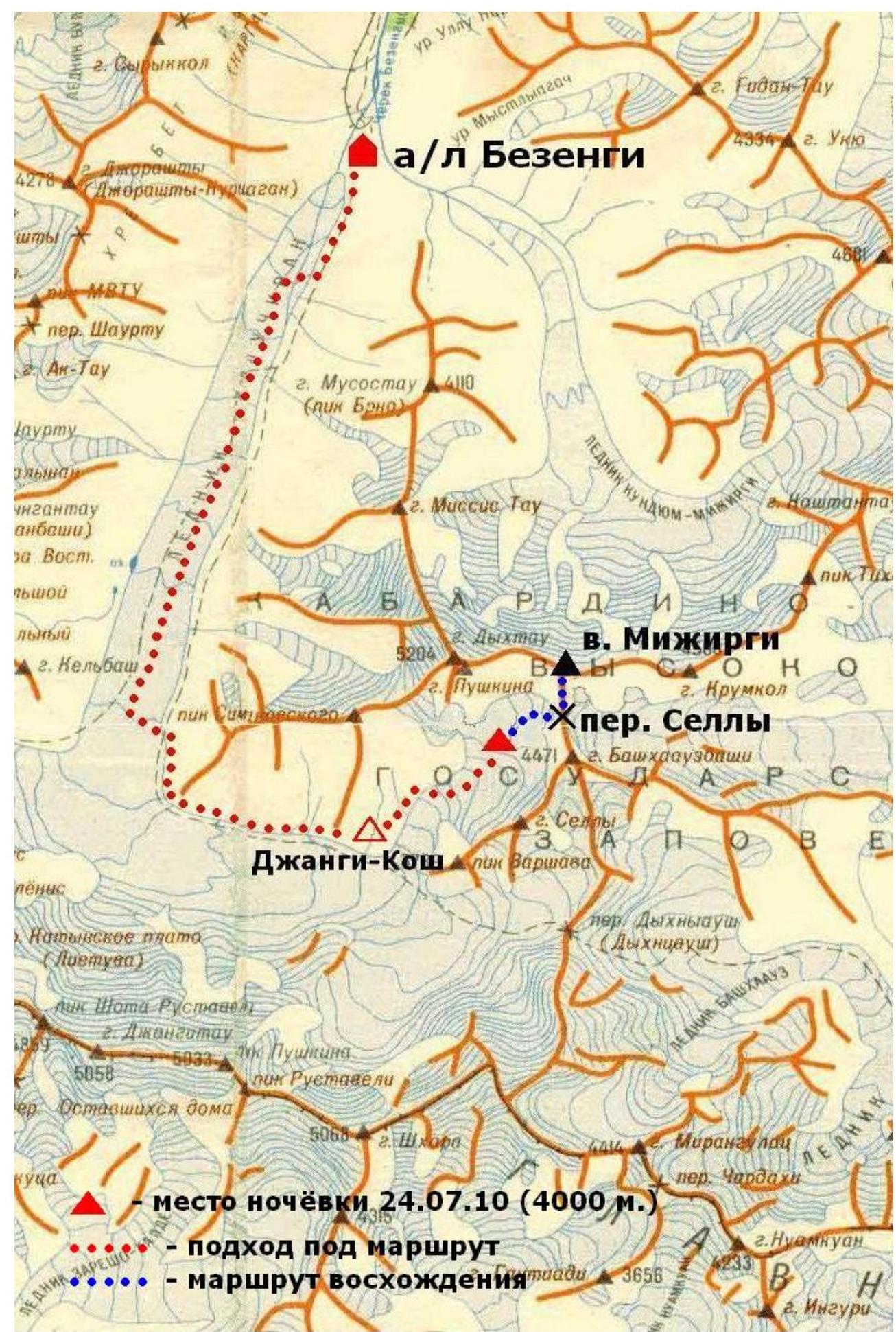
- Caucasus.
From Kitlod Pass to Gezivts Pass (north of the Main Caucasian Range) 2.5
- Mt. Mizhirgi (3) 5025 m., 2.5.107
via S ridge, L. Salandina route, 1934.
- 5A category of difficulty.
- Route type — combined.
- Elevation gain — 1030 m. (ridge part — 675 m.)
Distance — 2100 m. (ridge part — 1200 m.). Section lengths:
- IV category of difficulty — 500 m.
- V category of difficulty — 50 m.
Average slope of the entire route — 35°. Ridge part — 45°. Key section (R5–R6) — 70°
- Equipment used:
rock pitons — 3, ice screws — 10, protection gear — 140, previously driven pitons — 12.
- Climbing hours — 39, days — 4.
- Team leader: Yermakov Yu. N. II grade.
Participants: Neumoina K. E. II grade., Igumnov A. B. II grade.
- Coach: Kutkin S. A. CMS
- Departure for the route — August 25, 2010, 4:30
Reached the summit — August 27, 2010, 10:15. Returned to camp (Dzhangi-Kosh hut) — August 28, 2010, 13:30
- Organization: RSO "Moscow Power Engineering Institute Climbers' and Rock Climbers' Club"
 □
□
Route Diagram in UIAA Symbols.
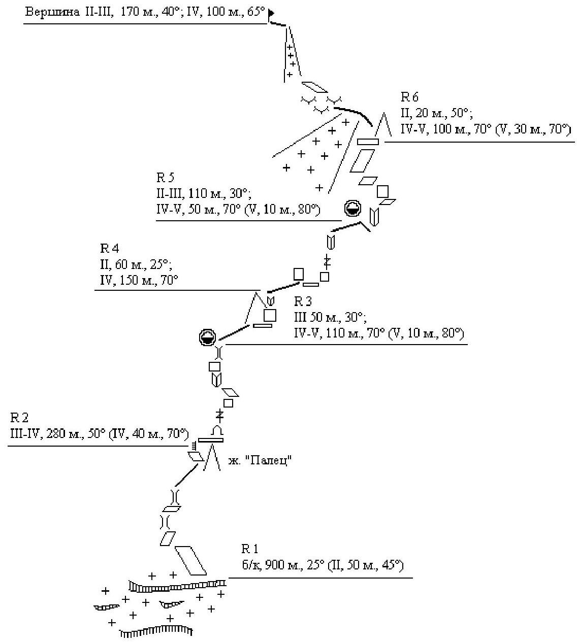
Route Profile. (slope of sections)

Route Description by Sections.
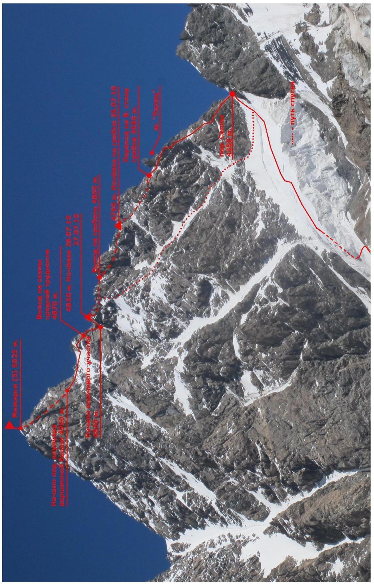
R0–R1 From the rocky island, move across broken snowfields and scree to approach the ice drop, which is bypassed on the left (simultaneous movement with ice screw protection). Then, bypass several crevasses and ascend a steep snow slope with a bergschrund to reach Sely Pass. b/c, 900 m, 25° (II, 50 m, 45°)
R1–R2 From the pass, ascend destroyed rocks of medium difficulty (90 m). Then, veer left through:
- inclined slabs with small walls,
- 2 chimneys, to reach the ridge (80 m), leading to the "Paltsev" gendarme. The gendarme is bypassed on the left. From the col behind the gendarme, move upwards to the right across inclined slabs towards the ridge. III–IV, 280 m, 50° (IV, 40 m, 70°)
R2–R3. Traverse to the E wall of the S ridge and, with some loss of height, move along a ledge for about 50 m. Then:
- ascend and move right through a system of cracks and separations (difficult climbing, old pitons present),
- reach inclined slabs,
- from there, ascend towards the ridge through internal corners and a chimney.
On the ridge, on a small col, there's a spot for a tent. III 50 m., 30°; IV–V, 110 m., 70° (V, 10 m., 80°)
R3–R4. Move along the ridge to the base of the second gendarme (60 m.). Then:
- move right and down, traversing along a narrow ledge (40 m.),
- the path then goes up the E wall of the gendarme, upwards and to the right, towards the ridge (120 m.).
II, 60 m., 25°; IV, 150 m., 70°
R4–R5. Continue along the ridge, passing two small gendarmes, which are climbed head-on (100 m). Upon reaching a 20-meter sheer wall, traverse right (onto the E wall of the ridge) through a smooth, steep slab, approach a narrow, sheer crack, and ascend through it, then through a wide internal corner to reach the ridge. Move along the ridge for another 10 m until a sharp drop. Here, on the western side of the ridge, there's a small ledge suitable for a tent. II–III, 110 m, 30°; IV–V, 50 m, 70° (V, 10 m, 80°)
R5–R6 Descend (20 m) to a col before a gendarme, which is the key section of the route. Then:
- ascend through an internal corner starting left and below the col,
- reach a ledge under the SE wall of the gendarme (30 m),
- ascend the wall — upwards and to the left, to reach an inclined slab with a narrow ledge,
- traverse left and upwards across the slab (30 m),
- then, across dissected slabs on the SW wall of the gendarme, reach an inclined ledge.
II, 20 m, 50°; IV–V, 100 m, 70° (V, 30 m, 70°)
R6 — summit. Bypass the gendarme's summit on the left, traverse a large snow-ice couloir towards the "sheep's foreheads" (100 m). Then:
- move left and upwards,
- continue across an inclined ledge leading to an ice gully (50 m),
- ascend the gully — mixed climbing on rimmed ice and rocks, staying on the left side (120 m).
After reaching the summit ridge — move left across destroyed rocks of the ridge to the summit. II–III, 170 m, 40°; IV, 100 m, 65°
Ascent
Schedule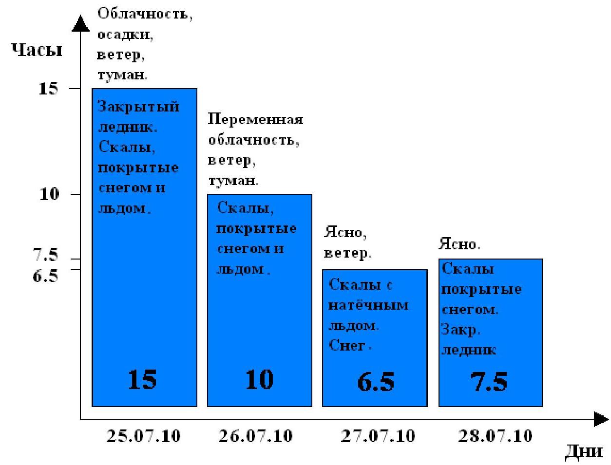
Passage of Key
Sections.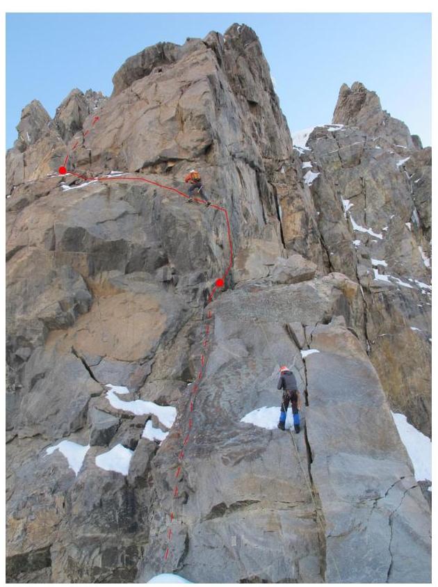
1. Key Section — 3rd Gendarme.
2. Summit Tower.
1. Key Section — 3rd Gendarme.
Ascend through an internal corner starting left and below the col. Rocks in it are covered with rimmed ice, overcome using ice tools (possible with artificial aids, but we climbed it free). Protection is difficult to organize (piton, protection gear).
Reach a ledge under the SE wall of the gendarme (30 m).
According to the route:
- Ascend the wall — upwards and to the left, to reach an inclined slab with a narrow ledge.
- Many old pitons are present.
- Cramp ons are very helpful as the relief is fine.
- Traverse left and upwards across the ledge (30 m).
It's better to set up a belay station at the turn, otherwise there will be significant friction and poor audibility.
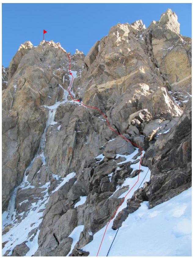
2. Summit Tower.
Bypass the gendarme's summit on the left, traverse a large snow-ice couloir towards the "sheep's foreheads" (100 m). Then, move left and upwards and continue across an inclined ledge leading to an ice gully (50 m). Simultaneous movement with protection through ledges is possible.
Then, ascend the gully — mixed climbing on rimmed ice and rocks:
- Initially on the right side,
- After widening and slight flattening — stick to the left side (120 m).
After reaching the summit ridge — move left across destroyed rocks of the ridge to the summit. The section is climbed in crampons and with ice axes. Protection is easily organized — ice screws, protection gear. Old pitons and loops are present.
Additional Photos:
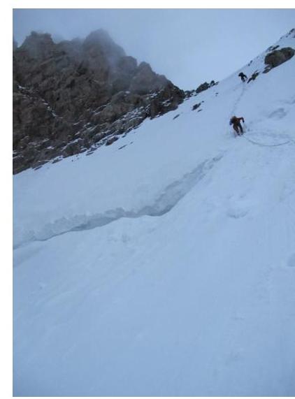
Ascent to Sely
Pass.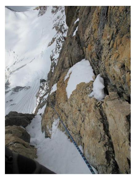
Traverse of 2nd
Gendarme.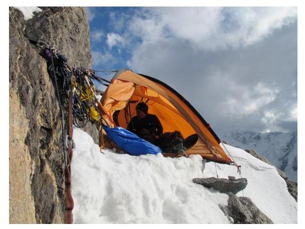
Overnight Stays on 26th and 27th.
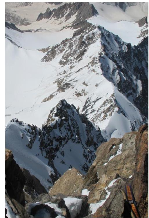
View of the Route from the
Summit.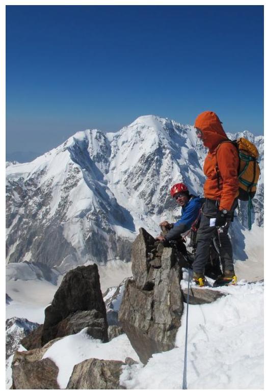
On the Summit.