Russian Alpine Championship
in the high-altitude technical class
Report
On the ascent to the summit of Koshtantau via the left part of the Central Counterfort of the North wall (Simonik route) 6A category of complexity by the team from Rostov region from October 8 to 10, 2020
I. Ascent Passport
| 1. General Information | ||
|---|---|---|
| 1.1 | Full name, sports rank of the team leader | Vasilyev Andrey Sergeyevich, Master of Sports |
| 1.2 | Full name, sports rank of the team members | Rybalchenko Dmitry Andreyevich, Master of Sports; Shipilov Vitaly Viktorovich, Master of Sports |
| 1.3 | Full name of the coaches | Pyatnitsin Alexander Alekseyevich, Spiridonov Alexander Semyonovich |
| 1.4 | Organization | FAIiS RO, alpinist club "Planeta" |
| 2. Characteristics of the Ascent Object | ||
| 2.1 | Region | Caucasus, Central Caucasus |
| 2.2 | Valley | Bezengi valley |
| 2.3 | Section number according to the 2013 classification table | 2.5 |
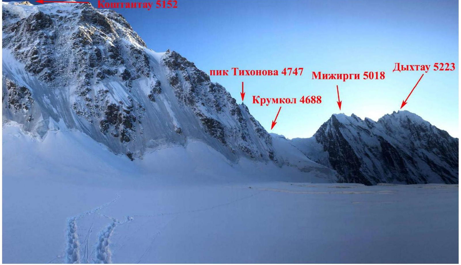
| 2.4 | Name and height of the summit | Koshtan-tau, 5152 m |
| 3. Characteristics of the Route | ||
| 3.1 | Route name | Via the left part of the Central Counterfort of the North wall (Simonik route) |
| 3.2 | Proposed category of complexity | 6A |
| 3.3 | Degree of route exploration | — |
| 3.4 | Terrain characteristics of the route | Combined |
| 3.5 | Altitude difference of the route (altimeter or GPS data) | 1151 m |
| 3.6 | Route length (in meters) | 1540 m |
| 3.7 | Technical elements of the route (total length of sections of varying complexity with terrain type) | 1st cat. snow — 100 m. 3rd cat. firn — 500 m. 4th cat. mixed — 270 m. 5th cat. mixed — 490 m. 6th cat. mixed — 180 m. Used aid climbing equipment (A₂): 19 |
| 3.8 | Average slope of the route, ° | 60° |
| 3.9 | Average slope of the main part of the route, ° | 70° |
| 3.10 | Descent from the summit | Via ice streams to the right of the Kalishevsky route 5B cat. (classic descent route — via North ridge, Vulley route 4B cat.) |
| 3.11 | Additional route characteristics | Absence of ledges for bivouac |
| 4. Characteristics of Team Actions | ||
| 4.1 | Time of movement (team's walking hours, in hours and days) | 28 hours |
| 4.2 | Bivouacs | First bivouac sitting (carved ledge in ice + hammock), second — lying down |
| 4.3 | Time spent on route preparation | — |
| 4.4 | Start of the route | 4:00 October 8, 2020 |
| 4.5 | Summit reach | 10:50 October 10, 2020 |
| 4.6 | Return to base camp | 19:00 October 11, 2020 |
| 5. Meteorological Conditions | ||
| 5.1 | Temperature, °C | −15 °C |
| 5.2 | Wind speed, m/s | 0 |
| 5.3 | Precipitation | 0 |
| 5.4 | Visibility, m | clear |
| 6. Responsible for the Report | ||
| 6.1 | Full name, e-mail | Vasilyev Andrey Sergeyevich, andre.vasiliev@gmail.com |
II. Ascent Description
1. Characteristics of the Ascent Object
1.1. General photo of the summit

- via the left part of the Central Counterfort of the North wall (Simonik, 1961) 6A category of complexity
- via the right part of the Central Counterfort of the North wall (Vasilyev, 1966) 5B category of complexity
- via the left part of the North wall (Nosov, 1969) 5B category of complexity
1.4. Photopanorama of the area
2. Route Characteristics
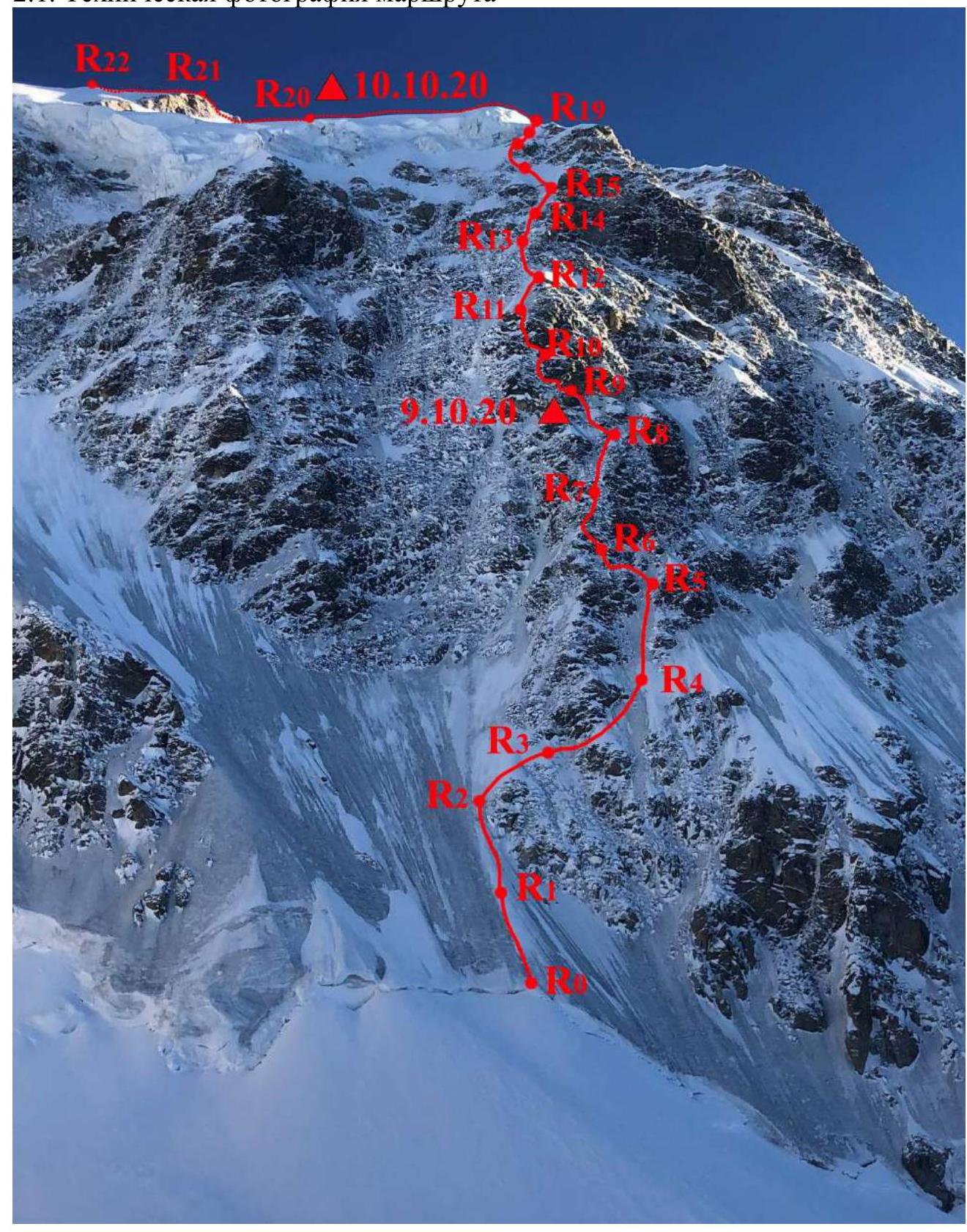
2.1. Technical photo of the route
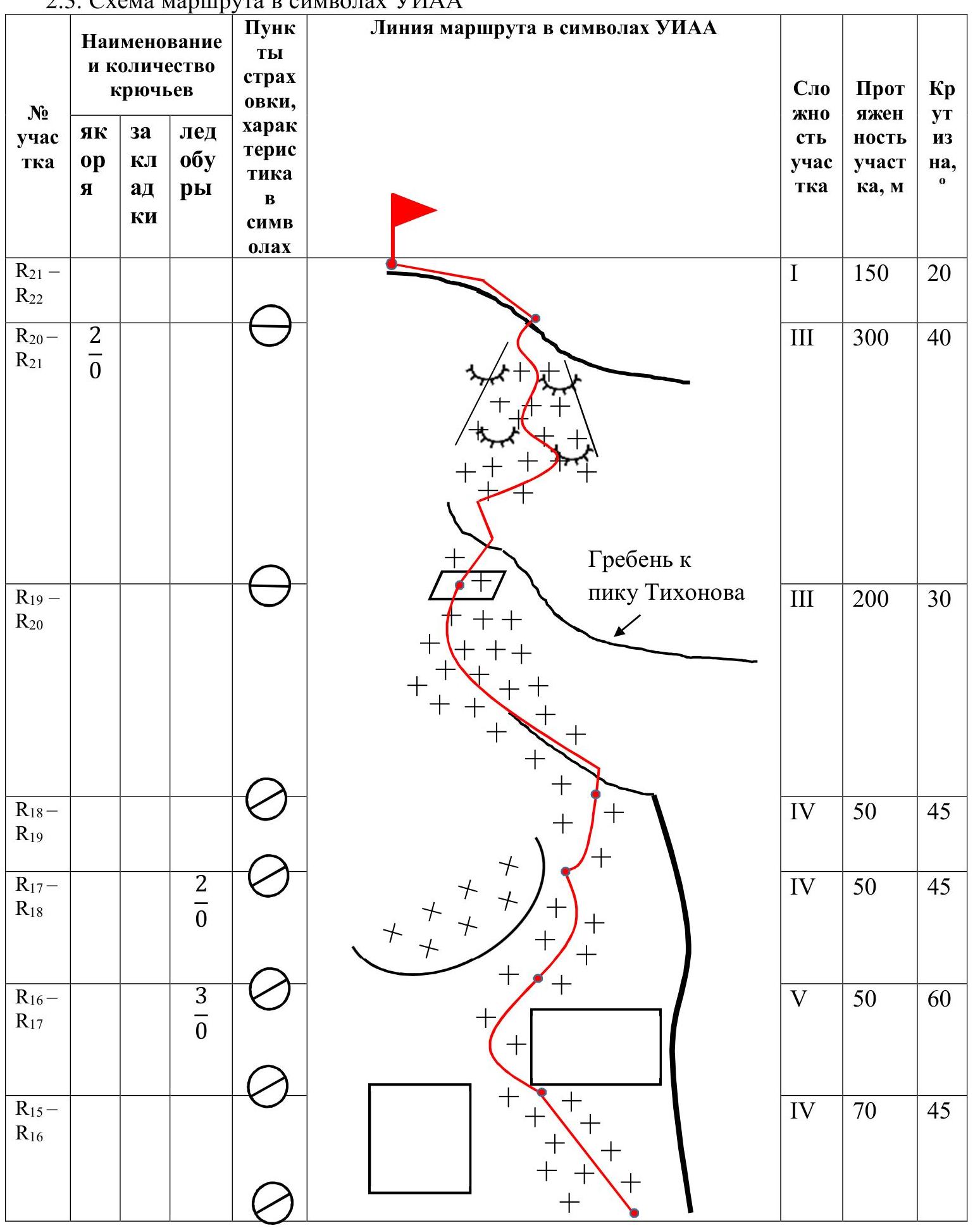
2.3. Route diagram in UIAA symbols
| Section # | Pitons (rock) | Pitons (ice) | Pitons (other) | Difficulty | Length, m | Angle, ° | Notes |
|---|---|---|---|---|---|---|---|
| R21–R22 | 1 | 150 | 20 | ||||
| R20–R21 | 2/0 | 3 | 300 | 40 | |||
| R19–R20 | 3 | 200 | 30 | Ridge to Tikhonov peak | |||
| R18–R19 | 4 | 50 | 45 | ||||
| R17–R18 | 2/0 | 4 | 50 | 45 | |||
| R16–R17 | 3/0 | 5 | 50 | 60 | |||
| R15–R16 | 4 | 70 | 45 | ||||
| R14–R15 | 5 | 50 | 60 | ||||
| R13–R14 | 5 | 50 | 60 | ||||
| R12–R13 | 5 | 25 | 85 | ||||
| 6 | 25 | 70 | (continuation of R12–R13) | ||||
| R11–R12 | 5 | 50 | 60 | ||||
| R10–R11 | 4/3 | 1/0 | 5/1 | 6 | 50 | 80 | |
| R9–R10 | 8/7 | 2/1 | 4/0 | 6 | 40 | 75 | |
| R8–R9 | 5+ | 30 | 70 | Sitting bivouac, carved in ice | |||
| R7–R8 | 3/0 | 5/0 | 5 | 30 | 70 | ||
| 6 | 20 | 80 | (continuation of R7–R8) | ||||
| R6–R7 | 5/3 | 1/1 | 6/0 | 5 | 15 | 85 | Counterfort of the North wall |
| R5–R6 | 4/3 | 6/0 | 6 | 35 | 80 | ||
| R4–R5 | 6 | 10 | 80 | ||||
| 5 | 40 | 70 | (continuation of R4–R5) | ||||
| R3–R4 | 5 | 50 | 70 | ||||
| R2–R3 | 5+ | 50 | 75 | ||||
| R1–R2 | 4 | 50 | 60 | ||||
| R0–R1 | 5 | 50 | 60 | ||||
| 4 | 50 | 60 | (continuation of R0–R1) |
 Conventional signs and continuation of the route diagram:
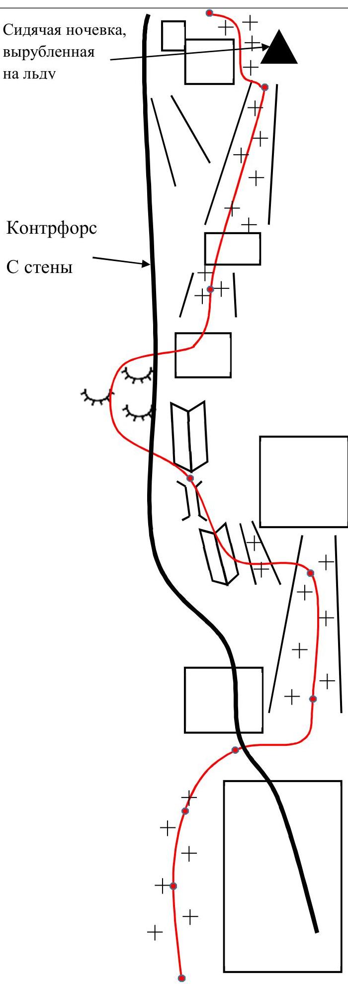
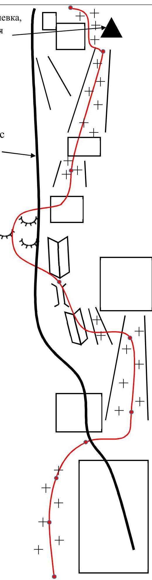
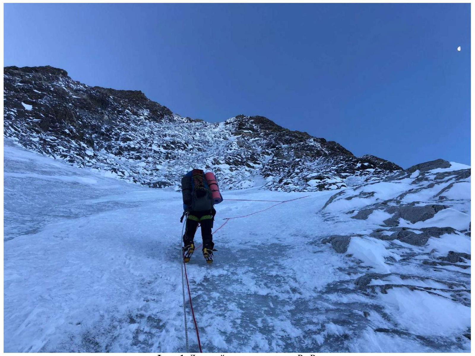
Photo 1. Ice slope on section R2–R3
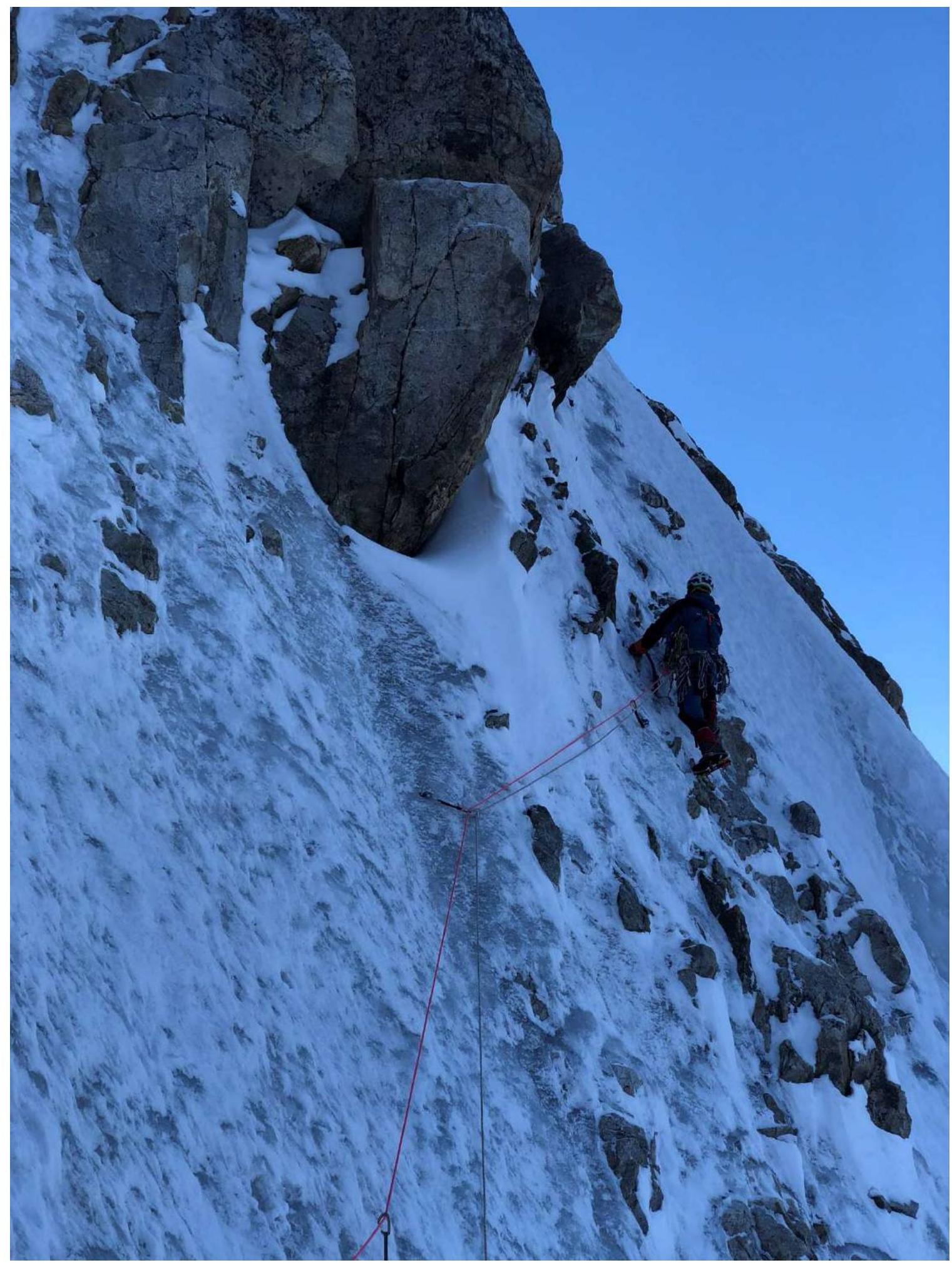
Photo 2. Traverse on section R3–R4
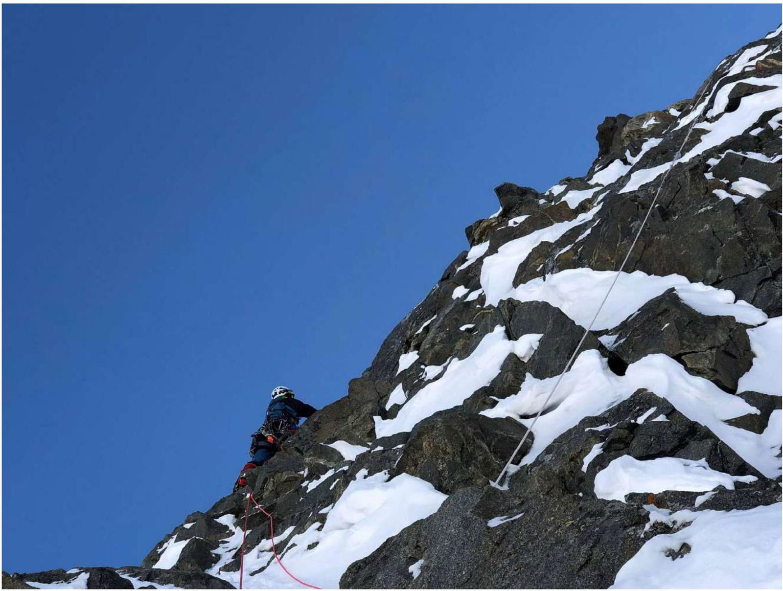
Photo 3. Difficult mixed climbing on section R6–R7
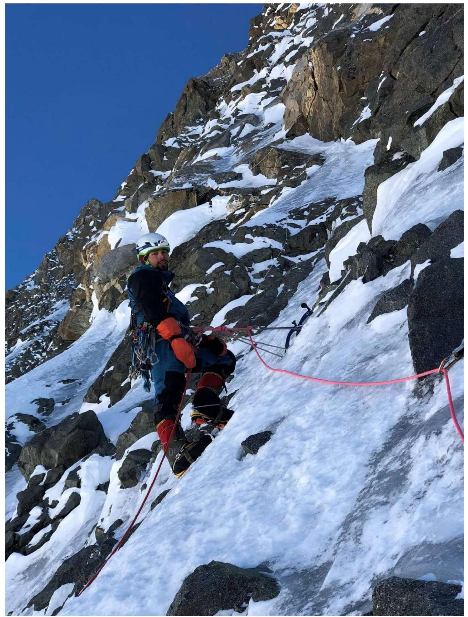
Photo 4. Section R7–R8
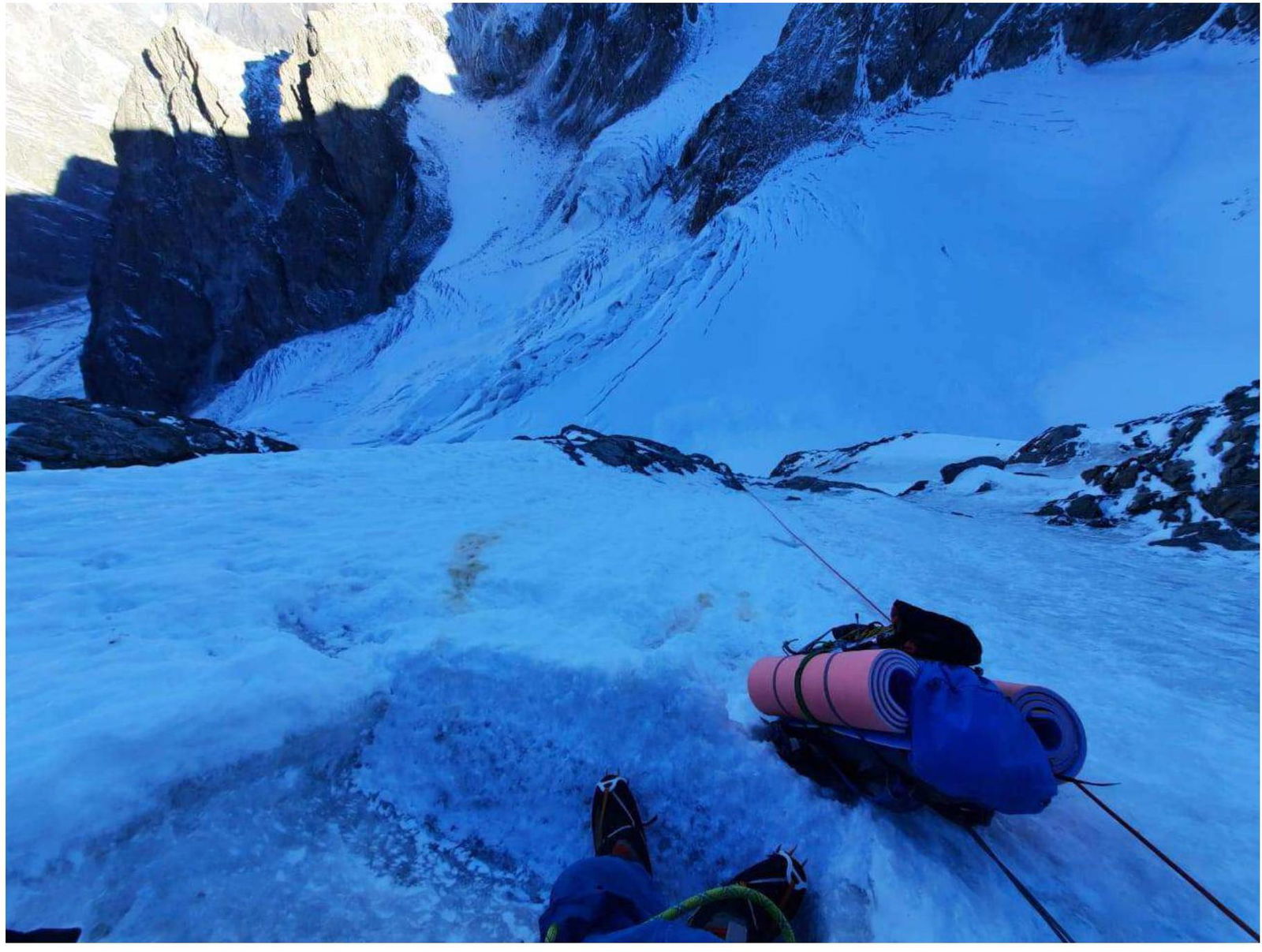
Photo 5. Bivouac
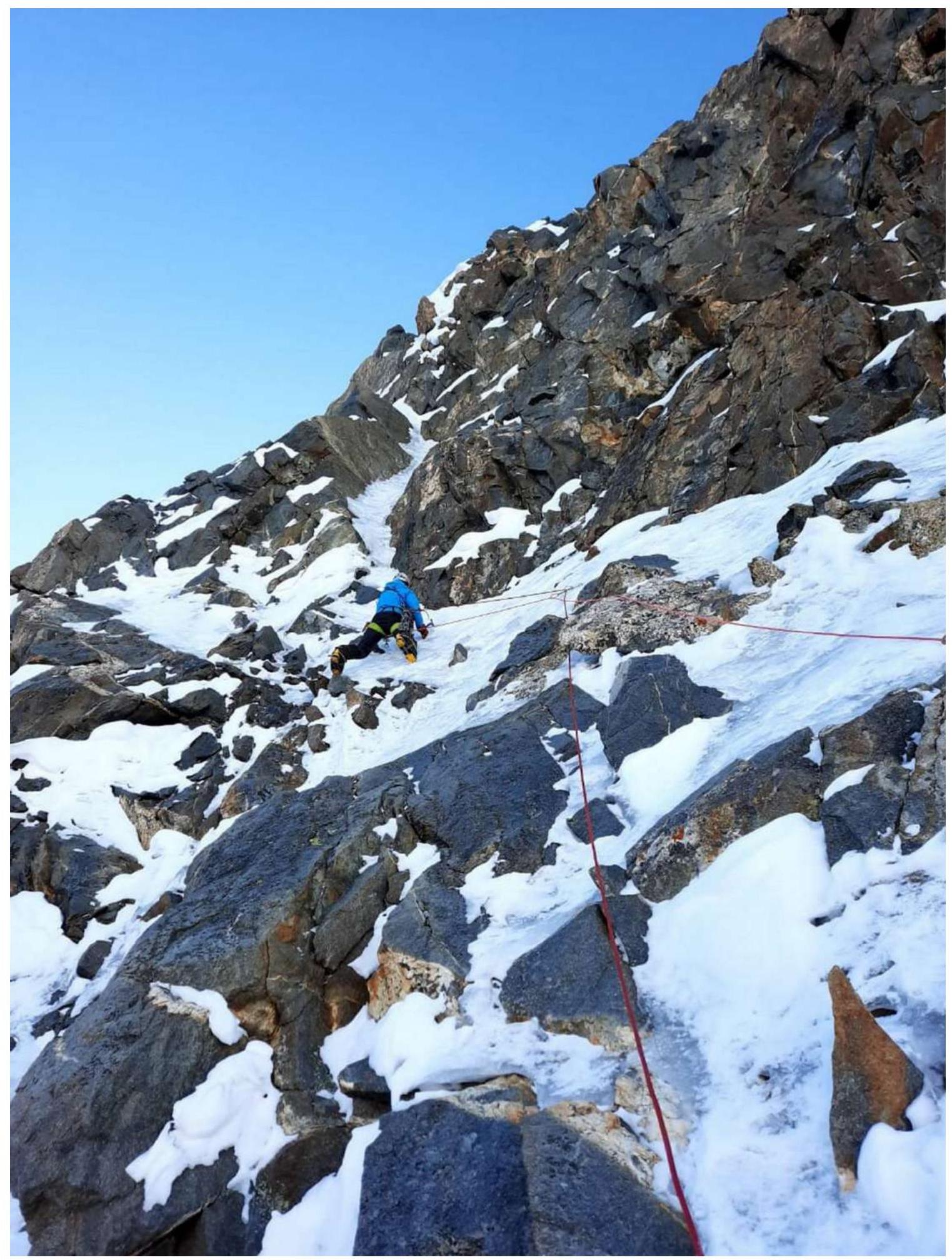
Photo 6. Mixed climbing on section R10–R11
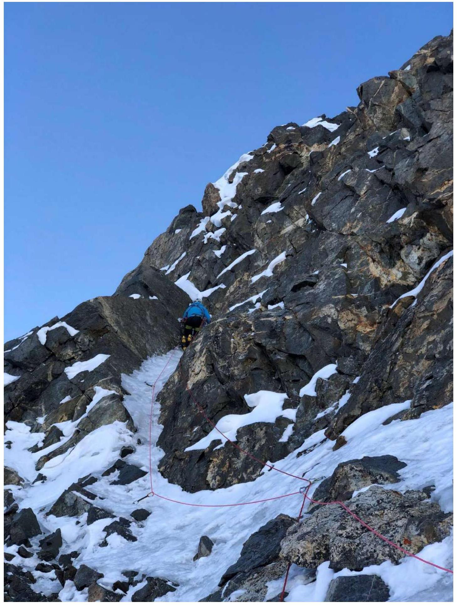
Photo 7. Narrow steep ice couloir on section R10–R11
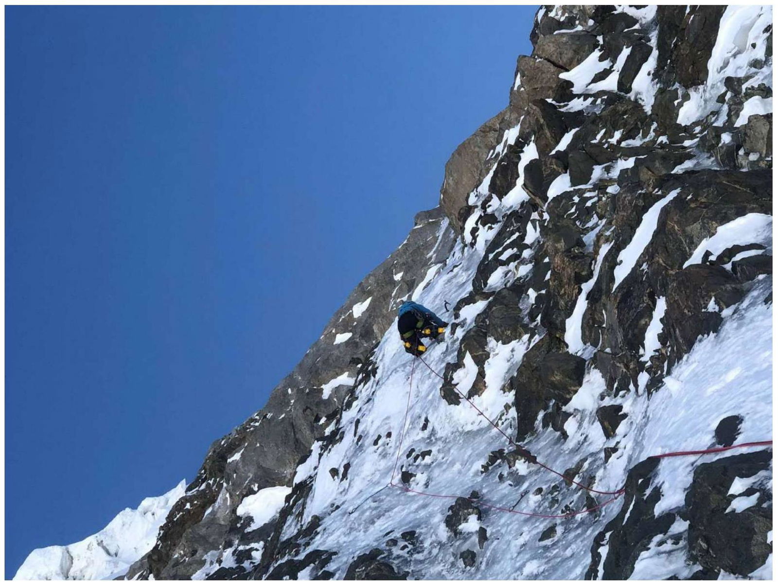
Photo 8. Steep wall on section R12–R13
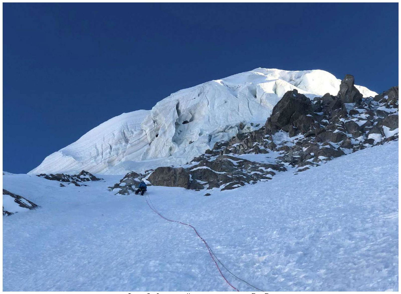
Photo 9. Firn slope on section R15–R16
3. Characteristics of Team Actions
3.1. Brief description of the route passage.
The lower part (R0–R3) is an ice slope with a slope of approximately 60°06.
The middle part of the route (R3–R19) follows a clearly defined counterfort of the North wall. The sections are similar — mixed climbing, steep ice gullies (up to 90°), a complete absence of any ledges. Depending on the route's condition and the presence of ice, the line of ascent can shift ±30 meters from the counterfort, with the difficulty remaining roughly the same. Most of the protection was organized using ice screws, with some areas having thin ice, necessitating short ice screws. Rock equipment is also necessary. The most difficult sections are R6–R8 and R9–R11. On sections R5–R11, there are old ropes (likely from rescue efforts in 2000); these ropes are rotten and should not be used under any circumstances. Throughout the route, there are no ledges for bivouac, not even sitting ones. We carved a small ledge on a steep ice wall at R8 and extended it with a hammock, creating a sitting bivouac.
Sections R15–R19 are a steep firn slope. It is impossible to organize intermediate protection; we were unable to dig down to the ice. Stations were organized on rocks (once we had to tie a rope, as 60 meters was insufficient). R19 is the exit onto a firn ridge, where the slope becomes gentler (30–40°). The only suitable bivouac spot is about 200 meters further along the ridge (simultaneous movement), at the junction with the ridge coming from Tikhonov peak — R20. Here, it is possible to dig a good spot for a tent.
The pre-summit ascent is a steep firn slope with patches of ice — movement is simultaneous, and protection can be organized on rock outcrops.
On the upper part of the route, a large ice serac hangs over the rocks. If ice falls, sections R0–R3 and R15–R18 are most dangerous. In summer, the route is likely to be rockfall-prone. We recommend attempting the ascent in autumn.
The route is an interesting combined climb, providing good preparation for longer high-altitude technical ascents. In autumn, the entire North wall of Koshtantau is very attractive for climbing. Many ice gullies form, and the rockfall danger is low. Specifically, a logical ascent route via ice gullies (with prolonged vertical and even overhanging sections) on the wall to the right of the Kalishevsky route was visible.
Classic descent routes:
- via the North ridge
- via the Vulley route 4B category of complexity
3.2. Photo of the team on the summit with the control post
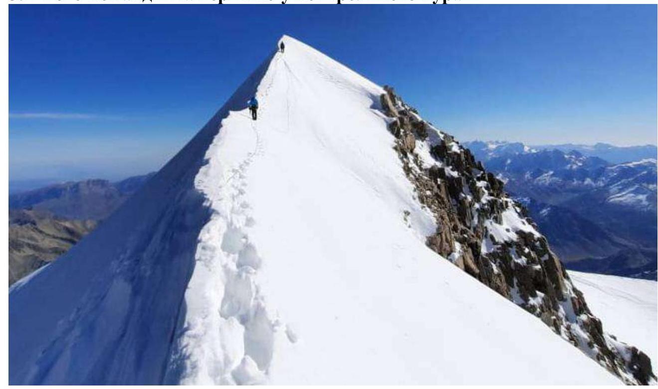
Last meters before the summit
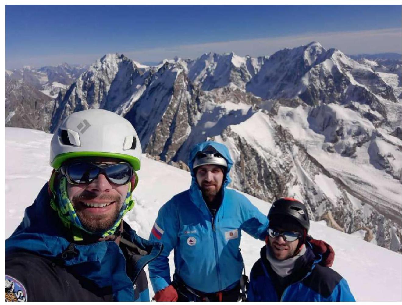
Photo on the summit
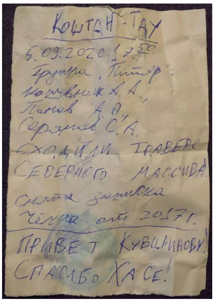
Note from the control post
4. Meteorological Conditions
From October 2 to 5, the area experienced unstable weather, with snowfall on October 2 and 5. From October 6 and throughout the ascent, the weather was good. On the first day of the ascent, there was wind on the ridge, and small powder avalanches came down the route. By the evening of October 8, the wind had died down, and it was almost still. Adverse factors included severe frost (approximately −15 °C) and a short daylight period.
5. Team Tactical Actions
The team planned to ascend Koshtantau via the Simonik route 6A and subsequently traverse the North massif to Dykhtau. The objective was chosen as a replacement for a high-altitude expedition to Nepal, which was canceled due to border closures. Initially, the team understood that the route was very labor-intensive, and climbing the 6A category required a significant amount of equipment. They planned to make the ascent in a team of four, but the fourth participant had to withdraw a few days before the planned start.
To our knowledge, the last passage of the Simonik route was made in 2012 by climbers from Minsk (Shikhov, Mazur, Ryzhikov, Zyuzina). The long interval since then is likely due to the high rockfall and avalanche danger on the route during summer, as noted by previous climbers in their reports. In this sense, autumn appears to be a favorable time for attempting the route. During this season, the sun does not illuminate the lower part of the North wall, and the upper part is lit for only one or two hours in the evening. The temperature remains below 0 °C throughout the day.
Despite the route's popularity in the past, a good description was lacking. Available descriptions contradicted each other, and the route's path was only schematically outlined.
Bad weather delayed the team's planned departure date by a week. They arrived at the "3900" bivouac after the bad weather on October 6. The next day, October 7, they moved the camp to the upper step of the glacier (approximately 4050 m), setting up the tent at a safe distance from the wall. They also observed the wall that day. They did not process the route. Processing was unnecessary since the lower part of the route is not difficult. All rocks were covered with fresh snow.
They began working on the first rope of the route at 4:00 on October 8. Over the day, they climbed 10 ropes of 50 meters each but found no ledges for even a sitting bivouac. They spent about three hours carving a ledge about 30 cm on a steep ice slope. They extended the ledge with a hammock, creating a sitting bivouac. Working on mixed terrain, the crampons and ice axe picks became very dull, so they had to sharpen them. They advise future climbers to bring a file.
The next day, they started late (the first climber began at 8:30), and by 16:00, they reached a steep firn couloir (R15). From here to the flattening (R19) was a physically demanding section, with step-cutting taking a lot of time, and it was impossible to organize intermediate protection. As a result, they reached the previous team's bivouac site R20 after dark, around 20:30. The heavy backpacks, which were loaded with everything needed for the traverse of the North massif, were a significant factor. On the morning of the next day, they summited and continued along the ridge toward Tikhonov peak. However, fatigue from the ascent, primarily due to lack of proper sleep, and insufficient acclimatization became apparent, so they decided to abandon the traverse and descend. They descended via ice gullies to the right of the Kalishevsky route and returned to the "3900" bivouac by lunchtime, reaching the Bezengi alpine camp in the evening.
Throughout their stay in the high-altitude zone, the group maintained regular radio contact with the Bezengi alpine camp and had a satellite phone.