Central Federal District Climbing Championship
Ascent Report
TO THE SUMMIT of Dykhtau, Main peak via left South buttress (Alexashin's Route) 5A cat. diff. Voronezh 2023
I. Ascent Passport
| 1. General Information | ||
|---|---|---|
| 1.1 | Full Name, Sports Rank of the Leader | Torshin Mikhail Viktorovich, 1st sports rank |
| 1.2 | Full Name, Sports Rank of the Participants | Ahn Konstantin Radievich, CMS |
| 1.3 | Full Name of the Coach | |
| 1.4 | Organization | VRPO "Sportivnaya federatsiya alpinizma" |
| 2. Characteristics of the Ascent Object | ||
| 2.1 | Region | Caucasus, Kabardino-Balkaria |
| 2.2 | Valley | Bezengi valley |
| 2.3 | Number of the section according to the 2013 Classification Table | 2.5. From Kithlod Pass to Gezhevscek Pass (from the north of the Main Caucasian Ridge) |
| 2.4 | Name and Height of the Summit | Summit Dykhtau Main, 5204 m. |
| 3. Route Characteristics | ||
| 3.1 | Name of the Route | via left South buttress (L. Alexashin, 1959) |
| 3.2 | Category of Difficulty | 5A |
| 3.3 | Degree of Route Exploration | |
| 3.4 | Nature of the Route Terrain | combined |
| 3.5 | Height Difference of the Route (data from altimeter or GPS) | 1200 m. |
| 3.6 | Route Length (in meters) | 1700 m. |
| 3.7 | Technical elements of the route (total length of sections of varying difficulty with indication of terrain type (ice-snow, rock)) | I cat. diff. ice/rock/combination — M. II cat. diff. ice/rock/combination — M. III cat. diff. ice/rock/combination — M. IV cat. diff. ice/rock/combination — 300 m. V cat. diff. ice/rock/combination — 430 m. VI cat. diff. ice/rock/combination — 200 m. |
| 3.8 | Average Steepness of the Route, ° | 70° |
| 3.9 | Descent from the Summit | Via the ice couloir between Main and East summits. |
| 4. Characteristics of the Team's Actions | ||
| 4.1 | Time of Movement (team's walking hours, in hours and days) | 19 hours, 2 days |
| 4.2 | Overnight Stays | one overnight stay, lying down |
| 4.3 | Departure from "Bezengi" tourist camp. Departure from Jangy hut. Departure from overnight stays at the base of the buttress | 10:00, July 31, 2022 10:00, August 1, 2022 5:00, August 2, 2022 |
| 4.4 | Arrival at the Summit | 9:00, August 3, 2022 |
| 4.5 | Return to Jangy hut. Return to "Bezengi" tourist camp | 21:00, August 3, 2022 15:30, August 4, 2022 |
| 5. Weather Conditions | ||
| 5 | August 2 — clear. August 3 — fog, light snow, clear from afternoon. | |
| 6. Person Responsible for the Report | ||
| 6.1 | Full Name, e-mail | Torshin Mikhail Viktorovich, TMV2001@yandex.ru |
II. Ascent Description
1. Characteristics of the Ascent Object
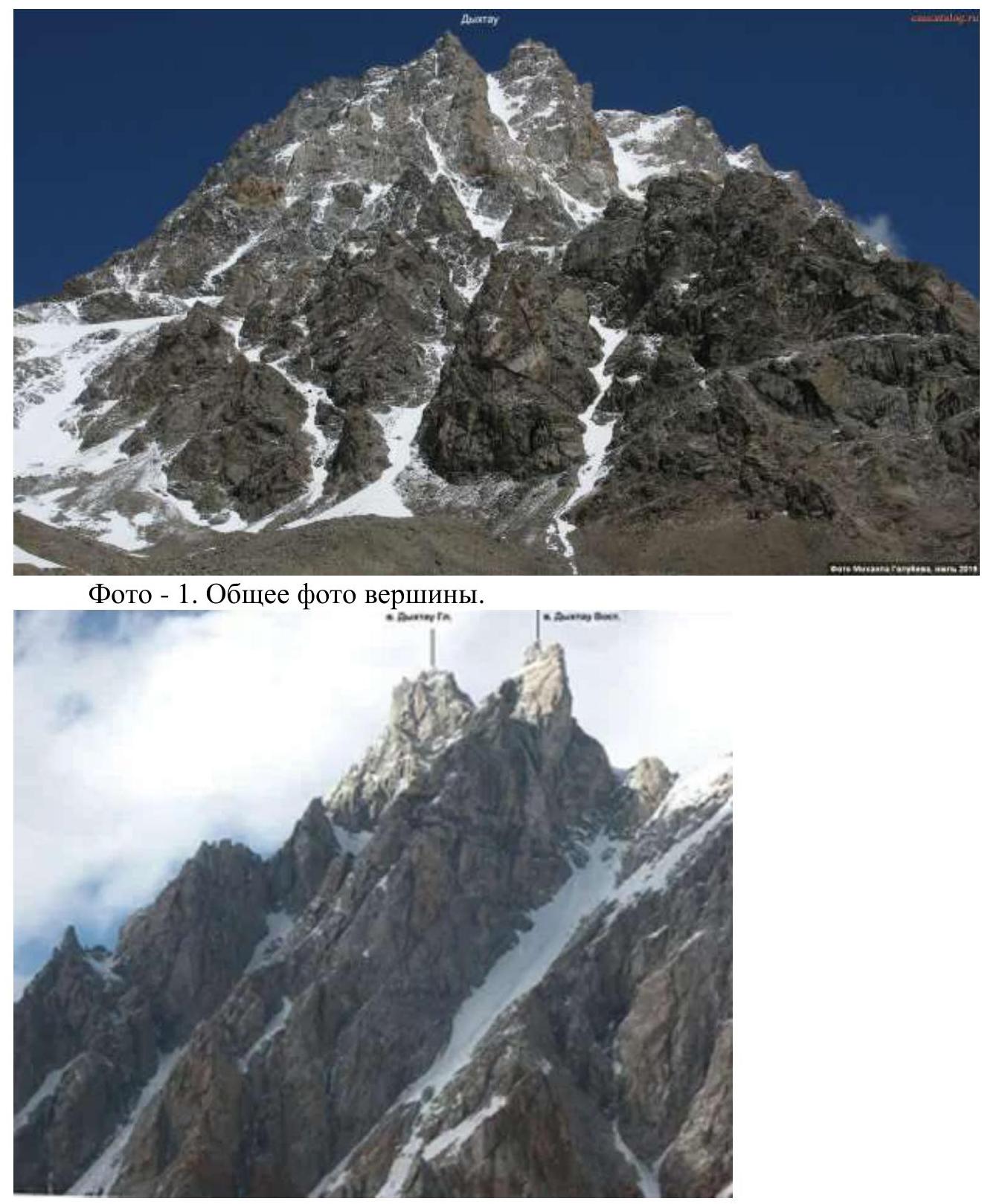
Photo — 1. General photo of the summit.
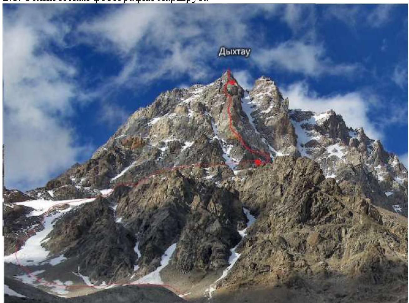
Photo — 2. Route profile.
Photo — 3. Area diagram.
2. Route Characteristics
2.1. Technical Photograph of the Route

Photo — 4. Technical photo of the route.
- R1–R2 (80 m, 2, 45°; 30 m, 4, 80°): From the platform, ascent via a snowy couloir 80 m to the right of the buttress, then up via icy rocks 30 m. Exit to a debris-filled ledge.
- R2–R3 (50 m, 3, 30°): Up and left via simple rocks (black rock), exit to the buttress ridge.
- R3–R4 (50 m, 4, 60°): Up via the buttress ridge, exit to bright red rocks.
- R4–R5 (80 m, 5, 75°; 50 m, 4, 60°): Via steep monolithic rocks (white) 80 m to a ledge, then via rocks of average difficulty 50 m, ascent to a wide ledge under the base of a steep rock bastion.
- R5–R6 (50 m, 6, 80°): From the ledge up 15 m via the wall, then 10 m under an internal angle. Via the internal angle (overhanging at the top) 20 m, then 10 m via a steep slab with a cleft, exit to a platform under a sheer rock bastion wall.
- R6–R7 (50 m, 5, 80°): From the platform left between the wall and a large detached rock, then 6 m left via the wall and up 30 m via steep rocks, ascent to a depression on the ridge.
- R7–R8 (50 m, 5, 80°): Via a rock slab left of the buttress ridge 50 m.
- R8–R9 (30 m, 5, 70°): Via a slab and then via an internal angle, exit to the summit of the rock bastion (3rd Gendarme).
- R9–R10 (50 m, 6, 80°): Up via an internal angle (difficult section) and then via the wall, monolithic rocks.
- R10–R11 (50 m, 4, 60°): Right and up, exit to the ridge 50 m.
- R10–R11 (100 m, 3, 40°): 100 m traverse of the 4th Gendarme from the right and then traverse of a snowy slope under the base of the 5th Gendarme.
- R12–R13 (50 m, 5, 80°; 30 m, 6, 70°): 50 m up via the wall and rock slabs on the right side, directly up to the Gendarme 30 m.
- R13–R14 (60 m, 3, 10°): Descent 10 m via rappel to an icy slope, traverse of the icy slope 20 m and then via a simple ridge 30 m, exit to a saddle under the base of the flat wall of the 6th Gendarme.
- R14–R15 (50 m, 5, 75°): Up via a flat wall 20 m under an overhang and then traverse left 25 m.
- R15–R16 (70 m, 5, 70–80°): Vertically up 70 m. Exit to a snowy saddle. Via it 20 m under a rock.
- R16–R17 (50 m, 5, 85°, 100 m, 4, 70°): Via steep vertical rocks of average difficulty 50 m and then 100 m via the ridge.
- R17–R18 (60 m, 6, 80°): Via a steep ridge, exit to a shoulder under the base of the chimney of the summit tower. Descend to the right, there are places for a bivouac. Lying down overnight stay for 2 people. The ledge is not very large.
- R18–R19 (30 m, 6, 85°): Chimney is vertical, initially with an overhang, then exit to a crack.
- R19–R20 (50 m, 4, 70°): From the crack (cave) exit and via rocks of average difficulty, ascent to the summit.
Descent from the summit into the ice couloir between the Main and East summits. Via it, keeping to the right (in the direction of travel) side of the rappel (stations on rocks are present), descent to the start of the south buttress of the Main summit. Then via the ascent route exit to overnight stays at the base of the buttress and further to Jangy hut.
3. Characteristics of the Team's Actions
| Section | Description | Photo Number |
|---|---|---|
| R1–R4 | Simultaneous movement. | |
| R4–R16 | Alternating movement. | |
| R16–R17 | Simultaneous movement. | |
| R16–R20 | Alternating movement. |
The entire route was traversed with free climbing. The leader moved with a light backpack on two ropes. The second participant climbed with top rope (except for key sections where belays were set up (R5–R6, R9–R10, R18–R19)). The team had a set of equipment for working on a combined route, a full-fledged bivouac (tent, sleeping bags) and a supply of food and gas for 2-3 days in case of bad weather.
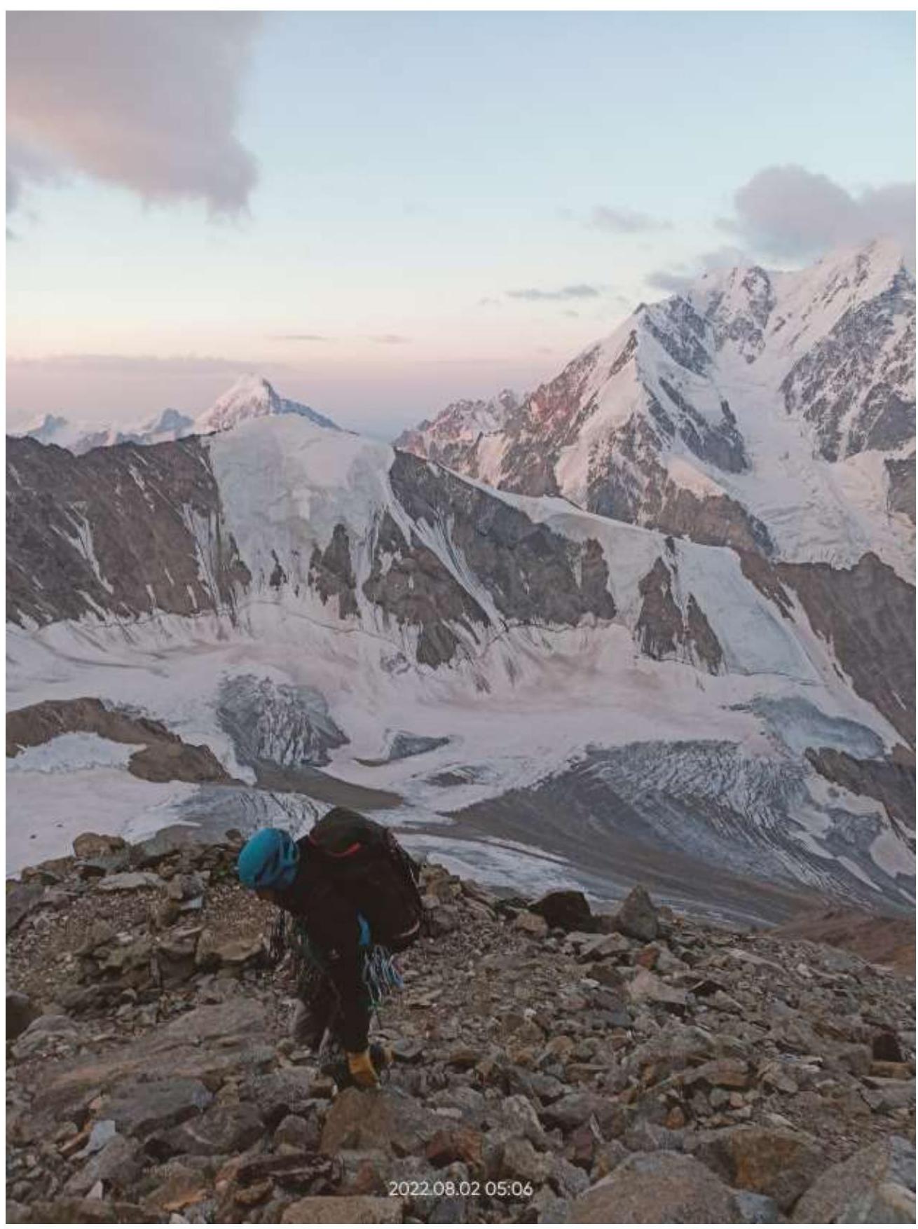
Photo — 5. Departure from overnight stay at the base of the buttress.
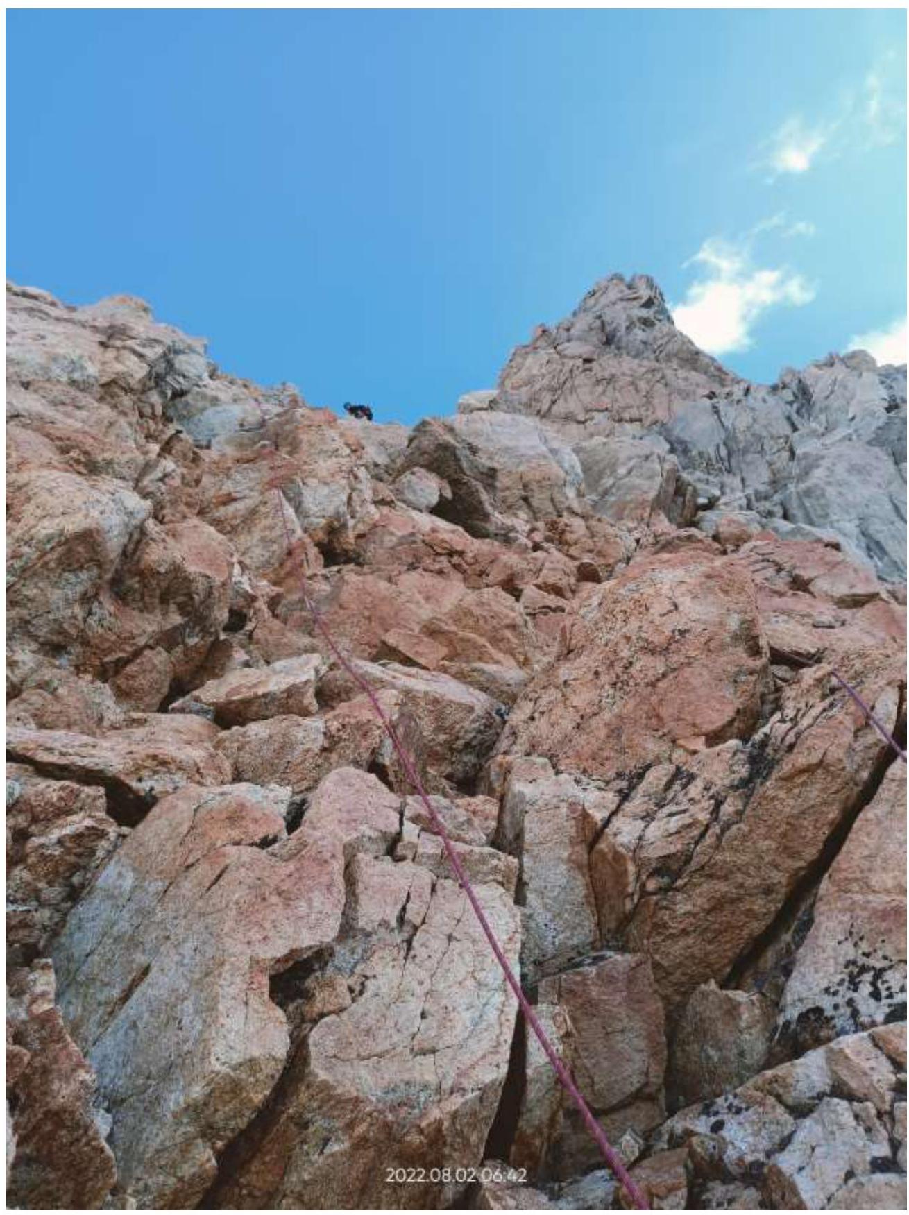
Photo — 6. Section R3–R4.
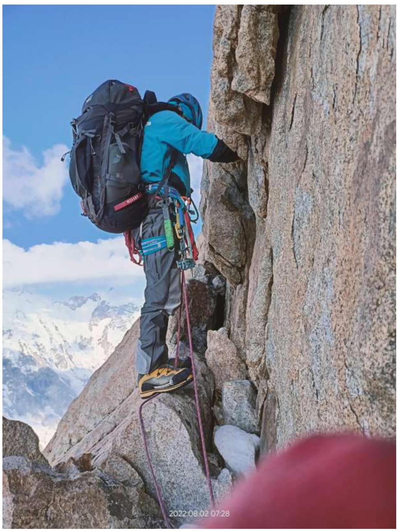
Photo — 7. Section R4–R5.
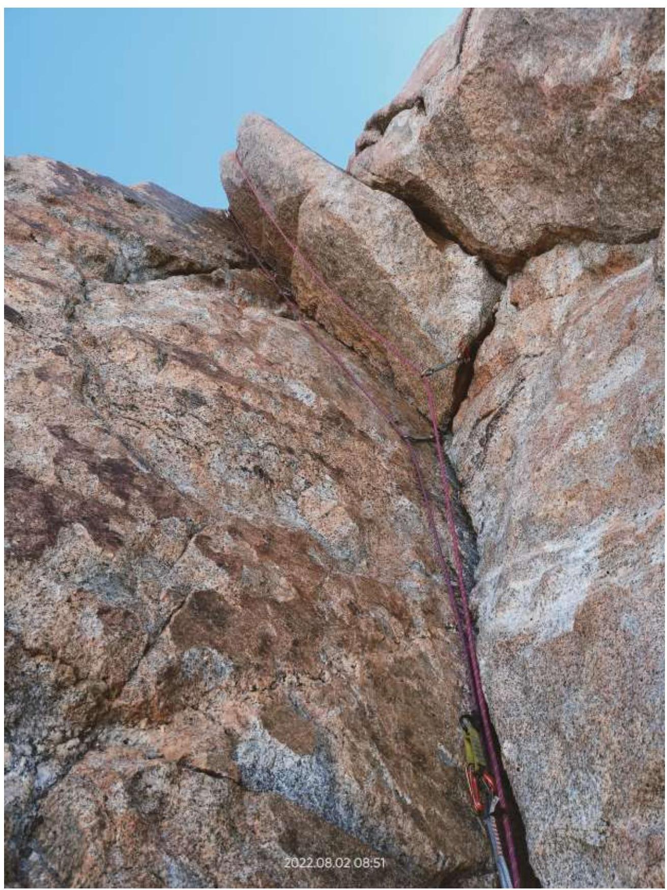
Photo — 8. Section R5–R6.
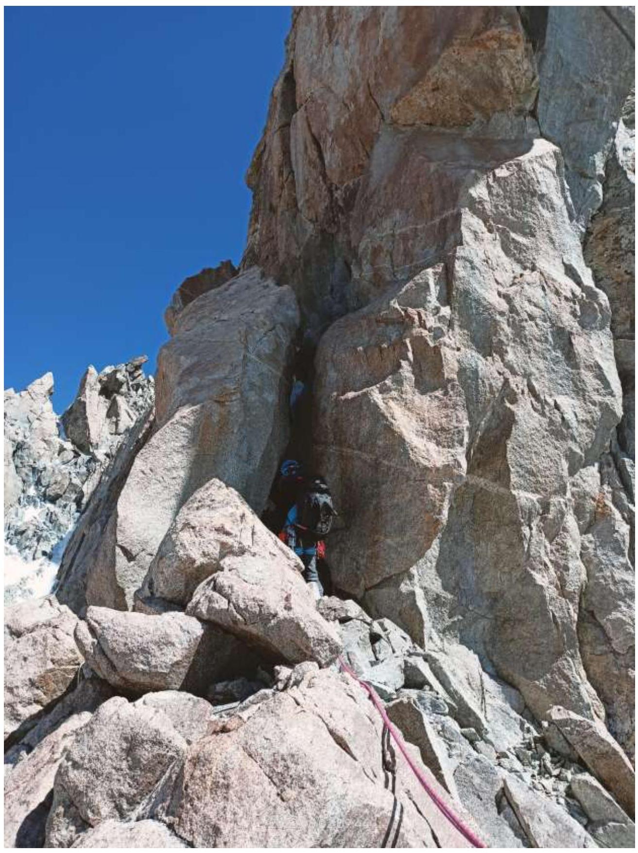
Photo — 9. Section R6–R7.
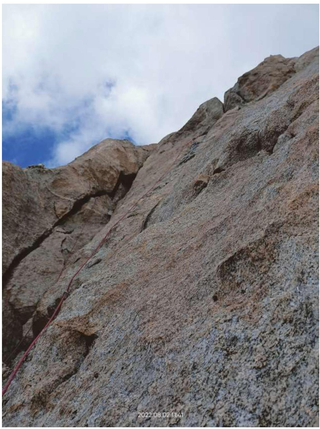
Photo — 10. Section R9–R10.
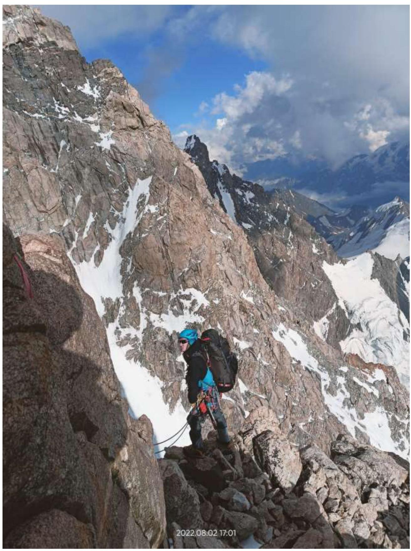
Photo — 11. Section R12–R13.
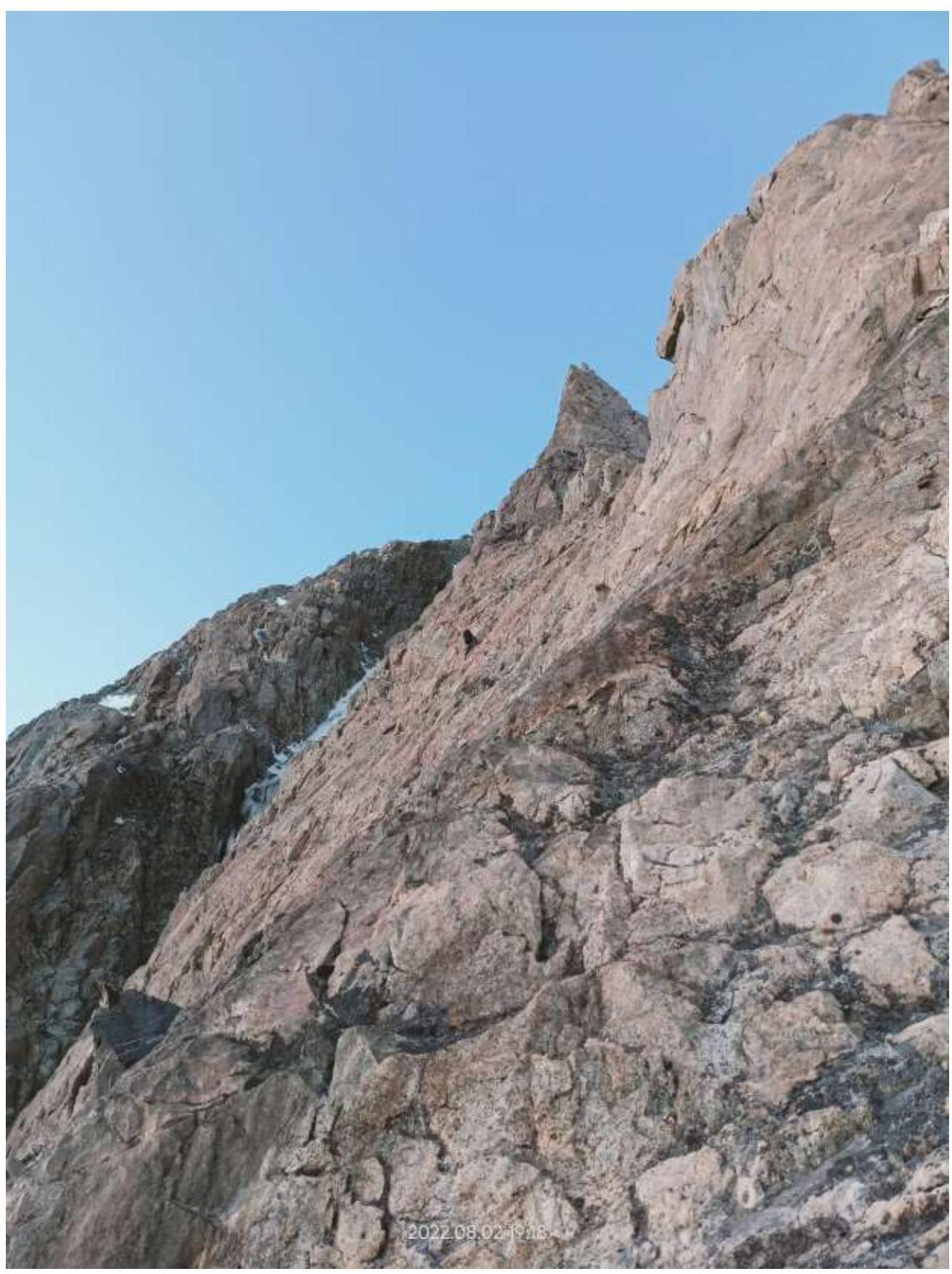
Photo — 12. Section R16–R17.
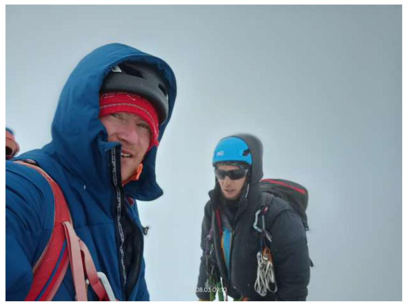
Photo — 14. Summit.
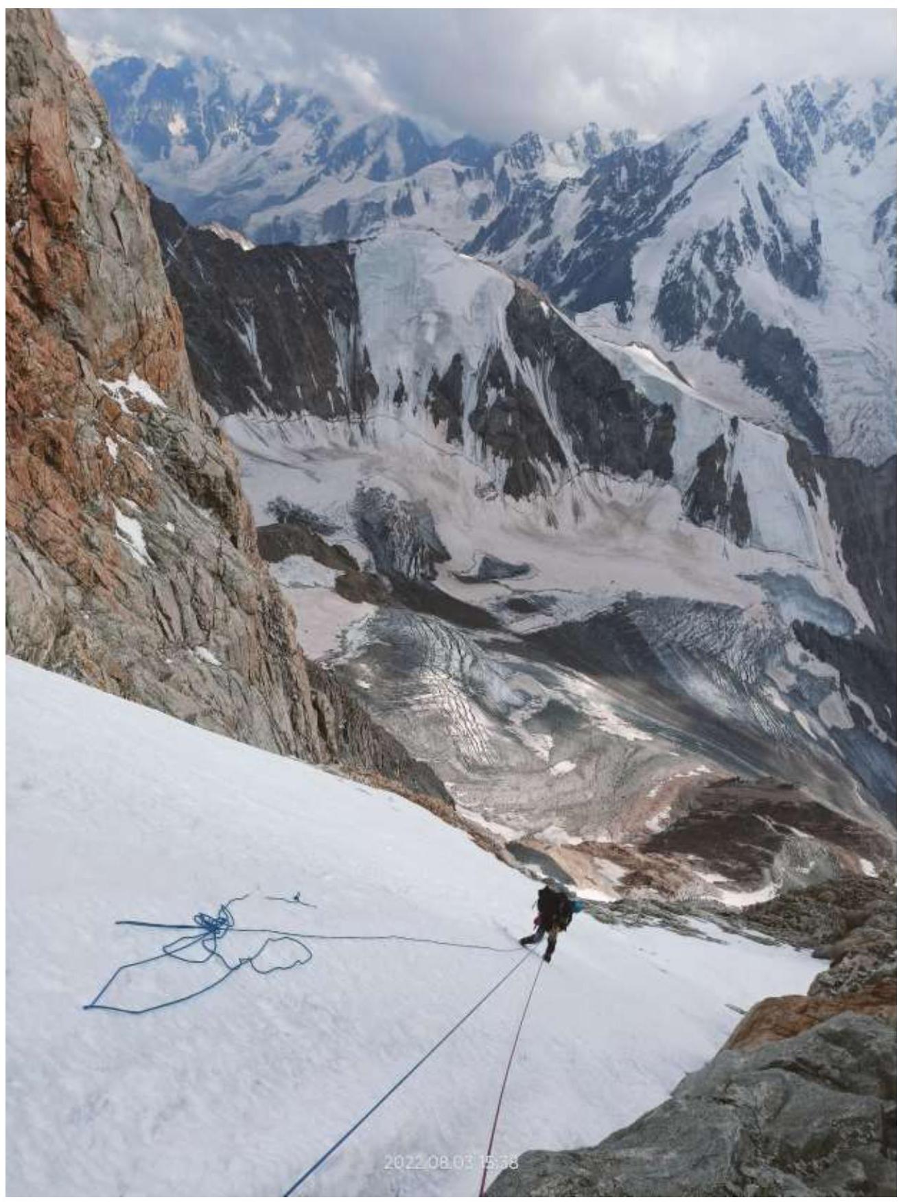
Photo — 15. Descent via the couloir.