Report
ON ASCENDING AK-KAYA PEAK VIA VASILYEV'S ROUTE, CATEGORY 5B, BY FA SPb TEAM FROM JANUARY 1 TO JANUARY 5, 2019
St. Petersburg 2019
I. ASCENT DOCUMENTATION
| 1. General Information | ||
|---|---|---|
| 1.1 | Full Name, Sports Rank of the Leader | Churkin Ivan Sergeyevich, 1st sports rank |
| 1.2 | Full Name, Sports Rank of Participants | Teplov Dmitry Konstantinovich, Candidate for Master of Sports |
| 1.3 | Full Name of Coach | Timoshenko Tatiana Ivanovna, Candidate for Master of Sports |
| 1.4 | Organization | FA SPb |
| 2. Characteristics of the Ascent Object | ||
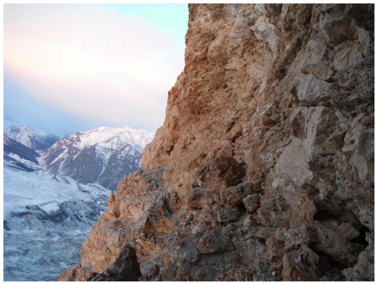
| 2.1 | Region | Bezengi |
| 2.2 | Valley | Bezengi Valley |
| 2.3 | Section Number according to the 2013 Classification Table | 2.5.1 |
| 2.4 | Name and Height of the Peak | Ak-kaya, 3367 m |
| 3. Route Characteristics | ||
| 3.1 | Route Name | via SW wall (Vasilyev's) |
| 3.2 | Difficulty Category | 5B |
| 3.3 | Route Exploration Level | - |
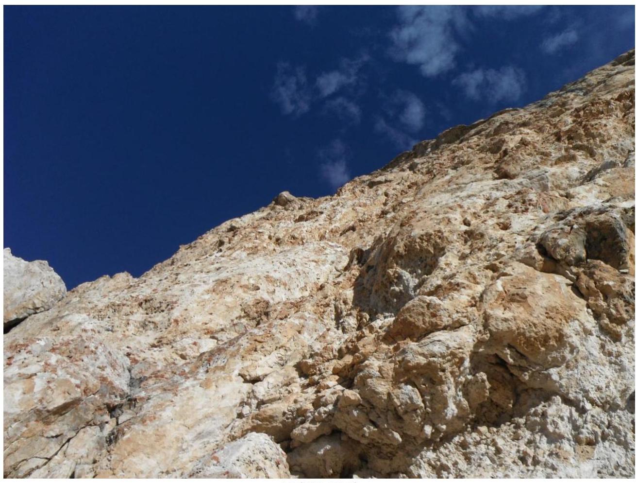
| 3.4 | Route Terrain Character | Rocky |
- 3.5 | Height Difference (from altimeter or GPS data) | 500 | | 3.6 | Route Length (in meters) | 640 | | 3.7 | Technical Route Elements (total length of sections by difficulty category, with terrain character (ice-snow, rocky)) | I cat. rocky — 78 m. II cat. rocky — 60 m. III cat. rocky — 25 m. IV cat. rocky — 80 m. V cat. rocky — 293 m. VI cat. rocky — 76 m. VI cat. rocky, A1 — 17 m. VI cat. rocky, A2 — 12 m. | | 3.8 | Average Route Steepness, ° | 85 | | 3.9 | Average Steepness of the Main Route Part, ° | 85 | | 3.10 | Descent from the Summit | 100 m west of the saddle between Kara-Kaya Main and Kara-Kaya Western, a neat descent of 50 m down a steep slope to a large stone with a loop. From it, 5 rappels onto gentle grassy slopes at the base of the wall. | | 3.11 | Additional Route Characteristics | No water sources; snow is present in a grotto; rare small snow patches are on ledges | | | 4. Characteristics of Team Actions | | | :--: | :-------------------------------------------------------------------------------------------------------: | :----------------------------------------------------------------------------------------------------------------------------------------------------------------------------------------------------------------------------------------------------: | | 4.1 | Time in Motion (team's walking hours, in hours and days) | approach and descent: 0.7 days, 16 h; wall movement: 1.2 days, 29 h; sleep and rest: 2.6 days, 62 h; TOTAL: 4.5 days, 107 h | | 4.2 | Overnights | January 3, 2019 — in a grotto, on a site, January 4, 2019 — on the summit, on a site | | 4.3 | Time Spent Processing the Route | 6.5 h, 0.3 days | | 4.4 | Start of the Route | 06:30, January 1, 2019 | | 4.5 | Reach the Summit | 16:30, January 4, 2019 | | 4.6 | Return to Base Camp | 15:30, January 5, 2019 | | | 5. Weather Conditions | | | 5.1 | Temperature, °C | Day: −10 °C, night: down to −15 °C | | 5.2 | Wind Speed, m/s | Up to 20 m/s, daily from 16:00 to 5:00 | | 5.3 | Precipitation | From 16:00 on January 4 — snow | | 5.4 | Visibility, m | From 16:00 to 22:00 on January 1. Visibility 10 m — fog; from 16:00 on January 4. Visibility 100 m — snowfall with short breaks; | | | 6. Report Responsible | | | 6.1 | Full Name, e-mail | Churkin Ivan Sergeyevich, chiws@bk.ru |
II. ASCENT DESCRIPTION
1. Object of Ascent Characteristics
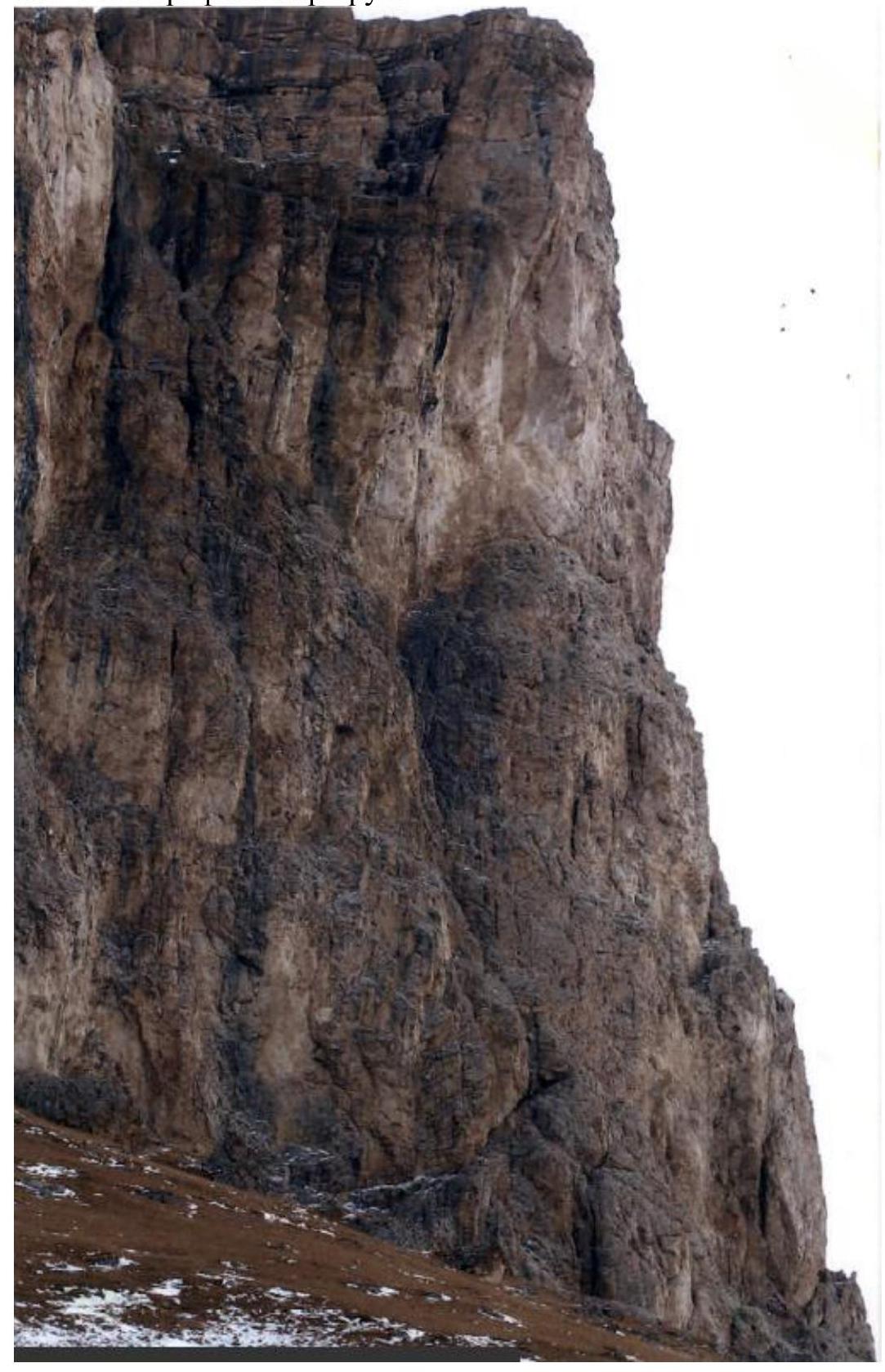
1.1. General Photo of the Route

1.2. Photo of the Route Profile
1.3. Drawn Profile of the Route

1.4. Photopanorama of the Area

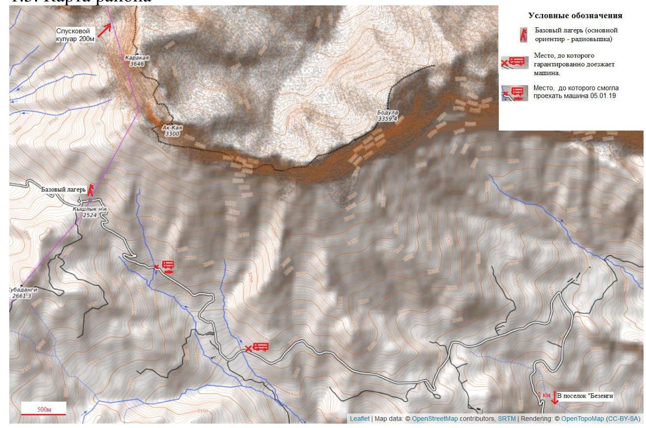
1.5. Map of the Area
2. Route Characteristics
UIAA Scheme
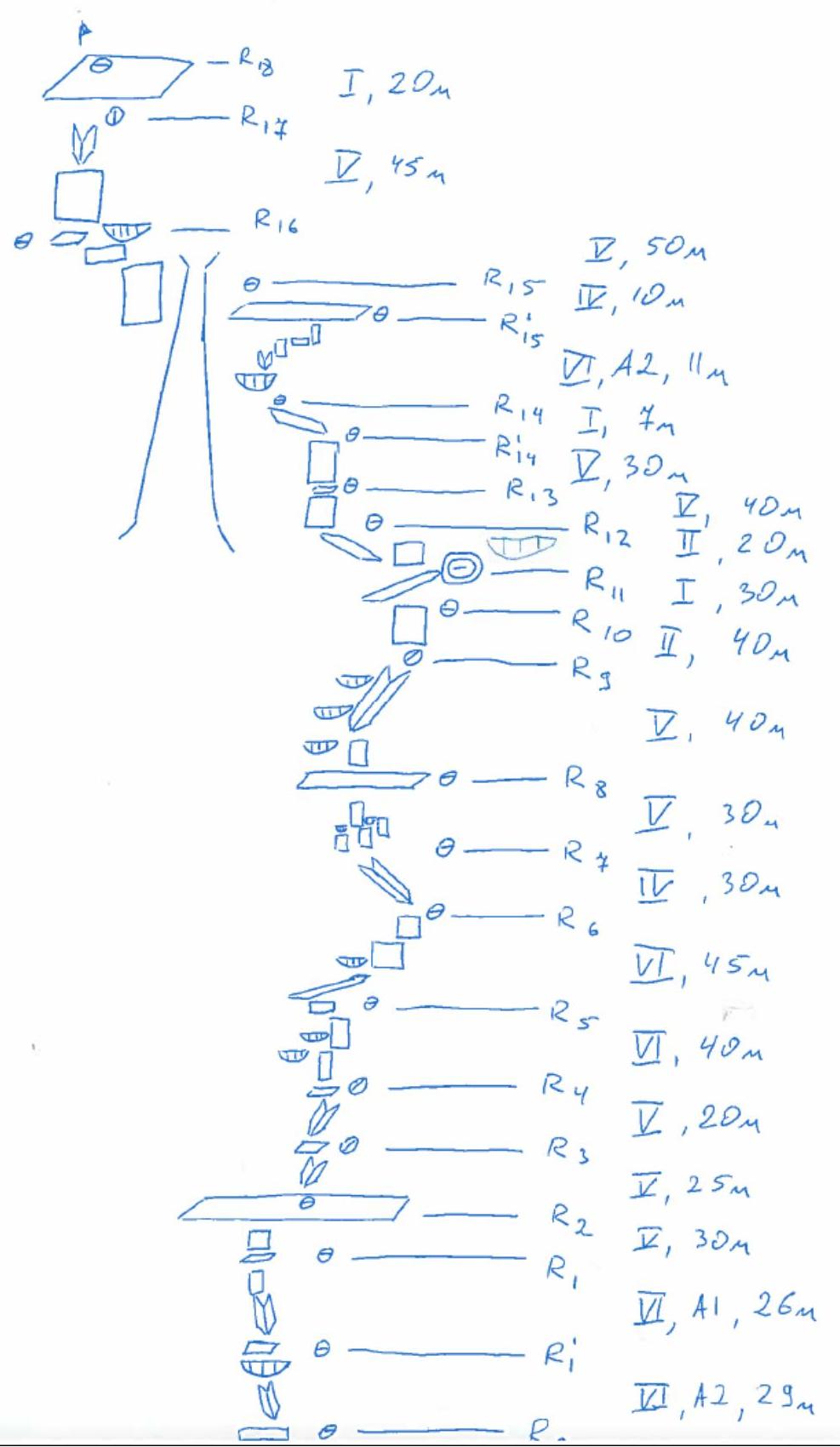 Length of Sections by Difficulty Category, meters
| Category of Difficulty | |||||||||
|---|---|---|---|---|---|---|---|---|---|
| Section | I | II | III | IV | V | VI | A1 | A2 | Total |
| R0–R1' | 10 | 15 | 4 | 29 | |||||
| R1'–R1 | 3 | 10 | 12 | 1 | 26 | ||||
| R1–R2 | 15 | 10 | 5 | 30 | |||||
| R2–R3 | 15 | 10 | 25 | ||||||
| R3–R4 | 20 | 20 | |||||||
| R4–R5 | 35 | 3 | 38 | ||||||
| R5–R6 | 3 | 30 | 8 | 3 | 2 | 46 | |||
| R6–R7 | 30 | 30 | |||||||
| R7–R8 | 35 | 1 | 36 | ||||||
| R8–R9 | 40 | 4 | 44 | ||||||
| R9–R10 | 40 | 40 | |||||||
| R10–R11 | 30 | 30 | |||||||
| R11–R12 | 20 | 20 | |||||||
| R12–R13 | 40 | 2 | 42 | ||||||
| R13–R14' | 30 | 1 | 31 | ||||||
| R14'–R14 | 7 | 7 | |||||||
| R14–R15' | 11 | 8 | 19 | ||||||
| R15'–R15 | 10 | 10 | |||||||
| R15–R16 | 50 | 1 | 51 | ||||||
| R16–R17 | 45 | 2 | 47 | ||||||
| R17–R18 | 20 | 20 | |||||||
| Total | 78 | 60 | 25 | 80 | 293 | 76 | 17 | 12 | 641 |
3. Team Actions Characteristics
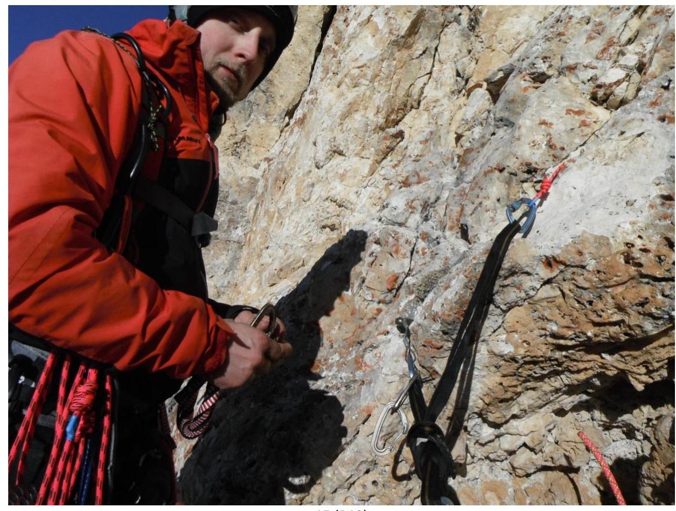
List of Equipment
| Equipment | Quantity | Note |
|---|---|---|
| Hammer | 1 | |
| Crampons | 0 | |
| Camalots | 5 | №№ 2; 1; 0.75; 0.5; 0.4 |
| Anchor Hooks | 7 | Krukonogi.com |
| Rocky Fifes | 2 | Krukonogi.com |
| Slings | 1 | set |
| Middle and Large Hexes | 5 | |
| Eccentrics | 5 | |
| 150 Loops | 2 | on station |
| 120 Loops | 4 | |
| 60 Loops | 6 | |
| 15 Quickdraws | 6 | |
| Non-gate Carabiners | 30 | including those on quickdraws |
| Screw-gate Carabiners | 16 | including personal |
| Belay Device | 2 | Glass |
| Jumar | 1 | |
| T-block (Petzl) | 1 | |
| Tent | 1 | |
| Sleeping Bag | 1 | |
| Down Jacket | 2 | |
| Burner | 2 | |
| Gas | 450 g. | |
| First-aid Kit | 1 | |
| Mobile Phone | 1 | |
| Radio | 1 | |
| Food for 3 Days | 1 | |
| Camera | 1 | |
| Multitool | 1 | |
| Wide Foam Pad | 1 |
Tactical Team Actions
December 31, 2018 07:11 Mineralnye Vody 09:30 Nalchik 11:30 Bezengi settlement 12:30 Setting up camp
January 1, 2019 05:00 Wake-up 06:30 Started processing 08:30 R0, began processing the first key 10:00 R1, passed the first key 15:00 R4 16:00 R0, headed towards the camp 17:00 Fog set in, visibility lost 22:00 Return to camp (fog cleared)
January 2, 2019
Rest day
January 3, 2019
- 04:00 — wake-up
- 05:00 — departure
- 06:30 — R0, started moving along the fixed ropes
- 08:00 — R4, started climbing the second key
- 10:00 — R5
- 13:00 — R7
- 15:00 — R8
- 17:00 — R9
- 18:00 — R11
- 19:00 — bivouac
January 4, 2019
- 06:00 — wake-up
- 08:00 — started moving
- 10:00 — R12
- 13:00 — R14, started climbing the third key
- 15:00 — R15
- 16:30 — summit
- 17:30 — bivouac on the summit
- 23:30 — wind broke the tent poles
January 5, 2019
- 06:30 — wake-up
- 07:30 — departure
- 11:00 — descent pass
- 12:30 — started rappelling
- 13:30 — started descending via scree
- 15:30 — Base camp
Description of Sections
| Section № | Description | Photo № |
|---|---|---|
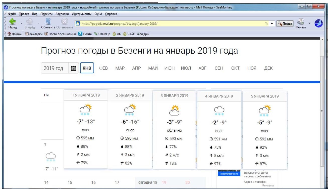
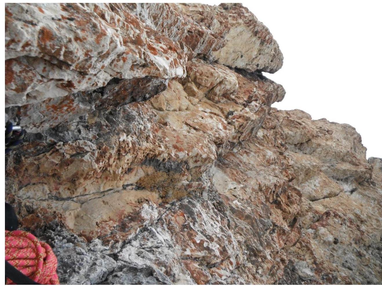
| R0–R1' | up small ledges 5 m (3); up an internal corner under an overhanging ceiling 10 m (6); 2 points on artificial aids across the ceiling (6); through a corniche up to a ledge 5 m (6). – 2 artificial aid points. | 1 |
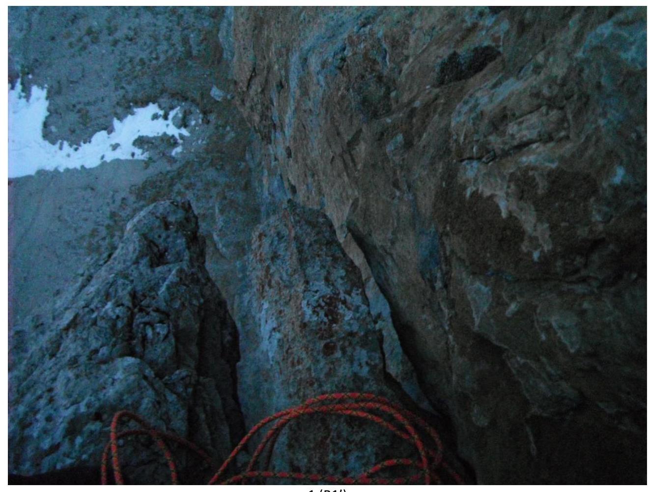
| R1'–R1 | right along a ledge 3 m (1); up an internal corner — wall 10 m (5); traverse right along the wall 7 m towards an old bollard (6), up to a small ledge 5 m (6). – 1 artificial aid point. | 2 |
| R1–R2 | left and up, exit to a large osypnaya ledge 5 m (5), 10 m (4), 15 m (1). – | 3 |
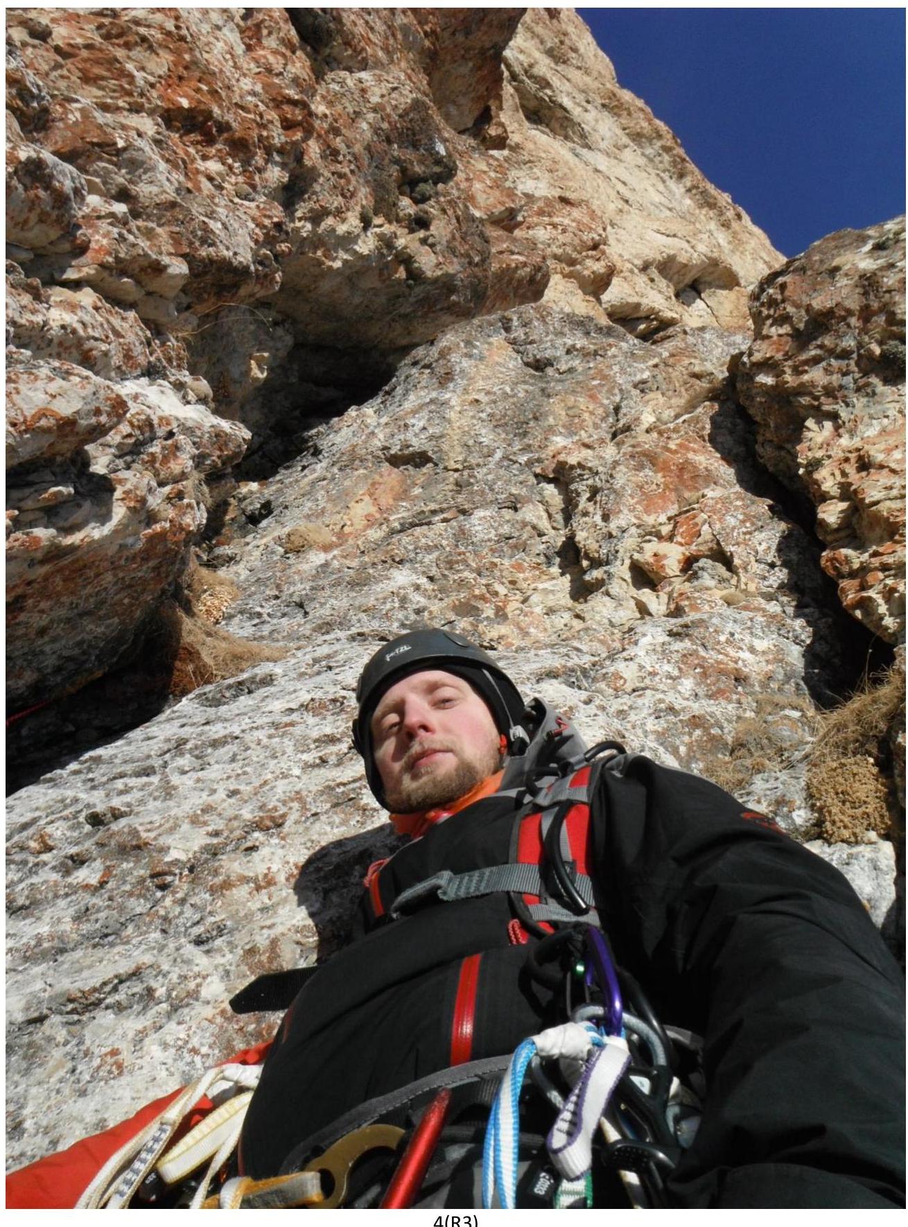
| R2–R3 | right and up monolithic rocks 15 m (3), 10 m (5). Station in an internal corner on a small ledge. | 4 |
| R3–R4 | up monolithic rocks, with a "carrot" and a rope along the way, 20 m (5). Station on a small ledge. | 5 |
| R4–R5 | up monolithic rocks under a triangular corniche (outcrop), a shlyam is on the wall to the left, a large camalot inside, along the wall to the right to the second shlyam, from it up, then left and up to a ledge above the corniche 35 m (6). – 3 artificial aid points. | 6 |
| R5–R6 | Right along a ledge 3 m (1); up under an overhang, an anchor on the wall 3 m (5); complex, crumbly traverse under the overhang to a reepschnur loop 3 m (6); right and slightly down, leaning on the reepschnur, onto monolith 5 m (4); up monolithic rocks (attention, belay for the second with a pendulum!) 30 m (4). Station on a ledge. – 2 artificial aid points. | 7,8 |
| R6–R7 | Left and up a simple internal corner, wall exit to a "field of walllets" 30 m (4). Station on a ledge. – | 9 |
| R7–R8 | Maneuvering between overhanging walllets, exit to a long ledge 35 m (5). Station on a long ledge. – 1 artificial aid point. | 10,11 |
| R8–R9 | Right and up a destroyed wall to the right of corniches. In the upper part, the overhang increases, the belay is unreliable, the rocks are strongly destroyed 40 m (5). Station in a wide monolithic crevice on the wall. 4 artificial aid points. Two points left: sling and anchor. | 12,13 |
| R9–R10 | Up simple monolithic rocks — exit to a "grotto", 40 m (2). Many stones and gravel on the ledges. | |
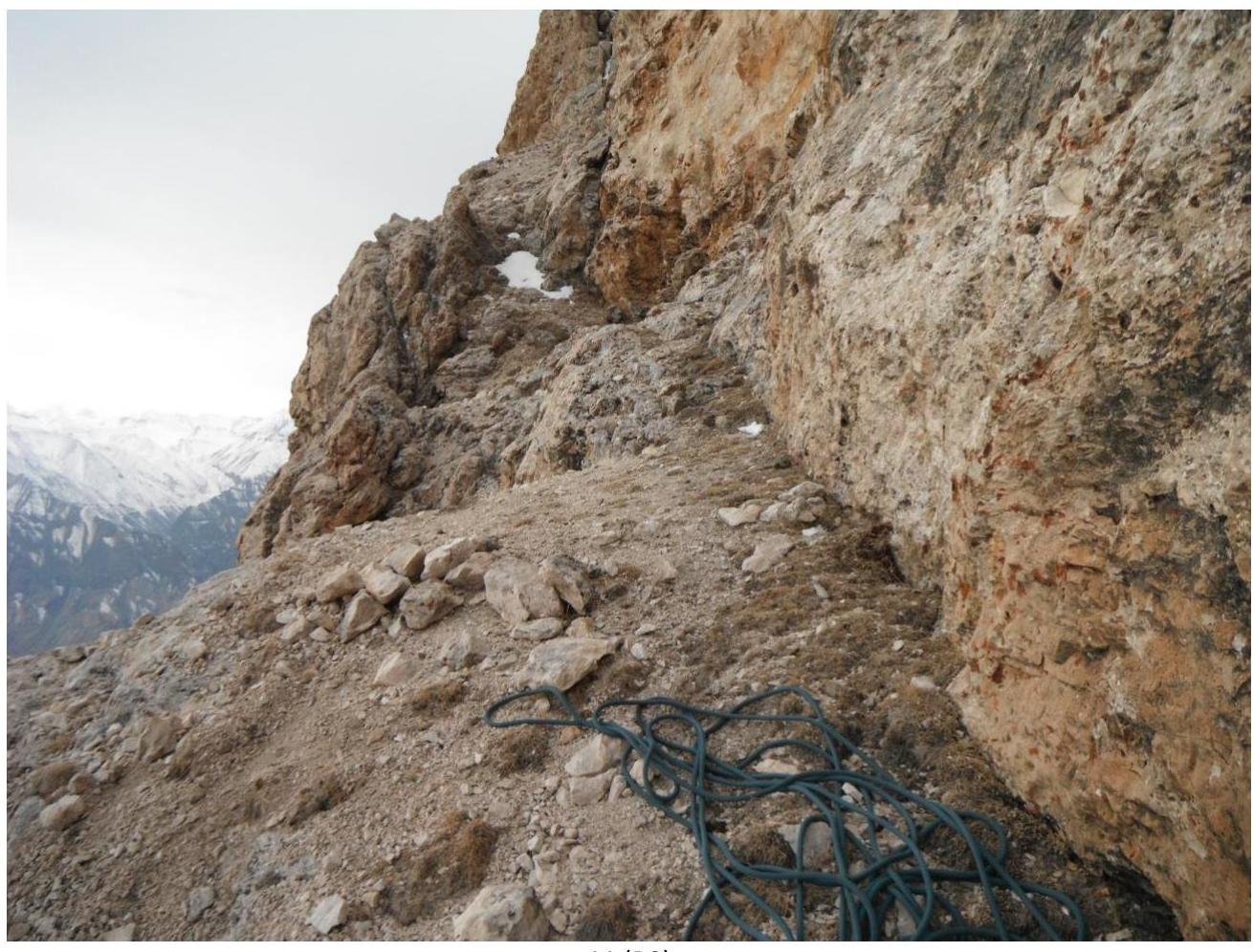
| R10–R11 | Up an inclined osypnaya ledge close to the wall, 30 m (1). Bivouac. | 14 |
| R11–R12 | From the bivouac, left along simple ledges around the corner to a hook at the base of a vertical wall. | 15,16 |
| R12–R13 | From the hook up the wall (in some descriptions, a wall with "feathers"), an old anchor along the way 40 m (5). Station on a small ledge. – 2 artificial aid points. | 15,16 |
| R13–R14' | Left and up monolithic rocks — exit to a ledge to the right of a large chimney 30 m (5). 1 artificial aid point. – | 17,18 |
| R14'–R14 | Left along a ledge close to a large chimney 7 m (1). Station on a "knob". – | 19 |
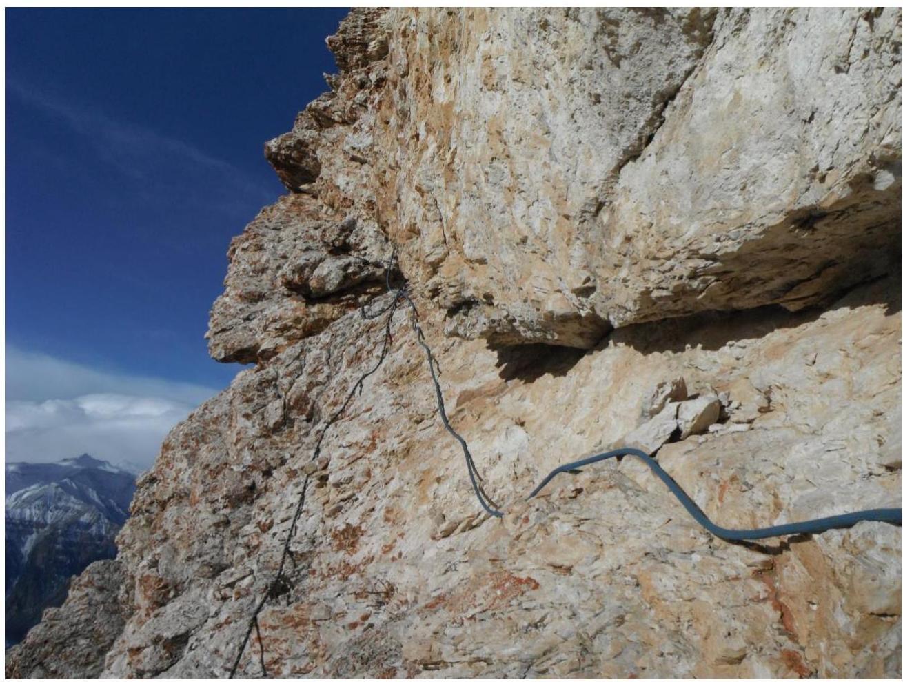
| R14–R15' | Right and up under a corniche (hook) 4 m (6); left to the next hook 2 m (A1), through the corniche and further up an internal corner 4 m (6); complex traverse right (a hook with a carabiner along the way) 3 m (6/A1), right and up the wall (anchor with a carabiner) 5 m (6/A1), exit to a ledge. Station on a narrow ledge across the entire wall. – 4 artificial aid points, 1 sling left. | 20 |
| R15'–R15 | Traverse left along a narrow ledge to a shlyam 10 m (4). Station on a ledge. – | 21 |
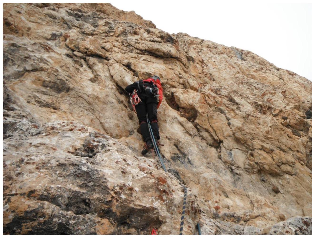
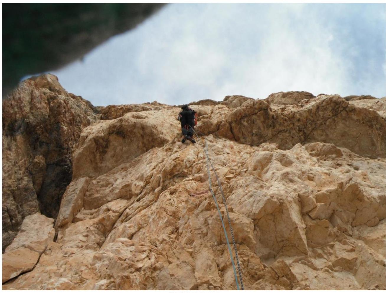
| R15–R16 | Traverse left, "stepping over" the "Big Chimney", then up the "gray mirror" to climb under a corniche with black stains. Then traverse left around the bend onto a ledge. 5 (4c), 50 m. An anchor hook is present along the way. Station on a ledge (1). 1 artificial aid point. | |
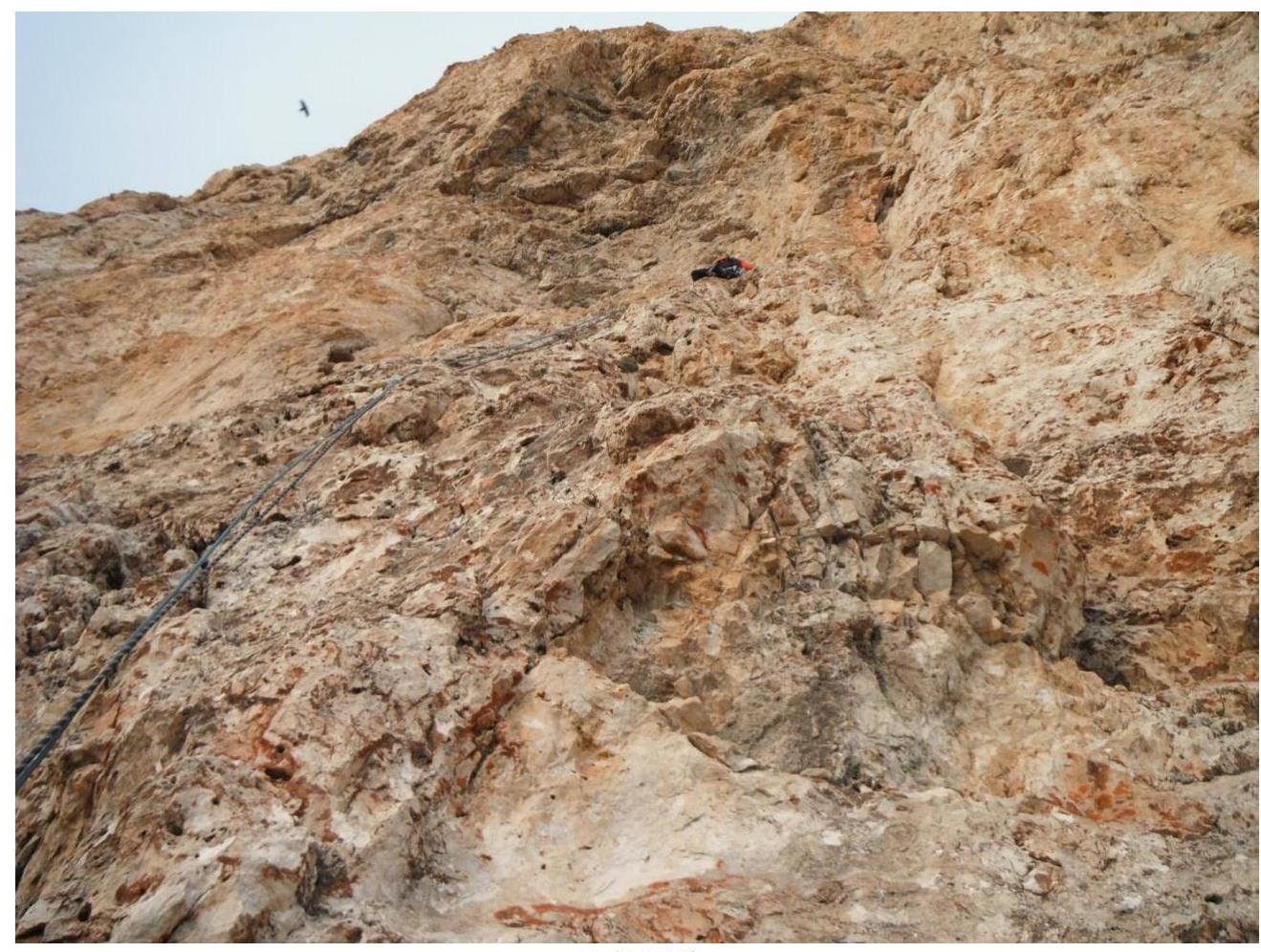
| R16–R17 | Up and slightly right, exit under the summit plateau 45 m (5). Hanging station on a bend before the plateau (1). 2 artificial aid points. | |
| R17–R18 | Exit to the plateau 20 m (1). |
Used on the Route
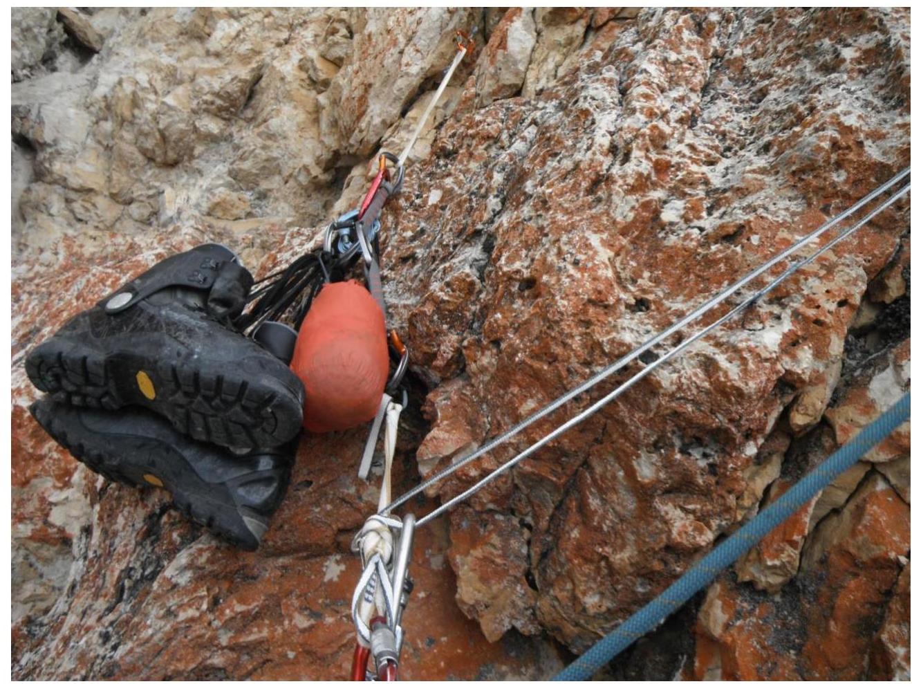
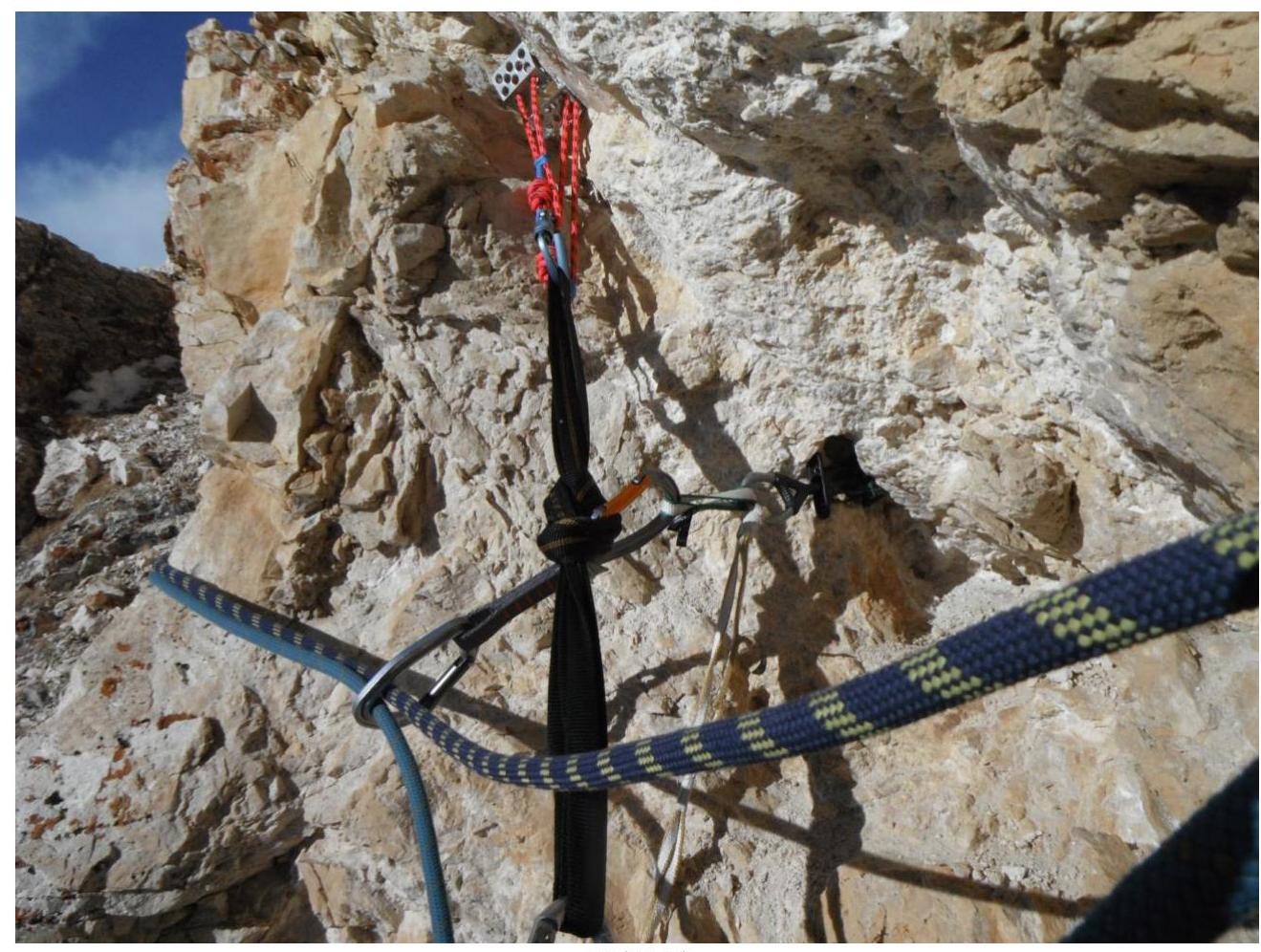
| Total Belay Points, excluding Stations | 170 |
|---|---|
| including Artificial Aids | 23 |
| left behind | 3 |
3.2. Photo of the Team on the Summit with the Control Tour:
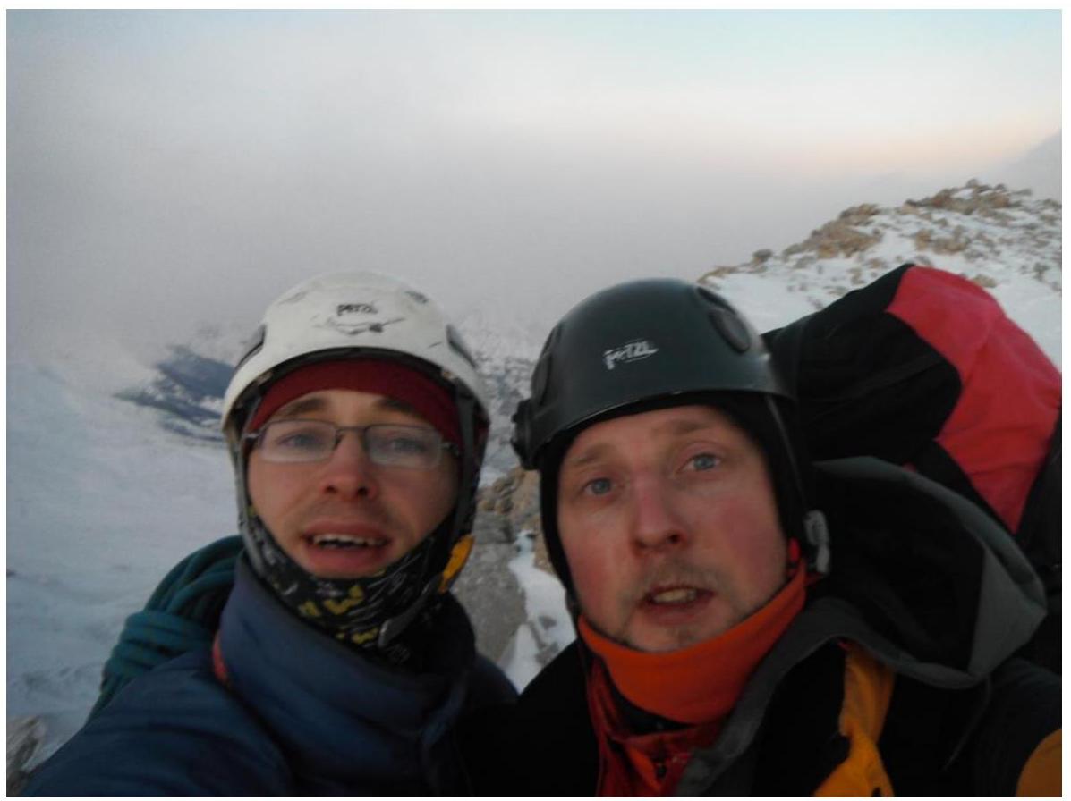
On January 5, 2019, at 05:00
3.3. Route Safety Assessment.
- Some sections are heavily destroyed and continue to deteriorate.
Options for Communication on the Route.
- Radio communication with Bezengi Base Camp is fairly stable on the wall part of the route. On the pass and on the summit plateau — no radio communication.
- There is no cellular communication on the pass (neither Megafon, nor MTS, nor Beeline). Megafon appears higher up the slope (approximately 30 minutes up, communication is unstable).
Recommendations for Future Climbers.
- 07:00 — 17:00
- During heavy snowfalls, the car does not reach the pass by about 2.5 km. From the car to the pass, approximately 45 minutes up without a backpack.
- From the pass to the start of the route without a backpack, 1.5 hours, with a backpack, 2 hours.
- There is snow in the grotto; rare small snow patches are on ledges (note: the 2018–2019 New Year was low in snow).
- Climbed in rock shoes, the climbing level is slightly lower than in Crimea but significantly higher than the "standard" 5B in the large mountains of the Caucasus. Artificial aids are trivial; old hooks are present.
- In conditions of fog and snowfall, orientation on the terrain is quite problematic. There are no trails. There are linear objects: a road and a power line, but they are below the pass and can lead to a neighboring valley.
Detailed Information about the Descent from the Summit, indicating Landmarks.
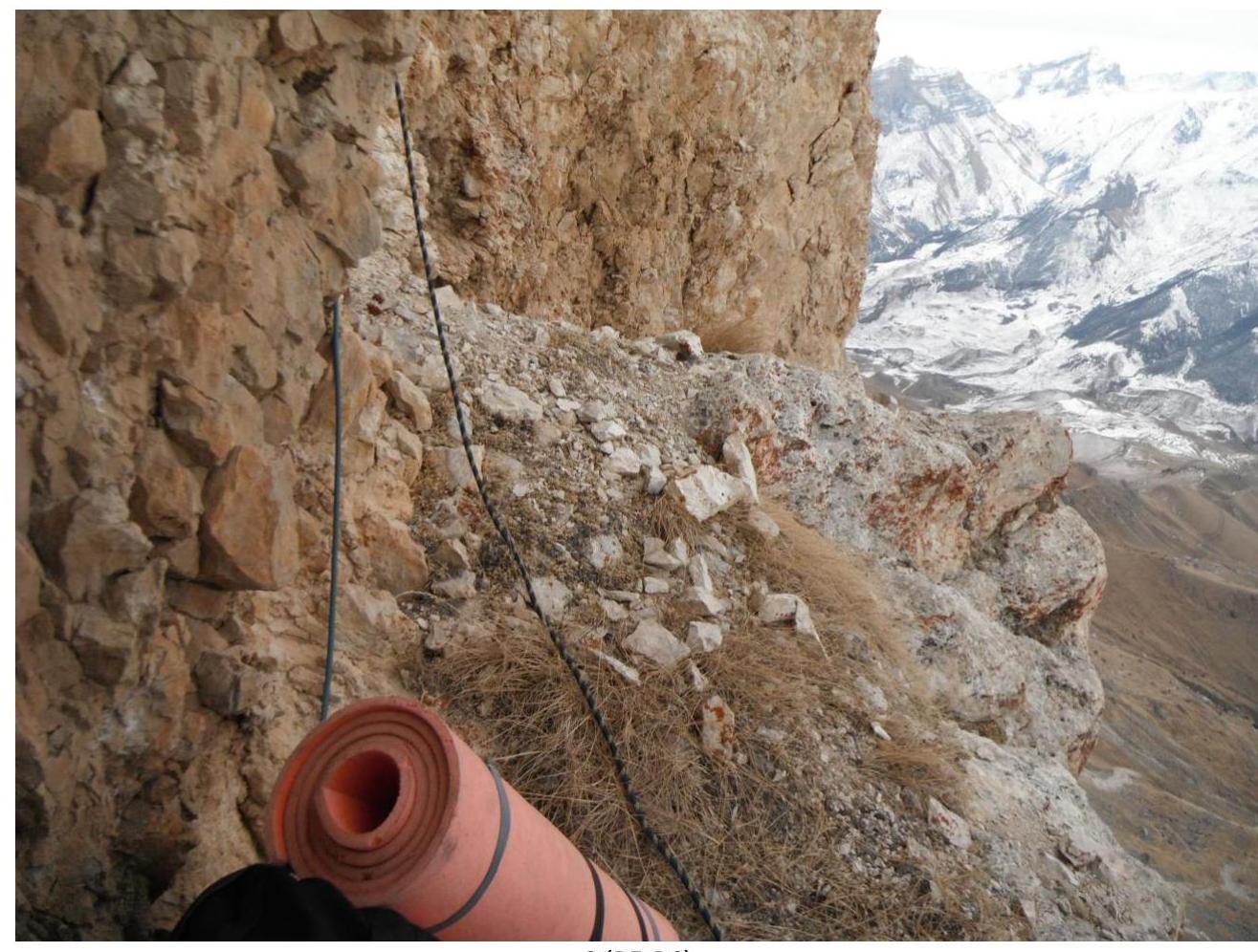
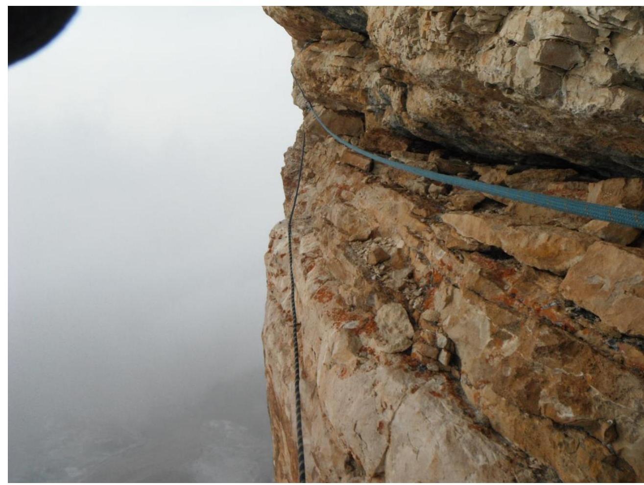
On foot to the extended pass Kara-kaya Main (sharp peak) — Kara-kaya Western (in the form of a funnel) and a bit up. A tur height of 50 cm. From the tur, below and closer to the Kara-kaya-Western peak, 50 m on foot along the scree to a loop.
- Rappelling 50 m along stones (25°), the next station on a stone.
- Rappelling 30 m diagonally (15°) — the next station on a stone "wrapped" in ropes, with a local carabiner on the reverse side.
- Rappelling 50 m vertical under cornices (90°) — vertically down, the next station on anchors and slings, local carabiner.
- Rappelling 50 m vertical (90°) — vertically down, into a narrow couloir (filled with snow, with ice underneath in some places).
- On foot down, overcoming (jumping over) small walls, 80 m.
- On the wall to the right, above, a hook with a loop, from it rappelling 50 m onto scree.
Conclusion on the Preliminary Route Assessment compared to Classified Routes of the Same Category in the Climbers' Experience.
- The climbing difficulty is above average for 5B in the large mountains of the Caucasus. Artificial aids are trivial; old hooks are present.
4. Weather Conditions Characteristics
4.1. Confirmation of Data specified in the Ascent Passport with Screenshots of Weather Forecasts from Websites:
- https://www.mountain-forecast.com↗
- https://www.meteoblue.com↗
- http://worldweather.wmo.int/en/home.html↗
- https://meteoinfo.ru/forecasts↗
- https://www.gismeteo.ru/↗
 1 (R1')
 2 (R1)
 3 (R2)
 4 (R3)
 5 (R4)
 6 (R4–R5)
 7 (R5)
 8 (R5–R6)
 9 (R6–R7)
 10 (R7–R8)
 11 (R8)
 12 (R8–R9)
 13 (R8–R9)
 14 (R11)
 15 (R12)
 16 (R12–R13)
 17 (R13)
 18 (R13–R14')
 19 (R14')
 20 (R14–R15')
21 (R15'–R15)