REPORT ON THE FIRST ASCENT TO THE SUMMIT OF Soviet VoIN PEAK VIA THE ROUTE OF 3A DIFFICULTY CATEGORY BY THE FRI-LINE TEAM FROM PYATIGORSK ON SEPTEMBER 28, 2023
I. Ascent Passport
| № | 1. General Information | |
|---|---|---|
| 1.1 | Full name, sports rank of the leader | Konstantinov G.A. 1st sports rank |
| 1.2 | Full name, sports rank of the participants | Popov M.L. CMS, Semenova O.A. 1st sports rank |
| 1.3 | Full name of the coach | Motienko N.I. CMS |
| 1.4 | Organization | Fri-line MAC |
| 2. Characteristics of the Ascent Object | ||
| 2.1 | Region | Caucasus, Kabardino-Balkaria |
| 2.2 | Valley | Kyrtyk River valley |
| 2.3 | Number according to the 2013 classification table | 2.4. From the Chiperezau Pass to the Gumachi peak (Baksan, Adylsu, Shkhelda, Kyrtyk valleys) |
| 2.4 | Name and height of the summit | Soviet VoIn peak, 4012 m |
| 2.5 | Geographical coordinates of the summit (latitude/longitude), GPS coordinates (1) | 43°19′330″ N 42°37′277″ E |
| 3. Characteristics of the Route | ||
| 3.1 | Name of the route | via the North wall |
| 3.2 | Proposed category of difficulty | 3A |
| 3.3 | Degree of route development | first ascent |
| 3.4 | Character of the route terrain | Ice and snow |
| 3.5 | Height difference of the route (data from altimeter or GPS) | 450 m |
| 3.6 | Length of the route (in meters) | 624 m |
| 3.7 | Technical elements of the route (total length of sections of different difficulty categories with terrain character indication) | I cat. diff. (ice) – 0 m. II cat. diff. (ice) – 140 m. III cat. diff. (ice) – 200 m. IV cat. diff. (ice) – 284 m. V cat. diff. – 0 m. |
| 3.8 | Descent from the summit | via the North wall to the Mkyara glacier |
| 3.9 | Additional characteristics of the route | Movement on a closed glacier – 1000 m |
| 4. Characteristics of the Team's Actions | ||
| 4.1 | Time of movement (team's travel hours, in hours and days) | 10 hours |
| 4.2 | Overnight stays | no |
| 4.3 | Start of the ascent | 8:00 on September 28, 2023 |
| 4.4 | Reaching the summit | 13:00 on September 28, 2023 |
| 4.5 | Return to the base camp | 18:00 on September 28, 2023 |
| 5. Person responsible for the report | ||
| 5.1 | Full name, e-mail | Konstantinov Gennadiy Andreevich, bargest2008@gmail.com, 8 988 860 73 77 |
1. Characteristics of the Ascent Object
General photo of the Soviet VoIn peak from the Mkyara-Vostochny glacier
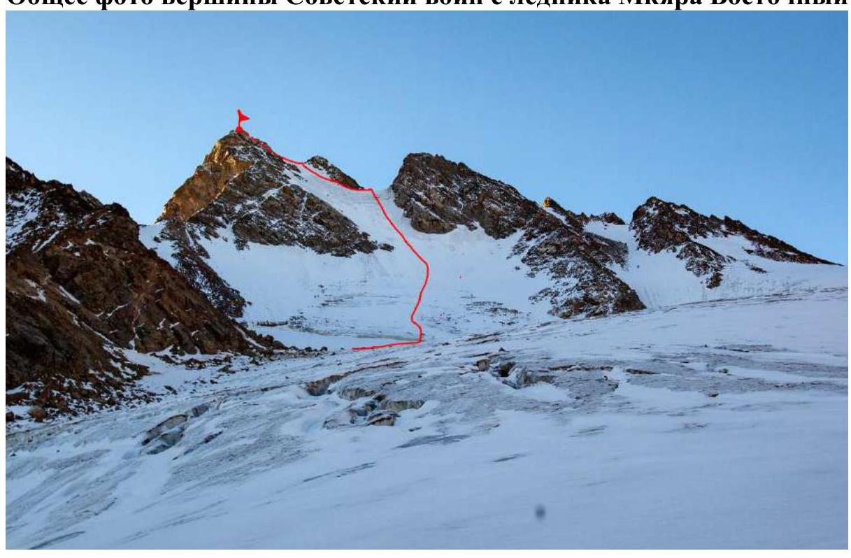
Red line – the route of the first ascent by the team
Photo of the route profile
 Dashed line –
first ascents
via the north ridge
green line – 2A cat. diff. via the
west ridge
Dashed line –
first ascents
via the north ridge
green line – 2A cat. diff. via the
west ridge
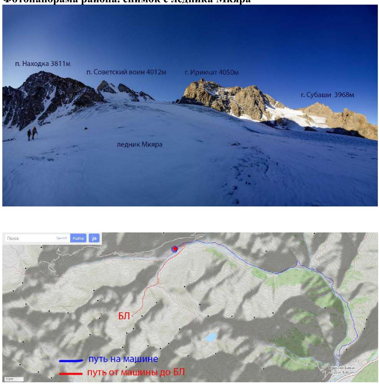
Panorama of the area. Photo from the Mkyara glacier
Brief Overview of the Ascent Area and Approach Description
The ascent area is located in the part of the Lateral Ridge of the Central Caucasus, stretching from the Irik peak (4046 m) to the Mukal peak (3899 m). The object of the ascent – the Soviet VoIn peak – is located in the ridge between the Kezgen and Irikchat peaks.
From the village of Verkhniy Baksan, a dirt road leads to the Kyrtyk River valley to the last sheepfold at the confluence of the Kyrtyk and Mkyara rivers (15 km). The road from Verkhniy Baksan is passable for vehicles like Lada "Niva" and UAZ "Patriot". Further, across a small bridge over the Mkyara River and along its orographically right bank, a marked trail leads up to the edge of the "hanging valley" (3 km). Then, to the right on the trail, bypassing peak 3428. At a convenient location, cross the Mkyara River and move up along the scree along the ridge connecting peak 3428 and the Nakhodka peak. After some time, the slope becomes gentler and transitions into a wide valley, and then a steep scree slope rises to the left towards the wall of the Nakhodka peak. There is a lake there, suitable for overnight stays. From the car, it takes 3 hours.
There is no mobile connection in the valley, but it is available on the Soviet VoIn peak. Border permits are not required.
2. Characteristics of the Route
Technical photo of the route
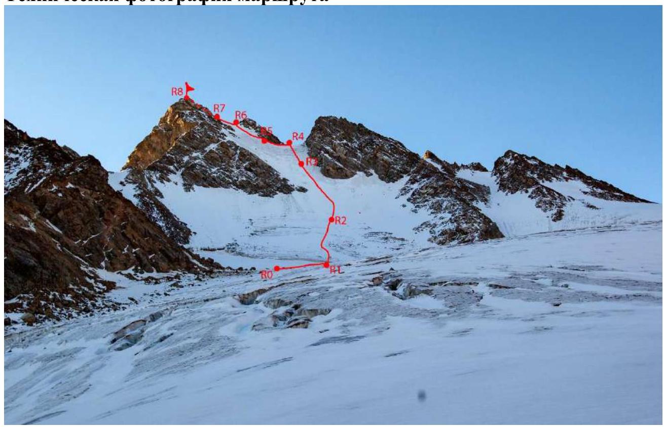
Technical characteristics of the route sections of 3A cat. diff.
| Section № | Character of the terrain | Category of difficulty | Length, m | Type and number of hooks |
|---|---|---|---|---|
| R0–R1 | Snow-ice slope | 2 | 70 | 0 |
| R1–R2 | Ice slope | 4; 3 | 4; 200 | 1; 8 |
| R2–R3 | Ice slope | 4 | 100 | 8 |
| R3–R4 | Ice slope | 4; 4 | 60; 40 | 8 |
| R4–R5 | Snow ridge | 2 | 50 | 1 |
| R5–R6 | Snow slope | 4 | 50; 30 | 4 |
| R6–R7 | Snow ridge | 2 | 20 | 1 |
| R7–R8 | Large-block scree | 2 | 60 | 0 |
3. Characteristics of the Team's Actions
| Section № | Description | Photo № |
|---|---|---|
| R0–R1 | on the glacier, 30° upwards, 2 cat. diff., 70 m to the bergschrund | 1 |
| R1–R2 | overcoming the bergschrund, 4 cat. diff., 4 m, then straight up the ice slope, 35°, 3 cat. diff. – 200 m | |
| R2–R3 | further, the slope steepness increases to 40–45°, 100 m, 4 cat. diff., straight up | 2 |
| R3–R4 | further, 100 m straight up towards the snow-ice saddle, slope steepness increases to 50°, last 40 m – 55°, 4 cat. diff., exit to the saddle | 3, 4 |
| R4–R5 | from the saddle, traverse to the left along the snow ridge, 50 m, 2 cat. diff. | 5 |
| R5–R6 | then up the snow slope towards the next saddle, 50 m, 40–45°, and 30 m, 50°, 4 cat. diff. | 6, 7 |
| R6–R7 | exit to the saddle and traverse to the left along the snow ridge, 20 m, 2 cat. diff. | 7 |
| R7–R8 | along the large-block scree slope, 50 m, 25°, 2 cat. diff., to the summit | 8 |
Photo №1. R0–R1
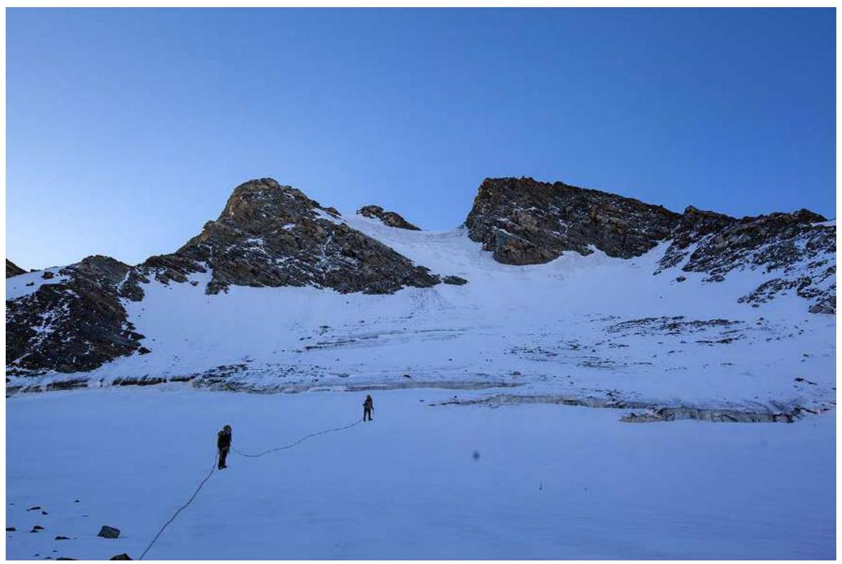
Photo №2. R1–R3
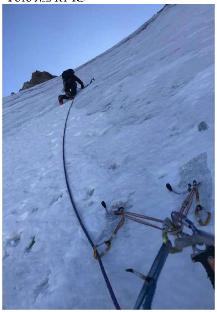
Photo №3. R3–R4
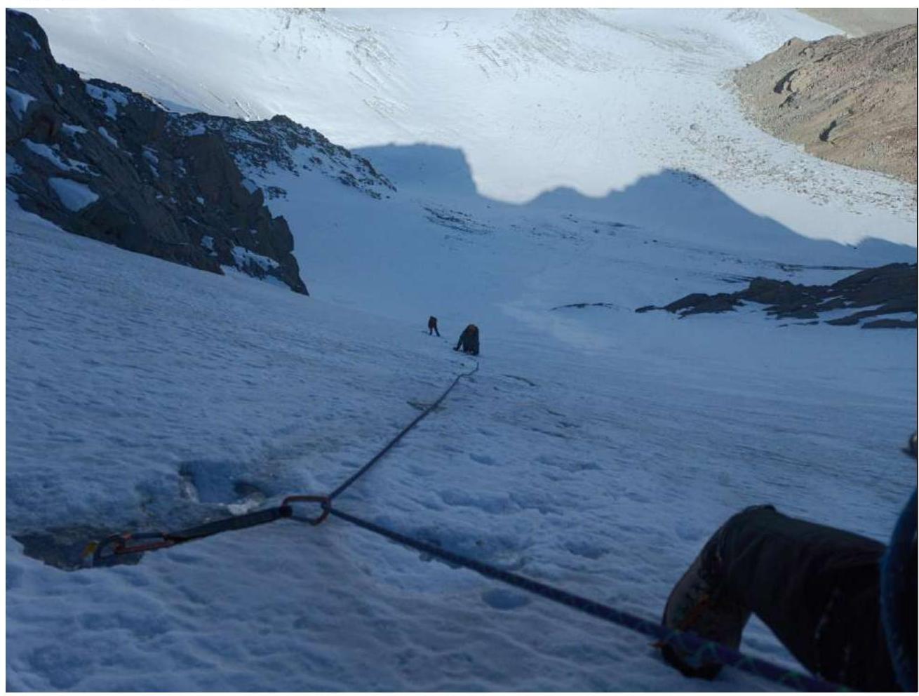
Photo №4. R4–R5
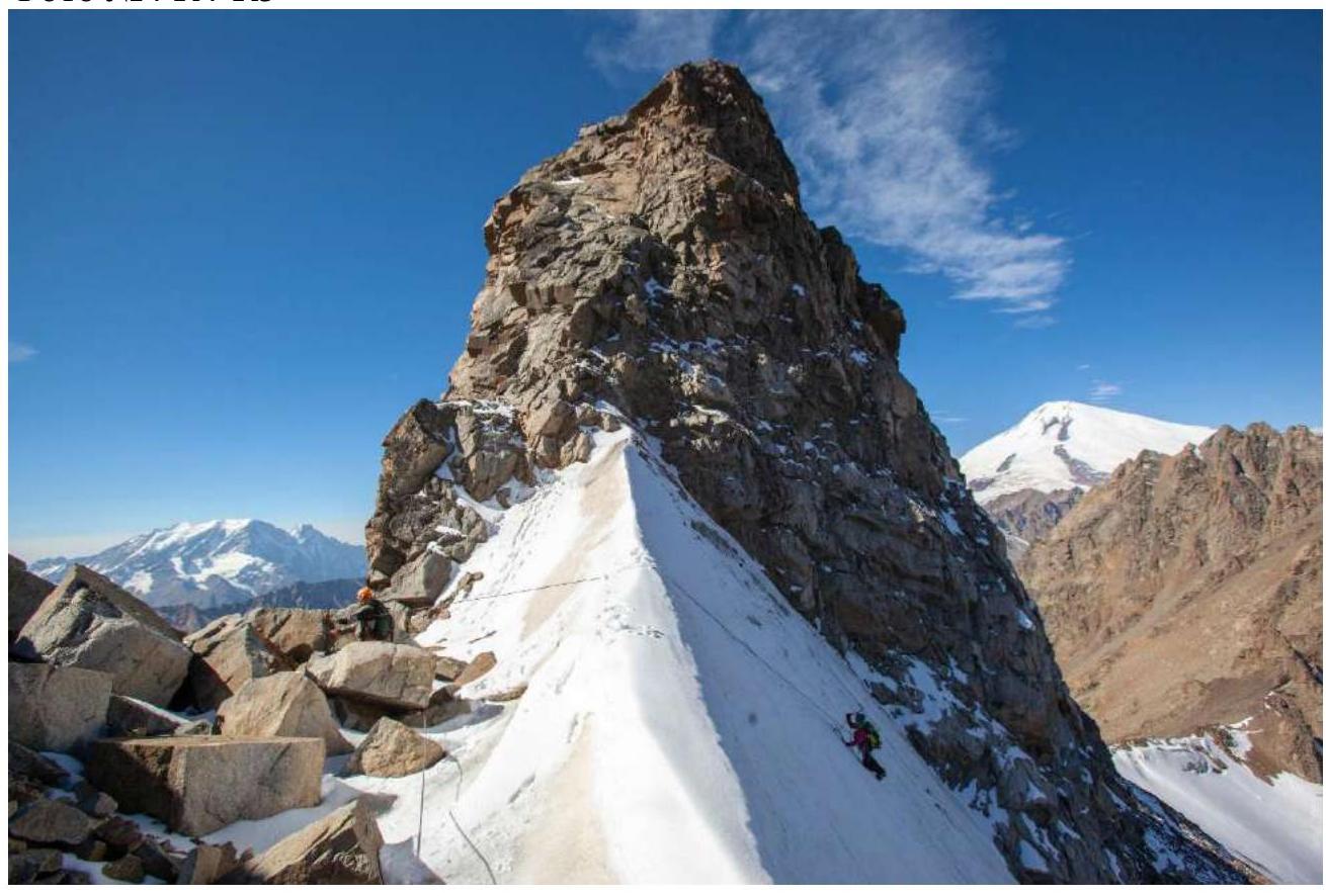
Photo №5. R5–R6
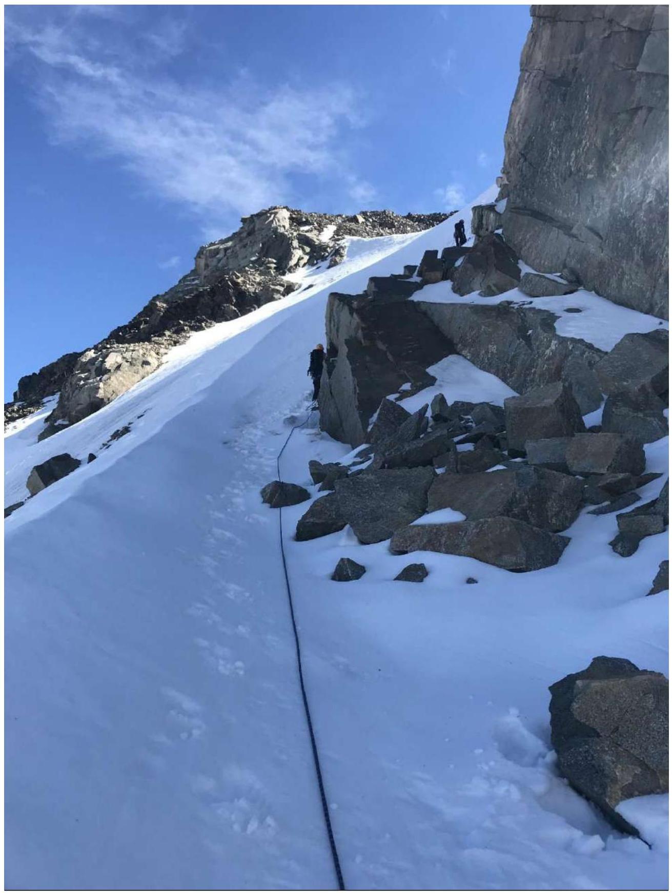
Photo №6. R6–R7
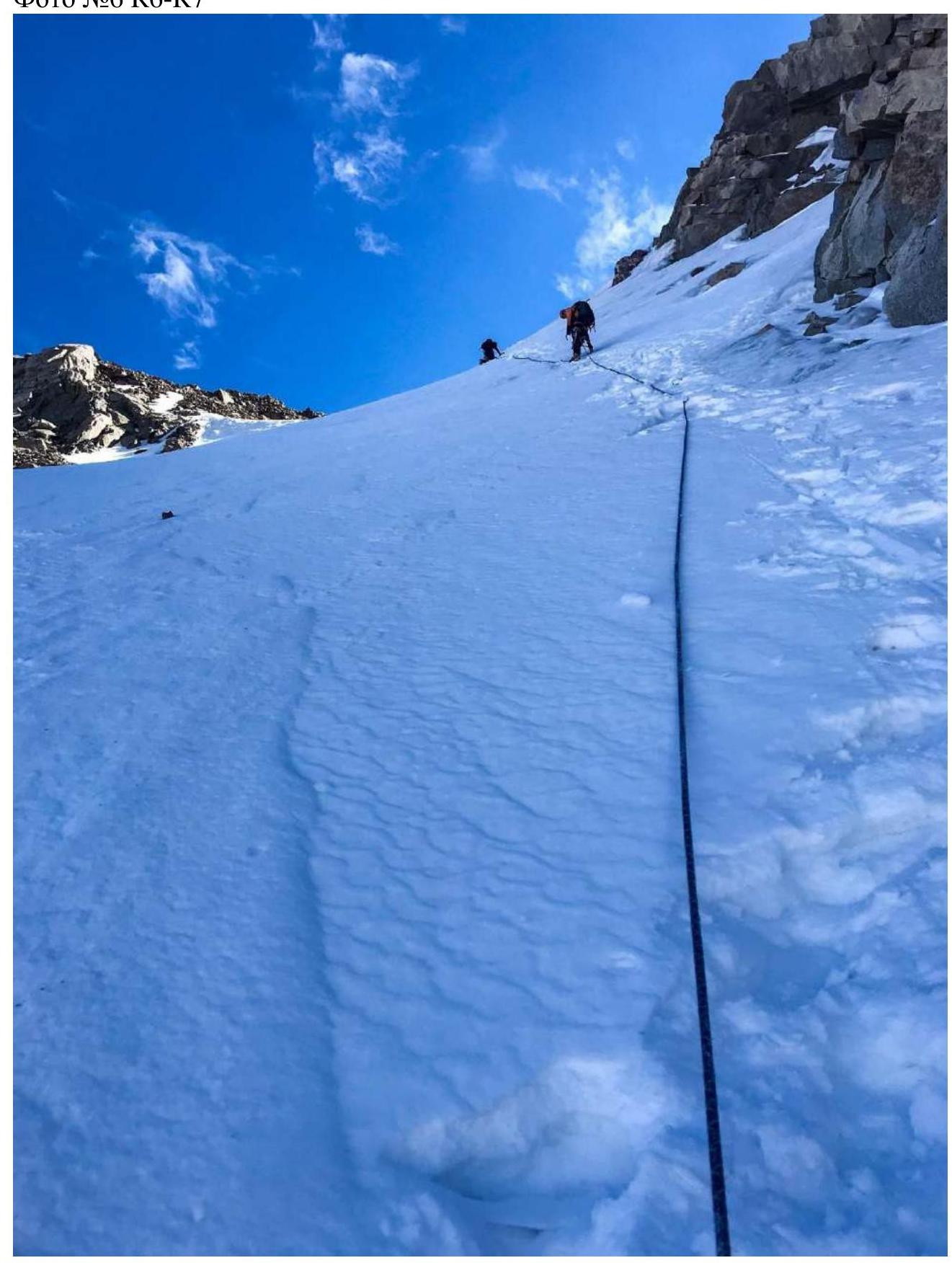
Photo №7. R6–R8

Photo №8. R7–R8
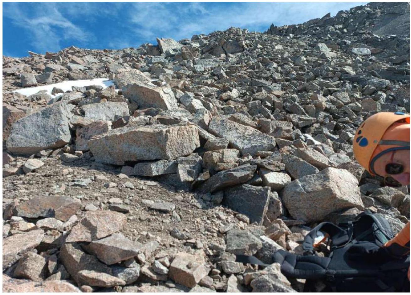
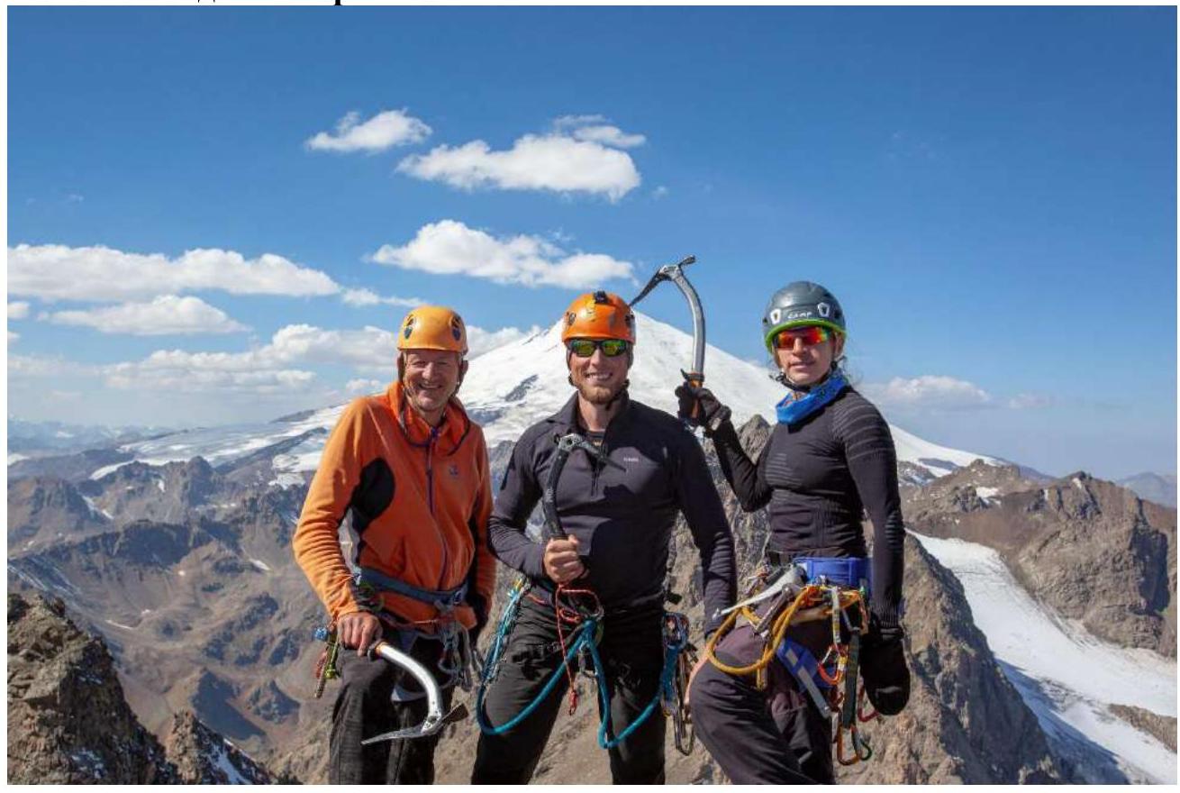
Photo of the team on the summit
Conclusions and Recommendations
The route is logical and safe in terms of rockfall danger. In our opinion, it corresponds to a strong 3A category. We compared it with a similar route on Sella peak, 3A cat. diff. The descent from the route can be logically done via the ascent route using rappelling or via 2A cat. diff. towards the Soviet VoIn pass. For safety, ice screws were used. Recommended for educational and sports ascents by a group of 2–4 people.