Addresses and Phone Numbers
Organization and address for inquiries:
- 361603, Kabardino-Balkarian Republic, Elbruss post office, KSP.
Coach: Tilov Boris Osmanovich
Shkhelda (C) via the left edge of the N. wall, 4295 m.
6A category of difficulty, first winter ascent.
Elevation gain: 1290 m, length — 1950 m.
5 category of difficulty — 520 m; 6 category of difficulty — 200 m.
Average steepness of the main part of the route — 57°.
Hooks left on the route (not removed) — 12 pcs.
Previously driven hooks used and not removed — 3 pcs.
Climbing hours — 44, days — 5.
Leader: Shepachkov S.E., CMS
Elarov A.V., CMS
Reznitsky D.V., 1st sports category
Rozin I.L., MS
21–25 February 1996
Elbrus Search and Rescue Service
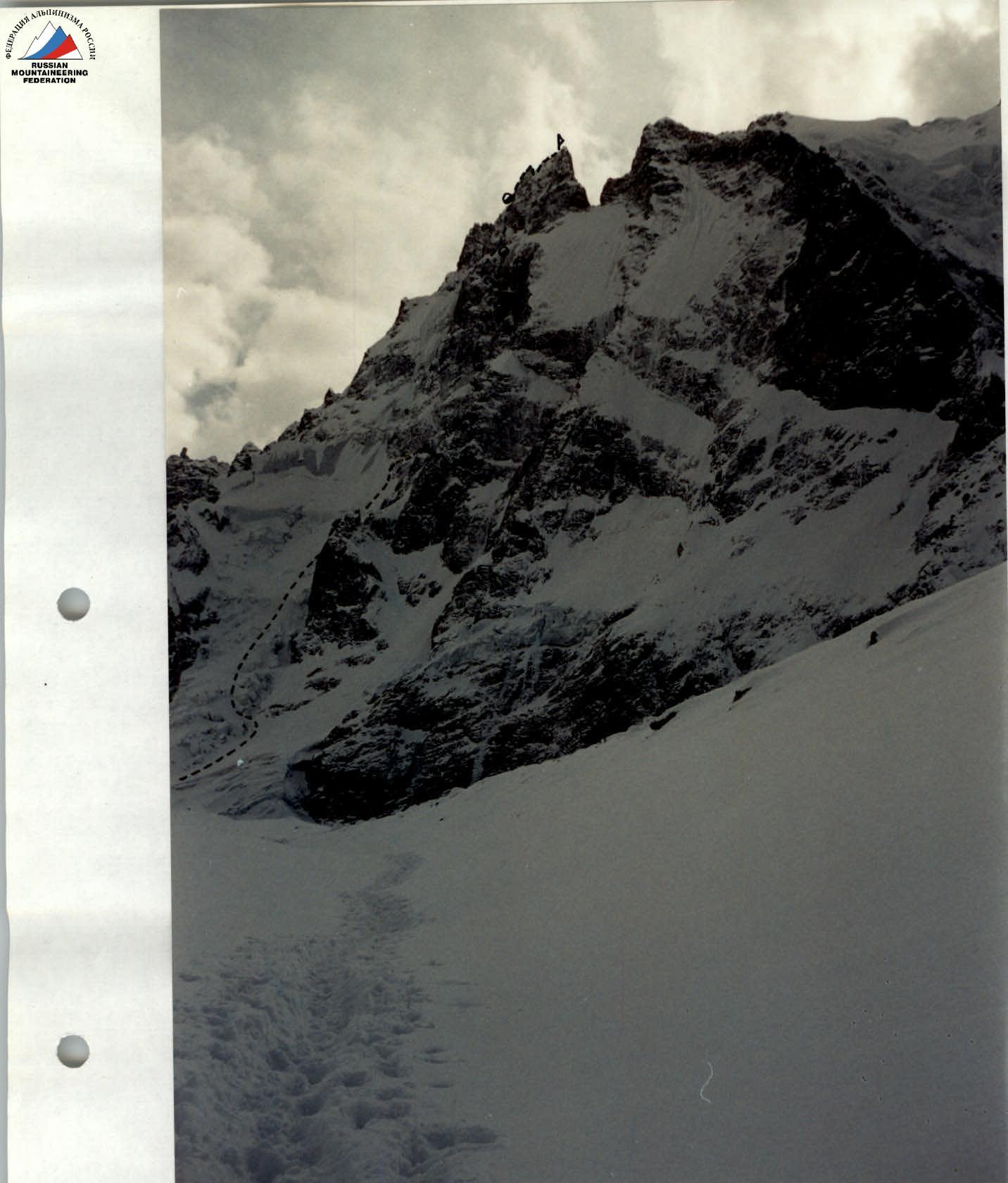
Profile of the wall from the right. Date taken 28 February 1996, 14:20.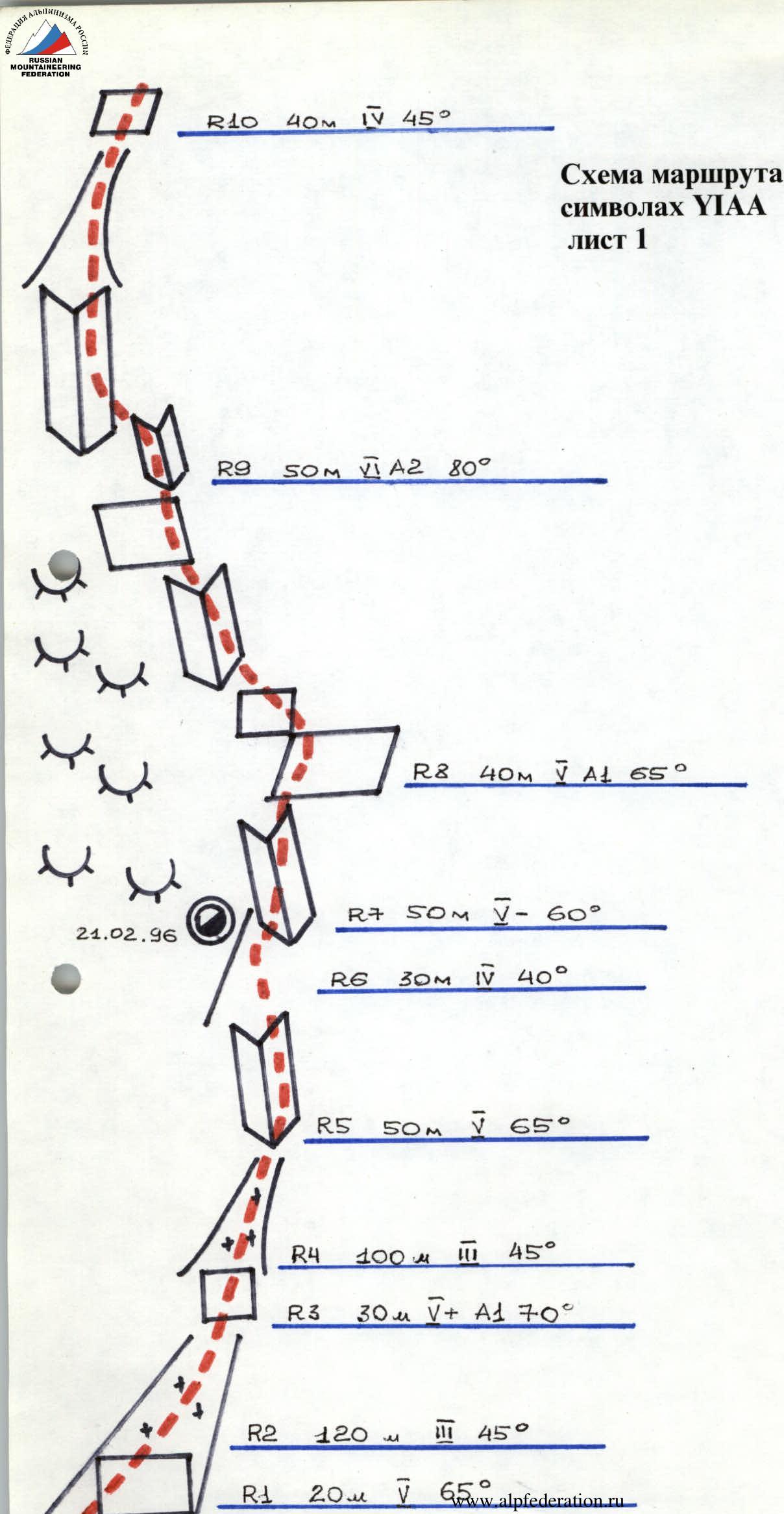
Route diagram in YIAA symbols R22 40 m, 75°.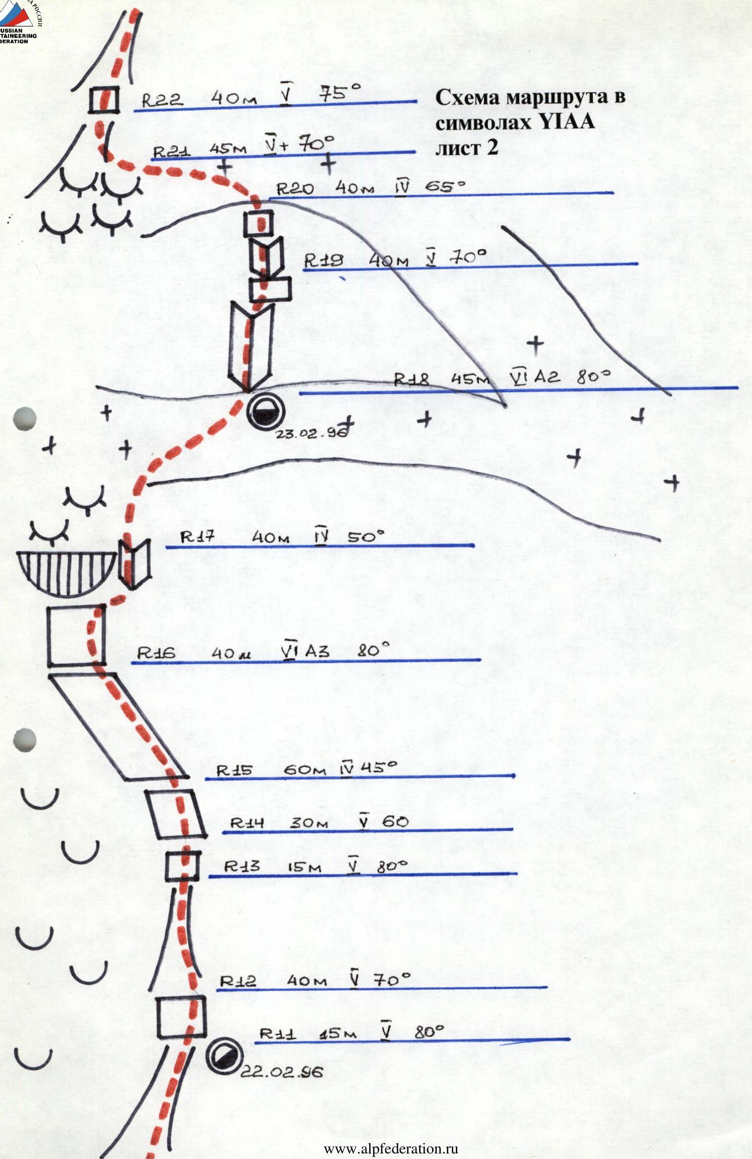 Route diagram in YIAA symbols sheet 3
Route Description by Sections
R0–R1 — approach via the icefall, overcoming a 15-meter bergschrund wall, to the base of a large couloir leading to the wall. R1–R5 — up the couloir, overcoming several complex rock belts. R5–R7 — via a system of icy internal corners, then via the ice slope to the snow-ice ridge. R7–R9 — via snow-covered, icy rocks of above-average difficulty using skyhooks and ice picks in combination with ladders to one of the key sections of the route. R9–R10 — 50 m of very difficult climbing on icy rocks of an internal corner (TIT, skyhooks, ice picks). R10–R15 — via complex rock walls alternating with ice sections, exit to a snow-ice shelf-slope. R15–R16 — left along the slope under the overhanging rocks of the upper part of the wall. R16–R17 — up the wall, bypassing the cornice on the right via an internal corner, then via icy rocks like "ram's foreheads", exit to an ice-snow slope under the tower (TIT, skyhooks, ice picks). R17–R18 — up the slope to the base of a large internal corner. R18–R20 — 45 m of extremely difficult climbing up an icy corner (TIT, ice picks), then 40 m of difficult climbing via snow-covered rocks like "ram's foreheads" (TIT), leading to a steep snow-ice slope. R20–R24 — left along the slope, then via snow-covered rocks and ice gullies under the rock wall, leading to the top of the tower. R24–R29 — 105 m of extremely difficult climbing up the wall (TIT, skyhooks). R29–R30 — 80 m rappel into the ridge gap. R30–R32 — ascent from the gap via complex snow-covered rocks under the overhanging left wall to the pre-summit ridge. R32–R33 — along a gentle snow ridge to the summit.
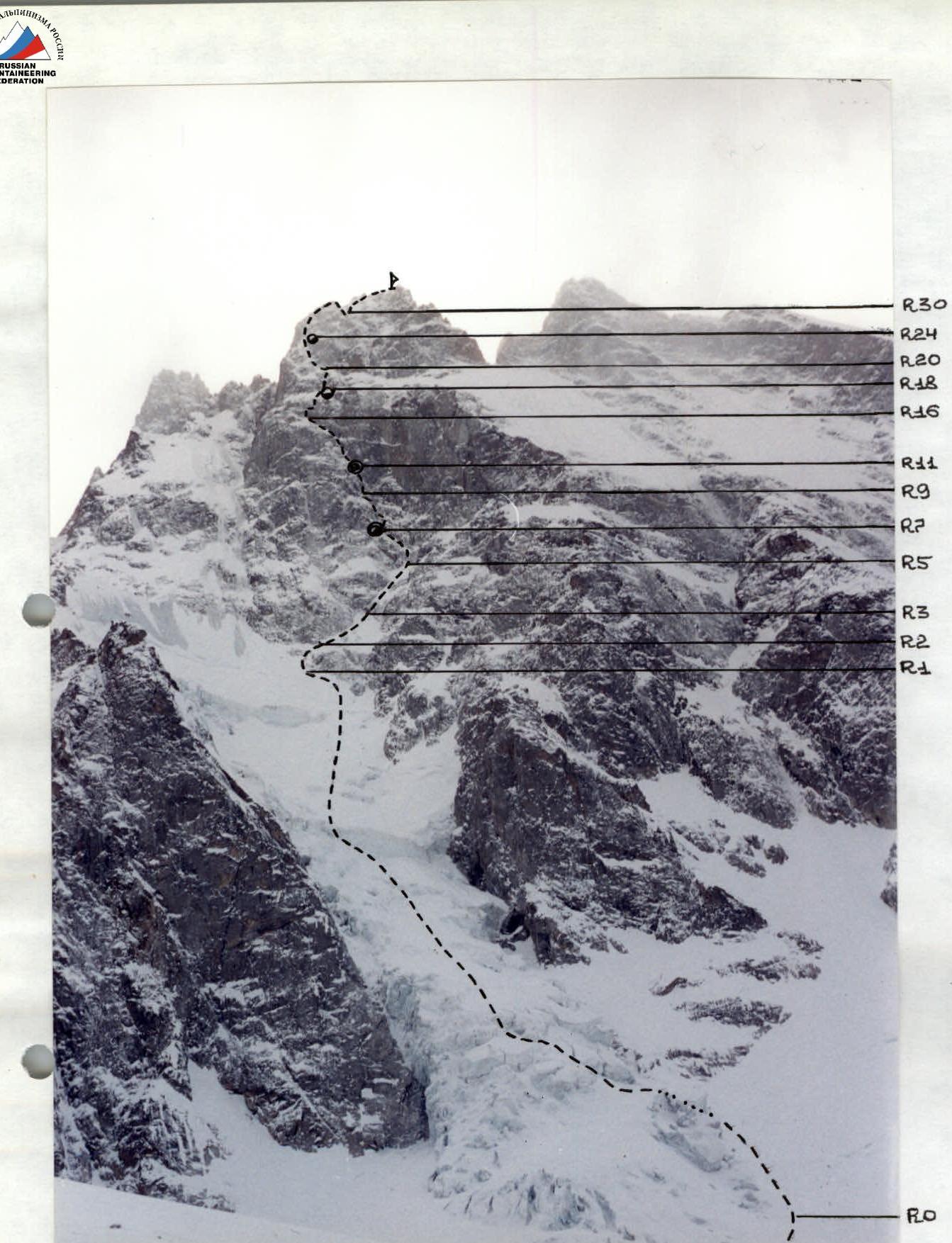
Technical photograph of the route. Date taken 28 February 1996. Time taken 14:30.