- Ascent class: winter
- Ascent area: Central Caucasus, Adylsu gorge
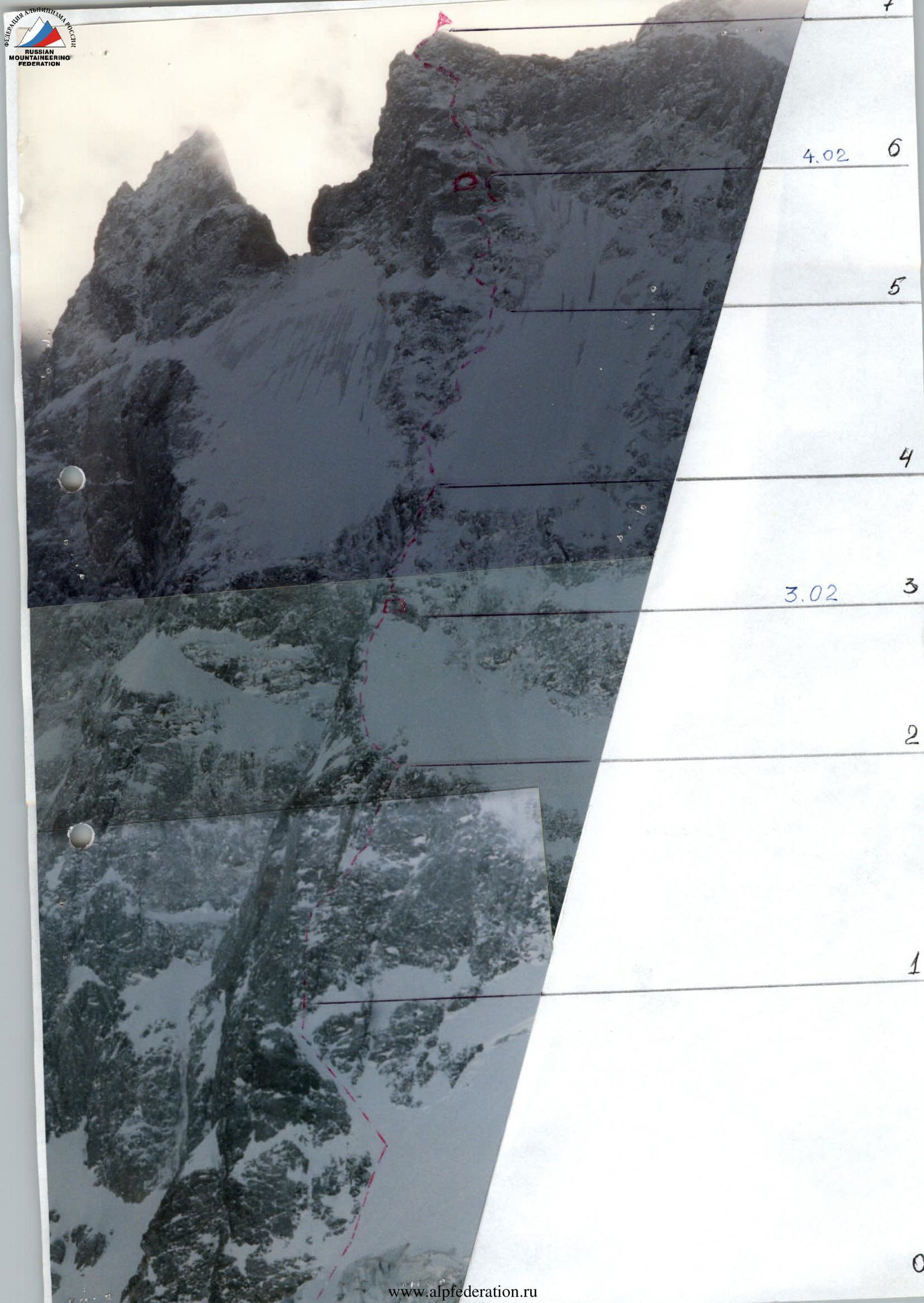
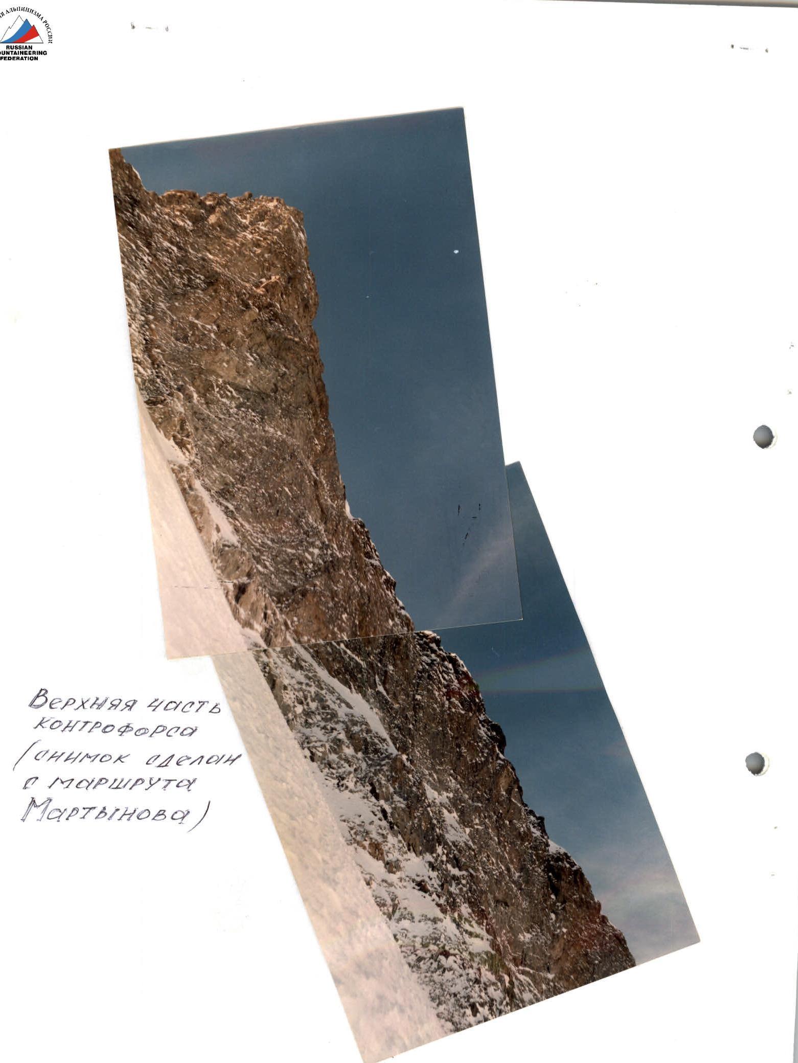
- Shkhelda 3rd Western peak via the counterfort of the North wall
- Category of difficulty: 5B
- Route characteristics: elevation gain 903 m, length 1152 m, average slope 56°
- Pitons driven: ice screws for belay 36, for aid climbing — 0 rock pitons for belay 88, for aid climbing — 5
- Total climbing time: 28 hours, 3 days
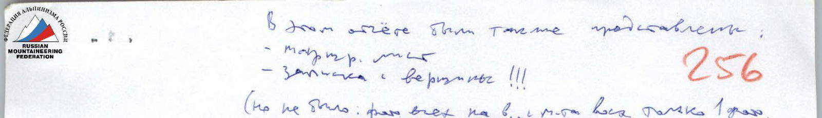
- Three bivouacs (all sitting, one on descent)
- Team members:
Pivikov D.E., 1st sports category — team captain
Japaridze Yu.O., Master of Sports — team coach
Zhitnik E.V., 1st sports category

- Departure date — February 3, 2000, return date — February 6, 2000
Tactical Actions
Based on studied photo materials, route description, consultations, and observations, we drew the following conclusions:
- The entire route is heavily snowed, so pure rock climbing as in summer is not possible. Due to abundant snow and possible ice, the micro-relief of the route may differ significantly from the description.
- A winter day is short, so the main task is to maximize the daily ascent without being tied to traditional bivouac locations.
- Descent from the summit is only possible via the ascent route, and in the upper part, via the ice-snow slab.
Based on these conclusions, we developed a tactical ascent plan. The task for the first day was to ascend above the first rocky belt, thus gaining the maximum possible height for the entire ascent. To accomplish this, the departure was scheduled for 2:00 AM. The route begins with traversing 250–300 m of snow. Therefore, the dark time of day is not an obstacle. The working time would be significantly less afterwards. For organizing bivouacs on snow and belaying, our equipment included a snow shovel. For sitting bivouacs on rocks, we brought plywood seats used in industrial climbing, which had proven themselves positively in Bezengi. Both were successfully used on the route. It was decided to use the route description only to determine the general direction of movement. The micro-relief was to be chosen based on specific conditions. Preference was given to icy sections, which could be traversed in crampons using ice axes and ice hammers. Practically from the middle of the first rocky belt, crampons were not removed until the end of the ascent, and ice axes were often used when climbing rocks where they work well when wedged into snow- and ice-filled rock cracks. Each working day, except the first, started at 7:00 AM and ended at 4:00–5:00 PM — with setting up ropes for further movement the next day. Movement in a team of three was done on a double rope, where the second in the rope team pays out the first, while the last one ascends on the fixed rope, bringing its lower end to the belayer. For safety, shock-absorbing devices of the "braid" type were used. Descent from the summit was along the ascent route to the ice couloir. Then, along the ice-snow slab, using ice screws for self-arrest, down to the first rocky belt, and then down to the tents.
 www.alpfederation.ru↗
 www.alpfederation.ru↗
Route Description by Sections
Sections R0–R1. Snow slope transitioning into a couloir with a slope of 45°–50°. The snow cover is dry, powdery snow, up to knee-deep. Footsteps do not compact. Movement requires significant physical effort; belaying through ice axes is ineffective. In the couloir, belaying was done through ice screws and rock pitons. Simultaneous movement. Section R1–R2. The first rocky belt begins with icy steep rocks, like "ram's foreheads." Then come steep snow-covered slabs alternating with small walls. On the slabs, under the snow, are loose rocks. The exit to a large snowfield (section 3) is through a steep chute. The rocks of the rocky belt are heavily destroyed. Movement was done in crampons, using ice axes; ropes were fixed. Section R2–R3. Snow slope with a cover depth of up to 30 cm; under the snow, ice and icy rocks. The snow structure is similar to section R0–R1. Belaying through ice and rock pitons. Organizing belays is complicated due to the long search for cracks. Rocks protruding above the snow surface are like "ram's foreheads." At the end of the slope, in a snow hollow, a bivouac site was dug out. Section R3–R4. The second rocky belt consists of destroyed rocks, frozen and heavily snowed. Simultaneous movement with belaying through ice and rock pitons; in the upper part, ropes were fixed. Due to the strong icing of the rocks, movement was done in crampons, using ice axes in the upper part. Section R4–R5. Exit to the snow-ice slab. Movement along the slab (as planned in the tactical ascent plan) was complicated due to deep, loose snow lying on ice. Therefore, it was done along the counterfort, along the edge of snow and rocks. The section represents a series of slab-like rocks and walls, heavily snowed and icy. In the upper part — a difficult steep ice couloir leading to an ice slope. Alternating movement with piton belaying; ropes were fixed. Section R5–R6. The most complex place on the entire route. Heavily snowed, icy steep rocks alternating with chimneys and chutes filled with ice, and steep icy slabs. In the upper part — a wall about 40–45 m with a crack filled with ice and snow. Movement was done using aid climbing techniques; ropes were fixed. Climbing is extremely difficult, in crampons, ice axes were used.
| Ice screws | Rock pitons | Route scheme | Avg. slope, length | Complexity of sections (additional) | Section # |
|---|---|---|---|---|---|
| 8 | 12 | February 5, 2000, 5 climbing hours, 4230 m | 55° III 80 m | 7 | |
| 50° V 40 m | |||||
| 60° V+ 75 m | 6 | ||||
| 6 | 12/5 | February 4, 2000, 10 climbing hours | 80° V+ 25 m | V+A2 25 m V+ 15 m V+ 20 m V+ 25 m | 5 |
| 12 | 14 | 50° V 30 m | |||
| 60° V 30 m | |||||
| 50° V 100 m | |||||
| 65° V 20 m | |||||
| 50° V 50 m | 4 | ||||
| 1 | 15 | 60° V 35 m | |||
| 45° III 50 m | |||||
| 70° V 30 m | 3 | ||||
| 2 | 8 | February 3, 2000, 13 climbing hours (route processing) | 50° IV 130 m | 70° V+ 50 m 70° V 15 m | 2 |
| 50° IV 30 m | |||||
| 6 | 23 | 60° IV 65 m | |||
| 45° III 15 m | |||||
| 60° V 40 m | 1 | ||||
| 1 | 4 | 50° IV 100 m | |||
| February 3, 2000, 2:00 AM, 3300 m | 45° III 140 m | 0 |
Section R6–R7. Exit from the wall to the right, into the ice couloir going from under the summit tower from left to right. To the left of the couloir is an inclined, snow-covered slab on which a sitting bivouac was organized. For the bivouac, seats used in industrial climbing were utilized. For further movement, two fixed ropes were set up. The couloir leads to a steep ice-snow slope. Along the slope to the right towards the summit tower:
- First, along rocks of medium difficulty (many loose rocks),
- Then a small traverse to the left into the couloir,
- Along the right side of the couloir — exit to the ridge of the summit tower and to the summit.
Descent was along the ascent route and along the snow-ice slab using ice screws for self-arrest.