Ascent Log
I. Winter Climbing Category.
-
Climbing Area: Central Caucasus, spur of the Main Caucasian Range.
-
Peak Chatyn 4368 m, route via the right part of the North face.
-
First ascent. Proposed difficulty category 5B.
-
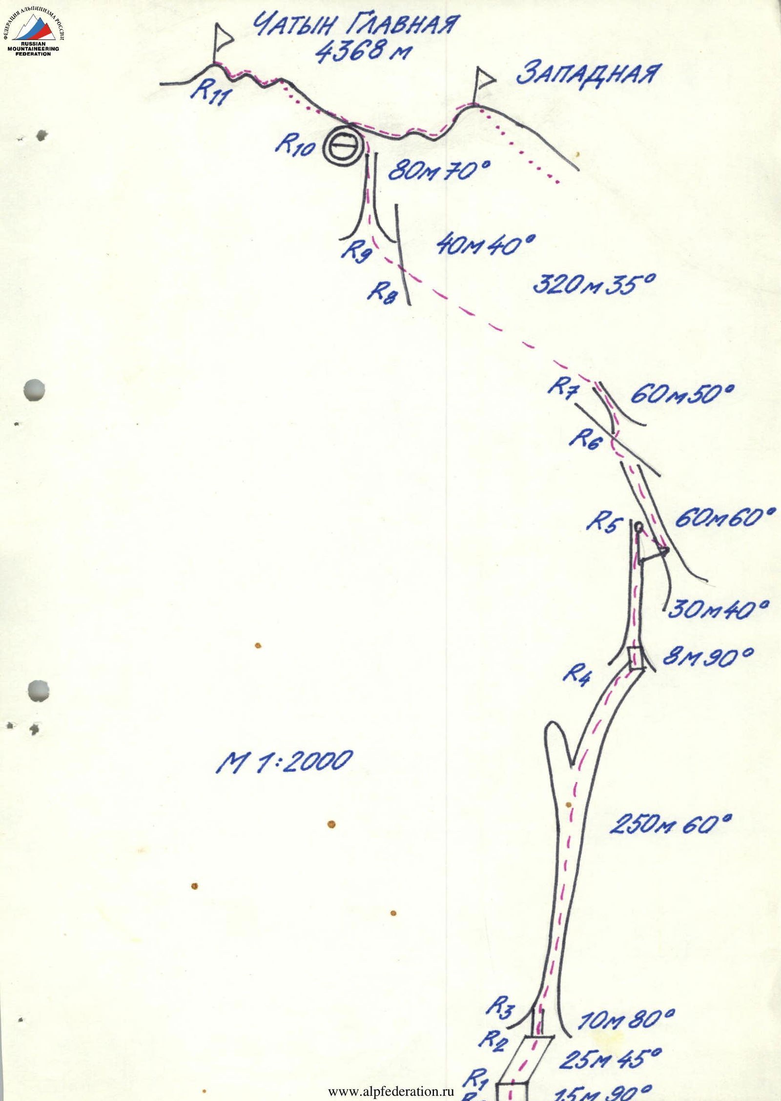
Route characteristics up to the ridge: height difference — 710 m, length — 855 m, average steepness — 56°, length of 5 m/tr sections — 675 m.
-
Pitons used: ice screws — 78, rock pitons — 2, chock stones — 4, bolt pitons — 0.
-
Total climbing hours: ascent with processing — 18.5, descent to Base Camp — 10.5.
-
Overnight stay: half-lying, on the shoulder before the ridge, ice was chopped.
-
Leader: Viktor Petrovich Avtomonov, Master of Sports.
Team Members:
- Igor Leonidovich Rozin, Master of Sports
- Alexander Mstislavovich Kopylov, Candidate for Master of Sports
- Viktor Yuryevich Pavlichenko, Candidate for Master of Sports
- Alexander Alexandrovich Romanov, Candidate for Master of Sports
- Viktor Vladimirovich Yanchenko, Candidate for Master of Sports
- Coaches: Boris Osmanovich Titov, Anatoly Pavlovich Makhinov.
II. Start of work on the route — February 18, 1994.
Reached the summit — February 20, 1994.
Returned to Base Camp — February 20, 1994.
- Organization: Elbrus Search and Rescue Service.
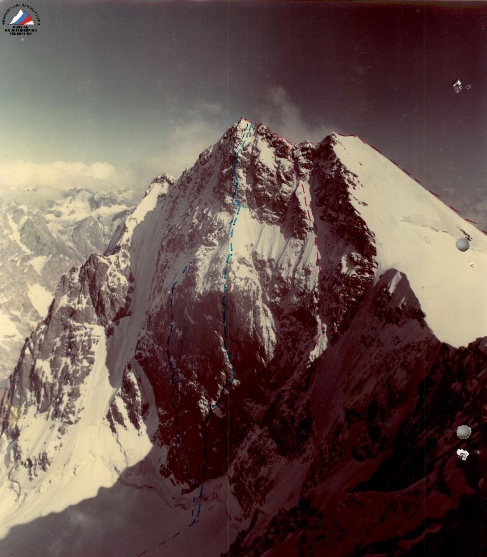
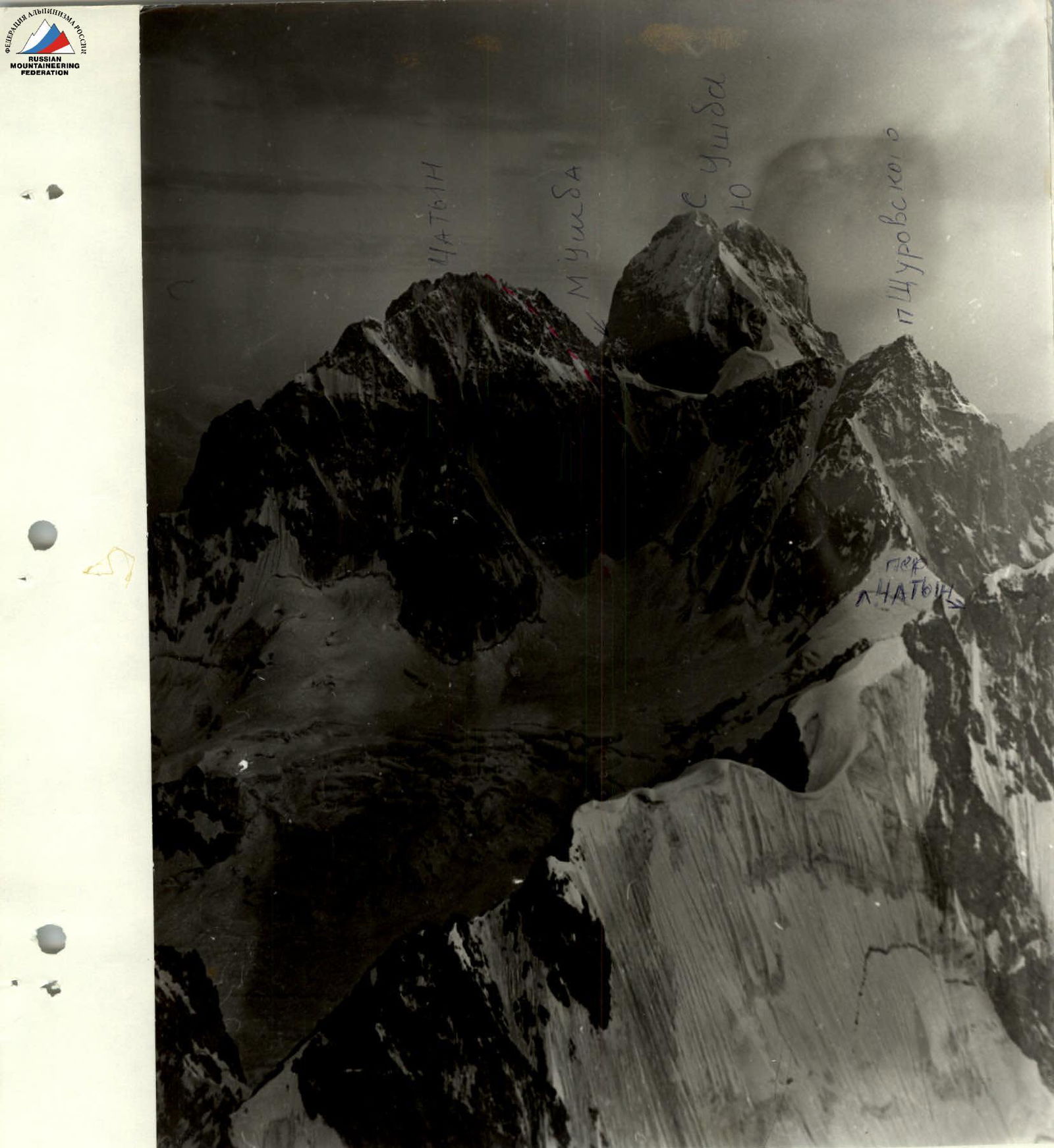
— ESRS team's route — Myshlyaev's route — Snesarev's route
Photo taken from p. Shchurovsky in July 1993.
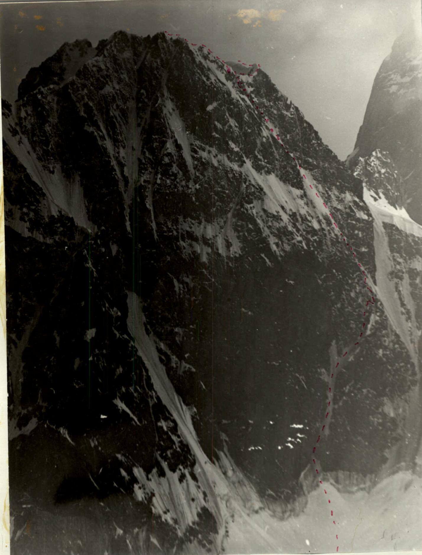
Upper Part of the Route Profile
Photopanorama of the Area
Team's Tactical Actions
Due to the absence of a judge in the area and considering that the strictest judge is a competitor, we proposed that the Rostov team sign the tactical plans before heading out on the route, which was done on the evening of February 17.
On February 18 at 9:00, we began processing. The team of Rozin–Romanov–Kopylov worked as planned. No rockfall was observed; a few times, snow "mushrooms" broke off, and small pieces of snow slowly flew by. By 17:00, the processing team returned to the tents.
On February 19 at 7:00, we started ascending via the fixed ropes. Then, the team of Pavlichenko–Avtomonov began moving towards a vaguely defined counterfort, to the right. Everywhere, the first climber was belayed with rope 1. The second climber ascended via the fixed ropes and carried the stiff fixed rope. The team ascended via the fixed ropes using two ascenders. The first climber's belay was through an eight figure. The first climber ascended with two ice axes, as this allowed not to knock off much ice onto those below.
Intermediate belay points were mainly:
- ice screws.
Features of using ice screws:
- In narrow couloirs, the use of ice screws is only possible in flattening areas where the ice is 5 or more centimeters thick.
- All ice screws have handles and a floating eyelet, allowing it to be moved along the thread to the ice surface.
- Ice screws often got dull from hitting rock.
Belay stations were made with two ice screws, as the ice is re-frozen, and it's possible to chip out a block along with the screw. All participants had a spare crampon; during the ascent, they broke 3 crampons and 1 ice axe. On the R4–R7 section, the ice is thin, and belaying was done on pitons in the rocks. In two places, no ice was left after us.
Movement regime:
- Processing took 8 hours from bivouac to bivouac on the plateau.
- On February 19, from 7:00 to 18:00 — 11 hours of moving along the route.
- 1 hour — setting up the tent.
- February 20 — worked for 11 hours.
There were no deviations from the tactical plan and movement schedule. No falls or injuries occurred.
There was no note on the summit; we built our own cairn and left a note. It was later retrieved by Pogorelov's team. Along the Main Ridge to the Western Ridge and on the descent from the Western Ridge, we moved simultaneously with piton belays.
The overnight stay was half-lying; we chopped ice near a gendarme, with a safe 20 m 30° ice slope to the main ridge.
Communication with observers was via "Lastochka" radio station, and they communicated with Base Camp via "Kaktus" radio station. From the upper part of the wall, the group had communication with the Rescue Team. Three observers watched the team's movement from p. L. L. Chatyn through binoculars.
The main rescue team was at Base Camp and could fly to Chatyn or the Ushba plateau at any time during the ascent, as a helicopter was operating in the Adyl-Su valley with an Austrian heli-ski group.
Route Description by Sections
R0–R1: bergschrund, 15 m of vertical ice, and a corniche. R1–R2: ice slope. R2–R3: narrow strip of ice in the rocks. R3–R4: wide, bifurcating ice couloir with thick ice at the top. R4–R5: vertical 5 m ice wall and a narrow couloir with thin ice. R5–R6: pendulum move to the right into a neighboring ice couloir and exit onto a rocky-ice ridge. R6–R7: ice couloir with thin ice. R7–R8: ice field with thick ice (ice screws can be screwed in fully). R8–R9: rocky ridge, transition to the left into an ice couloir. R9–R10: narrow, steep ice couloir. R10–R11: simple ridge to the summit.


