CHAMPIONSHIP OF THE CENTRAL AND NORTH-WESTERN FEDERAL DISTRICTS
class - high-altitude technical
REPORT
On the ascent to the summit Volnaya Ispaniya (4163 m) via the North-Eastern edge (Subortovich route) 5B cat. sl. by the team "Center"
August 7, 2024
| Leader: | FROLOV E.N. |
|---|---|
| Members: | Vasiliev A.V. |
| Khlopeckii D.S. |
I. ASCENT DOCUMENTATION
| 1. General Information | ||
|---|---|---|
| 1.1 | Full name, sports rank of the leader | Frolov Evgenii Nikolaevich, CMS |
| 1.2 | Full name, sports rank of participants | Vasiliev Anton Viktorovich, 1st sports rank, Khlopeckii Dmitrii Sergeevich, 1st sports rank |
| 1.3 | Full name of coach | Cheresku Igor Dionisovich |
| 1.4 | Organization | FGCU CGPIV "TERSKOL" MO RF |
| 2. Characteristics of the Ascent Object | ||
| 2.1 | Region | Central Caucasus |
| 2.2 | Valley | Adyl-Su |
| 2.3 | Section number according to the classification table 2013 | 2.4 |
| 2.4 | Name and height of the summit | VOLNAYA ISPANIYA (4163 m) |
| 2.5 | Geographical coordinates of the summit | |
| 3. Route Characteristics | ||
| 3.1 | Route name | via the North-Eastern edge (Subortovich route) |
| 3.2 | Category of complexity | 5B |
| 3.3 | Degree of route exploration | - |
| 3.4 | Route terrain characteristics | Combined |
| 3.5 | Height difference of the route (altimeter or GPS data) | 600 m |
| 3.6 | Route length (in meters) | 825 m |
| 3.7 | Technical elements of the route (total length of sections with different cat. sl. indicating the terrain type (ice-snow, rock)) | IV cat. sl. rocks — 100 m. IV cat. sl. ice/rocks/combination — 70 m. V cat. sl. rocks — 170 m. VI cat. sl. rocks — 50 m. |
| 3.8 | Average steepness of the route, ° | 48 |
| 3.9 | Average steepness of the main part of the route, ° | 78 |
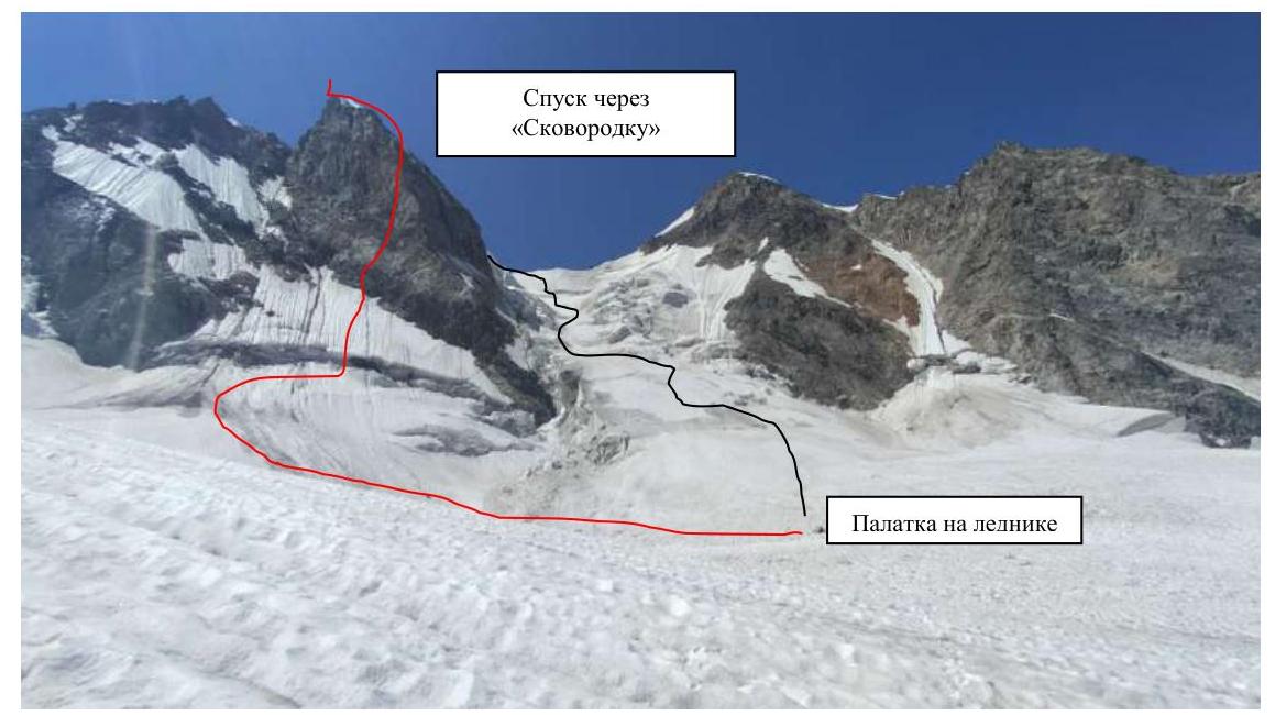
| 3.10 | Descent from the summit | via the western slope of the peak through "Skovorodka" |
| 3.11 | Additional route characteristics | - |
| 4. Team Actions Characteristics | ||
| 4.1 | Time of movement (team's working hours, in hours and days) | 14 h – 1 day |
| 4.2 | Overnight stays | no |
| 4.3 | Route processing time | no |
| 4.4 | Start of the route | 03:00 August 7, 2024 |
| 4.5 | Summit attainment | 17:00 August 7, 2024 |
| 4.6 | Return to the base camp (to the tents on the glacier plateau) | 22:00 August 7, 2024 |
| 5. Weather Conditions | ||
| 5.1 | Temperature, °C | |
| 5.2 | Wind speed, m/s | |
| 5.3 | Precipitation | short-term light snowfall on the "roof" |
| 5.4 | Visibility, m | variable cloudiness |
| 6. Responsible for the report | ||
| 6.1 | Full name, e-mail | Frolov E.N., destiny0013@yandex.ru |
II. ASCENT DESCRIPTION
1. Characteristics of the Ascent Object
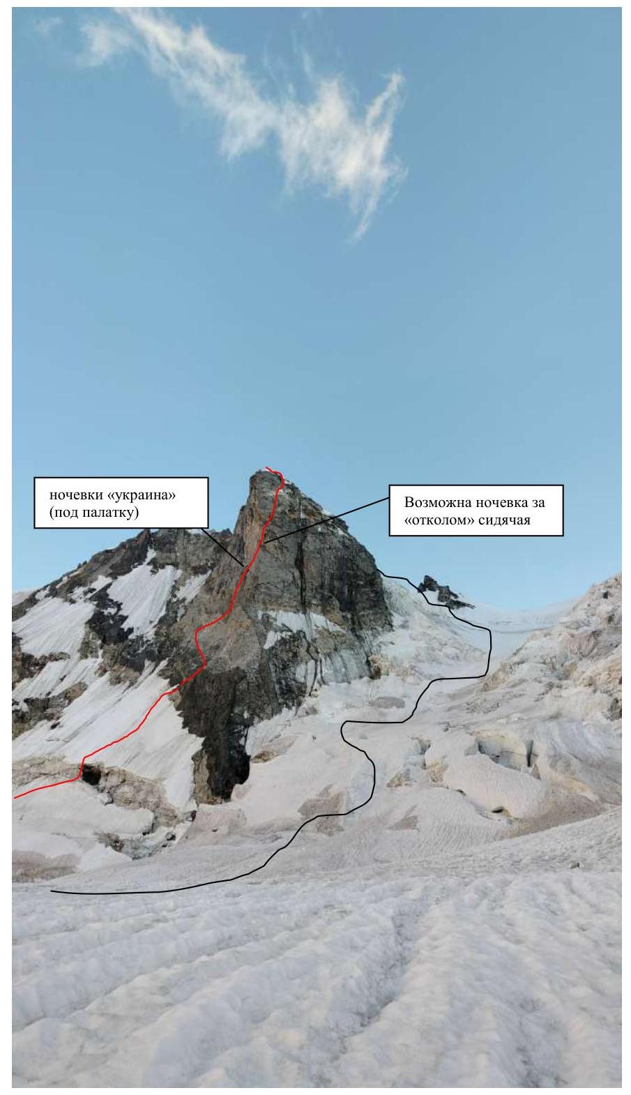
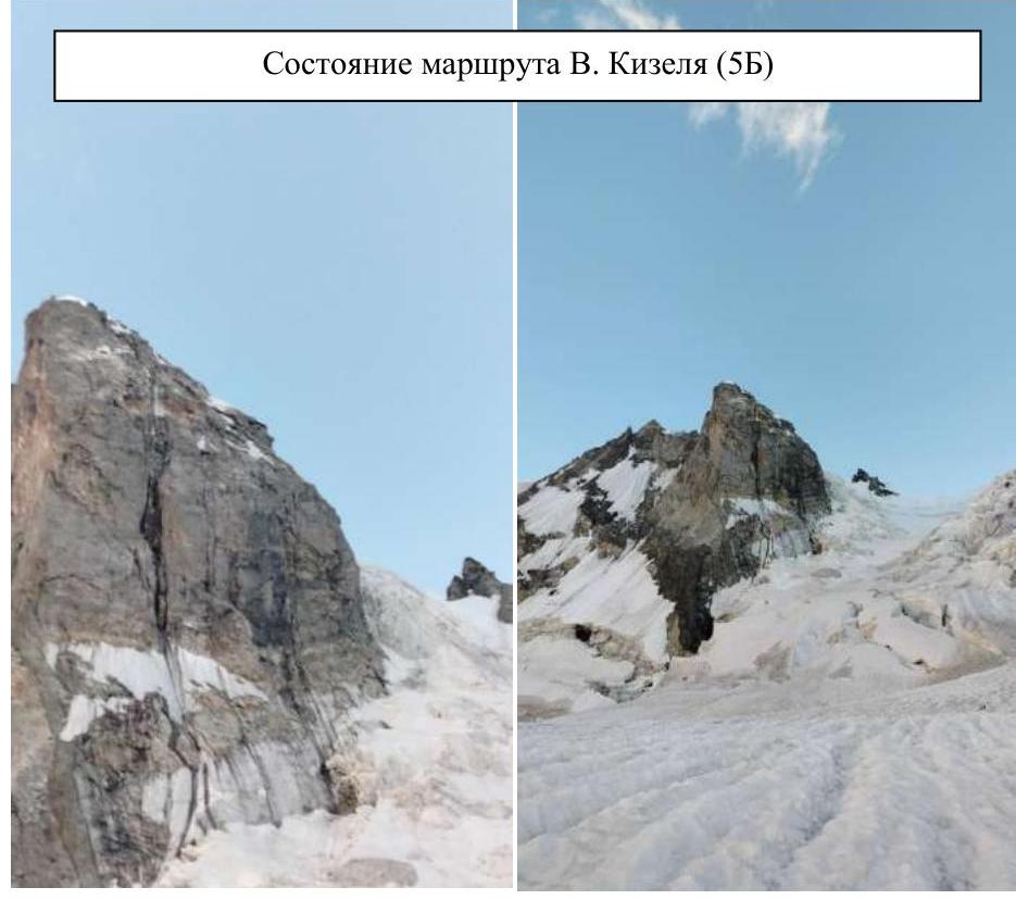
1.1. General photo of the summit.
Description of the area.
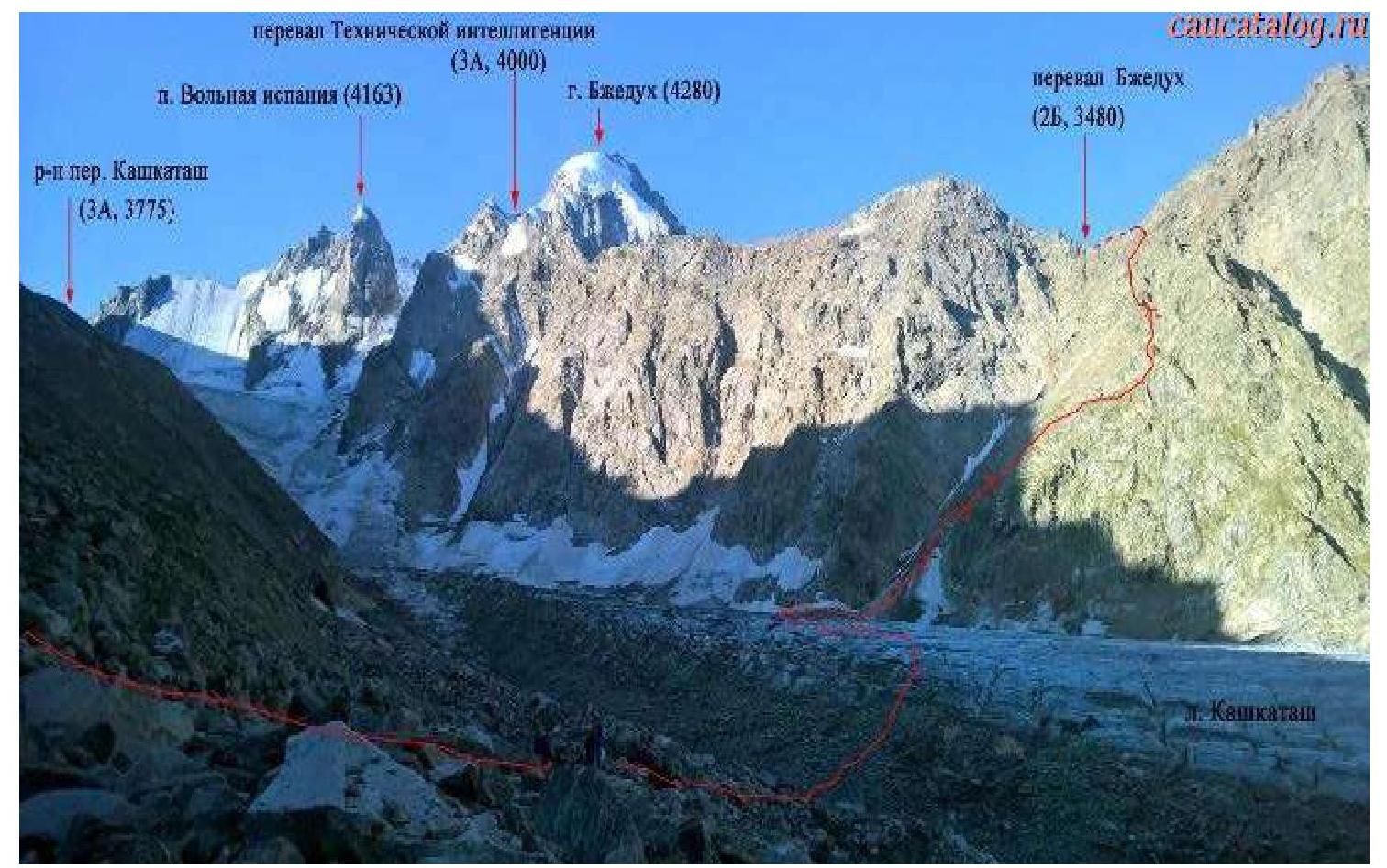
The ridge of the Main Caucasus stretches, bending multiple times, changing direction from north to south, from the North-Eastern peak of Shchurovskii in the west to the western slopes of Ullukara in the east. In the center of this section of the ridge, the ice cap of the summit Bzhedukh rises. East of Bzhedukh, on a short segment of the ridge, the rock peak Volnaya Ispaniya towers. To the west of Bzhedukh, the ridge includes peaks: Kavkaza, Vulley, and Zhelezhnodorozhnikov. To the north, from almost all parts of the ridge, snow-ice slopes descend, interrupted by numerous rocky spurs, ridges, and counterforts. Volnaya Ispaniya drops off with a rocky slope to the upper plateau of the Kashkatash glacier. From the southern side, the ridge rises with steep rocky walls above the Chalayat and Lekzyr glaciers.
1.2. Photopanorama of the area
2. Route Characteristics
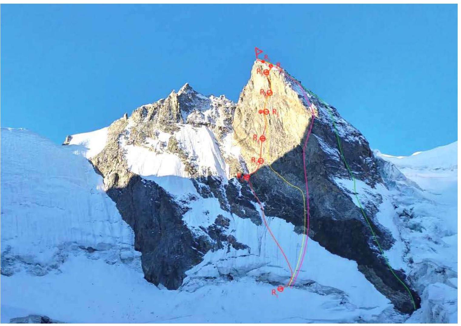
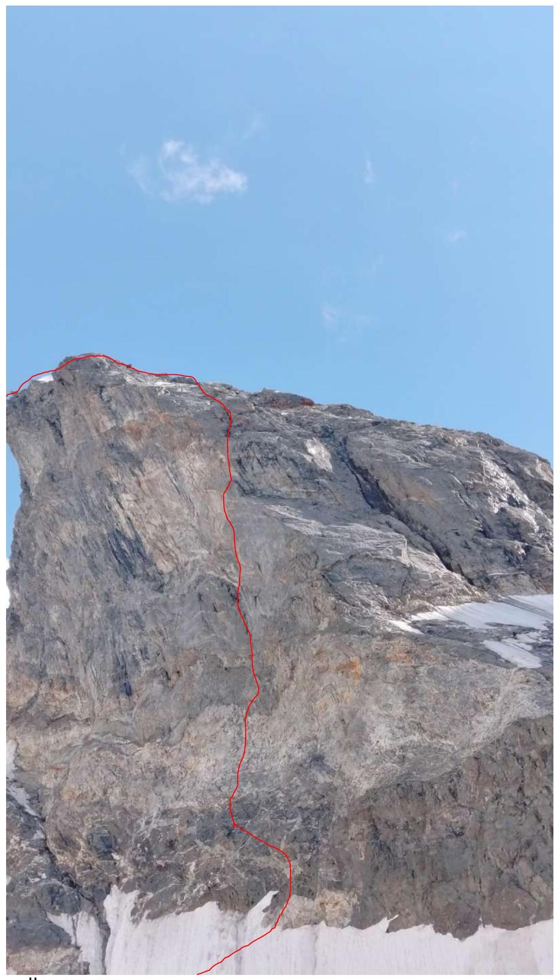
2.1. Technical photo of the route.
2.2. Outline of the route in UIAA symbols.
3. Team Actions Characteristics
3.1. Photo of passing sections.
3.5. Tactical actions.
The team departed from Terskol on August 5, 2024, at 12:00 to the Dzhangutan alpine camp. From the Dzhangutan alpine camp to the overnight stay in the moraine pocket, it took about 2.5 hours (there was no water at the overnight stay; either descend to the glacier or stay a bit higher where there were snow patches), alternatively, one could ascend to the "red rocks" (there is water there, ascent takes about 40 minutes), but the subsequent passage to the glacier via traverse is rockfall-prone.
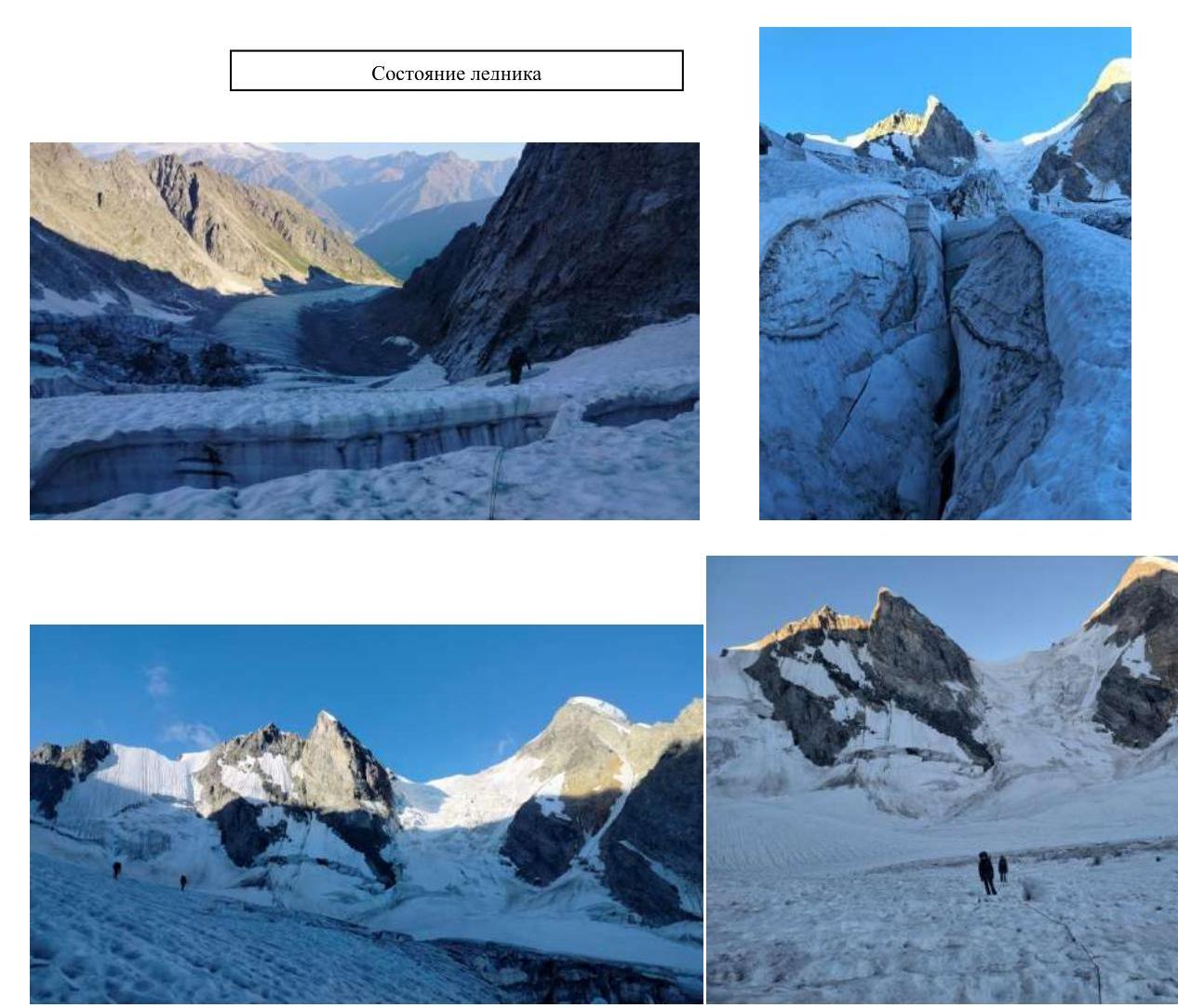
On August 6, 2024, departure from the overnight stay was at 4:00 (to cross the upper part of the glacier in a safe time), the glacier was heavily crevassed.
At 7:30, setting up tents under the mountain. Inspection of:
- the approach,
- the route,
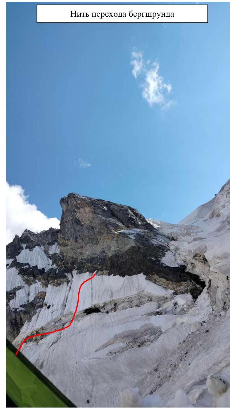
- the bergschrund,
- the descent route.
Departure from the overnight stay was at 4:00 on August 7, 2024. Bivouac gear was taken along.
The bergschrund was crossed via a snow bridge. In total, two ropes of snow (35–45°) were traversed before reaching the rocky section. Khlopeckii D. led first.
The entire rocky part of the route was led by Frolov E. Below the overnight stays with the inscription "Ukraina" (15 m), he changed into rock shoes. Two "keys" were passed using AID. Team members moved alternately.
On the "roof," on the snow-ice section, Vasiliev A. led (about 2 ropes, moved simultaneously).
At 17:00, all team members were on the summit. From the summit, 4 rappels (30 m, 40 m, 30 m, 30 m). From the last rappel, one needs to move aside under the wall as stones are falling from the team members.
Before nightfall, the direction to the bridge across the bergschrund in the upper part of the glacier was marked (rappel on a sack 30 m), and descent via "Skovorodka" — a loop between the crevasses in the glacier. At 22:00, they were in the tent.
3.6. Route safety assessment. Availability of communication on the route. Recommendations for subsequent climbers.
Detailed information on the descent from the summit with landmark indications. Conclusion on the preliminary assessment of the route compared to classified routes of the same cat. sl. in the team's climbing experience.
The route is technically complex and demanding. High skill in working with various equipment is required. On some sections, movement is via AID. It is also necessary to be able to navigate on the route and work on all types of terrain. The upper part of the route, the "roof," is ice-snow. The following are mandatory:
- crampons
- ice axes
- ice screws
Mobile communication via Megafon from the glacier cushion. We consider the route objectively safe. The route can be recommended as a first 5B. There are places on the route to wait out the dark time of day.
The descent from the bivouac was tracked using a COROS PACE 3 watch.

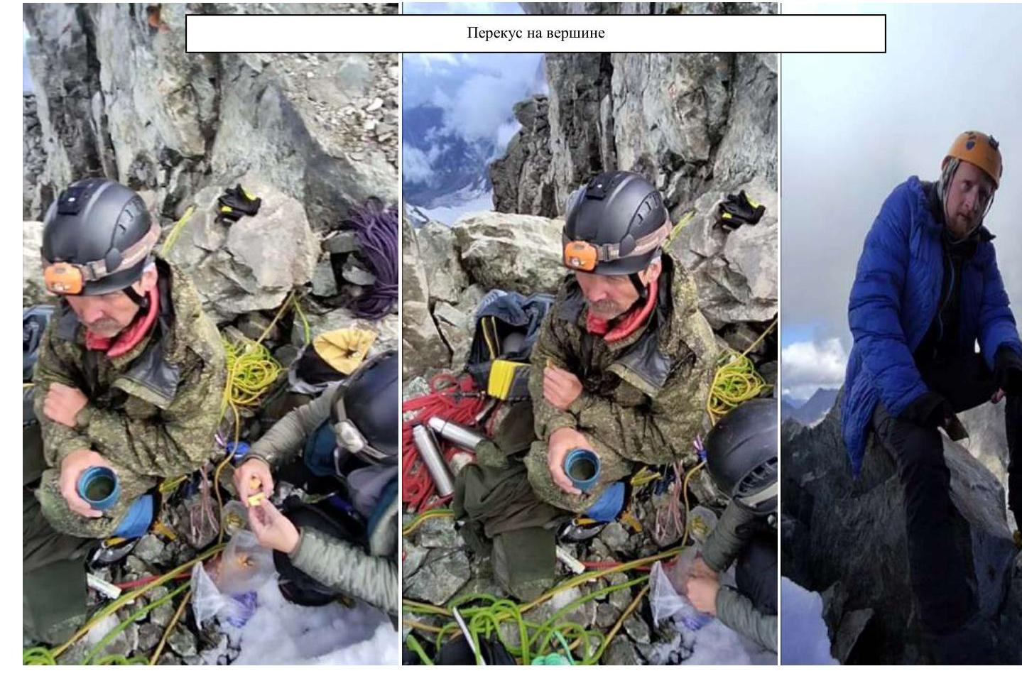
Snack on the summit