Ascent Passport
- Caucasus, Adyl-Su gorge, section 2.4.32.
- Volnaya Ispaniya peak, 4271 m, via N wall (V. Kizel, 1952).
- Difficulty category — 5B.
- Route character — combined.
- Route height difference — 500 m;
Route length — 800 m;
Length of sections:
- V difficulty category — 55 m
- VI difficulty category — 40 m Average steepness:
- main part of the route — 80°
- entire route — 60°.
- Pitons left on the route: total — 1;
incl. bolt pitons — 0;
Pitons used on the route:
- stationary bolt pitons — 3, incl. artificial anchors — 1;
- removable bolt pitons — 0, incl. artificial anchors — 0; Total artificial anchors (AAs) used — 9.
- Team's travel hours: 24 h, 2 days.
- Leader: Kadtsyn Vladimir Nikolaevich, Master of Sports.
Team members:
- Balandin Evgeny Valerievich, 1st sports category;
- Radostev Roman Mikhailovich, 1st sports category;
- Khrynyak Dmitry Vladimirovich, 1st sports category.
- Coach: Bukina Tatyana Vitalievna, Candidate Master of Sports.
- Departure for the route: 8:00, January 23, 2008.
Reach the summit: 14:00, January 24, 2008.
Return to Base Camp: 18:00, January 24, 2008.
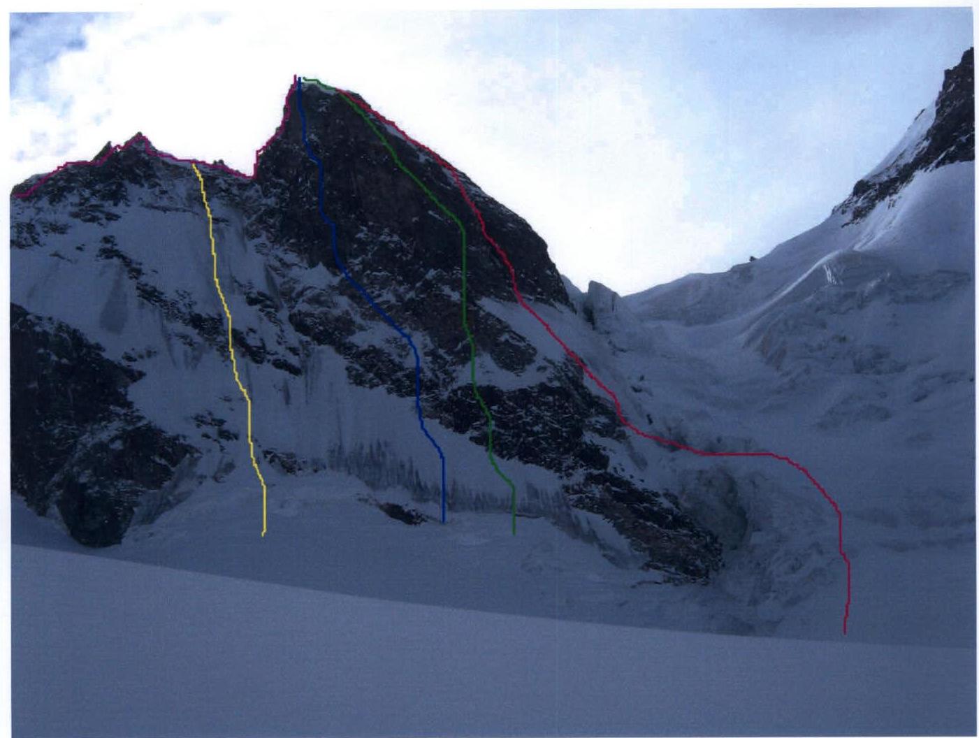
General photo of the summit (January 2008 from Kashkatash glacier)
- team's route
- B. Subortovich's route 5B category
- L. Myshlyaev's route 5B category
- V. Abalakov's route 4A category
- A. Osipov's route 4B category In preparation for the ascent, the team was guided by the card file of KSP "Shkhelda" and consultation with V. E. Puchnin, who was on the route in 2000. During the ascent, it became clear that over time, the route description did not correspond to its actual state. In this regard, the team considered it necessary to supplement the report with a route diagram in UIAA symbols and its description by sections.
Route description by sections
R0–R3 — up to the left along a gentle ice slope 55–60° under an overhanging rock. Then to the right into a steep ice couloir. Insurance on ice screws. R3–R4 — up a steep ice spire. Exit to a flattening relief. R4–R5 — up to the left along a vertical wall. AAs, bolts on the "station". R5–R6 — section of steep ice 80–85°, then flattening. Insurance on ice screws. R6–R10 — up to the ridge along ice gullies of medium steepness 55–65°. Insurance on ice screws. R10–R11 — exit along the ridge to the summit.
| ice axes | nuts | cams | bolts | sect. | m | difficulty category | ° | |
|---|---|---|---|---|---|---|---|---|
| - | - | - | - |  | R1 | 90 | 2 | 25–50 |
| 12 | - | - | - | 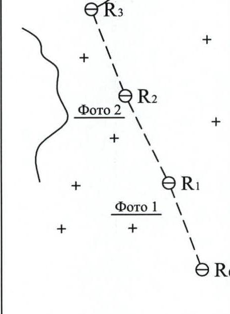 | R2 | 140 | 3 | 60 |
| 3 | - | - | - |  | R3 | 25 | 5 | 85 |
| 2 | - | - | - |  | R4 | 20 | 4+ | 60–70 |
| 1 | 6/5 | 5/4 | 3 | 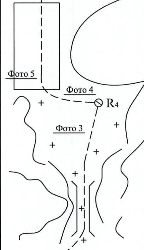 | R5 | 40 | 5–6 A2 | 85 |
| 3 | - | - | - | R6 | 20 | 5 | 75–80 | |
| 4 | - | - | - | 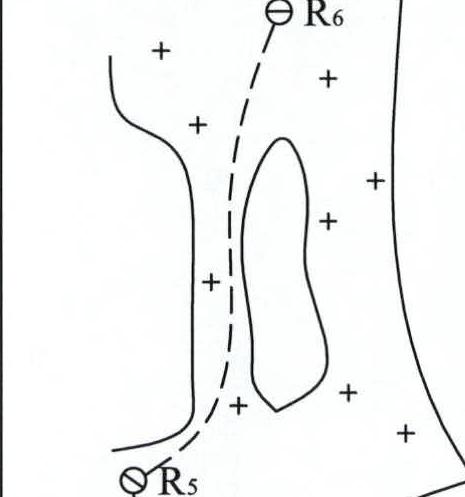 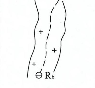 | R7 | 25 | 4 | 60 |
| 4 | - | - | - | 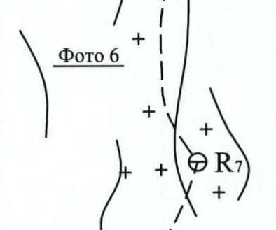 | R8 | 45 | 4 | 60 |
| 5 | - | - | - |  | R9 | 50 | 3 | 60 |
| 5 | 1 | - | - | 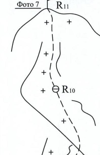 | R10 | 45 | 3 | 55 |
| 5 | - | - | - |  | R11 | 40 | 3 | 50–55 |
| 5 | - | - | - | v. Volnaya Ispaniya 4271 m | R12 | 40 | 3 | 45–55 |
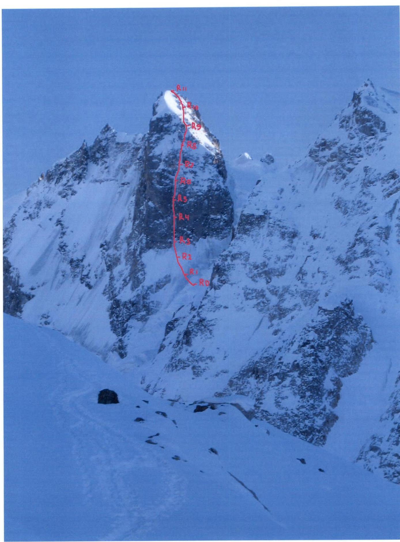
Technical photograph of the route