Ascent Record
- Central Caucasus, Adyl-Su gorge, section 2.4 according to CMGA.
- Bashkara peak, 4241 m, via the North Face.
- Claimed 6A category of difficulty, first ascent.
- Nature of the route — combined.
- Elevation gain of the route 540 m.
Route length 926 m. Length of sections:
- 5th category of difficulty — 345 m;
- 6th category of difficulty — 51 m. Average steepness of the main part of the route 70°, entire route — 55°.
- Pitons left on the route: total 0
Total used on the route: rock anchors — 26; ice screws — 20; nuts and similar — 43/3. No stationary or removable pitons were used on the route.
- Team's climbing hours: 27.5 hours, 3 days.
- Leader: Volodin Viktor Gennadievich — Master of Sports
Team members: Kazakov Andrey Eduardovich — Candidate for Master of Sports, Kochetkov Grigory Sergeevich — 1st category
- Coach: Volodin Viktor Gennadievich — Master of Sports
- Departure for the route: 8:00, February 24, 2003.
Reached the summit: 16:00, February 26, 2003. Returned to Base Camp: 21:00, February 27, 2003.
- Organization: Central Sports Club of Alpinists named after A.S. Demchenko
General photo of the summit — route ascended by the team
++++ route by Yu. Grigorenko — Prigoda, 1965
— route by V. Lifshits, 1961
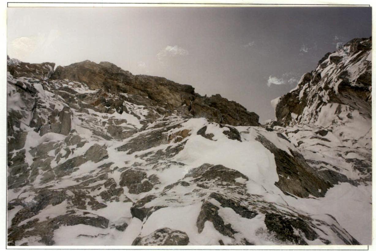
Technical photo of the route
— route ascended by the team
++++ route by Yu. Grigorenko — Prigoda, 1965
— route by V. Lifshits, 1961
Technical photo of the route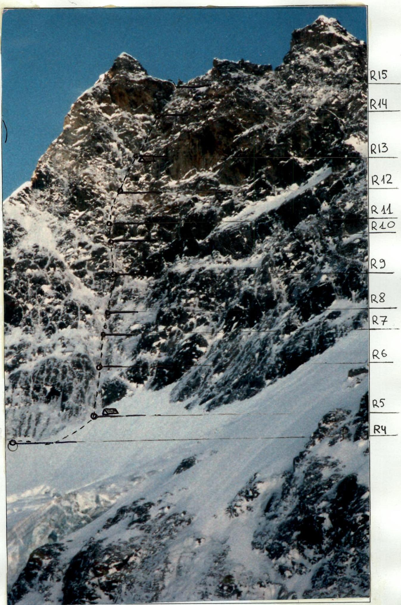
| Section # | Ice Screw | Rock Anchor | Nuts & other | UIAA Symbol Scheme | Diff. Cat. | Length (m) | Steepness (°) |
|---|---|---|---|---|---|---|---|
| 20 | 26 | 43/3 | February 26, 2003; 4241 m; 27.5 hours | 876 | |||
| R16 | - | 7 | 11/2 | February 26, 2003; 7:00 | 225 | ||
| R15 | - | - | - | 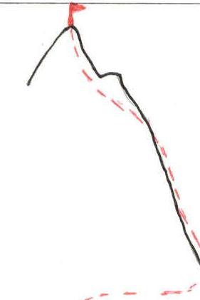 | 3 | 150 | 45° |
| R14 | 4 | 6 / 1 | 6 / 5+ | 10 / 25 | 85° / 70° | ||
| R13 | - | 3 | 5 / 1 | 6 / 5+ | 10 / 30 | 85° / 70° | |
| 14 | 17 | 29/1 | February 25, 2003; 4100 m; 11:00 | 310 | - | ||
| R12 | 2 | 4 | 6 / 1 | 5+ / 6 | 30 / 15 | 75° / 90° | |
| R11 | 1 | 3 | 4 | 5+ | 40 | 70° | |
| R10 | - | 3 | 3 | 5 | 20 | 65° | |
| R9 | 4 | - | 2 | 5 | 40 | 65° | |
| R8 | 2 | - | 3 |  | 6 / 5 | 5 / 45 | 85° / 60° |
| R7 | 1 | 2 | 2 |  | 5 | 25 | 65° |
| :----: | :--: | :--: | :--: | :--------------------------------------------------: | :--: | :--: | :--: |
| R6 | 3 | 7 | 5 | 40 | 65° | ||
| R5 | 4 | 2 | 2 |  | 5 | 50 | 60° |
| 6 | 2 | 3 | February 24, 2003; 3900 m; 9.5 hours | - | 341 | - | |
| R4 | - | 2 | 3 | 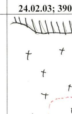 | 4 | 100 | 10° |
| R3 | 2 | - | - |  | 4 | 80 | 50° |
| R2 | 2 | - | - | 6 | 6 | 95° | |
| R1 | - | - | - | 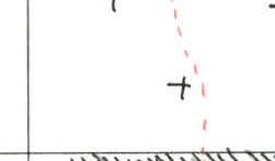 | 4 | 150 | 50° |
| R0 | 2 | - | - | 6 | 5 | 93° |
Route Description by Sections
R0–R1 — Bergschrund 2.5–3 meters high, with an overhanging upper edge. About 1 meter wide at its narrowest part. Snow bridges are unreliable and collapse. Ice screws can only be placed on the upper edge of the bergschrund.
R1–R2 — Steep ice slope covered with deep snow. Avalanche hazard. Movement is hampered. Belaying is problematic and is done through ice axes stuck in the snow.
R2–R3 — Upper bergschrund 3–4 m high. The upper edge is heavily overhanging. Snow bridges are unreliable. It is possible to screw in an ice screw into the overhanging edge.
R3–R4 — Ice slope covered with loose snow. Avalanche hazard. Problems with belaying.
R4–R5 — Traverse to the right, towards a large internal corner. Move along the boundary between rocks and ice. Intermediate protection on anchors and nuts.
R5–R6 — From R5 station, ascent begins up a large internal corner, transitioning into a couloir and leading to the sub-summit. The station can be made on ice screws. Further intermediate protection is achieved using anchors and nuts. Movement is over rocks covered with a thin layer of ice. Movement is complicated by constant small snow avalanches coming down the internal corner. At R5 station, under the protection of a small cornice, there is a sitting bivouac.
R6–R7 — Movement up a narrowing couloir. Rocks are covered with loose ice. Ice screws do not hold. Anchors and nuts are used for protection. There are short vertical sections that are very difficult to pass.
R7–R8 — 20–25 meters to the right along a narrow ice "river" towards a steep ice couloir. R8 station is on anchors and nuts.
R8–R9 — Move left upwards, towards an ice "river" that leads to a large cornice. Very difficult climbing on rocks covered with a thin layer of ice. Problems with intermediate protection. Before R9 station, a short section with 85–90° steepness is very difficult to pass.
R9–R10 — A system of narrow ice streams and "rivers" leads to a large cornice. Rocks are covered with ice.
R10–R11 — Move left, bypassing the large cornice. First, along a narrow snow ledge, then through a system of narrow ice streams and "rivers". Problems with belaying. Rocks are heavily destroyed, and ice screws only go in 1–2 cm.
R11–R12 — R11 station is located to the left of the large cornice, visible from under the start of the route. This is approximately the middle of the couloir. From this point, the overall steepness of the route gradually increases. Each subsequent rope length is more difficult than the previous. Difficult, and in places very difficult, climbing on rocks filled with ice.
R12–R13 — Very difficult climbing on rocks covered with loose ice. Crampons and tool picks cut through the loose ice. Steepness reaches 90°. Intermediate protection via rock anchors and nuts. A vertical crack at the start of the section is passed using artificial aids. The couloir leads to a steep snow-ice ledge. Here is a sitting bivouac.
R13–R14 — From the ledge straight up. Very difficult climbing up a narrow couloir leading directly to the summit tower. Overall steepness increases to 75–85°. Limited opportunities for intermediate protection. A steep wall in the upper part of the section is passed using artificial aids.
R14–R15 — This is the final rope length of the wall section, leading directly to the summit tower. Very difficult climbing on rocks. A steep crack — 85–90° before reaching the summit tower is passed with the use of artificial aids.
R15–R16 — 150 m along the rocks of the summit tower. Climbing of medium difficulty. Exit to the summit.
Descent via the Northeast ridge. Route category 3B. 20 meters from the summit, on the descent — overnight stay. A good ledge for a lying overnight stay can be prepared. From the saddle of the Northeast ridge, descend along the North slope of Bashkara peak.
Ascent graph
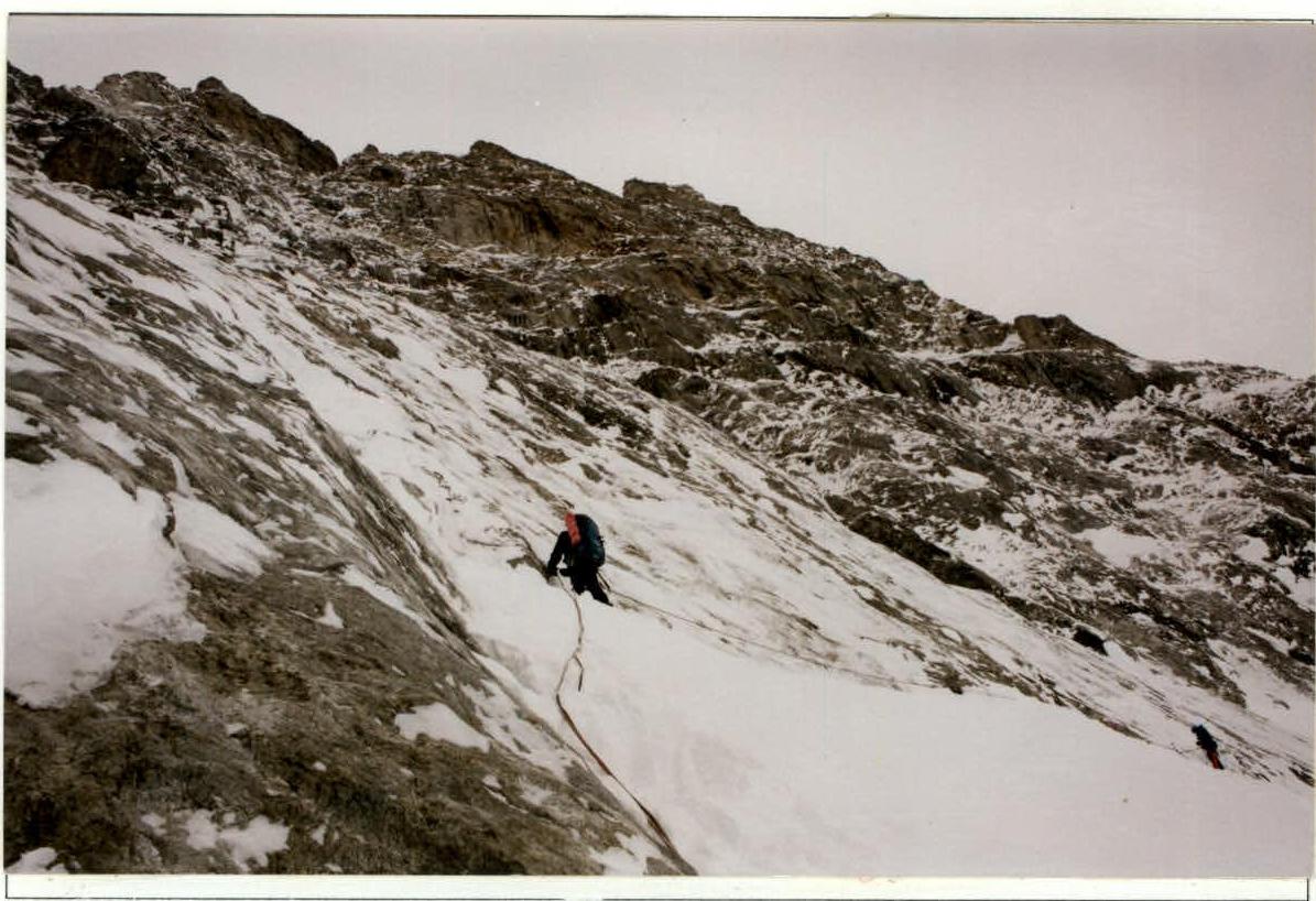
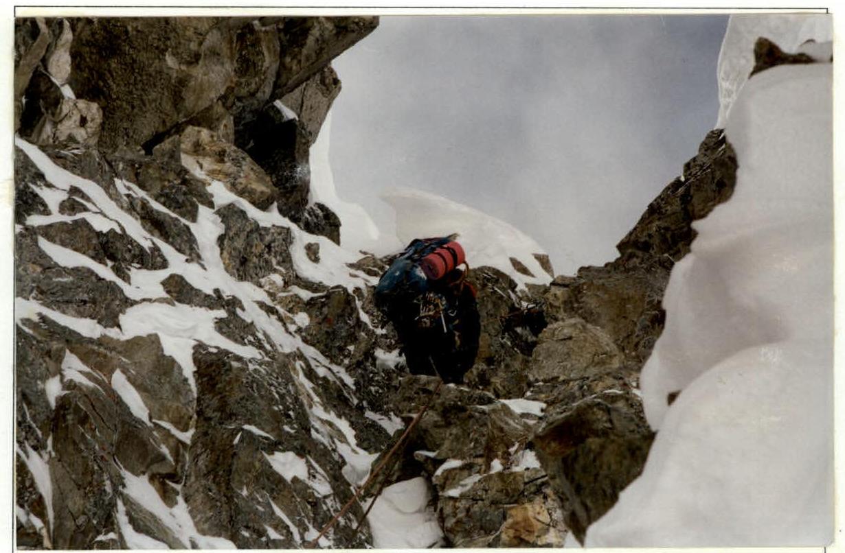
Section R4
- Traverse towards the couloir
Section R9
- Large cornice at the middle of the route
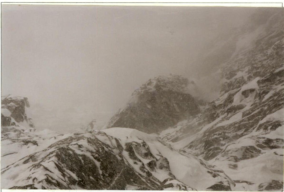
Section R13
- Summit tower visible on the left
Section R14
- Final rope length of the wall section
Note: The number of photos is small due to constantly bad weather during the ascent