Moscow City Climbing Championship
In the High-Altitude Technical Class

Report
On ascending to the summit of Chegem (4351 m) via the route on the northeast wall of the northeast ridge (V. Forostyana) 6A category of complexity by the KAIS MEI team
For the period from August 5, 2020, to August 7, 2020
Climbing and Mountaineering Club of Moscow Power Engineering Institute
I. Climbing Passport
| 1. General Information | ||
|---|---|---|
| 1.1 | Full Name, Sports Rank of the Leader | Markevich Konstantin Georgievich, MS |
| 1.2 | Full Name, Sports Rank of Participants | Pantyukhin Lev Vladimirovich MS, Kurochkin Alexey Vitalievich 1st sports rank, Leonkin Sergey Sergeevich 1st sports rank |
| 1.3 | Full Name of Coach | Kutkin Sergey Anatolievich |
| 1.4 | Organization | KAIS MEI |
| 2. Characteristics of the Climbing Object | ||
| 2.1 | Region | Central Caucasus |
| 2.2 | Valley | Chegem, Adyrsky ridge |
| 2.3 | Section Number according to the 2013 Classification Table | 2.4.1. |
| 2.4 | Name and Height of the Summit | CHEGEM (4351 m) |
| 2.5 | Geographical Coordinates of the Summit | |
| 3. Characteristics of the Route | ||
| 3.1 | Route Name | NE wall of NE ridge |
| 3.2 | Proposed Category of Complexity | 6A |
| 3.3 | Degree of Route Exploration | - |
| 3.4 | Relief Characteristics of the Route | Rocky |
| 3.5 | Height Difference of the Route (altimeter or GPS data) | 1200 m |
| 3.6 | Route Length (in meters) | 1900 m |
| 3.7 | Technical Elements of the Route (total length of sections of varying complexity with relief characteristics) | I cat. rocky — 100 m. II cat. rocky — 50 m. III cat. ice/rocky — 1200 m. IV cat. rocky — 190 m. V cat. ice/rocky/combination — 110 m. VI cat. ice/rocky/combination — 100 m. Rocky VI, A1–A2 — 150 m. |
| 3.8 | Average Steepness of the Route, ° | 45 |
| 3.9 | Average Steepness of the Main Part of the Route, ° | 90 |
| 3.10 | Descent from the Summit | Via 2B cat. complexity to Chegem valley |
| 3.11 | Additional Route Characteristics | No water on the bastion. |
| 4. Characteristics of Team Actions | ||
| 4.1 | Time of Movement (team's working hours, in hours and days) | 22 hours — 2 days |
| 4.2 | Overnights | Site on a large ledge, in a tent |
| 4.3 | Route Processing Time | 5 hours, 1 day |
| 4.4 | Start of the Route | 6:00, August 6, 2020 |
| 4.5 | Reach the Summit | 12:00, August 7, 2020 |
| 4.6 | Return to Base Camp | 21:00, August 7, 2020 |
| 5. Weather Conditions Characteristics | ||
| 5.1 | Temperature, °C | |
| 5.2 | Wind Speed, m/s | |
| 5.3 | Precipitation | |
| 5.4 | Visibility, m | |
| 6. Responsible for the Report | ||
| 6.1 | Full Name, e-mail | Leonkin S.S., leonkins@mail.ru |
II. Climbing Description
1. Climbing Object Characteristics
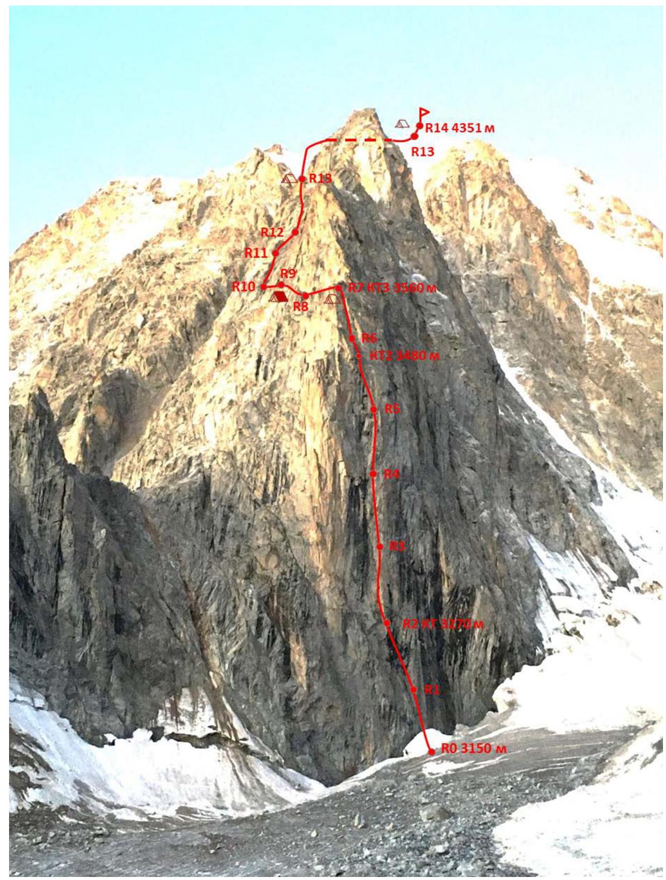
1.1. General Photo of the Summit.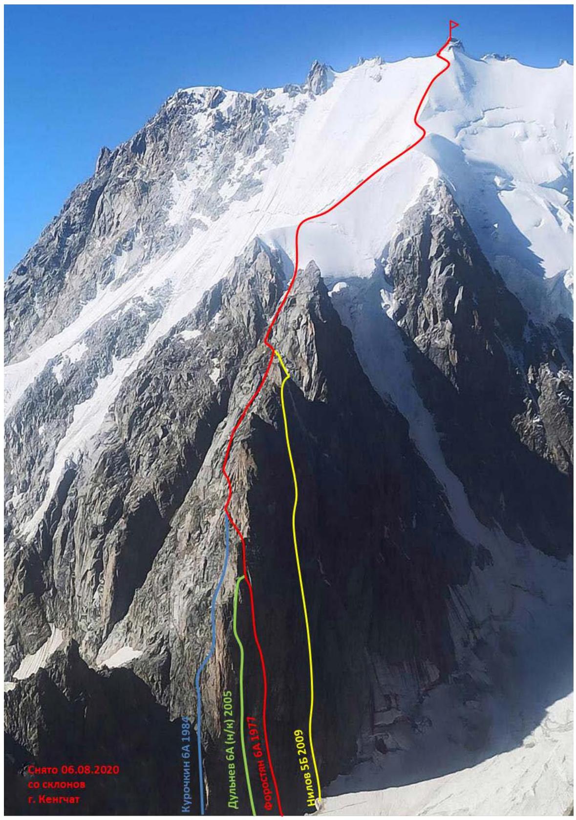
1.2. Profile of the Rocky Bastion. View from the side of Donkin Pass

Photo from Rashitov S.R.'s report, 2005
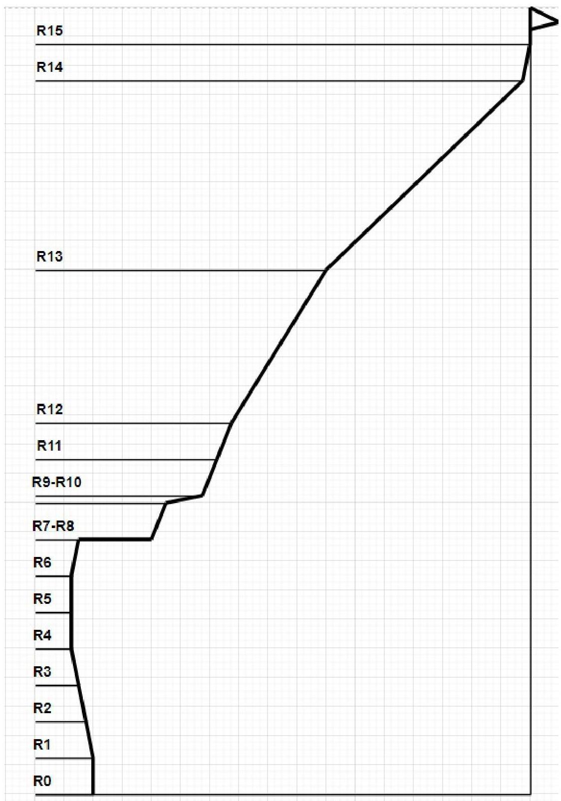
1.3. Hand-Drawn Profile of the Route
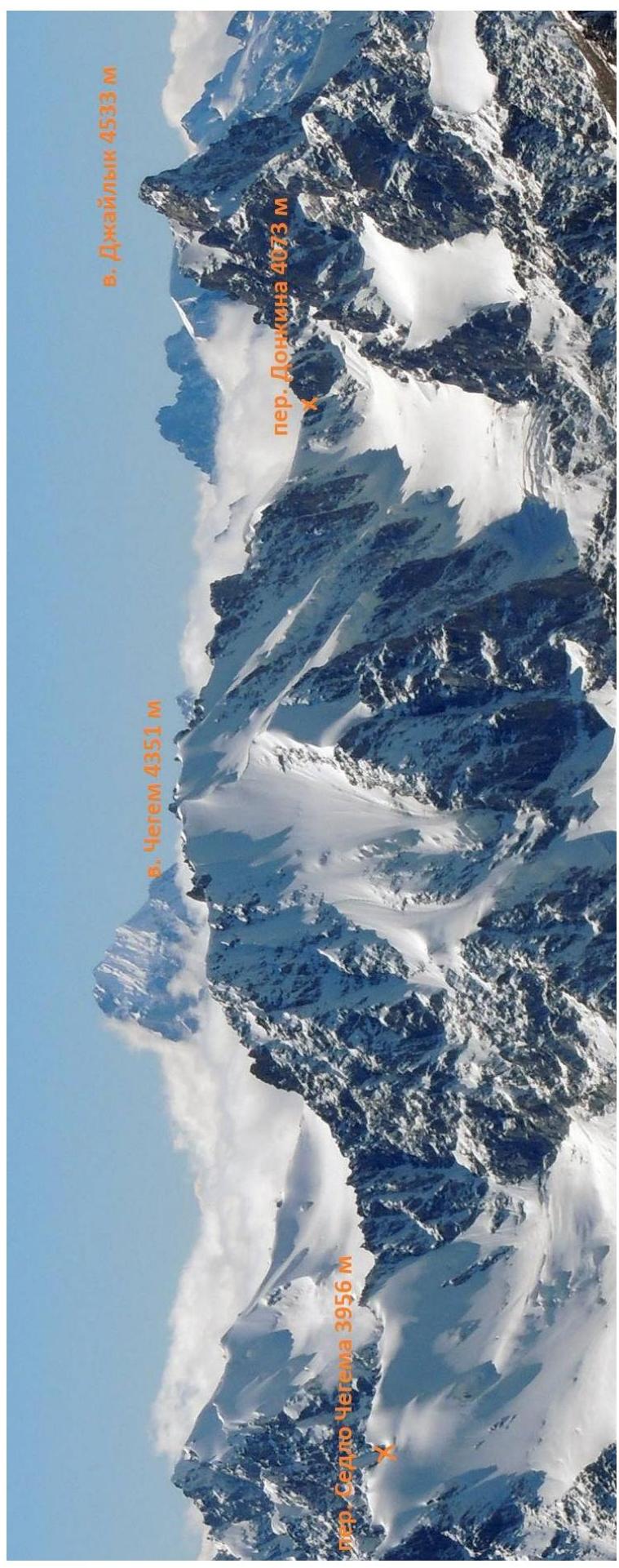
1.4. Photo Panorama of the Area
1.5. Map of the Area
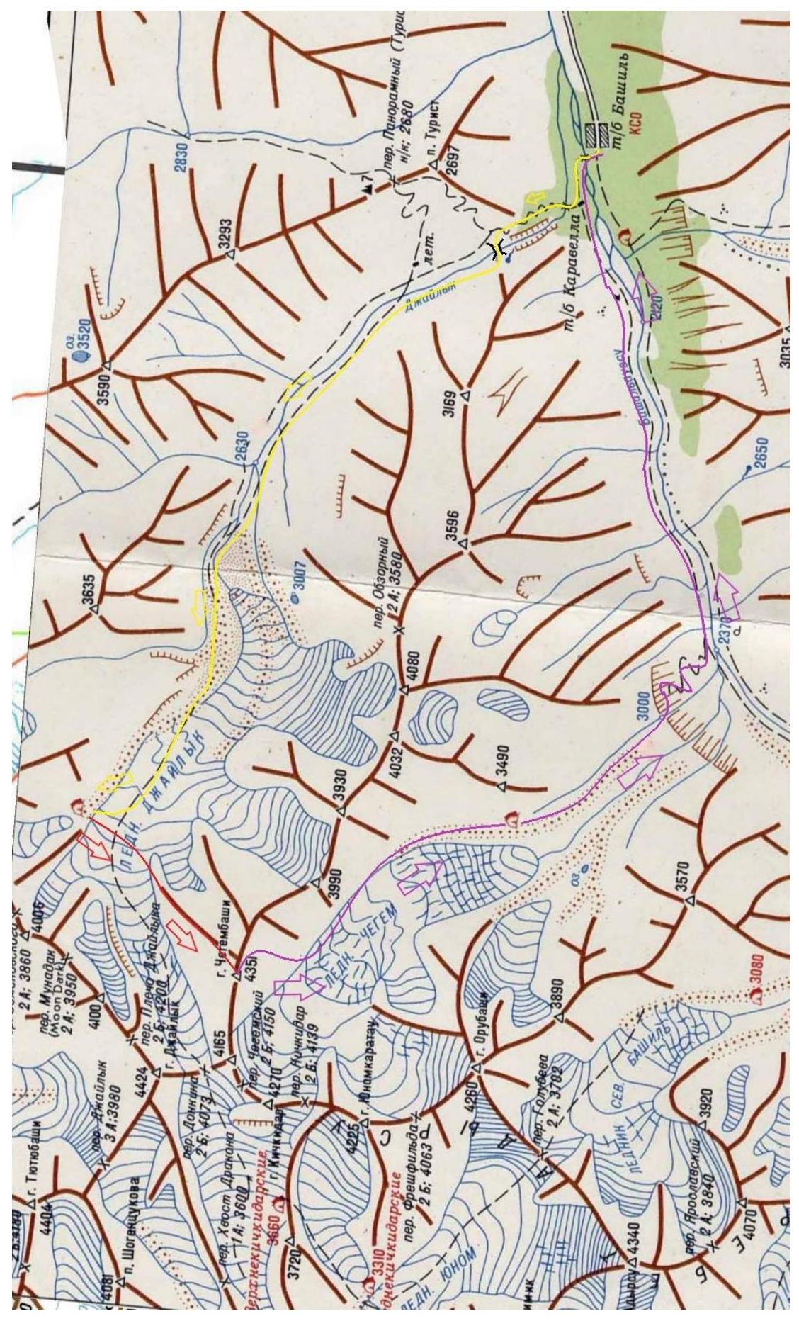
1.5. Approach Routes
To Bulungu settlement — asphalt road. Above — to Bashil tourist base — dirt road. Possible to drive with a passenger car in dry weather.
Above Bulungu settlement — border checkpoint. Passage and travel by personal transport strictly by passport. For ascents in the Chegem glacier area, a special permit is also required.
Near Bashil tourist base:
- Cross the Bashilaususu river via a suspension bridge.
- Then move along the trail upwards along the orographic left bank of the river.
- 10 minutes before the ruins of Karavella base, turn right.
- Cross the Dzhailyksu river via a small bridge.
- Move along a well-trodden steep trail upwards into the Dzhailyk valley.
The trail is equipped with steel cable handrails and passes through the forest. After an hour, the trail flattens out and exits the forest. At this point:
- Turn left — towards the third bridge.
- Cross it to the orographic right bank of the Dzhailyksu river.
- Move along it upwards along the grassy slopes to the moraines of the glacier — about 4 hours.
Ascend to the Dzhailyk glacier:
- Left — via moraine scree.
- Right — via the open part of the tongue.
Further movement along the gentle part of the glacier for about 2 hours. Initial bivouac opposite the NE bastion of Chegem on the left-bank orographic moraine of the Dzhailyk glacier.
- From Bashil tourist base: 6–8 hours.
- From overnight stays to the start of the route: 25–30 minutes along the flat glacier.
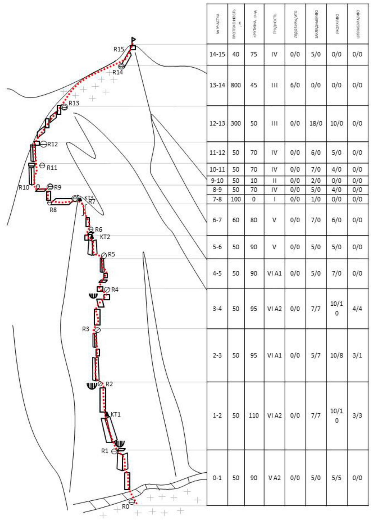
2. Route Characteristics
2.1. Technical Photo of the Route
2.2. Route Description in UIAA Symbols
3. Team Actions Characteristics
3.1. Brief Description of the Route by Sections.
R0–R1 (50 m, IV–V A1–A2, 80°–90°). Approach the rancleft via a snowy slope. Descend into it and transfer to the rocky bastion. Upwards along the destroyed wet rocks towards the triangular cornice. Station on a ledge, not reaching the cornice.
R1–R2 (50 m, VI A1–A2, 95°–120°). The cornice is passed head-on. Via a crack and then along the overhanging inner corner to a ledge. Upwards along a narrow vertical crack under the cornice. Control cairn No. 1.
R2–R3 (50 m, VI A1, 95°). Through the cornice along its right part. Then straight up to a narrow inclined ledge.
R3–R4 (50 m, VI A1–A2, 95°). From the ledge upwards along a crack towards the top of the spall (the spall "rumbles", the top is "live"). Then — through overhanging walls and cracks.
R4–R5 (50 m, V–VI A1, 90°). Then the overhanging stops, a vertical wall with alternating ledges and walls (shoulder bolts and hooks are encountered). Station at the top of the spall ("columns").
R5–R6 (50 m, V–V+, 90°). From the station, slightly upwards and left — around the corner, into a large inner corner. Along the corner, and then along its left wall — exit to a convenient horizontal ledge. Below the ledge on the wall — Control cairn No. 2.
R6–R7 (60 m, V, 80°). Then along the easing rocks towards the base of a large chimney. Along the left wall of the chimney, we exit onto a large ledge — the end of the rocky bastion. Control cairn No. 3. The first convenient site for a tent.
R7–R8 (100 m, I–II, 0°). On foot along the ledge left around the corner to its end.
R8–R9 (50 m, III–IV, 70°). Upwards and left along rocks of medium and above medium difficulty to a second large horizontal ledge. There are sites for 2 tents.
R9–R10 (50 m, I–II, 0°). On foot along the ledge left to approach under the inner corner.
R10–R11 (50 m, IV–V, 70°). Along the left wall of the corner towards the overhanging wall. Station on a small ledge.
R11–R12 (50 m, IV, 70°). Upwards along the inner corner-chimney, transitioning into a couloir, exit onto large talus ledges.
R12–R13 (300 m, II–III, 50°). Along the talus ledges upwards and left, encountering small simple walls and inner corners. Then a section where you need to descend a bit along the ledges, and then upwards and right along destroyed rocks to exit onto a saddle, from which the snow-ice slope begins. There is a site for a tent on the saddle.
R13–R14 (800 m, II–III, 30°–45°). Along the snow-ice slope, and then along the ridge to the summit tower. Below the summit, there is a flat snowfield where you can set up a tent.
R14–R15 (40 m, IV, 75°). Exit to the summit in the left part of the summit tower via a series of walls and ledges above medium difficulty.
Descent along the E ridge of Tal's route 2B to Chegem glacier — 2–3 hours.
3.2. Photos of Section Passages
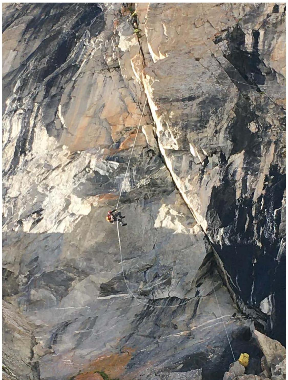
Photo 1. One participant at station R1, another passing the overhang on R1–R2.
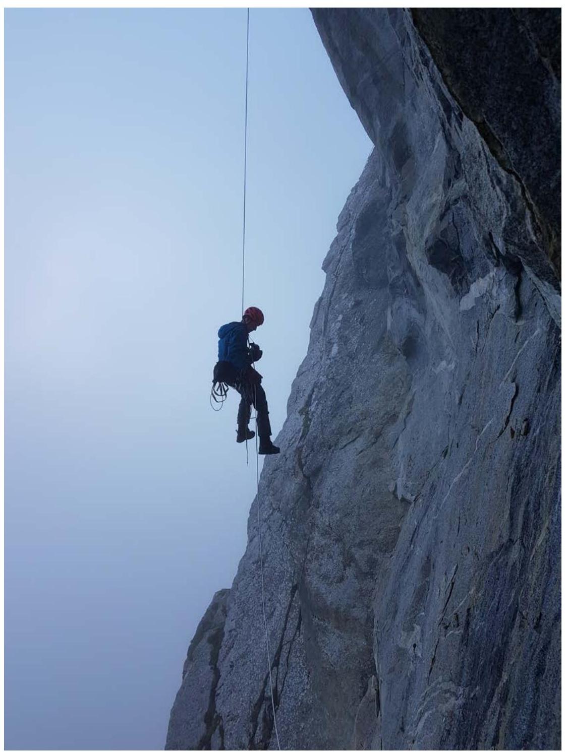
Photo 2. Descent via rappel from section R2–R3 on the processing day.
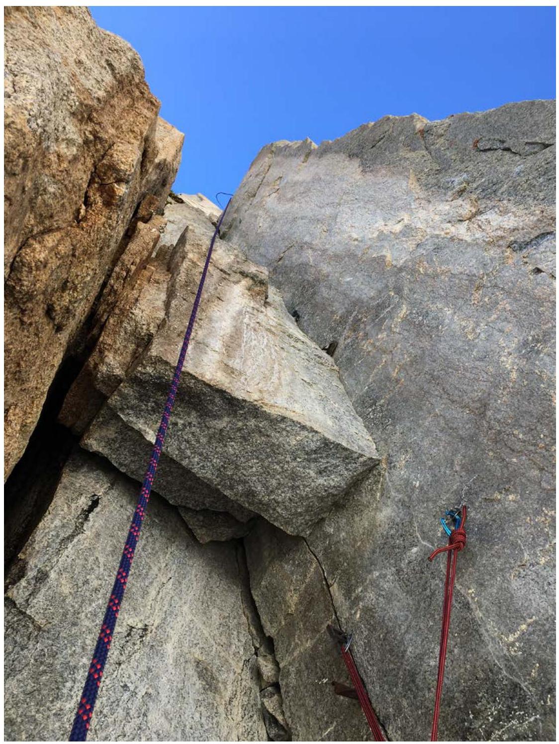
Photo 3. View from source on section R2–R3. Cornices.
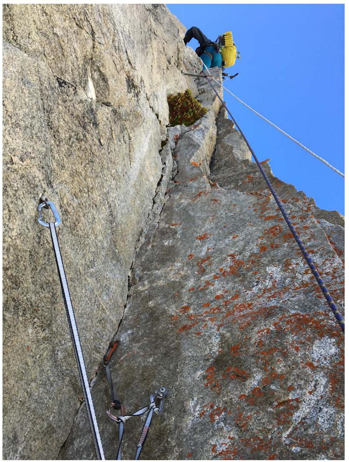
Photo 4. View from source on section R4–R5. Transition to free climbing.
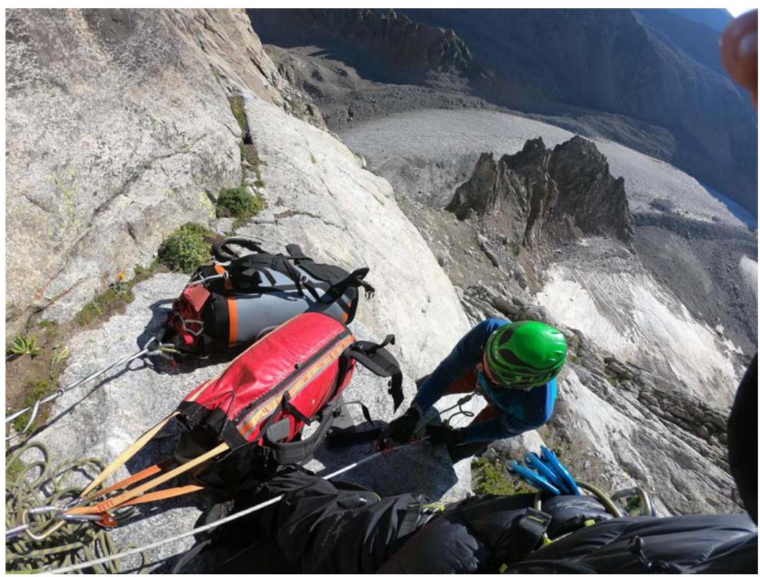
Photo 5. Pulling haul bags on section R10–R11
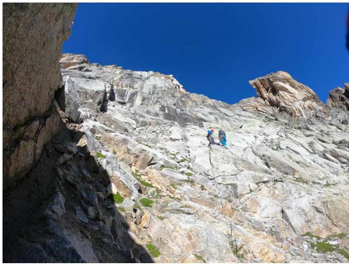
Photo 6. Exit onto talus ledges. Section R12–R13.
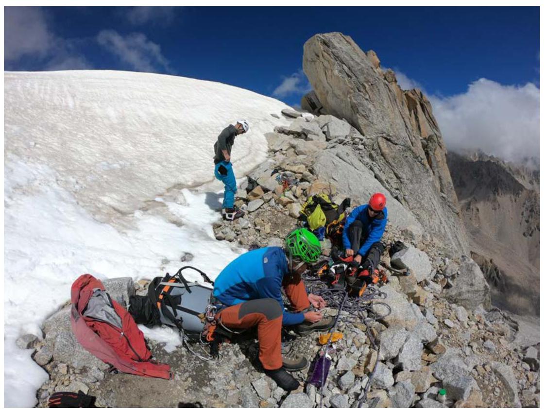
Photo 7. Exit onto snow saddle. Section R18. There is a site for a tent.
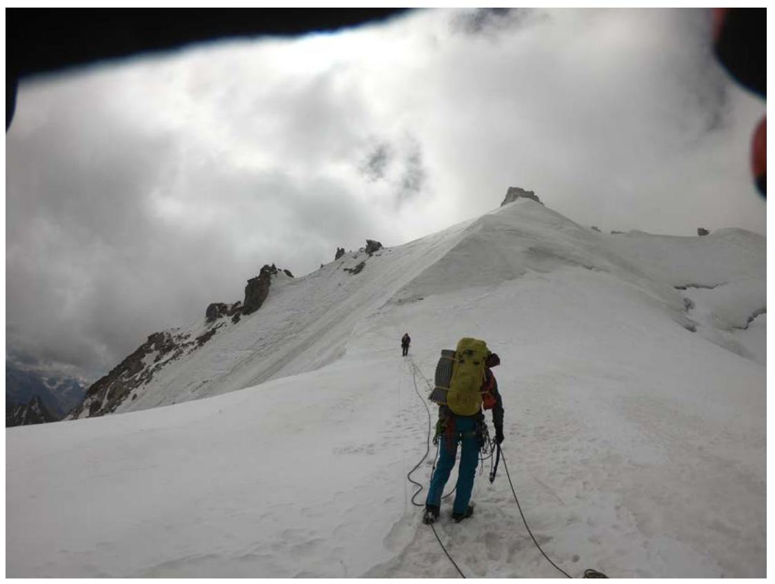
Photo 8. Movement along snow-ice slope. Section R13–R14.
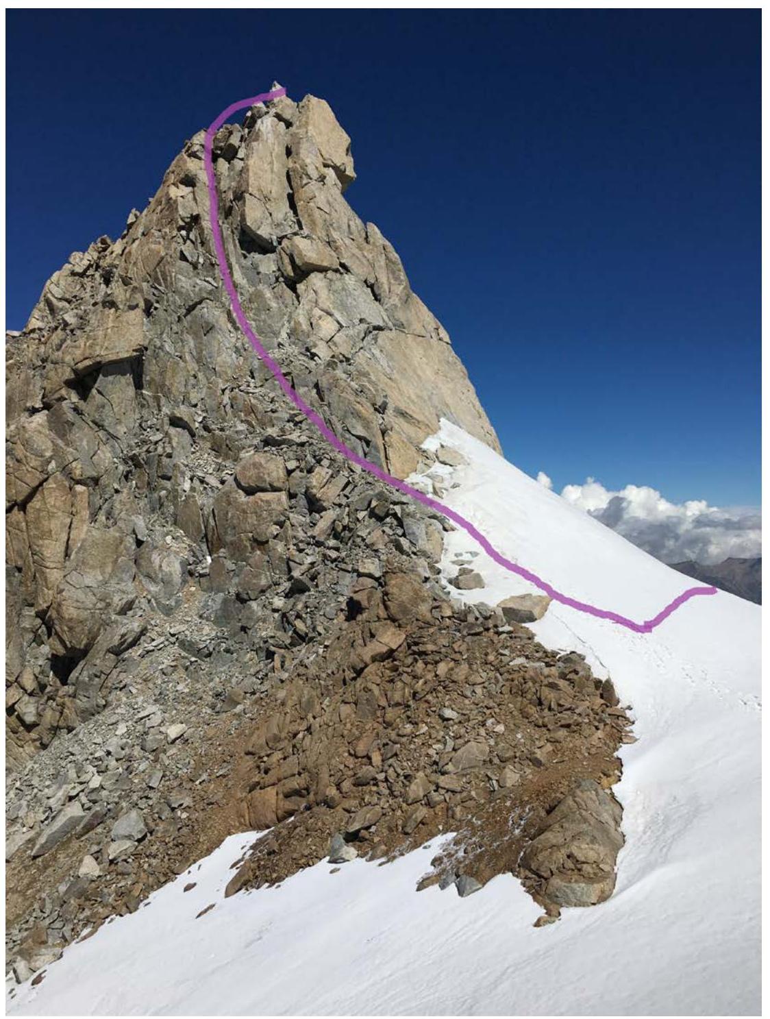
Photo 9. Summit tower. Section R14–R15.
3.4. Photo of the Team on the Summit.
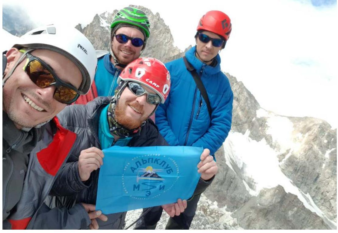
3.5. Note from the Summit.
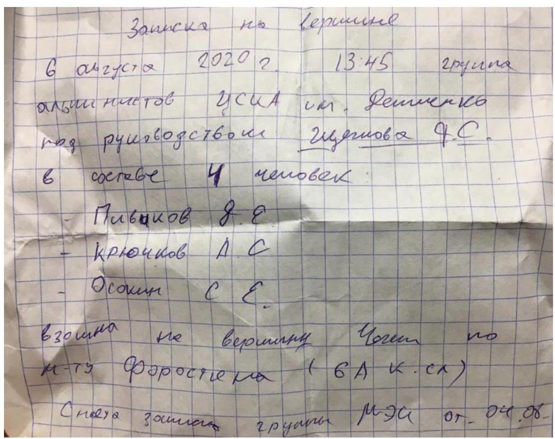
3.5. Tactical Actions
Before ascending Forostyana's route, an acclimatization reconnaissance trip was made to Chegem glacier. As part of MEI's training camp, a route on Chegem was found and passed via the E ridge 2B category of complexity by A. Tal, 1912. For ease of orientation on descent, cairns were set up. A new route description was uploaded to the FAR website. Thus, necessary acclimatization was obtained, and the fastest and safest descent from the summit was ensured.
On August 5, 2020, at 12:00, the team started processing the lower rocky bastion. By 17:00, 3 ropes of protection were set up on section R0–R3.
On August 6, 2020, at 6:00, they began movement along the protection ropes, and at 17:00, they settled on a bivouac on a large ledge, section R9.
On August 7, 2020, at 6:00, they continued movement along the route and at 12:00 stood on the summit of Chegem. At 15:00, they descended to Chegem glacier. At 19:00, they arrived at Bashil base.
Sections R0–R4 were passed by the leader predominantly on artificial technical aids. The remaining sections were climbed free (Photo 4). Other team members moved along the protection ropes on jumar clamps (Photo 1). The team's load was pulled up in haul bags (Photo 5).
3.6. Route Safety Assessment. Options for Communication on the Route. Recommendations for Subsequent Climbers. Detailed Information about Descent from the Summit with Landmarks. Conclusion on Preliminary Route Assessment Compared to Classified Routes of the Same Category.
The route is technically complex and saturated. High skill in working with various equipment is required. In particular:
- movement on artificial technical aids;
- many overhanging sections;
- ability to orient oneself on the route;
- ability to work on all types of terrain.
The upper part of the route is ice-snow. Presence of crampons, tools, and ice screws is mandatory.
Nevertheless, we consider the route objectively safe, as the main key part — the overhanging — and rocks do not fall along the bastion.
The route can be recommended as a first 6A — there is an opportunity to process the bastion as much as needed, depending on the level of preparation. There are no sites for overnight stays until section R7.
Limitations and Features:
- no sites for overnight stays until section R7;
- two neighboring routes, Dulnev's and Nilov's, may also be interesting;
- visually, they appear even more complex, and information on their repeated passage is not available.