Ascent Passport
-
Caucasus; Adyrsky ridge; section according to the classification table 2.4.1. From the Gumači summit to the Kitlod pass (Adyrsu, Lekzyr, Chegem gorges).
-
Name of the summit: Chegem (4461 m), name of the route: via the North-Eastern wall of the North-Eastern ridge (V. Forstyan, 1977).
-
Proposed — 6A cat. diff.
-
Nature of the route: combined.
-
Height difference of the route: 1160 m (by altimeter).
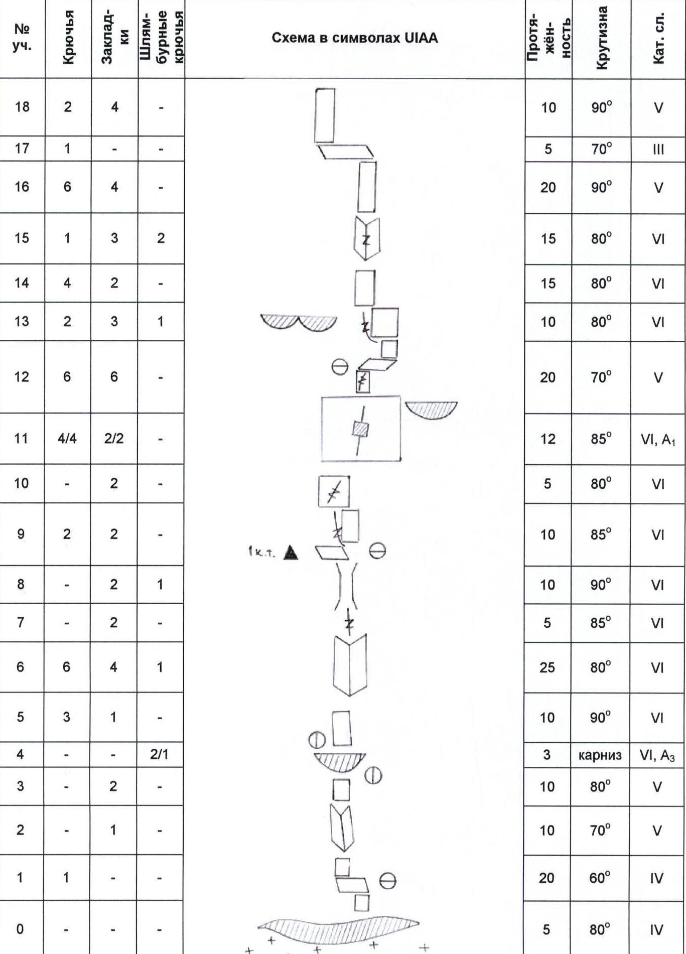
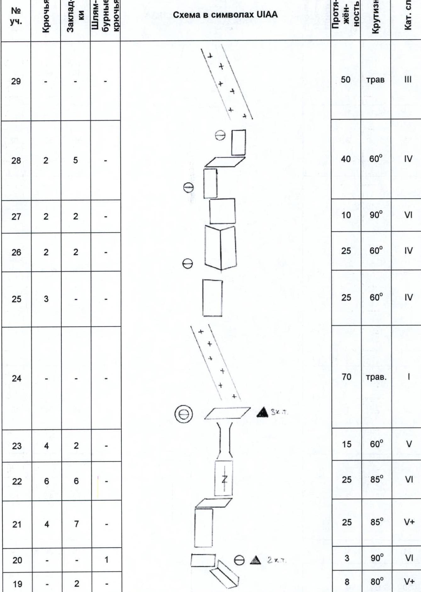
Route length: 1880 m. Length of sections:
-
V cat. diff. — 148 m.
-
VI cat. diff. — 138 m.
Average steepness:
-
main part of the route — 80°.
-
entire route — 40°.
-
"Own" pitons left on the route: total — 0; incl. bolted — 0. Pitons used on the route: stationary bolted — 3, incl. ATO — 2, removable bolted — 4, incl. ATO — 4.
Total artificial points of support (ATO) used: 70, including:
- pitons — 4
- chock stones — 2
- bolted pitons — 1
- skyhooks on relief and holes — 18
- fifi hooks — 34
- cam hooks — 11
-
Team's travel hours: 35 h, 4 days.
-
Leader: Rashitov Sergey Ravilevich — Candidate for Master of Sports.
Participants:
- Tabakov Sergey Vladimirovich — Master of Sports;
- Zinoviev Mikhail Ivanovich — Master of Sports;
- Gonov Dmitry Vladimirovich — Candidate for Master of Sports;
- Bychkov Andrey Vladimirovich — 1st sports category;
- Evstifeev Vladislav Vladimirovich — 1st sports category.
-
Coach: Tabakov Sergey Vladimirovich — Master of Sports.
-
Departure to the route: 8:00 July 24, 2005.
Summit ascent: 10:00 July 27, 2005. Return to UCB "Ullu-Tau": 18:00 July 27, 2005.
General photo of the summit

Photo № 1. Chegem summit. Date taken — July 24, 2005. Location — Dzhailik glacier.
LEGEND:
- route taken;
- control landmark;
- summit;
- overnight stays.
Drawn route profile
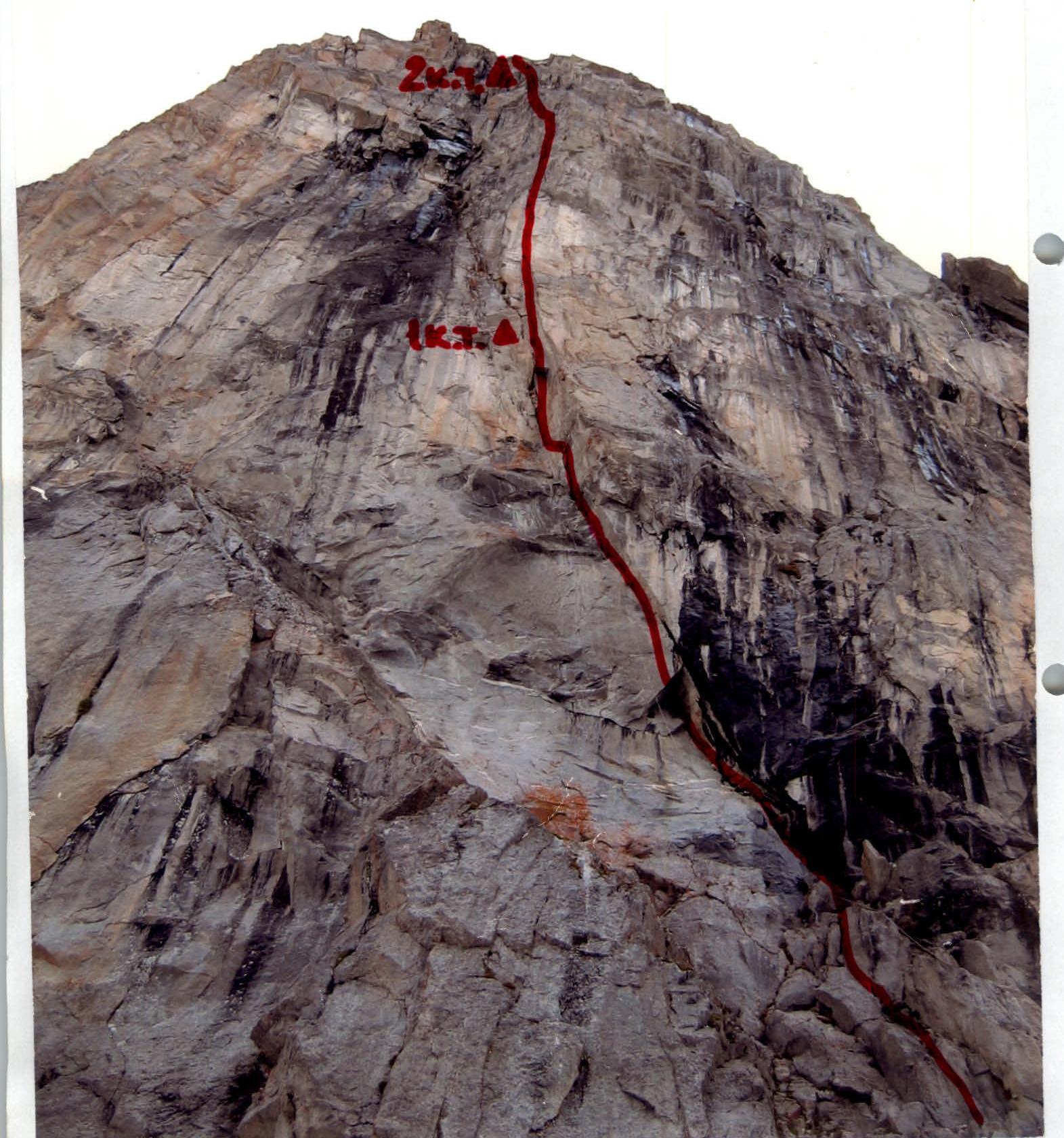
Photo of the wall profile on the right
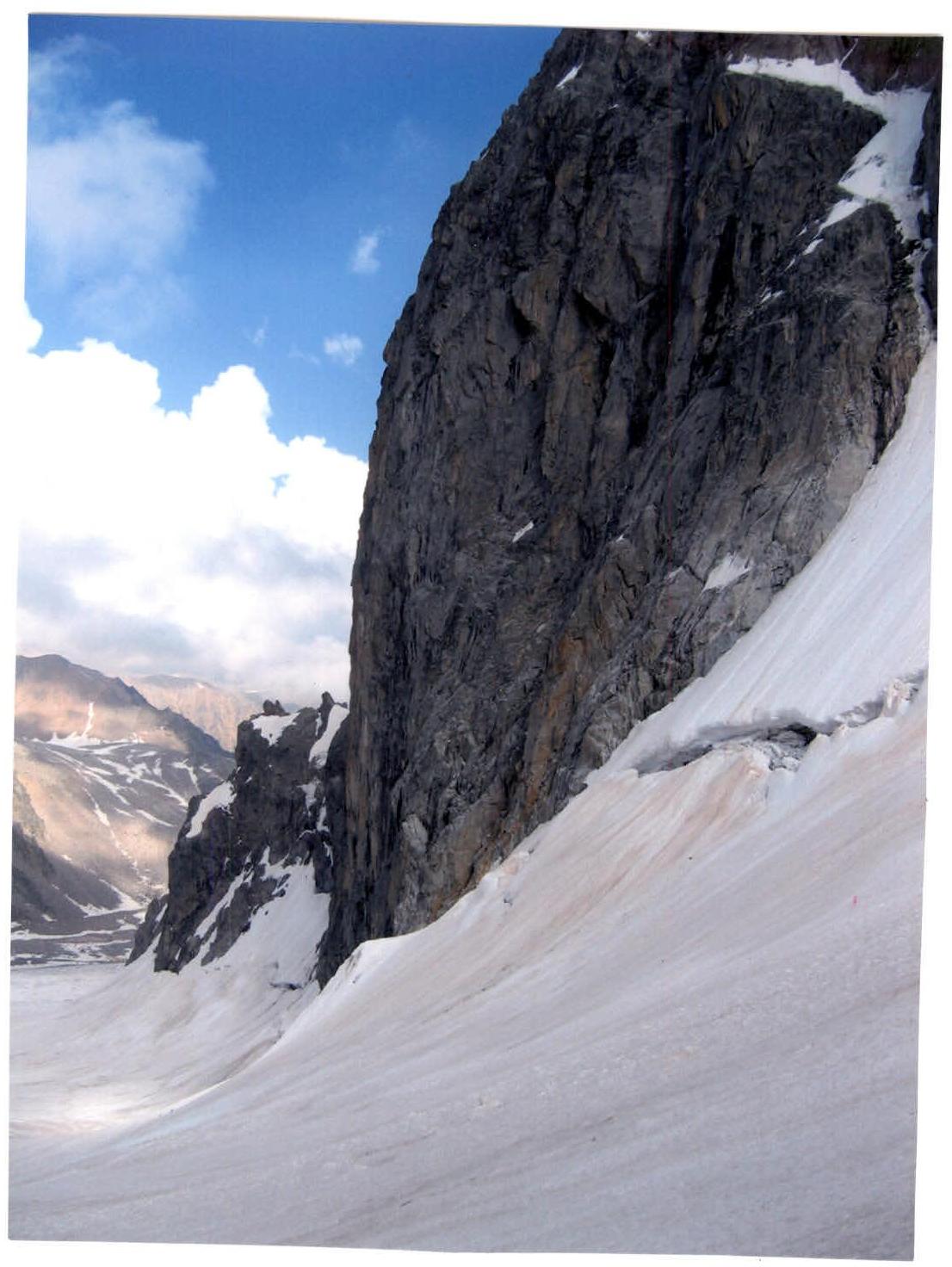
Photo № 2. Wall profile on the right. Date taken — July 24, 2005. Location — Dzhailik glacier.
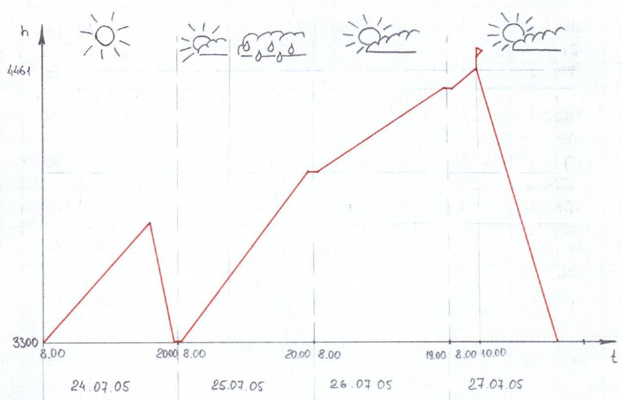
Ascent Graph
Description of the approach to the route from UCB "Ullu-Tau"
The object of the ascent — Chegem summit, is located in one of the most actively visited regions of the Caucasus due to its "accessibility" both geopolitically and economically. The approach to the route is possible from UCB "Ullu-Tau", as well as from the "Bashil" tourist base. In this case, the approach to the route was made from UCB "Ullu-Tau". From UCB "Ullu-Tau" the approach to the Donkin pass (3900 m), connecting the Western Yunom and Dzhailik glaciers — 8 h. Overnight stay is possible on the Donkin pass. From here, the profile of the route is clearly visible, as well as the descent path from the summit. From the Donkin pass, descent to the Dzhailik glacier — 150 m on steep (up to 60°) ice covered with a layer of snow. It is advisable to hang a rappel. Further descent along a fairly even, slightly crevassed glacier under the North-Eastern ridge of the Dzhailik summit (from the Donkin pass 1.5–2 h).
Photopanorama of the area
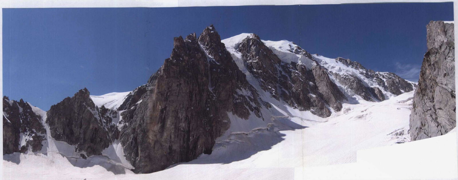
Photo № 3. Panorama of the Chegem massif (stitched on a computer). Date taken — July 24, 2005. Location — Dzhailik glacier.
Route scheme in UIAA symbols
Page 8a
Page 8b
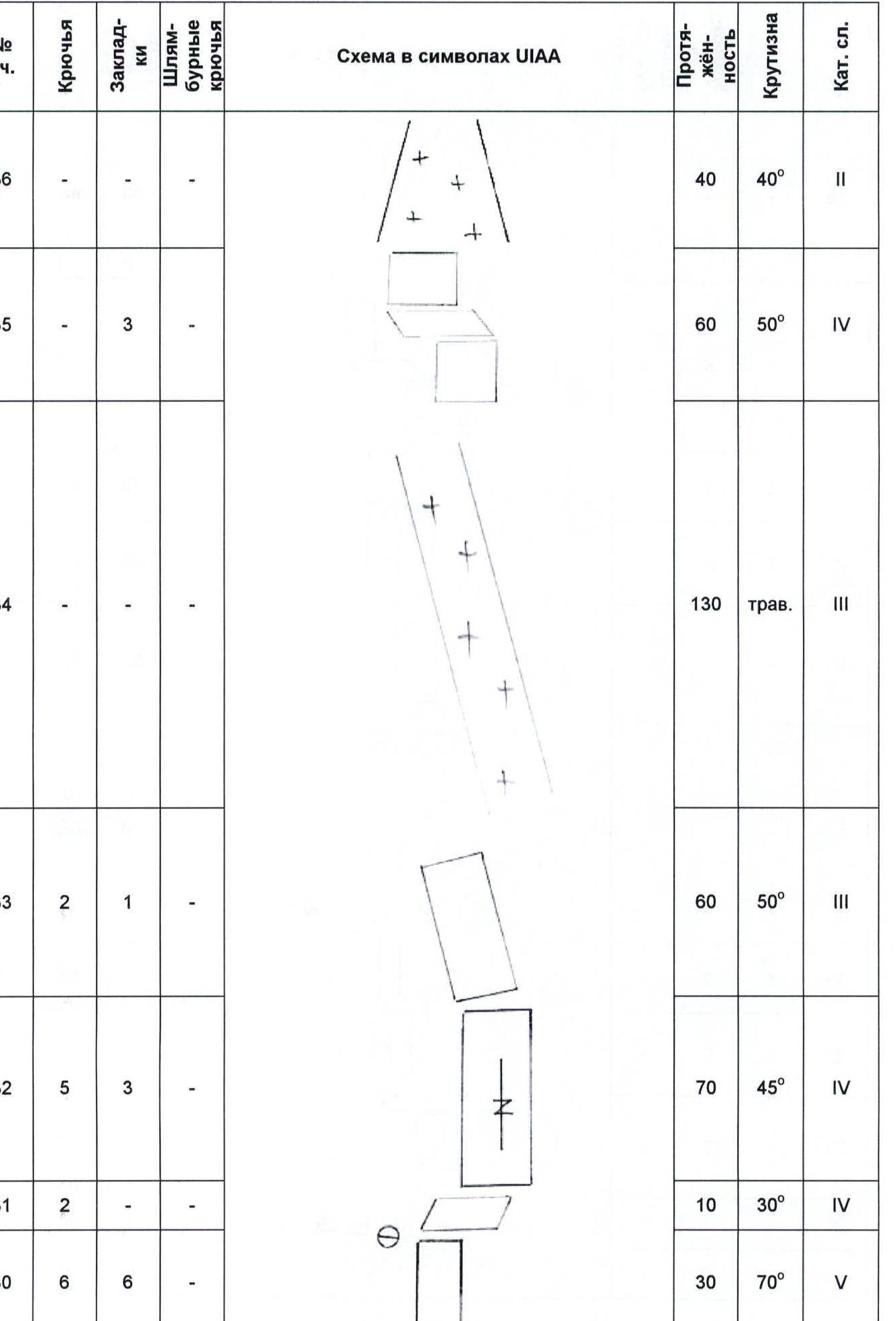
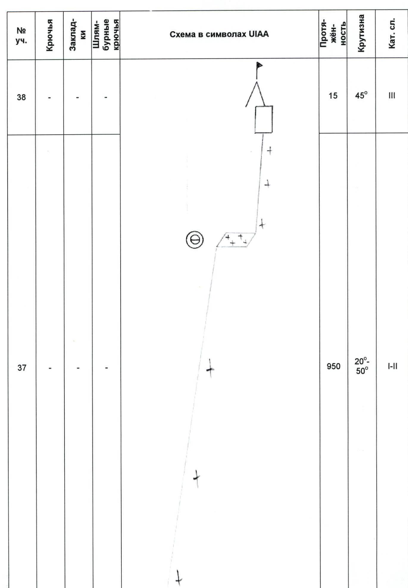
Photo illustration of the report

Photo № 5. Cornice passed. Taken from Section R5.
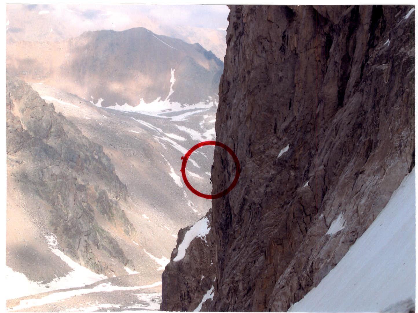
Photo № 6. Rashitov and Tabakov passing Section R11. Taken from Dzhailik glacier.

Photo № 7. Tabakov climbing on "perils". Section R22. Taken from the station on Section R21.
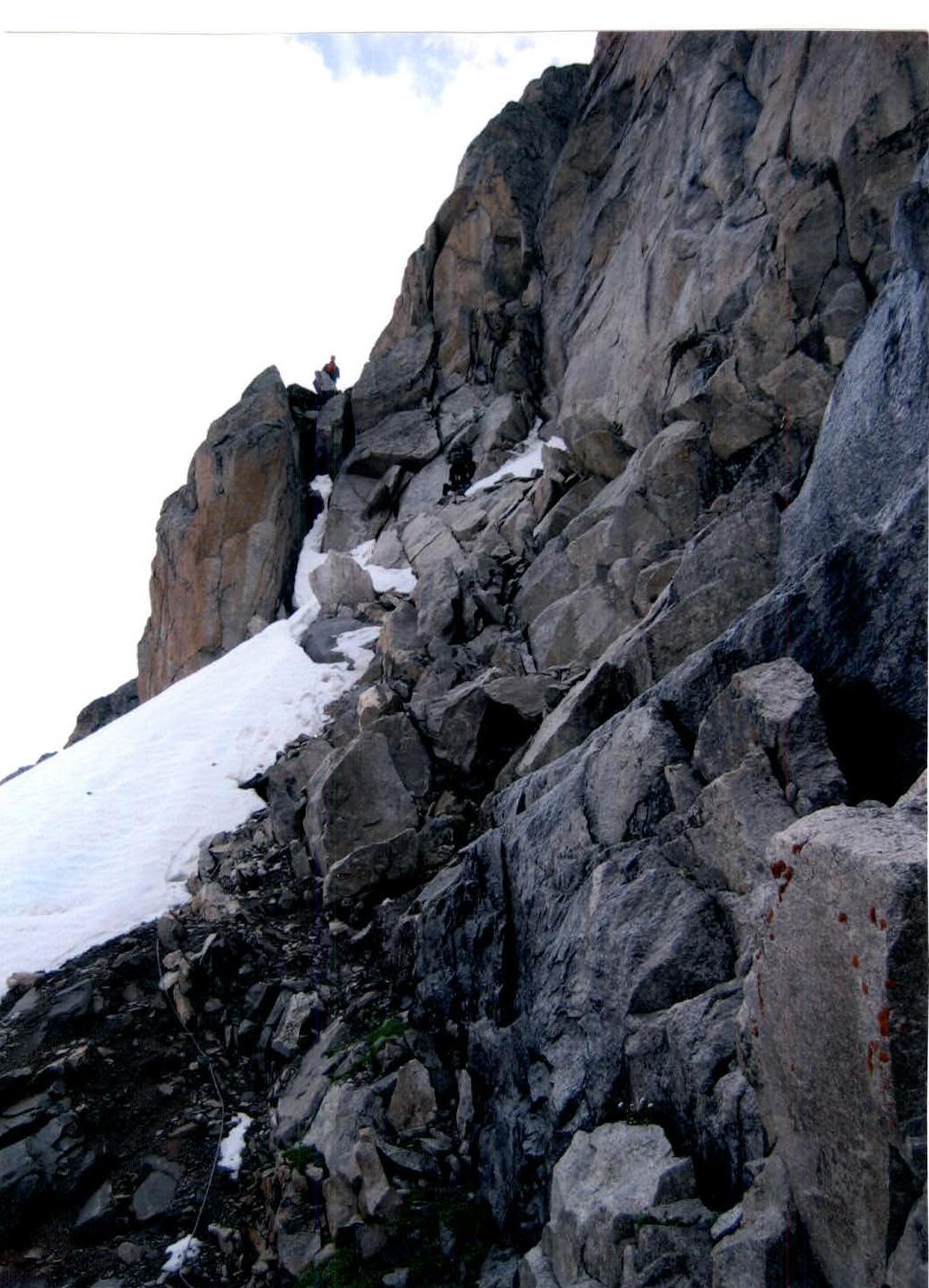
Photo № 8. At the end of Section R34.