Ascent Record
- Region: Central Caucasus, Chegem valley, Adyr ridge, classified under KMGV as 2.4.1
- Peak Chegem, 4461 m, ascent via the NE wall of the NE ridge (route by V. Forostyan).
- Route category: 6A.
- Route type: rock climbing.
- Route elevation gain: approximately 1160 m.
Route length: 1700 m.
Length of sections with 5th category difficulty: 248 m, with 6th category difficulty: 108 m.
Average steepness:
- wall section: 92°;
- entire route: 44°.
- Pitons left on the route: total 3; including bolted pitons: 0.
Total equipment used on the route:
- rock pitons: 59
- chocks: 102
- friends: 85
- ice screws: 12; Existing stationary bolted pitons on the route: 18. Total artificial protection points (APP) used: 158.
- Team's total climbing hours (until the summit): 34 hours, 4 climbing days, including 16 hours of route preparation. Descent via 3A category route along the 3rd ridge: 7 hours.
- Team leader: Pavlyuk Alexander Nikolayevich — CMS, 2nd category instructor, certificate No.203,
team members:
- Gurzhov Sergey Viktorovich — 1st sports category, born 1971
- Terekhov Alexey Anatolyevich — 1st sports category, born 1973
- Fedorov Vladislav Vladimirovich — 1st sports category, born 1977
- Coach: Kiselev Alexander Anatolyevich — CMS, 1st category instructor, certificate No.156.
- Departure from "Ullutau" base: July 22, 2006, at 10:30. Start of route preparation: July 25 and 26, 2006, at 8:00. Start of ascent: July 27, 2006, at 7:30. Reaching the summit: July 28, 2006, at 16:00. Return to "Ullutau" base: July 29, 2006, at 18:00.
General photograph of Chegem peak (NE wall).
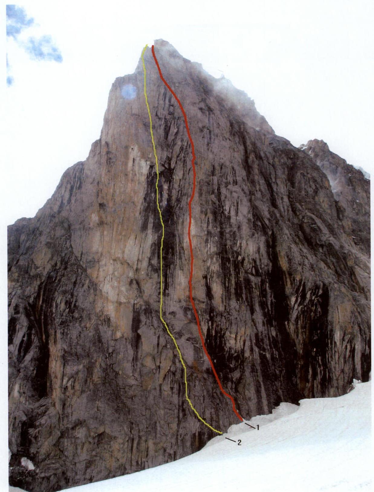
*The photograph was taken from the Djailyk glacier.
1st Forostyan route, 2nd Dulnev route
Technical Photograph of the Route
 R1–R2 – 25 m, 80°, IV–V; R2–R3 – 10 m, 90°, V, A1; R3–R4 – 5 m, 120°, VI, A2; R4–R5 – 10 m, 110°, VI, A1; R5–R6 – 10 m, 95°, VI, A1; R6–R7 – 45 m, 95°, VI, A1; R7–R8 – 8 m, 100°, V, A1; R8–R9 – 4 m, 100°, VI, A3; R9–R10 – 4 m, 90°, VI, A2; R10–R11 – 30 m, 90°, VI, A2; R11–R12 – 45 m, 90°, V; R12–R13 – 50 m, 90°, V; R13–R14 – 50 m, 90°, V; R14–R15 – 30 m, 80°, IV; R15–R16 – 40 m, 80°, V; R16–R17 – 150 m, 35–40°, II; R17–R18 – 80 m, 80°, IV; R18–R19 – 200 m, 60°, III–IV; R19–R20 – 750 m, 35–40°, II; R20–R21 – 4 m, 100°, V;
Brief Description of the Route and Photo Illustration of Sections with V–VI Category Difficulty
From the bivouac on moraine deposits, we cross the Djailyk glacier and approach the NE wall of the NE ridge of Chegem peak.
R0–R1. We overcome a 2.5 m wide crevasse by descending 4 m to a snow bridge.
R1–R2. We move straight up under the black overhanging rocks with water flowing down. The belay station is on a ledge under the overhang.
R2–R3. We move left and upwards through a diagonal crack to a cornice. APP, chocks, friends, pitons. (Photo 1)
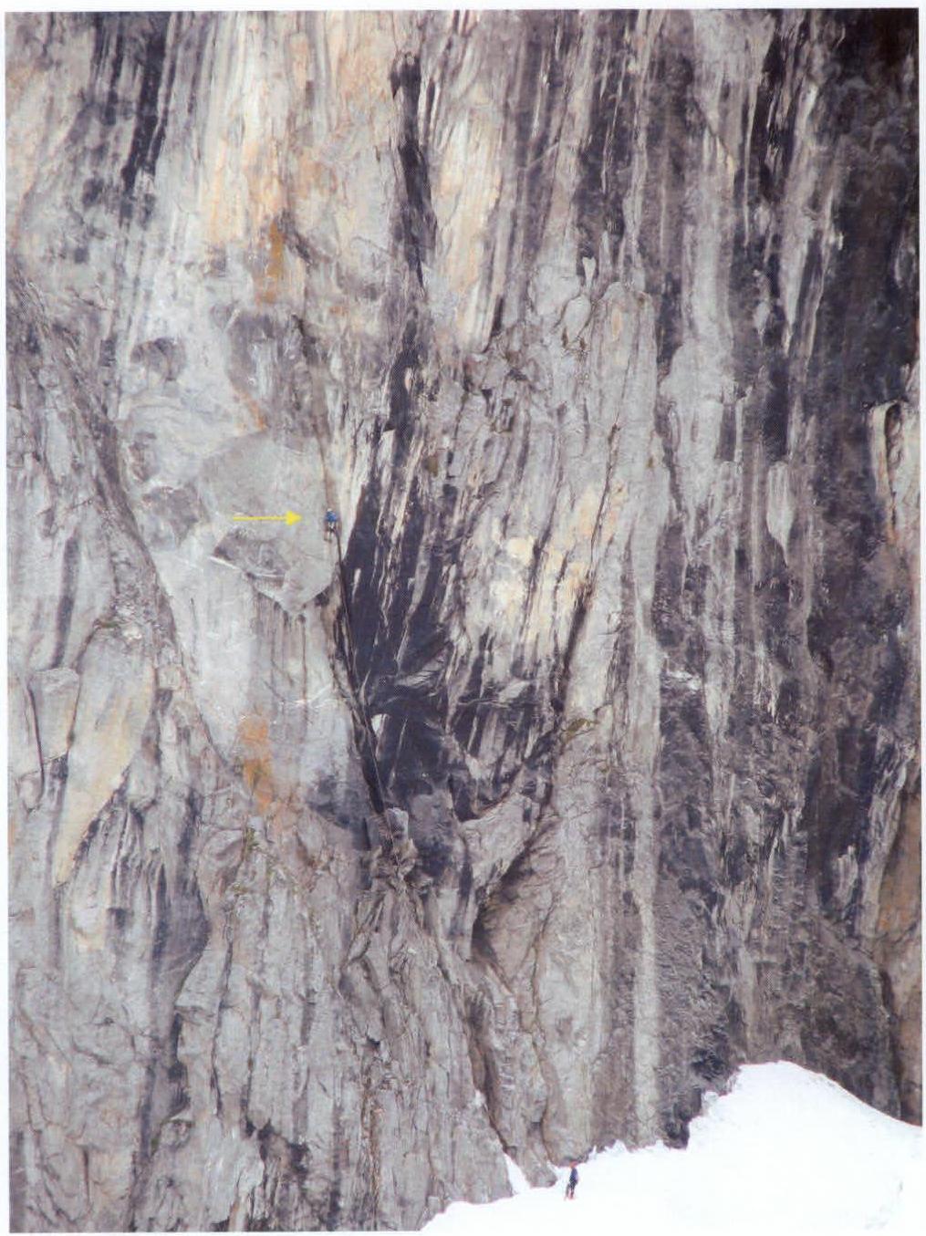 Photo 1
R3–R4. We pass the cornice directly.
- APP
- Chocks
- Friends
- Pitons
(Photo 2)
 Photo 2
R4–R5. We ascend via an inside corner to a small ledge with the first control cairn. APP, chocks, friends, pitons.
R5–R6. We climb straight up through a narrow vertical crack to a belay station on two bolts under a cornice. APP, chocks, friends, pitons, old bolts. (Photo 3)
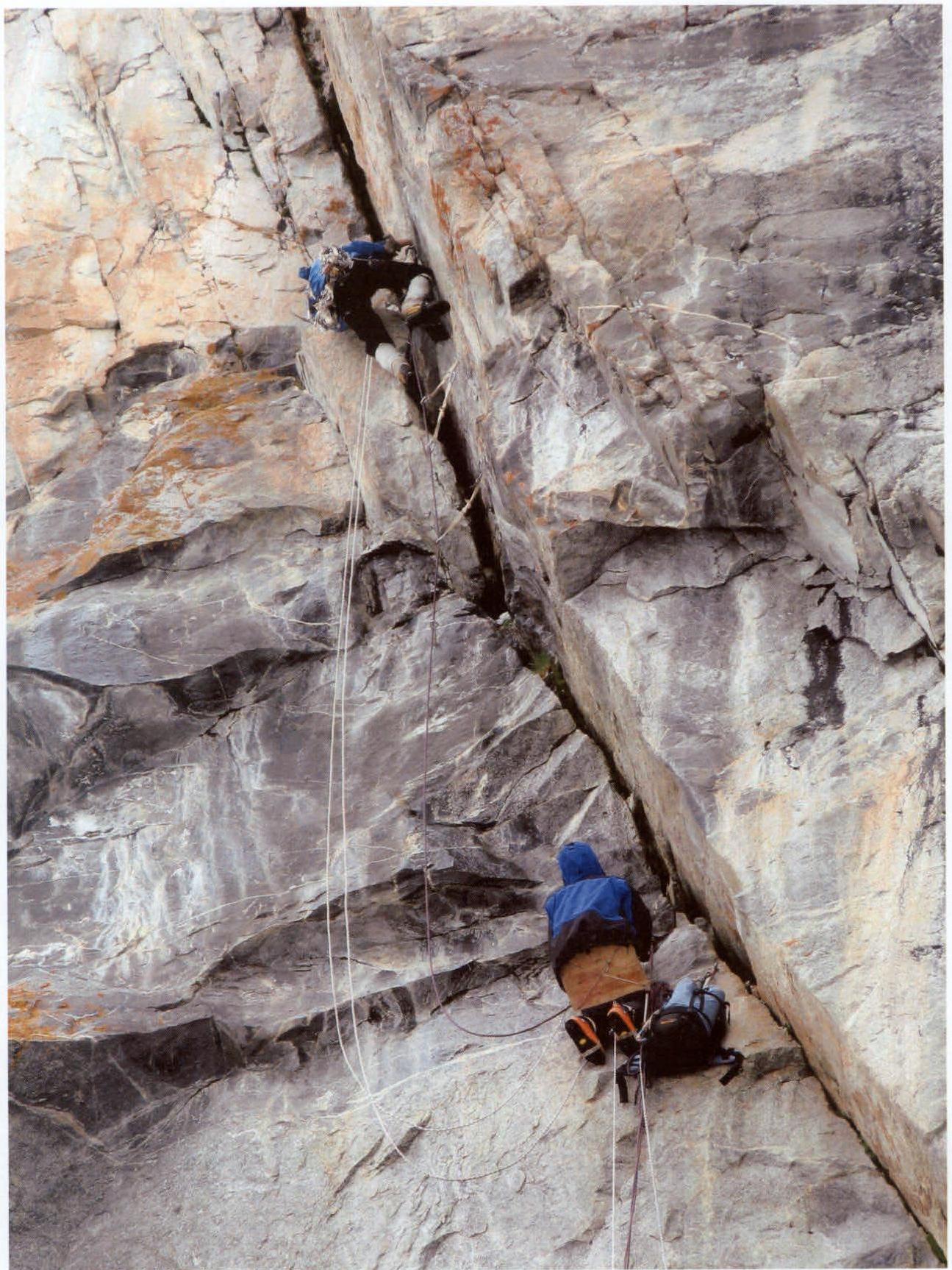 Photo 3
R6–R7. We overcome the cornice on the right and move straight up to a narrow inclined ledge. APP, chocks, friends, pitons, old bolts. (Photo 4)
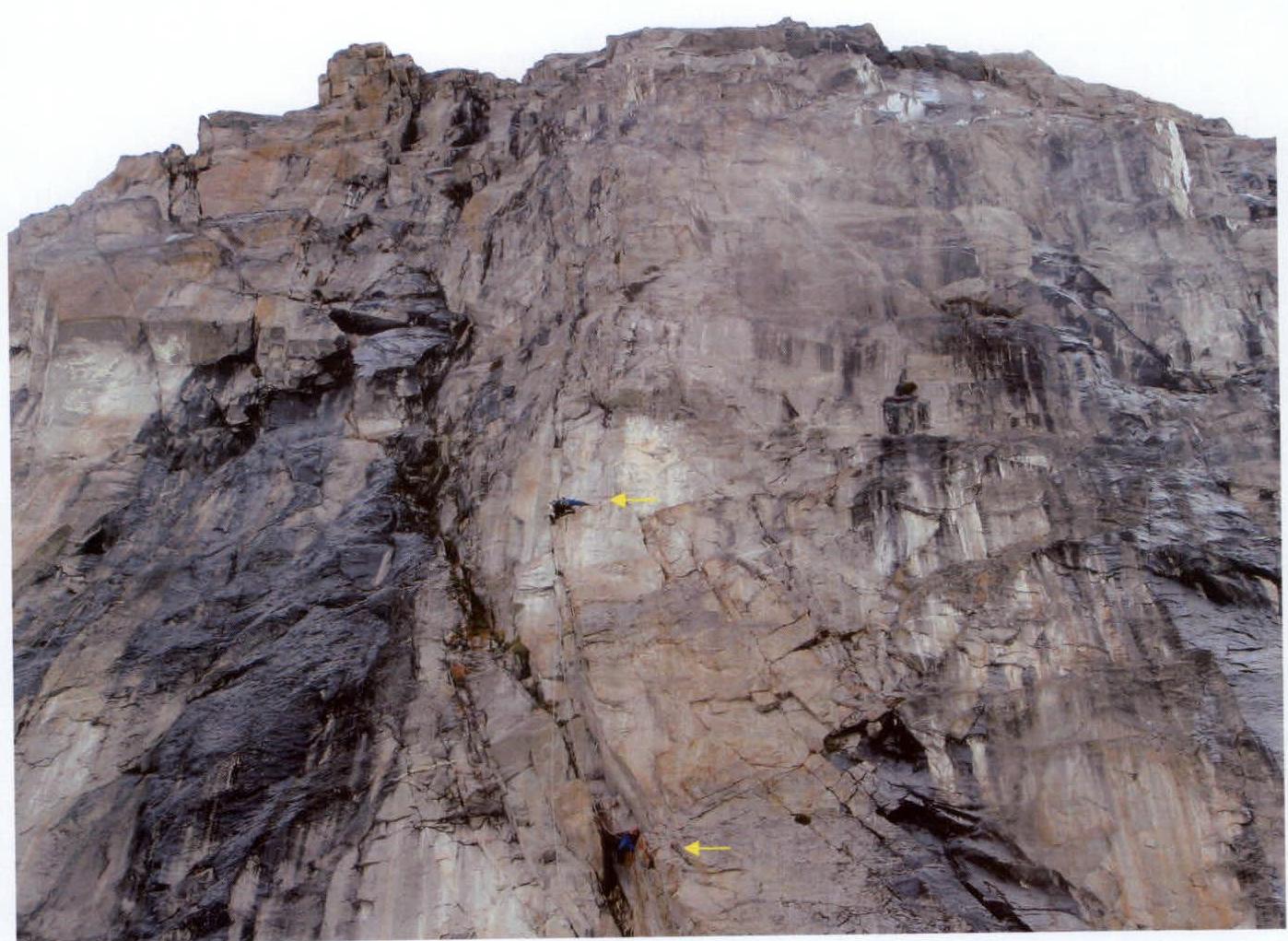 Photo 4
R7–R8. We climb straight up through a crack to the top of a rock spire (the upper part is loose!!!). We had to climb through it, wedging a rock with a shovel, as there were monolithic rocks on the right and an inside corner with many loose rocks on the left.
This is the only section on the entire wall where the leader can drop a rock on the belayer. (Photo 5)
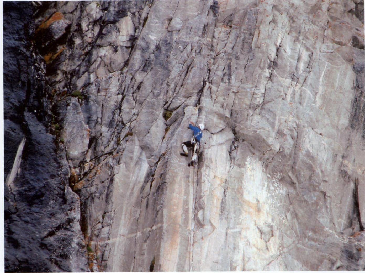 Photo 5
R8–R9–R10. Short sections of wall with old bolts every 4 m. Here, we placed the only bolt on the route (removable).
R10–R11. A vertical wall where APP sections alternate with free climbing.
R11–R12. We bypass the cornice on the right and move straight up with free climbing.
R12–R13. Alternating short vertical walls and narrow inclined ledges. All sections are climbed with free climbing. (Photo 6)
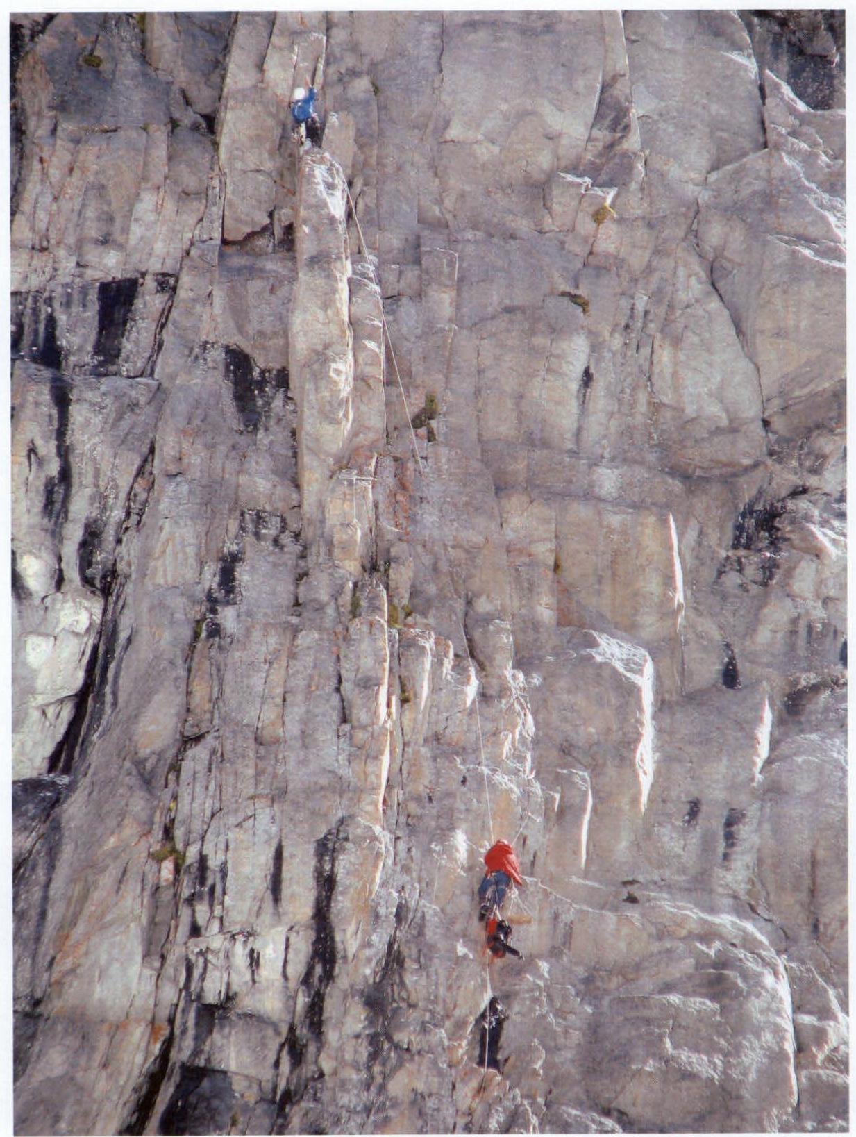 Photo 6
R13–R14. We move into an inside corner behind a bend, followed by a vertical wall. The second control cairn is in the middle of the wall. The wall ends with a large ledge. (Photo 7)
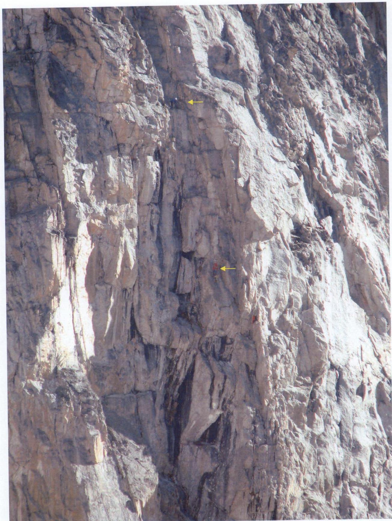 Photo 7
R14–R15. We continue on a gradually sloping wall with loose rocks under the base of a chimney.
R15–R16. We climb the left wall of the chimney to a wide ledge with the third control cairn.
R16–R17. We traverse the first pinnacle via easy scree ledges for 150 m until we stop for the night. We set up camp at 18:00 under heavy rain.
R17–R18. We climb straight up an 80 m narrow icy couloir to scree ledges.
R18–R19. We then traverse left and upwards through a system of walls and ledges until we reach a snowy ridge.
R19–R20. The snowy ridge is approximately 750 m long. We move simultaneously. (Photo 9).
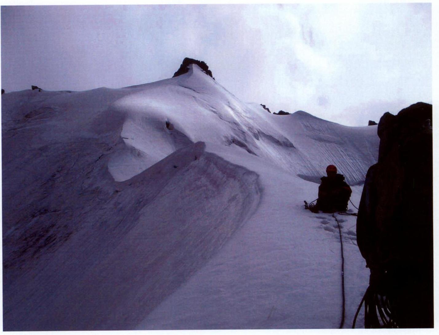 Photo 9
R20–R21. The final ascent to the summit involves 4 m of 5th category rock climbing. Snow, fog.
On the summit of Chegem, at 16:30 on July 28, 2005. (Photo 10);
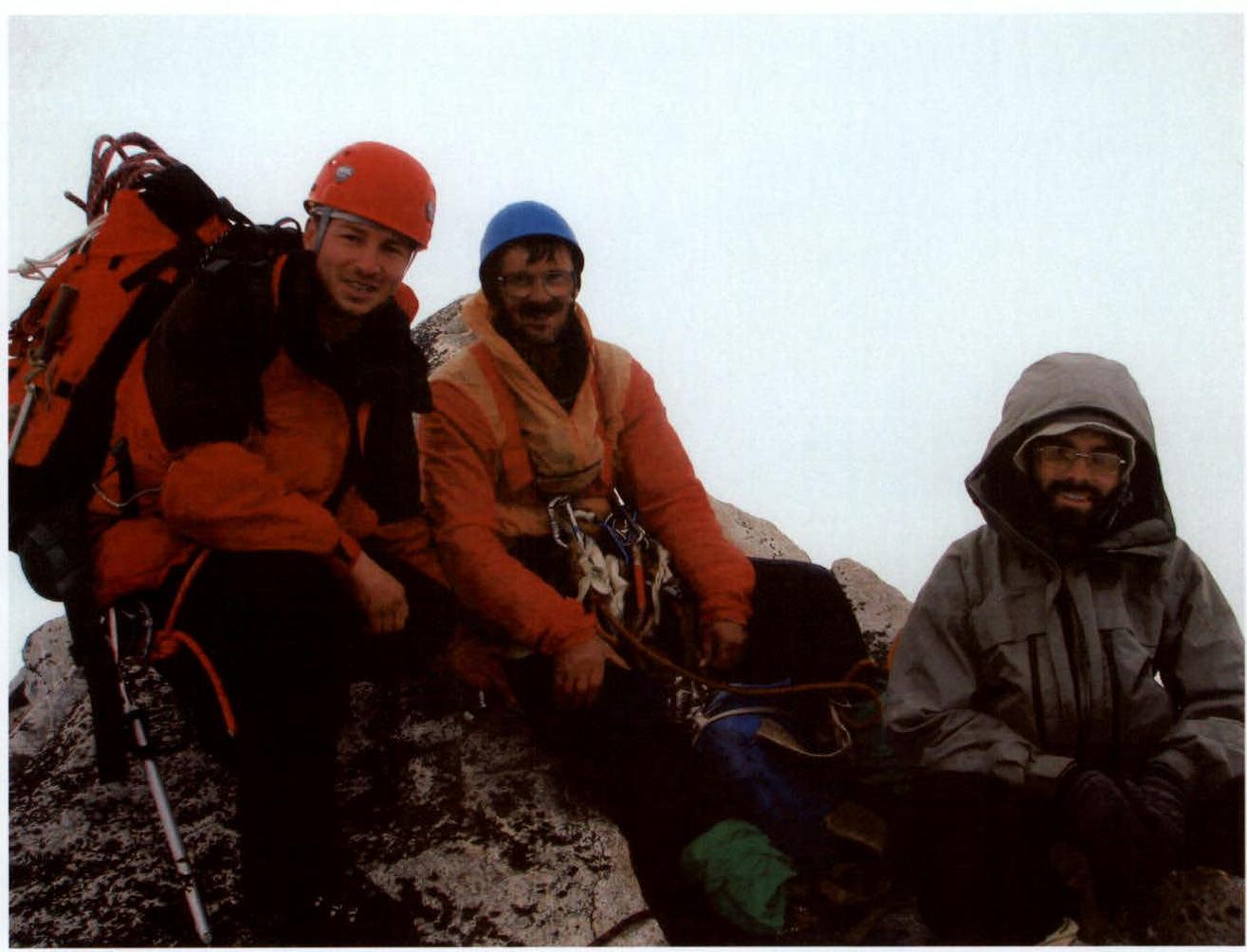 Photo 10
In the photo, from left to right: Gurzhov S.V., Pavlyuk A.N., Fedorov V.V. (photo taken by Terekhov A.A.). The descent from the summit was made along the Western ridge via a 3A category route.
UIAA Scheme of the Wall Section
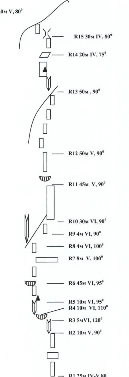 R16 – 40 m, V, 80°
R15 – 30 m, IV, 80°
R14 – 20 m, IV, 75°
R13 – 50 m, 90°, V
R12 – 50 m, V, 90°
R11 – 45 m, V, 90°
R10 – 30 m, VI, 90°
R9 – 4 m, VI, 90°
R8 – 4 m, VI, 100°
R7 – 8 m, V, 100°
R6 – 45 m, VI, 95°
R5 – 10 m, VI, 95°
R4 – 10 m, VI, 110°
R3 – 5 m, VI, 120°
R2 – 10 m, V, 90°
R1 – 25 m, IV–V, 80°
R16 – 40 m, V, 80°
R15 – 30 m, IV, 80°
R14 – 20 m, IV, 75°
R13 – 50 m, 90°, V
R12 – 50 m, V, 90°
R11 – 45 m, V, 90°
R10 – 30 m, VI, 90°
R9 – 4 m, VI, 90°
R8 – 4 m, VI, 100°
R7 – 8 m, V, 100°
R6 – 45 m, VI, 95°
R5 – 10 m, VI, 95°
R4 – 10 m, VI, 110°
R3 – 5 m, VI, 120°
R2 – 10 m, V, 90°
R1 – 25 m, IV–V, 80°