Chegem via ridge, combined, Tal, 1912, 2B
The route was completed during the training camp of the KAiS MEI in 2020. From the ruins of the "Bashil" tourist base, cross the bridge to the left (orographically) bank of the Bashil River. Move along the trail for 1.5–2 hours upstream along the river until you reach the turn into the gorge of the Maly Chegem River. Fig. 1. The landmark is a standalone birch tree. Higher up and to the left along the slope is a waterfall.
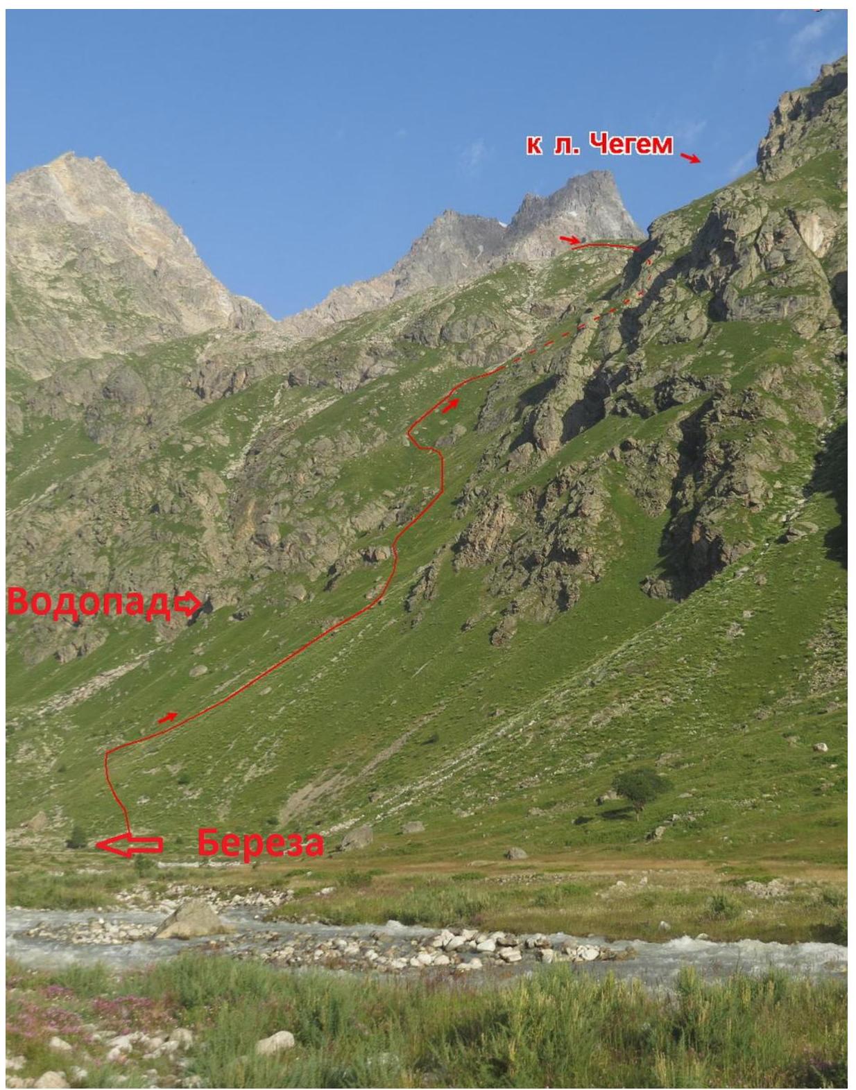
Climb the steep grassy slope and местами large-block talus for 2 hours until you reach a flattening on a large field with a stream. There is no trail, but there are tourist markers. Overnight stays are possible on the grassy field.
Then, reach the left-bank moraine of the Chegem glacier and move along its ridge for another 1.5–2 hours. Fig. 2. The moraine ridge leads to large-block talus. Approximately at the level of the glacier tongue are the overnight stays. This is the initial bivouac.
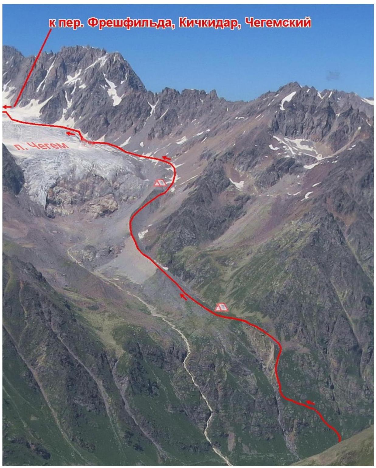
From the overnight stays, move up the large-block talus for 30 minutes until you reach the open glacier. On the gentle part, reach the glacier step. It can be overcome from the right side. The upper plateau of the Chegem glacier is the beginning of the route. From the bivouac, it takes 1–2 hours.
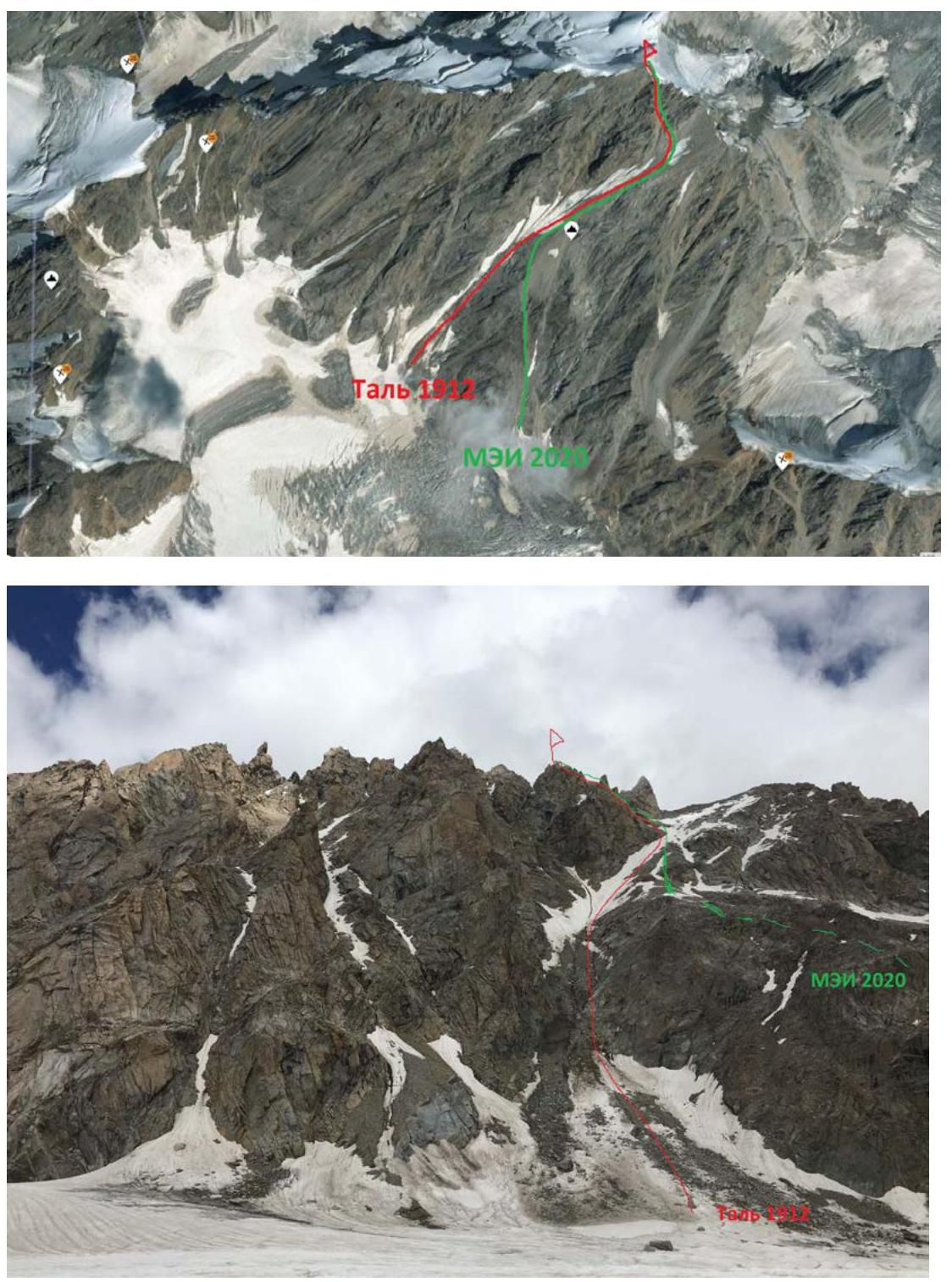
The original 1912 route went along the ice-snow slope from the glacier to the East Ridge of Chegem. Fig. 3 and 4. Nowadays, the snow has melted, and this part is a giant ledge that crosses the slope of Chegem diagonally from left to right.
The lower part is prone to rockfall, so it's better to reach Tal's ledge through a wide talus couloir. The landmark is giant rocks lying horizontally in a row in the middle of the couloir. Fig. 5.

Start moving along the avalanche cone, then along the talus. In the upper part, the couloir splits into two - turn left and exit onto Tal's ledge. Difficulty category is 1B.
Continue moving along the ledge upwards in the direction of the East Ridge of Chegem. местами talus, местами snowfields. 100 meters before the ridge, before a large gendarme "Zub," turn left into a talus couloir. Difficulty category is 2B. Fig. 6. From the start of the route, it takes 3–4 hours.

Along the couloir, reach the snowy saddle of the East Ridge before the summit tower.
The summit tower is the key part of the route. 50 meters of III–IV category difficulty rock climbing. Fig. 7.
From the start of the route to the summit, it takes 7–8 hours. Descent via the ascent route takes 4–6 hours.
