8-2.4.1.1385 Moscow Region Climbing Championship 2008 (Technical Class)
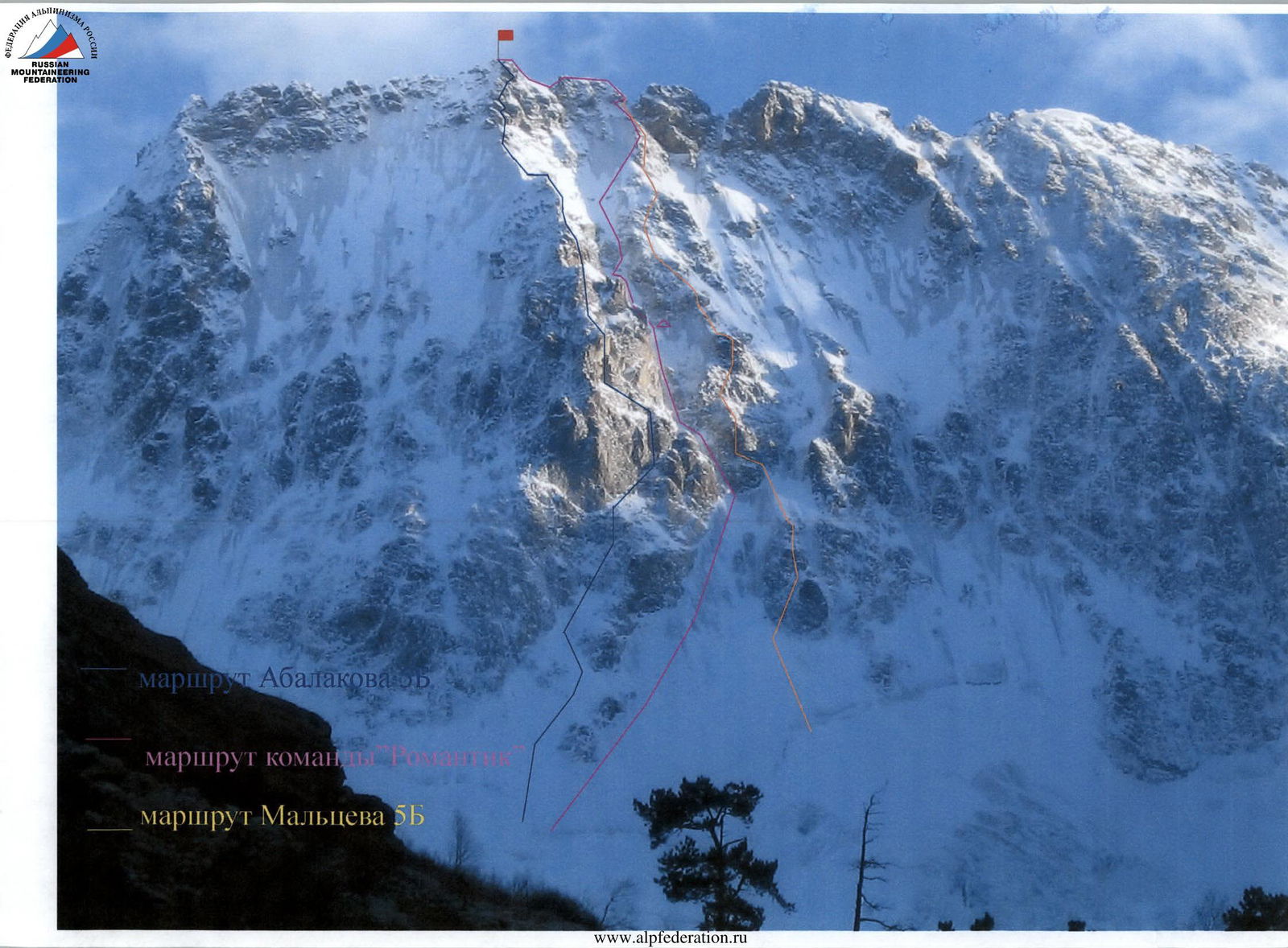
REPORT on the ascent of the Ullutau peak by the team from Shchelkovo via the north wall couloir, category 5B (first ascent)
- Region — Central Caucasus, Adyrsu gorge; KMGV code 2.4.1.
- Peak Ullutau-chana (Main) — 4207 m via the North Wall couloir
- Proposed category — 5B; first ascent.
- Route type — ice and snow climb.
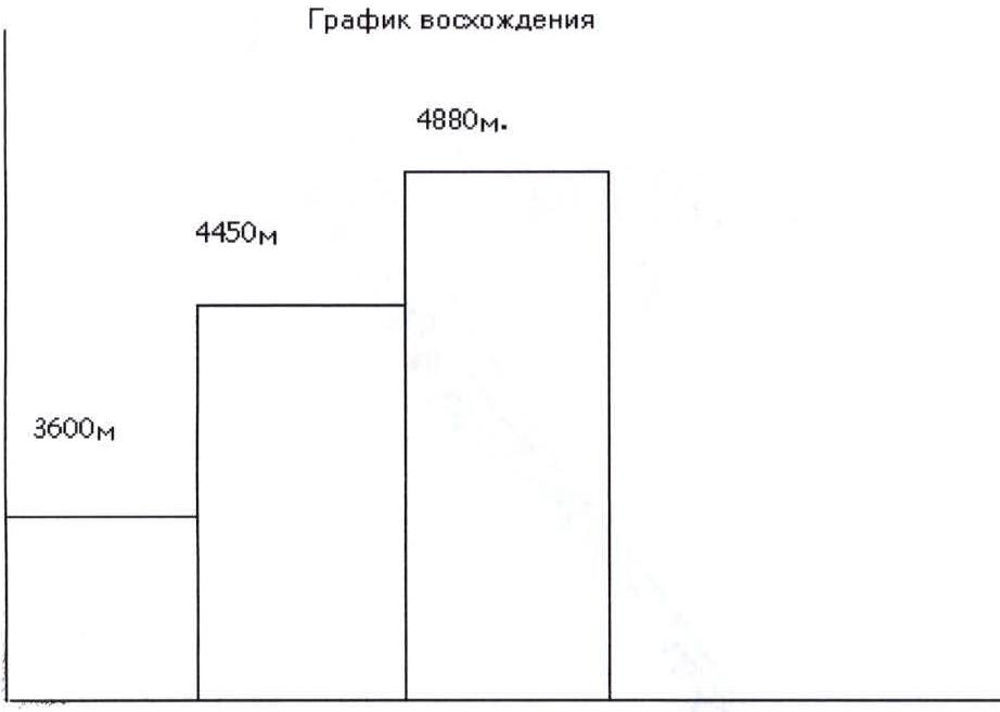
- Height difference — 910 m.
- Route length — 1100 m.
- Length of category 5 section — 210 m; category 6 section — 45 m.
- Average slope — 55°.
- Number of pitons: rock — 10; ice — 120.
- Climbing time — 27 hours; duration — 2 days.
- Team members: Pivikov D.E. — Master of Sports (team leader) Obysov E.P. — 1st sports category. Coach: Japaridze Yu.O. — Master of Sports.
- Departure to the route — October 20, 2008. Summit ascent — October 21, 2008. Return to Base Camp — October 22, 2008.
"Romantik" Center, Shchelkovo, Moscow Region, 141100, Proletarsky Prospect, 6
Ascent Schedule
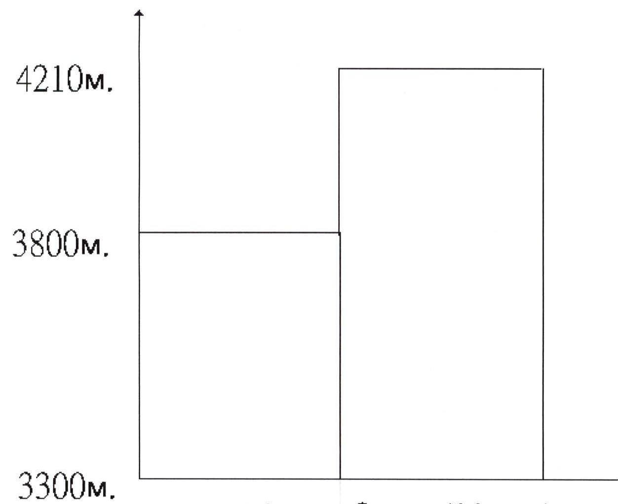
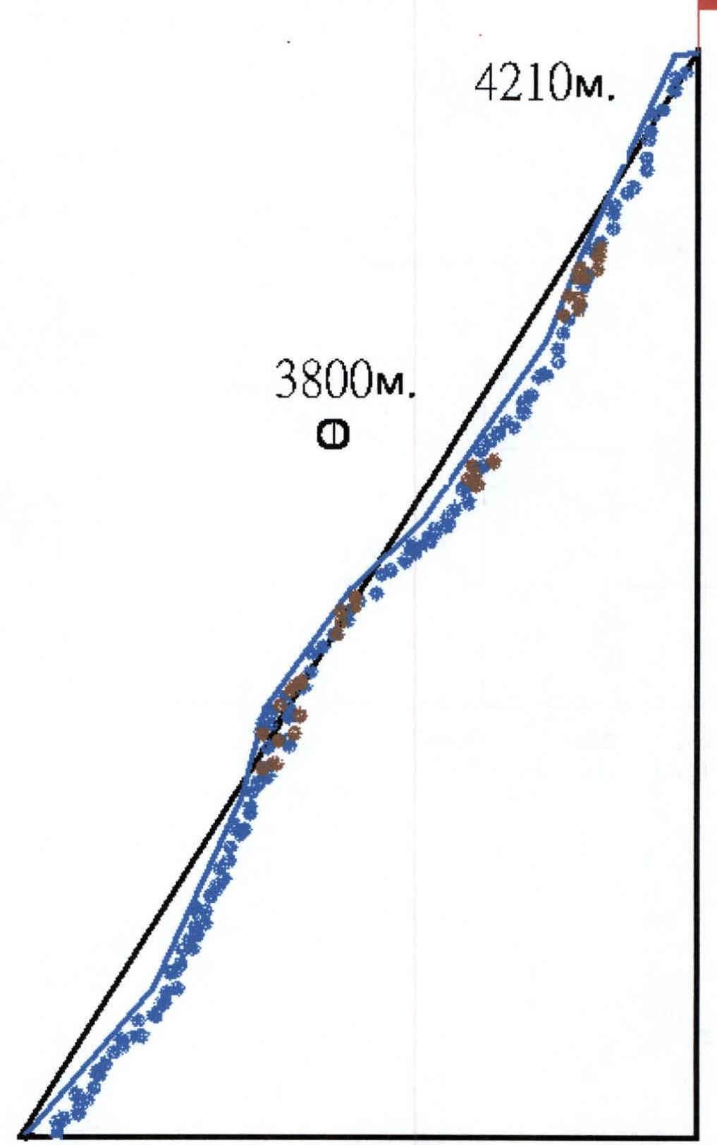
Route Profile
 Day 1 (14 hours) Day 2 (12 hours) Day 3 (6 hours)
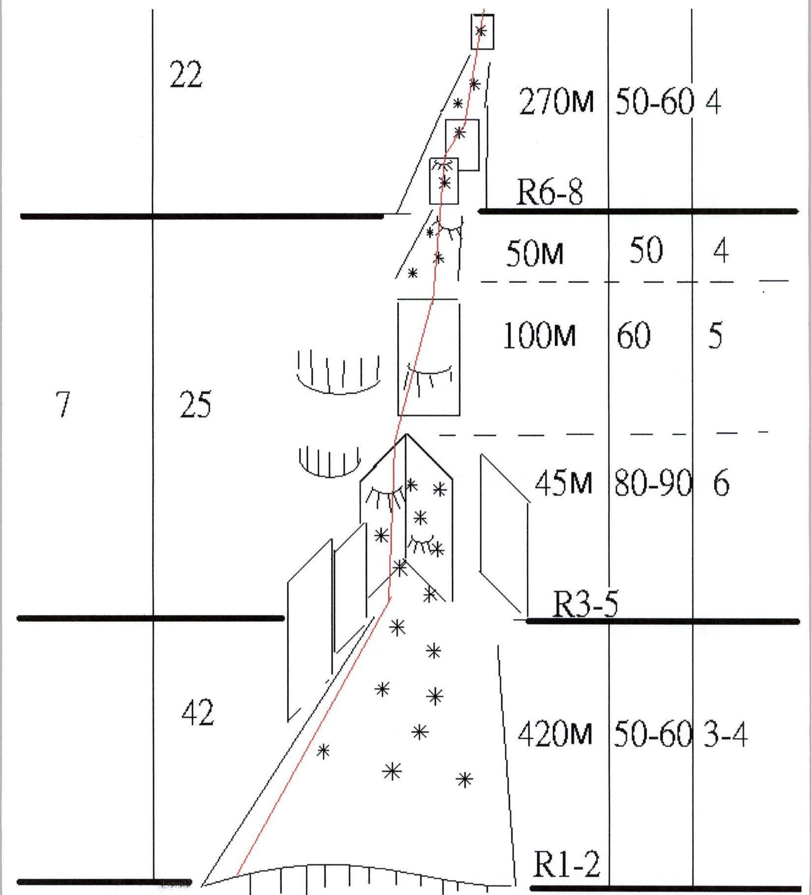 www.alpfederation.ru↗
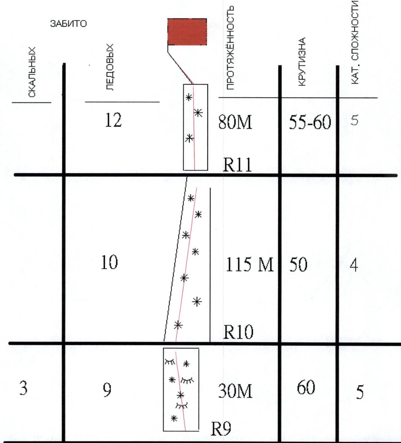 www.alpfederation.ru↗
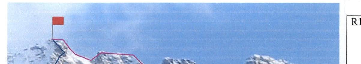
R11 R10 R9 R6–R8 R3–R5 R2 R1
Route Description
The route follows a narrow (50 m at its widest point) ice couloir between the Abalakov and Maltsev routes. The route is logical and straightforward, leading directly to the summit. However, ascending it is not safe during the summer. The route features sections with:
- rock formations resembling "ram's foreheads";
- "tiled" rock structure.
In winter, these sections are frozen with accretion ice. In summer, rockfall is possible. Therefore, this route is recommended for winter ascents. There are no suitable bivouac sites on the route; one possible option is to set up camp on the rocks of the Maltsev route.
The path begins at the left edge of the large bergschrund crossing the north wall of Ullutau. Move upwards and to the right towards the rock "islands" of the Abalakov route, bypassing them on the right. This section is an ice and snow slope with a slope angle of 45–50° and a length of 150 m (R1). Further on, the slope steepens and reaches 55–60° at the base of the couloir that goes up and to the left (R2 — 270 m). The beginning of the couloir is a narrow (~10 m) inner corner formed by rock formations resembling "ram's foreheads," filled with accretion ice, and with a slope angle of 80–90°. Very difficult mixed climbing — 45 m. There are challenges with setting up protection (ice screws only half-way in; cracks are filled with ice).
Next come:
- rocks with a "tiled" structure (accretion ice);
- an ice slope with rock outcrops (R3–R5).
Section R6–R8 is an ice slope with small rock walls, with a slope angle of up to 60°. On section R9 — 30 m of mixed terrain (challenges with setting up protection).
Then follows an ice slope with a gradually increasing slope angle:
- R10 — 115 m, 50°;
- R11 — 80 m, 60°;
leading to the ridge of Ullutau-chana. Then follow the ridge to the main summit of Ullutau. Descent is via the ascent route.
The climbers state that this route exceeds the technical difficulty and intensity of the ascent on Shota Rustaveli peak (Laletin route), which the team leader climbed in 1997.
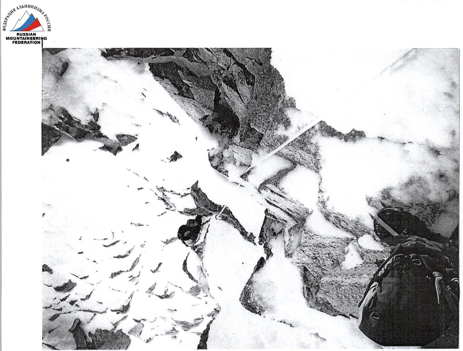
 At the start of the couloir
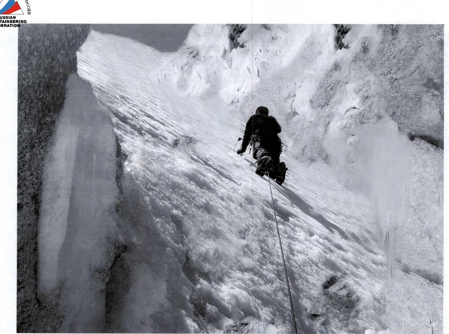
 Section 3–5
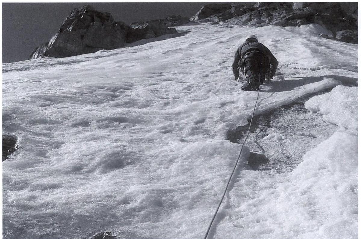
 Section 2–5
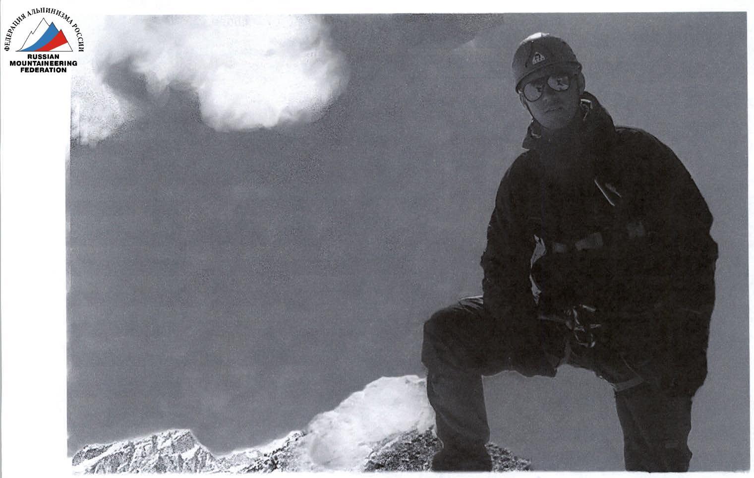
 Section 3
 www.alpfederation.ru↗
 www.alpfederation.ru↗