PASSPORT
-
Ice and snow ascent class
-
Caucasus, Adyr-Su gorge
-
Ulu-Tau East peak, 4058 m via the right edge of the N face (Monucharov route)
-
Complexity category 5B
-
Elevation gain 700 m, length 950 m. Length of sections with 5–6 cat. diff. 50 m. Average slope of the route 50°
-
Pitons used: rock: 23/0, drilled: 0/0, chocks: 45/3, ice screws: 55/0
-
Climbing time — 12 hours, descent — 9 hours
-
No overnight stays
-
Leader: Egunov Vladimir Aleksandrovich CMS
Participants:
- Braverman Vladimir Yakovlevich CMS
- Yarovikov Yury Mikhailovich CMS
- Bakaleinikov Evgeny Dmitrievich CMS
- Kokhanov Valery Petrovich CMS
- Smetanin Nikolai Aleksandrovich CMS
Coach: Laptenok Valery Dmitrievich MS USSR
Departure to the route: July 24, 1985.
Summit: July 24, 1985.
Return: July 24, 1985.
Combined team of the RSFSR sports committee.
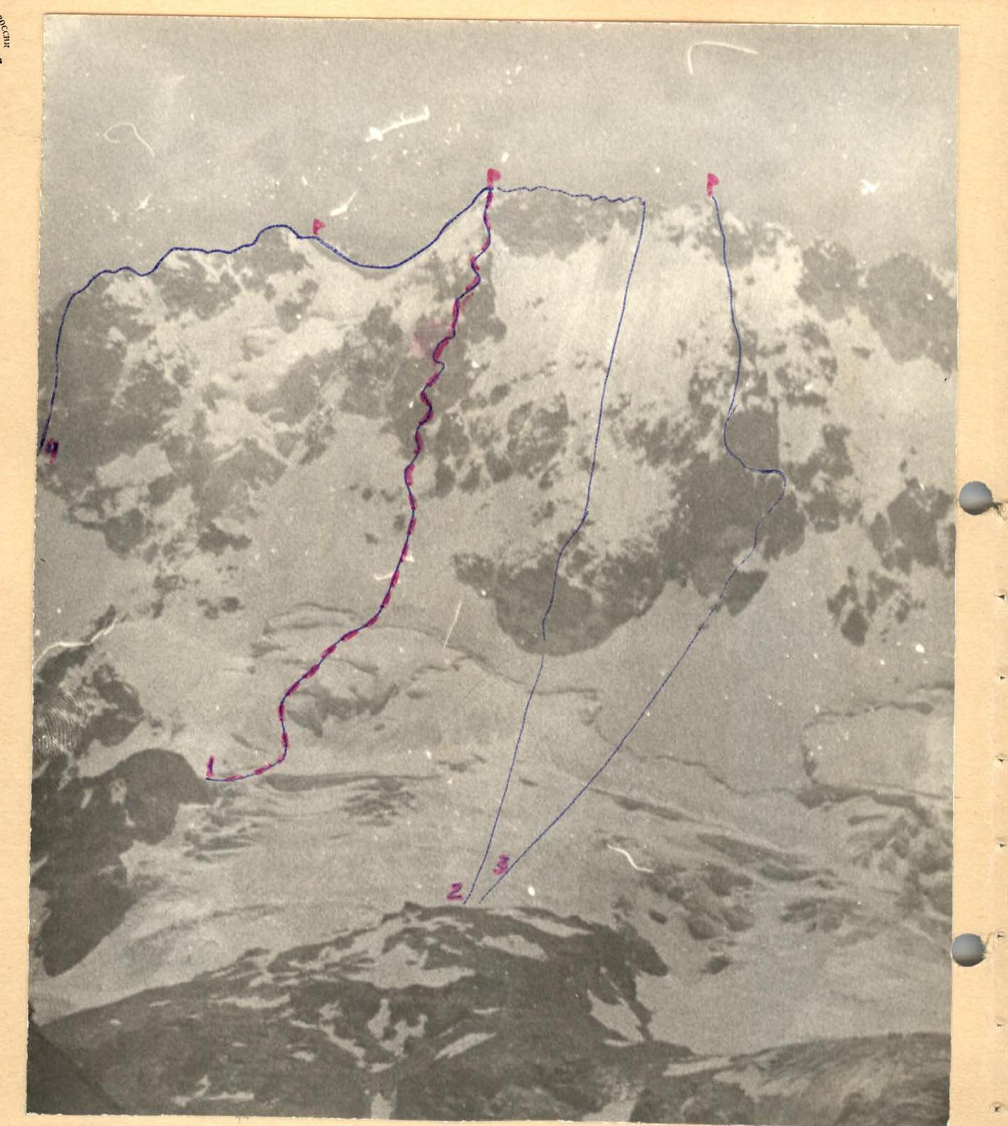
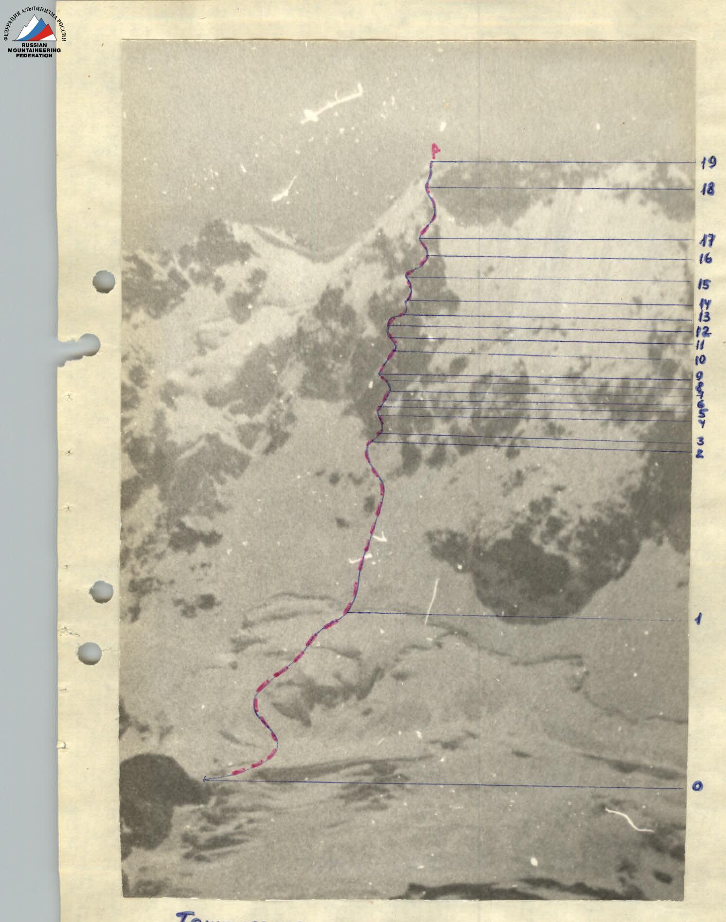
General photo of Ulu-Tau peak
- Ulu-Tau E via the right edge of the N face (Monucharov route)
- Ulu-Tau E via rock islands of the N face, 3rd ridge (Chernoslivina)
- Ulu-Tau Main via the N face (Abalakova route)
- Ulu-Tau E via the N face to the E shoulder (Chernoslivina) Taken on July 10, 1985, distance 5 km, "Industar-66" lens
Tactical actions of the team
According to the weather forecast, the departure to the route was shifted one day ahead, which accelerated the movement through frozen snow and reduced rockfall and avalanche danger.
The ice section of the route was traversed by autonomous rope teams with piton belays. On the rock section of the route, the Kokhanov – Yarovikov rope team worked ahead, alternating leaders as needed. Bakaleinikov and Egunov worked last.
The first climber moved on a double rope, the rest — on a fixed rope with belay. At the points of rope fixing, 3–4 chocks or pitons were used, significantly increasing the reliability of the first climber's belay and the safety of the others.
Changing the lead rope team was not planned due to the short length of the highest category sections (about 40 m of 5th and 6th cat. diff. in total).
In conditions of limited visibility, the team chose the safest and most logical path.
In case of weather deterioration, the team had:
- food supplies,
- bivouac equipment,
- radio power for 60 hours,
- flashlights.
Among the equipment in the team's arsenal were:
- rappelling gear,
- AIS-FI,
- jumar ascenders modified to grip icy ropes,
- a wide range of pitons and chocks.
For safety reasons, the team altered the descent route, making it together with the teams of RSFSR-2 and Kemerovo regional sports committee.
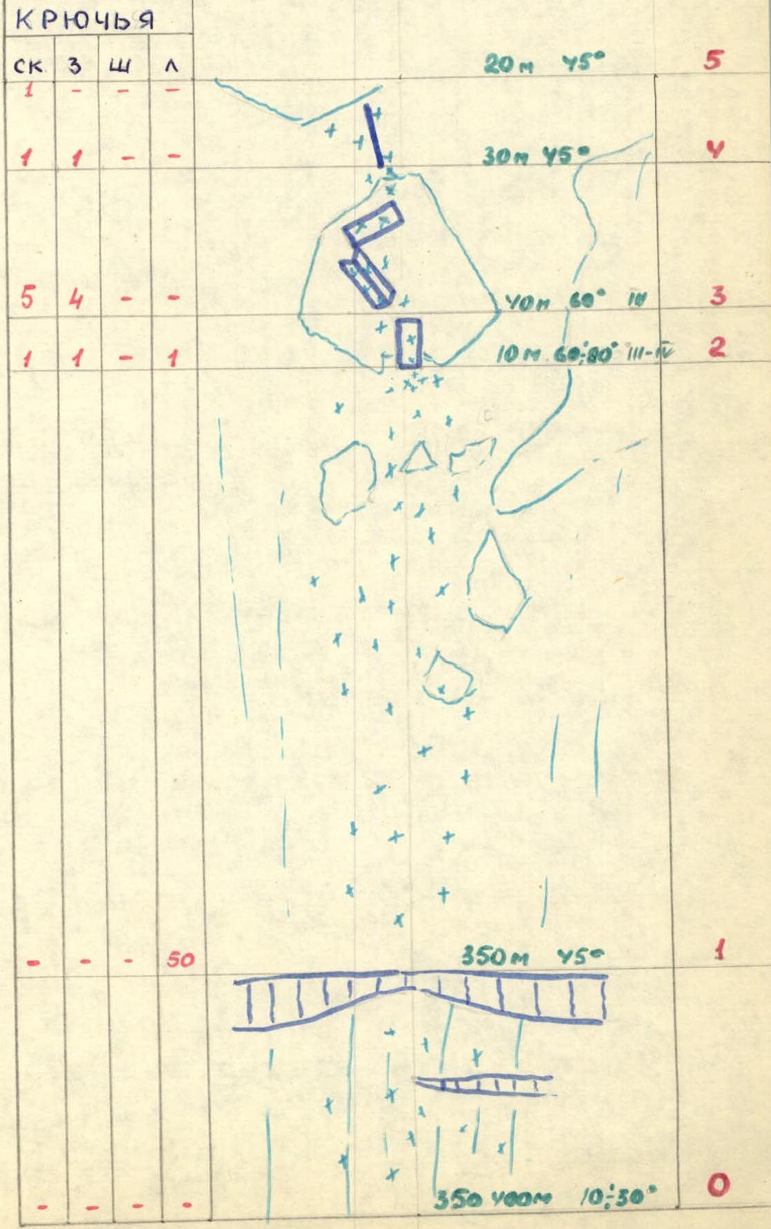
Route diagram in UIAA symbols, scale 1:2000 (Beginning)
Route diagram in UIAA symbols, scale 1:2000 (Continued)
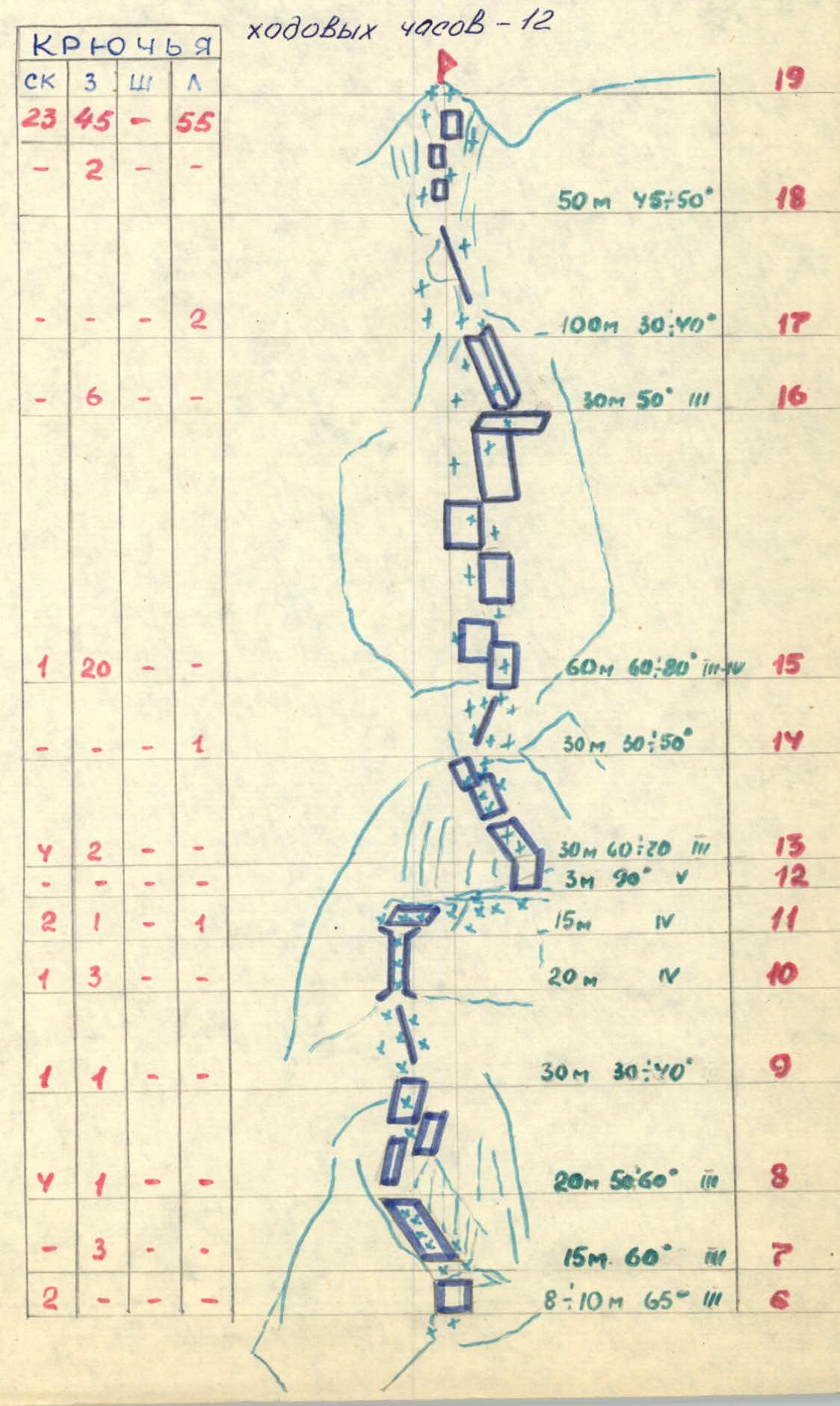
Route description by sections
| Section | Description |
|---|---|
| R0–R2 | Ice slope covered with 10–15 cm thick snow |
| R2–R3 | Rocks covered with ice and snow |
| R3–R4 | Snow-covered slabs |
| R4–R6 | Snow ridge |
| R6–R7 | Wall |
| R7–R9 | Slabs with snow |
| R9–R10 | Snow ridge |
| R10–R11 | Chimney with ice |
| R11–R12 | Snow-covered ledge |
| R12–R13 | Wall |
| R13–R14 | Ridge with snow |
| R15–R16 | Inclined slab with ice and snow |
| R16–R17 | Internal corner with ice layer |
| R17–R19 | Pre-summit ridge and snow-covered rocks |