Traverse Tyutyu Western–Eastern, combined, 3A
Route description:
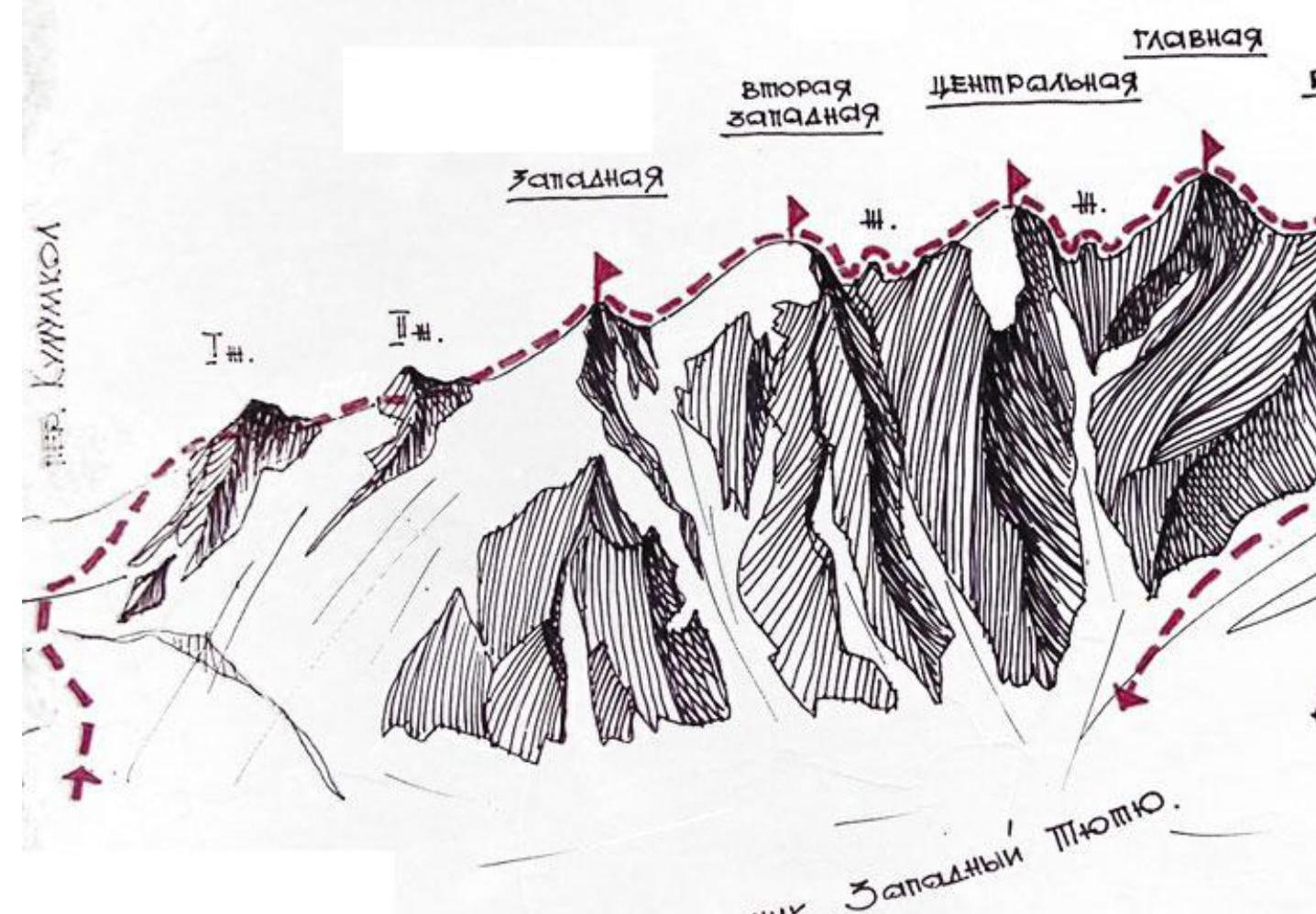
From the "Dzhaulyak" alpine camp, follow the right (orthographically) bank of the Kullumkol River along the trail to a stream, then turn right into the gorge. Cross the stream and move up the trail, which runs along the moraine ridge towards the rock screes. Below the screes, turn right and cross the large talus to the trail leading to the edge of the terminal moraine.
Tyutyu overnight campsite. 2.5 hours from the camp.
From the campsite, move along the left (in the direction of travel) edge of the glacier along the moraine ridges to reach the plateau below v. Tyutyu 1st Western. The plateau has crevasses. Turn left on the plateau and, bypassing the ice ascent to the left, reach the glacier terrace, from which:
- a straightforward ascent to the Kullumkol Pass.
If the snow is in good condition, from this terrace you can:
- turn right onto the steep snow-ice slope and immediately ascend to the ridge below the second "gendarm".
From the pass:
- climb to the first gendarm along the broken ridge to the right,
- and approach it from the left.
Continue along the wide snow ridge to the second gendarm, which is bypassed on the right via ledges (belay, simultaneous movement). Continue along the ridge to reach the summit of Tyutyu 1st Western, approaching it from the left or directly. Then, ascend along the long, wide talus ridge to the second Western summit of Tyutyu. From the second summit, descend along the snowy ridge, which ends in an 8-meter wall. Rappelling. Ascend to the Central summit along snowy rocks (belay using rock projections).
Descend from the Central summit along moderately difficult rocks to a col, moving to the right of the ridge. Climb monolithic block-type rocks to reach the Main summit. Descend to the col between the Main and Eastern summits along the ridge, staying on the right side due to possible cornices on the left. Reach the Eastern summit along the sharp ridge. Descend from the Eastern summit along the ridge for three rope lengths to the second depression on the ridge. Then, descend from this ridge to the left onto another ridge leading to a col (belay using rock projections). The descent involves broken rocks (two rope lengths, sport climbing).
The route continues as follows:
- From the col, the path goes right onto the Western Tyutyu glacier
- Then down to the end of the glacier
- And back to the camp
7-8 hours from campsite to campsite.
Tyutyu