St. Petersburg Climbing Championship 2021 (altitude-technical class)
Report on the ascent to Tyutyu West peak (4233 m), via the S wall, I. Khatskevich, 1973, cat. 5A
The route was climbed by the team of the Federation of Alpinism of St. Petersburg
St. Petersburg 2021
Ascent Passport
-
Western Caucasus, from the Gumači peak to the Kitlod pass. Section No. 2.4.1 of the classifier of routes to mountain peaks.
-
Tyutyu West peak (4233 m), via the S wall, I. Khatskevich, 1973.
-
Route character – combined.
-
Route elevation gain ~750 m.
Route length ~900 m. Section lengths: ~V cat. diff. 155 m, ~VI cat. diff. 25 m. Average steepness of the entire route ~70°.
-
Pitons left on the route: total – 0, including expansion bolts – 0. Total points used on the route: 41 (anchor pitons – 9, chocks (camalots) – 32, expansion bolts – 0). Of these, 4 for IT (Intermediate Tied belay). Old pitons removed – 3.
-
Team's climbing hours to the ridge – 9.5, and another 1.5 to the summit. Total: 11 hours (1 day).
-
Coach – Gagarinov A.Yu., 1st sports category. Leader: Maksimova Lomara Aslanovna, 1st sports category. Participant: Gagarinov Aleksey Yuryevich, 1st sports category.
-
Approach to bivouac – August 9, 2021, at 13:00.
Departure from bivouac – August 10, 2021, at 3:00. Under the route – August 10, 2021, at 4:00. Start of work on the route – August 10, 2021, at 5:15. Summit arrival – August 10, 2021, at 16:15. Return to bivouac – August 10, 2021, at 19:30. E-mail of the person responsible for the report: ymahaster@gmail.com. General photo of the summit

Route Scheme
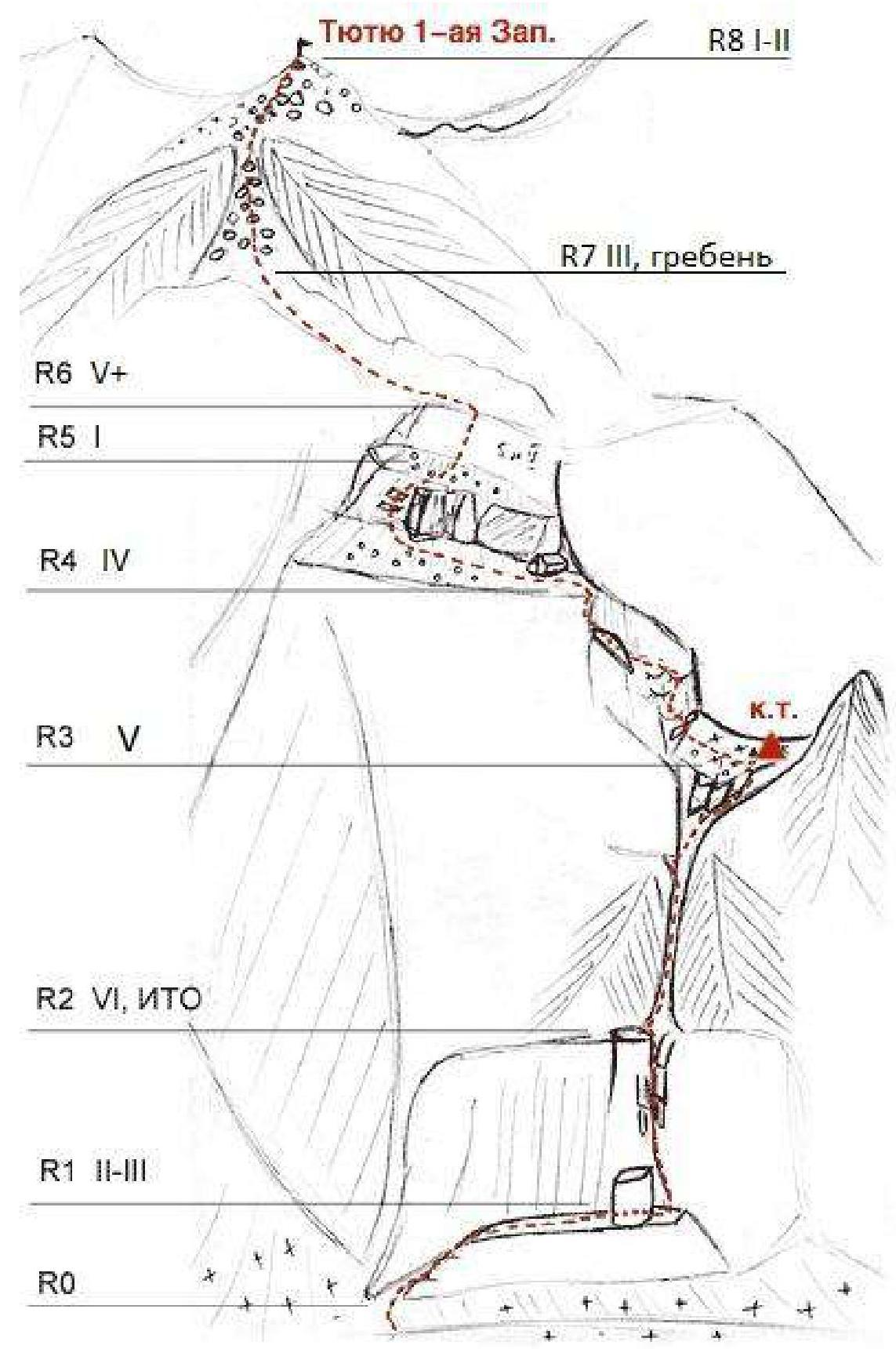
Route Description by Sections
| Section No. | Difficulty | Climbing (fr) | Length, m | Steepness, deg | No. of points | Terrain |
|---|---|---|---|---|---|---|
| R0–R1 | III II+ | – | 45 40 | 50 20 | 1 3 | couloir shelf |
| R1–R2 | V VI V+ | 6Б | 10 20 15 | 90 100 85 | 13 (3 IT) | crack |
| R2–R3 | V | 5А | 40 35 | 70 | 4 3 | couloir |
| R3–R4 | III III+ IV | 4 | 30 20 25 | 50 30 65 | 4 | wall traverse gully |
| R4–R5 | I | – | 80 | 0–15 | 0 | shelf |
| R5–R6 | VI V+ | 6Б/Б+ 5Б+ | 5 55 | 88 70–75 | 12 (1 IT) | wall |
| R6–R7 | III | – | 110 | 10–20 | 1 | ridge |
| R7–R8 | II I | – | 50 300 | 45 30 | 0 | scree couloir loose terrain |
Route Description
From the bivouac on the Shogentsukov shoulder, move to the Zap. Tyutyu glacier. Move up the glacier to a narrow couloir that goes left into the wall of Tyutyu West.
The start of the route is at the base of this couloir.
R0–R1. Move up (loose rocks at the very beginning), along the right wall of the couloir. After 40 m, reach a series of shelves. Then traverse right-up along the shelf to its end (30 m), to a gap. Then, beyond the gap, to a small platform.
R1–R2. Crux section. Up the crack. 10 m V climbing, then a small overhang 20 m VI (6Б), and 10 m V+. Station on a shelf.
R2–R3. From the shelf, a couloir goes right-up. Climb up the left wall of the couloir 40 m on broken rocks V cat. diff. Loose rocks! Be careful! To the left will be a convenient place for a station. Then climb 30 m V cat. diff. up the couloir, transitioning to its right wall and exit to a large platform. Before exiting to the platform, a small (about two meters) inner corner with an overhang. It can be bypassed on the right. On the platform is a control tour. Bivouac possible.
R3–R4. From the platform, climb up 30 m on rocks of medium difficulty, bypassing the overhanging wall on the right, and above it 20 m left above the couloir. Then 15 m up on rocks of above medium difficulty of a wide gully under the gray wall. Loose rocks! Under the wall, traverse 10 m left to a small platform. From the platform, climb up-left to a large shelf. On the shelf under the wall is a bivouac site. See the graphic diagram in Fig. 7.
R4–R5. Move along the shelf left and, turning the corner, climb up on simple, single rocks to the next shelf. On the shelf is fine scree. 80 m.
R5–R6. In the right part of the shelf, climb up very difficult climbing 5 m VI cat. diff. (6Б/6Б+). Then up on difficult rocks V cat. diff. 55 m, to the exit onto the ridge.
R6–R7. Along the ridge III cat. diff. move 110 m to a scree couloir.
R7–R8. 50 m up the scree couloir straight up. Then, on medium-sized scree, move to the Tyutyu West summit 300 m.
Descent from the summit towards the Kullumkol pass (via route 1Б to Tyutyu West).
Team's Tactical Actions
August 9, 2021.
At 13:00, after a heavy rain, we left the Ully-Tau alpine camp for the bivouac "Shogentsukov shoulder". At 17:00 we were at the bivouac.
August 10, 2021.
At 2:00 we woke up and at 3:00 left the bivouac. By 4:00 we were at the start of the route. Dark. We decided to wait for dawn. Until 5:00 we partially slept.
At 5:15 we started working on the route with one rope. The second participant moved with top rope. On section R0–R1, we used two ropes (40 m up the couloir, station on a ledge and 30 m traverse, station on anchors and chocks on a shelf).
At 6:30 we started working on the crux rope. We pulled out the second rope, put crampons on the leader. The first meters of the rope were passed quickly, then the crack began to narrow and overhang. The leader rested periodically on the points. A little further, it was possible to climb in opposition, but it was too early to relax. We used loops for IT. Total 45 m to the station. The second participant jumared up. At 8:47 we gathered at R2.
The next 2 ropes followed the same scheme: the first climbed, the second jumared.
The rope from R2 was subjectively the most unpleasant – loose rocks the size of the leader, few reliable places for belay. We organized a station after 40 m, then another 30 m to R3. Loose rocks were present, but in smaller quantities.
At R3 – control tour – at 10:40. Open platform, strong wind. After the control tour, the path to the large shelf was not the most obvious. Recommendation: follow strictly the description of section R3–R4, focusing on the graphic diagram (Fig. 7.1 and 7.2). Our group did not traverse enough under the gully, which is why we got stuck in difficult climbing, turning into a path of old anchors. We decided to pendulum back to the route (into the gully).
With the correct movement on section R3–R4, after traversing, you need to exit to a large convenient platform under the station to the left of the descending couloir (!). Presumably, from there up-left is a non-obvious exit to the gully.
At 12:50 on the large shelf (R4). Then simultaneously to the second shelf with fine scree (R5).
From R5 straight up, on very difficult rocks in the lower part (one IT point). After 60 m, we exit onto the ridge. (It seemed that to the left along the shelf there is a simpler option to exit onto the ridge: in the descriptions of other teams, climbing on this section is marked V–IV cat. diff. We managed to find climbing comparable to the crux, if not more difficult).
At R6 we put the second rope into the backpack. Time 14:40. We traversed the ridge simultaneously. The ridge abounded in gaps and resembled a rock knife.
Then we entered the scree couloir (R7–R8), continued to move with a rope (but better without).
After exiting to the pre-summit slope, we removed the rope and slowly walked with trekking poles on medium-sized scree. Summit at 16:15. We rested, snacked, and started descending. We returned to the bivouac at 19:30.
Summing up the impressions, the route is pleasant, logical, and climbing-intensive. According to the tactical plan, Maksimova led throughout the route. The rock climbing part is quite interesting, the ridge and further movement to the summit are quite dull. We took a full IT kit, but there was no need to use it. A confident group with good climbing skills in favorable weather can do without fixed ropes if they maximally lighten the second.
We recommend processing (if desired) up to and including the crux section, it will take two ropes: from station R1, you can take a shortcut to the ground. In August 2021, there was no water on the route (our group carried 1.5 liters with them to R4, then poured it out).
The lower part of the route to the control tour is in the shade. The group noted light rain/small snow grains, which did not cause significant hindrance. On section R3–R4, in good weather, there is a chance to warm up in the sun. In cloudy weather, the chance is only partial.
Comparing with previously climbed routes, we assess the Khatskevich route as more difficult than 5A Rybakov on Dolomit Severny, and easier than 5A Kiselev on Dalar.
Photo Illustrations
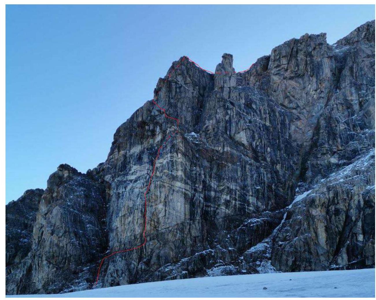
Fig. 1. View of the route from the Shogentsukov side.
Fig. 2. The leader sleeps under the route waiting for dawn.
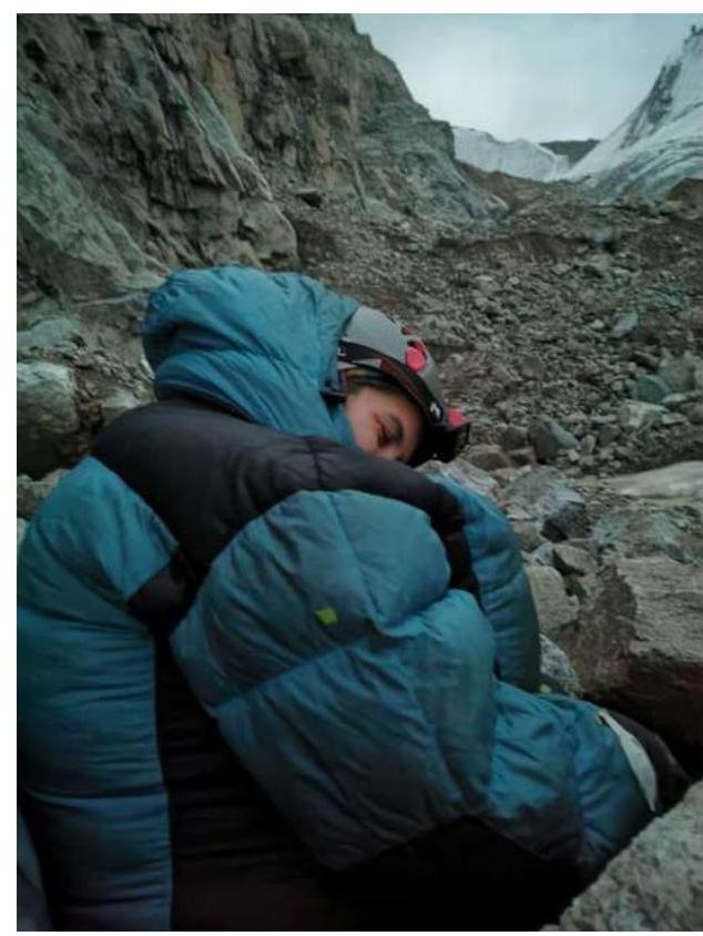
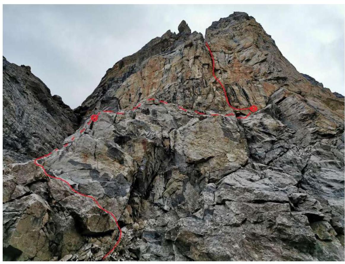
Fig. 3. Start of the route.
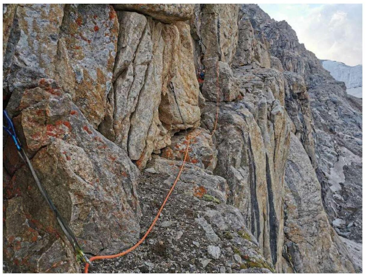
Fig. 4. Traverse on section R0–R1.
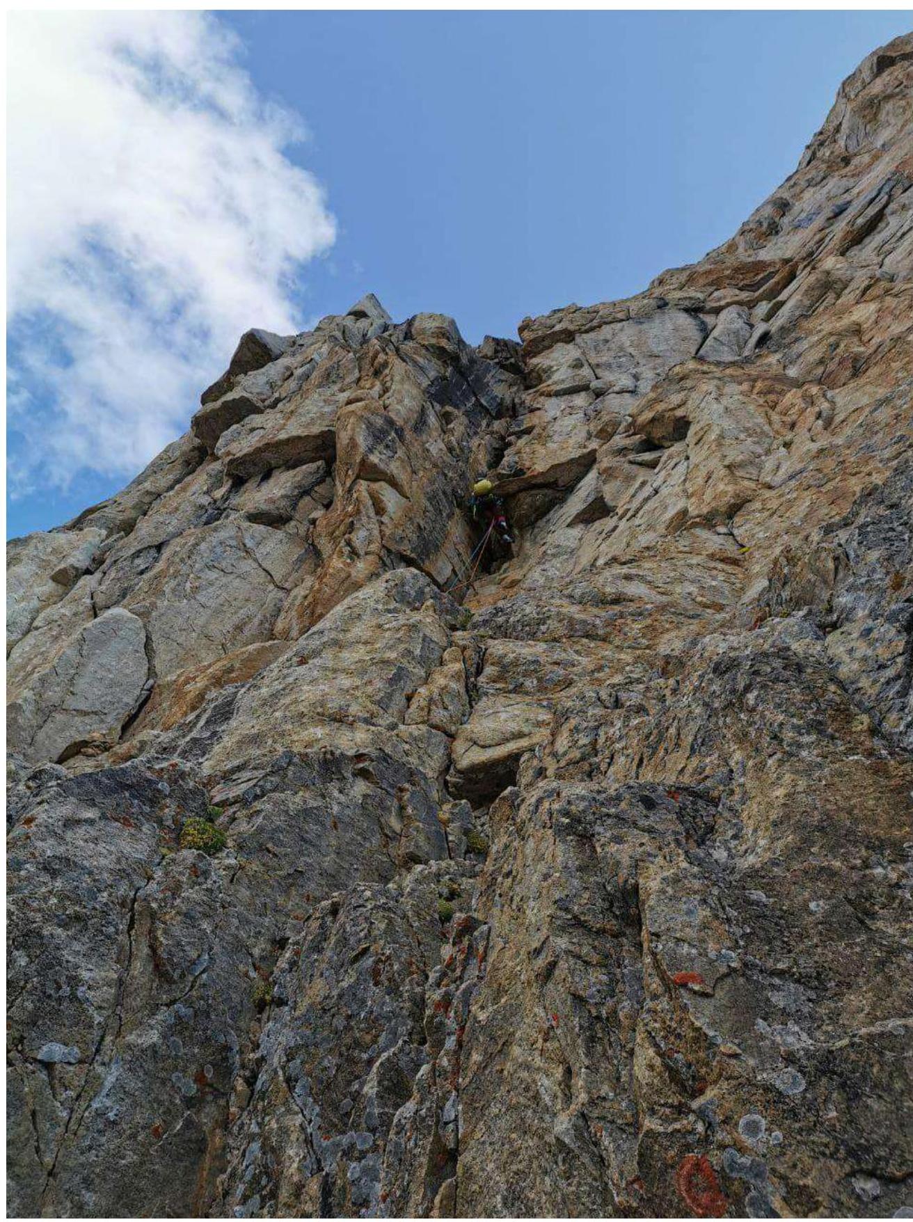
Fig. 5. Crux of the route – overhanging crack on section R1–R2.
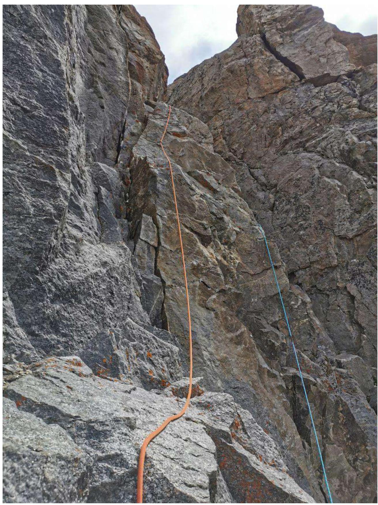
Fig. 6. Second rope from R2, exit to the control tour.
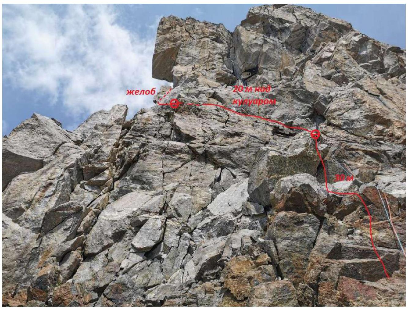
Fig. 7.1. View of section R3–R4 from the platform at the control tour.
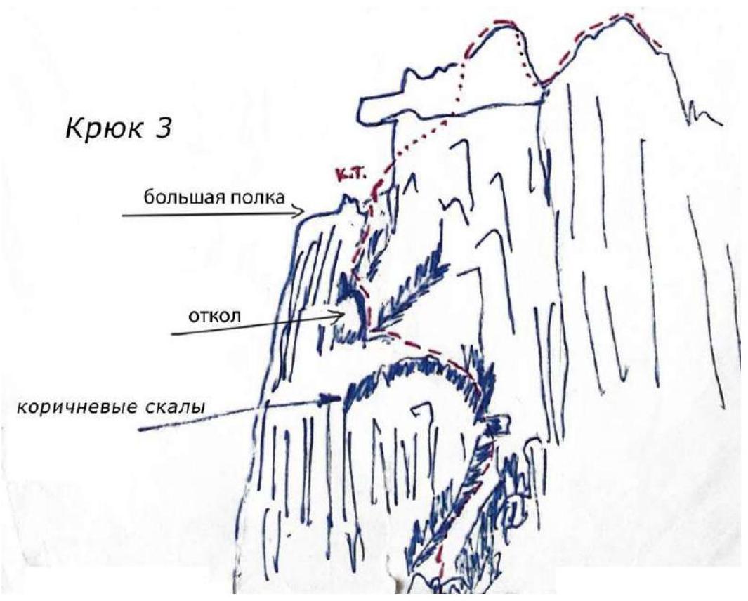
Fig. 7.2. Diagram of section R3–R4.
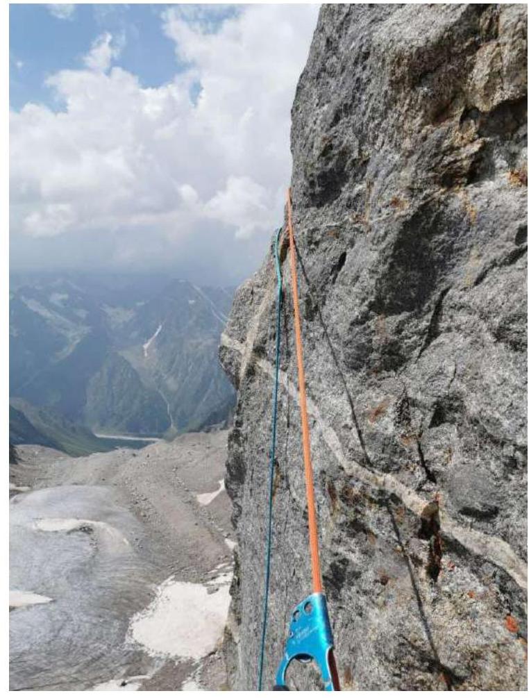
Fig. 8. Section R3–R4. The second participant pendulum into the gray gully (around the corner).
Fig. 9. View of the start of section R5–R6. "Additional" crux of our team.
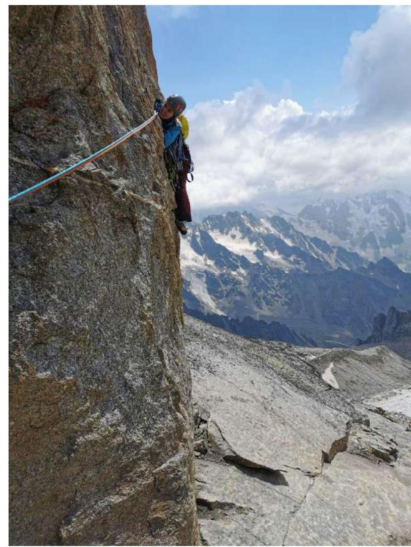
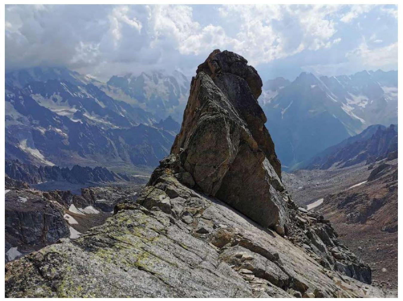
Fig. 10. Start of the ridge. In the photo is the pinnacle from which the team climbed.
Fig. 11. View of the rock knife of the ridge and the scree couloir in the distance.

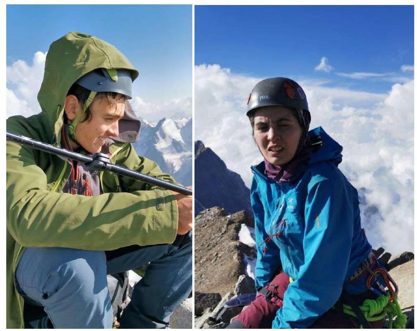
Fig. 12. Participants on the summit.