North-West Federal District Championship in Alpinism (high-altitude technical class)
Climbing Report
on the ascent of Dzhailik peak (4424 m) via 1st S buttress of 3 rib (M. Franzuzov's route, 1970, 5B grade)
The route was completed on August 5, 2024.
Participants:
- Yakuba
- Nikolai
- Chetverikov
- Denis
Contents
1 Climbing Passport — 3 2 Characteristics of the Climbing Object — 4 3 Route Diagram in UIAA Symbols — 10 4 Route Description by Sections — 12 5 Tactical Actions of the Team — 13 6 List of Equipment Used — 14 7 Photographs — 15
1 Climbing Passport
| 1. General Information | ||
|---|---|---|
| 1.1 | Full Name, sports rank of the leader | Yakuba Nikolai Vyacheslavovich, CMS |
| 1.2 | Full Name, sports rank of participants | Chetverikov Denis Petrovich, 1st sports rank |
| 1.3 | Full Name of the coach | Semiletkin Sergey Alekseevich |
| 1.4 | Organization | Alpcclub SPSU "Bars", UTS FA SPS |
| 2. Characteristics of the Climbing Object | ||
| 2.1 | Region | Caucasus, Kabardino-Balkaria |
| 2.2 | Valley | from Gumachi peak to Kitlod pass (Adyrsu, Lekzyr, Chegem valleys) |
| 2.3 | Section number according to the 2013 Classification Table | 2.4.1 |
| 2.4 | Name and height of the peak | Dzhailik, 4424 m |
| 3. Characteristics of the Route | ||
| 3.1 | Name of the route | via 1st S buttress of 3 rib (M. Franzuzov's route, 1970) |
| 3.2 | Proposed category of difficulty | 5B |
| 3.3 | Degree of route exploration | - |
| 3.4 | Nature of the route terrain | Rock |
| 3.5 | Height difference of the route | 670 m |
| 3.6 | Route length | 900 m |
| 3.7 | Technical elements of the route | V grade — 180 m, VI grade — 80 m |
| 3.8 | Average slope of the route | 58° |
| 3.9 | Average slope of the main part of the route | 79° |
| 3.10 | Descent from the peak | via 5A grade route along S ridge (“Monakh”) by V. Ruzhevsky |
| 4. Characteristics of the Team's Actions | ||
| 4.1 | Time of movement (team's walking hours, indicated in hours and days) | to the peak 9:50 (1 day), descent 5:16 |
| 4.2 | Overnight stays | no overnight stays on the route |
| 4.3 | Time of route processing | Route completed without processing |
| 4.4 | Exit to the route | August 5 4:48 — start of work on the route, August 5 9:40 — end of wall section, August 5 13:22 — on the ridge, at the pre-summit tower |
| 4.5 | Reach the peak | 05.08 13:50 |
| 4.6 | Return to the base camp | August 5 19:36 — descent to overnight stays on the glacier, August 6 13:30 — return to Ullu-Tau camp |
| 5. Characteristics of Weather Conditions | ||
| 5.1 | Weather | August 5 until 12:00 — clear, after 12:00 — variable cloudiness, strong wind |
| 6. Responsible for the Report | ||
| 6.1 | Full Name, e-mail | Yakuba Nikolai Vyacheslavovich, nick.yakuba@gmail.com |
2 Characteristics of the Climbing Object
Dzhailik (4424 m) is a key peak in the region of Adyrsu, Tutu, Sakashil, and Chegem valleys. It is one of the highest accessible peaks in the Ullu-Tau alpcamp area.
The most famous routes to the peak:
- Along the southeastern slope — 3B grade route (easiest)
- Along the northern slope — 4A grade route (one of the most popular)
- Along the steep monolithic southwestern walls — 5A grade and higher routes.
The presence of high-category routes makes the peak particularly attractive for sporting ascents.
Fig. 1: Map-diagram of the region. The diagram marks overnight stays, as well as approach and descent paths.
Figure 1 shows a map-diagram of the Ullu-Tau region, where corresponding numbers indicate overnight stays:
- 3 — Overnight stays at the Black Rocks
- 4 — Upper-Kichkidarskie overnight stays
- 5 — Sullu-Kolskie overnight stays
- 6 — Sandy overnight stays
- 7 — Lower-Kichkidarskie overnight stays
- 8 — Middle-Kichkidarskie overnight stays
The ascent was carried out as part of the training camp of the Alpcclub SPSU "Bars". After completing route 4B M. Foigel on Tutu 2nd Western on August 3, 2024, the group began their approach from the upper Paradise overnight stays.
The team passed through Lower, Middle, and Upper Kichkidarskie overnight stays, crossed the Western Yunom glacier, and set up a bivouac on a snowy field 15 minutes from the start of the route.
The descent to the alpcamp followed the Western Yunom glacier down to the Lower Kichkidarskie overnight stays, bypassing the steep scree descent from the Upper Kichkidarskie overnight stays.
On Fig. 1:
- The red line marks the approach path to the upper Paradise overnight stays.
- The yellow line marks the approach path to the overnight stays on the glacier.
- The blue line marks the descent path to the camp.
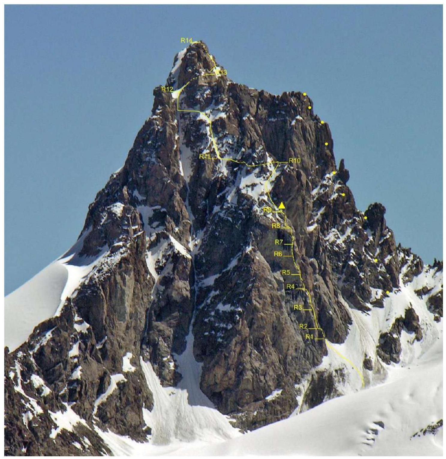
Fig. 2: General technical photo of the peak (copied from the report of MPEI CAiS, 2017)
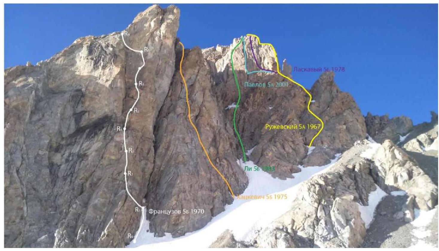
Fig. 3: Photograph of the wall section with marked lines of adjacent routes
The line of Franzuzov's route runs separately along the 1st rocky buttress of the southern wall of Dzhailik. The start of the route is easy to find. Landmark — a huge cork stuck at a height of about 30 m from the start of the wall. In winter, there may be snow at the bottom of the chimney.
The route is saturated with interesting climbing on monolithic terrain. ITO techniques are usually applied only on overhanging key ropes in the upper half of the wall section, where the first ascenders left a large number of bolts for protection.
Except for key sections, insurance on the route is organized easily. The team often used:
- Friends of medium sizes,
- Excentrics,
- Anchor hooks (mainly for organizing stations).
In the upper part of the route, it is possible to get lost. The route leads to the pre-summit tower via a snowy slope at the end of a large couloir, which is also accessed by the line of the 4A route along the northern slope.
After bypassing the gendarme in the upper part of the route, do not go too high. It is enough to traverse left along steep but simple rocks to reach a small couloir. After ascending along it, you need to approach the large snow-ice couloir. In summer, all snowy-ice sections can be bypassed along the rocks.
The large couloir:
- Leads to the upper part of the ice slope
- Then to the ridge at the pre-summit tower.
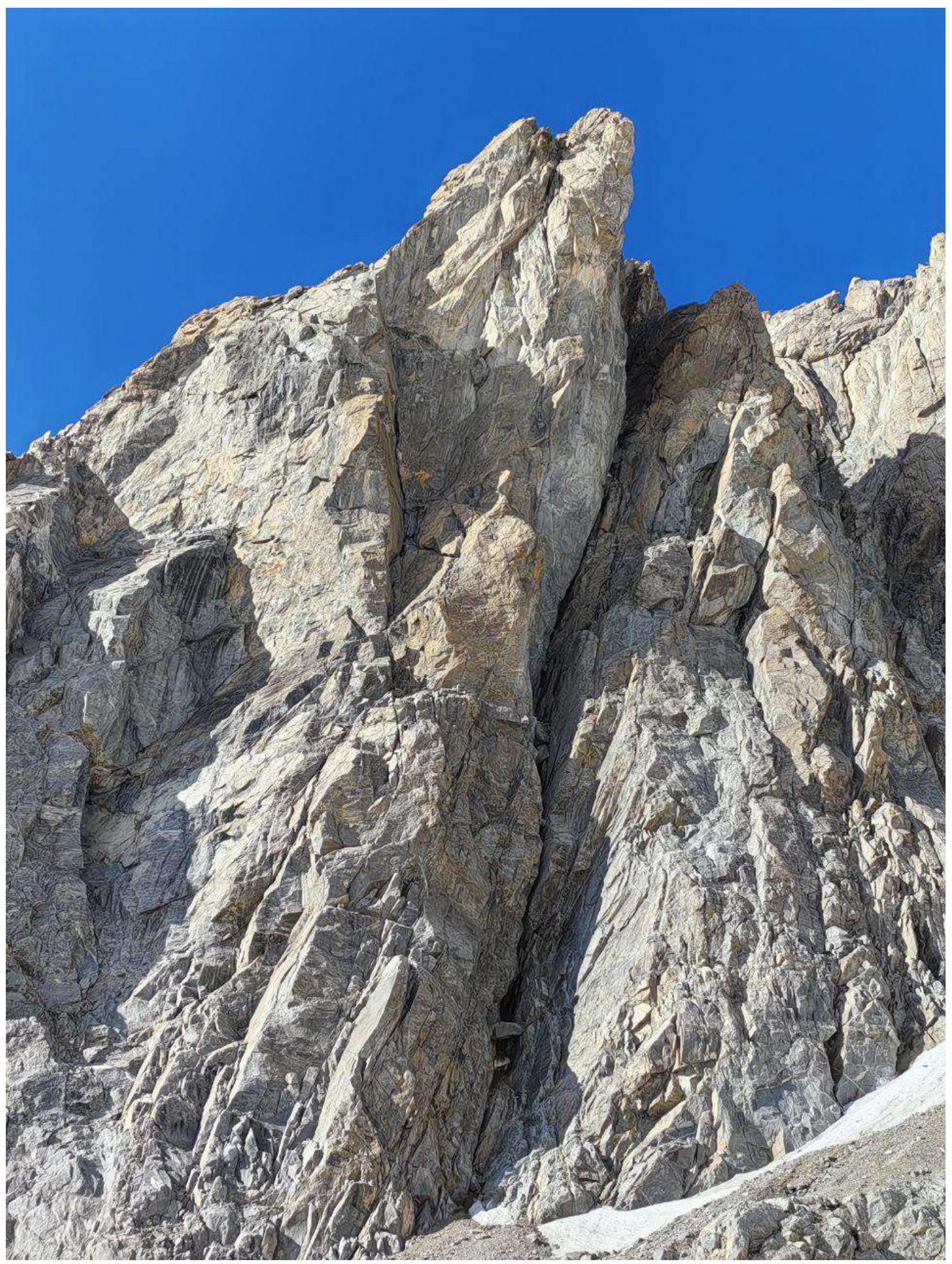
Fig. 4: Photograph of the wall section of the route. August 2024.
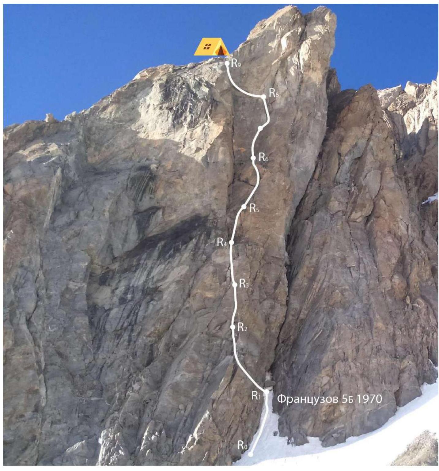
Fig. 5: Technical photograph of the route
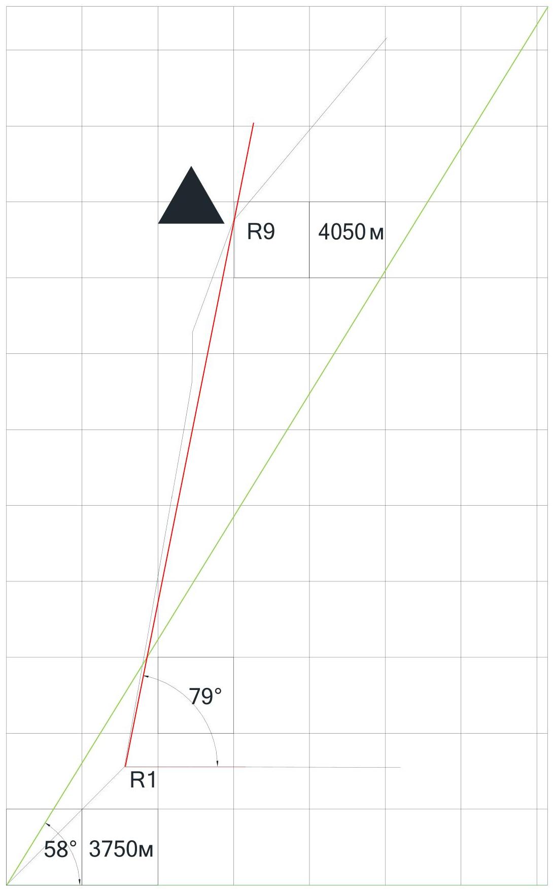
Fig. 6: Drawn profile of the wall section
3 Route Diagram in UIAA Symbols
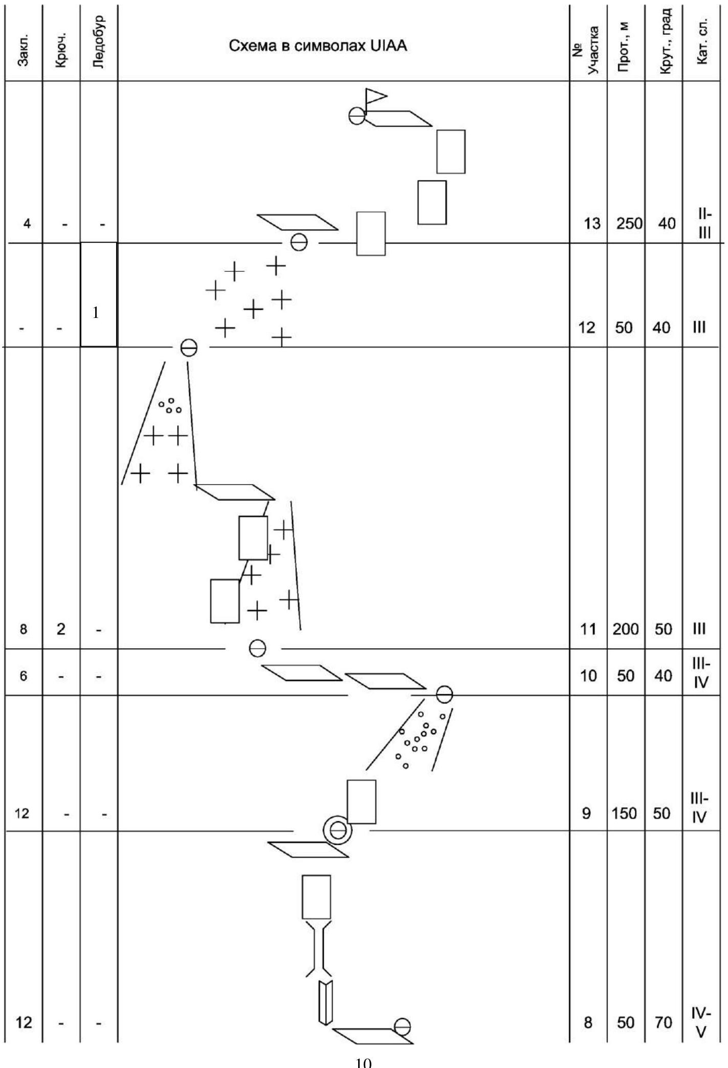
| Climbing | Brief | Bolts | UIAA Symbol Diagram | |||||
|---|---|---|---|---|---|---|---|---|
| Section | Length, m | Slope, deg. | Grade | |||||
| 7 | 3 / 2 | 1 / 5 | 7 | 20 | 90–100 | V–VI | ||
| 6 | 2 | - | 6 | 20 | 80 | V–VI | ||
| 11 | - | - | 5 | 30 | 80 | V–VI | ||
| 8 | - | - | 4 | 25 | 80 | IV | ||
| 10 | 1 | - | 3 | 30 | 80 | V | ||
| 8/3 | 1 | 1 / 1 | 2 | 30 | 70–90 | IV–V | ||
| 10 | 1 | - | 1 | 30 | 80 | V | ||
| - | - | - | 0 | 70 | 45 | II– | ||
| 102/3 | 10/2 | 2/6 |
4 Route Description by Sections
| Section | Description | Photo |
|---|---|---|
| R0–R1 | Snowy-icy couloir with a large stone cork in the upper part. | Fig. 7 |
| R1–R2 | Traverse up — left by climbing on a difficult wall. Exit to a ledge through an overhang. | Fig. 8 |
| R2–R3 | Traverse left under an overhanging gap. Overhang is passed on ITO along the gap. Further, an internal angle leads to a ledge. | Fig. 9 |
| R3–R4 | Along an internal angle and wall, exit to a wide ledge. | |
| R4–R5 | Along a 4 m gap, exit to a steep slab under the wall. Along it, exit to the right side of a large internal angle. | Fig. 10 |
| R5–R6 | 20 m right-up along a crack by climbing. After a small overhang, exit left to a comfortable ledge. | Fig. 11 |
| R6–R7 | 20 m along a steep wall of an internal angle up. | |
| R7–R8 | 15 m along a steep wall under an overhanging 2 m cornice into a gap. Cornice is passed on ITO. There are old bolts. Exit to an inclined ledge. | |
| R8–R9 | Along an inclined ledge 10 m left. Further 10 m along an internal angle to a narrow chimney. 10 m climbing along the chimney, then 10 m along the wall, climbing of medium difficulty. Exit to a wide platform. Place for overnight stay. There is snow, water. | |
| R9–R10 | Along a couloir, exit to slabs, then to a scree couloir right of the gendarme. | |
| R10–R11 | Bypass the gendarme right along ledges and destroyed rocks by traversing. Exit to a ridge at the pre-summit tower. There are loops for rappelling to the ridge. | |
| R11–R12 | From the ridge, traverse 200 m up — left along steep rocks, ribs, alternating with snowy-icy sections on the left side of the S ridge, exit to the upper part of the large couloir. | Fig. 12 |
| R12–R13 | Along a steep snowy-icy ridge, ascend to a platform at the pre-summit tower. | |
| R13–R14 | Up — right 70 m to the exit to a system of rocky ledges with a handrail, bypassing the summit tower left — right in a serpentine manner. Along the ledges, then along inclined slabs — exit to the peak. |
5 Tactical Actions of the Team
| Date, Time | Actions of the Team |
|---|---|
| August 2–3, 2024. Ascent to Tutu 2nd Western | |
| Team consisting of Sushko M., Chetverikov D., Yakuba N. left Ullu-Tau alpcamp and approached the upper Paradise overnight stays, from where on August 3, 1953, they made an ascent to Tutu 2nd Western peak via Foigel's route 4B (“Extempromptu”). After that, Sushko M. descended to the base camp, and the duo Yakuba and Chetverikov stayed on bivouac for rest and further relocation to Dzhailik. | |
| August 4, 2024. Relocation of the camp | |
| 9:50 | Exit from the upper Paradise overnight stays towards Lower-Kichkidarskie overnight stays. Took the cache. |
| 11:10 | Passed Lower-Kichkidarskie overnight stays. |
| 12:03 | Reached Middle-Kichkidarskie overnight stays, made a halt. |
| 14:12 | Ascended to Upper-Kichkidarskie overnight stays. |
| 16:00 | Set up on the Western Yunom glacier under the start of the route. |
| August 5, 2024. Ascent day | |
| 4:00 | Exit from the bivouac under the 1st buttress of S ridge |
| 4:48 | Start of work on section R0–R1 |
| 5:01 | Leader on R1 |
| 6:18 | Leader on R2 |
| 6:28 | Leader on R4 |
| 6:55 | Leader on R5 |
| 8:08 | Leader on R7 |
| 8:48 | Leader on R8 |
| 9:40 | Team completed the wall section at R9. End of wall section. |
| 13:22 | Team reached R13, to the ridge at the pre-summit tower. |
| 13:50 | Reached the peak |
| 14:20 | Start of descent from the ridge via Ruzhevsky’s 5A route |
| 19:36 | Descended to the overnight stay on the glacier. |
| August 6, 2024. Descent to the camp | |
| 9:40 | Start of descent down the Western Yunom glacier along the Dragon's Tail |
| 13:30 | Returned to Ullu-Tau alpcamp |
Throughout the wall section, the team worked according to a simultaneous movement scheme (variant of the Krasnoyarsk simultaneous scheme). Two ropes were used: dynamic and static, 60 m each.
The leader was tied to the end of the dynamic rope, and the second participant was clipped into its middle. The other end of the rope (30 m from the second) hung freely along the line of the route.
The static rope was also "halved": the leader clipped the end of the static rope to himself, climbed 30 m, made a station, and then the second participant, collecting all the equipment from the previous section, clipped it to a loop on the middle knot of the static rope and passed it up. The leader pulled the rope to the knot, removed the equipment, and clipped it to a belay on the muttered clip for the second. The second ascended along the belay with simultaneous insurance from the leader through the "Gri-Gri". Then the scheme was repeated.
On inclined sections, belays were clipped through protection points to avoid pendulum falls.
After completing the wall section from R9–R10, the duo moved simultaneously by climbing in boots, providing insurance to each other on a dynamic rope.
On section R10–R11, the group used existing loops and made a diagonal rappel along destroyed rocks to the ridge.
On the steep snowy-icy ascent R12–R13:
- Before reaching the ridge at the pre-summit tower, participants put on crampons.
- In the steepest part of the ascent, an ice screw was screwed for insurance.
On the pre-summit ridge, where the route connects with the familiar 4A route along the N slope of the W ridge, the group left their backpacks and equipment and reached the peak light.
The descent was planned to follow Ruzhevsky’s 5A route. However, due to unfamiliarity with the route, the group did not reach the necessary station with bolts on the ridge and instead took the adjacent 5B route by Laskavy.
A total of about 10 rappels were made, 50–60 m each. Most of the existing loops on the descent were suitable for use, but in one place, the group decided to leave their own cordelette for rappelling.
6 List of Equipment Used
- 2 storm rucksacks (leader and second)
- 2 ropes 60 m (static + dynamic)
- 9 friends (totems + duplicates)
- Set of tricams
- 7 anchors, 2 with offset
- Pair of skyhooks (not used)
- 8 extension loops (with carabiner)
- 3 quickdraws + 1 muftovannaya quickdraw
- 2 pairs of crab claws
- 2 ladders, crab hook
- 2 jumars + loops
- Gri-Gri, cup, 2 carabiners
- 2 harnesses with self-insurance loops
- 2 pairs of crampons
- 2 ice axes, 1 ice tool
- 4 non-muftovannye carabiners
- 3 free muftovannye carabiners each (total 6)
- 2 prusiks, 2 cordelettes 5 m, expendable cordelette 7 m
- 2 helmets, protective glasses
- 2 flashlights + spare batteries
- Radio + spare accumulator
- Group and personal first-aid kit (bandages, plasters, protective cream, lenses, wipes)
- Jetboil 1 l, gas cylinder
- Knife, 2 spoons
- Tent, 1 mat, 1 sleeping bag
- Food for 2 days, 2 water bottles 1 l + isotonic drink
- Spare clothes, 2 down jackets 7
Photographs
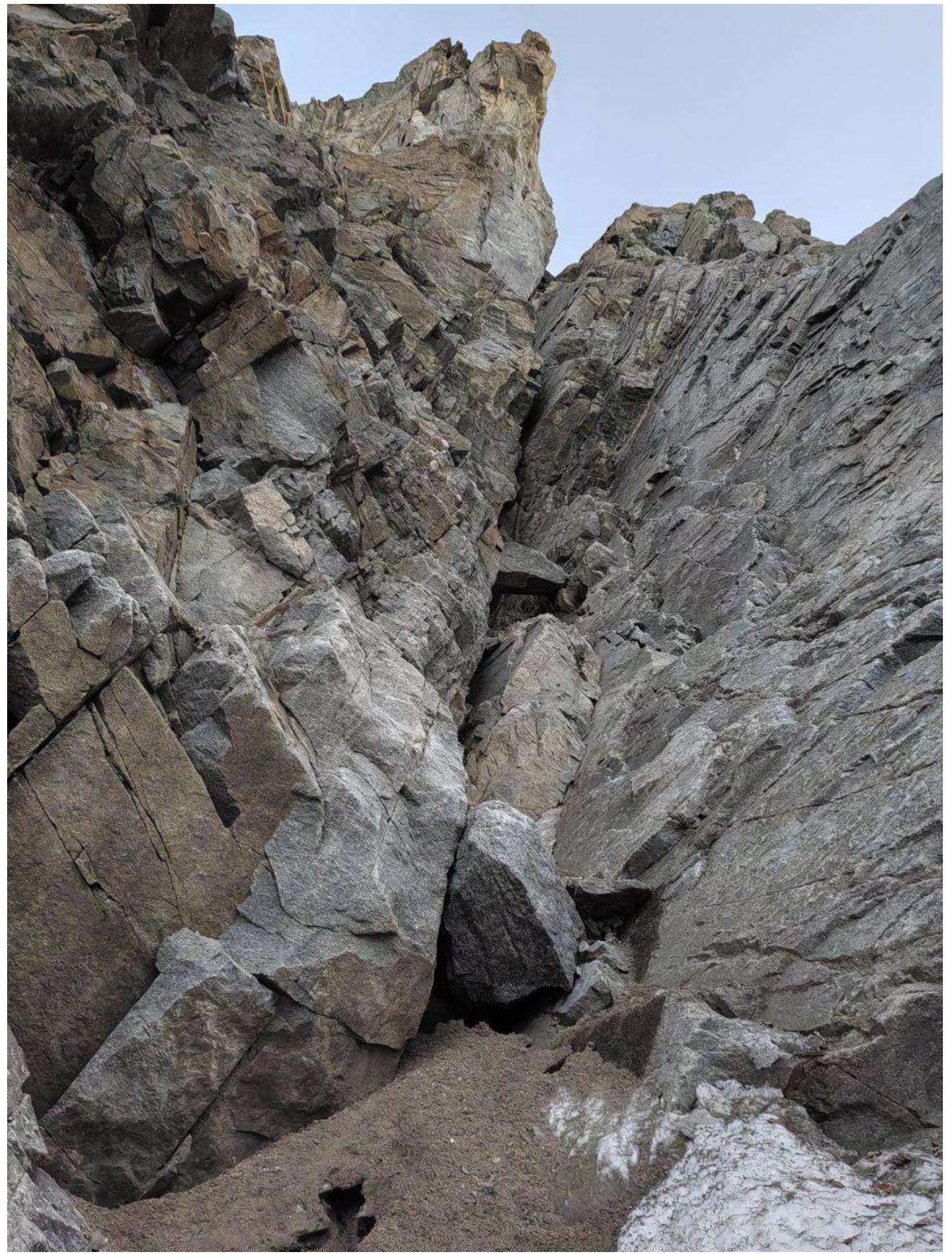
Fig. 7: Section
R0–R1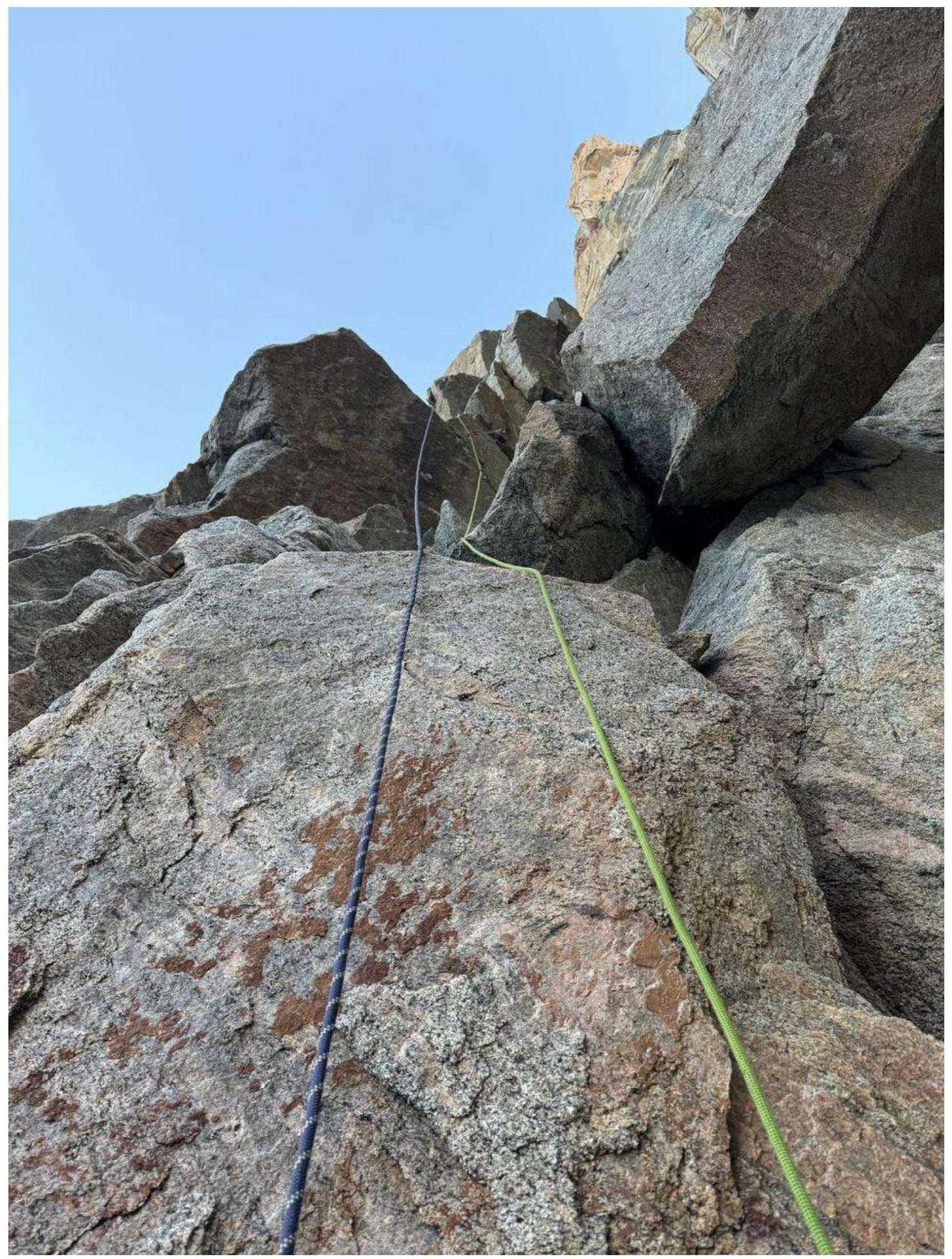
Fig. 8: Section
R1–R2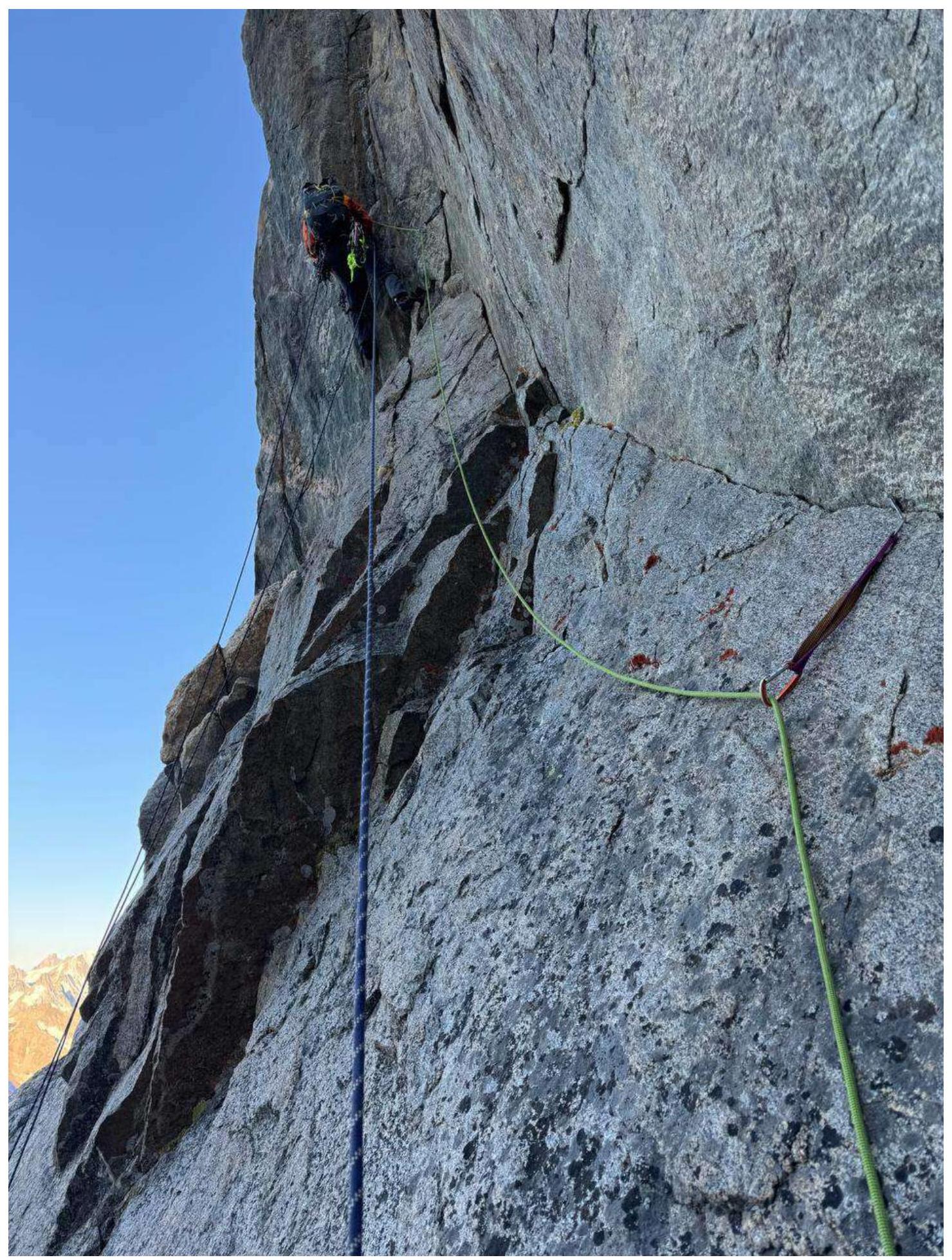
Fig. 9: Section
R2–R3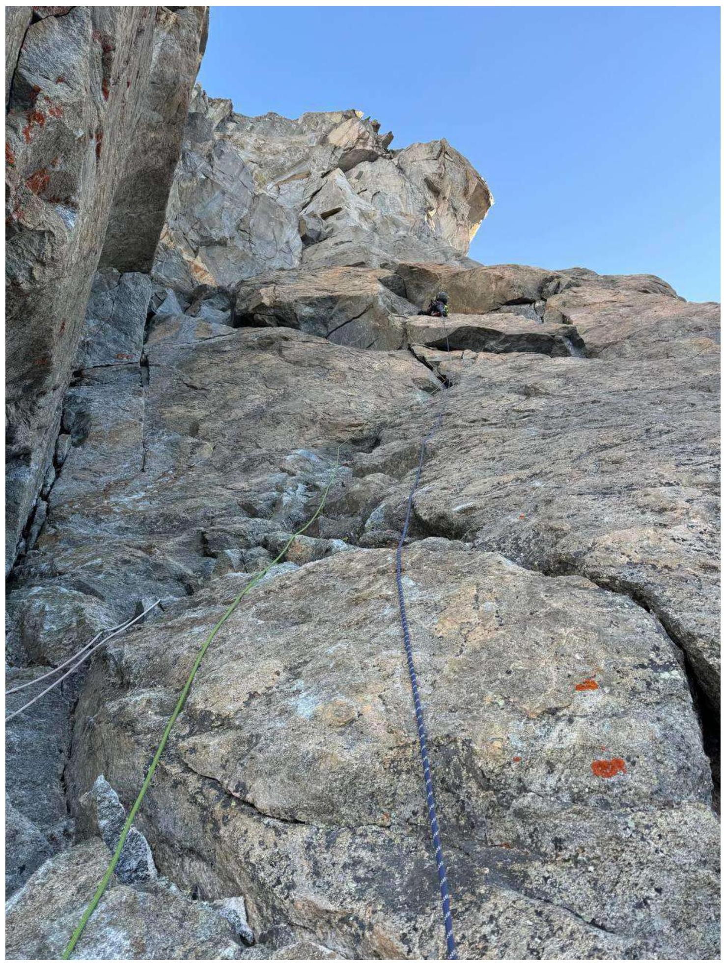
Fig. 10: Section
R4–R5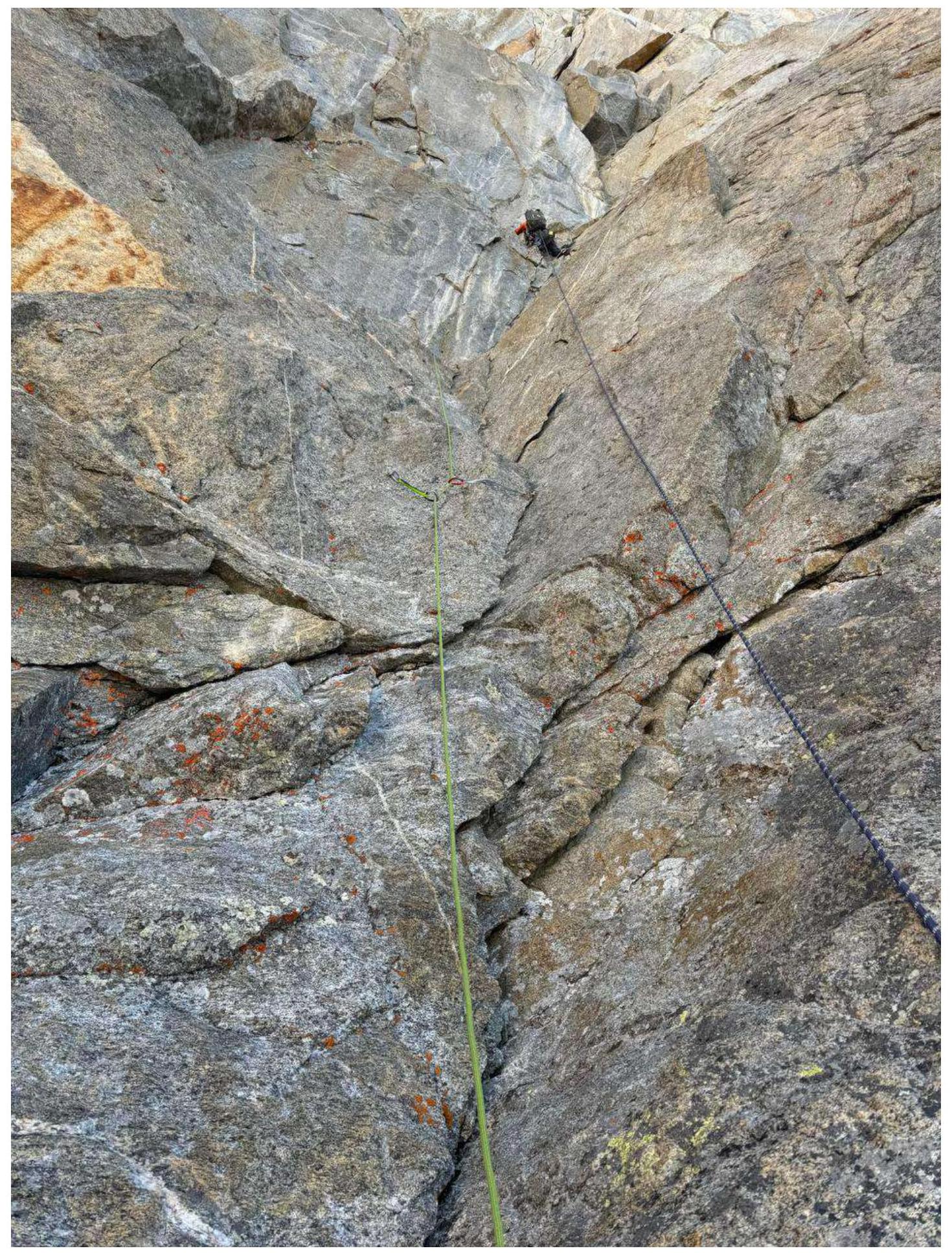
Fig. 11: Section
R5–R6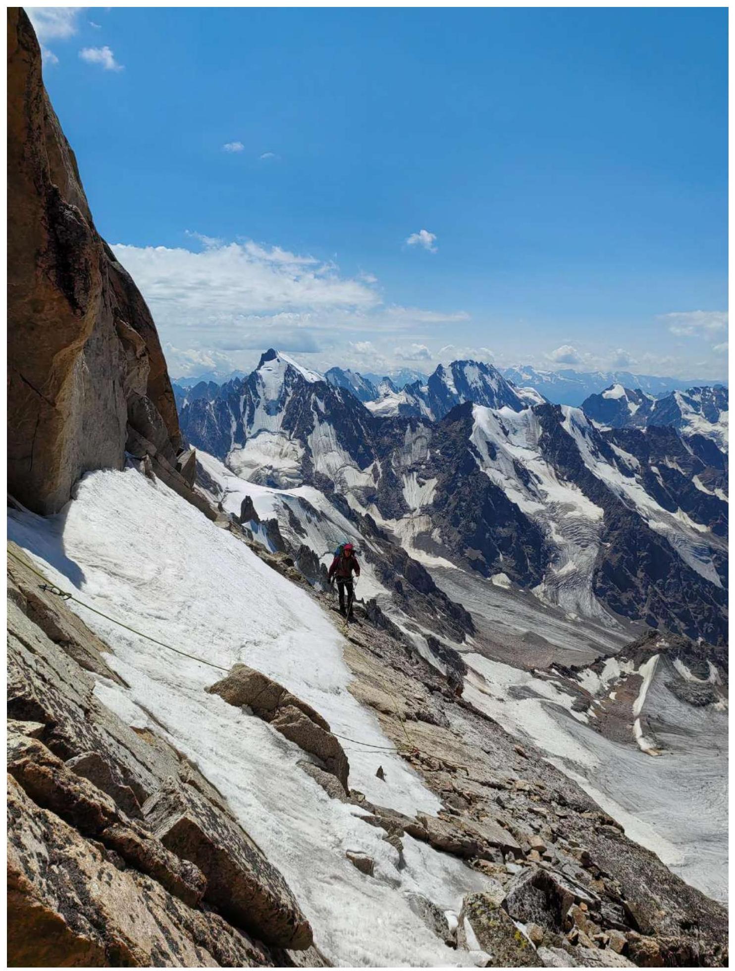
Fig. 12: Section
R11–R12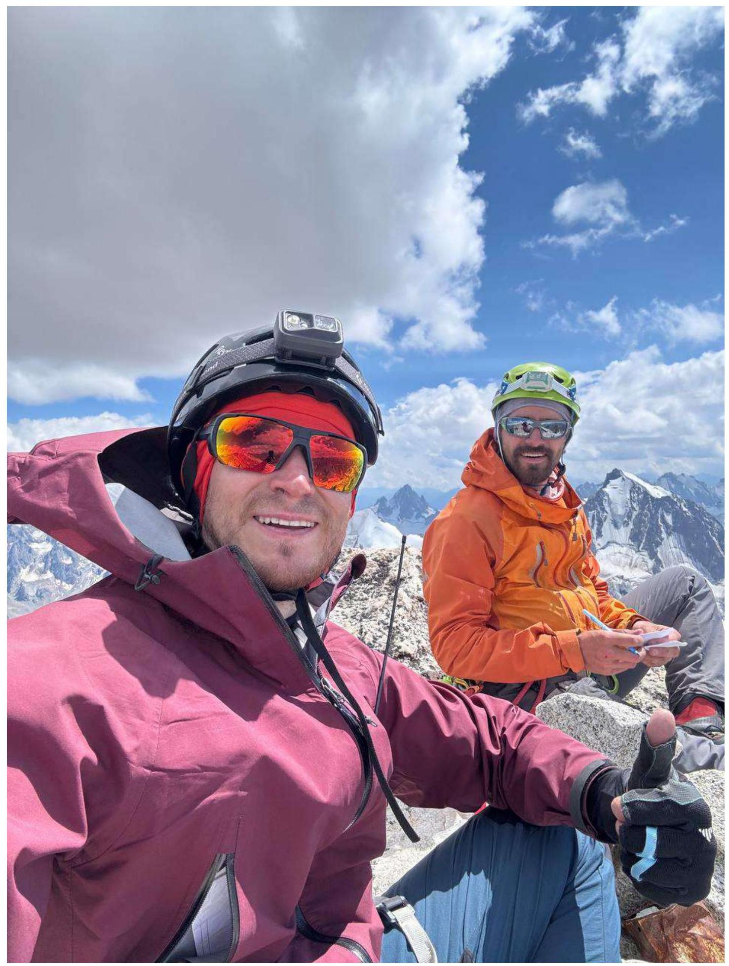
Fig. 13: Team Chetverikov and Yakuba on Dzhailik peak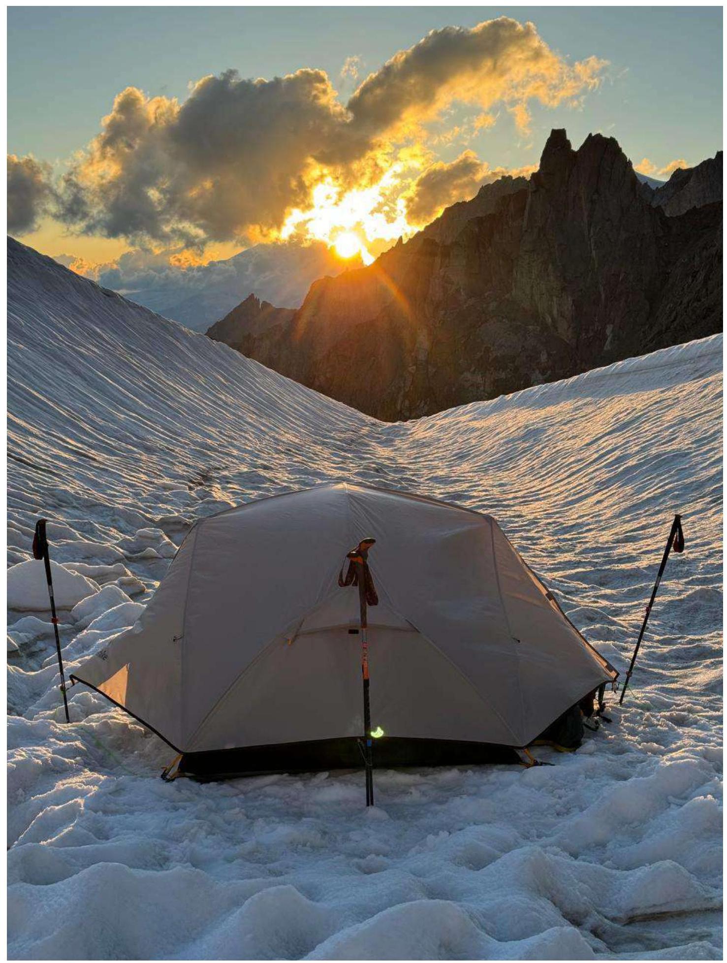
Fig. 14: Overnight stay on the snowy field under the start of the route