Passport
- Climbing category — technical
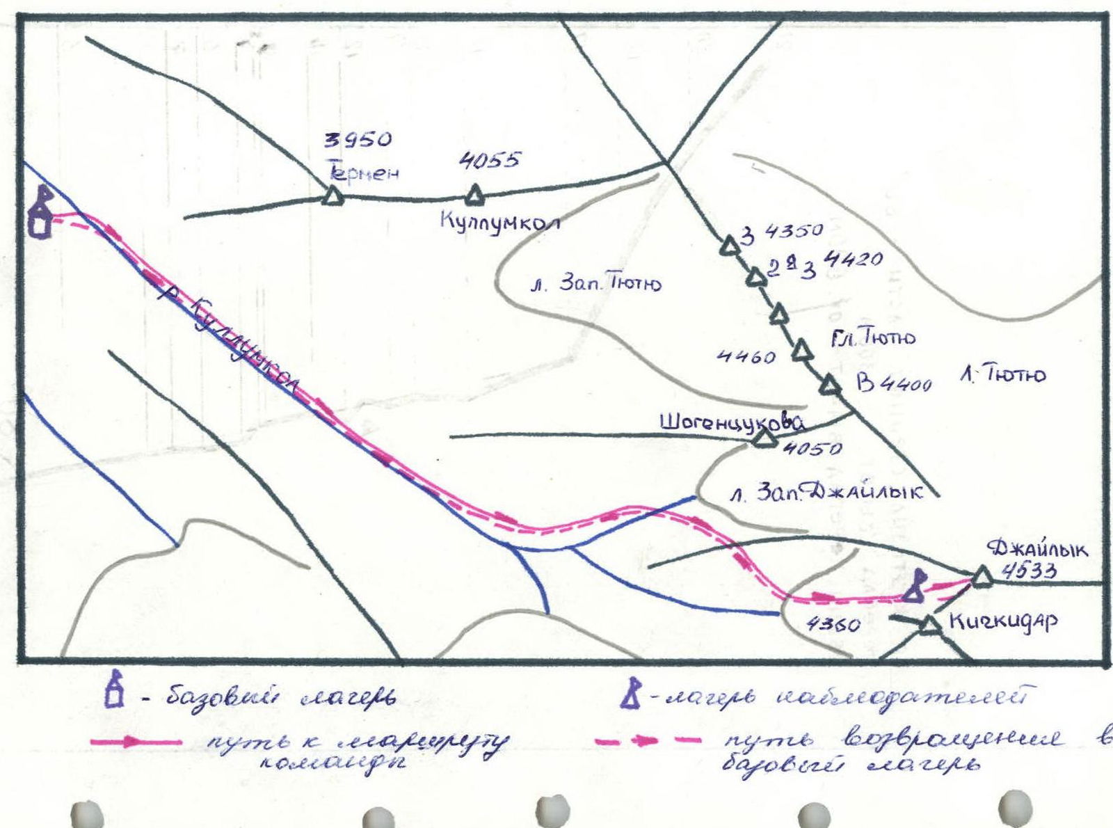
- Climbing region — Caucasus, Adyr-Su valley
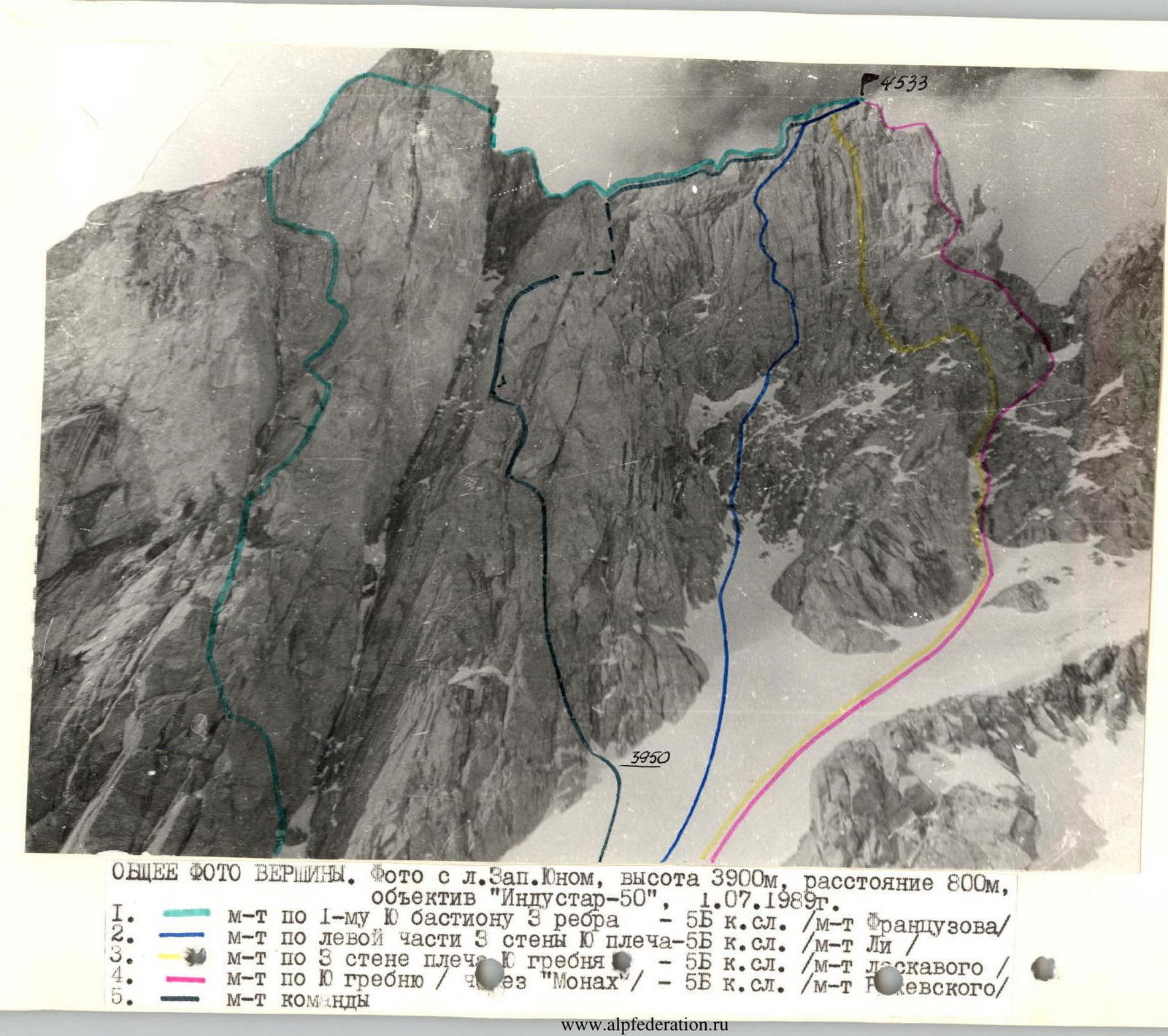
- Mt. Dzhailyk, via the Central counterfort of the South wall (Khazkevich's route)
- Difficulty category — 5B
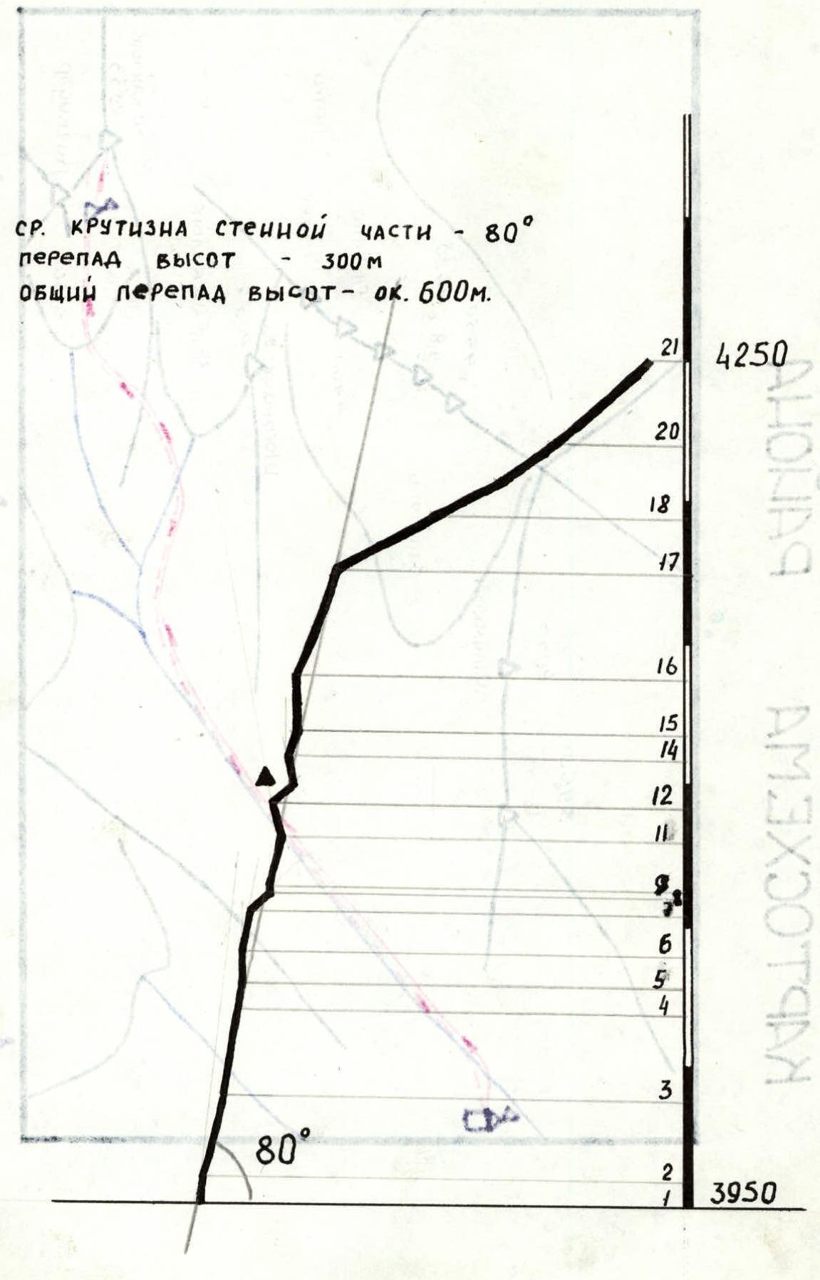
- Height difference — 600 m Height difference of the wall section — 300 m, route length — 1137 m, length of sections with 5–6 difficulty category — 202 m, average steepness of the wall section — 80°
- Pitons used: rock, bolt, ice, and chock placements: 38/3, 4×, 1+2×, 49/6× (reuse of previously driven pitons)
- Travel time: — 8.5 hours, days — 1
- Number of nights stayed — none
- Team leader: Aristov Ivan Efimovich — Candidate Master of Sports — Andryushchenko Anatoly Viktorovich — Master of Sports — Fukolov Alexander Vadimovich — Candidate Master of Sports — Popenyshev Igor Nikolaevich — 1st sports category — Sukovitsyn Gennady Yakovlevich — Candidate Master of Sports — Kravchenko Oleg Viktorovich — Candidate Master of Sports
- Coach: Andryushchenko Anatoly Viktorovich — Master of Sports
- Route start: July 2, 1989 Summit — July 2, 1989 Return — July 3, 1989
- Organization — team of the Krasnodar Regional Sports Committee
Profile of the wall section
Scale 1:2000
Map of the region
Mt. Dzhailyk, 4533 m
| Pitons | Bolt | Rock | Ice | Chock placements |
|---|---|---|---|---|
| Total | 4× | 38 | 1+2× | 49 |
| Driven | 3 | 1 | 6 |
Length — 1137 m. Including V–VI category — 202 m.
| Section # | Length, m | Steepness, ° | Category/Difficulty |
|---|---|---|---|
| R21 | 700 | 40 | III |
| R20 | 40 | 45 | III |
| R19 | 30 | 40 | IV |
| R18 | 25 | 30 | III |
| R17 | 40 | 30 | II |
| R16 | 40 | 70 | V– |
| R15 | 20 | 90 | VI |
| R14 | 10 | 80 | V |
| R13 | 7 | 100 | VI A2 |
| R12 | 10 | 45 | III |
| R11 | 10 | 100 | VI A2 |
| R10 | 10 | 60 | IV |
| R9 | 8 | 100 | VI A2 |
| R8 | 2 | 140 | VI A2 |
| R7 | 20 | 80 | V |
| R6 | 10 | 45 | III |
| R5 | 15 | 80 | V |
| R4 | 10 | 90 | VI A2e |
| R3 | 40 | 80 | V |
| R2 | 30 | 77 | V– |
| R1 | 10 | 85 | V+ |
| R0 | 50 | 30 | I |
Route diagram in UIAA symbols
Scale 1:2000
Section R0–R1
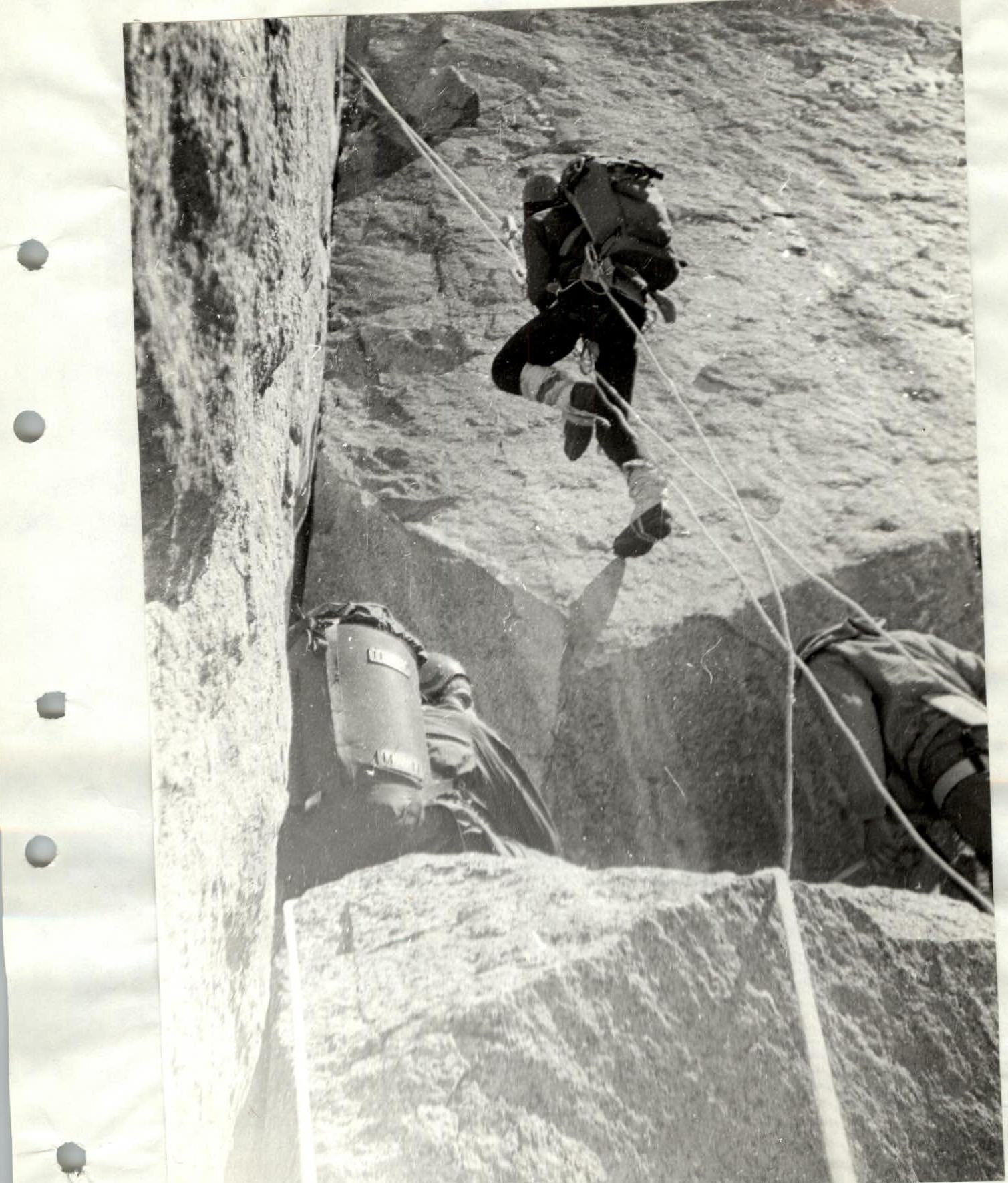
Section R8–R9