Report
on the second ascent of Mt. Adyrsu (4370 m) via the South-West wall through the central bastion from August 8 to 10, 2008, by the sports group of AUSB "Ullutau" consisting of:
- Privalov S.A. - leader
- Olkhovikov A.V.
Contacts
AUSB "Ullutau"
Leader Privalov S.A.
Coach Semykin B.I.
361602 KBR, Nalchik, tel. 8-8662-77-09-87 elimaso3@mail.ru, tel. 8-9272527095 sembi53@mail.ru, tel. 8-9053319763
The heights mentioned in the report were determined:
- visually;
- using a 50-meter main rope.
Passport
- Region, gorge, section number according to the 2001 classification table. Mountain system: Main Caucasian Ridge and its spurs from Gumači pass to Kitlod pass. Region: Adyrskiy Ridge. Gorge: Adyrsu. Section number according to the 2001 classification table: 2.4.1.
- Name of the peak: Adyrsu (4370 m). Route name: via the South-West wall through the central bastion.
- Route category: assumed - 5B category of difficulty. Second ascent.
- Route type: combined.
- Route elevation gain: 870 m. Route length: 1460 m. Length of sections: 5th category of difficulty - 455 m, 4th category of difficulty - 560 m. Average steepness of the main part of the route - 65°. Total route - 57°.
- Pitons left on the route: total - 3; including bolted pitons - 0. Pitons used on the route: bolted stationary - 0, including for artificial climbing - 0. bolted removable, including for artificial climbing - 0. Total artificial climbing points used - 0: rock - 3/1, bolted - 0/0, chocks - 54/0, ice - 21/0.
- Team's climbing hours - 12.5 (not including descent) and days - 2.
- Leader: Privalov Sergey Anatolyevich, 1st sports rank. Participant: Olkhovikov Alexander Vyacheslavovich, 1st sports rank.
- Coach: Semykin Boris Ivanovich, Candidate Master of Sports, 2nd category instructor.
- Departure for the route: August 9, 2008, at 6:10. Reach the summit: August 10, 2008, at 12:15. Return to the base camp: August 10, 2008, at 18:40.
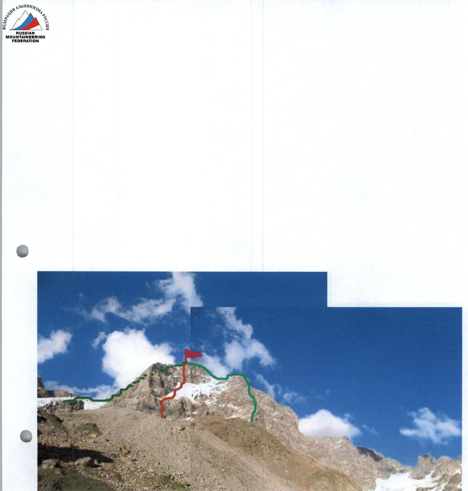
Photo 1. General view of the South-West buttress. Path of the first ascent (red):
- Route via the Western buttress of the South ridge, 3A category of difficulty (right)
- Route via the North-West ridge, 3B category of difficulty (left)
Photo taken: August 4, 2008, at 18:50. Location: moraine opposite the "Red Rocks".
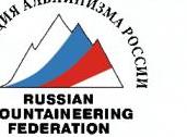
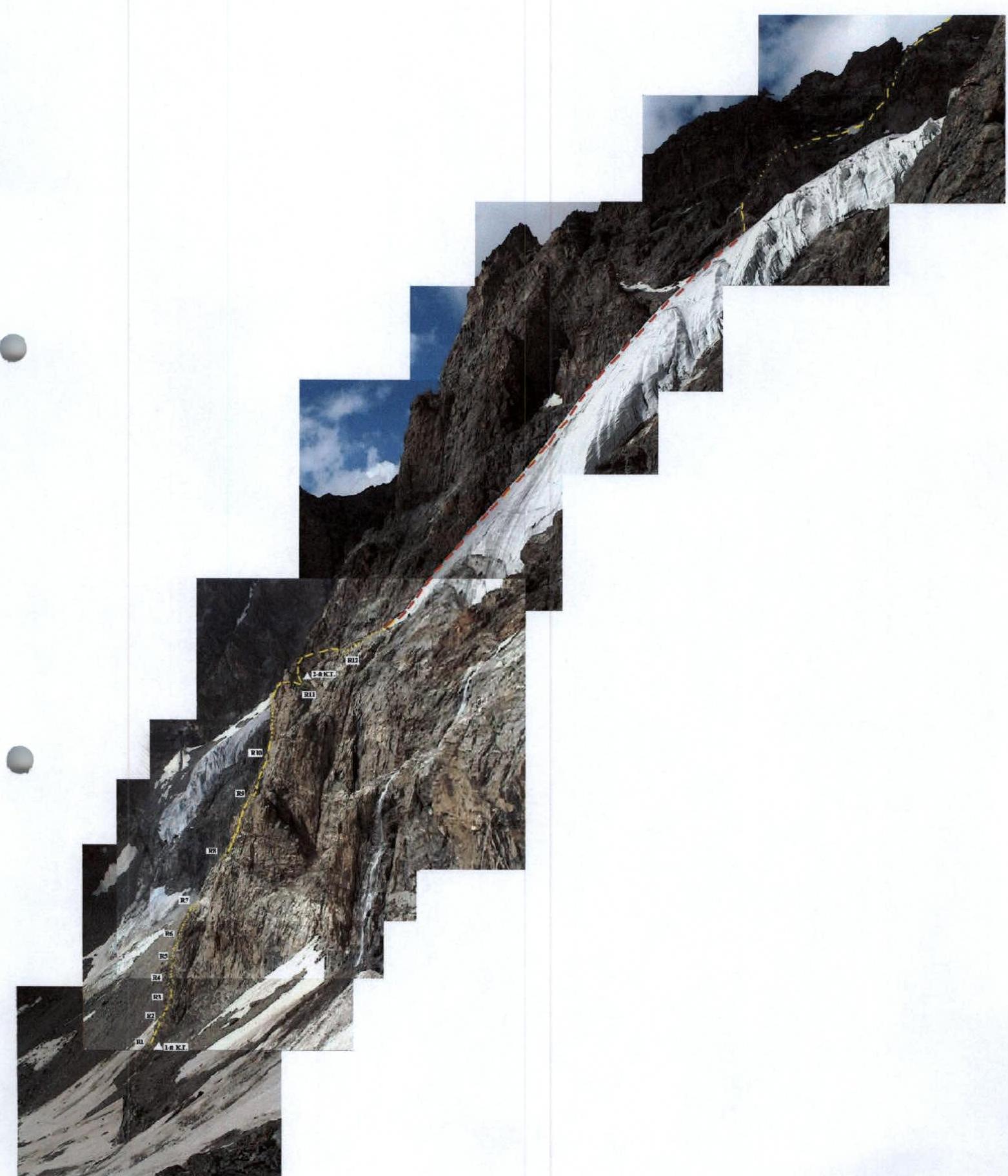
Photo of sections R13-R20.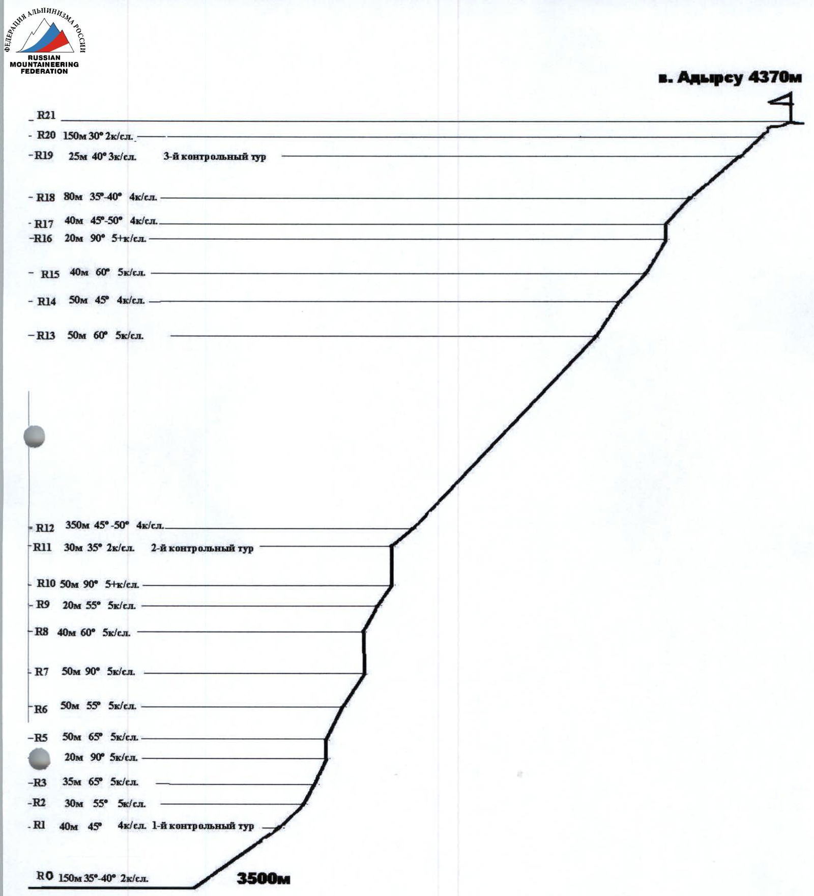
Profile diagram of the route.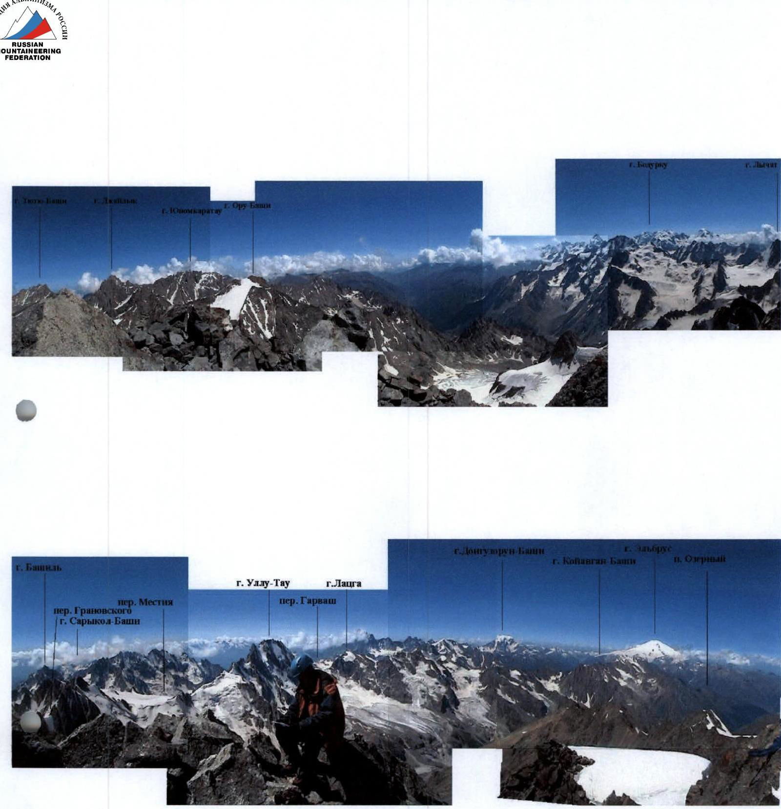
Photo 3, 4. Panorama from the summit.
Route diagram in symbols.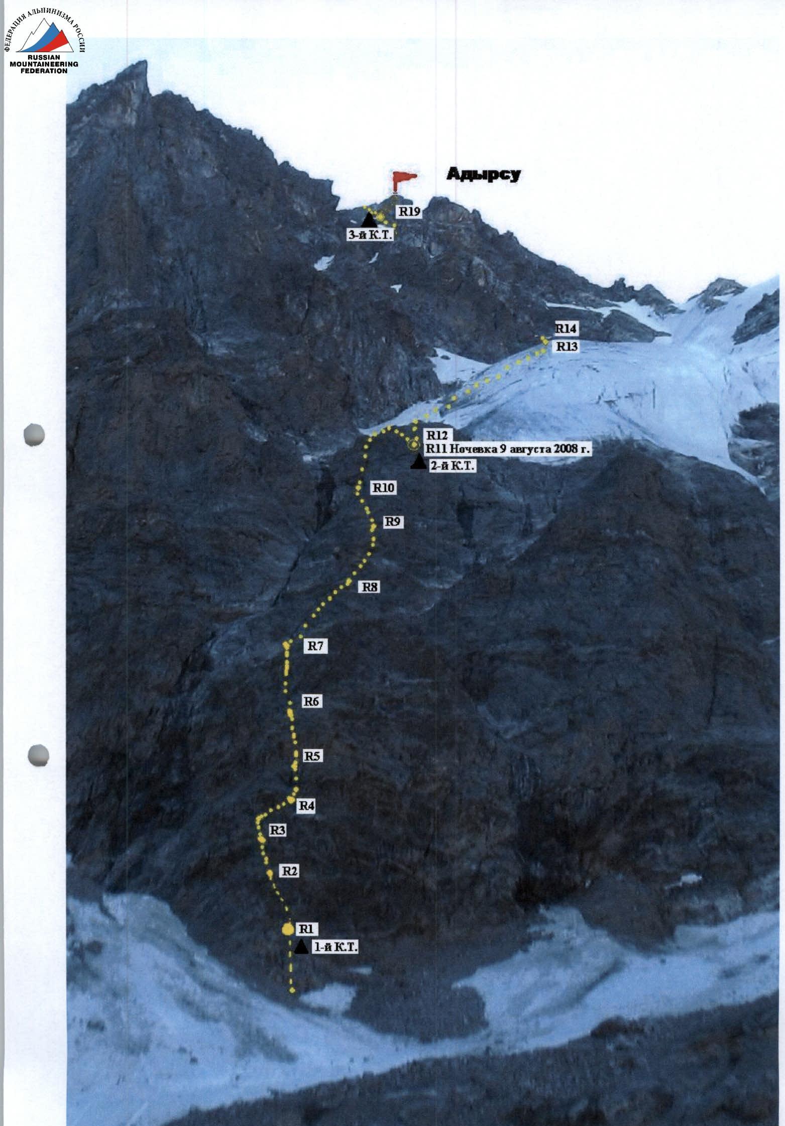
Route description by sections
R0-R1: 150 m, 35-40°, 2nd category of difficulty - from the moraine to the lower part of the bastion (3500 m) via a steep snow-ice slope to a ledge. 1st control point. R1-R2: 40 m, 45°, 4th category of difficulty - straight up the wall. R2-R3: 30 m, 55°, 5th category of difficulty - left-upwards, exit to a ledge. R3-R4: 35 m, 65°, 5th category of difficulty - from the ledge, ascent to an internal corner to a station. R4-R5: 20 m, 90°, 5th category of difficulty - ascent right-upwards, then left, passage between a cornice and an overhang. R5-R6: 50 m, 65°, 5th category of difficulty - along the wall to a small ledge. R6-R7: 50 m, 55°, 5th category of difficulty - exit to a large ledge 15 m x 7 m. R7-R8: 50 m, 90°, 5th category of difficulty - bypass the overhang on the left and along an inclined ledge under the wall, difficult climbing. R8-R9: 40 m, 60°, 5th category of difficulty - exit to a good ledge. R9-R10: 20 m, 55°, 5th category of difficulty - from the ledge along the wall. R10-R11: 50 m, 90°, 5+ category of difficulty - difficult climbing to the overnight stay location. 2nd control point (Photo 6, 7). R11-R12: 30 m, 35°, 2nd category of difficulty - from the overnight stay, exit left to the top of the bastion to a snow-ice slope. R12-R13: 350 m, 45-50°, 4th category of difficulty - along the snow-ice slope and approach to wet, broken rocks, ledges. R13-R14: 50 m, 60°, 5th category of difficulty - along broken rocks to an inclined ledge to a snow-ice ridge. R14-R15: 50 m, 45°, 4th category of difficulty - along the ridge to the start of a couloir filled with snow and ice. Cross the couloir right to a ledge 20 m. R15-R16: 40 m, 60°, 5th category of difficulty - up a crack, exit to an internal corner (Photo 8). R16-R17: 20 m, 90°, 5+ category of difficulty - up a steep internal corner, exit to rocks of the ridge part of the route. R17-R18: 40 m, 45-50°, 4th category of difficulty - along the ridge, approach to a snow-ice ridge. R18-R19: 80 m, 35-40°, 4th category of difficulty - along a snowy ridge to a large rock, bypass it on the left and move right under an overhanging rock. Overnight stay. 3rd control point. R19-R20: 25 m, 40°, 3rd category of difficulty - from the bivouac left along a ledge, exit to the NW ridge. R20-R21: 150 m, 30°, 2nd category of difficulty - along a snowy dome and a simple rocky ridge to the summit of Adyrsu.
Descent via the route of 3A category of difficulty along the Western buttress of the South ridge.
Notes from control points and the summit are stored in the training department of AUSB "Ullu-Tau".
August 8, 2008
At 12:00, the team left AUSB "Ullutau" and arrived at the overnight stay location near the "Red Rocks" at 13:50. Set up a bivouac.
August 9
At 6:10, the team departed from the bivouac and, passing through scree, overcoming a steep snow-ice slope, approached the lowest part of the bastion, where they began working on the route. At 7:45, they reached a scree ledge, where the 1st control point was established. Exchanged a note and, tied with a safety rope, continued their movement.
Straight up the wall, shifting left-upwards, we exit to a large rock ledge. From it, via an internal corner to the next ledge, along which we moved right to a more convenient location to continue the route upwards. Then, on friction upwards - left passage between a cornice and an overhang to a good ledge. From it, we move to a small ledge, where insurance is possible, and further to a good large 15 m x 7 m scree area with an overhanging upper part.
On the site:
- Under the overhang, a tent can be set up.
- Water is available on the left in a couloir.
- The right couloir experiences frequent rockfalls.
Next, bypass the overhanging part on the left and along an inclined ledge under the 90° wall. Then 40 m to a good ledge. From the ledge, 20 m straight up the wall, and then with difficult climbing, we exit to the 2nd control point and the overnight stay location in a tent (13:20).
From the "Red Rocks" bivouac - 7 hours.
August 10
At 7:00, the team ascended simple rocks on the left under the glacier tongue. The further path went along a steep snow-ice slope. Upward movement is recommended along the left part of the glacier along the rocky ridge. 350 m from a large rock under the wall, we ascend the wall to a small ledge. Along it, left-upwards, to a gentle, wide couloir (about 100 m), with snow in the upper part. From it, right along rocks of medium difficulty, through a steep internal corner, we exit to a simple ridge and further move to a snow-ice ridge. Along this ridge, we approach under a large square rock and, bypassing it on the left, move right-upwards under an overhanging rock of the North-West ridge. Here, a site is laid out, which can be enlarged for tent installation if desired. Here is also the 3rd control point.
From the overnight stay on the bastion - 4 hours. Continuing the movement, we move left along a simple destroyed ledge to the North-West ridge and along it, at 12:15, we ascend to the summit of Adyrsu.
The descent went along the South-West ridge via the route of 3A category of difficulty to the trail on the moraine under the "Red Rocks" and took 3 hours.
The team returned to AUSB "Ullutau" at 18:40.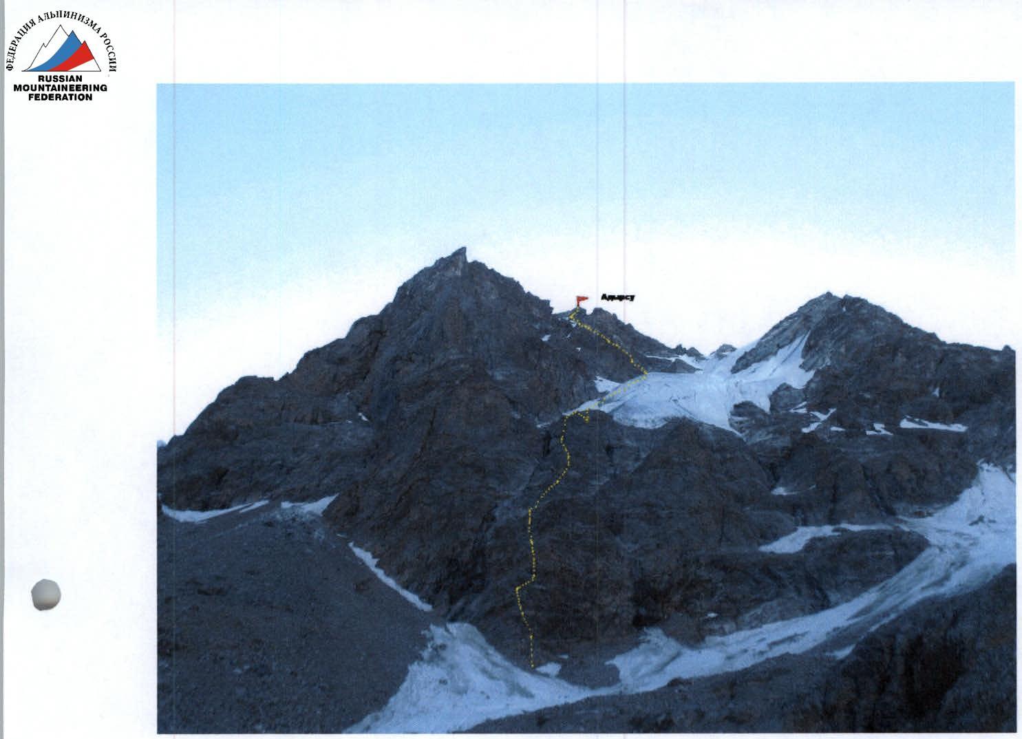
General photo of Mt. Adyrsu.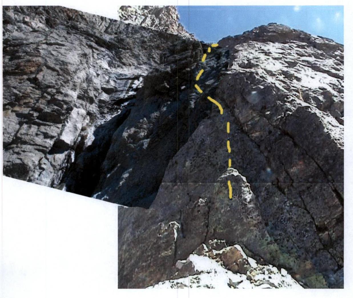
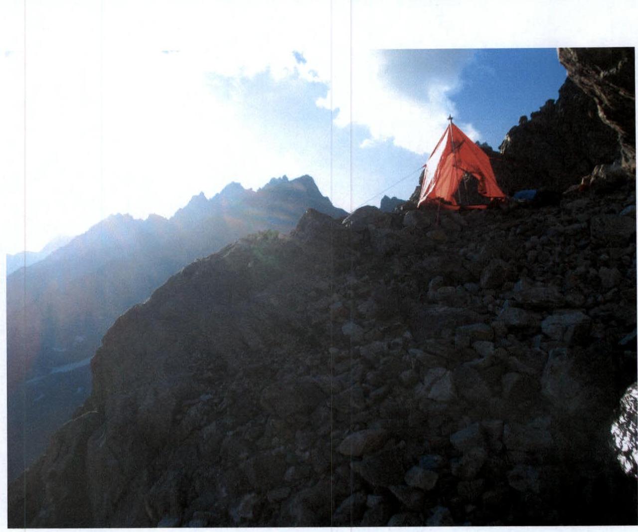
Photo 7. Section R11.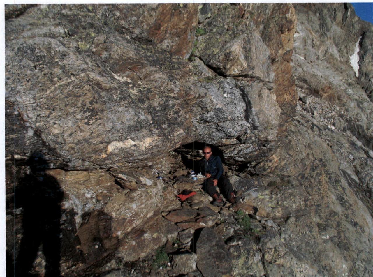
Niche on section R11.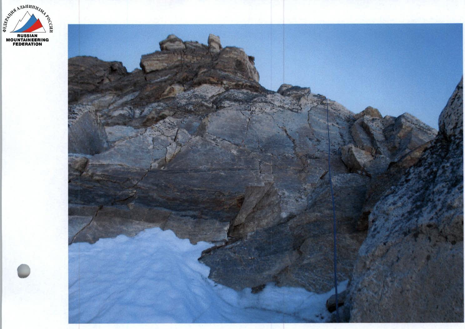
Photo 8. Section R15-R16.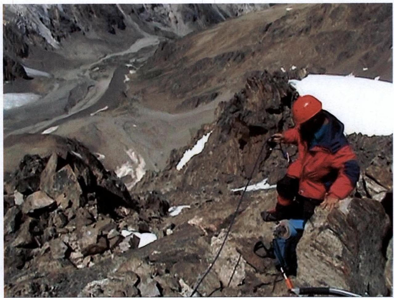
Photo 9. Section R18-R19.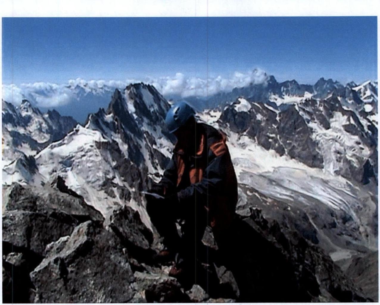
Photo 9. On Mt. Adyrsu.
Photo 10. Section R17-R19.
Conclusions and Recommendations
- The route is interesting and safe in dry weather.
- We assume that the site for a tent at the top of the bastion can be fired upon by large stones coming from the glacier, with small stones ricocheting right and left along the streams. For a more peaceful rest during the period of abundant stone thawing, we recommend a niche (1 m x 2 m) in the wall of this site.
- When passing the second half of the route (ice part), it is necessary to consider the presence of other groups on the pre-summit part of the South-West ridge (3A category of difficulty), as stones falling from it fall directly along the ascent path along the glacier.
- Since after the site on the bastion under the glacier tongue there are no convenient places for a bivouac on the route, we recommend that subsequent groups, if necessary, organize an overnight stay in the hollow of the North-West ridge, where the descent is made via the 3B category of difficulty route.
- The thawing of stones and their silent fall along the glacier body in the second half of the day makes the ascent hazardous. Thus, we recommend including an overnight stay on R11 in the ascent plan; departure to the glacier R12-R13 only in the cold time of day.
- Taking into account the tactical conditions of the ascent, the complexity of individual sections of the route in aggregate, we recommend the route as a 5B category of difficulty ascent.
In preparation for the ascent, the following were used:
- materials from the training department of AUSB "Ullu-Tau";
- consultations with Zaitsev K.K.;
- consultations with the leader of the group of first ascenders of the route, Monaenkov E.I.