Report
on the passage of Krugozor-Myrdy, 2A cat. sl. of the Popov V.I. team
| 1. General Information | ||
|---|---|---|
| Full name, sports rank of the leader | Samofeeva, CMS | |
| Full name, sports rank of participants | Bondarenko A.Yu., Plotnikov I.I., Simonov P.A., Strizhko A.S., b/r. | |
| Full name of the coach | Popov V.I. | |
| 2. Characteristics of the ascent object | ||
| Area | From Nakhar Pass to Chipereza Pass | |
| Valley | Krugozor-Myrdy circus | |
| Name and height of the summit | Krugozor-Myrdy, height 3476 m | |
| 3. Characteristics of the route | ||
| Name of the route | Along the eastern ridge, traverse | |
| Category of complexity | 2A | |
| Degree of route exploration | Often chosen by climbers | |
| Characteristics of the route relief | Rocky, ridge | |
| Descent from the summit | Descent from the summit along the eastern ridge, into the Krugozor-Myrdy circus. | |
| 4. Characteristics of the team's actions | ||
| Time of movement (team's walking hours, indicated in hours and days) | 7.5 hours | |
| Departure on the route | 7:00 | |
| Arrival at the summit | 10:30 | |
| Return to the base camp | 12:00 | |
| 5. Responsible for the report | ||
| Full name | Plotnikov I.I., Simonov P.A. | |
| Route Section | Description | Photo number |
| :--: | :--: | :--: |
| Start of the route | From the parking lot under Trezubets along a grassy rocky slope, then along a scree slab, look up, possible rockfall. We enter from the northern side and then move along the slabs. | - |
| R0–R1 | Crossing the ridge along scree ledges. | - |
| R1–R2 | We move along a scree slope on the right side, complexity 1+. | - |
| R2–R3 | We move along the ridge to an elevation (R3), here we set up a station, to the left of the ridge, on a platform. | 1 |
| R3–R4 | Descent by climbing down, with our own anchors, possible rappelling, there are loops for descent, first along a slab with anchors, then we turn left onto a ledge. | - |
| R4–R5 | From the station, setting up anchors, descent down by climbing, at the bottom is a scree ledge, to the right of it is a breakaway, suitable from the station. | - |
| R4–R6 | Then we move along a trail and climb up a scree slope, we reach the ridge, simultaneous movement in rope teams. | - |
| R6–R7 | We move in rope teams along slabs, along the ridge, setting up a rope. | - |
| R7–R8 | Rappelling 40 m down to a station, it is on the right (there are pitons hammered around and a rope stretched), we do not orient to the station in the couloir, rocks fall on it from subsequent descending climbers. | - |
| R8–R9 | We rappel to the left through a couloir onto a ledge (balcony), we set up a station. Then in rope teams along the ledge to a turn behind a pile of rocks. | 2 |
| R9–R10 | We climb up a scree slope onto the ridge in rope teams (live rocks). | 3 |
| R10–R11 | We bypass a jendarmerie on the right and reach a large | - |
| sunken ledge before the ascent. | ||
| :-- | :-- | :-- |
| R11–R12 | Simultaneous in rope teams, we climb up a scree slope and a simple ridge (a trail is visible). | 4 |
| Descent | We move along the eastern ridge along a trail along the ridge, rope teams are not needed (we orient ourselves on cairns), we move in a southern direction until a view opens up to a small nameless circus, immediately without losing height, we go to its left ridge (orographic right ridge of the Krugozor-Myrdy circus). Then 100 m along the ridge to a depression (landmark - a large stone, on it is a cairn). From the cairn, a trail goes down to a scree slope, along it we reach a small snowfield (crampons are not needed), then we reach the parking lot of the Krugozor-Myrdy circus. ATTENTION! Along the trail from the summit without transitioning to its left ridge DO NOT GO! You will end up in a neighboring circus. | 5 |
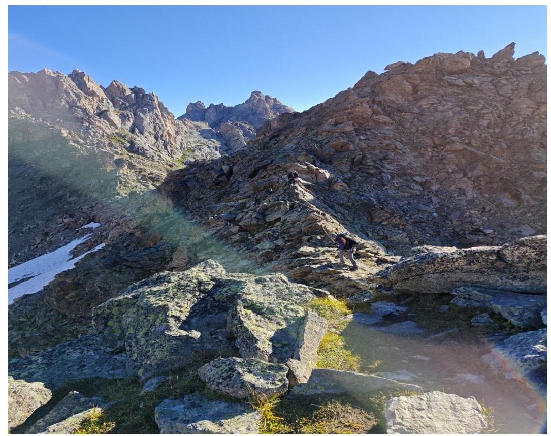
Fig. 1
R2–R3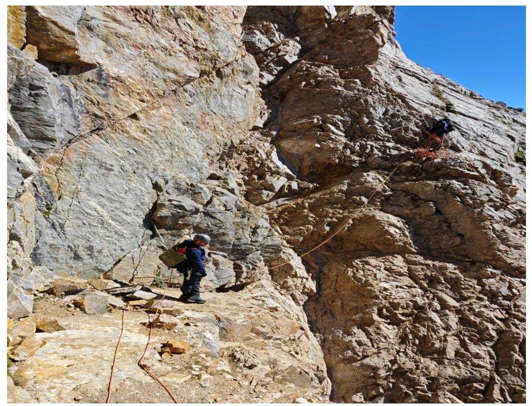
Fig. 2
R8–R9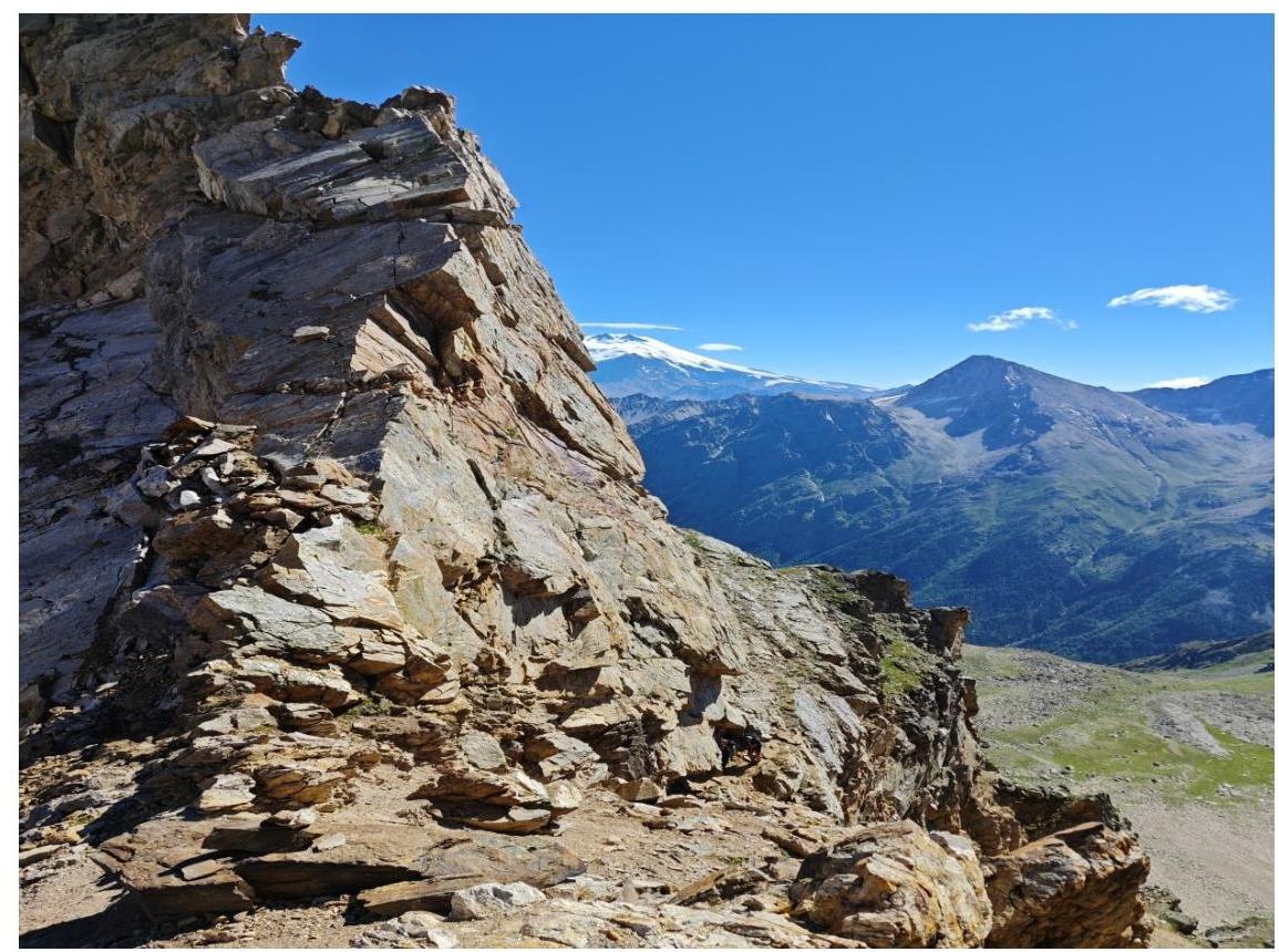
Fig. 3
R9–R10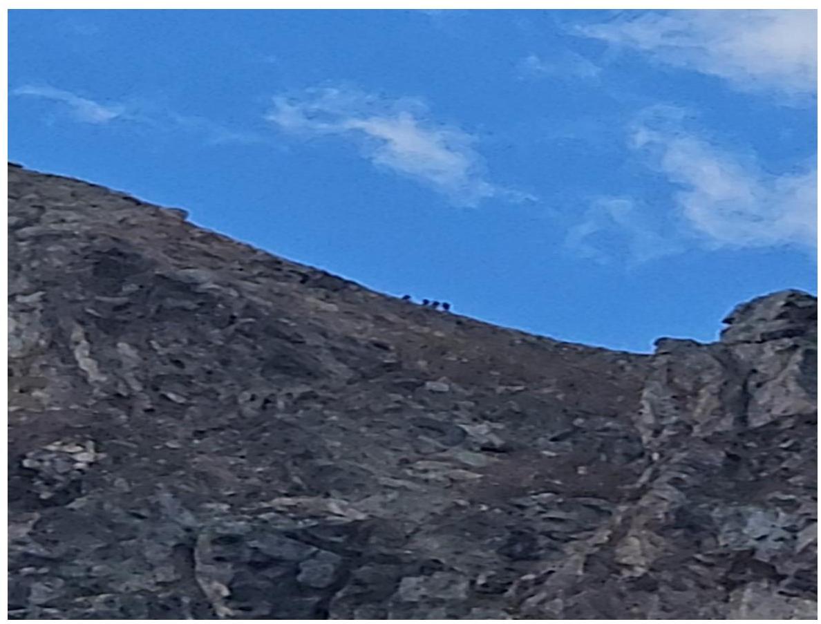
Fig. 4
R11–R12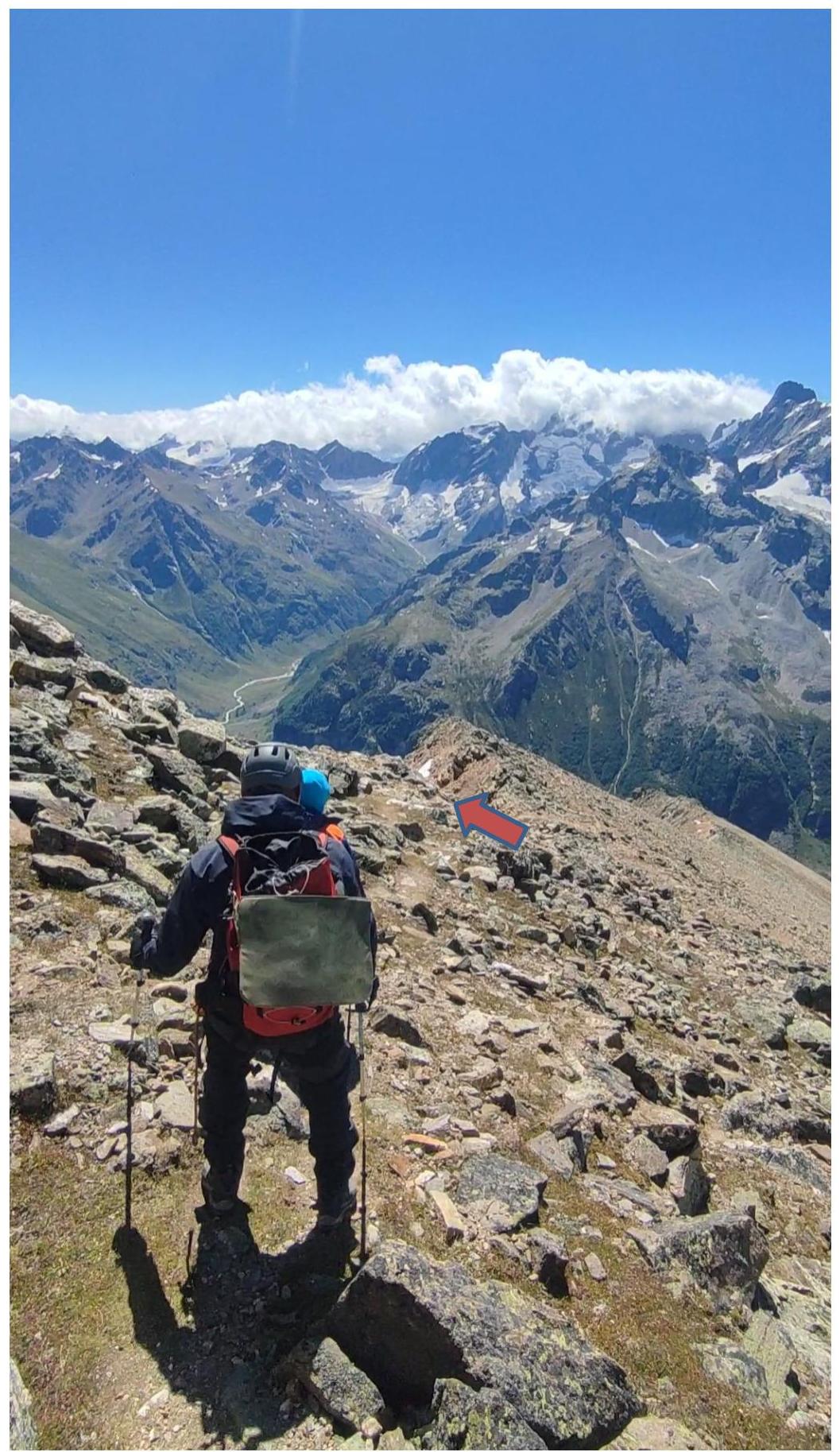
Fig. 5 Direction
of descent.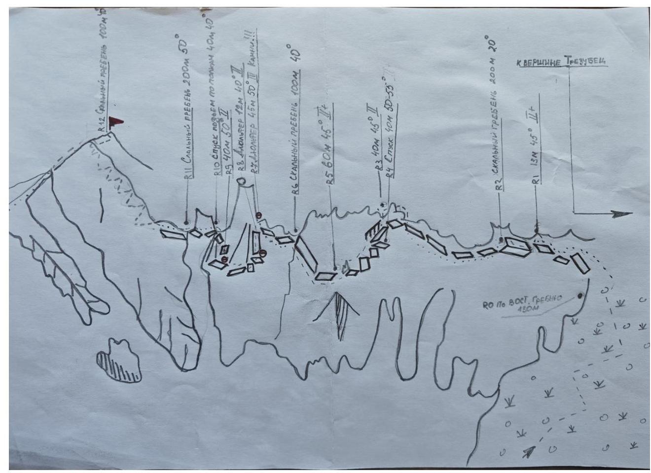
Fig. 6 Route scheme.