Ascent Passport
- Western Caucasus, Uzunkol gorge
- Name of the peak: Dalar via the left part of the N wall.
- Proposed — 6A category of complexity (Snesarev — Shopin combination)
- Route type: rock
- Height difference: 950 m.
Route length — 1200 m.
Length of sections:
- 5th cat. diff. – 415 m
- 6th cat. diff. – 280 m Average steepness:
- main part of the route — 76°
- entire route — 65°
- Pitons left on the route: total — 6 pcs.
including bolted — 2 pcs.
Pitons used on the route:
- stationary bolted, including ITO — 3
- removable bolted — 3, including ITO — 2 Total ITO used — 96
- Team's travel hours: 47 h and 4 days.
- Leader: Shavrovich Alexander Leonidovich — MS, Perm, st. P. Osipenko, 56–20
Participants:
- Puchnin Vyacheslav Yevgenyevich — CMS
- Rylov Nikolay Valeryevich — CMS
- Smirnov Andrey Pavlovich — 1st sports category
- Coach: self-coached
- Route entry:
- 8:00 July 29, 2000
- reaching the summit — 19:10 August 1, 2000
- return to base camp — 18:30 August 2, 2000
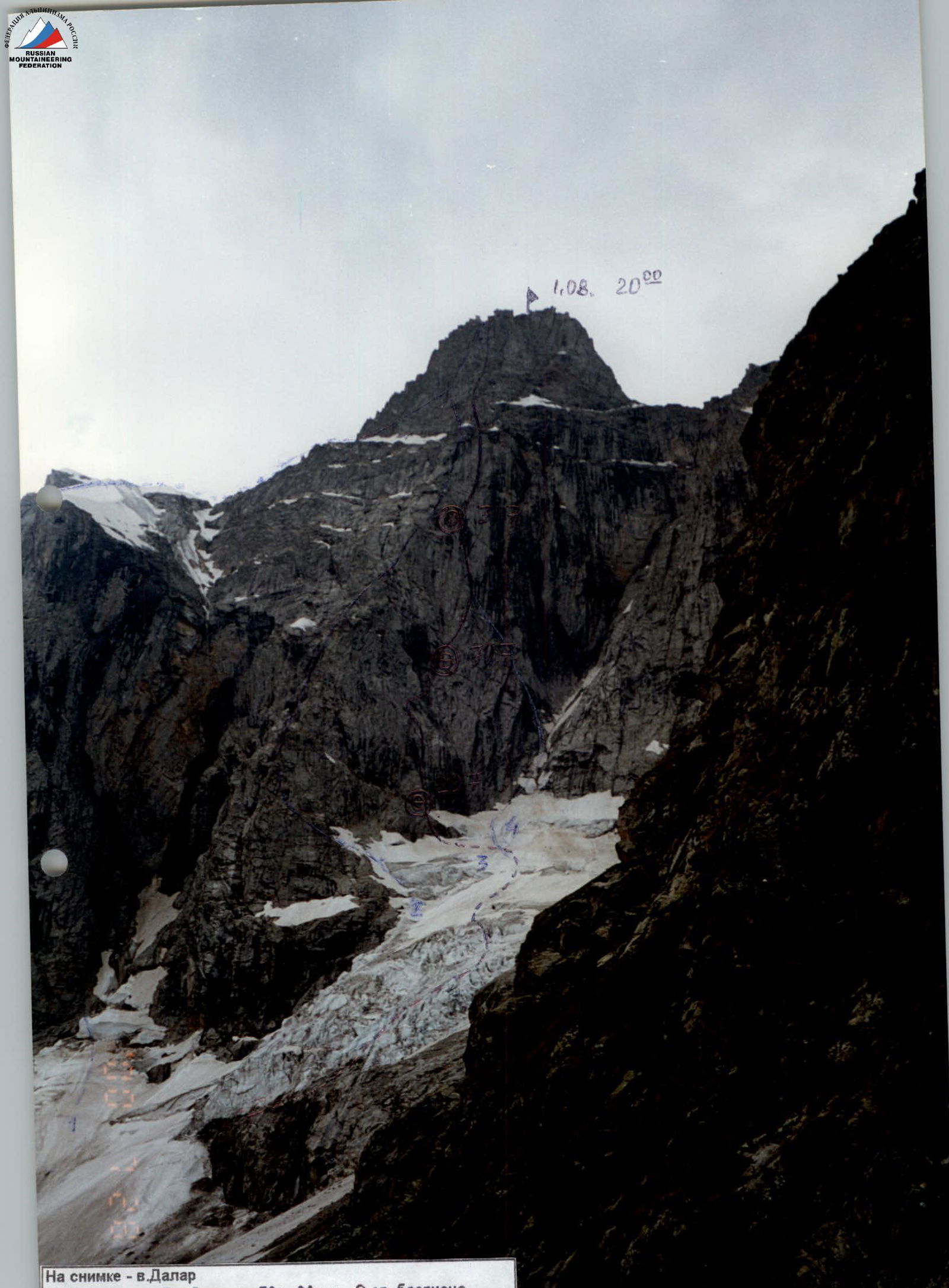
In the photo — Mt. Dalar:
- № 1 — Varburton's route, 1976, 6A cat. diff., N wall of the bastion
- № 2 — Stepanov's route, 1962, 5A cat. diff., via NE ridge
- № 3 — Snesarev's route, 1962, 6A cat. diff.
- route via the left part of the N wall (6A cat. diff.)
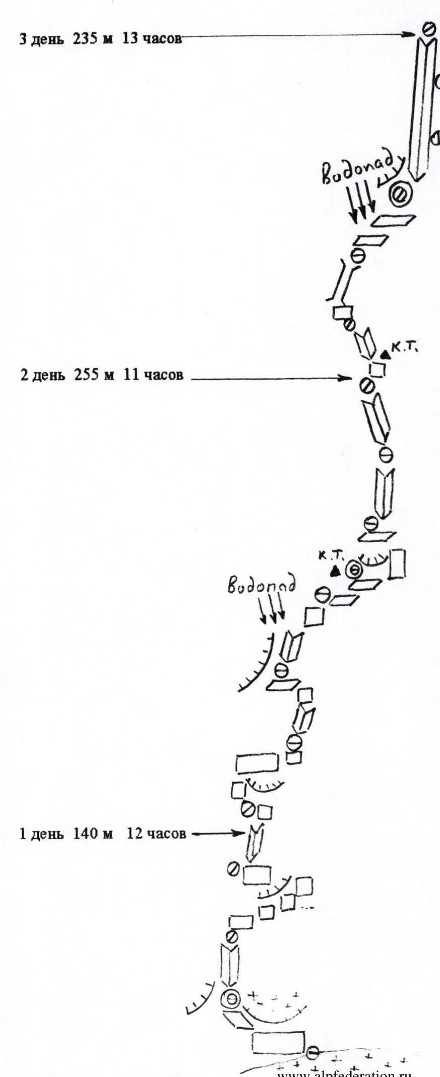
Route diagram. Snesarev — Shopin variation on Mt. Dalar via the left part of the N wall (6A cat. diff.)
3rd day: 235 m, 13 h
2nd day: 255 m, 11 h
1st day: 140 m, 12 h
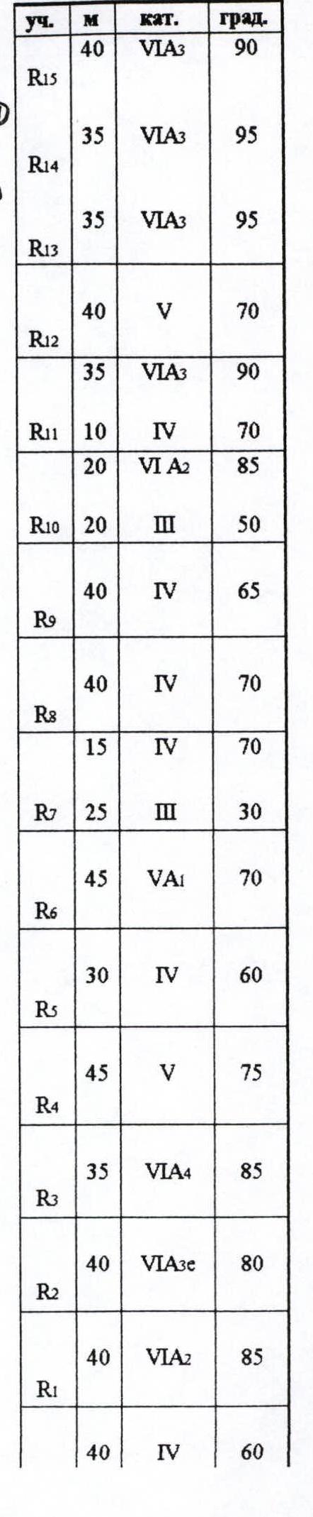
| sect. | M | cat. | grade |
|---|---|---|---|
| R15 | 40 | 3 | 90° |
| 35 | 3 | 95° | |
| R14 | |||
| 35 | 3 | 95° | |
| R13 | |||
| 40 | 5 | 70° | |
| R12 | |||
| 35 | 3 | 90° | |
| R11 | 10 | 4 | 70° |
| 20 | 2 | 85° | |
| R10 | 20 | 3 | 50° |
| 40 | 4 | 65° | |
| R9 | |||
| 40 | 4 | 70° | |
| R8 | |||
| 15 | 4 | 70° | |
| R7 | 25 | 3 | 30° |
| 45 | 5 | 70° | |
| R6 | |||
| 30 | 4 | 60° | |
| R5 | |||
| 45 | 5 | 75° | |
| R4 | |||
| 35 | 4 | 85° | |
| R3 | |||
| 40 | 3 | 80° | |
| R2 | |||
| 40 | 2 | 85° | |
| R1 | |||
| 40 | 4 | 60° |
Mt. Dalar, 3979 m
| sect. | M | cat. | grade |
|---|---|---|---|
| R28 | |||
| 120 | 3 | 20° | |
| R27 | |||
| 20 | 5 | 75° | |
| R26 | |||
| 40 | 5 | 60° | |
| R25 | |||
| 45 | 5 | 65° | |
| R24 | |||
| 45 | 6 | 80° | |
| R23 | |||
| 45 | 5 | 70° | |
| R22 | |||
| 40 | 5 | 70° | |
| R21 | |||
| 40 | 5 | 60° | |
| R20 | |||
| 45 | 5 | 60° | |
| R19 | |||
| 45 | 4 | 60° | |
| R18 | |||
| 45 | 4 | 45° | |
| R17 | |||
| 30 | 4 | 40° | |
| R16 |
Team's Tactical Actions
July 29, 2000. Departure from camp on the glacier at 6:00. Under the route — at 8:00. Started working at 8:30. At the start of the route — an open rantkluft. Constant rockfall from above, rockfalls coming down the right part of the wall, so we need to approach the wall before sunrise.
On section R2–R3, we find old bolts, but the inner corner with the cornice is heavily damaged, and it's very dangerous to climb. We decide to bypass it on the right — complex ITO using skyhooks, 45 m. We exit back into the "live" inner corner. The 3rd and 4th participants descend to a ledge at point R1, which is protected from rocks by a cornice. We organize a night's stay on this ledge. 12 travel hours.
July 30, 2000. Started work at 8:00. Extremely complex ITO, then exit up to the right under the waterfalls. By 17:00, we reached the 1st control point, the overnight stay location. Until 19:00, we processed two ropes above the overnight stay. 11 travel hours.
July 31, 2000. Started work at 8:00. By 9:30, we reached the 2nd control point (old portsiгар). Further — complex climbing, partly ITO, then very complex ITO via a damaged, damp vertical chimney. After the ledge, we transition under an overhanging inner corner. On the ledge — waterfalls, rockfall from under the tower. We make an overnight stay at the base of the corner. By 21:00, we hung two ropes along the inner corner. 13 travel hours.
August 1, 2000. Started work at 8:00. Reached a ledge under the summit tower. Snow is melting, rocks are falling. We decide to move left onto Shopin's route — it's drier there and less rockfall. By 18:00, we reach the ridge. At 19:10 — the summit. 11 travel hours. Before dark, we descend under the summit tower for an overnight stay.

Passage of section R2
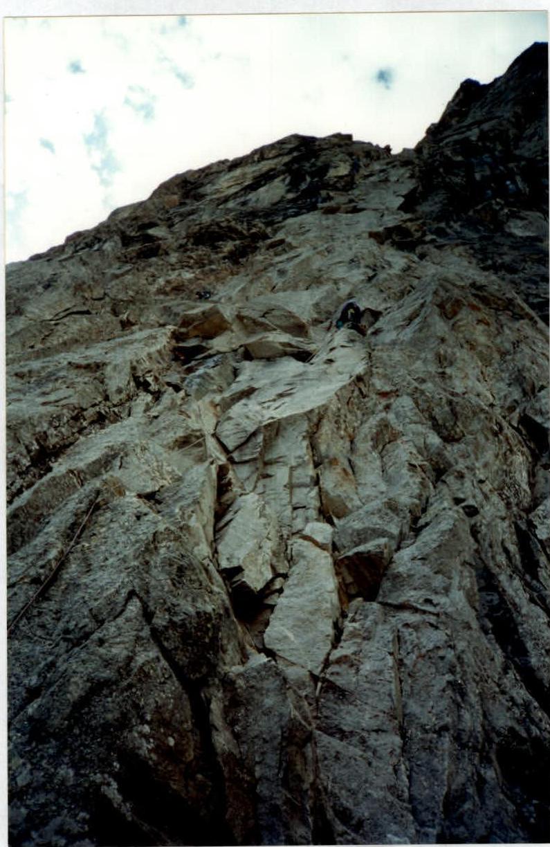
Bypassing the damaged cornice, R3
Sections R11, R12


