
PASSPORT
- Category — rock.
- Caucasus, Aksaut gorge.
- Marukh-kaya peak via the N slope and W ridge.
- Proposed — 3A cat. diff. (combined), first ascent.
- Height difference — 400 m, length — 650 m.
Average steepness of the route — 35–40°.
- Pits were not left on the route.
- Climbing hours on the route — 8.
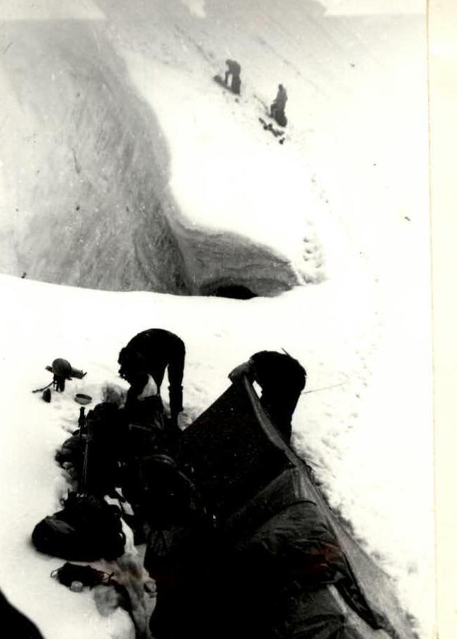
- Overnight stops — I (on Marukhkay pass).
- Leader — Bagirov Sergey Mikhaylovich, I sports category Rogachev Sergey Borisovich, III sports category Khalikov Albert Kasimovich, III sports category Krikun Marina Viktorovna, III sports category
- Coach — Korenev Eduard Anatolyevich
- Organization — Kaliningrad City Alpine Club “Edelweiss” of Moscow Region.
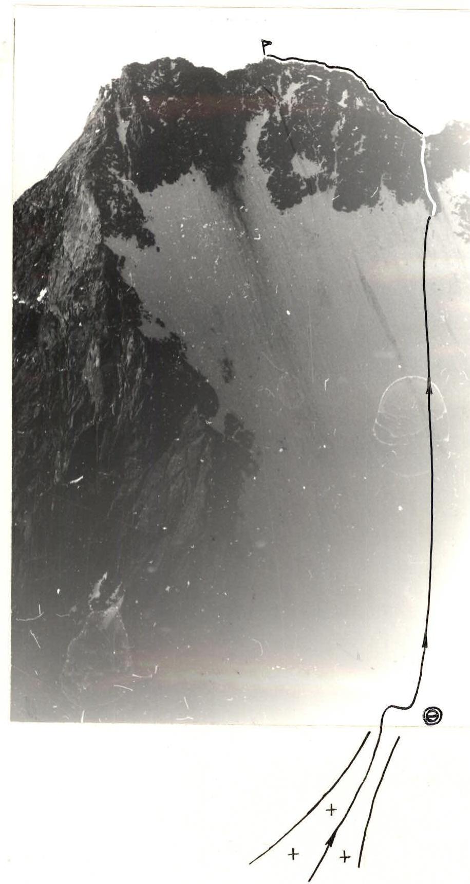
The survey was carried out from the SE ridge of Marukh-bashi peak (survey point No. I), camera — “Zenit”, distance — 0.7 km.

Route Description
to Marukh-kaya peak via the N slope and W ridge 3A cat. diff. combined. With overnight stops on the moraine or South-Karakay glacier. Approach to the bergschrund below Marukhkay pass (between Marukh-bashi peak and Marukh-kaya peak).
The bergschrund is overcome head-on in the narrowest part. Ascent to the pass via the right part of the snow couloir (300 m, steepness 35–45°). Exit to the pass via the left part of the couloir, or straight, cutting through the snow cornice. The couloir is stonefall hazardous, especially after 11-12 pm. Further ascent up the northern snow-ice slope of Marukh-kaya peak (250 m, 35–45°) in the direction of a weakly expressed gap in the western ridge, from which a rock “claw” descends down the slope. The slope is stonefall hazardous, especially in the second half of the day. In the upper part of the slope, protection is provided by ice screws.
After ascending the slope, move right onto a heavily destroyed rock “claw” with a large number of loose rocks and then up a vaguely expressed rock couloir, sticking to its left part (40 m, 30–40°, 2-3) ascent to the saddle of the western ridge. Piton protection.
Along the ridge, composed of large blocks (there are loose ones!), left (40 m, 30°, 2) and then along the flattening 40 m to the summit cairn.
Descent via the ascent route. Due to the fact that the descent from the pass in the second half of the day is stonefall hazardous, an overnight stop on Marukhkay pass is recommended. A safe bivouac spot is located on a snow pad in the right part of the pass (below the breakaway line), directly at the beginning of the SE ridge of Marukh-bashi peak.
From the South-Karakay glacier to the pass — 3-4 hours, from the pass to the summit — 2.5-3.5 hours.
Equipment for a group of 4-6 people:
- Crampons, ice axes — according to the number of participants;
- main rope — 2x40 m;
- ice screws — 4 pcs.;
- rock pitons — 3-4 pcs.;
- rock hammer — 1 pc.
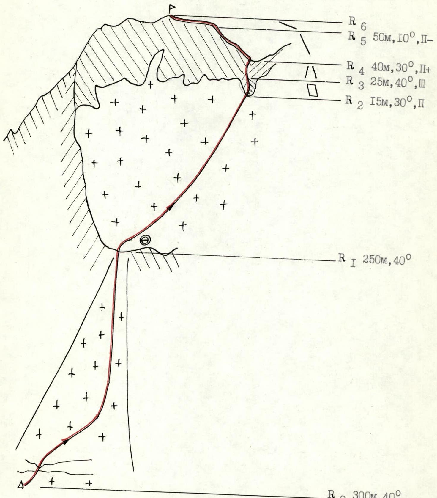
UIAA symbol route diagram
R6
R5 50 m, 10°, II-
R4 40 m, 30°, II+
R3 25 m, 40°, III
R2 15 m, 30°, II
R1 250 m, 40°
R0 300 m, 40°
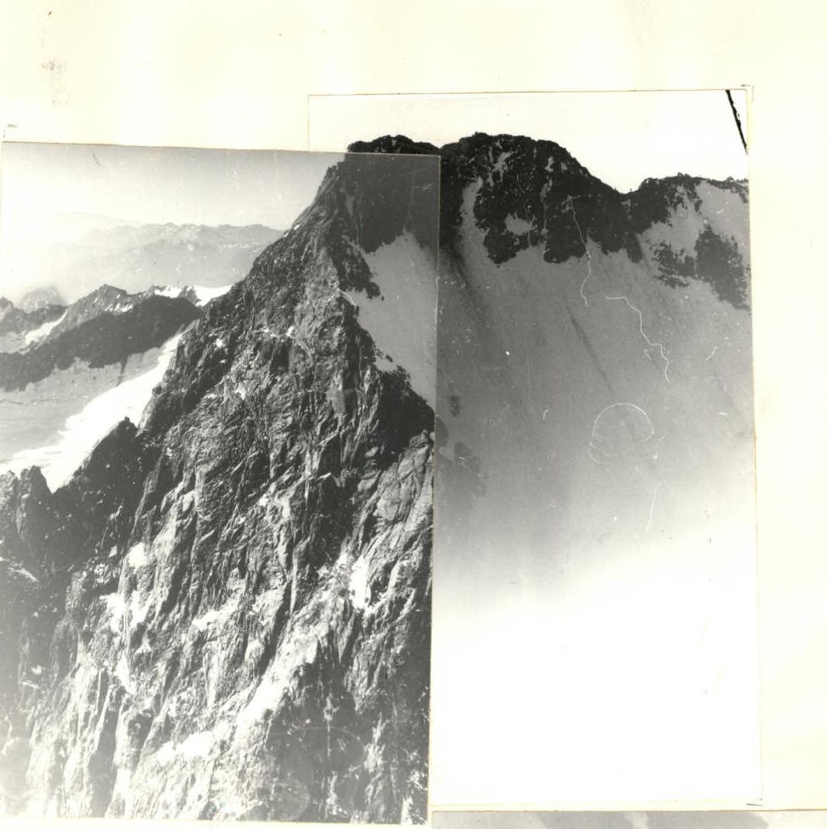
General view of Marukh-kaya peak and bivouac site on Marukhkay pass.
Comments
Sign in to leave a comment