
REPORT
- on the ascent made in the area ch. Caucasian ridge and its spurs from Marukh pass to Pakhar pass to the summit of KAP PIK (3400 m) from the Belalakaisky glacier (from the north)
Group Members:
- Slezyn Yu. — MS
- Ovcharenko V.D. — 1st sports category
- Pilipenko V.S. — 1st sports category
- Volkov L.B. — 1st sports category
- Maly A.F. — CMS
- Moskaltcov P.V. — 2nd sports category
- Babitsky A.V. — 2nd sports category
- Bondarev B.M. — 2nd sports category
- Mishustin A.G. — 2nd sports category
- Kokodii P.G. — 2nd sports category
Sports organization — tourist center "Alibek"
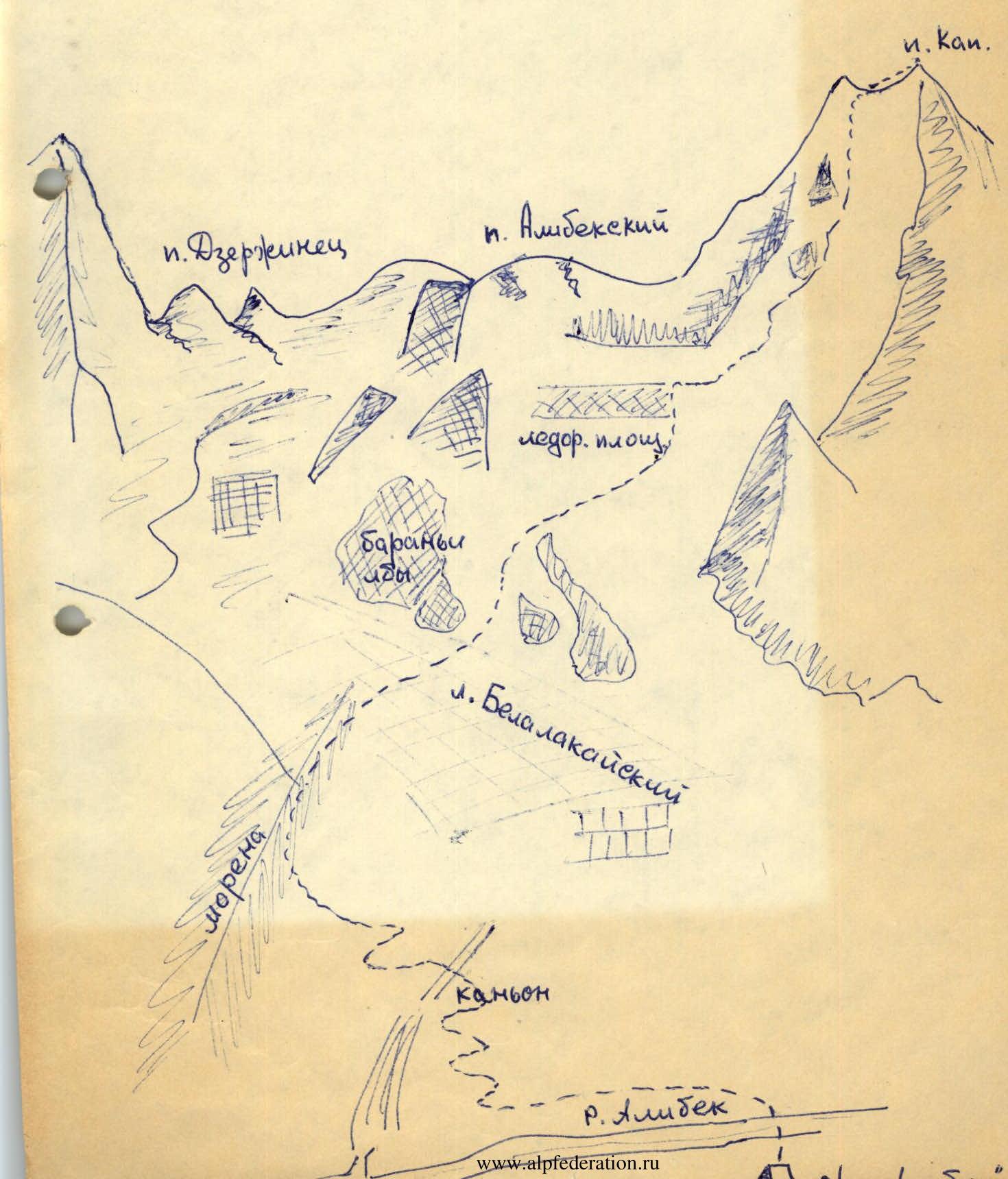
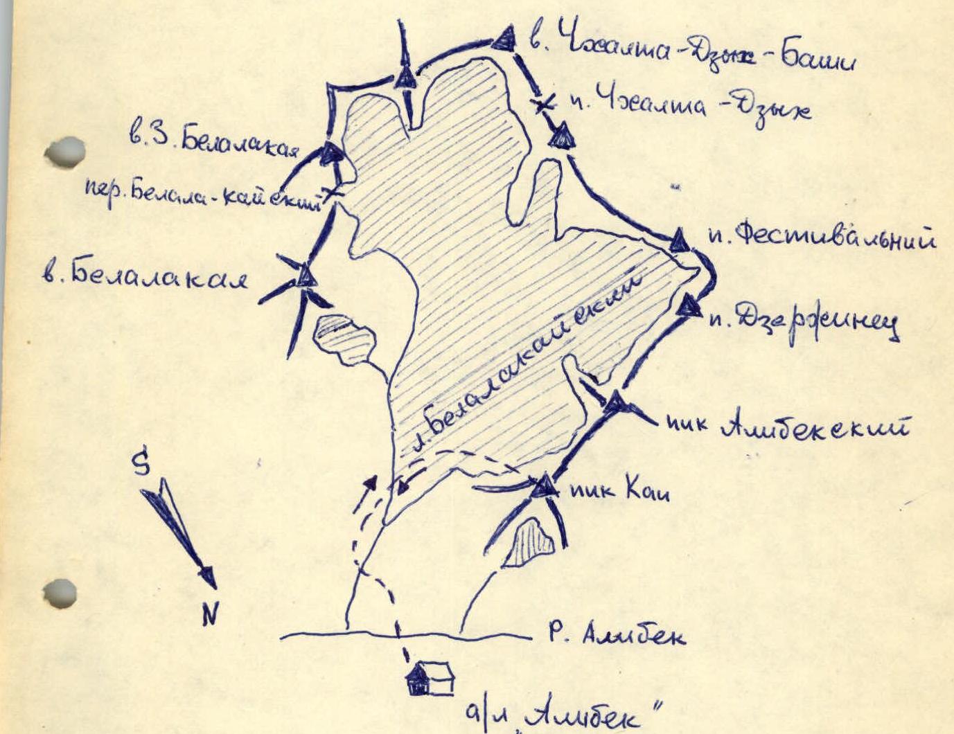
The summit of KAP PIK is located on the southern side of the Alibek river gorge.
Route:
From the Alibek tourist center, cross the bridge to the trail leading to the Belalakaisky Canyon. Up the canyon on the trail leading to the training cliffs, past them to the Belalakai bivouac site. From the camp 1 hour 30 minutes. From the bivouac site, follow the trail to the bridge over the river flowing from the Belalakaisky cirque, to the other side of the river. Then, follow the trail to the moraine ridge and along the ridge to the Belalakaisky cirque. Crossing it, approach the eastern slopes of Kap peak. From the Belalakai bivouac site 1 hour 30 minutes. Up the slope to the "ram's foreheads". From them, up and to the right to the saddle between Kap peak and Alibeksky peak. From the saddle, ascend along the rocky ridge to the summit (belaying!).
From the Belalakai bivouac site to the summit 5-6 hours. Descent via the ascent route.
The route is objectively safe, featuring diverse rocky and snowy-icy terrain.
The group believes that this route corresponds to category 1B difficulty and recommends it for mountaineers at the II stage of training as part of a team.

View from the north.
Comments
Sign in to leave a comment