Report
On the ascent of the Karachay-Cherkess Republic team to the summit of Pik Maly Ine (Gold) 3060 m
via the right buttress of the western wall. Presumably IV-B category of difficulty. First ascent.
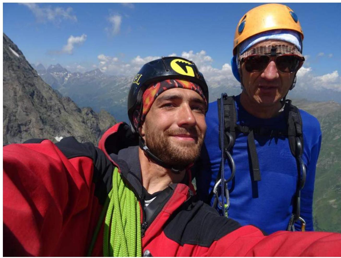
Semyonov M. A. — leader, Popov M. L. — Candidate for Master of Sports
2. Caucasus
2.2 From Marukh Pass to Nakhar Pass
Participants of the ascent
- Leader — Semyonov Mikhail Alexandrovich, Candidate for Master of Sports. Coach — Shipilov V. A. Address: 144001, Elektrostal, Oktyabrskaya st., 8, apt. 117. Tel.: +7 (906) 724–94–53. Email: aravigehc@mail.ru
- Popov Mikhail Lvovich, Candidate for Master of Sports, Essentuki. Coach — Motienko N. I.
Ascent Passport
- Western Caucasus, Dombay region, section 2.2 of the route classifier for mountain peaks.
- Pik Ine Maly (Pik Zoloto) 3060 m. Via the eastern ridge.
- Proposed category of difficulty: 4B. First ascent.
- Rock climbing route.
- Height difference: 680 m. Route length: 970 m. Length of sections with category IV difficulty: 175 m Length of sections with category V difficulty: 130 m Average steepness: 60°.
- Number of pitons left on the route: 1
- Team's total climbing time: 15 hours, 2 days.
- Descent from the summit via route 2A, category of difficulty 2A, along the southwestern ridge.
- Leader: Semyonov Mikhail Alexandrovich, Candidate for Master of Sports, coach Shipilov V. A. Participant: Popov Mikhail Lvovich, Candidate for Master of Sports, coach Motienko N. I.
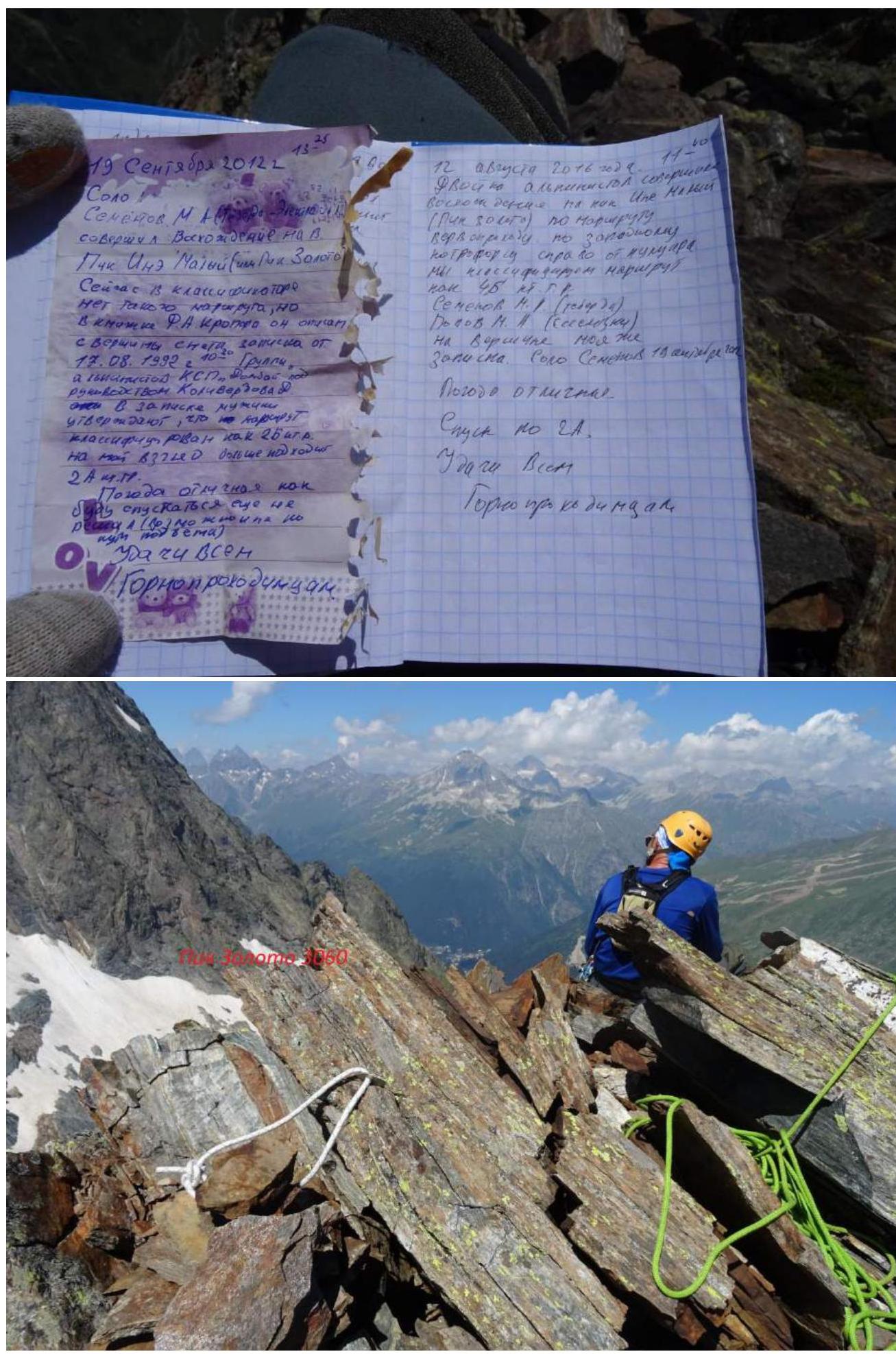
- Start of the route: 11:00, August 11, 2016. Summit reached: 11:40, August 12, 2016.
- Alpclub "ARKHYZ", alpclub "FREELINE".
- Responsible for the report: Semyonov M. A. aravigehc@mail.ru
Description of the Ascent Area
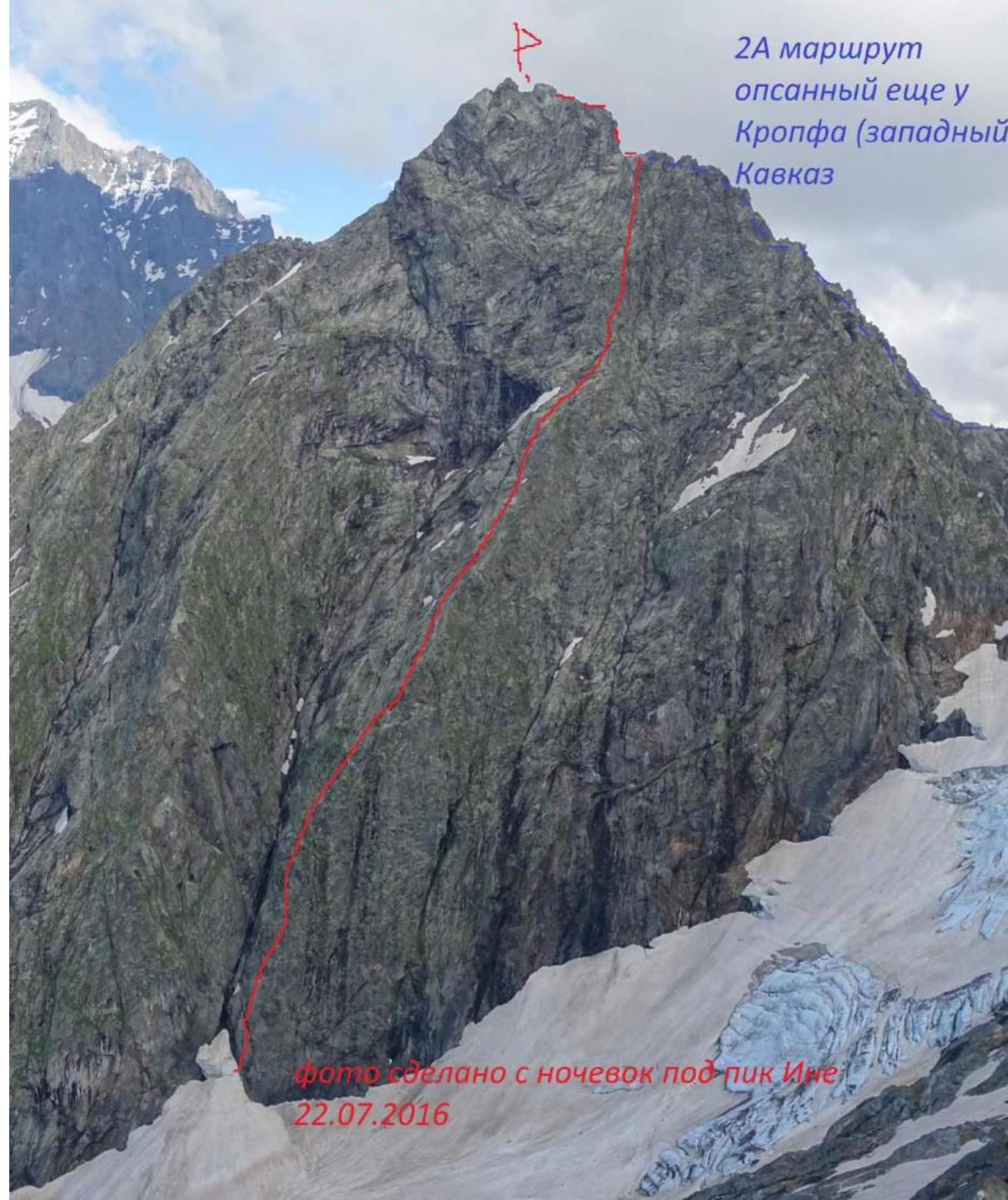
The summit of Pik Ine Maly (Pik Zoloto) 3060 m is located on a spur from the Main Caucasian Range in the Dombay-Ulgen gorge, immediately behind the Pik Ine summit. Hence, probably, the name Pik Ine Maly. The classic route to Ine Maly starts from the Ptysh campsites. The last ascent of this mountain was made on August 18, 1992, as far as I know. During this ascent, an accident occurred — a participant fell, and rescue operations were carried out. I understand that the rescuers set up campsites directly before the start of route 2A. It was the only route climbed on this mountain, described in F. A. Kropf's book "Western Caucasus". Unfortunately, it disappeared from the classifier, although the route is quite logical and can be recommended as a first ascent with a category of difficulty 2A. The path to the summit begins from the Dombay glade, through the Dombay-Ulgen gorge. Just before the fork to the Chuchkhur waterfalls and the trail to the Ptysh gorge, it's possible to drive up to this point in an off-road vehicle. On foot, it takes approximately 1.5 hours. It's convenient to cross the river at its widest point. Then, move along the grassy slopes past the waterfall, which falls between the summits of Pik Zoloto and Pik Ine. The waterfall is passed on the right side. Continue upwards, past the glacier under the walls of Pik Zoloto (the glacier remains on the right), to the first moraine with grass. A good bivouac site was set up on the moraine — suitable for one tent (there is water). From the Dombay glade, it takes 3–4 hours.
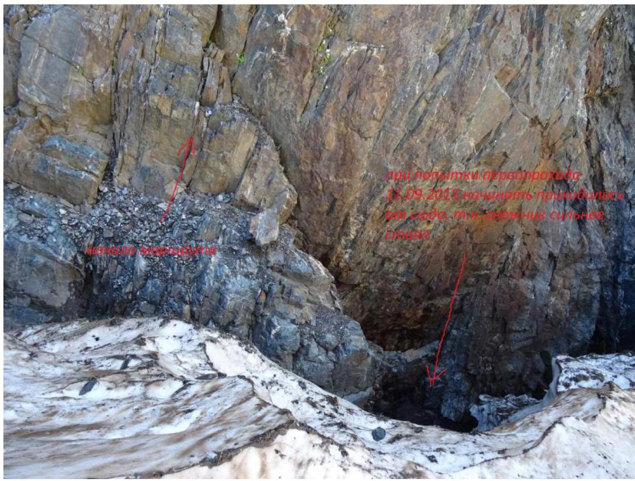
The idea to climb this route arose from studying old descriptions by Ferdinand Aloizovich Kropf. On September 19, 2012, I climbed the route to Pik Zoloto. From its summit, quite steep walls drop towards Pik Ine. When I mentioned this observation, Shipilov V. A. told me that in his youth, he had an idea to climb this wall, and that the route should be at least category 5. In September 2015, a first attempt was made to make the first ascent of this buttress on the mountain, in a team of two with Vlad Tkachenko (Teberda). Then, a good campsite was set up opposite the wall on Pik Zoloto, immediately after the glacier. The site was solid, large, flat, with water nearby. In 2015, we climbed 5 ropes (the first one was lower than the current one because, at that time of year, the snowpatch under the wall recedes more, and the first rope goes through a slightly overhanging wall with good holds). We lost a lot of time searching for a good start and climbing the 4th rope. We were not prepared for a cold bivouac, so it was decided to retreat. In July 2016, I, together with Popov M. L., decided to make two first ascents: the first one on Pik Ine via the eastern ridge, and the second one on Pik Ine Maly via the right buttress of the Western wall. However, due to three days of bad weather, we managed to complete only the first ascent on Pik Ine; there was not enough time for Pik Zoloto. In August, we decided to make another attempt.
Pik Ine Maly (Pik Zoloto) 3060 m
2A route, described in Kropf's book (Western Caucasus).
| Section | Col2 | Col3 | Col4 | Col5 | Col6 | Col7 | Col8 | Length (m) | Steepness | Col11 | Category of difficulty |
|---|---|---|---|---|---|---|---|---|---|---|---|
| R0–R1 | - | - | - | - | - | - | - | 30 | 35° | - | 2 |
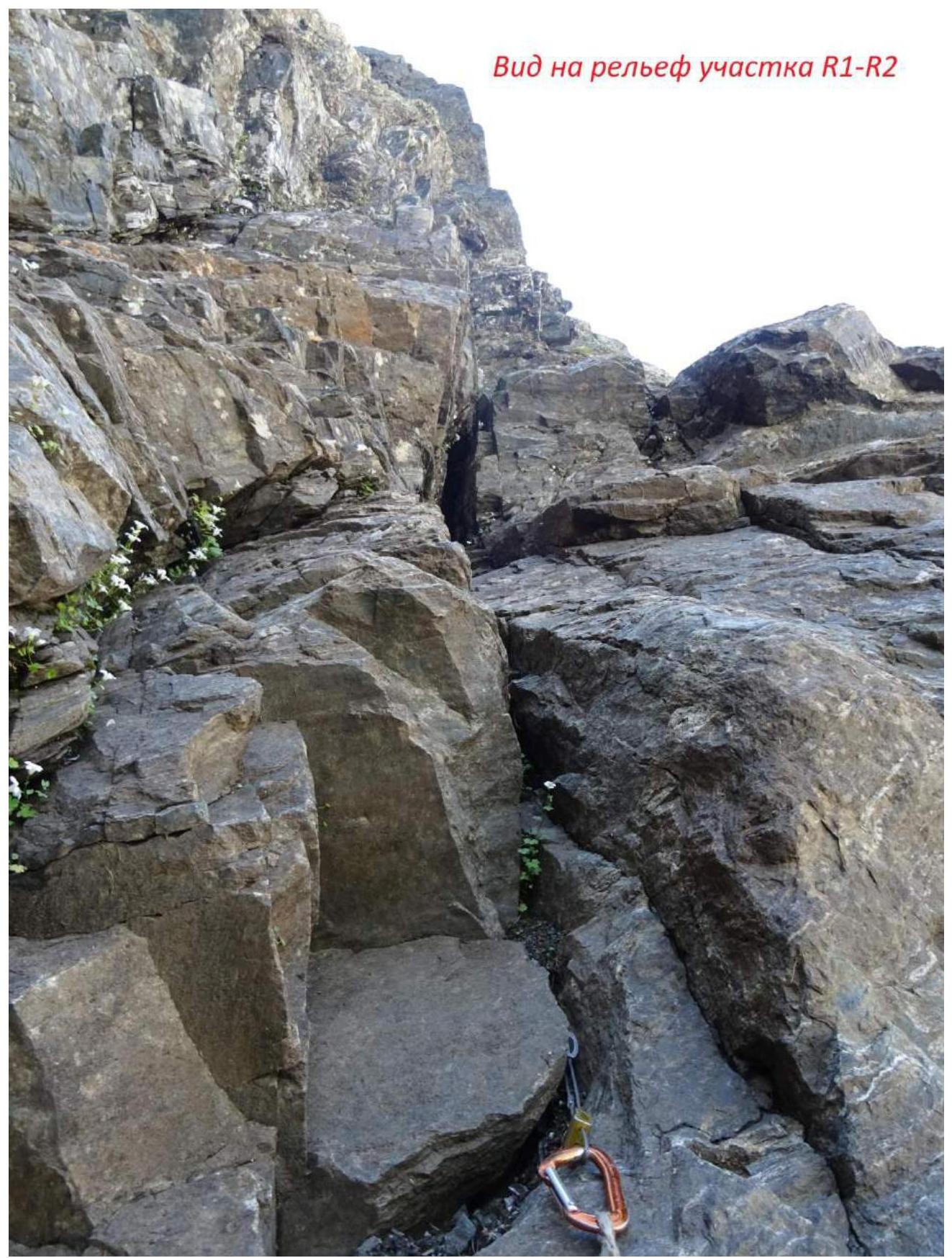
| R1–R2 | - | - | - | - | - | - | - | 35 | 70–75° | - | 5 |
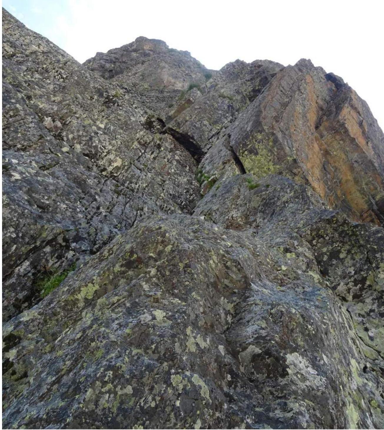
| R2–R3 | - | - | - | - | - | - | - | 40 | 45° | - | 4- |
| R3–R4 | - | - | - | - | - | - | - | 45 | 80° | - | 5+ |
| R4–R5 | - | - | - | - | - | - | - | 50 | 75° | - | 5 |
| R5–R6 | - | - | - | - | - | - | - | 45 | 70° | - | 4+ |
| R6–R7 | - | - | - | - | - | - | - | 50 | 45° | - | 2+ |
| R7–R12 | - | - | - | - | - | - | - | 250 | 40–50° | - | 2–3 |
| R12–R13 | - | - | - | - | - | - | - | 45 | 60° | - | 4 |
| R13–R14 | - | - | - | - | - | - | - | 45 | 60° | - | 4- |
| R14–R15 | - | - | - | - | - | - | - | 45 | 65° | - | 3+ |
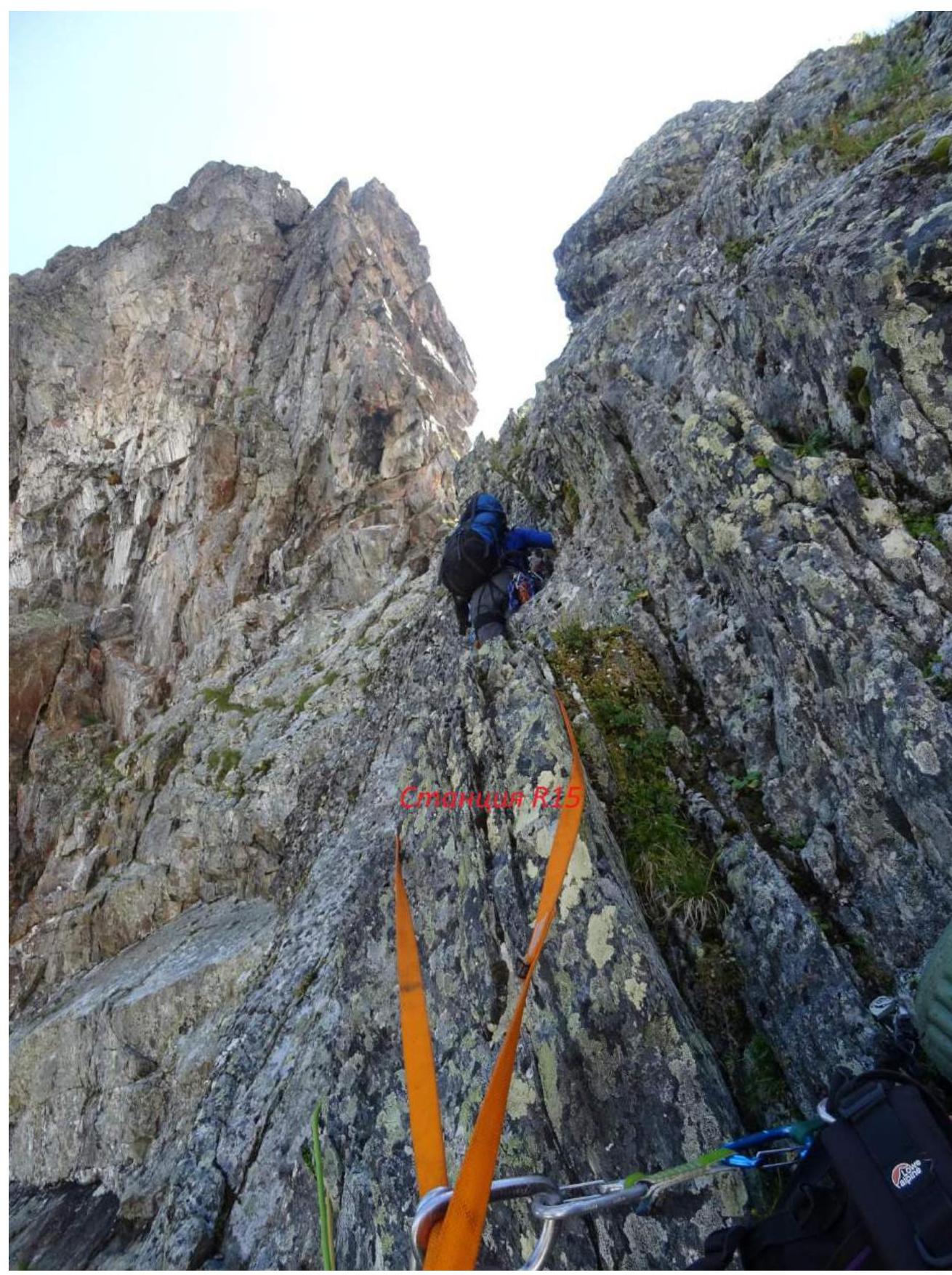
| R15–R16 | - | - | - | - | - | - | - | 15 | 60° | - | 3+ |
| R16–R17 | - | - | - | - | - | - | - | 150–200 | 50° | - | 2 |
Route Description by Sections
R0–R1 — cross from the snowpatch to a stepped scree shelf and along it to the wall (on the right) with a cleft. At the time, the transition from the snow was straightforward (a wide step from the snow to the shelf and walking along it to the wall). A year ago, the snowpatch had receded more, and an additional rope was used for the slightly overhanging cleft with good holds, category V. 30 m, 35°, 2-.
R1–R2 — climb the cleft (internal corner) upwards to a fork, then to the right and upwards — a convenient belay station. 35 m, 70–75°, 5.
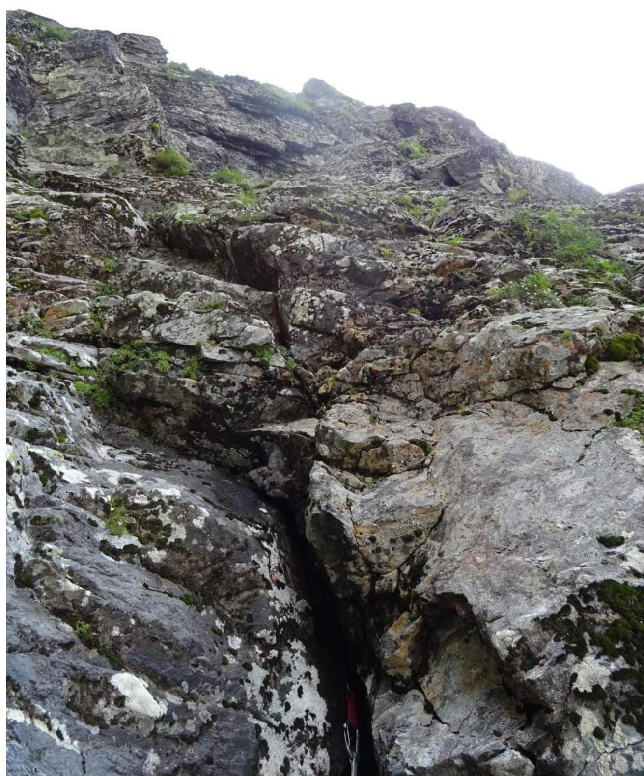
R2–R3 — climb the internal corner and then an inclined cleft to exit into a couloir and a little further along it to a convenient belay station. Problems with protection. 40 m, 45°, 4-.
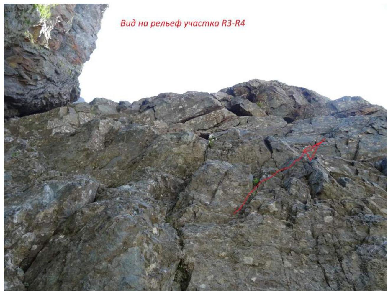
R3–R4 — climb directly up the wall to an inclined cleft (ledge), then to the right and upwards along the wall with few holds — exit onto a small ledge, a control cairn. Problems with protection. 45 m, 80°, 5+.
R4–R5 — climb up the wall with a cleft, exit onto simpler terrain. 50 m, 75°, 5.
R5–R6 — climb left and upwards along the terrain to a convenient ledge, difficulties with protection. 45 m, 70°, 4+.
R6–R7 — climb left and upwards along the terrain to a place remotely resembling a grotto. 50 m, 45°, 2+.
R7–R12 — follow the direction of the buttress upwards along the terrain, with some problems with protection, to a snowpatch (here we had a bivouac), another rope, following the same direction. 250 m, 40–50°, 2–3.
R12–R13 — climb up the internal corner. 45 m, 60°, 4.
R13–R14 — climb as easily as possible to the right and upwards. 45 m, 60°, 4-.
R14–R15 — climb a few meters to the right and upwards along the internal corner, then left and upwards — transition into another internal corner and climb up it. 45 m, 65°, 3+.
R15–R16 — continue moving upwards towards the saddle on the ridge of route 2A. 15 m, 60°, 3+.
R16–R17 — the route then coincides with route 2A along the southwestern ridge of Maly Pik Ine, along the ridge mostly on the right side to the summit. The summit is double-peaked, on one of the peaks lies a cairn, and I also hammered in a titanium piton as a landmark during my solo ascent. 150–200 m, 50°, 2.
Leader of the ascent: Semyonov M. A. Participants: Popov M. L. Coaches: Shipilov V. A., Motienko N. I.
12
View of the terrain on section R1–R2
View of section R2–R3
View of the terrain on section R3–R4
View of the terrain on section R4–R5
View from station R4 upwards
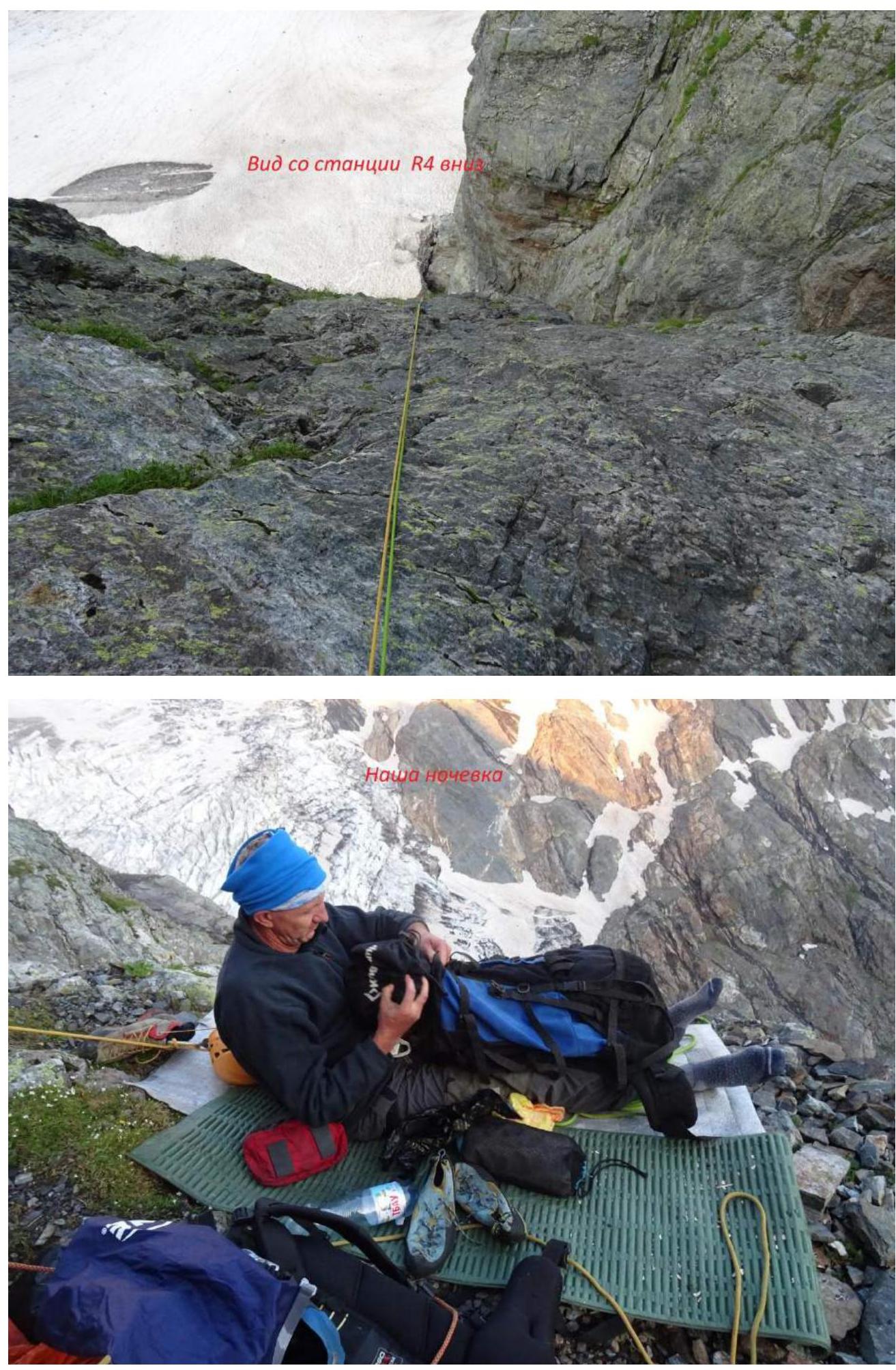
Our bivouac
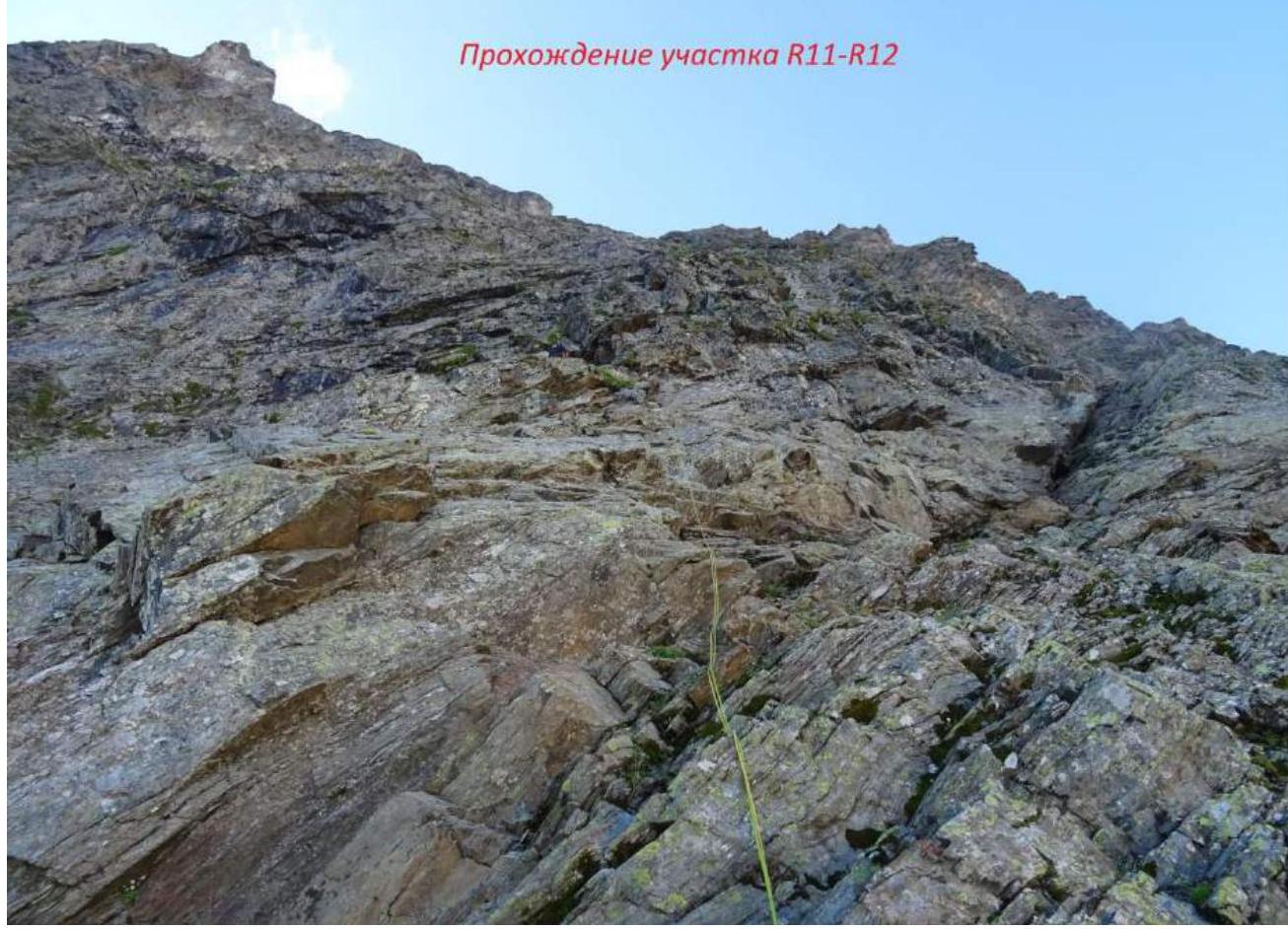
Climbing section R11–R12
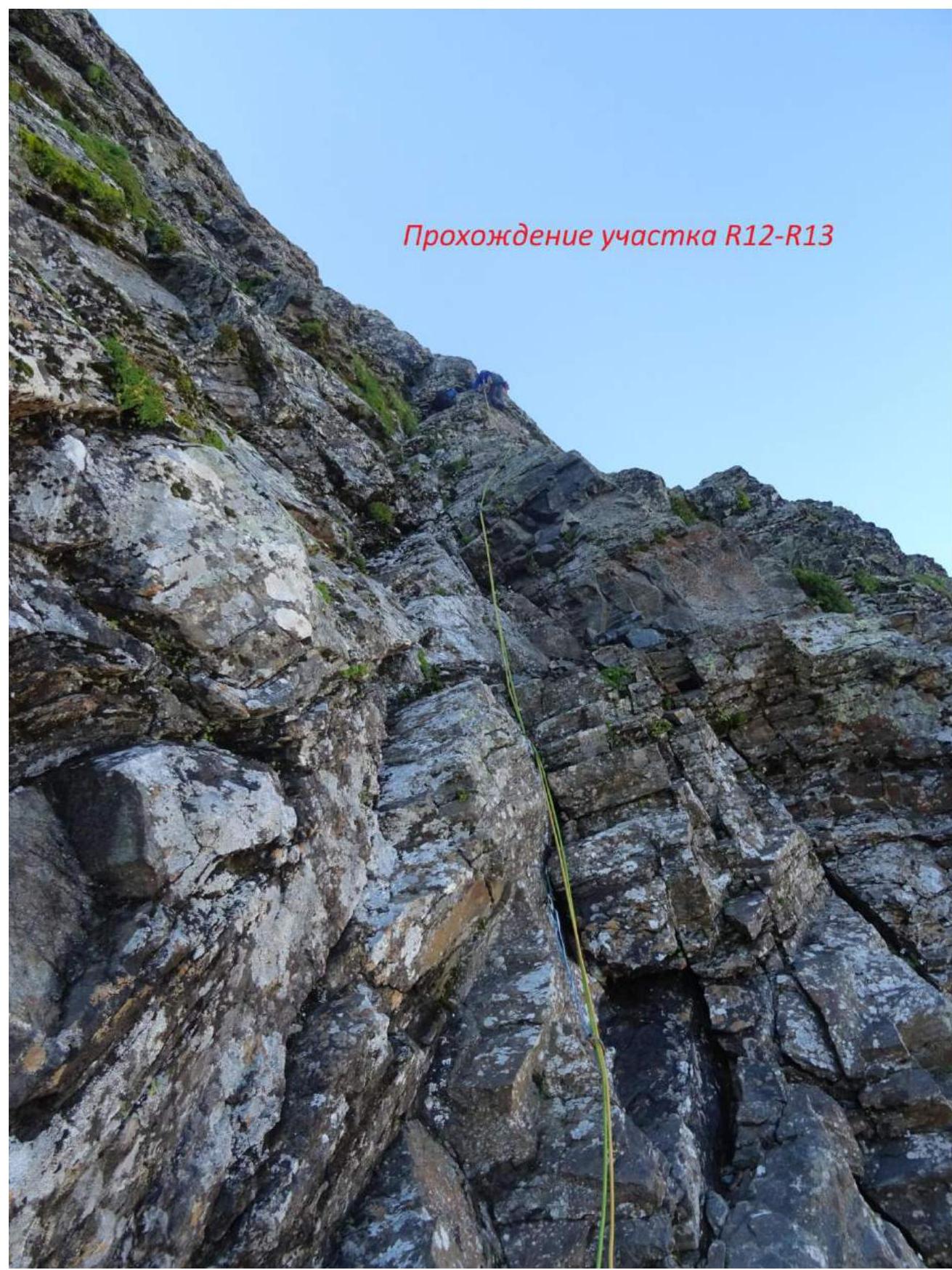
Climbing section R12–R13
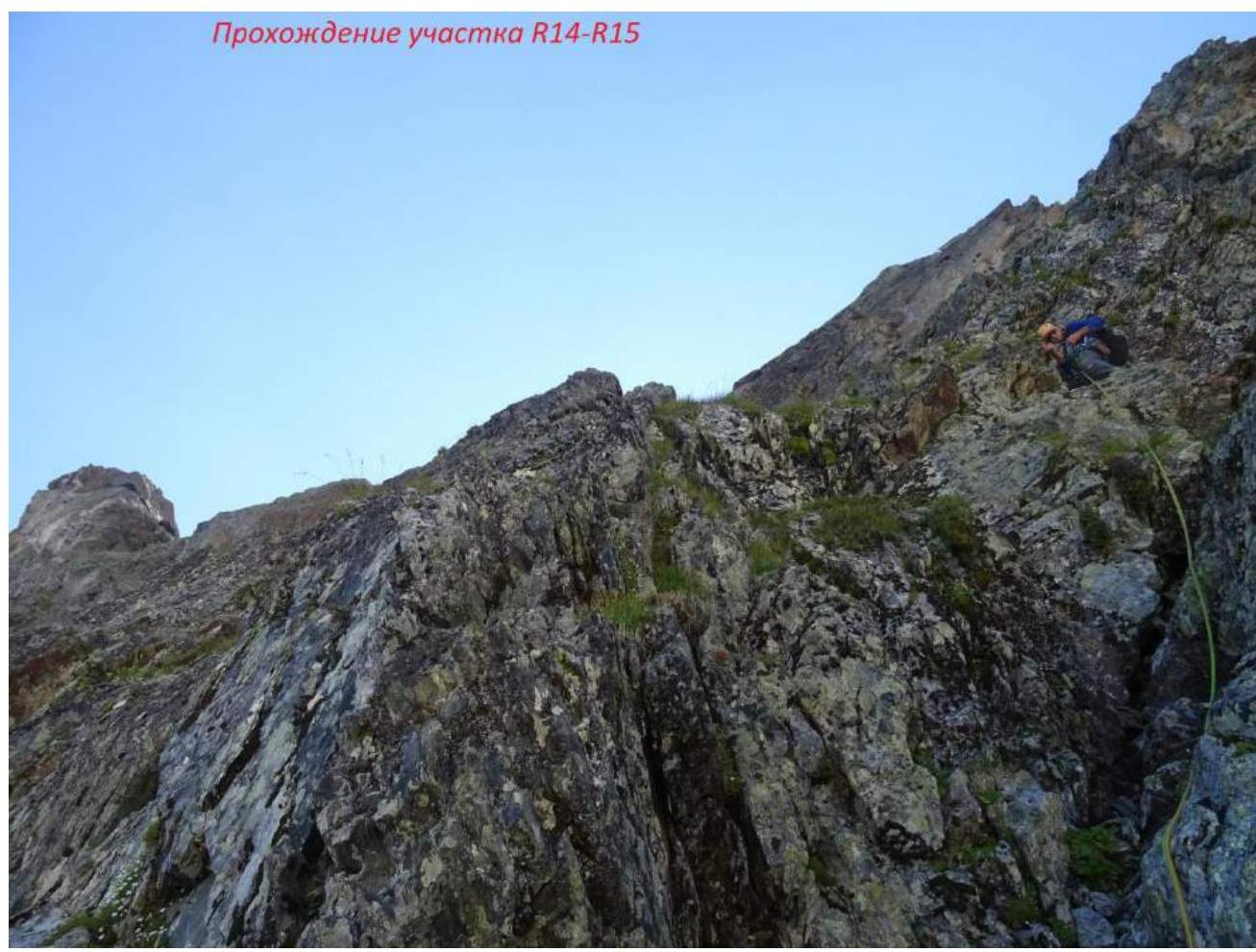
Climbing section R14–R15
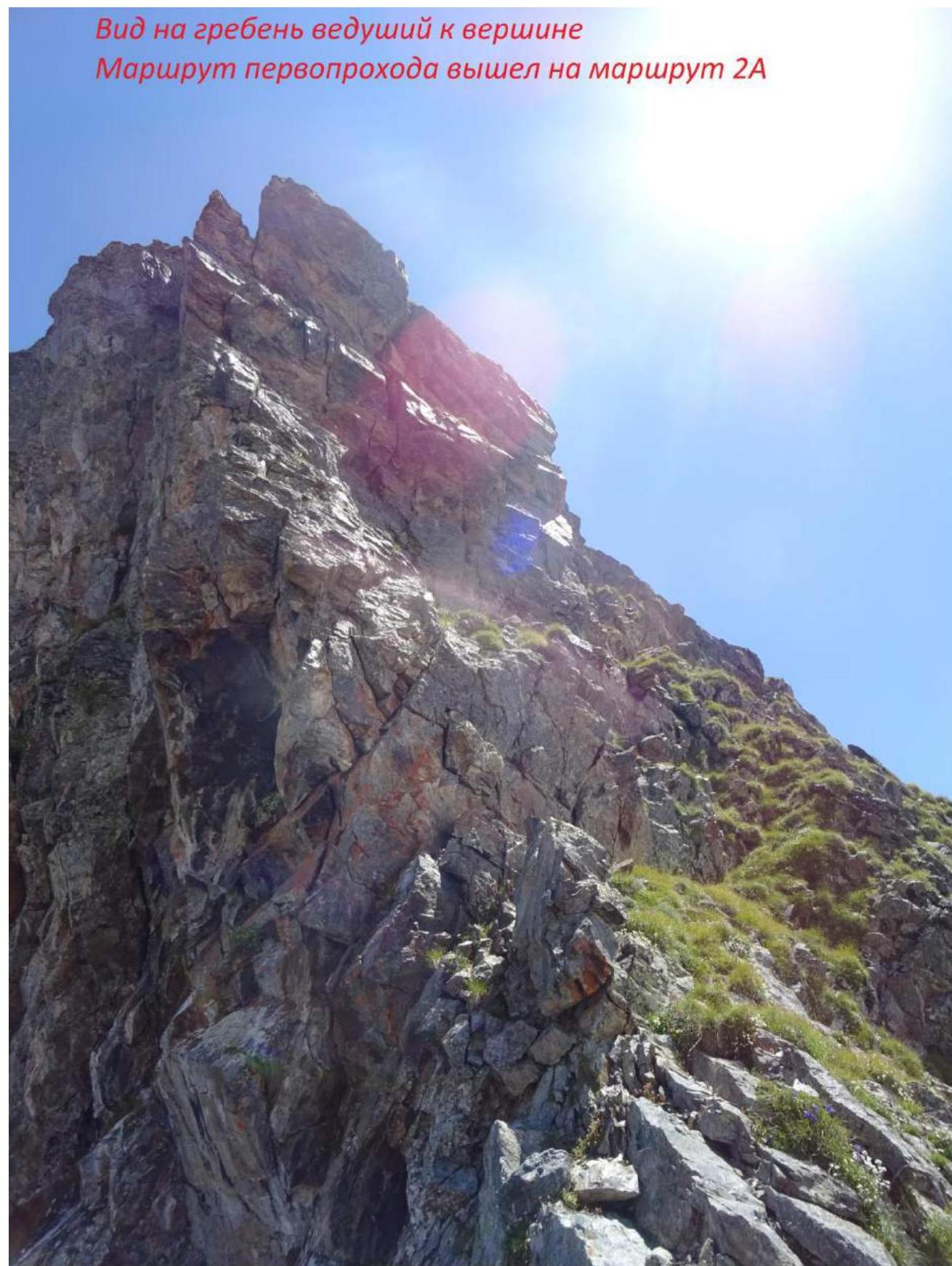
View of the ridge leading to the summit.
The first ascent route merged with route 2A.
23
24


