
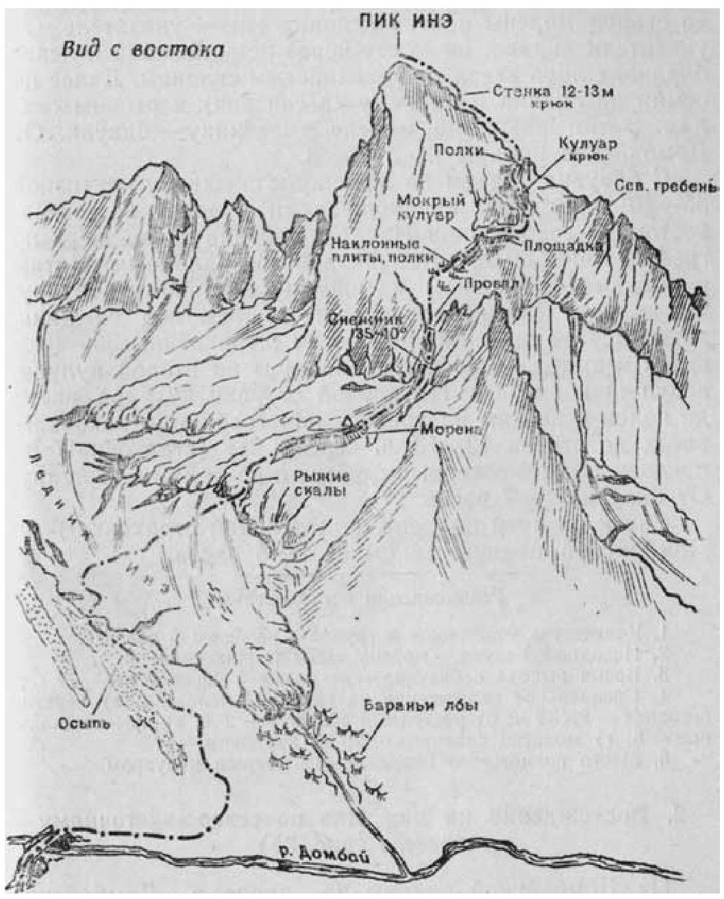
Fig. 34
1. Ascent to Peak Ine (3409 m) from the northeast — category 2A difficulty (Fig. 34)
From Dombayskaya Polyana along the trail to Dombayskoye valley to the old moraine opposite the Ine glacier — there is a signpost. From the signpost to the right, across the bridge over the Dombay river and to the left of the "ram's foreheads" up the grassy slopes. Further along the scree to the glacier and on it (in teams) to the "red rocks". Then up the moraine to the glacier bivouac. From Dombayskaya Polyana 4–5 hours.
From the bivouac, ascent along the glacier to a snowfield with a slope of 35–40° and along it up to the right to a gap in the north-eastern ridge of Peak Ine. From the gap up to the left along the ridge for 180–200 m, then to the right along inclined slabs and ledges (belay!) to a wet rocky couloir. Up the couloir (danger of rockfall!) to below a snowfield, then to the right of the snowfield along the rocks (belay!) 30–40 m up and exit left above the snowfield to the second couloir leading to the ridge. Up the right side of the couloir to the ledges and along them to the ridge. Along the ridge (belay!) up to a 12–13 m wall, over it (belay!) to the pre-summit northern ridge and along it to the summit. From the bivouac 6–7 hours.
Descent by the ascent route (careful belay!) to Dombayskaya Polyana takes 5–6 hours.
Recommendations for climbers
- Number of participants in the group — no more than 6 people.
- Initial bivouac — moraine above the "red rocks".
- Departure time from the bivouac — no later than 5:00 am.
- Special equipment for a group of 4 people: a) main rope 2 × 30 m; b) expendable reepschnur — 2 m; c) rock pitons — 5; d) rock hammers — 2; e) karabiners — 8.
- Possible bivouac location — behind the wet couloir.
Comments
Sign in to leave a comment