Report
On the Ascent
TO THE SUMMIT OF FISHT 2867 m VIA THE NORTH-EAST RIDGE ROUTE, CATEGORY 2B DIFFICULTY BY THE "FREELINE" MAC TEAM FROM JUNE 28, 2024 TO JUNE 30, 2024
2024
I. Ascent Passport
| № | 1. General Information | |
|---|---|---|
| 1.1 | Full Name, Sports Rank of the Leader | Kovalev Roman Alexandrovich, 1st sports rank |
| 1.2 | Full Name, Sports Rank of Participants | Timoshina Victoria Alexandrovna, 3rd sports rank. Laptev Alexander Vladimirovich, 3rd sports rank. |
| 1.3 | Full Name of Coach | Motienko Nikolai Ilyich, CMS |
| 1.4 | Organization | MAC "Freeline" |
| 2. Characteristics of the Ascent Object | ||
| 2.1 | Region | Krasnodar and Stavropol Krais up to Marukh Pass |
| 2.2 | Valley | |
| 2.3 | Number of Section According to the 2013 Classification Table | 97 |
| 2.4 | Name and Height of the Summit | Fisht, 2867 |
| 2.5 | Geographical Coordinates of the Summit (Latitude/Longitude), GPS Coordinates | 43°57′13″ N 39°54′11″ E |
| 3. Characteristics of the Route | ||
| 3.1 | Name of the Route | NE ridge |
| 3.2 | Proposed Category of Difficulty | 2B |
| 3.3 | Degree of Route Exploration | |
| 3.4 | Nature of the Route Terrain | K |
| 3.5 | Height Difference of the Route (altimeter or GPS data) | 1167 m |
| 3.6 | Length of the Route (in meters) | 2400 m |
| 3.7 | Technical Elements of the Route (total length of sections of varying difficulty with terrain characteristics) | 1st cat. rock, glacier – 1100 m. 2nd cat. rock – 940 m. 3rd cat. rock – 300 m. 4th cat. rock – 60 m. |
| 3.8 | Descent from the Summit | Via route 1B, S-slope |
| 3.9 | Additional Route Characteristics | |
| 4. Characteristics of the Team's Actions | ||
| 4.1 | Time of Movement (team's walking hours, in hours and days) | 14 hours |
| 4.2 | Overnight Stays | no |
| 4.3 | Departure on the Route | 05:30, June 29, 2024 |
| 4.4 | Arrival at the Summit | 16:40, June 29, 2024 |
| 4.5 | Return to Base Camp | 19:30, June 29, 2024 |
| 5. Person Responsible for the Report | ||
| 5.1 | Full Name, e-mail | Kovalev Roman Alexandrovich, trogvar.kmv@gmail.com |
II. Description of the Ascent
1. Characteristics of the Ascent Object
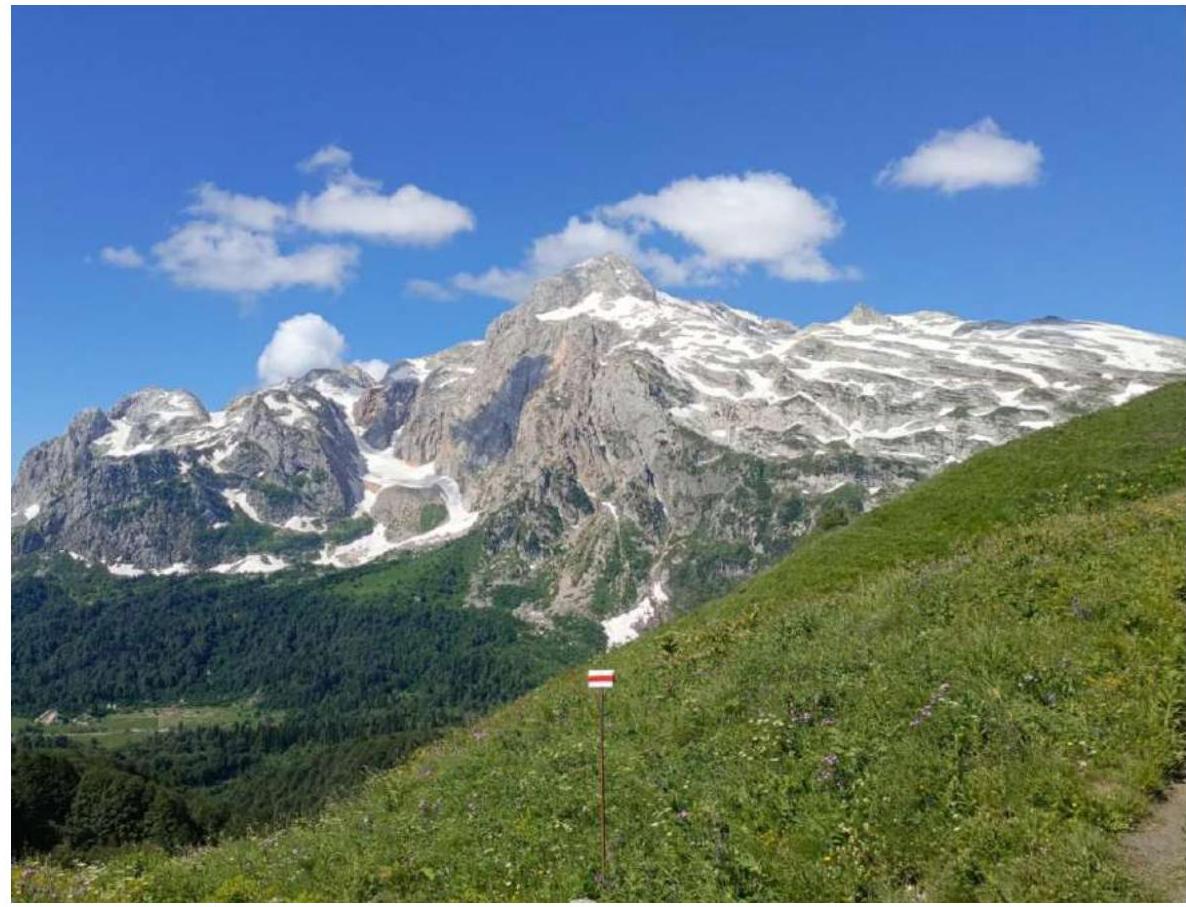 1.1. General photo of the summit
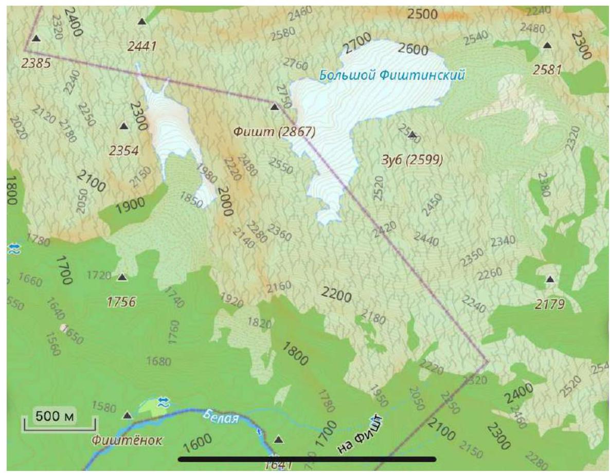 1.2. Map of the area
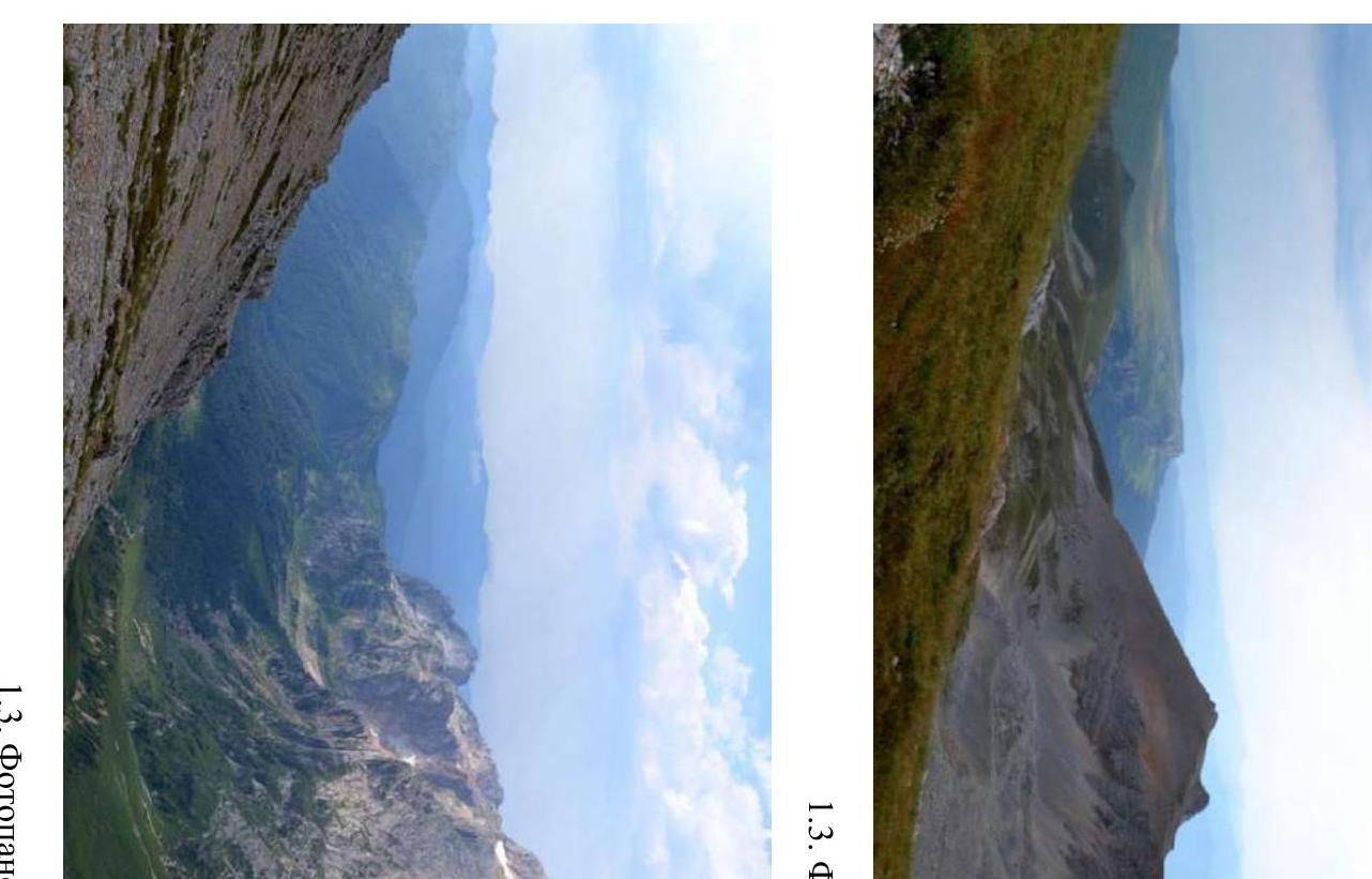 1.3. Photopanorama of the area
 1.3. Photopanorama of the area (continued)
2. Characteristics of the Route
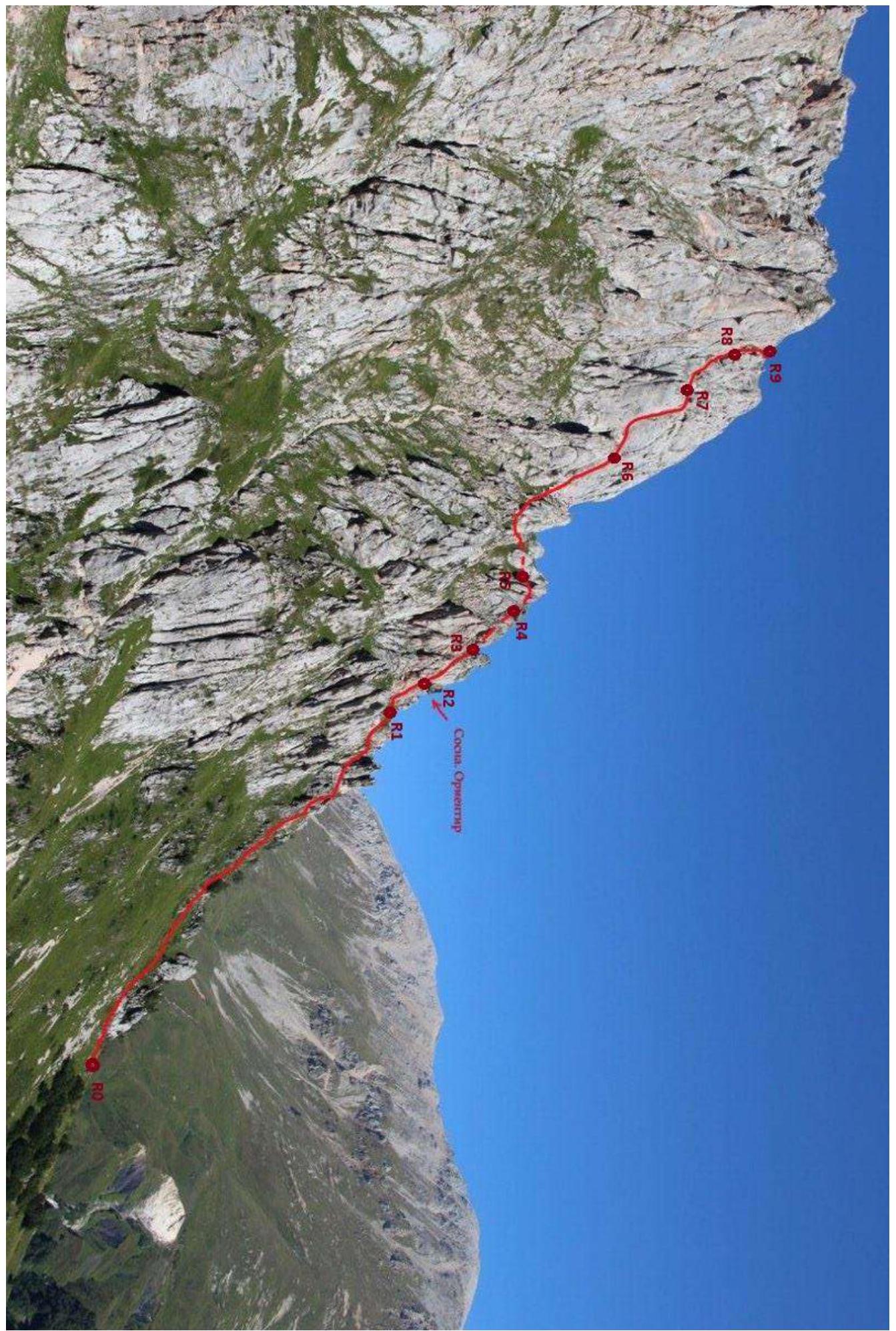 2.1. Technical photograph of the route (rocky part)
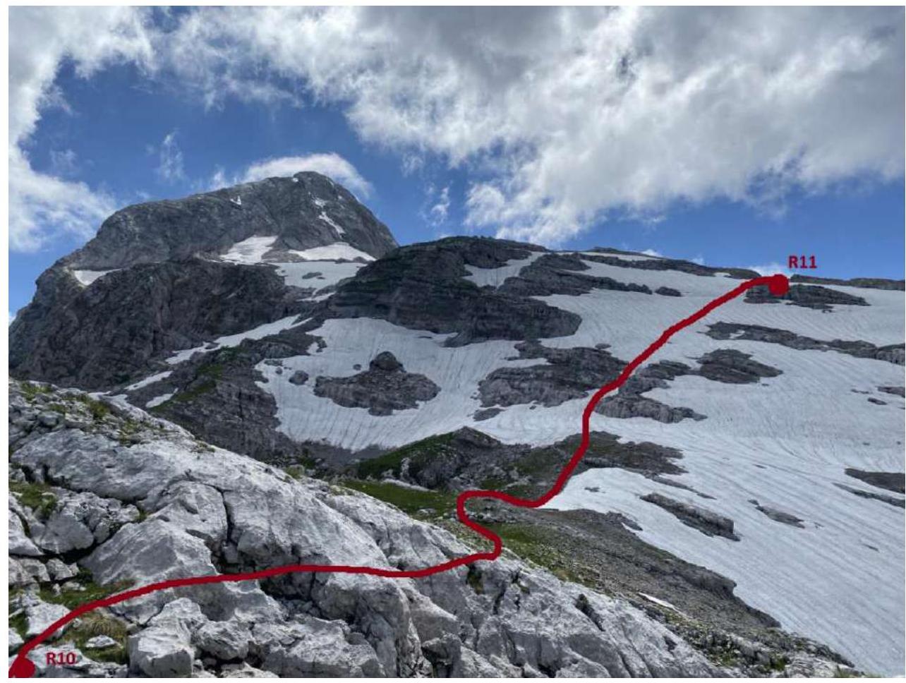 2.1. Technical photograph of the route (exit to the plateau)
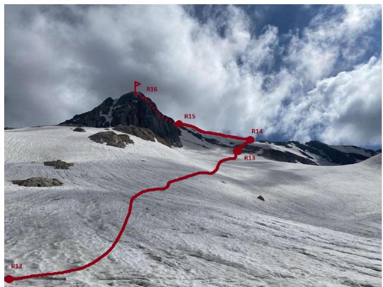 2.1. Technical photograph of the route (snow-ice part)
2.3. Technical characteristics of the route sections
| Section № | Terrain Characteristics | Category of Difficulty | Length, m | Steepness | Type and Number of Pitons |
|---|---|---|---|---|---|
| R0–R1 | Grassy ridge, rocky walls | 1 | 310 | 35° | 0 |
| R1–R2 | Shelf, rocky wall | 3 | 40 | 45° | 2 |
| R2–R3 | Rocky wall, rocky couloir | 3 | 50 | 45° | 3 |
| R3–R4 | Shelf, wall, ridge | 3 | 40 | 45° | 2 |
| R4–R5 | Ridge | 3 | 40 | 35° | |
| R5–R6 | Grassy slope, rocky ridge, rocky wall | 2–3 | 100 | 45° | 1 |
| R6–R7 | Cleft, inner corner | 4–3 | 60 | 65° | 6 |
| R7–R8 | Walls, chimney | 3–4 | 60 | 65° | 6 |
| R8–R9 | Walls, ridge | 2 | 60 | 45° | 1 |
| R9–R10 | Slabs | 1 | 100 | 35° | |
| R10–R11 | Ridge | 2 | 300 | 25° | |
| R11–R12 | Plateau | 1 | 250 | 15° | |
| R12–R13 | Glacier | 1 | 450 | 25° | |
| R13–R14 | Snow ridge, rocks | 2 | 120 | 45° | |
| R14–R15 | Snow ridge | 2 | 300 | 30° | |
| R15–R16 | Ridge | 2 | 120 | 10° |
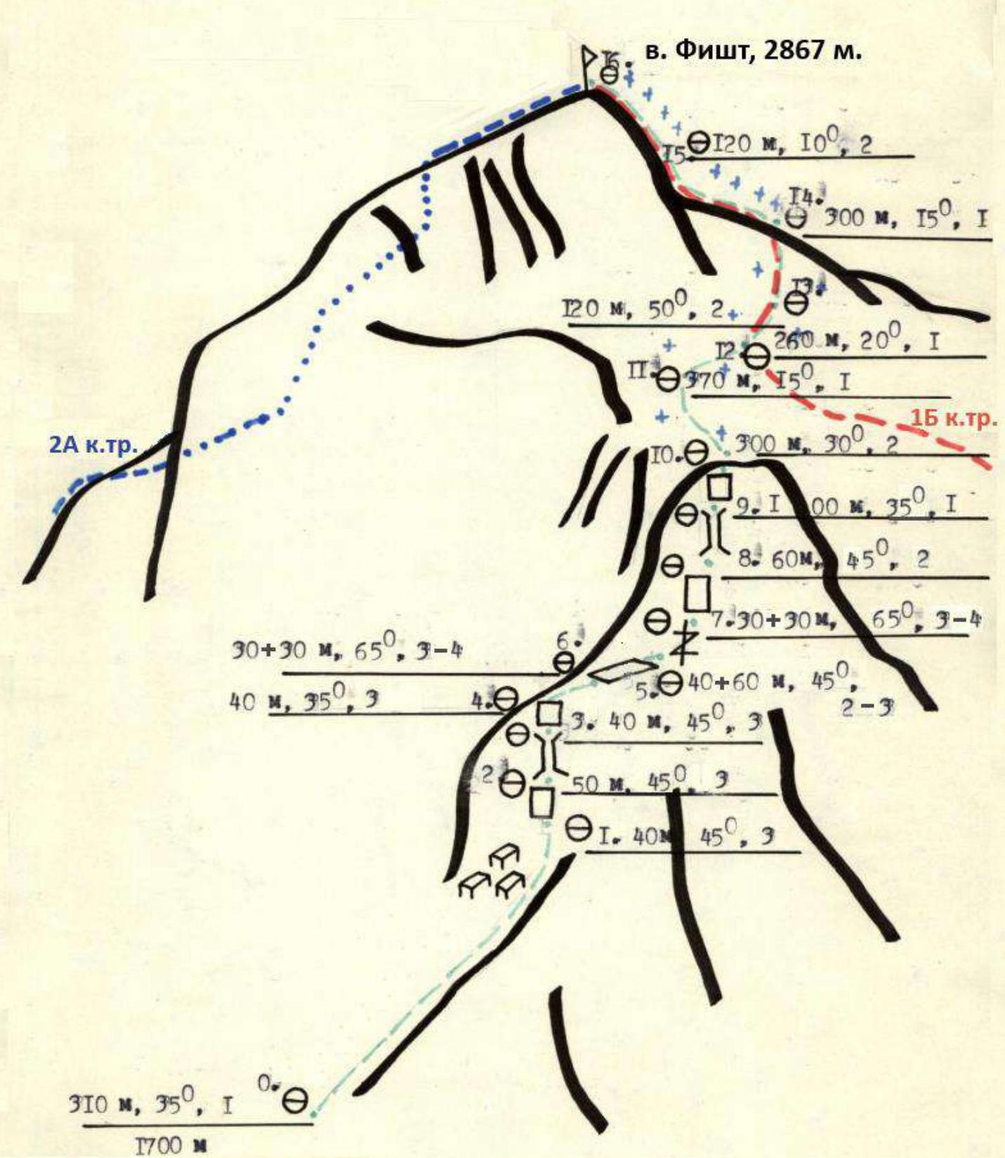
2.4. Technical diagram of the route sections in UIAA symbols
3. Characteristics of the Team's Actions
| Section № | Description | Notes |
|---|---|---|
| R0–R1 | From the "Fisht" tourist shelter, follow the marked trail to the base of the NE ridge, orienting towards a lone pine tree under the base of the first wall of the ridge. Then upwards along the grassy ridge with rock outcrops and small rocky walls. | |
| R1–R2 | Upwards to the left along the shelf, at the end of which there is a transition to the rocky wall and then to the right towards a large pine tree. Belay on anchors. Station on a tree. | Photo 1 |
| R2–R3 | From the pine tree, up the wall to the left, transition into a rocky couloir and then upwards through it. As you enter the couloir, your partner cannot be heard. Station on a ledge. | Photo 2 |
| R3–R4 | To the left upwards along the shelf with a transition to the right onto the ridge. On the ridge, there are many loose rocks that can fall onto the belay station. | |
| R4–R5 | From the station upwards along the broken ridge to a ledge with a loop, descend 15 m from it, and then upwards along the grassy slope to two "gendarme" rocks. They can be passed either directly or bypassed on the right through a wide cleft formed by a split slab. | Photo 3 |
| R5–R6 | Along the rocky wall, exit onto the broken ridge, and then to the right upwards to a large shelf. The entire section is 60 m. | Photo 4 |
| R6–R7 | Descend from the ridge 2 m to a large shelf under a monolithic gray wall. On its right part, there is a cleft that narrows at the top. Upwards through the cleft and then to the left into an inner corner, reaching a rocky shelf with a cairn. Station on a ledge. Belaying is not rich; anchors are mainly used. Section is 60 m. "The key to the route!" | Photo 5 |
| R7–R8 | From the station, to the left upwards along the monolithic wall and then to a narrow chimney. It's better to overcome it on the right along monolithic inclined slabs and then up the chimney. Belaying is varied; friends and anchors go well. Section is 60 m. Station at the exit from the chimney on your own points or on a small outcrop. | Photo 6 |
| R8–R9 | Along simple walls and shelves, exit onto the ridge. On it, a station on a ledge. | Photo 7 |
| R9–R10 | Along slabs and then along the ridge, move to the right upwards in the direction of the Fisht glacier; movement is simultaneous. | |
| R10–R11 | ||
| R11–R12 | ||
| R12–R13 | Transition into the circus and to the beginning of the glacier and exit onto it. Further, the route coincides with route 1B along the S-slope. Movement is simultaneous. Crampons and ice axes will be needed. At the summit, a memorial cross is installed. No note was found in the summit cairn. | |
| R13–R14 | ||
| R14–R15 | ||
| R15–R16 | Photo 8 |
4. Photographs of the Route Sections
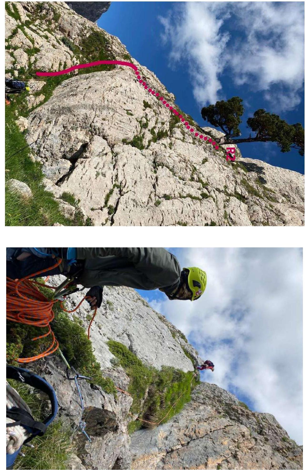 Photo 1 (section R1–R2)
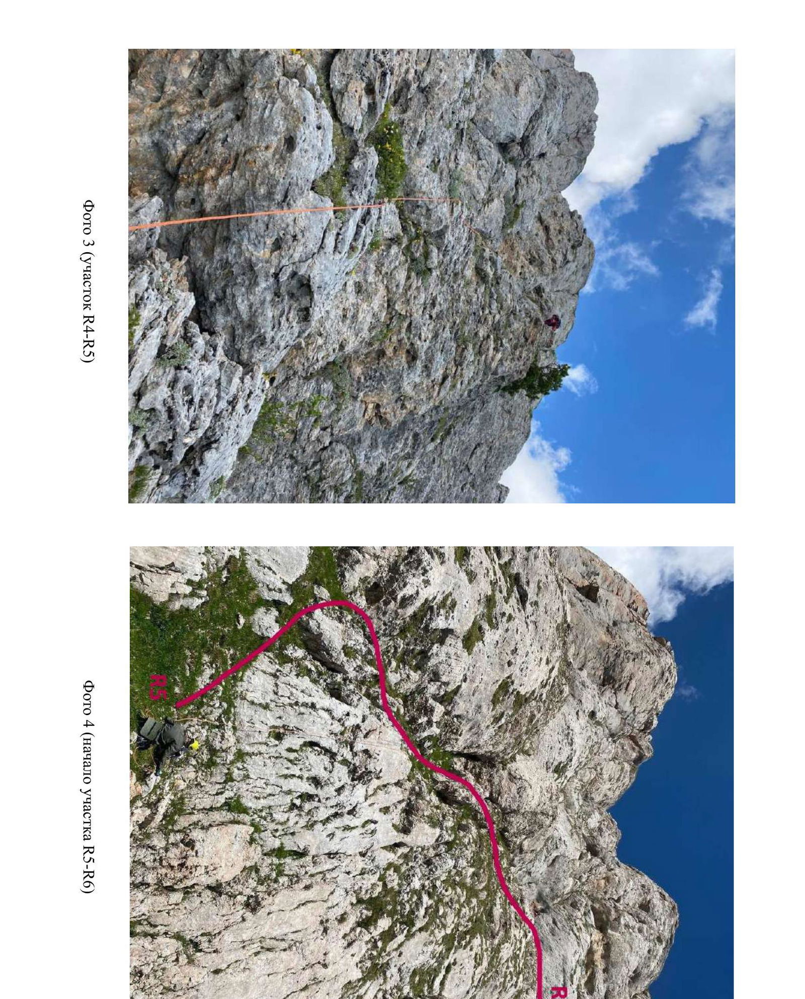 Photo 2 (beginning of section R3–R4)
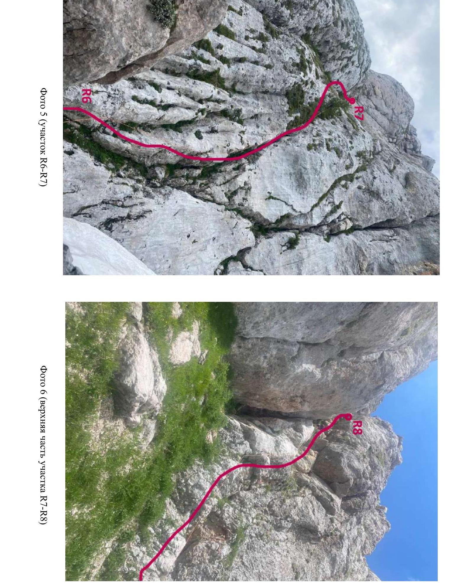 Photo 3 (section R4–R5)
Photo 4 (beginning of section R5–R6)
Photo 5 (section R6–R7)
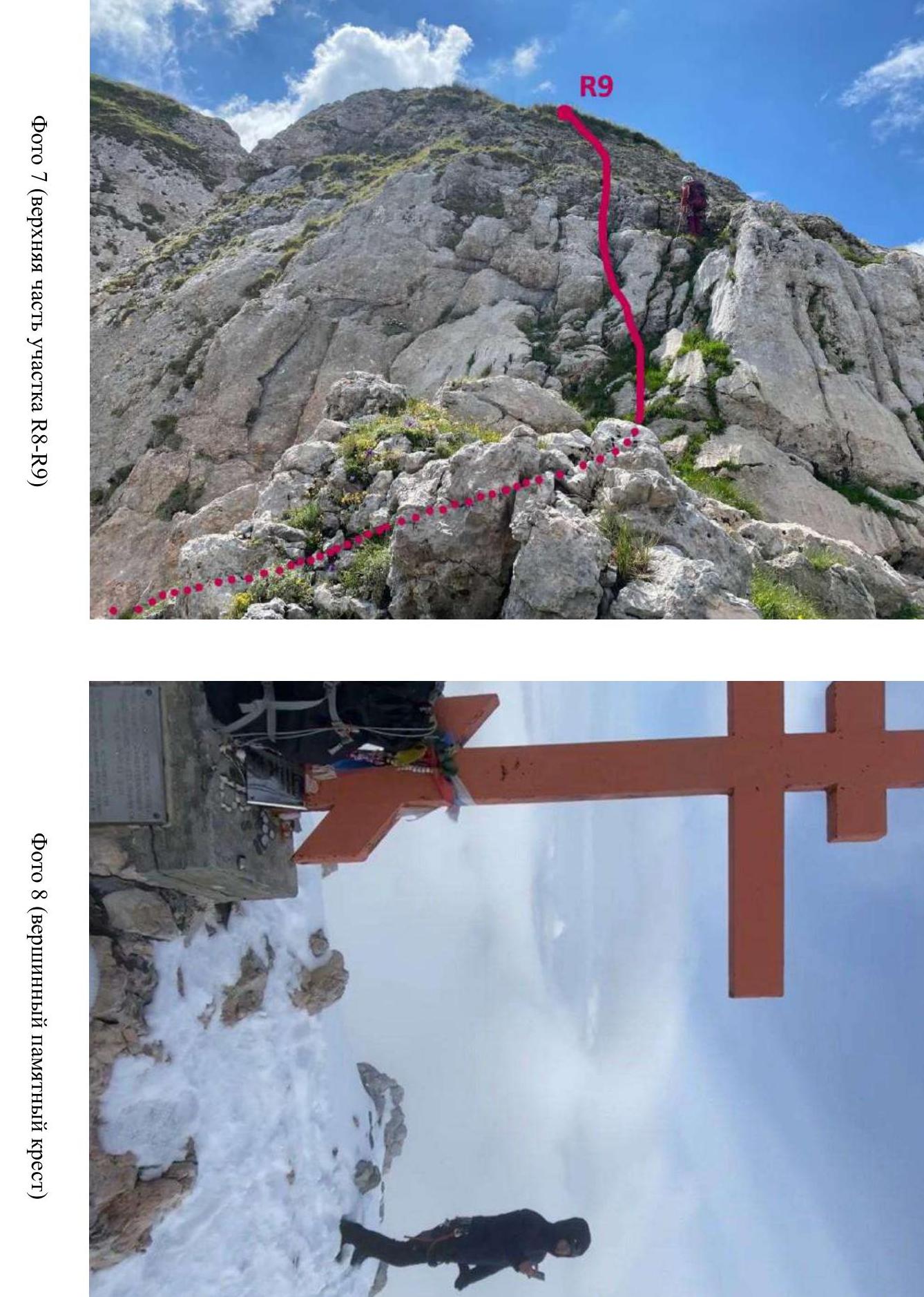 Photo 6 (upper part of section R7–R8)
Photo 7 (upper part of section R8–R9)
Photo 8 (summit memorial cross)