
Peak 3226.0 (Dimitrov-100, Taulan). Route: via the western couloir and northern ridge. Category: 3A (combined). Leader: V. Babkin
Western Caucasus, Arkhyz, Orlenok gully, Karajash mountain massif. Section in KMGV — 2.1.
E-mail — ZHUR58@RAMBLER.RU
Report
On the first ascent of the climbing route to peak 3226.0 (Dimitrov-100, Taulan) "Via the western couloir and northern ridge. Category: 3A (combined)" at the year-round alpine event: "Championship and primacy of NP 'Club of Northern Travels 'Sauk-Pai' 2012 (class 'First ascents')".
Region: Karachay-Cherkess Republic. Mountain country: Western Caucasus. Valley: Orlenok gully. Ridge: Karajash mountain massif. Peak: 3226.0 (Dimitrov-100, Taulan). Route: via the western couloir and northern ridge, 3A category (combined). Difficulty level: 3A category (combined) (approximately). Prepared by: V. Babkin, S. Zhuravlev. May, 2012.
Description of the peak
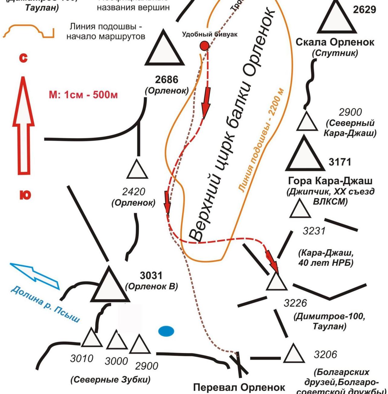
Peak 3226.0 is one of the peaks in the northern part of the Karajash ridge. It is located in the territory of the North Caucasian Federal District of the Russian Federation, in the Karachay-Cherkess Republic, Arkhyz mountain region, between the Pshish and Sofia rivers.
Peak 3226.0 is a prominent mountain of the Karajash massif, located northwest of the nodal peak Karajash (3171.0). The peak is easily identifiable from the upper cirque of the Orlenok gully. The peak does not have an official name, so it has conditional tourist and climbing names:
- Tourist name — Taulan
- Climbing name — "Dimitrov-100"
which creates some confusion when identifying the peak.
Description of the route
The route "Via the western couloir and northern ridge" is a typical sports combined route of IV category, with a full set of natural obstacles corresponding to routes of this level.
Equipment
For the ascent, a sports team of 4 people will need the following special equipment on the route:
- Personal: standard, crampons, ice axe
- Group:
- main rope 10 mm — 2×50
- rock hammer — 2 pcs.
- rock pitons — 16 pcs.
- ice axe — 1 pc.
- protection elements — 12 pcs.
- friends — 6 pcs.
- ice screws — 0 pcs.
- quick draws — 16 pcs.
- slings — 10 pcs.
Approach
The ascent starts from a bivouac in the upper cirque of the Orlenok gully. To reach the upper cirque: cross the Sofia river by a bridge from the Taulu clearing and ascend the Orlenok gully — first on a forest road, then on a well-traced path.
The cirque is well-defined, snowy in winter and spring, and overgrown with high-altitude vegetation in summer, with two beautiful lakes among small birch and pine groves. The height of the cirque above sea level is 2200 m. The ascent from the Taulu clearing to the cirque takes 1.5–2 hours.
The upper cirque of the Orlenok gully has:
- convenient places for tents,
- water (streams),
- firewood,
- dry areas, freed from snow by the end of April — beginning of May.
In the panorama of the cirque, peak 3226.0 (Taulan, "Dimitrov-100") is easily identifiable.
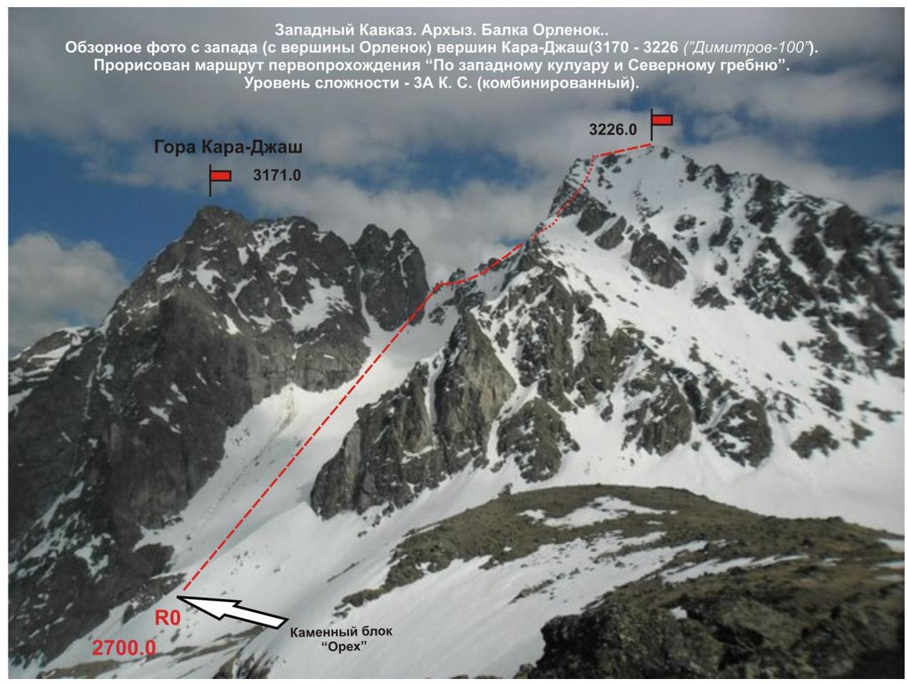
The approach from the campsite in the upper cirque of the Orlenok gully to the start of the route — the "Orekh" rock block — takes about one and a half hours.
The "Orekh" rock block, located in the couloir separating:
- peak Karajash (3171),
- peak 3226.0 (Taulan, "Dimitrov-100"),
is easily identifiable at any time of the year.
Technical part
The route begins with an ascent up a snowy slope to the "Orekh" rock block. There is a platform on the "Orekh" rock block, allowing for the organization of rope teams. Then:
- up the snowy western couloir.
- direction to be held towards the pronounced "Korona" gendarme.
- In summer, rocky slabs are exposed in the upper part, requiring the organization of insurance and self-insurance.
- In winter and spring, the slabs are covered with a layer of snow.
From the "Korona" gendarme, movement does not cause difficulties in orientation, as it follows strictly along the line of the ridge (to the right of the ascent). Further, there is a logical ascent up the northern ridge. First, on simple, then on rocks of medium complexity, ascend under an inclined wall. The wall is overcome "head-on" and leads to a rocky shoulder. On simple rocks, approach the summit pinnacle.
The key to the route is the ascent to the summit pinnacle. A steep wall. Rocks of increased complexity, but with an abundance of relief, allowing for the organization of intermediate insurance points with the help of pitons and protection elements. The most convenient are:
- among pitons — shвеллера,
- among protection elements — friends.
Rockfall danger — subjective. In the off-season, there may be formed ice on the rocks. After passing the key wall — exit to a simple rocky ridge, flattening out towards the summit.
The summit is clearly expressed. The cairn is easily found. A note from a sports group from Nevinnomyssk, which made an ascent to the summit via a 3A category route on the NE wall, was taken.
The descent from the summit is carried out in a northerly direction to a snowy saddle, then — down a wide couloir separating peaks 3226.0 (Dimitrov-100, Taulan) and 3206.0 (Bulgarian friends, Bulgarian-Soviet friendship) — into the upper cirque of the Orlenok gully.
Recommendations to the instructor
Due to the accessibility of the route in terms of orientation, it can be recommended for both training and sports teams (SP-1, 2) and for independent sports groups of discharge athletes, conducting leadership or training ascents.
Time spent on the route for a training and sports team of discharge athletes of average training level (SP-1, 2):
- 12–14 hours.
The route is similar to classified routes to this peak from the east and corresponds to a combined route of 3A category. Orographic scheme of the northern cirque of the Karajash mountain massif (Western Caucasus, Arkhyz, Karajash ridge)
Conditional designations
Nodal peaks marked on the topographic map of the Russian Federation:
- 2629 — heights of peaks,
- 3231 — heights of peaks not marked on the topographic map of the Russian Federation.
Karajash mountain:
- Official names of peaks: Dimitrov-100,
- Unofficial names of peaks: Taulan
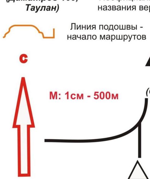
Line of подошвы — start of routes
Fragment of the map "Arkhyz" region of ascents.
Additional conditional designations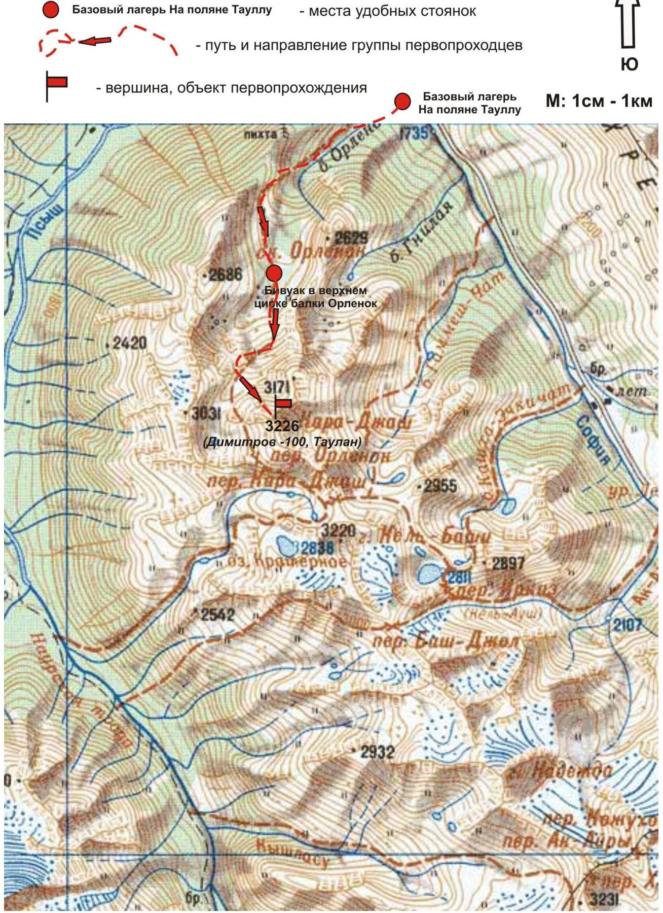
Passport
- Number of section according to KMGV — 2010 — 2.1.
Western Caucasus, mountain region — Arkhyz, Karajash ridge
- Name of peak: 3226.0 (Dimitrov-100, Taulan) height: 3226.0 m. Route: via the western couloir and northern ridge
- Category of complexity: 3A category.
- Character of the route — combined.
- Height difference of the route: 826 m
- Length of the route: 1250 m
- Length of sections of the highest category:
1 category — 1 section — 300 m, 2 category — 4 sections — 800 m, 3 category — 3 sections — 120 m
4 category — 1 section — 20 m 5 category — 0 sections — 0 m 6 category — 0 sections — 0 m
- Average steepness: main part of the route — 60°.
total route — 50°
- Number of pitons used:
Used in total on the route:
- rock pitons — 9
- protection elements — 33
- stationary bolted pitons — 0
- IT — 0
- removable bolted pitons — 0
Left on the route: total — 1; including bolted — 0.
- Exit to the route — 6:00, May 1, 2012.
Exit to the summit — 15:00, May 1, 2012. Return to BL — 17:00, May 1, 2012.
- Team's walking hours: — 11 hours.
- Leader: Vyacheslav Babkin (CMS, instructor-methodologist of 3rd category, Yekaterinburg).
Team members:
- A. Erygin (3rd sports category, Voronezh)
- N. Sysoev (3rd sports category, Voronezh)
- A. Sotnikov (3rd sports category, Voronezh)
- Coach: Zhuravlev Sergey Vasilyevich, title — CMS, instructor-methodologist of 1st category.
Western Caucasus, Arkhyz, Orlenok gully, Peak 3226.0 ("Dimitrov-100", Taulan). Route: "Via the western couloir and northern ridge" 3A (combined) (approximately).
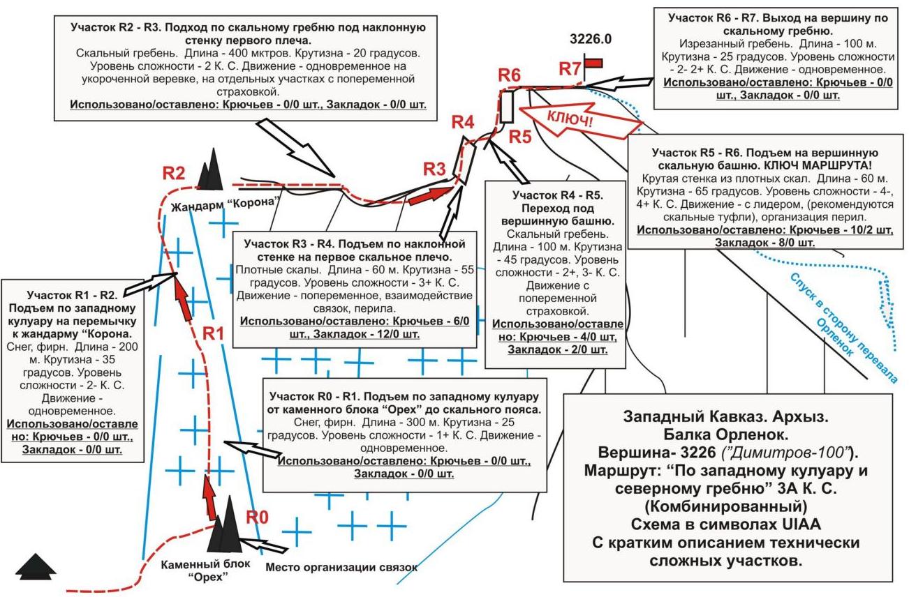
Table of natural obstacles on the route:
| Section | Length | Steepness | Character of relief | Category | Number of pitons/protection elements |
|---|---|---|---|---|---|
| R0 — start of the route — "Orekh" rock block. Height mark — 2400 m | |||||
| R0–R1 Ascent up the western snow/ice couloir | 300 | 25 | snow/ice slope | 1 | 0 / 0 |
| R1–R2 Ascent up the western snow/ice couloir to the northern ridge to "Korona" gendarme | 200 | 35 | snow/ice slope | 2 | 0 / 0 |
| R2–R3 Ascent along the northern ridge | 400 | 20 | Ridge, destroyed rocks | 2 | 0 / 0 |
| R3–R4 Passage of an inclined slab and exit to the first rocky shoulder | 60 | 55 | Rocky slab | 3+ | 6 / 12 |
| R4–R5 Transition along the ridge under the summit pinnacle | 100 | 45 | Destroyed rocky ridge | 2+, 3- | 4 / 2 |
| R5–R6 Passage of a rocky wall on the summit pinnacle (KEY!) | 60 | 65 | Wall, rocky monolith | 4– (20 m) 3+ (40 m) | 10 / 8 |
| R6–R7 Ascent to the summit along the pre-summit ridge | 100 | 25 | Cut ridge | 2 | 0 / 0 |
| R7 — summit 3226.0 ("Dimitrov-100", Taulan) |
Total
Route length — 1220 m. Average steepness — 55°. Character of relief — combined.
Sections:
- 1 category — 1 section
- 2 category — 3 sections
- 3 category — 3 sections
- 4 category — 1
Pitons and protection elements used: 20/22. Pitons and protection elements left: 4/0.
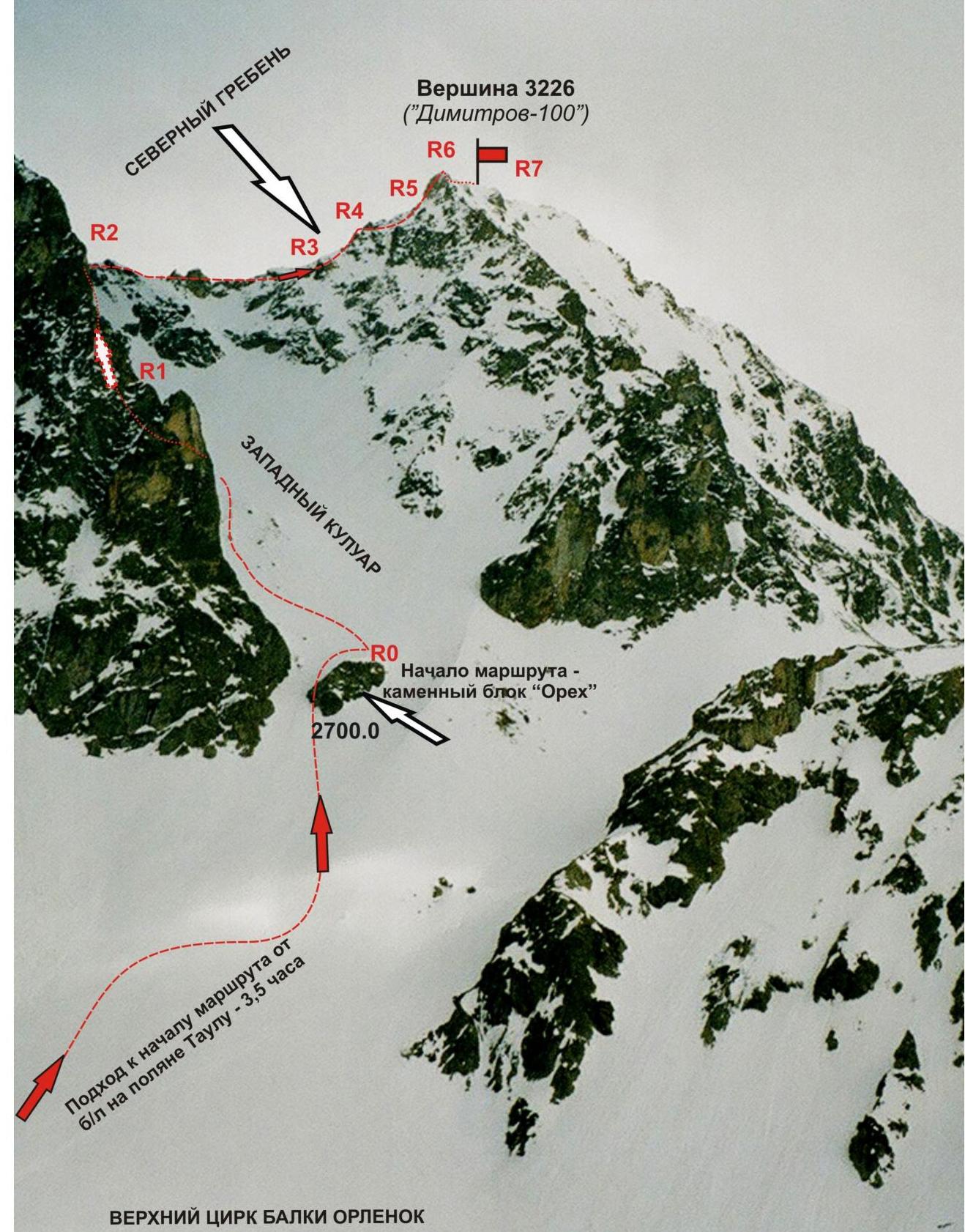
Western Caucasus. Arkhyz. Orlenok gully. Peak — 3226 ("Dimitrov-100"). Route profile: "Via the western couloir and northern ridge". Difficulty level — 3A category (Combined).
Photo from the west (from the slopes of Orlenok peak)
Western Caucasus. Arkhyz. Orlenok gully. Peak — 3226 (Dimitrov-100, Taulan). Route: "Via the western couloir and northern ridge 3A (combined)".
Photo of the technical part of the route
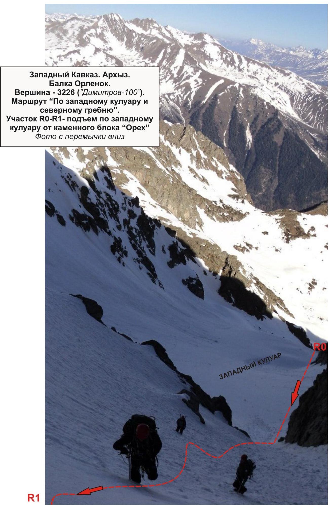
R1.
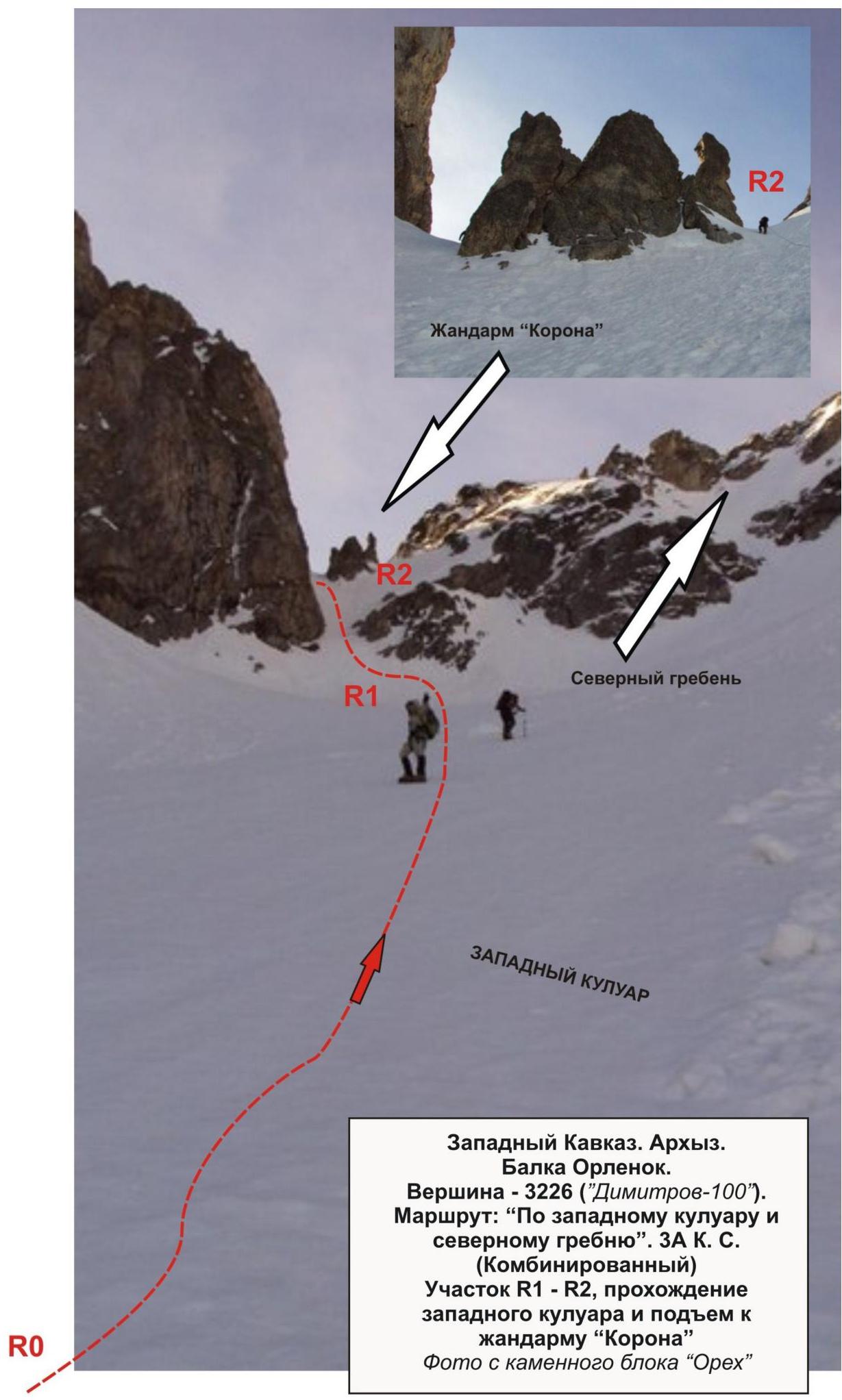
Western Caucasus. Arkhyz. Orlenok gully. Peak — 3226 ("Dimitrov-100"). Route: "Via the western couloir and northern ridge". 3A category (combined). Section R1–R2, passage of the western couloir and ascent to "Korona" gendarme. Photo from the "Orekh" rock block.
Saddle on the northern ridge.
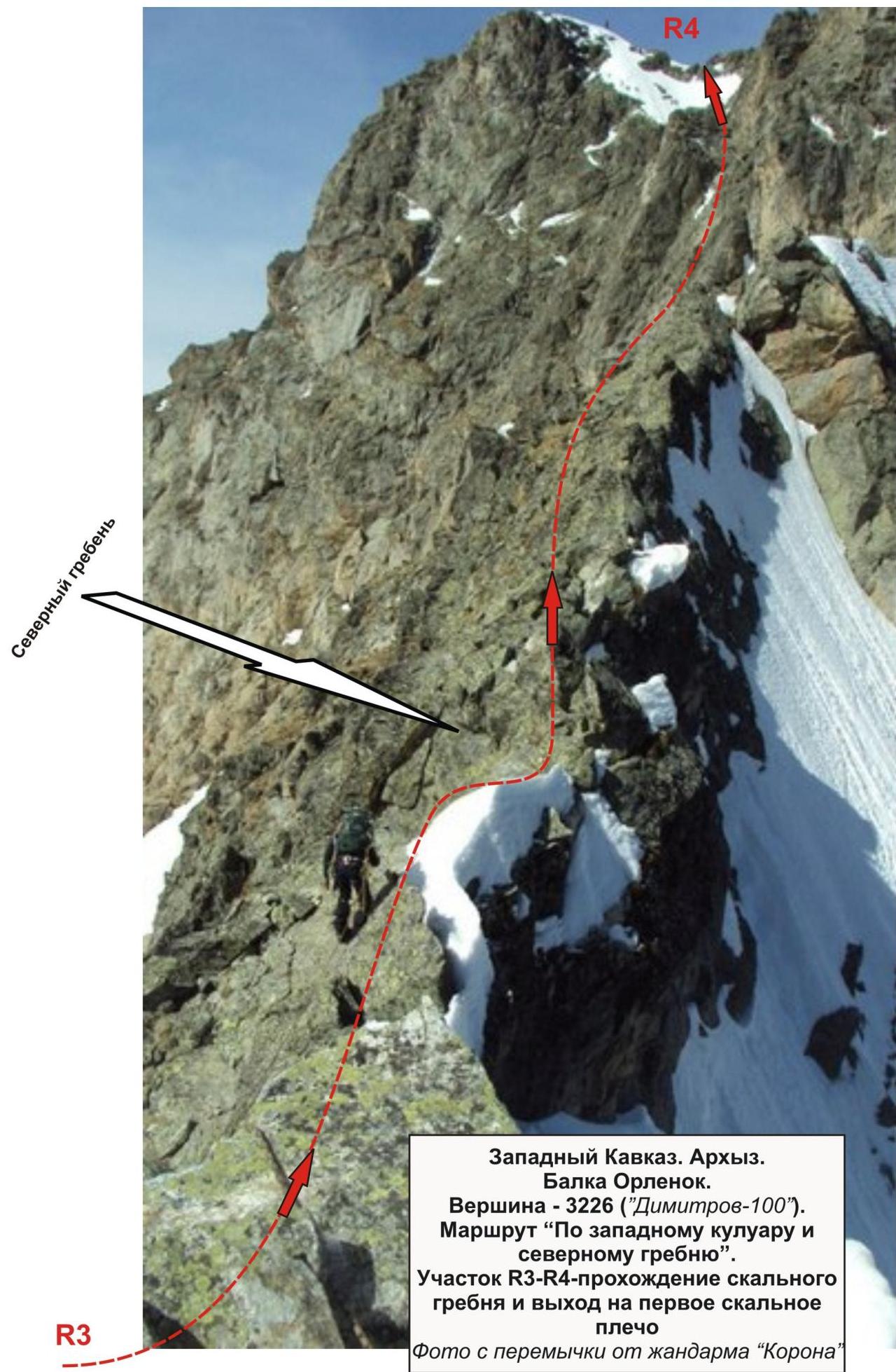
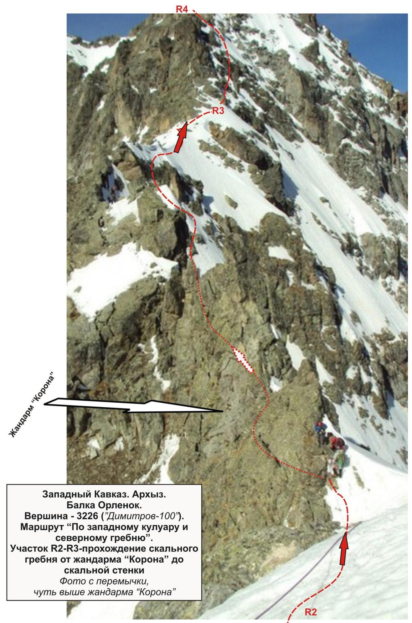
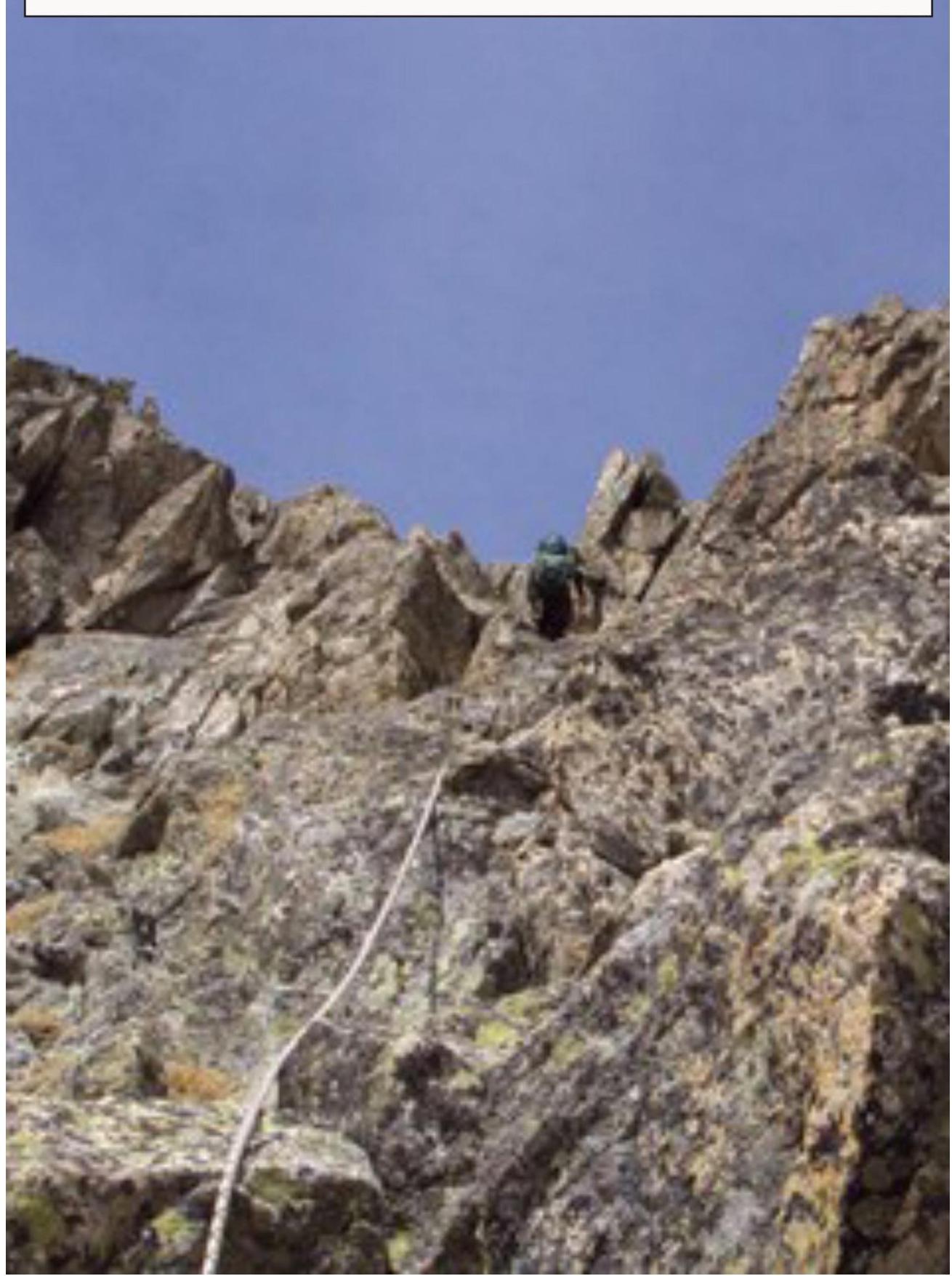
Western Caucasus. Arkhyz. Orlenok gully. Peak — 3226 ("Dimitrov-100"). Route "via the western couloir and northern ridge". Section R3–R4 — passage of the rocky ridge and exit to the first rocky shoulder. Photo from the saddle from "Korona" gendarme.

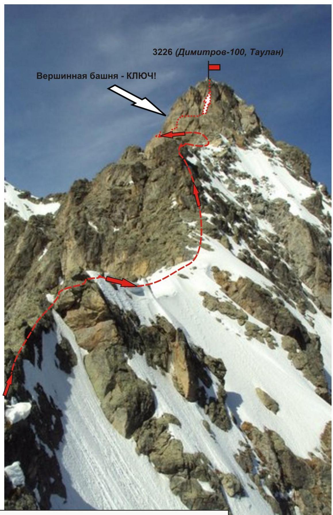
Western Caucasus. Arkhyz. Orlenok gully. Peak — 3226 (Dimitrov-100, Taulan). Route: via the western couloir and northern ridge 3A (combined).
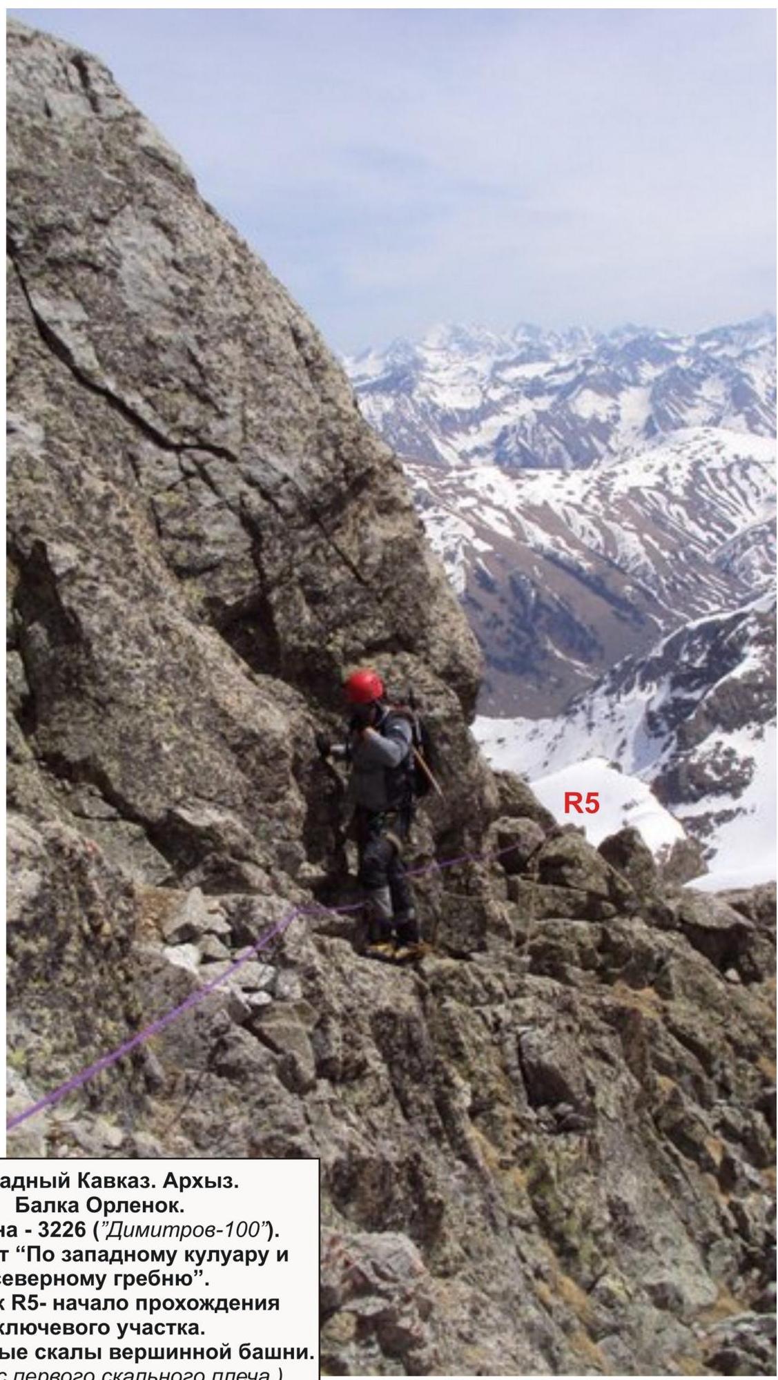
Western Caucasus. Arkhyz. Orlenok gully. Peak — 3226 ("Dimitrov-100"). Route "via the western couloir and northern ridge". Section R5 — start of the passage of the key section.
Characteristic elements:
- Characteristic rocks of the summit pinnacle
- Photo (from the first rocky shoulder)
- Western Caucasus. Arkhyz. Orlenok gully. Peak — 3226 (Dimitrov-100, Taulan)
- Route: "via the western couloir and northern ridge 3A (combined)"
- Photo — characteristic rocks of the key
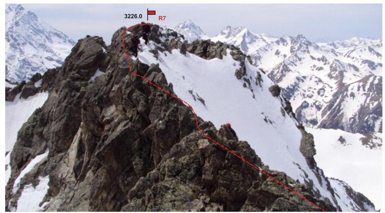
Western Caucasus. Arkhyz. Orlenok gully. Peak — 3226 m ("Dimitrov-100"). Route: "Via the western couloir and northern ridge" 3A category (combined). Section R5–R7 — ascent along the pre-summit ridge to the summit.
Comments
Sign in to leave a comment