
Description of the route to the summit of Unnamed "Peak 2330 m", "Peak SOCHI 2014".
Ascent Passport
- Krasnodar Krai, Mzymta River gorge, Aibga ridge, section number in KMGV — 2.1
- Peak 2330 m (Peak Sochi 2014), from the Southeast.
- Proposed — 1B cat. diff., first ascent.
- Character of the route: rock.
- Height difference of the route: 300 m (by GPS)
Length of the route: about 500 m. Length of sections: 3 cat. diff.: 30 m. Average steepness of the route: 25°.
- Pitons left on the route: none.
- Team's walking hours: 5 hours, 1 day.
- Leader: Khamitsaev Kazbek Borisovich.
Participants: alpinada team consisting of 50 people.
- Coach: Khamitsaev K.B.
- Start of the route from BL: date, month, year
Route started: November 13, 2009. Summit reached: November 13, 2009. Return to BL: November 13, 2009. Descent from the summit: via the ascent route.
-
Organization: Federation of Alpinism of North Ossetia.
-
Responsible for the report: Khamitsaev K.B.
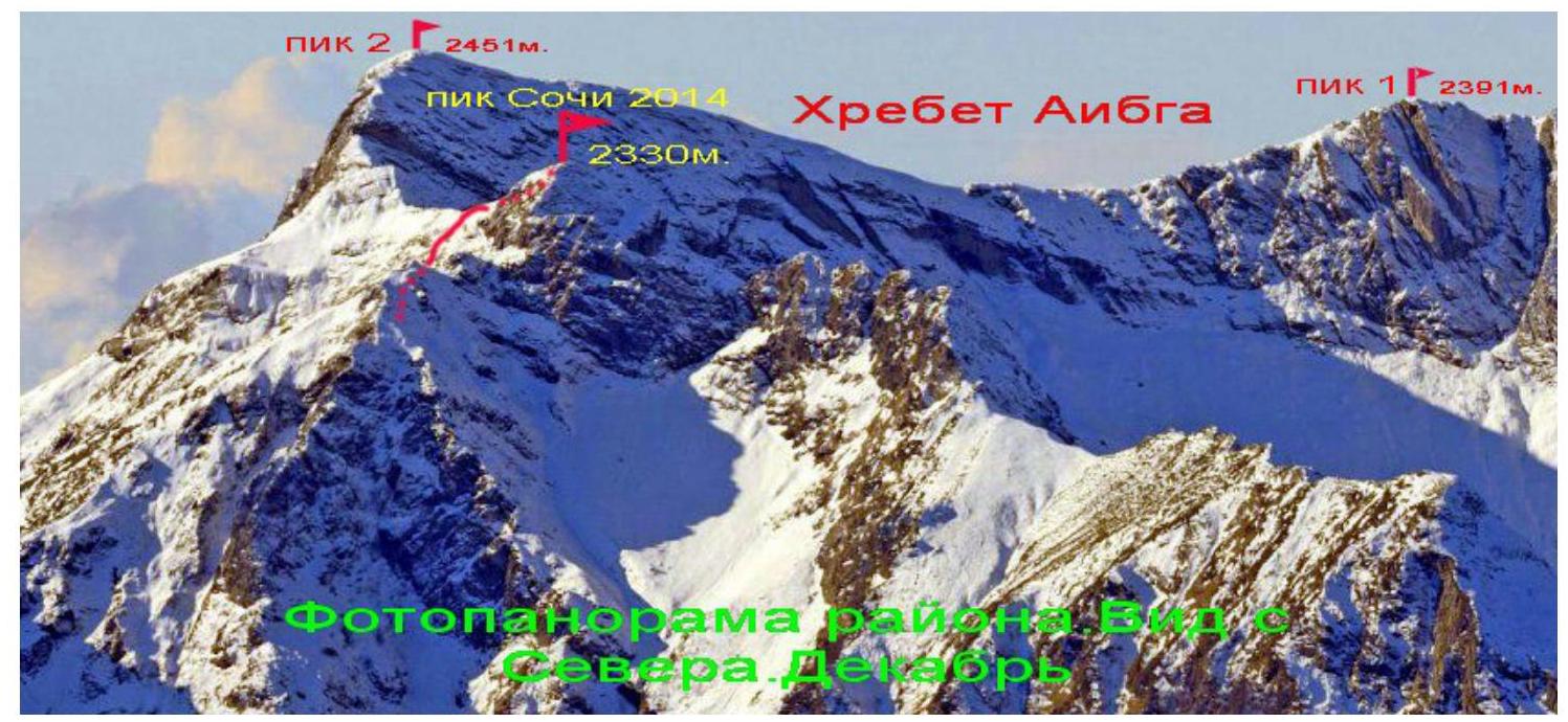
Email and phone: kazberg@yandex.ru, 8 928 480 23 33. Technical photo of the summit, with the route marked 
Photo of the route profile, with the first ascent route marked 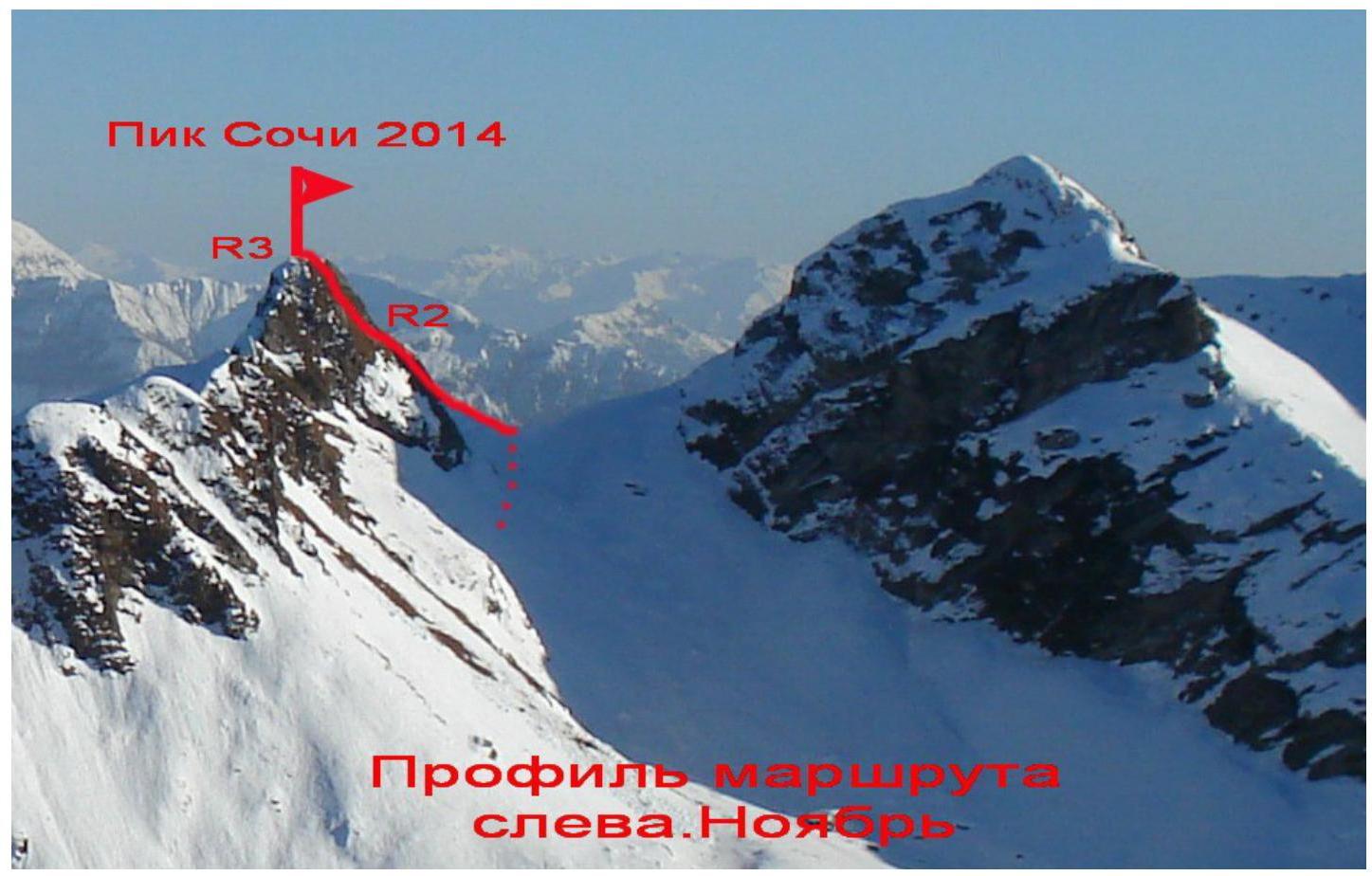
Peak Sochi 2014
Photopanorama of the area.
Map of the area.
The Unnamed summit "Peak 2330 m" is located in the Aibga ridge massif in the popular ski resort area "Krasnaya Polyana", coordinates: 43°38′39.50″ north latitude, 40°15′45.68″ east longitude 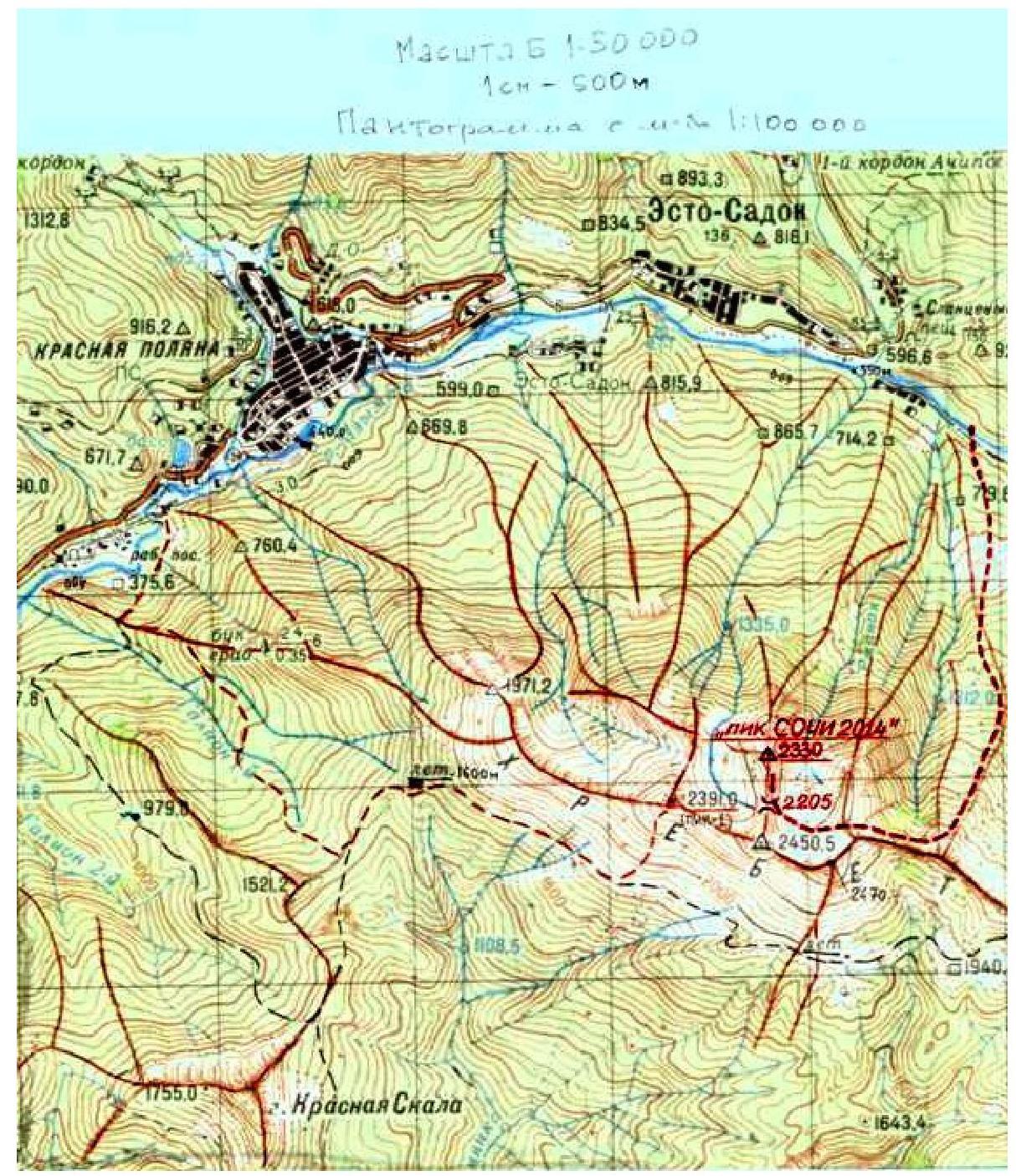
Difficulty of sections.
| № | Length | Steepness | Character of relief | Category of difficulty | Number of pitons |
|---|---|---|---|---|---|
| B | |||||
| :-- | :-- | :-- | :-- | :-- | :-- |
| R0–R1 | 400 m. | 15–20° | Grassy-scree slope | 1 | - |
| R1–R2 | 50 m. | 20–30° | Rocky-scree slope | 1-3 | 2 |
| R2–R3 | 50 m. | 25–35° | Rocky-scree slope | 1-3 | 3 |
Brief description of the route
Approach to the route:
From the city of Sochi, take a vehicle to the resort town of Adler (20 km). From there, take a vehicle to the settlement of Moldovka and up the Mzymta River gorge along the right (orographic) bank to reach Krasnaya Polyana (38 km)
From the settlement, take a vehicle to the "Alpika-Servis" cable car — 12 km. Under the cable car, reach the crest of the Aibga ridge (in summer and winter, it's possible to take the cable car).
Description of the route:
R0–R1:
From the upper station of the cable car, move west towards the visible peak 2330 m. The route goes along the southeastern ridge — slope. You need to keep direction left of the summit tower. The length of this section is about 400 m, 1 cat. diff.
R1–R2:
Reach the saddle left of peak 2330 m, further visible is the cirque of Aibga peaks. Here, you need to turn right and move along the rocky-scree slope, with individual rock outcrops, towards the summit, to a wide terrace. Section length 50 m, 1-3 cat. diff., 20–30°.
R2–R3:
Further ascent in the same direction, to the summit tower. Climb to it on the left part, via rocks of 2-3 cat. diff. The entire section is 50 m, 1-3 cat. diff., 25–35°. The summit is a good panoramic point — from here, the entire panorama of Krasnaya Polyana and the areas of the XXII Winter Olympic and XI Paralympic Games "Sochi 2014" are visible.
Descent is via the ascent route.
The ascent was made in honor of the XXII Winter Olympic and XI Paralympic Games "Sochi 2014". Participants included:
- staff of the Sochi 2014 Organizing Committee,
- partners of "Sochi 2014",
- team of the project "Russia on the peaks of the World" led by Kazbek Khamitsaev, Ambassador of "Sochi 2014".
The main goal is to include this route in the "Classifier of routes to mountain peaks" with the name "Peak Sochi 2014".
Recommendations for passing the route.
The first ascent route, in terms of length and difficulty of key sections, corresponds to 1B cat. diff. In winter and spring, with a large amount of snow, section R0–R1 is avalanche-prone.
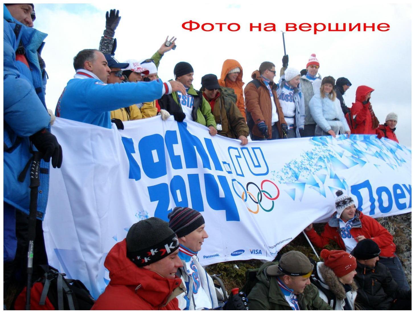
Photo at the summit
Comments
Sign in to leave a comment