Report
on the ascent to the summit 2839.8 m Pseashkha West via the south-west ridge presumably 1B cat. diff. First ascent
Climbing Passport
- Area: Western Caucasus, Krasnaya Polyana area, Pslukh valley, section 2.1 of the route classifier for mountain peaks.
- Summit: 2839.8 m Pseashkha West, via the south-west ridge.
- Proposed category: 1B cat. diff., first ascent.
- Route type: rock.
- Height difference: 700 m. Route length (technical part): 1900 m (600 m). Length of sections with III cat. diff.: 50 m. Average steepness of the technical part: 15 degrees.
- Pitons left on the route: 0. "Pitons" used on the route: 3 (slings). Bolt pitons and ITO were not used.
- Travel time: 7 hours, 1 day.
- Descent from the summit: via the ascent route.
- Leader: Dergachev Andrey Viktorovich, 1st sports category, instructor III category. Participants: G. Kotenko, zn, S. Mokrova, zn.
- Date of ascent: August 22, 2015. Departure from base camp: 14:00. Arrival at the ridge (start of the route): 15:30. Arrival at the summit: 17:30. Return to base camp: 21:00.
- Alpine Federation of Krasnodar Krai.
- Responsible for the report Dergachev A.V. aderg@narod.ru
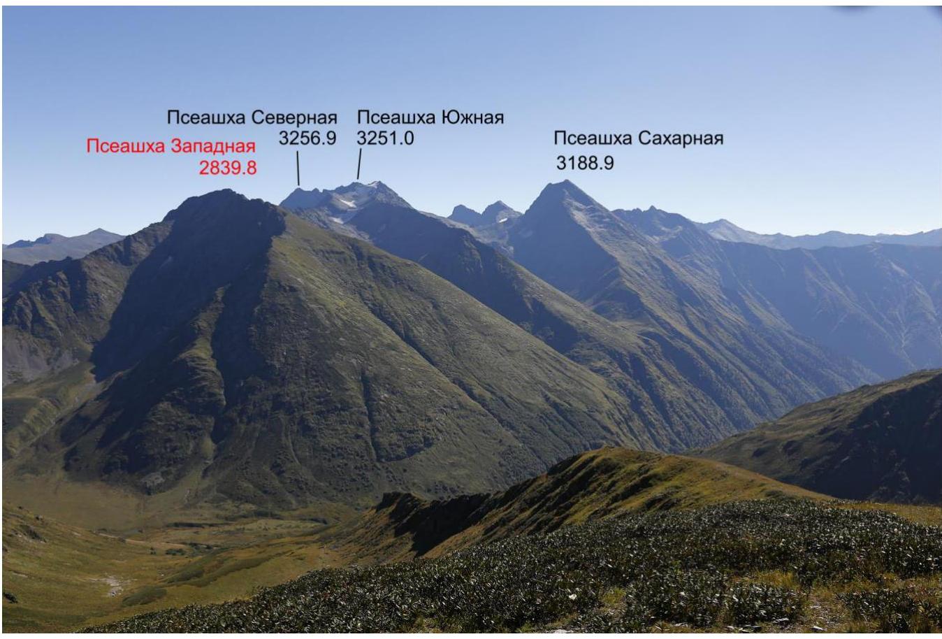
Fig. 1. General view from the west (from v. Perevalnaya South). September 13, 2014.
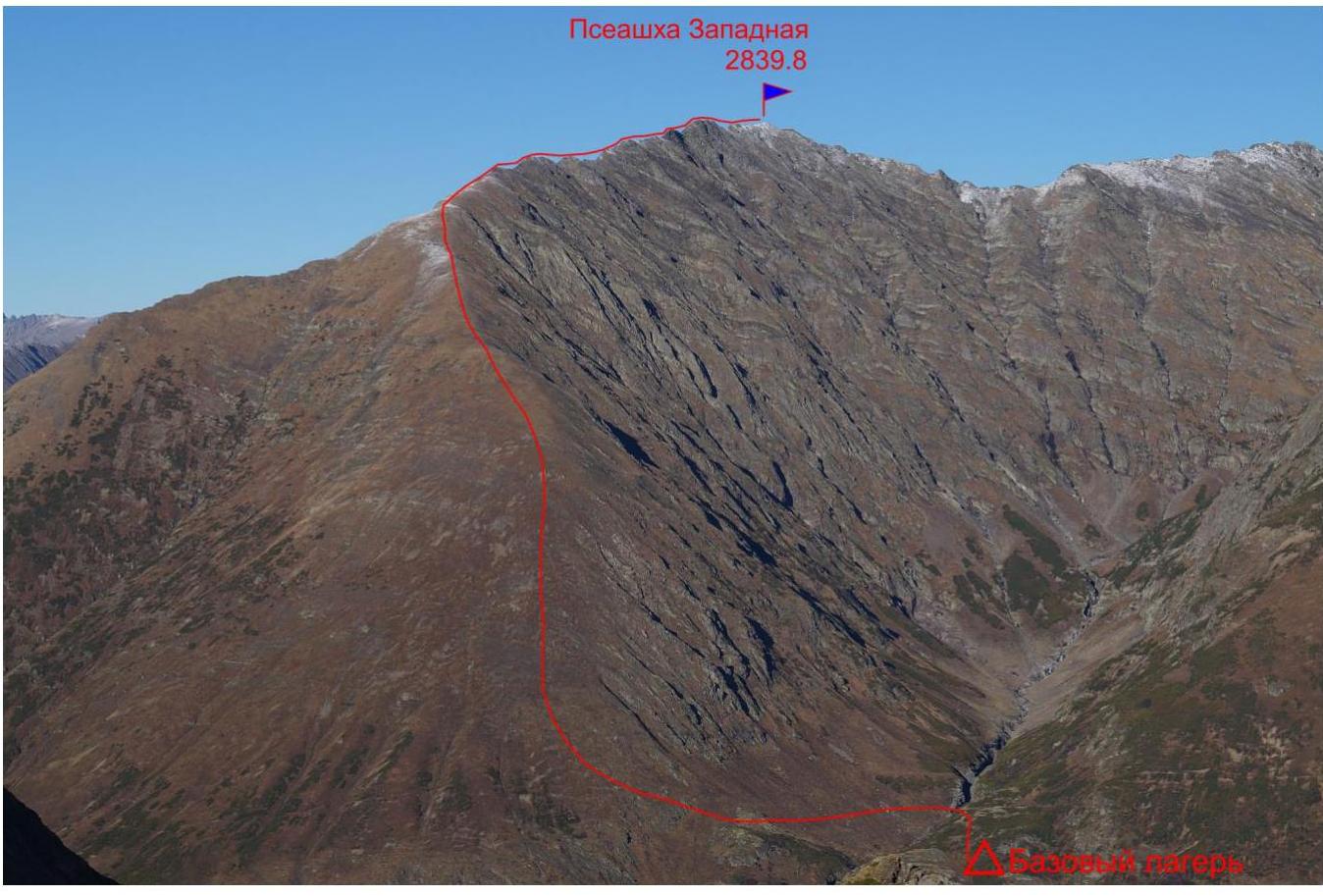
Fig. 2. General view from the southwest (from Bzerpi peak). October 28, 2015.
Geographical description of the area and the object of ascent
The object of ascent - a summit with a height of 2839.8 m - is located in the area of the Krasnaya Polyana resort town of Sochi. The summit is situated in the western spur of the Pseashkha massif. On topographic maps, there is a height mark of the summit, but the name is not signed. However, in tourist literature, it is referred to as Pseashkha West.
The nearest settlement with regular transport links is the village of Esto-Sadok (railway station Rosa Khutor).
The ascent was made from the side of the Pslukh river valley, a right tributary of the Mzymta river. The base camp was located at the first left tributary of the Pslukh river. The path to the base camp starts from the cable car station of the Gazprom mountain tourist center "Pikhhtovaya Polyana" (mark 1650 m). First, follow the established hiking trail to the Bzerpinsky Karniz shelter, then about 1 km along the trail leading to the Kholodny camp. Before reaching the Pseashkha pass, turn right and cross the source of the Pslukh river. Then follow the trail along the left bank of the Pslukh to its first left tributary. On the left bank of the tributary, there is a good place for a camp.

Fig. 3. Overview map of the area.
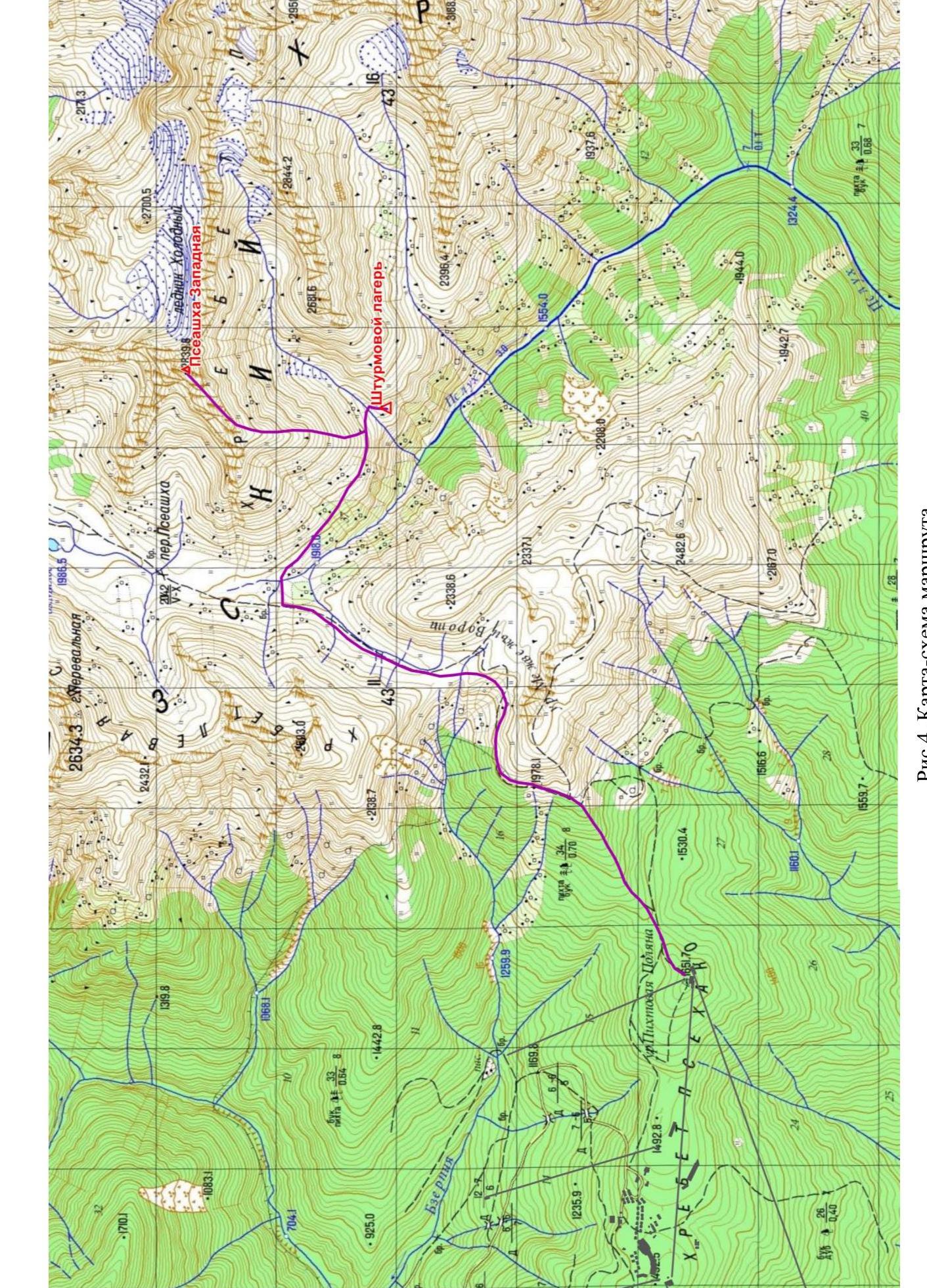
Fig. 4. Route map.
Table 1. List of technical sections of the route.
| Section | Length, m | Steepness, degrees | Terrain type | Cat. diff. | Number of pitons |
|---|---|---|---|---|---|
| R0–R1 | 1300 | 30 | Grassy ridge | - | 0 |
| R1–R2 | 350 | 10 | Rocky-scree ridge | 1–2 | 0 |
| R2–R3 | 50 | 25 | Rocky ridge | 2–3 | 3 |
| R3–R4 | 200 | 10 | Rocky-scree ridge | 1–2 | 0 |
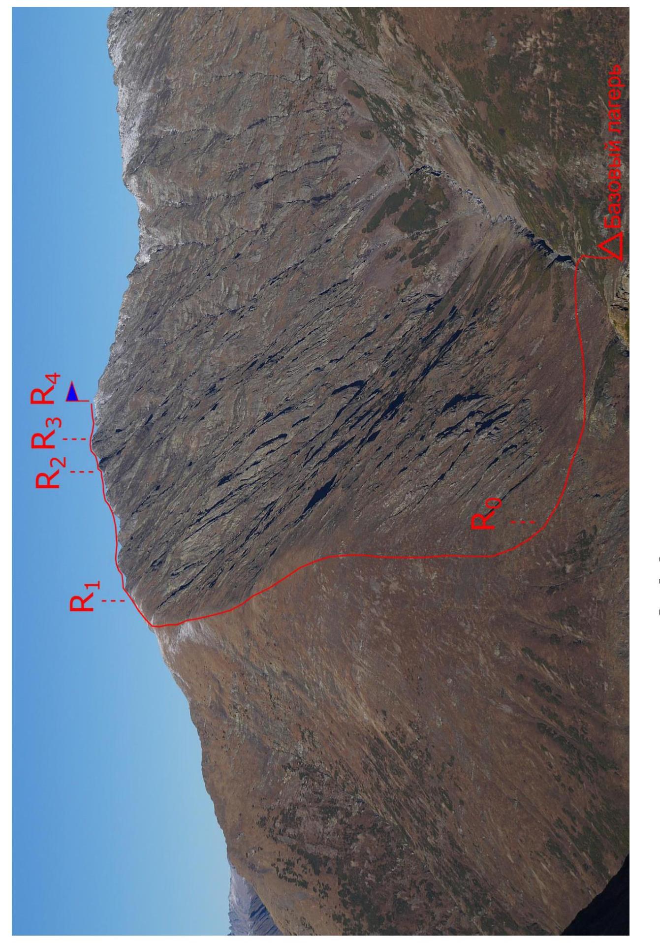
Fig. 5. Route photo.
Description of the approach to the start of the technical part of the route
Along the western slope of the summit, there is a trail from the source of the Pslukh river to its second tributary. 200 m from the intersection of the trail with the first tributary, ascend the steep grassy ridge. Where the grassy ridge becomes less steep, rocky sections begin to appear. This is the start of the technical part of the route. From the base camp - 1 hour 30 minutes.
Description of the route passage
Section R0–R1. Ascend the grassy ridge (in winter, avalanche danger!) to the flattening and the beginning of the rocky section. 1300 m.
Section R1–R2. Along the destroyed grassy-rocky-scree ridge to the sharp rocky "knife". 350 m, 1–2 cat. diff.
Section R2–R3. Along the rocky "knife", then a small rocky ascent. Alternating belay. 50 m, 2–3 cat. diff.
Section R3–R4. Along the destroyed rocky-scree ridge to the summit. 200 m, 1–2 cat. diff.
Descent from the summit via the ascent route.
Route photos
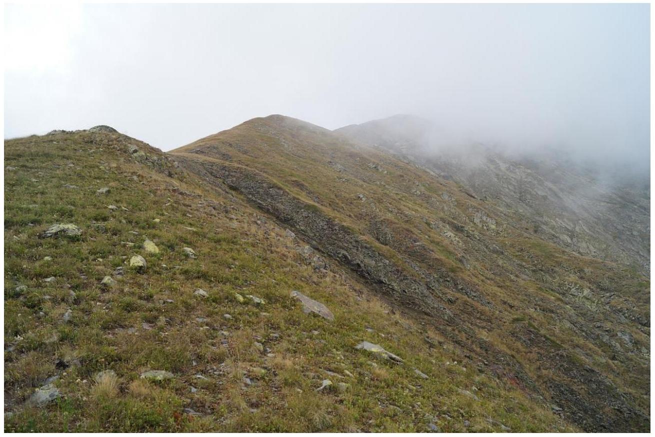
Fig. 6. Section R0–R1 (grassy ridge, upper part).
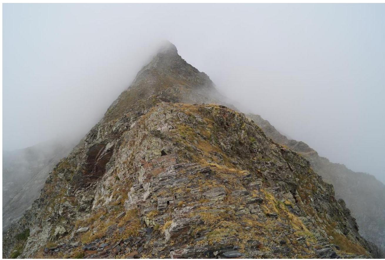
Fig. 7. Section R1–R2.
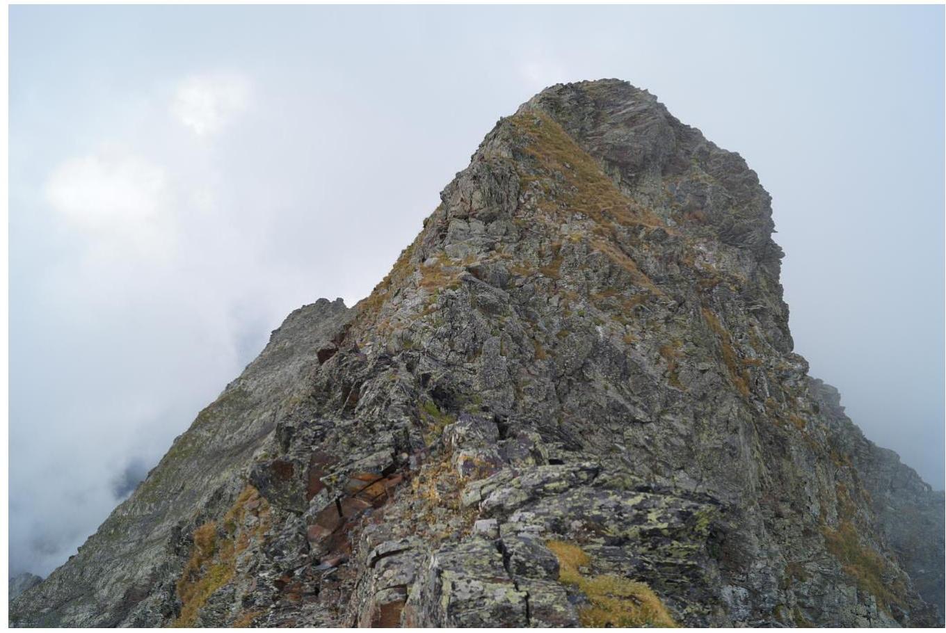
Fig. 8. Section R1–R2.
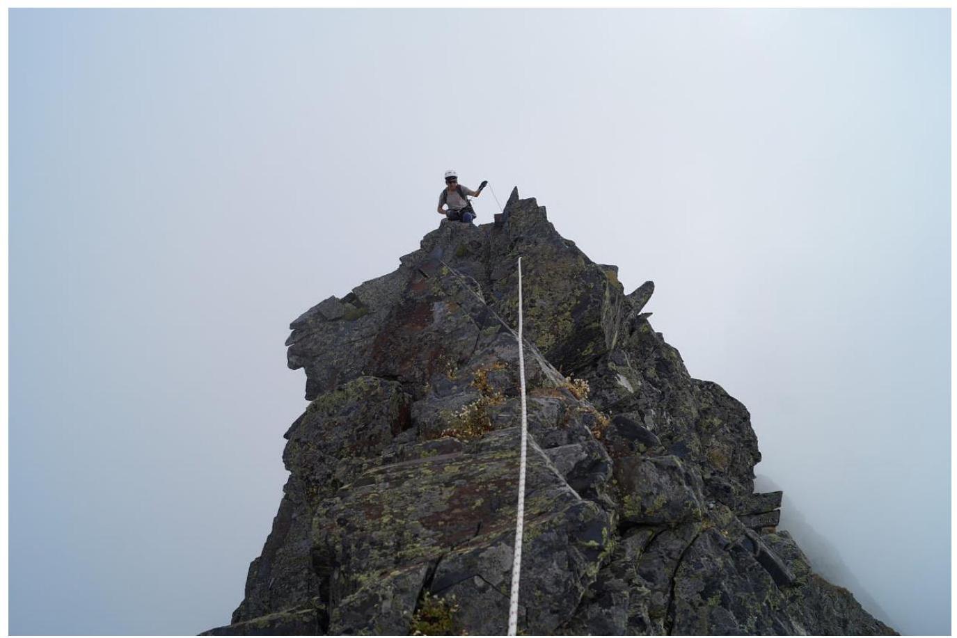
Fig. 9. Section R2–R3.
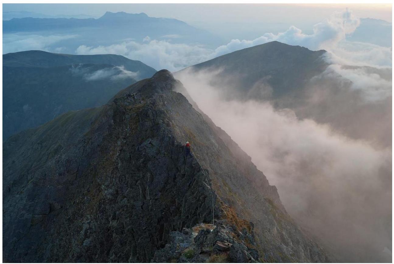
Fig. 10. Section R2–R3.
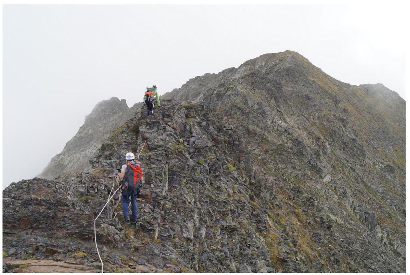
Fig. 10. Section R3–R4.
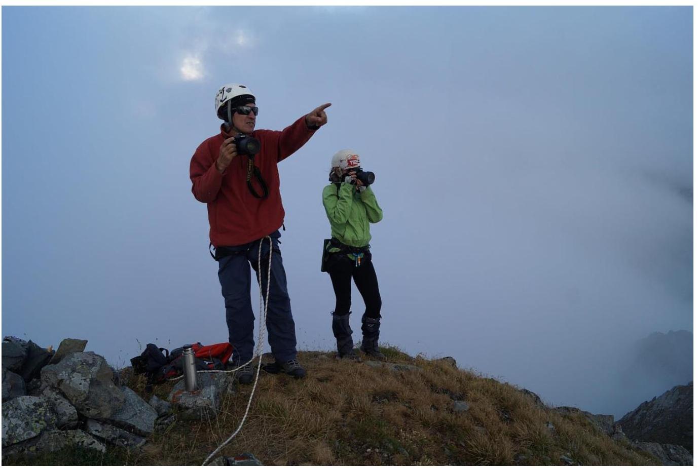
Fig. 11. Group at the summit.
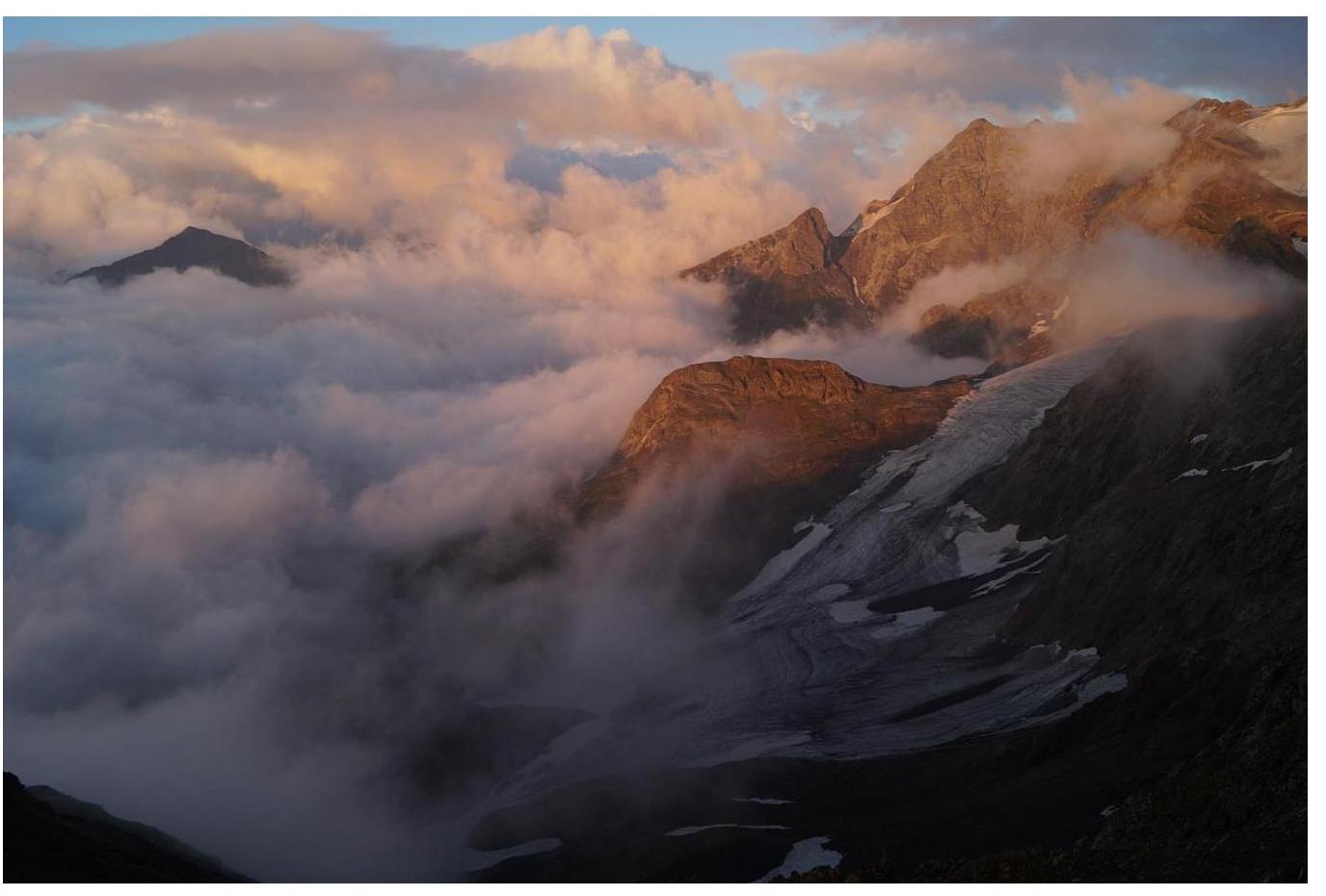
Fig. 12. View from the summit to the east.
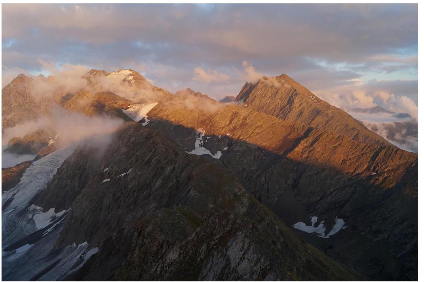
Fig. 13. View from the summit to the southeast.
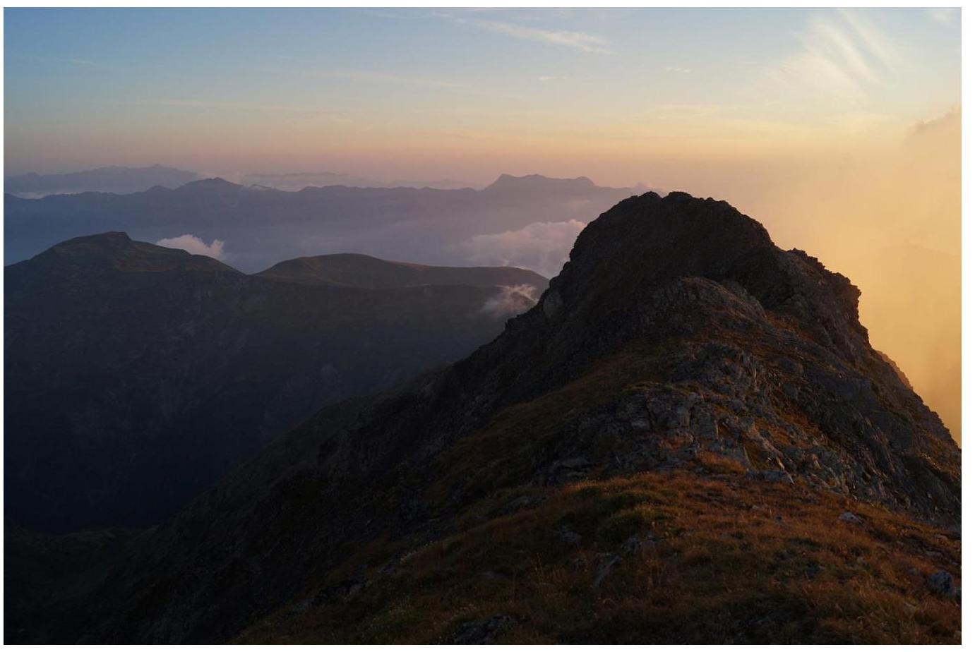
Fig. 14. View from the summit to the southwest.
General conclusions
The nearest classified route in the area - 1B cat. diff. to the summit Loyub, has a different terrain character. Similar in difficulty and terrain character from the nearest routes climbed by the participants:
- Pik Kislovodsk in Arkhyz via the north ridge 1B cat. diff.
The route and especially the approach to it in winter and inter-season can be avalanche-prone.
Based on the objective difficulty of the technical part of the route to the summit 2839.8 m Pseashkha West via the southwest ridge and comparing it with other routes climbed by the participants, it is proposed to classify it as 1B cat. diff.